• Happy National Garlic Day! 🧄🚫🧛🏼‍♂️

Maps. What do you do with 'em?

Joined
Oct 22, 2014
Messages
542
Reaction score
345
Location
Maryland
First off, a little tribute to maps, by whoever wrote "West with the Night."

---------------------------begin quote, except I substituted "paddler" where the author wrote "pilot"---------------------------

A map in the hands of a paddler is a testimony of a man's faith in other men; it is a symbol of confidence and trust. It is not like a printed page that bears mere words, ambiguous and artful, and whose most believing reader--even whose author, perhaps--must allow in his mind a recess for doubt.

A map says to you, "read me carefully, follow me closely, doubt me not." It says, "I am the earth in the palm of your hand. Without me, you are alone and lost."

And indeed you are. Were all the maps in this world destroyed and vanished under the direction of some malevolent hand, each man would be blind again, each city be made a stranger to the next, each landmark become a meaningless signpost pointing to nothing.

Yet, looking at it, feeling it, running a finger along its lines, it is a cold thing, a map, humorless and dull, born of calipers and a draughtman's board. That coastline there, that ragged scrawl of scarlet ink, shows neither sand nor sea nor rock; it speaks of no mariner, blundering full sail in wakeless seas, to bequeath, on sheepskin or a slab of wood, a priceless scribble to posterity. This brown blot that marks a mountain has, for the causal eye, no other significance, though twenty men, or ten, or only one, may have squandered life to climb it. Here is a valley, there a swamp, and there a desert; and here is a river that some curious and courageous soul, like a pencil in the hand of God, first traced with bleeding feet.

Here is your map. Unfold it, follow it, then throw it away, if you will. It is only paper. It is only paper and ink, but if you think a little, if you pause a moment, you will see that these two things have seldom joined to make a document so modest and yet so full with histories of hope and sagas of conquest.

No map I have paddled by has ever been lost or thrown away; I have a trunk containing continents.....
---------------------------end quote---------------------------

I'm sure I have lost or thrown away a map or two, but I still have a lot of them. I gotta figure out something to do with them other than this:
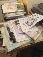
Pile o maps.jpg

So, how do you store your maps? Or, should I even bother storing 'em? It's all online now anyhow.
 
Yeah - I have a deep drawer and a couple 4" plastic tubes full of 'em. Saved for the possibility that the GPS satellites someday become useless. Perish the thought.....

Actually, I like to refer to maps still, because they give a better perspective of the overall lay of the land than the little GPS screen or even Google Earth on the PC does. When planning, maps are still irreplaceable, IMO. When on foot in places I don't know well, I still carry a copy of the area map as backup, in case my GPS dies. On rivers, I guess I just figure it all goes downhill - so I admit to not being so prepared.
 
Great quote!

I have them in manila folders between beefy books on the bookshelf. They just don't want to stack very well being of different sizes. When I travel I usually laminate several color copies of the area I'm travelling in and take the original in a freezer bag a s backup.
 
I love maps, I love to plan with maps. I love taking maps on my trips. (I do not use GPS at all, plus I would be afraid it would fail.) In a remote situation, I am constantly making sure I know exactly where I am on the map. Thank you for the quote. It was great. FQCK just had an auction on an old map chest of drawers. Had I the money and space, that is what I would have for maps.
 
I love maps and charts. When I was a navigator on a ship I used to save the old charts when a new addition came out instead of throwing them away. They were all corrected manually and were usable. I kept them flat under my bunk mattress (rolling charts and maps is a no-no !). One dark and stormy night (yes, they do actually happen once in a while) the ship took a big roll and my mattress and I landed hard on the deck. I had accumulated enough charts that the mattress was no longer contained by the bunk frame and was just resting on a pile of paper!!
 
One of my favorite quotes; "It's not a map, it's a to do list"
 
We have ours on a CD and just print them off as needed. Wasteful types that we are we seldom bother to keep them. We do have a few of the favourite routes laminated and stashed away somewhere.
 
Most of my maps are folded in use so that they fit in my map case. That map case is an old Gaia, with an 11.5 x 15.5 inch window on both sides, so it fits quarter folded topos nicely and I can arrange them for continuation orientation front and back.

The folded maps, in fact all of the maps excepting bound river guides, are in file cabinets. In hanging files, Alabama through Wyoming. Four long file cabinet drawers worth of State by State information, maps of all kinds, paddling info, park handouts and stuff picked up along the way. Some States take up more than one hanging file, and some regions have their own separate file, Adirondacks, etc.

I do not always know where I might end up on a long road trip wander, so I cull through the likeliest State files, pull the relevant information and take it with me. I usually come back with more info and maps than I started, and it all goes back in the appropriate file til next time.

Some of that information is from the 1980s, decades out of date and largely available on line. That would require a massive file drawers purge, and I can think of almost anything else I would rather do.
 
Dave, that's a funny story about the unmoored mattress!

Iskweo, sounds like technology well employed!

Mike, I shoulda known--most things you do seem to be thoroughly done! You'll be getting a call soon!
 
I, too, have maps filed by state and area. Not so much as MM, but still growing...
One time I was driving from Chicago to Wash DC. I stopped at my suster's palace overnight in Cleveland.
In the morning I took out my map to see how I was leaving Cleveland and which route I wanted to take to DC.
She burst out laughing because I still have paper maps.
I just looked at her and said, "I have never had a paper map die on me...ever."
 
Another map and atlas lover here. I have stacks of them on the bookshelves and in the cupboard. With so many people relying on their phones to tell them where to go these days, it seems like they have no sense of direction or the lay of the land anymore.
 
Here's a GPS failure story. Not canoeing, but I flew out west to see the solar eclipse. I had three contingency plans based on the weather. I bought road atlases for Idaho and Oregon, but not Wyoming. Also the vehicle I rented had GPS, so I figured I was okay.

But, the weather sent me toward Casper, I had some rudimentary maps (like they hand out in tourist kiosks) and went on some back roads, through Jackson Hole, into Wyoming. Took a left turn that I thought GPS indicated and after a while found myself on roads that were getting smaller and smaller and smaller, until there was grass growing through the cracks in the pavement. I took the latter as a clue that this was not the road to the capital city in Wyoming. Neither the car nor my phone could get a signal. And I had no map. I was feeling really, really stupid at this point.

I headed back as best I could, took a left to what looked like it might be a small town. It was, but there was no gas station, no grocery store, no convenience store. There was a school (closed) and a bar. I went in the bar to assess what kind of a bar it was and could tell pretty quickly it was not a bar in which friendly people would provide me with directions. I walked outside and wondered what to do next. There was a group nearby of mostly middle aged women and men talking nearby and so I sauntered over (I am neither a saunterer nor a talker :eek:) and asked for assistance from these folks.

Long story short, I was invited to a fund raiser barbecue and one woman let me camp on her ranch overnight. The people in small town Wyoming are great. The nicest, friendliest people - to a complete stranger! - I have met in a long time. (There is no cell service and no internet service for miles and miles.) But it could have turned out much differently.

Never, never, never go without a paper map!!! Preferably two or three copies in different packs and if possible in separate canoes.

Erica
 
Here's a GPS failure story. Not canoeing, but I flew out west to see the solar eclipse.

Never, never, never go without a paper map!!! Preferably two or three copies in different packs and if possible in separate canoes.

Erica
I am sure that in Wiyoming you had a good view of the eclipse. I was under a perfect sky in Missouri at the time.

As a long time (>40;years) backcountry off trail hiker, I am never without my paper maps and compass. I also rely on them for SAR and as a land navigation instructor.

My GPS story: While touring Scotland in a van recently with my wife, adult son and 3 grandkids, I had my own recently updated Garmin auto GPS. We wanted to go from one small town to another in the Scotland Highlands. A glance at the map showed a long looping road that the GPS would surely take us on. I entered the town names and the GPS promptly took us on a smaller road toward a farm house. We traveled through the farm yard on what was no more than a driveway through ranch land, up and down hills and around many blind curves. I could see on my paper and electtronic map versions what was happening. My son (who happens to be an Air Force fighter pilot) was driving, and we had the best time, as it was spring lambing season. Many newborn lambs and Scottish highland cattle were resting near (thankfully not on) the road). We had the best time driving at fighter pilot speed through the highland mountains and viewing the livestock on that curvy and hilly, but smooth farm path. Fortunately we did not encounter any other traffic or farm vehicles. At the end the path dumped us out at the destination village where we treated ourselves to a wonderful local lunch (haggis included).

On a different trip in Germany, we wanted to go from one WWII "Band of Brothers" memorial monument to another a few miles away on main roads. In similar fashion the GPS directed us to a farm field, on to a barely passable dirt tractor path through a cow pasture, right to our destination monument.
 
Last edited:
I'm studying maps and planning ADK trips including some for my new lite canoe. I once ran into a kayaker on a wilderness lake in the ADK s late in the afternoon who was waving his paddle at me. His GPS had failed and he had no map or compass. He didn't even have a conception of the lakes shape and didn't know the direction to the launch.I guided him back so he could see his car at the launch. He practically kissed me.
 
I LOVE maps! They are everywhere in my man cave (i.e. extra bedroom where my wife can close the door to my fly tying, guitar playing, trip planning mess!). I would never be without one (or my compass) on a wilderness trip. I rarely carry a GPS. The ones for the ADKs where I paddle are so marked up, it may be time to replace some. My maps of the trout streams I frequent are barely readable (Im sure there are some fly fisherman in my area that would plan a crime to get their hands on those).
 
I have a 6 drawer map chest that my wife bought for me as a kit. I keep several dozen USGS 1:24K topo maps flat in it. In a separate brief case I keep the folded 1:25K USGS maps along with plotting tools. These are all the ones I use most often, either for my own off trail hiking, or for SAR, or for training classes. I also have 200-300 other less likely to be used (such as for distant SAR) maps kept flat on a table in the basement. Taken together, these all cover most of NY State and a few other places, especially all of the Adirondacks.

H17xQ7g.jpg
 
Last edited:
YEP Map junkie here. Started with my Dad, who taught me to use a compass. He was an old school Norwegian who grew up way North in Malangen. He joined the commercial fishing and whaling fleet at 14 to support the family after his dad passed away. When I was a kid, when we went for a drive or to the country, he always had a West German compass with a wheel at the op which acutated a dial on the reverse side. He would run it over the map route and consult the correct ratio on the face for the distance. My daughter carries it to this day.

My map collection started with National Geographic maps, Then road maps from HS and College road trips. My military time was in the map and compass era, and now I have maps from almost all of the 30 or so countries I have visited for work or pleasure. Pocket sized city pop up maps, full size, all shapes and sizes, plus nautical charts of places I've lived or gone. Then there are the Gazeetteers of WY, CO, ID, IN, WI and separate maps all marked with fishing holes, hunting spots, bird coveys and lean tos I have annotated for the last 20 years....

RIght now they mostly in a large Tupperware, but I have plans for my retirement house. I plan to have them organized in a file drawer and have a rod with lion clips hanging on a wall where I can select a map and clip it up to plan the next expedition.
 
I too love maps.

The Mrs allowed me to "borrow" (heh, heh) a collapsible rack for drying her sweaters. Has 6 dowels that I can drape the maps over. I came across a drafting table at a garage sale so now I store the maps on the sweater rack and use binder clips to attach the map to the table. Makes it easy to stare at them for hours.

While climbing the 46 I used the same map for the entire journey. Pretty tattered now, but my gift to myself for completion is getting it framed with a brass tag with the date of completion. If the kids don't want it I will stuff it in the casket.
 
Back
Top