• Happy Weed Appreciation Day! 🌱🌿🌻

Snowdrift River, Northwest Territories (2001)

snowdrift083.jpg

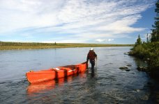
July 17. We rose at 6:00 a.m. to a gentle mist resting on the surrounding tundra ridges. Very comforting. After bannock breakfast and tea, we carried to the water 200 m over some difficult, rocky terrain to the end of the third rapid marked on the 1:250,000 map.
snowdrift084.jpg

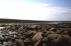
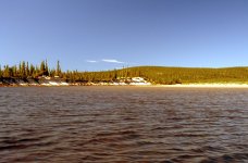
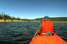
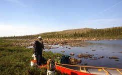
We began our paddling day at 9:00 by heading south, down a small lake with a rocky protrusion on the east shore.


snowdrift085.jpg

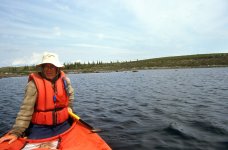
The end of that small lake drained into a very narrow channel that I expected we would be forced to drag or portage.


snowdrift086.jpg

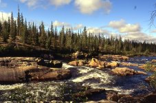
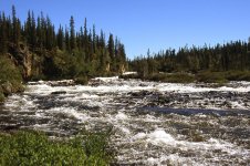
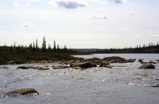
Surprisingly, however, we half ran/half lined down this channel and then paddled nearly another 1 km (0.6 miles) through a couple of rapids.

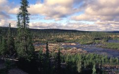
We arrived at the section indicated on the topographic map as "indeterminate." The river was indicated by dotted lines. Kathleen and I now faced our longest portage on the Snowdrift River—a real portage of about 400 m (yards) to the beginning of a 3-km (1.5 miles) string of larger lakes. The first of these lakes drained into the second through a 100-m chute, which we dragged. The last of these lakes ended in a thin arm on the east side, from which we lined and dragged, quite easily, about 150 m (yards) to a small hourglass-shaped lake. I say quite easily because there was almost enough water to run. At the end of this lake, though, the water completely disappeared into rocks at the lake’s outlet. We began our carry to camp of about 200 m (yards) at 2:30 p.m. Not a real portage, though. Just a carry to camp.
snowdrift087.jpg

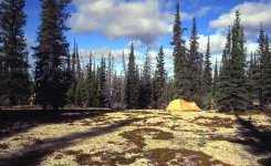
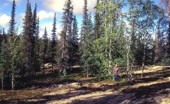
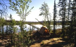
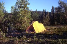
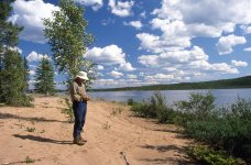
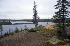
We were camped on the right bank, in a lovely, open, boreal forest. Dry and quiet. We had enjoyed transitioning into the boreal forest and seeing again some of its common plants, such as Twinflower and Fireweed. The scientific name of Twinflower is Linnaea borealis. Borealis because it is so common in the circumpolar boreal forest. And Linnaea in honour of Carl Linnaeus, who created the binomial taxonomic system for naming plants and animals. Twinflower was apparently Linnaeus’ favourite plant.

Toward the end of today’s paddle, we approached a moose feeding along the shore, and minutes later a pair of Greater Yellowlegs chased us, very noisily, from their nesting territory. We were camped only 2 km (1.2 miles) away from permanent water. Only 2 km remained in Tundra Tom's 10-km portage. Looking at the topographic map, I expected, at most, there was only one more kilometre of portaging. Maybe we would get lucky and wouldn’t have to portage at all. I doubted it, though. I expected we would be on the true portage trail tomorrow. About the same difficulty as today. But after that, the most demanding portion of our journey would be over. Should be a gentle journey then.

July 18 . Up at 7:00 a.m. in a low, grey drizzle. On the water at 9:30. We paddled down a small lake and ran the 300-m (yards) chute leading to the first of two very small lakes. The short chute to the second of the small lakes, just above the fourth rapid marked on the 1:250,000 map, was completely clogged with rocks. We beached on river right to scout “Rapid Number 4.” Un-runnable. Un-draggable. We scouted on the right bank all the way to what appeared on the topographic map to be “permanently flowing water.”
snowdrift088.jpg

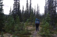
We eventually found a pretty nice trail through open forest. Our route cut off most of the slight bend and avoided the large boulders and rocks near the river.
snowdrift089.jpg

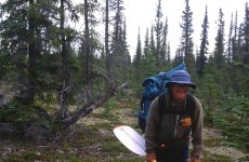
We began our 1-km portage at 10:45 and finished at 12:30 just below the last “wide” section above the anticipated “permanently flowing water.” We leapfrogged our gear along the trail, which went reasonably well for two reasons. First, we didn't lose any gear, and secondly because Kathleen never once uttered the dreaded words "I thought you said this was going to be an easy trip."

From the sardonic look on her face, though, I assumed she was thinking it much of the time.
snowdrift090.jpg

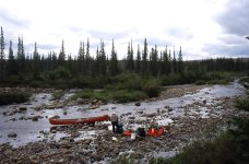
After lunch, just past the end of the fourth marked rapid, we lowered our boat and gear down a 2-m cliff, which was the easiest and shortest access back to the river. That launching spot, however, was too shallow to paddle or line down to the beginning of a short gravel bar, beyond which lay runnable water.
snowdrift091.jpg


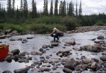
“If only just a few of those rocks weren't in the way, Michael. We might have deep enough water to drag down to that gravel bar.”

“That’s a great idea. Why didn’t I think of that?” I eagerly jumped into the shallow water and tossed aside 7 or 8 rocks.

We then dragged our loaded canoe 50 m (yards) to the gravel bar, lifted over a few canoe lengths, and ran, what I believed, was the final 75 m (yards) of Tundra Tom’s dreaded 10-km portage.

Note that we lifted over the gravel bar. As I explained to Kathleen, a lift over is not really a portage, which requires that you actually carry your canoe and gear a significant distance. Kathleen looked skeptical. Her argument went something like this: “But I thought you said a portage is when you unload the canoe, carry all your stuff, load the canoe and then paddle away.”

Hey. I don't make the rules. I just explain them. For example, if you drove your van to the water’s edge and then carried your canoe and gear a few metres to the river, would you call that a portage? Of course not. I wouldn’t either. It therefore follows that what Kathleen and I had just done was not a portage. It was a lift over.

At 2:00 p.m we had spent 4.5 hours on the water. Since leaving Sandy Lake, we had spent a total of about 15.5 hours “on the water,” including lunches, breaks, scouting, paddling, dragging, carrying to and from camp, lifting over, and portaging. Tom didn’t point out or mention where his portage ended, but we had gone about 10 km, maybe a little bit more, since leaving Sandy Lake. Also, based on the topographic map, I believed that the hardest portion of our journey was now over. We certainly didn’t endure a full 10 km of portaging, but quite of bit of work, nevertheless.
snowdrift092.jpg


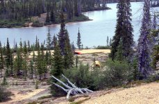
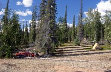
We then easily paddled 3−4 km (2-3 miles) to a very pretty lake and set up camp at 3:00 p.m. on a gentle slope clothed with open forest. After a chili supper, Kathleen and I lay in our tent, relaxing and sipping tea. We were definitely back in the boreal forest now. Today we saw American Robins, Gray Jays (also known as Canada Jays and Whiskey Jacks), four moose (1 male and 1 female with two calves), and one Tundra Swan. Red squirrels scolded us from treetops.


This un-named lake is likely where most Snowdrift River paddlers put in, including Tundra Tom's clients who arrived here 7 days ago, by float plane.


We were only about 10 km(six miles) behind schedule, and we intended to take a layover day tomorrow—laundry, fishing, and strolling. Let the gentle journey truly begin.
snowdrift093.jpg

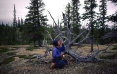
July 19. We slept very well and rose at 8:00 a.m., already feeling much refreshed and renewed. I set up a clothesline, made breakfast, and hauled water and wood while Kathleen did the laundry.

The tree line has shifted over the years, and was 150 to 250 km (90-155 miles) further north as recently as 9,000 years ago in the western arctic and 3,000 years ago in the eastern arctic. Some stands of spruce beyond current tree line are actually remnants of a warmer time, and can not replace themselves from new seed if these small groves are lost to disturbances such as fire.


snowdrift094.jpg

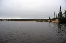
The day remained grey, misty, and windy. We returned to the tent at noon to doze and relax. Up at 3:30 for a brief, unsuccessful fishing attempt in the very shallow water next to shore. No bites except from scores of frenzied mosquitoes. A Least Sandpiper wandered up to within 2 m.

After a quick supper, we organized gear for our descent down the Snowdrift River tomorrow. We hoped to reach Ed Struzik’s “Waterfall Rapid,” about 27 km (16 miles) away. But we'll see what we feel like. Maybe we wouldn’t go that far.

Our laundry never completely dried, despite hanging on the line for 5 hours. Today’s strong northeast wind carried a great deal of mist. To the tent at 7:00 p.m. We anticipated an early start. We were ready to resume paddling.

One of the most enjoyable parts of the day occurred during supper, when two Common Loons performed their mating dance. They repeatedly rose up, flapped their wings, plunged downward, and then glided with heads along the surface of the water, like Northern Shovelers.


.
 
July 20 . I woke at 4:30 a.m., ready to get up, but very reluctant to do so. Another cool, grey, dreary, windy day. We forced ourselves out of the tent at 6:00 a.m., boiled tea water on the stove, ate a granola bar, and headed west, down the lake at 7:00. We felt cold in the brisk wind and the 10° temperature.
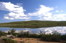
We ran a fairly long rapid about 1 km (0.5 miles) below the lake, where the river constricted as it bent south and then north again. Another fairly long rapid 2 km downstream of the next lake required some dragging to push our way through. A few more Class I riffles and we arrived at the marked rapid just upstream from Ingstad Creek. Ed Struzik’s guide reported that “this is actually a cascade and waterfall, turbulent enough to make lining out of the question.” (Note: This is not what I call Ed’s Waterfall Rapid, which still waited for us downriver.)

(Another Note: Ingstad Creek is named for Helge Ingstad, a very accomplished Norwegian and author, who travelled through the area in the 1920s. The following link describes his exploits.

https://en.wikipedia.org/wiki/Helge_Ingstad)


As Ed suggested, Kathleen and I portaged the rapid above Ingstad Creek.We found a very pleasant and easy route on the north, or right, bank, through open stands of spruce with a park-like understory of lichen and Crowberry. The portage was only150 m (yards). We barely breathed heavily, and I actually enjoyed the exertion to warm up a bit.

“You know, Kathleen, it’s not really a portage if you enjoy the activity. Portages happen only if you’re not having fun.”

She didn’t say anything. I think Kathleen might have been growing a bit disenchanted with the “it’s not a portage if…” game.

We lunched on a 6-m (20 feet) cliff, down which we lowered the boats and gear, and launched across a swath of alder and willow. In case you are a bit skeptical that we lowered our stuff down a 6-m cliff, I didn’t say the cliff was vertical. You might be right to be skeptical, though. It was, perhaps, more like a steep bank. We did use rope, however. We loaded the canoe and ran the outlet rapid below the falls.

We then paddled through the next lake and ran a somewhat rocky and lengthy rapid just after the lake's outlet, again where the river narrowed, bending south and then north. A nice, swift chute greeted us in the narrow “breakout” through the esker in the next lake. If you weren't paying attention, you could pass right on by the outlet without noticing it.

snowdrift095.jpg

A few more chutes and riffles put us at Ed’s Waterfall Rapid, which, as he promised, was a must portage. Following Ed’s advice, we beached on the north shore and found a very pleasant route—a stroll actually—of about 500 m (yards) through open stands of spruce.

snowdrift096.jpg

We set up camp halfway, meaning that the portage had become merely a carry to camp. Nice work on our part. Ed recommended that we “might want to camp here, as it is one of the prettiest spots along the river route.” We agreed completely.

It was a very good day. Lots of wildlife. Greater Yellowlegs incessantly chased us down the river. An Arctic Tern dive-bombed repeatedly within a metre of Kathleen's head. Bald Eagles soared above in nearly every viewpoint. Five more moose—two lone bulls and a cow with two calves, stared intently at us, even after we had already paddled by more than 150 m (yards)

snowdrift098.jpg.


We had pushed noticeably deeper into the boreal forest. Firewood became increasingly more plentiful. We had completed virtually all of the likely portages, had paddled 27 km (16 miles), and were dead on with our tentative itinerary. Things were going very well. Because the rest of the trip should be easy, we would likely reach Austin Lake, our end point, with several days to spare.

The weather had also been kind to us. No rain despite never seeing the sun. A day-long tailwind. Cool weather that made portaging so much easier.

snowdrift097.jpg

We enjoyed meeting up with our old Boreal Forest friends: Water Birch, Paper Birch and Northern Comandra.

July 21. Up at 6:00 a.m., with the sky still very grey but improving. Calm and quiet. By the time we finished our breakfast bannock, the sky was mostly blue.

We again scouted the rest of the portage, or rather the carry to the water. We confirmed that yesterday’s first impression of the best route was correct, and we returned to camp, photographing along the river in warm, bright sunshine. We easily completed the carry to the water and began paddling downstream at 10:00 a.m., with Bank Swallows darting and swooping overhead.

snowdrift099.jpg

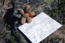
Beency studies the map, and points out long, winding, wide, stretches to just float and cruise.

“You know, Kathleen, this is our 20th day on the trip. Not even three weeks and already we havereached water flowing permanently in the direction we want to go, with likely no more real portages. I told you this was going to be an easy trip.”

There was no response from Kathleen in the bow. She probably couldn’t hear me over the sound of the river.

We glided along, so very much enjoying the scenery and warmth, so very unlike the two previous cold days. A beautifully varied and wooded river. Approximately 500 m (yards) downstream of today’s first lake, we ran a rocky rapid. Interesting, but not Class II as purported. Another 500 m later, where the river bent left (west), split by an island, we entered a second, more challenging rapid. We eventually ended up on river left, against the shore, above a narrow chute falling over a low ledge. We easily lined the remaining 50 m and set off again.


snowdrift100.jpg

Near the end of the next lake we rested for lunch.


snowdrift101.jpg

Beautiful gravel beach, open forest, medium-sized boulders for chairs, and a cow moose with calf browsing and foraging on the opposite shore. We lingered and savoured.


Off again, we encountered a third, marginally challenging Class II rapid below the lake's outlet, in the narrow bend left and then right. We moved easily back and forth, and eventually scooted over the ledge at the bottom of the drop.

We then drifted through a very long, straight section, with much of the forest on river left recovering from a recent fire. Two Ospreys scolded us as we neared their enormous nest on the top of a tall, shoreside snag. Greater Yellowlegs, perhaps the world's most annoying bird, badgered us constantly, in relays, down the river.

snowdrift102.jpg

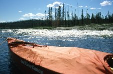
The weather was now very hot -- 26 degrees (79 F) by late morning. We paddled silently from outside bend to outside bend, seeking the deepest water, and trying to avoid sand bars.

snowdrift103.jpg

The Snowdrift River was named because of its white-sand banks, which looked like drifts of snow from a distance.

snowdrift104.jpg


We then paddled up the delta of the Eileen River to admire this trip's most spectacular waterfall/cascade. A Belted Kingfisher plunged headfirst into the swirling pools at the bottom of the rapid.

At 3:30 p.m. we paddled over to the right bank and set up camp with a great view of the Eileen River. We immediately heated several pots of water, and stripped and bathed for the first time since July 13: 8 days ago at Tundra Tom’s camp. We basked in warm afternoon heat—hot water poured over our heads and hair—and no bugs. A perfect end to a perfect day.

snowdrift105.jpg

July 22. Another glorious, sunny, calm morning. A relatively uneventful, mesmerizing seductive paddle across golden-green water broken occasionally by black depths.

snowdrift106.jpg

Kathleen enjoys her lunch break.

snowdrift107.jpg


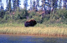
During one somnambulant period, when we were more asleep than awake, we were stunned to see a muskox foraging on the north shore. Surprised to see a muskox so far from the tundra. Maybe we shouldn’t have been surprised, but we were. In case you’re wondering, we sighted this muskox at approximately 62°25' N, 108°45' W. These coordinates were only my approximation from the 1:250,000 map, as I didn't carry a GPS. If you have information that this sighting at this location was unlikely, please let me know. Anyway, we were downwind, and easily drifted with the current to within 15 m of the solitary muskox before he noticed us. He stared, twitched, then quickly walked up the ridge, looked back once, and then disappeared.

Moments later, we frightened a Common Merganser family, which included 5 or 6 young. The mother flopped and flapped toward river centre, luring us away from her brood, which scooted along right up against the shoreline, where they soon hid themselves, cheeping all the while. The mother continued to feign injury, noisily thrashing in the water for another 500 m (yards), when she easily took flight, flew inland over river right, and circled back to her family. I was confident that a happy reunion ensued.

Much of the journey today occurred along and beneath nearly vertical, 10-m (35 feet) banks of pure sand. Amazing that the dense forest is able to exist and prosper on such poor, deficient ground. All the banks on the outside bends were badly eroded and slumping from the short, intense power of spring floods. Carpets of moss, lichen, Rock Cranberry and Crowberry festooned the edges and hung, draped over the precipice, like bunting at ceremonial parades. Black Spruce, White Spruce, and Tamarack stood in long lines along the edge, seemingly to gain the best view of canoeists parading past. Some had stood too close, and now hung headfirst over the precipice, barely hanging on by the very tips of their roots.

Black Spruce and White Spruce have nearly identical distributions in North America, predominantly north of the 49th parallel. Both species can be found all the way to treeline. Yet it seems that most people travelling in northern Canada tend to call all spruce Black Spruce. There seems to be an assumption that northern spruce must be Black Spruce. This assumption is incorrect, however. Black Spruce tends to occur on poorly drained, boggy, nutrient-poor sites, whereas White Spruce tends to occur on well-drained, moist sites. Next time you’re wondering about distinguishing between these two species, have a look at the cones. Those of Black Spruce are generally less than 3 cm (1 inch) long and are ovoid or egg shaped. The cones of White Spruce tend to be somewhat longer and more cylindrically shaped. If nothing else, just don’t assume that all northern spruce are Black Spruce. This has always bothered me.

snowdrift108.jpg

We had advanced today about 27−30 km (!6.75-18.5 miles) to the bends toward the west, when we stopped at 5:00 p.m. Eight hours for 30 km (18.5 miles). We probably paddled closer to 40 km (25 miles), though, as we continually zigzagged from outside bend to outside bend, seeking water deep enough to float the canoe. Very interesting and scenic country with varied vistas and landscapes. Seemingly endless and empty. Only us, the boreal forest, a few birds, and even fewer mammals. We often saw tracks of moose, and occasionally of bear. In general, though, the land belonged to us. We were alone.

snowdrift109.jpg

The weather had become quite hot, nearing 30 degrees (86 F) by mid-morning, and we sought shade for our camp.
 
snowdrift110.jpg - Click image for larger version  Name:	snowdrift110.jpg Views:	0 Size:	408.7 KB ID:	112920

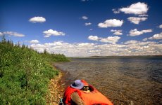
July 23. A few sprinkles of rain in the morning but clearing by the time we put on the river at 9:15 a.m. We seemed to have more current today, and covered 15 km (9 miles) by noon. Blue sky, and again hot, reaching 30 C (86 F) by lunch. Kathleen and I paddled quietly, with few words, as we drifted through our serene, gentle forest.

snowdrift111.jpg - Click image for larger version  Name:	snowdrift111.jpg Views:	0 Size:	557.7 KB ID:	112921

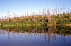
At approximately longitude 109°08' W, just beyond an island, in a sandy area, we entered an area where a large wildfire had burned. Although this TR is not really a guide, I thought you might like to know where the burned area began. If so, just find the above longitude at the bottom of your map and trace up until you reach the river. That will necessarily also be the appropriate latitude. We felt a little depressed to see blackened stems where park-like stands of spruce once dominated.

snowdrift112.jpg - Click image for larger version  Name:	snowdrift112.jpg Views:	0 Size:	903.5 KB ID:	112922

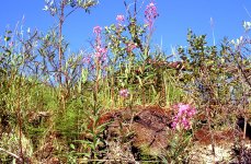
Historically, though, the boreal forest burns every 50−100 years, and rarely does a stand exceed 150 years. We learned later that this wildfire on the Snowdrift River occurred in 1994. By 2001 the land is already recovering, as fireweed and other plant species all grow thickly.

About 30 minutes later, as we approached a narrow constriction, at approximately 109°14' W, we heard the sound of a large rapid. We could see no rapid, though. As we neared, the sound grew louder, but we could still not see whitewater above or below the apparent, but invisible rapid. We floated on.

"This doesn't seem to be much of a rapid. Shall we just slam that puppy down the middle, Kathleen?”

(Note: I have plagiarized that last phrase from Dave Kilpatrick, a fearless member of our Beaver Canoe Club. Whenever Dave was asked about the best way to run a rapid, he would always say, “Just slam that puppy down the middle.”)

Surprisingly, Kathleen said, “OK.”

I say surprisingly because we are very cautious. We normally don’t slam puppies or rapids down the middle.

We drifted closer to the sound. "How can there be so much noise when there's no rapid below and no rapid above?"

"It must be a ledge. Let's go to shore and have a look.”

That sounds more like us.

Sure enough. A ledge. Slamming that puppy down the middle would have put us into a diagonal, recirculating hole. Glad we stopped. A safer route presented itself on river left—a green tongue, between two rocks, that extended into a train of haystacks only 70 cm (2 feet) high. We ran easily, and again congratulated ourselves for having stopped to look first.

Once again we drifted beneath a warm sun, gliding above a rippled, sandy riverbed bathed in green, yellow, and golden hues. Once again we were surprised to see a muskox on river right, at approximately 109°18' W. This one galloped off into the bush almost immediately. When I say “this one” galloped off into the bush, I mean the muskox, not me.

We drifted on, ready to camp, but found nowhere in the burned remnants of a forest that yesterday had been so inviting and soothing. Finally, at 5:30 p.m., about 10 km upriver from Siltaza Lake, on a hard bend to the left (south), an unburned patch beckoned. A small stand of red-barked Water Birch and white-barked Paper Birch invited us to set up camp in a small oasis of park-like forest surrounded by blackened stems at approximately 109°24' W.


snowdrift113.jpg - Click image for larger version  Name:	snowdrift113.jpg Views:	0 Size:	681.3 KB ID:	112923

We pitched our tent on a point above the river, which slid silently by. Jack Pine and Common Juniper, two more plant species common to the boreal forest, adorned our sandy site.

snowdrift114.jpg - Click image for larger version  Name:	snowdrift114.jpg Views:	0 Size:	575.2 KB ID:	112924

Kathleen and I lingered by the fire, enjoying a slow supper over a slow bed of glowing coals. In the tent at 9:15. Late for us. We prefer making a fire pit on a sandy beach, to protect the vegetation, to prevent starting a forest fire. After our generally small fire, we cover the coals with sand, thereby leaving none, or very little trace of our fire.

snowdrift115.jpg - Click image for larger version  Name:	snowdrift115.jpg Views:	0 Size:	830.5 KB ID:	112925

Surprising to us that these mushrooms are growing so luxuriantly in such sandy soil.

Kathleen and I felt comfortable and content. Likely only two more paddling days, approximately 48 km (30 miles) to the cabin on the topographic map, our pickup point on the north shore, halfway down Austin Lake.

snowdrift116.jpg - Click image for larger version  Name:	snowdrift116.jpg Views:	0 Size:	342.4 KB ID:	112926


July 24 . Up at 7:15 a.m. Sore and tired but driven by the excitement of only two more paddling days to our pickup halfway down Austin Lake.

On the water at 9:45. A beaver briefly swam in front of our canoe, with only its head above water, and then disappeared beneath the surface.

Very hot again—26 C (79 F) by late morning. We paddled silently from outside bend to outside bend, seeking the deepest water and trying to avoid sand bars and flats. Crossing over as soon as possible and then running with the current right up against the bank worked best.

We landed for a break and clambered up the bank into the burned forest. Willow, Birch, Green Alder, Common Horsetail, Bluejoint, Fireweed and scattered spruce seedlings already grew luxuriantly only 7 years after the 1994 fire.

snowdrift117.jpg - Click image for larger version  Name:	snowdrift117.jpg Views:	0 Size:	545.5 KB ID:	112927


We reached Siltaza Lake at 12:30, struggling slightly against a persistent headwind. We hadn't seen another potential campsite since we left camp this morning. We headed down the north shore, crowded with thick, unburned forest. Dense, with no camping spots; 31C; 88 F. At 3:30 we rested at the base of a point about 8 km (5 miles) down the lake. We sat on the shady side of the point, wishing that the beach had been wide and sandy instead of narrow and rocky. If so, we would have gladly stopped to camp.

“It’s a scenic spot here. Maybe there’s good camping up on top of this point. Let’s go have a look.”

snowdrift118.jpg - Click image for larger version  Name:	snowdrift118.jpg Views:	0 Size:	608.4 KB ID:	112928


A quasi trail led up the 10-m (yards) ridge, which was only 15 m (yards) wide. Even so, we found a very camp-able site that was open and flat. In fact, others had camped here before us, but not likely for 10 years or more. There were two fire pits, and rustic tables and chairs that were now crumbling and decaying. Rock Cranberry and Crowberry trailed over a neatly stacked pile of sawn firewood. We gladly set up camp in our new home.

Although this camp had obviously been well used at one time, there was not any garbage. Not even a single can. Quite unusual for semi-permanent bush camps. Exactly like the well-used site at our camp opposite the Eileen River. It would be nice to know who used these camps at one time. Perhaps trappers, as the Eileen River camp had stakes for tying dogs.

Only one paddling day, approximately 25 km (15 miles), to the cabin at Austin Lake. We should arrive at our pickup spot four days early. It would be nice if somehow we could contact Big River Air to let them know that we would be ready sooner than expected. I guess that’s one reason people bring satellite phones on wilderness canoe trips.

snowdrift119.jpg - Click image for larger version  Name:	snowdrift119.jpg Views:	0 Size:	538.4 KB ID:	112929

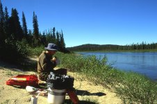
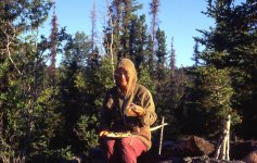
July 25. Up early. Kathleen enjoys bannock on another glorious morning. You might have noticed that Kathleen and I are often wearing our bug jackets, which is our preferred method of dealing with the ubiquitous and swarming insects. Before a trip, I saturated each jacket with a 2.5 fl ounce bottle of 95% deet. We rarely get bitten on our trips. The open weave of the jacket makes for a relatively cool ensemble, particularly when working hard. Depending on the amount of work, and rain, I normally re-saturate the jackets after about two weeks. We store the jackets when not in use in a large ziplock bag.


snowdrift120.jpg - Click image for larger version  Name:	snowdrift120.jpg Views:	0 Size:	470.7 KB ID:	112930


As we entered the narrow portion of Siltaza Lake, on the north shore, we finally caught up with Tundra Tom’s clients. They had been dropped off July 11 at the same lake Kathleen and I had reached on July 18. Eric, his wife Sandy, and their 13-year-old daughter Brittany were in their last camp, waiting for pickup tomorrow afternoon. They were very much looking forward to being picked up, as last night a bear had ransacked their camp. No one was hurt or threatened, but the bear had absconded with the pack containing their toilet paper. Apparently the bear didn’t need toilet paper, as a 15-minute search that morning produced the missing pack and all of its very valuable contents.

snowdrift121.jpg - Click image for larger version  Name:	snowdrift121.jpg Views:	0 Size:	913.0 KB ID:	112931


This family from Florida was quite hospitable and invited us into their large, bug-free tent for morning coffee. We chatted a bit and learned that Eric carried a satellite phone because of his heart condition.

“Would it be possible for us to make a phone call? We can pay for it. We’d like to call Big River Air in Fort Smith to see if they can pick us up early.”

“Sure. Do you know the number?”

“Actually, we don’t. I never thought about bringing their number. Too bad. It would have been nice to call.”

“Well, you can call information.”

That hadn’t occurred to me. I’m not really accustomed to making phone calls from the wilderness. This was my first time.

Anyway, I called information and got the number for Big River Air. Doug answered the phone, and said he would pick Kathleen and me up two days early, around noon on the 27th. The technology was amazing, but it certainly diminished and shrank the feeling of wilderness.

After about an hour-and-a-half of conversation and coffee, we all wished each other luck and said our goodbyes.

“Be sure to say hello to Tundra Tom for us. Tell him we're sorry we didn't have time to wait for him.”

I couldn’t help myself. It’s too bad Tundra wasn't coming today, though. It would have been great to see the look on Tom’s face as we helped him down out of the plane’s cockpit. Ten kilometre portage indeed. “Hah,” I say to that.

snowdrift122.jpg - Click image for larger version  Name:	snowdrift122.jpg Views:	0 Size:	471.8 KB ID:	112932

Kathleen and I paddled down to the outlet of Siltaza Lake for lunch. Back on the water, we soon encountered a rapid—quick, shallow, and rock strewn, but mostly fun.

Then, two more rapids in quick succession, a little more difficult, where there were two “button” bays on river left, about 1 km (0.5 miles) below the outlet. Both rapids had granitic, shield outcroppings that created ledges and deep, reversing troughs. We lined the first and escaped the second by running down a side channel on river right.

snowdrift123.jpg - Click image for larger version  Name:	snowdrift123.jpg Views:	0 Size:	449.9 KB ID:	112933

The rest of the "river" to Austin Lake was quite pleasant. A few drops interspersed with quiet sections. The shallow, sandy river provided poor fishing.

snowdrift124.jpg - Click image for larger version  Name:	snowdrift124.jpg Views:	0 Size:	376.1 KB ID:	112934

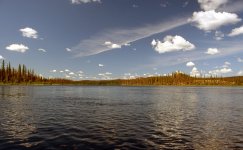
We approached Austin Lake around 4:00 p.m. As we scooted down the last chute, a Bald Eagle flew across our bow. When we entered the lake, a Common Loon yodelled its welcome. A tailwind sped us along the north shore, which offered many excellent camping spots.

We reached the cabin at our pickup spot less than an hour later but were very disappointed with the garbage and debris spread over what seemed like a hectare (2 acres) or more.

snowdrift125.jpg - Click image for larger version  Name:	snowdrift125.jpg Views:	0 Size:	799.4 KB ID:	112935

We paddled east, back up the lake about 15 minutes, to set up camp in an open forest. Sandy beach. Beautiful evening light. We had arrived. To the tent for celebratory brandy.

Note: You might remember that our brief guide by Ed Struzik indicated that the last 50 km (30 miles) from Austin Lake to Great Slave Lake was a must portage. For you information, please click on the following link to see that section of the river from the perspectives of two kayakers. Impressive. http://slaveriver.blogspot.com
 
Last edited:
Beautiful trip, didn't look too hard to me, lol. Thanks again for all your efforts, your reports are the highlight of my day!
 
Beautiful trip, didn't look too hard to me, lol. Thanks again for all your efforts, your reports are the highlight of my day!

Glad to hear that you are enjoying the trip report, mem. Without feedback there is a tendency to wonder.

The trip is not over yet, though. There is still a layover day, followed by the day we are picked up by Big River Air. I plan to post these two days in a few hours. Then the trip will be truly over.

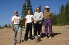
Yesterday, I wondered about Eric and Sandy, the canoeists from Florida who shared their campsite with us for a couple of hours. Well, I googled “Eric Sandy Florida canoe,” and received a couple of hits for Eric and Sandy Bailey, of Jupiter, Florida. For many years, beginning in 1980, they owned Canoe Outfitters of Florida, and with trips focussed primarily on the Loxahatchee River. It seems that they no longer own the business, and I couldn’t find any contact information for them. But these gotta be the same people. I would like to send them our image of us posing on the beach together. I’m thinking there must be someone on canoetripping that knows them!
 
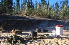
July 26. We woke feeling relaxed at 7:00 a.m., and crawled out of the tent into yet another hot, sunny morning. Another bannock, over a very slow fire, followed by a bath on our sandy beach. We then dozed in the shade until noon, when we hiked up the ridge and then west, down to the site of the cabin, which we learned later had been a fire suppression camp. Such a horrible mess. If they can bring all that stuff in, why can’t they take all that stuff out? Anyway, I put some of this debris to good use. I set three, 4-litre (1 gallon) white-gas cans on stumps to practise with my .308 rifle. Three, quick dead-centre shots at about 50 m (yards), the distance at which I envision shooting at a charging bear. I was very satisfied and pleased.

snowdrift126.jpg


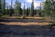
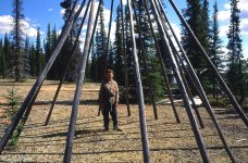
On our return to camp, through the bush, we overshot by about 150 m (yards) and discovered a teepee site. Virtually no garbage. We saw another teepee site on the opposite shore, in the narrows to the east. Three “communities” within 1 km (0.5 miles) of each other. We were certainly close to civilization now.

snowdrift128.jpg

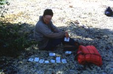
Back at camp for lunch and more resting. Still so very hot at 33 C (91 F). We amused ourselves with activities that people normally do while waiting to be picked up. Kathleen played solitaire in the shade to get away from the heat. For a diversion, she sometimes fed mosquitoes to ants.

snowdrift129.jpg

I scratched in the sand with a small stick. I studied the contents of our repair kit, and for some reason, seemed particularly interested in my roll of electrician’s tape.

snowdrift130.jpg

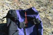
Later in the afternoon, I restrung the day pack with spare rope, of which we always bring a very plentiful supply. I am fond of saying that you can never have too much rope on a wilderness canoe trip.

snowdrift127.jpg

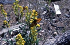
Kathleen photographed Lesser Fritillary butterflies feeding on Spike-like Goldenrod. According to E. C. Pielou, the Lesser Fritillary settles on plants in a way that maximizes the warmth it can absorb from the sun. It settles with its wings spread, and then, if the sun is shining, it will turn itself until its head points away from the sun, which orients the spread wings at the best angle to be warmed.

snowdrift131.jpg


During our soup supper, a proud family of four Common Loons promenaded along our shore, yodelling confidently in their joyous freedom. It was as though they were saying farewell and inviting us to come back again. I always wonder, at the end of each trip, if this will indeed be the last time. Twenty-four hours from now, we should be back in Fort Smith, with our month-long adventure already a memory. I miss the tundra even now. I already miss the Snowdrift River, which indeed had eventually become a gentle journey.


July 27. Yet again, another hot, sunny morning. Also, yet again, we relaxed over a slow fire and a bannock cooked slowly to the proverbial golden brown. We then started to pack, for the final time, and to load the canoe for the 15-minute paddle down Austin Lake to our pickup spot. I folded the tent and fly, rolled them up, and crammed them into the stuff-sack. We carried the canoe and all the smaller parcels and hand-held items down to the beach. I leaned my .308 rifle up against the canoe. We then returned for the three large canoe packs.

snowdrift132.jpg
(Note: This image is just so you have something pretty to look at. The tent was already down, and the canoe was on the shore.)


"Michael. There's a bear!"

I turned. Sure enough. A large (aren't approaching bears always large?) black bear was ambling toward the packs, striding right through the patch of Kinnikinnick where our tent had stood only moments ago. Together, Kathleen and I backed off slowly toward the beach and my .308 rifle leaning up against the canoe. The bear kept advancing, but not toward us. Kathleen and I stopped, stood together to appear larger and more formidable, and yelled out things that bears probably wouldn’t like to hear, such as “Hey bear.”

The bear didn’t seem to mind these harsh words too much, though, as he kept advancing and was now only 5 m from the canoe packs.

Kathleen and I have seen a lot of bears during our wilderness experiences. Well, it seems like a lot to us, anyway. I estimate about 200 black bears, 40 grizzly bears, and 5 polar bears. Other than the polar bears, this is the first bear that appeared unafraid and undeterred by our presence.

What to do? I preferred not to turn my back on the bear to walk about 30 m (yards) to get my .308 rifle leaning, somewhat inconveniently, up against the canoe on the beach. So we yelled some more. Probably said, “Hey bear,” again, with no visible effect whatsoever.

"Why don't you try your bear banger, Kathleen. Do you have it?"

"Yes. I almost packed it away, but I thought no, we're still in the wilderness. I better keep it with me."

My foresightful adventuring partner reached into her shirt pocket and pulled out the pen-sized launcher on which the explosive was screwed. She fumbled only slightly with the release mechanism and held the banger overhead.

The first small bang when the explosive launched produced no impact on the bear at all, who was now within sniffing distance of our three large packs of gear, clothing, food, (and toilet paper). Seconds later, the loud “bang” overhead caught the bear's attention. He looked over at us, and seemingly for the first time, noticed that we stood in the clearing.

He appeared confused, uncertain about his course of action. He looked at us again and then turned to walk away. After a few steps, he broke into a run and disappeared into the willows and spruce, heading along the shore, west, down the lake. It was good to know that the bear banger does actually work. At least sometimes.

We resumed packing, checking the periphery of our forest clearing with furtive inspections every few seconds.

snowdrift133.jpg

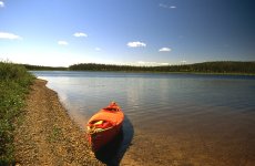
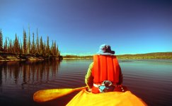
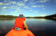
Minutes later, we paddled away onto a lake of glass beneath a warm, blue sky.

snowdrift134.jpg


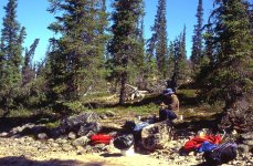
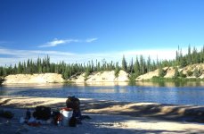
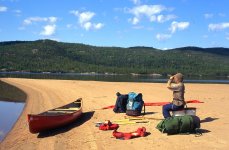
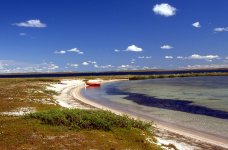
We glided up to the sand spit at our prearranged pickup site and spread our gear on the sand so that the pilot could more easily see us from the air. The morning grew hotter, and we talked of our first meal back in Fort Smith.

"I don't know whether to have beer and burgers, or beer and pizza. All I know is that I really want a cold beer."

"Me too," Kathleen agreed. "Maybe Doug the pilot will bring us a cold beer.”

"That would be great. Not likely, though. But that sure would be great."

snowdrift135.jpg

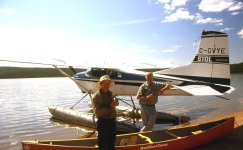
Around noon, just as arranged by satellite phone at Siltaza Lake, we heard, and then saw, the Cessna 185 flying in low from the southwest. Our pickup was coming. Pretty darned exciting.

snowdrift136.jpg

The float plane taxied up to the spit, and Doug stepped out holding a small box. "Are you guys thirsty? Would you like a cold beer?"

As I write these words, I’m staring directly into the page and holding my right hand up, just like Jack Paar, as though taking an oath. It really happened. Just like that. I kid you not.

We sucked in the beautiful liquid, as we stood in the hot sun on an isolated sandy spit on the north shore of Austin Lake. I then helped Doug load our gear into the plane. I climbed into the back, with our gear, while Kathleen stepped into the co-pilot's seat. We taxied east up the lake and lifted off the water. Our adventure was now truly over.

It seemed like three adventures in one trip. The challenge of finding our way, with compass and maps, from the outlet of Lynx Lake to the upper end of Whitefish Lake. The joy of heading over the height of land and then down the disappearing water below Sandy Lake. When I stood strong and still young—running rapids, portaging through the boreal forest, dragging and pushing our canoe through an unending labyrinth of impenetrable rock gardens. Then, to drift easily down the Snowdrift River, camping in a park every night. Alone in the wild isolation of northern Canada. Just me, the loons, the moose, the muskox, and my willing, supportive, necessary, and much appreciated adventuring partner, otherwise and forever after, known as Cupcake.

...............................................................

The following four images are how Kathleen and I end our slide show on the Snowdrift River.

snowdrift137.jpg

To us, Canada’s northern landscape provides much more than a refuge for plants and animals, and wild places. It also provides an oasis of simplicity, tranquillity, contentment, and challenge for the human spirit.

snowdrift138.jpg

The challenge of finding our way across vast distances, and over the heights-of-land armed only with compass, map and personal judgment.

snowdrift139.jpg

And the contentment that we feel for just being alone in this landscape.

snowdrift140.jpg


For Kathleen and me, though, among the greatest gifts of Canada' Arctic Oasis is a tranquillity of life lived in unbroken silence. And the simplicity of standing, as people were meant to stand, surrounded by wild, nurturing isolation -- forever adventuring, forever strong, and dare we hope, forever young.

.............................................................

So that's it. I have no more wilderness canoe trip reports. Hopefully Kathleen and I will be able to return to the Barren Grounds next summer - for another trip, and another trip report!
 
Spectacular. This has been my favourite trip you've shared. Flora, fauna, landscape, and relaxed approach to gentle exploration.
Thanks for this and all the others.
 
A very enjoyable read, with great photos. A reminder of what will be missed this summer, with the NWT border closed.

I am glad that no puppies were injured in the making of this report.

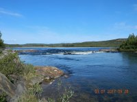
The puppy, unslammed:

DSCN1626.JPG
 
Thanks, memequay. I have tried my best to be entertaining. This Snowdrift trip report was the first one I have ever written, where I tried purposefully to be more lighthearted, if perhaps not epic.

And, Odyssey, the Snowdrift was one of my favourite trips, too. It had so many elements. Over the-height-of-land. Warnings that we couldn’t get through the 10 km below Sandy Lake. Barren Grounds. Boreal Forest. And yet, compared to several of my other trip reports, it received relatively few views. Perhaps because the Snowdrift is less well Known than some of the other rivers. Perhaps it just didn’t have the same cache. One never knows.

And, wjmc, are you telling us that you didn’t just slam that ledge down the middle? Where was the photo taken? Is it in the NWT? We hope to get back next summer. I’m 72 now. Still reasonably spry. But in another year, who knows?

Michael
 
Michael - that is your puppy, the only rapid of significance on the Snowdrift between the Eileen junction and Siltaza Lake, at about 109 d 13' W. Taken July 1, 2017. The little V on RL was my choice as well.

I also hope to return to the NWT next year, but turning 70 next month I too am conscious that there are a limited number of opportunities remaining.

That’s very interesting! I showed your image to Kathleen, and she didn’t recognize our puppy either. Thanks for sharing. Did you enjoy the Snowdrift? Where did you start and end? What caused you to choose the Snowdrift, which is relatively unknown. Did you happen to camp at any of the same places we camped? I’d love to see a trip report.
 
The last few posts are why I hang around.
I had an outdoor career and have run lots of rivers, but at 71 will probably never get to the Arctic or the Barren Lands.
This is the next best thing. Thanks.
 
Back
Top