I'm enjoying the sense of being close to the land. Thanks for this exciting glimpse of a Yukon spring.
-
Happy Plum Pudding Day! 🟣🍮
You are using an out of date browser. It may not display this or other websites correctly.
You should upgrade or use an alternative browser.
You should upgrade or use an alternative browser.
Breakup on the Yukon River, 2006
- Thread starter PaddlingPitt
- Start date
- Joined
- Aug 21, 2018
- Messages
- 1,812
- Reaction score
- 4,603
Sunday, April 30. Minus 11 C (+12 F) at 8:00 a.m. Breakup usually occurs in May, which begins tomorrow. American Robins sang to me as I strolled to the outhouse. The weather report predicts +14 C (+57 F) for Wednesday. Seven Mallards landed in the watering stream at noon.
In the late afternoon, Kathleen and I headed down the bush trail to Peter and Marion’s for Sunday supper. About half way there, we saw a black bear with two cubs. I suddenly felt vulnerable, and picked up a large tree branch to use as a club. Now I felt primal. Must have scared the bears, as they headed out across the Yukon River. Canada Geese honked loudly the rest of the way to Peter and Marion’s, where American Tree Sparrows greeted us.
Peter answered when we knocked on the cabin door. “I got the fire going in the sauna,” he said. “There’s a bowl of water in there. And towels and soap. Feel free to enjoy a sponge bath.”
So that’s what we did. Me first, and then Kathleen. It was a smallish sauna. Not really large enough for two people to comfortably enjoy the experience. The word “enjoy” does not adequately describe the sheer luxuriance of that sauna. I stepped in, closed the door, and removed my clothes. I sat there for about 10 seconds, and then said, “Oh, baby.” And I don’t use those words. They just came out, all on their own. I actually said it a second time, lingering on all three syllables. “Oooh, Bay-Bee.” It was a very sensual experience.
Ruffed Grouse drummed in the bush as we left Peter and Marion’s to head home. Many tracks of moose and bear heading out onto Yukon River. The ice obviously remains plenty thick. We arrived home at 11:00 p.m., in beautiful twilight.
Monday, May 1. Still cold at -8 C (+17 F) at 6:00 a.m. April was unusually cold. We recorded only two days reaching +10 C (+50 F) or higher, whereas an average of 10 days are warmer than +10 C in April. The weather report predicts -10 C (+14 F) for tonight, compared to an extreme low of -8.2 C (17.2 F) for the last 30 years for the month of May in Dawson City.
We walked down to the bluff in the afternoon, where it was sunny and warm (+9 C; +48 F), until the clouds moved in. Much of the snow on the Yukon River has either melted, or taken on a very ‘sooty’ appearance.
Tuesday, May 2. Minus 2 C (+28 F) at 6:00 a.m. There was so much bare ground on the bush trail toward Reliance Creek, that several sections would be more suited to a quad than a ski-doo. Reliance Creek itself was running low, well below the level of ice on its banks. Sediment now discoloured open sections of the Yukon River. American Widgeons joined Northern Pintails along the watering stream. Both species fled when an immature Bald Eagle soared overhead. A Rusty Blackbird wandered among riverside willows. Swallows again swooped and darted over our camp.
Wednesday, May 3. We woke at a 7:00 a.m. to -1 C (+30 F). The temperature soared to +12 C (+54 F) in the afternoon. Kathleen and I basked in the heat, as we watched ice dams form in the watering stream, when blocks of ice broke away and floated down, before becoming wedged in a corner or narrow constriction. Moments, or minutes later, the current washed them away. Breakup really does seem to be happening. Even so, the main portion of the Yukon River remains frozen. A fox easily crossed over to the opposite bank from our side of the river.
Tommy had instructed us to clean up all the woody debris from the windstorms last summer. So we spent the early evening gathering downed branches and limbs, and then burning them in a giant bonfire. As the fire burned down, we enjoyed supper outside, while admiring our work. Lots of fun today. Summer really is on the way!
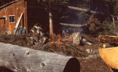
Everyone loves a bonfire!
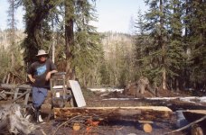
Admiring our work.
Thursday, May 4. We woke at 6:00 a.m. to +5 C (+41 F). And although the temperature eventually reached +13 C (+55 F), it seemed like winter had returned. Grey skies prevailed throughout the day, and snow still dominated the dog yard because of its protective cover of trees. The east-facing hills across the Yukon River also still showed snow on the ground.
Even so, we could see open water on the opposite bank in the morning, and then in river-centre by evening. Very large mud/cobble flats appeared between Fort Reliance and Reliance Creek in sections of the bush trail that were snow-covered only last Sunday. We again sat on the bank to watch ice dams wash away in our watering stream. Northern Shovelers and a shorebird arrived to join the American Widgeons and Northern Pintails loafing about in the open water. All were sent scattering by what was likely a hunting Peregrine Falcon. Around 8:30 p.m., a fox crossed back to our side of the river. He purposefully sought out white ice, and avoided sooty-looking ice, which he tested with his paws. He eventually had to leap across an open lead of water to reach the river bank.
These were all good signs that breakup approaches. Yet the weather forecast on the radio said that breakup won’t occur for at least another week. We’ll see.
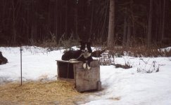
Rocca relaxing in the still snow-covered dog yard.
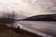
Kathleen looking south toward Dawson City.
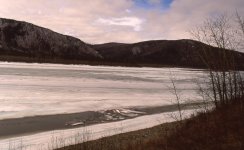
We enjoyed watching ice dams wash away in our watering stream.
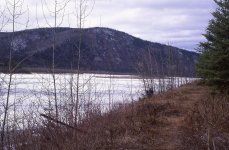
Me waiting and watching for breakup.
The following information is from https://en.wikipedia.org/wiki/Fort_Reliance
Fort Reliance consisted of several buildings of various types of construction. All that remains of these buildings are ground features such as pits or post holes. After it was abandoned, many of its buildings were used as fuel by the steamboats that sailed the Yukon River. The main buildings consisted of three or four log cabins built for the traders. The largest of these cabins was described by François Mercier to be roughly 25 feet (7.6 m) long by 30 feet (9.1 m) wide. The remains of five pit houses are found at the site. These pits were roughly 4.5 to 5 meters square and four of the five had dug out entryways leading into them that were between 2.5 and 5 meters long. The pit houses were likely inhabited by the Han Indians that traded at the site.
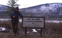
Kathleen with Fort Reliance Sign, May 4.
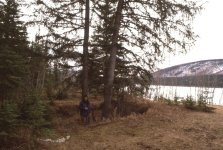
Kathleen standing in the remains of a Fort Reliance pit house, May 4.
Friday, May 5. Plus 2 C (+36 F) at 6:00 a.m. It seems that we now have continuous thaw. How much longer until breakup? Overnight a river sprang up between the cabin and the dog yard, more or less slipping beneath the low bridge before winding its way to, and down our access to the Yukon River. By 6:00 p.m. our original watering hole had essentially become an open river, 1.5 km (one mile) all the way down to the bluff point.
The open water near river centre is now nearly 1 km (0.5 miles) long, with a steady progression of large ice floes. We heard a Northern Flicker, and saw two American Widgeons riding downriver on a pan of ice. Ruffed Grouse drummed their courtship ritual throughout the day. We again enjoyed supper at the campfire. Scads of miniature white ‘moths’ emerged in the evening sun. I think they were moths, anyway.
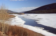
Looking south toward Dawson City.
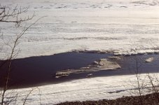
Our original watering hole now flowed all the way down to the bluff point.
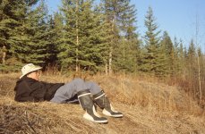
Me wondering how much longer can it be to breakup.
Saturday, May 6. For the fourth day in a row, more ‘breakup’ occurred than on the previous day. Ice floes six by three metres and 15-20 cm thick (20 x 10 feet and 6-8 inches thick) piled into each other, like vehicles on an icy road. “Trains’ of ice plowed channels through, and beyond, increasingly widening leads. The positive feedback mechanism was definitely gaining momentum. Saw a Bald Eagle scavenging for food while standing on the ice. Canada Geese rested on the ice in mid-river.
Tommy had told us that we would probably have to move some dogs when their spot became too muddy. Well, the snow in the dog yard had melted, which created very muddy conditions for six of the dogs. They needed to be moved to higher ground, and chained to trees.
We had seen the bedlam that resulted when dogs had previously escaped. We wanted to conduct the move calmly, without creating a ruckus. We had strolled through the dog yard many times in the last five weeks. Picking up poop. Scooping out food. Petting and giving affection. The dogs had become very accustomed to the routine, and generally paid very little attention to us.
But, as you know, dogs are very attentive. They could tell by our slightly altered body language that something was afoot. They all stared intently at us. “What are those humans up to?” they seemed to ask. “They’re not acting normal. Something different is gonna happen!”
Pandemonium erupted as soon as we unchained the first dog. “Take me. Take me. Take me. I wanna go too. Where are you going? I don’t care, though. I just wanna go too. Take me!”
After we moved the sixth dog, Kathleen and I immediately headed back up the trail toward the cabin. All the dogs instantly settled back into their usual routines. The excitement was over. The six moved dogs seemed very content to have escaped the mud. They would probably enjoy sleeping under the stars—without their houses—on dry ground.
Kathleen and I enjoyed a pizza supper at the campfire, even though a swirling wind forced us to keep changing locations.
Sunday, May 7. We heard on the radio that the community of Rock Creek, about 17 km (10 miles) up the Klondike River from the confluence with the Yukon, was evacuated due to an ice jam and rising water. Reliance Creek is now truly flowing, although over the top, and within channels of the ice. The bush trail, which drains muskeg, is mostly a river, except when it’s a lake. The Yukon River is brown, from the many tributaries of tea-coloured, peat-stained, brackish water.
We sat on the bank until 4:00 p.m, watching a succession of large ice blocks add their bodies to the ice jam. Green-winged Teal rested on the moving ice. We left to feed the dogs, and returned at 5:00 p.m, only to discover that we had missed a major shift of the entire river of ice over to our bank, crushing the ice jam in the process. No truly open water remained.
Thirty minutes later the entire river groaned and headed down. Spectacular for five minutes, as breakup seemed to be happening. Then it all stopped. The powerful force had somehow been resisted. Nevertheless, if we had a tripod attached to a clock, ‘breakup’ at Fort Reliance might have been official. After supper, we strolled down to the beach to sit on blocks of ice. I guess it could be a couple more days before the ice finally flushes downriver.
We saw moose browsing in the evening on Nuclacco Island, the former site of a Hän fishing village, just opposite Fort Reliance. Two mosquitoes arrived. Yep. Spring seems to be here!
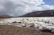
After first ice movement, 5:30 p.m.
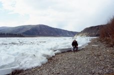
Me sitting on blocks of ice in the evening of May 7.
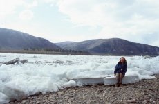
Kathleen sitting on blocks of ice in the evening of May 7.
In the late afternoon, Kathleen and I headed down the bush trail to Peter and Marion’s for Sunday supper. About half way there, we saw a black bear with two cubs. I suddenly felt vulnerable, and picked up a large tree branch to use as a club. Now I felt primal. Must have scared the bears, as they headed out across the Yukon River. Canada Geese honked loudly the rest of the way to Peter and Marion’s, where American Tree Sparrows greeted us.
Peter answered when we knocked on the cabin door. “I got the fire going in the sauna,” he said. “There’s a bowl of water in there. And towels and soap. Feel free to enjoy a sponge bath.”
So that’s what we did. Me first, and then Kathleen. It was a smallish sauna. Not really large enough for two people to comfortably enjoy the experience. The word “enjoy” does not adequately describe the sheer luxuriance of that sauna. I stepped in, closed the door, and removed my clothes. I sat there for about 10 seconds, and then said, “Oh, baby.” And I don’t use those words. They just came out, all on their own. I actually said it a second time, lingering on all three syllables. “Oooh, Bay-Bee.” It was a very sensual experience.
Ruffed Grouse drummed in the bush as we left Peter and Marion’s to head home. Many tracks of moose and bear heading out onto Yukon River. The ice obviously remains plenty thick. We arrived home at 11:00 p.m., in beautiful twilight.
Monday, May 1. Still cold at -8 C (+17 F) at 6:00 a.m. April was unusually cold. We recorded only two days reaching +10 C (+50 F) or higher, whereas an average of 10 days are warmer than +10 C in April. The weather report predicts -10 C (+14 F) for tonight, compared to an extreme low of -8.2 C (17.2 F) for the last 30 years for the month of May in Dawson City.
We walked down to the bluff in the afternoon, where it was sunny and warm (+9 C; +48 F), until the clouds moved in. Much of the snow on the Yukon River has either melted, or taken on a very ‘sooty’ appearance.
Tuesday, May 2. Minus 2 C (+28 F) at 6:00 a.m. There was so much bare ground on the bush trail toward Reliance Creek, that several sections would be more suited to a quad than a ski-doo. Reliance Creek itself was running low, well below the level of ice on its banks. Sediment now discoloured open sections of the Yukon River. American Widgeons joined Northern Pintails along the watering stream. Both species fled when an immature Bald Eagle soared overhead. A Rusty Blackbird wandered among riverside willows. Swallows again swooped and darted over our camp.
Wednesday, May 3. We woke at a 7:00 a.m. to -1 C (+30 F). The temperature soared to +12 C (+54 F) in the afternoon. Kathleen and I basked in the heat, as we watched ice dams form in the watering stream, when blocks of ice broke away and floated down, before becoming wedged in a corner or narrow constriction. Moments, or minutes later, the current washed them away. Breakup really does seem to be happening. Even so, the main portion of the Yukon River remains frozen. A fox easily crossed over to the opposite bank from our side of the river.
Tommy had instructed us to clean up all the woody debris from the windstorms last summer. So we spent the early evening gathering downed branches and limbs, and then burning them in a giant bonfire. As the fire burned down, we enjoyed supper outside, while admiring our work. Lots of fun today. Summer really is on the way!

Everyone loves a bonfire!

Admiring our work.
Thursday, May 4. We woke at 6:00 a.m. to +5 C (+41 F). And although the temperature eventually reached +13 C (+55 F), it seemed like winter had returned. Grey skies prevailed throughout the day, and snow still dominated the dog yard because of its protective cover of trees. The east-facing hills across the Yukon River also still showed snow on the ground.
Even so, we could see open water on the opposite bank in the morning, and then in river-centre by evening. Very large mud/cobble flats appeared between Fort Reliance and Reliance Creek in sections of the bush trail that were snow-covered only last Sunday. We again sat on the bank to watch ice dams wash away in our watering stream. Northern Shovelers and a shorebird arrived to join the American Widgeons and Northern Pintails loafing about in the open water. All were sent scattering by what was likely a hunting Peregrine Falcon. Around 8:30 p.m., a fox crossed back to our side of the river. He purposefully sought out white ice, and avoided sooty-looking ice, which he tested with his paws. He eventually had to leap across an open lead of water to reach the river bank.
These were all good signs that breakup approaches. Yet the weather forecast on the radio said that breakup won’t occur for at least another week. We’ll see.

Rocca relaxing in the still snow-covered dog yard.

Kathleen looking south toward Dawson City.

We enjoyed watching ice dams wash away in our watering stream.

Me waiting and watching for breakup.
The following information is from https://en.wikipedia.org/wiki/Fort_Reliance
Fort Reliance consisted of several buildings of various types of construction. All that remains of these buildings are ground features such as pits or post holes. After it was abandoned, many of its buildings were used as fuel by the steamboats that sailed the Yukon River. The main buildings consisted of three or four log cabins built for the traders. The largest of these cabins was described by François Mercier to be roughly 25 feet (7.6 m) long by 30 feet (9.1 m) wide. The remains of five pit houses are found at the site. These pits were roughly 4.5 to 5 meters square and four of the five had dug out entryways leading into them that were between 2.5 and 5 meters long. The pit houses were likely inhabited by the Han Indians that traded at the site.

Kathleen with Fort Reliance Sign, May 4.

Kathleen standing in the remains of a Fort Reliance pit house, May 4.
Friday, May 5. Plus 2 C (+36 F) at 6:00 a.m. It seems that we now have continuous thaw. How much longer until breakup? Overnight a river sprang up between the cabin and the dog yard, more or less slipping beneath the low bridge before winding its way to, and down our access to the Yukon River. By 6:00 p.m. our original watering hole had essentially become an open river, 1.5 km (one mile) all the way down to the bluff point.
The open water near river centre is now nearly 1 km (0.5 miles) long, with a steady progression of large ice floes. We heard a Northern Flicker, and saw two American Widgeons riding downriver on a pan of ice. Ruffed Grouse drummed their courtship ritual throughout the day. We again enjoyed supper at the campfire. Scads of miniature white ‘moths’ emerged in the evening sun. I think they were moths, anyway.

Looking south toward Dawson City.

Our original watering hole now flowed all the way down to the bluff point.

Me wondering how much longer can it be to breakup.
Saturday, May 6. For the fourth day in a row, more ‘breakup’ occurred than on the previous day. Ice floes six by three metres and 15-20 cm thick (20 x 10 feet and 6-8 inches thick) piled into each other, like vehicles on an icy road. “Trains’ of ice plowed channels through, and beyond, increasingly widening leads. The positive feedback mechanism was definitely gaining momentum. Saw a Bald Eagle scavenging for food while standing on the ice. Canada Geese rested on the ice in mid-river.
Tommy had told us that we would probably have to move some dogs when their spot became too muddy. Well, the snow in the dog yard had melted, which created very muddy conditions for six of the dogs. They needed to be moved to higher ground, and chained to trees.
We had seen the bedlam that resulted when dogs had previously escaped. We wanted to conduct the move calmly, without creating a ruckus. We had strolled through the dog yard many times in the last five weeks. Picking up poop. Scooping out food. Petting and giving affection. The dogs had become very accustomed to the routine, and generally paid very little attention to us.
But, as you know, dogs are very attentive. They could tell by our slightly altered body language that something was afoot. They all stared intently at us. “What are those humans up to?” they seemed to ask. “They’re not acting normal. Something different is gonna happen!”
Pandemonium erupted as soon as we unchained the first dog. “Take me. Take me. Take me. I wanna go too. Where are you going? I don’t care, though. I just wanna go too. Take me!”
After we moved the sixth dog, Kathleen and I immediately headed back up the trail toward the cabin. All the dogs instantly settled back into their usual routines. The excitement was over. The six moved dogs seemed very content to have escaped the mud. They would probably enjoy sleeping under the stars—without their houses—on dry ground.
Kathleen and I enjoyed a pizza supper at the campfire, even though a swirling wind forced us to keep changing locations.
Sunday, May 7. We heard on the radio that the community of Rock Creek, about 17 km (10 miles) up the Klondike River from the confluence with the Yukon, was evacuated due to an ice jam and rising water. Reliance Creek is now truly flowing, although over the top, and within channels of the ice. The bush trail, which drains muskeg, is mostly a river, except when it’s a lake. The Yukon River is brown, from the many tributaries of tea-coloured, peat-stained, brackish water.
We sat on the bank until 4:00 p.m, watching a succession of large ice blocks add their bodies to the ice jam. Green-winged Teal rested on the moving ice. We left to feed the dogs, and returned at 5:00 p.m, only to discover that we had missed a major shift of the entire river of ice over to our bank, crushing the ice jam in the process. No truly open water remained.
Thirty minutes later the entire river groaned and headed down. Spectacular for five minutes, as breakup seemed to be happening. Then it all stopped. The powerful force had somehow been resisted. Nevertheless, if we had a tripod attached to a clock, ‘breakup’ at Fort Reliance might have been official. After supper, we strolled down to the beach to sit on blocks of ice. I guess it could be a couple more days before the ice finally flushes downriver.
We saw moose browsing in the evening on Nuclacco Island, the former site of a Hän fishing village, just opposite Fort Reliance. Two mosquitoes arrived. Yep. Spring seems to be here!

After first ice movement, 5:30 p.m.

Me sitting on blocks of ice in the evening of May 7.

Kathleen sitting on blocks of ice in the evening of May 7.
- Joined
- Jan 7, 2016
- Messages
- 960
- Reaction score
- 1,885
Just five more months of waiting until breakup here on the Tanana River (a tributary of the Yukon).
You have captured on film and prose the essence of spring in the far north.
You have captured on film and prose the essence of spring in the far north.
- Joined
- Aug 21, 2018
- Messages
- 1,812
- Reaction score
- 4,603
Monday, May 8. Overnight the ice snugged up tighter against the shore. Other than that, not much change. Still no truly open water. Blocks of ice lay strewn across the beach, cutting off our river-side walks.
We heard on the radio that three ice jams have now formed below Rock Creek on the Klondike River. The tripod on the Yukon River at Dawson City stands firm. We endured rain showers and cold wind all day. Despite the cool weather, Orange-crowned Warblers and Yellow Warblers arrived from the south. We walked back and forth to the river all day, just to check on the ice. We didn’t want to miss any movement. After all, that’s why we were here. We wanted to see the ice go out.
We headed back to the river after supper, slightly before 7:00 p.m. As we neared the bank, we heard the ice begin to move, and ran to watch. The ice seemed to be picking up speed. “There’s no stopping it this time,” I yelled. “It’s going out, Kathleen!”
But I was wrong. There was more movement today than yesterday, but the ice eventually jammed up, and came to a halt, downriver at the bluff point. We could see completely open water, though, above the island to our south. Blocks of broken and shattered ice lay about in disarray. The river began rising. This is why we came. danged exciting. We stayed watching the ice until late in the evening.
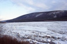
Completely open water above the island to our south.
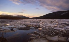
Late evening, May 8.
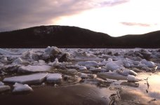
Broken and shattered ice lay about in disarray.
Tuesday, May 9. According to data we saw regarding breakup in Dawson City, today marks the “average day” of break-up. Below our camp, ablation needles collapsed, and tired ice slumped throughout the morning. By noon, broken ice had replaced most of the solid sheets. We could see only open water upriver.
After a quick lunch, Kathleen and I returned to the river, only a few seconds after the final flow began. The moving ice picked up speed, with the river flowing in behind. An hour later, it was all over, and the Yukon River finally ran free. An unveiling of the now bawdy, eager, virginal bride. A transformation from winter to summer. A metamorphosis from icy silence to flowing life. Two gulls, riding residual ice down the river, appeared proud, smug and content.
We walked down the bush trail, which had dried out somewhat, but was still 20 cm (8 inches) deep in many spots. Reliance Creek flowed stronger than on our last visit two days ago. Up on the southwest-facing knoll, Prairie Crocuses treated us to a carpet of spring blooms. In the distance, though, through binoculars, we could see that ice still encased the river above Dog Island, likely all the way up to Dawson City.
As kid in the 1950s, I was crazy-infatuated with the Walt Disney series featuring Fess Parker playing Davy Crockett. I read all the Davy Crockett books in our school library. I saw all the Davy Crockett movies that came to town. Like most boys on my suburban block, I proudly wore my own Davy Crockett coonskin cap.
Why am I telling you all this about Davy and me? Well, in my diary, up on that southwest-facing knoll, I wrote that I imagined the Dawson City tripod to be standing tall and defiant, as a resolute defender of winter, just like Davy Crockett defending the Alamo. (Note: I intend no political or moral judgements regarding Crockett and the Alamo. I merely wrote what I imagined, from the perspective of an eight-year-old boy.)
That evening, we hung out with the ice that remained strewn along the riverbank. Although the Yukon was now running free, access to Fort Reliance by Tommy and his boat would not be possible for probably at least another week. Kathleen and I had seen our breakup. We decided to head to Dawson City tomorrow. Maybe we could see breakup a second time.
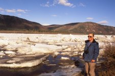
Kathleen with the ice, 9:00 a.m., May 9.

After the ice went out, May 9.
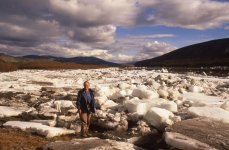
Ice still blocked easy access to Fort Reliance from the river.
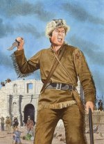
The Dawson City Tripod and Davy Crockett both stood tall and defiant until the last moment.
Wednesday, May 10. Kathleen and I distributed hunks of dried salmon to our 29 dogs, and left for Dawson City at 9:00 a.m. The bush trail was very wet, and Reliance, Fourth and Clear Creeks were swollen rivers.
When we reached the village of Moosehide we met Benjamin. At the time, no one lived permanently at Moosehide, which served primarily as a traditional Tr'ondëk Hwëch'in centre for special occasions and celebrations. Periodically, however, individuals go to Moosehide, or are sent to Moosehide, to reflect on aspects of their life. We talked briefly with Benjamin, and told him that we were on our way to Dawson City.
“Be careful,” he advised. “Don’t try to go across Moosehide Slide. Too dangerous. There is a trail that goes up and around the top. Trail starts at a flat rock, at Suicide Point, just before the slide.”
“Thanks, Benjamin. We’ll be careful.”
A few minutes later we stood before Moosehide Creek, wider and deeper than all the other creeks we had crossed this morning. A bridge with a handrail on one side was submerged about waist deep.
“I’ll see if I can get across on the bridge, Kathleen. You wait until I get to the other side.”
I took off my gum boots and wool socks, and stepped onto the bridge. I couldn’t make it even half way. That water was so bleepin’ cold. I instantly went numb, and turned back after only a few steps. I sat on the grass, towelling off.
“I’ve never been so cold, Kathleen. We gotta make our own bridge above the water.”
We searched around for logs to toss across the 2-m wide (6 feet) Moosehide Creek. It’s not easy to find poles exactly the right diameter to support your weight, and just the right length to extend to the opposite shore. It took us about an hour to create a bridge at the narrowest spot we could find. We eventually installed the bridge beneath some overhanging branches that we could cling to while crossing over. We certainly didn’t want to be swept away down into the Yukon River itself.
Anyway, Kathleen and I made it across, one at a time, and headed on down the bush trail. We soon reached a spot that provided a splendid view of Dawson City next to the frozen Yukon River
We agreed that we were likely at Suicide Point. After all, it was a point. A point with a flat rock. The trail had been mostly dry since leaving Moosehide Creek. We sat on the flat rock to change out of our gum boots into our hiking boots, and then looked for the trail.
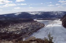
View of Dawson City from Suicide Point.
We searched above the rock in several directions. We couldn’t find any trail. We went back a bit, in case we had missed it. No trail. We agreed that we must not have reached the turnoff yet, and continued along the bush trail.
We soon found ourselves out on Moosehide Slide, pretty much where Tommy and Benjamin told us not to be. But we continued on, looking for the trail that led upward. We were both starting to feel vulnerable. You probably remember from the clogged stove pipe episode that I am uneasy with heights. I am particularly uneasy with heights when clinging to the side of a cliff high above the Yukon River.
Nevertheless, we pushed on, sidling across the slide, crouching low, leaning in against Moosehide Slide. Left arms outstretched to hold onto rocks, more for balance than support, trusting that they wouldn’t pull away. We sometimes straddled narrow chutes of loose talus that slid and cascaded away below us. But the farther we went, the more precarious our position seemed to become. I don’t know how far we went across Moosehide Slide. I’m thinking almost halfway before we turned back.
A few minutes later we saw Benjamin coming across the slide to get us. “You missed the turnoff. I’ll show you.”
It turns out that we had changed our boots at Suicide Point. We had sat on the flat rock that marked the beginning of the trail that went up and over the top of Moosehide Slide. Benjamin led us a fair distance to where a very indistinct trail began. It was obviously not a well-travelled route above and around Moosehide Slide. Benjamin escorted Kathleen and me all the way to town. The descent on the other side down to Dawson City seemed long and steep. At the end of the hike I was leg-weary and foot-sore. I am not the man I used to be. Certainly not the man that likely existed primarily in my imagination.
We stopped in at Tommy’s house, went for supper and a glass or two of wine, and turned in early. We were both tired. At 12:55 in the morning of May 11, the Fire Department sounded their sirens to indicate that the tripod had moved, and that breakup in Dawson City had begun. Upon hearing the sirens, the entire population of Dawson City heads off to the river to view the victory of spring. Kathleen joined them. I stayed snugged and warm in bed. I was tired. I was not the man I used to be. And anyway, I had already seen breakup art Fort Reliance.
I don’t know who won the lottery for coming closest to guessing the exact time of breakup. Kathleen guessed May 8 at 7:52 p.m., exactly one month after her birthday. She lost. I don’t remember what time I guessed. I think a few days before ‘average’ breakup, believing that global warming would be on my side. I lost.
(Note: Since 1896, the earliest date of breakup was April 23, in both 2019 and 2016. The latest date of breakup, in 1964, was May 28.)
If you haven’t seen Moosehide Slide, I have provided an image below taken on May 20, our penultimate day in Dawson City. As you can see, it is quite steep. Not a good place to be for people somewhat uneasy with heights, and also unfamiliar with the best route. I think we were making our way across about halfway up, level with Suicide Point, which is quite high, as illustrated by the image on the previous page.
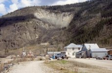
Moosehide Slide, May 20, 2006.
The following information about Moosehide Slide is taken from http://www.trondek.ca/downloads/Fina...FEB%202016.pdf
Trail access to (The Village of) Moosehide is important, particularly when the river is impassable or unsafe. There are two overland trail options between Moosehide and Dawson City. Both trails share the same route from the village to the lookout point (sometimes known as ‘Suicide Point’) where the trails split before rejoining to cross Moosehide Slide.
The first bridge crossing immediately after leaving the village was replaced in 2015. This is only a temporary structure but there are no immediate plans to replace it. The trail is in good condition for the most part, with the exception of the lower option that crosses below the bluff. This has deteriorated and become dangerous and should be decommissioned. Improved signage is required to direct walkers to the upper trail and advise of the dangers. Fallen trees and debris block the trails in some places, but not to the extent to make them impassible. Small portions are suffering from erosion or are swampy underfoot. Crossing the Moosehide Slide can be hazardous. Trail signage is limited and better directional signage would increase use and improve safety. Improvements to signs should be restricted to directional and advisory signs only, if tourists are not to be encouraged beyond current levels. There may be a need to research how trails signage affects liability.
Thursday, May 11. Dawn insisted that we stay over an extra day in Dawson City. “But what about the dogs?” we asked. “We’re worried about the dogs. Two days is a long time without food.”
“It’s good to fast them every once in a while,” Dawn replied. “You need to stay another day.” We acquiesced, and accomplished a lot of business and personal tasks in the afternoon.
We finished the day at Diamond Tooth Gertie’s Gambling Hall, where I lost $20.00 playing Blackjack. I don’t think that my dealer, Sylvie, had a lower up-card than 9 all night. Because I was gambling, though, I successfully avoided being ensnared by the stage girls. Kathleen doesn’t gamble, and eventually found herself singing And The Band Played On, as the stage girls encircled her front row table.
Friday, May 12. We took only a slight wrong turn going back over the top of Moosehide Slide. As I mentioned before, the trail was indistinct. We stopped briefly to take pictures at Suicide Point, and then fairly flew across Moosehide Creek. We arrived in Fort Reliance at 12:45. The bush trails were wet and muddy.
The dogs were very excited to see us, and had lost no energy despite having gone 52 hours without food or water. We thought they must be thirsty, and started to give each dog a bowl of clear, fresh water. They showed no interest at all. Pretty much looked at the water quite disdainfully. Tommy had told us that the dogs would not drink clear water. I don’t know why that would be, but Tommy was right. Of course, they were his dogs. He would know.
Kathleen and I sat on the bank of the river for lunch. We dozed in the sun, listening to the rolling drum of Ruffed Grouse, the squeaking of American Widgeons, and the calving of bergs from the multitude of shoreline ice. We heard a motor, and then saw a boat heading upriver toward town. It was most likely “Crazy Rob.” During one of Tommy’s visits, we told him that we had heard a dog barking, seemingly pretty much directly across the Yukon River from Fort Reliance. Tommy said, “Crazy Rob lives over there. You shouldn’t have anything to do with him.” Tommy didn’t elaborate on Rob’s craziness, and we never met him, so can’t offer any more clarification. Just as well, I suppose. We hadn’t come to Fort Reliance to meet crazy neighbours.
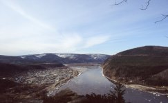
Toward Dawson City from Suicide Point, May 12.
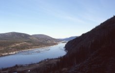
Looking downriver from Suicide Point, May 12.
Saturday, May 13. Kathleen and I spent most of the day sawing, hauling and stacking wood. We also mopped and vacuumed the cabin in preparation for leaving.
We built a bonfire of brush debris in the afternoon, followed by supper around the campfire. During the day, very little ice floated by on the Yukon River. By early evening, though, the progression of ice increased. Interesting to speculate that some of the pieces may have travelled more than 100 km (60 miles) in the last 24 hours. By early evening the temperature had reached +17 C (+63 F). The once angular blocks of shore ice had dripped, shifted, slumped and settled into a rounded, congealed mass. Our 29 dogs seemed very content in the warmth and sun. They remained calm and at ease, even when we returned from extended walks away from camp.

Our 29 dogs seem content in the warmth and sun.
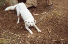
Shiver, flashing those beautiful, blue eyes.
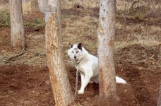
Silver.
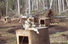
Wagner.
Sunday, May 14. Since breakup, the Yukon River has carried a very heavy sediment load. Very unappealing for drinking. So in the morning, Kathleen and I carried up fresh pure block ice in a pot, and candled ice in a garbage bag. More than a day’s worth of excellent drinking water.
Today was hot at +20 C (+68 F). We enjoyed ice-cold orange drinks while sitting on the river bank, watching small pieces of ice floating down the river. After lunch we searched, without success, for the small lake that Tommy indicated was behind the camp. It would have been good to find a convenient, steady supply of fresh water.
We did, though, discover the grave that Tommy said was “McLeod’s Baby.” I recently did some internet searches, and found the following article:
http://trondekheritage.com/images/pdfs/mary_mcleod.pdf
Mary McLeod was born about 1893 in Eagle Alaska. By arrangement, she married Simon McLeod from Dawson, from the Moosehide people. In an interview for the above article, Mary said, “Little Dave told my husband to look after woodcamp at Eight Mile Creek (Quebec Creek on the topographic maps), below Moosehide. It was maybe 1940s. We were there nine years. Lots of good berries there – blueberries, raspberries, cranberries, highbush berries, black currants. We have fish trap just up creek from wood camp. Lots of moose, caribou near there.”
The article says that Mary had four children, and an adopted son. The article indicates that another child died at a young age. That child must have been Baby McLeod.
I don’t know how the child came to be buried at Fort Reliance, but Peggy Kormendy says in the article that:
“When I was little ... I used to go trapping after, go trapping with Grandma McLeod all the way down to Fort Reliance, there’s cat trail there, we use that, we walk down and she get some furs and we bring it back, we get back around dark.”
Obviously Mary McLeod knew the area well, and likely camped and stayed wherever she pleased. It would be interesting to how how Baby McLeod died, and at what age.
In the afternoon more Mew Gulls arrived, and a Red Squirrel tried to move into Tommy’s storage shed. Periodically throughout the day, I did some more dragging and stacking of logs.
Kathleen and I enjoyed supper around the campfire, although Kathleen did get bitten twice by mosquitos. We wondered how much longer it would be before Tommy came to get us. We were ready to go home.
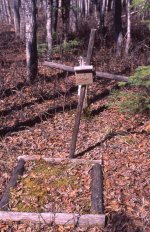
Baby McLeod’s grave at Fort Reliance.
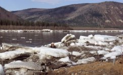
Me collecting fresh, clear water from ice blocks.
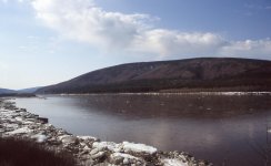
We watched small pieces of ice floating down the river.
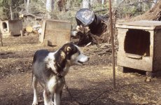
Chum, May 14.
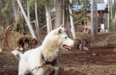
Kanga, white, with blue eyes, just like Shiver. May 14.
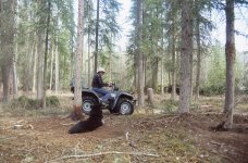
Rocca watching me haul logs.
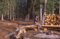
Kathleen enjoying supper around the campfire.
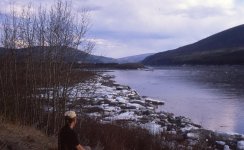
Kathleen wondering how much longer before Tommy comes to get us.
We heard on the radio that three ice jams have now formed below Rock Creek on the Klondike River. The tripod on the Yukon River at Dawson City stands firm. We endured rain showers and cold wind all day. Despite the cool weather, Orange-crowned Warblers and Yellow Warblers arrived from the south. We walked back and forth to the river all day, just to check on the ice. We didn’t want to miss any movement. After all, that’s why we were here. We wanted to see the ice go out.
We headed back to the river after supper, slightly before 7:00 p.m. As we neared the bank, we heard the ice begin to move, and ran to watch. The ice seemed to be picking up speed. “There’s no stopping it this time,” I yelled. “It’s going out, Kathleen!”
But I was wrong. There was more movement today than yesterday, but the ice eventually jammed up, and came to a halt, downriver at the bluff point. We could see completely open water, though, above the island to our south. Blocks of broken and shattered ice lay about in disarray. The river began rising. This is why we came. danged exciting. We stayed watching the ice until late in the evening.

Completely open water above the island to our south.

Late evening, May 8.

Broken and shattered ice lay about in disarray.
Tuesday, May 9. According to data we saw regarding breakup in Dawson City, today marks the “average day” of break-up. Below our camp, ablation needles collapsed, and tired ice slumped throughout the morning. By noon, broken ice had replaced most of the solid sheets. We could see only open water upriver.
After a quick lunch, Kathleen and I returned to the river, only a few seconds after the final flow began. The moving ice picked up speed, with the river flowing in behind. An hour later, it was all over, and the Yukon River finally ran free. An unveiling of the now bawdy, eager, virginal bride. A transformation from winter to summer. A metamorphosis from icy silence to flowing life. Two gulls, riding residual ice down the river, appeared proud, smug and content.
We walked down the bush trail, which had dried out somewhat, but was still 20 cm (8 inches) deep in many spots. Reliance Creek flowed stronger than on our last visit two days ago. Up on the southwest-facing knoll, Prairie Crocuses treated us to a carpet of spring blooms. In the distance, though, through binoculars, we could see that ice still encased the river above Dog Island, likely all the way up to Dawson City.
As kid in the 1950s, I was crazy-infatuated with the Walt Disney series featuring Fess Parker playing Davy Crockett. I read all the Davy Crockett books in our school library. I saw all the Davy Crockett movies that came to town. Like most boys on my suburban block, I proudly wore my own Davy Crockett coonskin cap.
Why am I telling you all this about Davy and me? Well, in my diary, up on that southwest-facing knoll, I wrote that I imagined the Dawson City tripod to be standing tall and defiant, as a resolute defender of winter, just like Davy Crockett defending the Alamo. (Note: I intend no political or moral judgements regarding Crockett and the Alamo. I merely wrote what I imagined, from the perspective of an eight-year-old boy.)
That evening, we hung out with the ice that remained strewn along the riverbank. Although the Yukon was now running free, access to Fort Reliance by Tommy and his boat would not be possible for probably at least another week. Kathleen and I had seen our breakup. We decided to head to Dawson City tomorrow. Maybe we could see breakup a second time.

Kathleen with the ice, 9:00 a.m., May 9.

After the ice went out, May 9.

Ice still blocked easy access to Fort Reliance from the river.

The Dawson City Tripod and Davy Crockett both stood tall and defiant until the last moment.
Wednesday, May 10. Kathleen and I distributed hunks of dried salmon to our 29 dogs, and left for Dawson City at 9:00 a.m. The bush trail was very wet, and Reliance, Fourth and Clear Creeks were swollen rivers.
When we reached the village of Moosehide we met Benjamin. At the time, no one lived permanently at Moosehide, which served primarily as a traditional Tr'ondëk Hwëch'in centre for special occasions and celebrations. Periodically, however, individuals go to Moosehide, or are sent to Moosehide, to reflect on aspects of their life. We talked briefly with Benjamin, and told him that we were on our way to Dawson City.
“Be careful,” he advised. “Don’t try to go across Moosehide Slide. Too dangerous. There is a trail that goes up and around the top. Trail starts at a flat rock, at Suicide Point, just before the slide.”
“Thanks, Benjamin. We’ll be careful.”
A few minutes later we stood before Moosehide Creek, wider and deeper than all the other creeks we had crossed this morning. A bridge with a handrail on one side was submerged about waist deep.
“I’ll see if I can get across on the bridge, Kathleen. You wait until I get to the other side.”
I took off my gum boots and wool socks, and stepped onto the bridge. I couldn’t make it even half way. That water was so bleepin’ cold. I instantly went numb, and turned back after only a few steps. I sat on the grass, towelling off.
“I’ve never been so cold, Kathleen. We gotta make our own bridge above the water.”
We searched around for logs to toss across the 2-m wide (6 feet) Moosehide Creek. It’s not easy to find poles exactly the right diameter to support your weight, and just the right length to extend to the opposite shore. It took us about an hour to create a bridge at the narrowest spot we could find. We eventually installed the bridge beneath some overhanging branches that we could cling to while crossing over. We certainly didn’t want to be swept away down into the Yukon River itself.
Anyway, Kathleen and I made it across, one at a time, and headed on down the bush trail. We soon reached a spot that provided a splendid view of Dawson City next to the frozen Yukon River
We agreed that we were likely at Suicide Point. After all, it was a point. A point with a flat rock. The trail had been mostly dry since leaving Moosehide Creek. We sat on the flat rock to change out of our gum boots into our hiking boots, and then looked for the trail.

View of Dawson City from Suicide Point.
We searched above the rock in several directions. We couldn’t find any trail. We went back a bit, in case we had missed it. No trail. We agreed that we must not have reached the turnoff yet, and continued along the bush trail.
We soon found ourselves out on Moosehide Slide, pretty much where Tommy and Benjamin told us not to be. But we continued on, looking for the trail that led upward. We were both starting to feel vulnerable. You probably remember from the clogged stove pipe episode that I am uneasy with heights. I am particularly uneasy with heights when clinging to the side of a cliff high above the Yukon River.
Nevertheless, we pushed on, sidling across the slide, crouching low, leaning in against Moosehide Slide. Left arms outstretched to hold onto rocks, more for balance than support, trusting that they wouldn’t pull away. We sometimes straddled narrow chutes of loose talus that slid and cascaded away below us. But the farther we went, the more precarious our position seemed to become. I don’t know how far we went across Moosehide Slide. I’m thinking almost halfway before we turned back.
A few minutes later we saw Benjamin coming across the slide to get us. “You missed the turnoff. I’ll show you.”
It turns out that we had changed our boots at Suicide Point. We had sat on the flat rock that marked the beginning of the trail that went up and over the top of Moosehide Slide. Benjamin led us a fair distance to where a very indistinct trail began. It was obviously not a well-travelled route above and around Moosehide Slide. Benjamin escorted Kathleen and me all the way to town. The descent on the other side down to Dawson City seemed long and steep. At the end of the hike I was leg-weary and foot-sore. I am not the man I used to be. Certainly not the man that likely existed primarily in my imagination.
We stopped in at Tommy’s house, went for supper and a glass or two of wine, and turned in early. We were both tired. At 12:55 in the morning of May 11, the Fire Department sounded their sirens to indicate that the tripod had moved, and that breakup in Dawson City had begun. Upon hearing the sirens, the entire population of Dawson City heads off to the river to view the victory of spring. Kathleen joined them. I stayed snugged and warm in bed. I was tired. I was not the man I used to be. And anyway, I had already seen breakup art Fort Reliance.
I don’t know who won the lottery for coming closest to guessing the exact time of breakup. Kathleen guessed May 8 at 7:52 p.m., exactly one month after her birthday. She lost. I don’t remember what time I guessed. I think a few days before ‘average’ breakup, believing that global warming would be on my side. I lost.
(Note: Since 1896, the earliest date of breakup was April 23, in both 2019 and 2016. The latest date of breakup, in 1964, was May 28.)
If you haven’t seen Moosehide Slide, I have provided an image below taken on May 20, our penultimate day in Dawson City. As you can see, it is quite steep. Not a good place to be for people somewhat uneasy with heights, and also unfamiliar with the best route. I think we were making our way across about halfway up, level with Suicide Point, which is quite high, as illustrated by the image on the previous page.

Moosehide Slide, May 20, 2006.
The following information about Moosehide Slide is taken from http://www.trondek.ca/downloads/Fina...FEB%202016.pdf
Trail access to (The Village of) Moosehide is important, particularly when the river is impassable or unsafe. There are two overland trail options between Moosehide and Dawson City. Both trails share the same route from the village to the lookout point (sometimes known as ‘Suicide Point’) where the trails split before rejoining to cross Moosehide Slide.
The first bridge crossing immediately after leaving the village was replaced in 2015. This is only a temporary structure but there are no immediate plans to replace it. The trail is in good condition for the most part, with the exception of the lower option that crosses below the bluff. This has deteriorated and become dangerous and should be decommissioned. Improved signage is required to direct walkers to the upper trail and advise of the dangers. Fallen trees and debris block the trails in some places, but not to the extent to make them impassible. Small portions are suffering from erosion or are swampy underfoot. Crossing the Moosehide Slide can be hazardous. Trail signage is limited and better directional signage would increase use and improve safety. Improvements to signs should be restricted to directional and advisory signs only, if tourists are not to be encouraged beyond current levels. There may be a need to research how trails signage affects liability.
Thursday, May 11. Dawn insisted that we stay over an extra day in Dawson City. “But what about the dogs?” we asked. “We’re worried about the dogs. Two days is a long time without food.”
“It’s good to fast them every once in a while,” Dawn replied. “You need to stay another day.” We acquiesced, and accomplished a lot of business and personal tasks in the afternoon.
We finished the day at Diamond Tooth Gertie’s Gambling Hall, where I lost $20.00 playing Blackjack. I don’t think that my dealer, Sylvie, had a lower up-card than 9 all night. Because I was gambling, though, I successfully avoided being ensnared by the stage girls. Kathleen doesn’t gamble, and eventually found herself singing And The Band Played On, as the stage girls encircled her front row table.
Friday, May 12. We took only a slight wrong turn going back over the top of Moosehide Slide. As I mentioned before, the trail was indistinct. We stopped briefly to take pictures at Suicide Point, and then fairly flew across Moosehide Creek. We arrived in Fort Reliance at 12:45. The bush trails were wet and muddy.
The dogs were very excited to see us, and had lost no energy despite having gone 52 hours without food or water. We thought they must be thirsty, and started to give each dog a bowl of clear, fresh water. They showed no interest at all. Pretty much looked at the water quite disdainfully. Tommy had told us that the dogs would not drink clear water. I don’t know why that would be, but Tommy was right. Of course, they were his dogs. He would know.
Kathleen and I sat on the bank of the river for lunch. We dozed in the sun, listening to the rolling drum of Ruffed Grouse, the squeaking of American Widgeons, and the calving of bergs from the multitude of shoreline ice. We heard a motor, and then saw a boat heading upriver toward town. It was most likely “Crazy Rob.” During one of Tommy’s visits, we told him that we had heard a dog barking, seemingly pretty much directly across the Yukon River from Fort Reliance. Tommy said, “Crazy Rob lives over there. You shouldn’t have anything to do with him.” Tommy didn’t elaborate on Rob’s craziness, and we never met him, so can’t offer any more clarification. Just as well, I suppose. We hadn’t come to Fort Reliance to meet crazy neighbours.

Toward Dawson City from Suicide Point, May 12.

Looking downriver from Suicide Point, May 12.
Saturday, May 13. Kathleen and I spent most of the day sawing, hauling and stacking wood. We also mopped and vacuumed the cabin in preparation for leaving.
We built a bonfire of brush debris in the afternoon, followed by supper around the campfire. During the day, very little ice floated by on the Yukon River. By early evening, though, the progression of ice increased. Interesting to speculate that some of the pieces may have travelled more than 100 km (60 miles) in the last 24 hours. By early evening the temperature had reached +17 C (+63 F). The once angular blocks of shore ice had dripped, shifted, slumped and settled into a rounded, congealed mass. Our 29 dogs seemed very content in the warmth and sun. They remained calm and at ease, even when we returned from extended walks away from camp.

Our 29 dogs seem content in the warmth and sun.

Shiver, flashing those beautiful, blue eyes.

Silver.

Wagner.
Sunday, May 14. Since breakup, the Yukon River has carried a very heavy sediment load. Very unappealing for drinking. So in the morning, Kathleen and I carried up fresh pure block ice in a pot, and candled ice in a garbage bag. More than a day’s worth of excellent drinking water.
Today was hot at +20 C (+68 F). We enjoyed ice-cold orange drinks while sitting on the river bank, watching small pieces of ice floating down the river. After lunch we searched, without success, for the small lake that Tommy indicated was behind the camp. It would have been good to find a convenient, steady supply of fresh water.
We did, though, discover the grave that Tommy said was “McLeod’s Baby.” I recently did some internet searches, and found the following article:
http://trondekheritage.com/images/pdfs/mary_mcleod.pdf
Mary McLeod was born about 1893 in Eagle Alaska. By arrangement, she married Simon McLeod from Dawson, from the Moosehide people. In an interview for the above article, Mary said, “Little Dave told my husband to look after woodcamp at Eight Mile Creek (Quebec Creek on the topographic maps), below Moosehide. It was maybe 1940s. We were there nine years. Lots of good berries there – blueberries, raspberries, cranberries, highbush berries, black currants. We have fish trap just up creek from wood camp. Lots of moose, caribou near there.”
The article says that Mary had four children, and an adopted son. The article indicates that another child died at a young age. That child must have been Baby McLeod.
I don’t know how the child came to be buried at Fort Reliance, but Peggy Kormendy says in the article that:
“When I was little ... I used to go trapping after, go trapping with Grandma McLeod all the way down to Fort Reliance, there’s cat trail there, we use that, we walk down and she get some furs and we bring it back, we get back around dark.”
Obviously Mary McLeod knew the area well, and likely camped and stayed wherever she pleased. It would be interesting to how how Baby McLeod died, and at what age.
In the afternoon more Mew Gulls arrived, and a Red Squirrel tried to move into Tommy’s storage shed. Periodically throughout the day, I did some more dragging and stacking of logs.
Kathleen and I enjoyed supper around the campfire, although Kathleen did get bitten twice by mosquitos. We wondered how much longer it would be before Tommy came to get us. We were ready to go home.

Baby McLeod’s grave at Fort Reliance.

Me collecting fresh, clear water from ice blocks.

We watched small pieces of ice floating down the river.

Chum, May 14.

Kanga, white, with blue eyes, just like Shiver. May 14.

Rocca watching me haul logs.

Kathleen enjoying supper around the campfire.

Kathleen wondering how much longer before Tommy comes to get us.
Last edited:
Such a good narrator and the story is great
- Joined
- Aug 21, 2018
- Messages
- 1,812
- Reaction score
- 4,603
Monday, May 15. We searched again, unsuccessfully, through the bush, for the lake allegedly behind our camp. We did collect enough pots of candled ice in the morning, though, to provide about eight days of clear water, which should be enough. We hope so. The rising river has covered much of the remaining ice with mud.
The suddenly abundant Snowshoe Hares have mostly changed into their summer ‘browns,’ and the mosquitos have become much more numerous. Kathleen made another loaf of bread, which should be enough to last us until Tommy comes. To make myself useful, I cleaned the spark arrestor in the stove pipe cap, which had become slightly clogged again with creosote. It wasn’t as intimidating to go up on the roof as last April 29.
We probably won’t need to use the wood stove much more, anyway. At 10:00 p.m. the cabin temperature was +22 C (+72 F), and we didn’t bother lighting the stove.
Afternoon showers occurred for the fourth straight day. Summer seems to be here, and we are ready to go home. Crazy Rob motored upriver toward town this morning. Maybe Tommy will be coming to get us soon. Shoreline ice still blocks easy access to Fort Reliance, though. Kathleen and I just have to be patient. Tommy will come for us when the time is right.
Tuesday, May 16. A cool, moist morning. Overnight, the river through our camp forced its way through the bank ice to join with the rising Yukon River. Tommy’s boat would now have easy access to Fort Reliance.
In the afternoon, Kathleen and I walked downriver between the shore ice and the high river bank. Most of the ice looks very unhappy as it melts in place, except where it is still stacked six-nine metres (20-30 feet) high where the river narrows and bends toward the bluff point.
We climbed above the river, near the bluff point, and sat down on a dry, rocky cliff with Spotted Saxifrage and Fragrant Fern. A Violet-green Swallow soared overhead, while a shore bird, perhaps a Spotted Sandpiper searched for food in the mud flats.
Ten minutes after returning home, a hard rain began that lasted 2.5 hours. Our wet and muddy dogs accepted their condition very stoically, but they looked miserable to us. Nothing we could do for them, though, other than hope for the sun.
Wednesday, May 17. Cool, misty and showery, with a few, brief bursts of sun until mid-afternoon, when the sun finally remained out long enough to dry the dog yard.
The shore ice has has given up the fight, and slips into the rising river with only a whimper and quiet splash. Boat access now nearly reaches the road leading up to the cabin. The river flowing down this road has slowed noticeably.
Kathleen spent most of the day giving affection to the dogs, while I dragged logs, split wood, and burned brush. We likely saw a Swainson’s Thrush in the morning, but were not sure. Thrushes are secretive—generally flitting about in the underbrush—and are difficult for us to positively identify.
We sat on the bank in the evening sun, watching the river flow by—so satisfying, and very relaxing. Now that the Yukon River is truly flowing, with no meltwater ponds, the ducks have moved on. Kathleen and I would also like to move on. Tommy will probably be coming for us in a day or two.
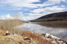
Me watching the Yukon River flow by, 7:45 p.m., May 17.
Thursday, May 18. Virtually no ice flows down the river anymore, and the shore ice is essentially gone. Fort Reliance is easily accessible from the Yukon River. In the morning we thought we heard the George Black Ferry in Dawson City going back and forth to West Dawson.
While we sat on the bank sipping our morning tea, we saw Scaups in the middle of the river, swimming hard upstream. After losing about 0.5 km (0.25 miles) to the current, they would fly upriver and land, only to repeat the process all over again. White-crowned Sparrows, a Greater Yellowlegs, a Semi-palmated Sandpiper, Goldeneyes and a Sharp-shinned Hawk joined our little community.
Around 2:00 p.m., it seemed that a canoe was headed downriver. Not likely we thought. Probably just a log, with branches sticking up, that looked like people. We peered through our binoculars, and sure enough, it was a canoe with two paddlers! As they neared, we called out to them, and they paddled over to shore. It was Axel and Vam, who had spent the winter in Paris. A few days ago they flew to Whitehorse, and then bussed up to Dawson City, where they rented a canoe. They were headed down the Yukon River to their home somewhere in Alaska. I don’t remember where. Now that’s an adventure.
Axel and Vam joined us in the cabin for tea and conversation. They confirmed that the George Black Ferry had indeed resumed service this morning. We invited them to spend the night with us, and to have supper around our campfire. Axel said he would like that, but Vam said, “No. We gotta get home. Thanks anyway.”
The afternoon showers were brief, about 30 minutes, followed by blue sky and warm sun. The Prickly Roses are finally leafing out, and the Buffalo Berries have been flowering for several days. The Yukon River was very quiet as we sat on the bank in the evening. Very few sounds of ice slumping or slipping—very gently—into the water. Breakup is over. Time to go home.
(Note: I was curious about the name, Vam. Had I entered incorrectly in my diary? I just googled “Alex Vam Alaska,” and the following website came up:
http://cc-outfitters.com
It’s Crystal Clear Outfitters, operated by Vamori and Axel Burgheim. Well how about that?!!)
Friday, May 19. A warm, sunny day. Kathleen and I hiked south, along the top of the bank, and rediscovered the ducks in some shallow sloughs.
Sitting around the campfire at 5:00 p.m, thinking of supper, we heard a motor. The dogs looked toward the river, and we headed down the road. Tommy, Dawn and a summer assistant, Louie, clambered over the bank. “We’ve come to take you to town tonight. After that, you can stay as long as you like.”
“Well, Tommy. We like it here, but our work is done. We have things we need to do on our own property. It’s time for us to go home.”
Saturday, May 20. After a very relaxing sleep at Tommy’s house, Kathleen and I headed over to the Riverwest Bistro for breakfast. After shopping for gifts and supplies, we motored back to Fort Reliance to feed the dogs. Along the way, we stopped at Dog Island , to prepare for the tourist season. We raked leaves and put the dock back in the water. Tommy and Dawn run Fishwheel Charters, and the following information is from their website:
https://fishwheeltoursyukon.com/summer-tours/
“Departing Dawson City, we’ll float on the Yukon River past the village of Moosehide, which is a reminder of the traditional Hän lifestyle, and where every two years the Moosehide Gathering takes place, welcoming locals and visitors from around the globe to celebrate the stories and songs of the Hän people. We’ll continue on to Fort Reliance, established as a fur trading and mining post in 1874.
As we make our way along the river we’ll stop at Dog Island where my family’s fish camp is located. Here it is my pleasure to provide you with tea and bannock, as we take a break and stretch our legs to have a closer look at a fishwheel, one of the most important tools of the Hän way of life for thousands of years.”
After returning to Dawson City, we barbecued smokies in Tommy and Dawn’s back yard. Kathleen and I finished the day at Diamond Tooth Gertie’s Gambling Hall, which gave us a season pass as Yukon residents. Too bad we were going to be in Dawson City for only one more day. I won $38.00 from Sylvie at the Blackjack table. She still had good up-cards, but poor down-cards. We stayed for two shows, put on by very entertaining and talented young performers.
(Note: You might have noticed that Kathleen and I had breakfast at the Riverwest Bistro, which completely contradicts what I said at the very beginning of this story: that Kathleen and I always have breakfast at the Jack London Grill in the Downtown Hotel. I can’t explain the discrepancy. I was very tempted to ignore what I wrote in my diary for May 20, but the truth must come out.)
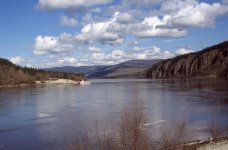
The George Black Ferry resumed service on May 18. Image taken May 20.
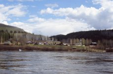
Floating past the village of Moosehide, which is a reminder of the traditional Hän lifestyle.
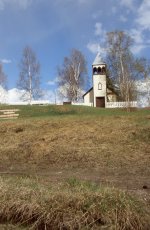
Church at Moosehide Village.
Sunday, May 21. Kathleen and I sauntered and relaxed in the sun of Dawson City until 1:00 p.m. Then, with Dawn, Tommy and Louie, we returned to Fort Reliance to take the dogs to Dog Island, just upriver from Clear Creek, where Peter and Marion lived. Five trips later, at six dogs per trip, we were all on Dog Island. The dogs were reasonably relaxed while in the boat, but became immediately excited as soon as the boat slowed toward shore. An energetic scramble up the bank completed their short journey.
We were back in Dawson City at 5:30 p.m. to clean up, and then motor down to Peter and Marion’s at 6:30 p.m. for Sunday supper. After way too many drinks, we returned to Dawson City at 11:00 p.m. Not wanting to waste our season’s pass, Kathleen and I strolled over to Diamond Tooth Gertie’s Gambling Hall for the midnight show. Unfortunately, I also gave back $39.00 to Sylvie, the Blackjack dealer.
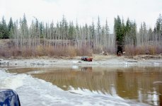
Leaving Fort Reliance with the dogs.
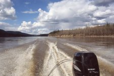
Heading upriver to Dog Island.
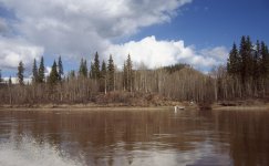
Heading to Clear Creek for Sunday supper with Peter and Marion.
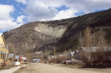
It never struck me that Moosehide Slide looked like a moose hide. The following information is from:
https://sightsandsites.ca/central/site/dawson-city-9th-avenue-trail
Samuel Whitehouse used to tell a story of a time when prophesy and preparation worked to protect the Tr’ondëk Hwëch’in.
Long ago, raiders chased a local man up the hill where the slide is now. He took refuge under some trees and near a pile of rocks and roots that had been piled nearby in anticipation of just this event.
When the warriors got very close, the man pulled out the stabilizing roots which caused a landslide. The rocks crashed down on the warriors and killed all but one man who carried the message back to his people on the upper Stewart River.
The land slide site is now called the Moosehide Slide in English and Edda dadhecha, literally “weathered Moosehide hanging,” in the Tr’ondëk Hwëch’in traditional language.
....................................................................................
Oh, “weathered moosehide hanging.” I can see that.
The next day Kathleen and I packed the van, and headed south down the highway toward our home on Pender Island, British Columbia. We looked forward to getting home, but we thoroughly enjoyed our winter vacation at Fort Reliance, and the opportunity to witness breakup on the Yukon River.
THANKS FOR READING!
The suddenly abundant Snowshoe Hares have mostly changed into their summer ‘browns,’ and the mosquitos have become much more numerous. Kathleen made another loaf of bread, which should be enough to last us until Tommy comes. To make myself useful, I cleaned the spark arrestor in the stove pipe cap, which had become slightly clogged again with creosote. It wasn’t as intimidating to go up on the roof as last April 29.
We probably won’t need to use the wood stove much more, anyway. At 10:00 p.m. the cabin temperature was +22 C (+72 F), and we didn’t bother lighting the stove.
Afternoon showers occurred for the fourth straight day. Summer seems to be here, and we are ready to go home. Crazy Rob motored upriver toward town this morning. Maybe Tommy will be coming to get us soon. Shoreline ice still blocks easy access to Fort Reliance, though. Kathleen and I just have to be patient. Tommy will come for us when the time is right.
Tuesday, May 16. A cool, moist morning. Overnight, the river through our camp forced its way through the bank ice to join with the rising Yukon River. Tommy’s boat would now have easy access to Fort Reliance.
In the afternoon, Kathleen and I walked downriver between the shore ice and the high river bank. Most of the ice looks very unhappy as it melts in place, except where it is still stacked six-nine metres (20-30 feet) high where the river narrows and bends toward the bluff point.
We climbed above the river, near the bluff point, and sat down on a dry, rocky cliff with Spotted Saxifrage and Fragrant Fern. A Violet-green Swallow soared overhead, while a shore bird, perhaps a Spotted Sandpiper searched for food in the mud flats.
Ten minutes after returning home, a hard rain began that lasted 2.5 hours. Our wet and muddy dogs accepted their condition very stoically, but they looked miserable to us. Nothing we could do for them, though, other than hope for the sun.
Wednesday, May 17. Cool, misty and showery, with a few, brief bursts of sun until mid-afternoon, when the sun finally remained out long enough to dry the dog yard.
The shore ice has has given up the fight, and slips into the rising river with only a whimper and quiet splash. Boat access now nearly reaches the road leading up to the cabin. The river flowing down this road has slowed noticeably.
Kathleen spent most of the day giving affection to the dogs, while I dragged logs, split wood, and burned brush. We likely saw a Swainson’s Thrush in the morning, but were not sure. Thrushes are secretive—generally flitting about in the underbrush—and are difficult for us to positively identify.
We sat on the bank in the evening sun, watching the river flow by—so satisfying, and very relaxing. Now that the Yukon River is truly flowing, with no meltwater ponds, the ducks have moved on. Kathleen and I would also like to move on. Tommy will probably be coming for us in a day or two.

Me watching the Yukon River flow by, 7:45 p.m., May 17.
Thursday, May 18. Virtually no ice flows down the river anymore, and the shore ice is essentially gone. Fort Reliance is easily accessible from the Yukon River. In the morning we thought we heard the George Black Ferry in Dawson City going back and forth to West Dawson.
While we sat on the bank sipping our morning tea, we saw Scaups in the middle of the river, swimming hard upstream. After losing about 0.5 km (0.25 miles) to the current, they would fly upriver and land, only to repeat the process all over again. White-crowned Sparrows, a Greater Yellowlegs, a Semi-palmated Sandpiper, Goldeneyes and a Sharp-shinned Hawk joined our little community.
Around 2:00 p.m., it seemed that a canoe was headed downriver. Not likely we thought. Probably just a log, with branches sticking up, that looked like people. We peered through our binoculars, and sure enough, it was a canoe with two paddlers! As they neared, we called out to them, and they paddled over to shore. It was Axel and Vam, who had spent the winter in Paris. A few days ago they flew to Whitehorse, and then bussed up to Dawson City, where they rented a canoe. They were headed down the Yukon River to their home somewhere in Alaska. I don’t remember where. Now that’s an adventure.
Axel and Vam joined us in the cabin for tea and conversation. They confirmed that the George Black Ferry had indeed resumed service this morning. We invited them to spend the night with us, and to have supper around our campfire. Axel said he would like that, but Vam said, “No. We gotta get home. Thanks anyway.”
The afternoon showers were brief, about 30 minutes, followed by blue sky and warm sun. The Prickly Roses are finally leafing out, and the Buffalo Berries have been flowering for several days. The Yukon River was very quiet as we sat on the bank in the evening. Very few sounds of ice slumping or slipping—very gently—into the water. Breakup is over. Time to go home.
(Note: I was curious about the name, Vam. Had I entered incorrectly in my diary? I just googled “Alex Vam Alaska,” and the following website came up:
http://cc-outfitters.com
It’s Crystal Clear Outfitters, operated by Vamori and Axel Burgheim. Well how about that?!!)
Friday, May 19. A warm, sunny day. Kathleen and I hiked south, along the top of the bank, and rediscovered the ducks in some shallow sloughs.
Sitting around the campfire at 5:00 p.m, thinking of supper, we heard a motor. The dogs looked toward the river, and we headed down the road. Tommy, Dawn and a summer assistant, Louie, clambered over the bank. “We’ve come to take you to town tonight. After that, you can stay as long as you like.”
“Well, Tommy. We like it here, but our work is done. We have things we need to do on our own property. It’s time for us to go home.”
Saturday, May 20. After a very relaxing sleep at Tommy’s house, Kathleen and I headed over to the Riverwest Bistro for breakfast. After shopping for gifts and supplies, we motored back to Fort Reliance to feed the dogs. Along the way, we stopped at Dog Island , to prepare for the tourist season. We raked leaves and put the dock back in the water. Tommy and Dawn run Fishwheel Charters, and the following information is from their website:
https://fishwheeltoursyukon.com/summer-tours/
“Departing Dawson City, we’ll float on the Yukon River past the village of Moosehide, which is a reminder of the traditional Hän lifestyle, and where every two years the Moosehide Gathering takes place, welcoming locals and visitors from around the globe to celebrate the stories and songs of the Hän people. We’ll continue on to Fort Reliance, established as a fur trading and mining post in 1874.
As we make our way along the river we’ll stop at Dog Island where my family’s fish camp is located. Here it is my pleasure to provide you with tea and bannock, as we take a break and stretch our legs to have a closer look at a fishwheel, one of the most important tools of the Hän way of life for thousands of years.”
After returning to Dawson City, we barbecued smokies in Tommy and Dawn’s back yard. Kathleen and I finished the day at Diamond Tooth Gertie’s Gambling Hall, which gave us a season pass as Yukon residents. Too bad we were going to be in Dawson City for only one more day. I won $38.00 from Sylvie at the Blackjack table. She still had good up-cards, but poor down-cards. We stayed for two shows, put on by very entertaining and talented young performers.
(Note: You might have noticed that Kathleen and I had breakfast at the Riverwest Bistro, which completely contradicts what I said at the very beginning of this story: that Kathleen and I always have breakfast at the Jack London Grill in the Downtown Hotel. I can’t explain the discrepancy. I was very tempted to ignore what I wrote in my diary for May 20, but the truth must come out.)

The George Black Ferry resumed service on May 18. Image taken May 20.

Floating past the village of Moosehide, which is a reminder of the traditional Hän lifestyle.

Church at Moosehide Village.
Sunday, May 21. Kathleen and I sauntered and relaxed in the sun of Dawson City until 1:00 p.m. Then, with Dawn, Tommy and Louie, we returned to Fort Reliance to take the dogs to Dog Island, just upriver from Clear Creek, where Peter and Marion lived. Five trips later, at six dogs per trip, we were all on Dog Island. The dogs were reasonably relaxed while in the boat, but became immediately excited as soon as the boat slowed toward shore. An energetic scramble up the bank completed their short journey.
We were back in Dawson City at 5:30 p.m. to clean up, and then motor down to Peter and Marion’s at 6:30 p.m. for Sunday supper. After way too many drinks, we returned to Dawson City at 11:00 p.m. Not wanting to waste our season’s pass, Kathleen and I strolled over to Diamond Tooth Gertie’s Gambling Hall for the midnight show. Unfortunately, I also gave back $39.00 to Sylvie, the Blackjack dealer.

Leaving Fort Reliance with the dogs.

Heading upriver to Dog Island.

Heading to Clear Creek for Sunday supper with Peter and Marion.

It never struck me that Moosehide Slide looked like a moose hide. The following information is from:
https://sightsandsites.ca/central/site/dawson-city-9th-avenue-trail
Samuel Whitehouse used to tell a story of a time when prophesy and preparation worked to protect the Tr’ondëk Hwëch’in.
Long ago, raiders chased a local man up the hill where the slide is now. He took refuge under some trees and near a pile of rocks and roots that had been piled nearby in anticipation of just this event.
When the warriors got very close, the man pulled out the stabilizing roots which caused a landslide. The rocks crashed down on the warriors and killed all but one man who carried the message back to his people on the upper Stewart River.
The land slide site is now called the Moosehide Slide in English and Edda dadhecha, literally “weathered Moosehide hanging,” in the Tr’ondëk Hwëch’in traditional language.
....................................................................................
Oh, “weathered moosehide hanging.” I can see that.
The next day Kathleen and I packed the van, and headed south down the highway toward our home on Pender Island, British Columbia. We looked forward to getting home, but we thoroughly enjoyed our winter vacation at Fort Reliance, and the opportunity to witness breakup on the Yukon River.
THANKS FOR READING!
wow ...Just ...wow
Super! Great adventure!
- Joined
- Jan 7, 2016
- Messages
- 960
- Reaction score
- 1,885
Poop mountain, only thing I don't miss about not having a dog team in back of the house.
I wore out a few chainsaws prior to getting one out with a chain brake, didn't read the manual, never knew it was there until a friend was using it to fit roof poles on a cabin. He used the brake while walking around up off the ground as a safety feature on the running saw in case he slipped or fell.
Spring break-up on the big rivers can be spectacular, ice jams are a real danger,causing major flooding some years to villages along them.
Great story, can not wait for you and Kathleen's next adventure, big or little.
- Joined
- Aug 21, 2018
- Messages
- 1,812
- Reaction score
- 4,603
Thanks Jim, Cruiser, Mem, Chip and Boreal for your kind words.
I think my next posting, Boreal, will be our 1993 trip down the Thelon River in the Northwest Territories and Nunavut. Mostly a Barren Grounds trip. Just the two of us. About 950 km (600 miles) from Lynx Lake to Baker Lake at the head of Chesterfield Inlet on Hudson Bay. Thirty-seven days. It remains our favourite trip, probably because it was our first time all by ourselves. We also loved the landscape, although not everyone does. We used to give a lot of slideshows when we lived in Vancouver. The most common response after our Thelon presentation was, “Great trip. Glad it was you, and not me.”
http://ontheworldmap.com/canada/prov...and-towns.html
http://chrs.ca/the-rivers/thelon/map/
Last edited:
Wow, I wait with keen anticipation for your next report, sounds like it is gonna be a doozy!
I really enjoyed your story, thanks again. Looking forward to the next one.
Mark
Mark
Good one Pitt. I really like the people up North. There are very sturdy, especially the women.
Canadians are different than Alaskans. Maybe you can help us understand the difference.
Dealing with the Athabascans is easy.
Break up is a big deal on the Yukon.
Canadians are different than Alaskans. Maybe you can help us understand the difference.
Dealing with the Athabascans is easy.
Break up is a big deal on the Yukon.
- Joined
- Aug 21, 2018
- Messages
- 1,812
- Reaction score
- 4,603
ppine. Breakup on the Yukon is a very big deal for people living along its banks. I would not want to hazard a guess or an opinion about the difference between Canadians and Alaskans. In my experience, pretty much everyone, regardless of nationality or ethnicity, are just people. Potential friends, and more than willing to lend a helping and welcoming hand.
Wow. This could indeed be a poster for TL;DR but I greatly enjoyed it. After reading this and the Theron trip adventure (which incidentally is what led me to this site, from a site that gathered links to canoeing stories) I think you should publish.
I think Tommy got a great deal.
I think Tommy got a great deal.
I was there for the 1000 mile canoe race just after the record 2009 ice breakup. The shoreline was completely devastated, mostly in shoreline places below Dawson. Former treed islands were completely wiped clean. it looked like a giant cheese cutter had scoured all the trees for a considerable distance from the river bank. The village of Eagle, Ak was all but wiped out as were many First Nation native fish camps and smaller villages. Trees that had been uprooted were deposited downstream in the shallows of the Yukon Flats, as the root balls caught in the shallows and the tops rested all pointing down-current like a cemetery of weather-vaned monuments to the grand forests they once were members of.
- Joined
- Aug 21, 2018
- Messages
- 1,812
- Reaction score
- 4,603
Glad you enjoyed it, Woodpuppy. That’s the whole reason to post! Have you paddled the Thelon? Are you planning to paddle the Thelon?Wow. This could indeed be a poster for TL;DR but I greatly enjoyed it. After reading this and the Theron trip adventure (which incidentally is what led me to this site, from a site that gathered links to canoeing stories) I think you should publish.
I think Tommy got a great deal.
I think I got the best of the deal. Not only did I have a great place to view breakup, but I also learned a lot from Tommy.
Last edited:
Similar threads
- Replies
- 9
- Views
- 2K
