• Happy Weed Appreciation Day! 🌱🌿🌻

What is your local day paddle?

Glenn MacGrady

Administrator
Staff member
Joined
Oct 24, 2012
Messages
4,967
Reaction score
2,952
Location
Connecticut
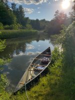
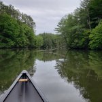
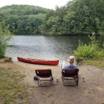
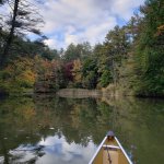
If you just want a day paddle, what's your local water body? Descriptions and pictures are always appreciated.

Here's a thread about my local paddle on the Housatonic River in Connecticut, which south of my town is dammed up into a series of lakes, the first one being Lake Lillinonah.

 
If you just want a day paddle, what's your local water body? Descriptions and pictures are always appreciated.

Here's a thread about my local paddle on the Housatonic River in Connecticut, which south of my town is dammed up into a series of lakes, the first one being Lake Lillinonah.

Ipswich River, Ipswich MA - particularly the run between Winthrop St (just below the Willowdale Dam) and Peatfield St. The Ipswich River Watershed Association (ipswichriver.org) sponsors/maintains a series of put ins and take outs along the river from North Reading to the mouth if the Ipswich by Pavilion Beach.
 
Like Glenn I liver near the Housatonic River, but farther north. There are some class V and IV, but I don't have the skill or inclination for any areas above II. It wanders through some quaint New England towns and is very pretty. Unfortunately the area I frequent becomes a rock garden in the summer.

1648129163894.png

Most of my day paddling is on Tyler lake. It is small (200 acres) and gets a fair amount of boat traffic in the summer, but an inlet runs into our property so I can hardly complain.

IMG_4951.jpgC1ADC23C-908A-42D6-9465-0218D4E25FD4.JPG

Bob
 
My local paddle is Marsh Creek State Park, https://www.dcnr.pa.gov/StateParks/FindAPark/MarshCreekStatePark/Pages/default.aspx

As a boy growing up in the early 60's, in what was then dairy farm country, I regularly pedaled my bike to work on local farms in the Marsh Creek valley where there were several historic water powered mills for grinding grain & corn. The village of Milford Mills was located in the valley and there was a post office, mill workers housing, and the summer estate of the notorious Philadelphia mobster and fight promoter Max "Boo-Boo" Hoff.

In the early 70's the state decided it was a good idea to build a dam, flood the valley, and create public recreation as well as flood control and future drinking water reserves. All the village structures are now deep under the reservoir and the country roads I pedalled cut off. The state even moved a historic covered bridge. My wife (then girlfriend) and I lost our virginity in a field which is now just a memory yards from that old bridge!

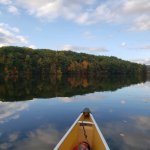
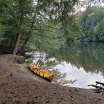
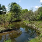
I enjoy paddling those waters now, and ponder mytempImageffK8z2.pngtempImageeb9dK9.pngtempImageLucAoC.png childhood memories as I glide silently above my youthful haunts.
 
The brook across from my house is part of the Wilder dam reservoir on the Connecticut. So I put in there and paddle down to the river. From there downstream is an esker and a couple of islands with nice picnic spots. If its just an afterwork paddle those are my/our typical destinations.

20200524_115231.jpg
197402291_10225796712567305_882425547490637768_n.jpg199809926_10225788779168975_8488228988489136086_n.jpg241407707_10226346273665989_1921158876543144363_n.jpg245148009_10226543992208829_1067590152757095511_n.jpg245334277_10226543992088826_836672672846599559_n.jpg245371875_10226543992248830_1418703075182556421_n.jpg
 

Attachments

  • 187362003_10225610965643748_4377245206609442347_n.jpg
    187362003_10225610965643748_4377245206609442347_n.jpg
    360.8 KB · Views: 1
There's a small stream (Pettengill Stream) a mile from my house that I explored a couple of times last year. It's only about a mile as the crow flys but it has enough switchbacks to make a couple of hours paddle if you take your time.
The St Georges river is nearby and run from Searsmont, Maine down to lower Senebec Lake is on my list, but I'll wait till I get a Royalex canoe for that trip.
Map of the Pettengill Stream,0F9898B0-B905-46EC-A891-2E8189CA99F4.jpeg

pettingill 2.PNG

Pettingill 1.PNG

Pettingill 3.PNG
 
I live a bit over a mile as the crow flies from the Susquehanna River. We're about 15 miles downstream of where the river leaves Otsego Lake in Cooperstown, NY, with three access points within 8 miles of my house. It's mostly pastoral and a delight to paddle. I get to observe a lot of wildlife and the bald eagles and osprey have made a strong comeback over the years. The river continues downstream through Oneonta, NY where I worked for 40 years and I used to take advantage of that to go paddling on my lunch break during the summer months. I could be on the water within 10 minutes of leaving my campus' office. Since it was summer, and no classes were in session, I could usually get an hour on the water before heading back to school. I would paddle upstream until I hit the I-88 bridge, turn around and then headed back to my truck. Always a nice mid-day break. I still paddle various stretches on the river whenever I can only now I'm accompanied by my dog instead of students.

That's all for now. Take care and until next time...be well.

snapper
 
No photos (that is my wife's domain), we are next to Braddock Bay on Lake Ontario. There are quite a few streams and other ponds within a few minutes as well. A favorite of ours is to put in on Salmon Cr (our neighborhood assn launch) paddle downstream to Braddock, then take the channel out into the lake to a beach nearby.

Edit: here is a photo taken by my wife of me while on a sunset paddle.
 

Attachments

  • Screenshot_20220325-205453~2.png
    Screenshot_20220325-205453~2.png
    731.1 KB · Views: 5
Last edited:
“If you just want a day paddle, what's your local water body? Descriptions and pictures are always appreciated”

My homewaters, for many years, decades actually, was the Gunpowder Falls between Prettyboy and Loch Raven Reservoirs. The middle 15 mile stretch, below the short WW section, runs for 12 miles between the Masemore and Sparks bridges.

Masemore to Blue Mount is a lovely and lively 5 mile stretch, Blue Mount to Sparks a more sedate 8 mile section, both with excellent launch/take out/parking areas.

I have not been down any of the Gunpowder in a couple years. Some idiot elected to hike in with a chainsaw some years ago and cut out all of the strainers. Not just the hazardous strainers but several miles of un-obstructing crossriver fallen logs. AND THEN PUBLICIZE HIS SAWYERING WITH ACTION PHOTOS!

Nice work moron. The Gunpowder falls is a “Blue Ribbon” trout stream. The RiverKeeper is a local fly fishing guide. Trout fishermen value shading, pooling strainers. At last count there were at least 8 get-out-and-carry-around strainers, large trees with accumulated woody debris piles, along the bottom 8 miles, gawd knows how many along the faster, narrower top 5 miles.

The Gunpowder Falls is a beautiful little river, only a few miles from my home. And it is just not worth the effort anymore. It was a wonderful poling/snubbing river before it filled with strainers.

IMG022 by Mike McCrea, on Flickr

That is DougD, waving a New Hampshire hello, minutes after proclaiming that he had not swum in 15 years. OK, Doug is not always that saturated when poling.

IMG015 by Mike McCrea, on Flickr

My other life-long “home water” is the Susquehanna below Holtwood dam. My family had a camp there, and from ages 8 – 16 I spent every weekend paddling and boating there. Having finally broken down and bought a damnable Fish Commission launch permit the upper Susquehanna Pool, 45 minutes away, may once again become my “home waters”.

P3250016 by Mike McCrea, on Flickr

Although, with OOSOBO now reservoir permitted and locked up easy launch at the reservoir’s edge, a whopping 4 miles from home, the upper Susquehanna Pool may have some competition.

P3090003 by Mike McCrea, on Flickr
 
For day paddles I use a local state park that has two lakes ... but the Wisconsin River back waters is a great place to explore and practice portaging with my dog Jake as well as play in the timber with both dogs. Lastly, the ice breaks up earlier on the river so we get more time to paddle explore here.

Prospector 4.jpgProspector  2.jpgphoto14558.jpg
 
Cunningham slough is across the road from my house. I can carry down the driveway and find a place to launch through the cattails. It's a pretty small body of water but when water levels are perfect I can paddle through 2 culverts into a couple adjoining lakes. These are all shallow and muddy but make for pleasant evening paddles with good wildlife. I generally have them all to myself. 20200627_194306.jpg

View from my yard
20210724_203316.jpg
 
From my place, runoff drains to the Severn River, mostly a wide, open, tidal river with housing and power-boat docks shoulder to shoulder for most of it's 12-mile length. Unfortunately, the only public access is at the Annapolis end of the river. I sea kayak there in the summer. The reflected waves, mostly from the many large power boats, bouncing off the seawalls of the Naval Academy produce a fun merry-go-round, clopotis for the sea kayak. Not so much fun for the canoe.

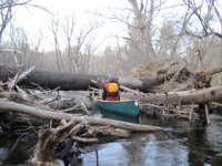
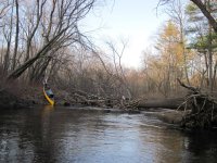
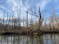
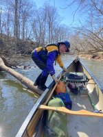
I love to canoe my local Patuxent River. Like McCrae's middle Gunpowder, it's full of timber and strainers. There are now entire stands of dead forest, decimated by the emerald ash borer about 5 years ago. I never knew the extent of the ash population in that watershed until they all started dying. Paddling the 7-mile stretch between Governors Bridge and Queen Anne Canoe Launch last fall, we ran into 14 strainers requiring getting out of the boat. We don't count them if you can bump over or limbo under. My buddy and I have been out about every week since. We hack and deconstruct, and had it down to 6 pull-overs last week. It's all temporary. The dead ash keep snapping off, and every time there's a big rain, they all start moving. So, it's going to be a tough stretch for years to come.

Dead forest (mostly) along the Patuxent
IMG_6742.jpeg

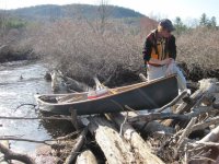
All but one strainer can be negotiated by running the bow up on a log, getting out of the boat, and pulling it across the strainer.
IMG_6702.jpeg

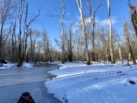
A frozen side channel of the Patuxent, January '22. When the water is up, a fascinating array of side channels and beaver ponds can be paddled. Low water in the photo.
Pax-JanIce22.jpeg

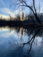
Doesn't seem to matter what time we get on the water. We usually find a way to paddle until last light.
Pax-reflect121321.jpeg

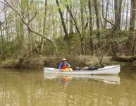
2003 to 2019, 18 consecutive years, I co-organized a spring cleanup on the section of the Patuxent downriver from Queen Anne. In the photo below, my co-organizer hauls trash in my Brownline Mayfly.
Pax-Ralph-Brownline.jpeg

Queen Anne was a happening place prior to about 1750. It was the head of navigation for ocean-going ships, and it had the southernmost bridge over the river. It was on the route from Washington to Annapolis, and was the only road connection between southern Maryland and the rest of the world. The bridge is still there, but hasn't carried traffic since the 1960s. The port of Queen Anne was silted in by about 1750 and it is now just a cluster of rural houses. For all the times I've paddled under it, I really should have a photo.

In conclusion, my favorite local paddle is the Patuxent River. It's intimate. I've encountered other boaters in there about 1 in 50 times. Never used to see a soul, but since Covid it's been discovered by local fishermen, and I may see as many as 20 people in the 7-mile stretch I most frequently paddle. The current runs about 1 - 2 mph, and to me, current adds so much interest to the paddling. The timber clogs are a pain, but keep the riff-raff away and add to the challenge.
 
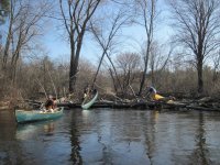
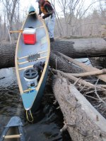
For years a few of us did the a couple of local rivers, the Merrimack running from Franklin at the headwaters down to Penacook, a nice run but lazy river. The other river we liked was the Blackwater River and it was at times, year to year, a mess but a lot of fun. I haven't been on it in a few years now but in the past we paddled it a lot. A few pics from one of the last times we ran it.
 

Attachments

  • Once Again.jpg
    Once Again.jpg
    197.1 KB · Views: 18
  • Humping.jpg
    Humping.jpg
    132.6 KB · Views: 17
  • Hmmm.jpg
    Hmmm.jpg
    120.6 KB · Views: 18
  • Drag Over.jpg
    Drag Over.jpg
    188.3 KB · Views: 17
  • dang.jpg
    dang.jpg
    179.9 KB · Views: 16
For years a few of us did the a couple of local rivers, the Merrimack running from Franklin at the headwaters down to Penacook, a nice run but lazy river. The other river we liked was the Blackwater River and it was at times, year to year, a mess but a lot of fun. I haven't been on it in a few years now but in the past we paddled it a lot. A few pics from one of the last times we ran it.
That reminds me of a creek we'd paddle growing up in SC. We had a 14 foot aluminum canoe, a snake stick, and a pillowcase. We'd catch snakes on the way down (putting them in the pillowcase), then let them loose at the end. I remember both of us laying out over the bow trying to slide the boat off a log. Lots of heaving and hoing (hoeing?). Oh yeah, and looking on and under every log to see if a snake was about to drop into the canoe. Good times.
 
I have 4 within 15 minutes, and some maybes I haven't scouted out yet. Chamout River is about 8 miles from Lake Ontario to Depauville Dam. FC outrages, farms, and forests - including 300' I own. my own canoe base someday. There's another 10 or so miles to LaFargeville through farm land I want to try.

French Creek is designated NY wildlife management area - 8 or so miles of no buildings or other paddlers (no motors allowed) ending in the Village of Clayton. Mostly cattails. Very calm and protected.

Chippewa Bay off St Lawrence Seaway has creeks off both ends. Crooked Creek is south west, about 12 miles of very calm water. Mostly surrounded by Thousand Island Land Trust property. I don't know name of creek to north east but looks like 8 miles.

I haven't ventured out on St Lawrence yet but would like to try, paddle to several boat access only state parks and around the Thousand Islands.

I'm having trouble with picture resizer but will try to add some shots.
 
Back
Top