• Happy 100th, Norma Jeane (1926-62)! 🎥⭐👩🏼👄

Does flatwater need classifications similar to whitewater?

Considering some of the replies so far...

the problem with classifying flatwater is far more extreme than WW will ever be simply because WW is generally graded either by the average or peak for a particular section or river, while flatwater can encompass every description known because you can literally have riffles, blowdowns, strainers, ledges, ponds, lakes, overgrowth, tides, and meandering bends, all within a few hundred yards. Add in current, wind funneling, wind fetch, and the human factor (crowds, fences, bridges, etc.) and it becomes a real dogs breakfast.

Flat water has no gradient but it can be as rough as you want.
Lake Tahoe has a surf club. Big lakes with long fetch can have enormous waves.

That's the argument for breaking flatwater down into categories that reflect the difficulty and risk of paddling in various conditions encountered within that category. As with whitewater, each flatwater category would have ratings based on the range from least demanding to most demanding conditions. Currently the all encompassing category of flatwater is basically worthless in assessing the proficiency needed and risks involved in paddling a body of water. Quietwater and bigwater are probably the most used and best understood terms for categories of flatwater, but they're not defined and don't have a common understanding of difficulty ratings within each category. Moving flatwater has no common understanding and yet is where paddlers often get into trouble.

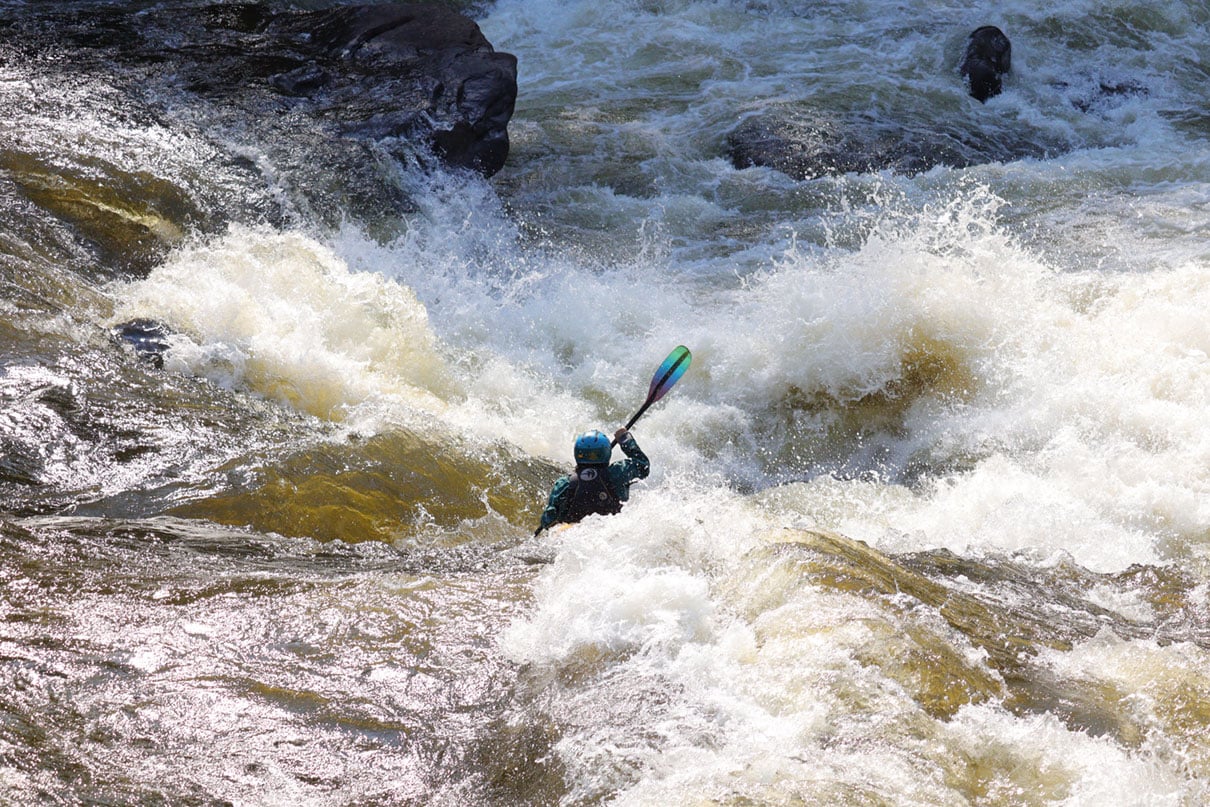
I see the problem with [quickwater] as the same problem with "Class 1" designations. My local river has a ~15 mile stretch that is called class one by everyone who ever wrote about it AFAIK. Yet it is sometimes strewn with serious hazards - sweepers, strainers, powerful eddys, etc. Right in the first hundred yards, last year there was a 90° bend with a strainer on the outside. I've watched multiple "experienced" class 1 paddlers get in trouble there, including several swims and one pinned boat. This whole stretch is what I think of as quickwater, and in my estimation is closer overall to the lower end of class one.

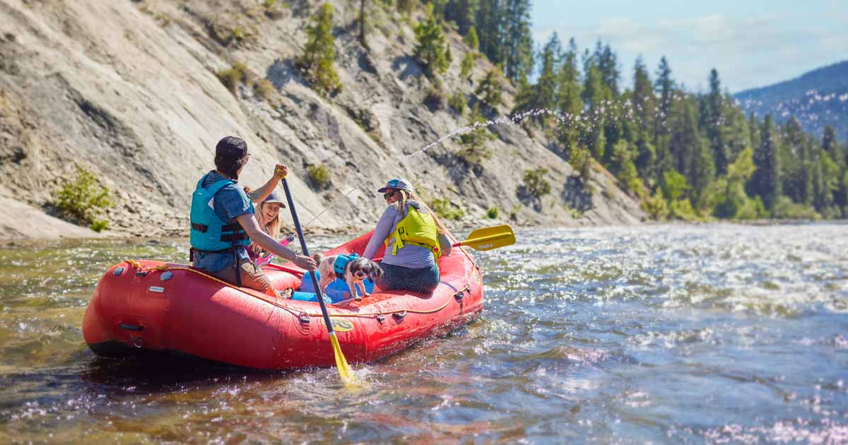
The snake in Idaho can be fickle.
How about 1a, 1b, 1c? With weather/hazard criteria identified for each?

Maybe thinking of quickwater as class 1 whitewater misses the mark and it needs to be broken into two broad categories, much as quietwater and bigwater reflect the two broad categories of non-moving or slow moving water. For moving water not considered Class 2 to 5 whitewater, quickwater could be the less difficult category and something called "heavywater" (or something similar) for the more difficult category. Each category would include a range of difficulty/risk levels depending on conditions likely to be encountered.

I often think about trips in terms of consequences. How likely am i have a problem? If i have a problem, what will happen?
That's what the range of risks within each broad category would provide for paddlers. From limited risk with good weather and paddling conditions on quietwater to the potential for drowning or severe injury with bad weather and hazardous conditions on bigwater or heavywater. (Again, these are just suggested terms.)

So categories for the range of water types encountered might include: quietwater; bigwater; quickwater; heavywater; and whitewater. Not saying those are the right categories or terms, but something to start with and certainly more descriptive than simply whitewater and everything else; i.e., flatwater.
 
Tketcham, the problem I have is that in the case of the river I described, 90% of that river is flatwater, usually with minimal or no current, but with very short, sudden changes like a "flood barrier" barely breaking the surface at regular flows, but can be 2-3" above the surface during summer flows or 2-3' below the surface with spring runoff, millponds where the dam has collapsed creating a 10' section of swiftwater, or a collapsing clay cliff that on one trip is just a slightly higher current or no current at all, that can literally change overnight with the erosion of a glacial erratic, or a sudden slump creating a partial blockage, raising water levels and flow overnight until the clay is washed away or a storm pushes the boulder into the hole below.
so do you change the classification just for that 10-30' hazard, or for the entire section? do you adjust the rating everyday to account for overnight level, velocity, or hazards that literally come and go day by day?
Unlike most white water rivers, this is in a very wide, flat, valley prone to flooding and created eons ago by glaciers and, in spots has over a hundred feet of till and sediments, in a Carolinian forest setting that is literally alive and changing day by day if not hour by hour, not solid granite or limestone that can change maybe annually at best.
"quietwater; bigwater; quickwater; heavywater; and whitewater" can literally describe ALL aspects depending on the day, water levels, heavy rain or storms, erosion, and even wind direction and force. Many southern Ontario rivers in the Great Lakes/ St. Laurent basin are similar- very few are in predictable, long-lasting, rock-cut channels but are in highly variable silt and till- based channels that are constantly changing and eroding-- I've literally found the main channel shifted and an oxbow lake created, after a single overnight thunderstorm, and the water level change by 3-4' in sections in the same day. in 60 years of paddling the only constant is that nothing is constant, and nobody I know has ever been able to classify it with any accuracy
within an hour's drive I know of 7 such rivers...
 
I'm don't see who would benefit from such a classification system. The flatwater paddlers who don't check the wind, thunderstorms, or water level and don't have the ability to recognize a strainer aren't the people who are going to check some complicated classification system.
 
Much like what @scoutergriz said, that local stretch of river I mentioned tends to change significantly, sometimes drastically, every spring. One feature that appeared after spring flood several years ago was a debris and log pile that blocked the existing channel so thoroughly that it created a wall with a 90° left turn, followed by a hard right into a strainer. Water piling up on the log wall caused an unstable boil that could easily dump an unskilled boater, depositing him into the strainer.

Remember - this is, by all accounts, a class 1 stretch.

A few years later, spring flood piled gravel ahead of that wall filling and realigning the channel, bypassing the whole mess but putting the flow directly into a strainer 100 yards below.

Last year, that short section was devoid of any complications. I haven't been down it yet this year. Spring flows were unusually mild this time though, so it might all be the same as last year.

Another example. The lake I mentioned. The open pool is flat on weekdays in fair weather. Come Saturday, there will be numerous ski boats, bass boats, jet skis and wakeboats - causing what often turns into a massive collection of clapotis.

You can escape that in spring and early summer to some degree by going into the flooded trees along the perimeter (where I like to fish for bass BTW), but that presents another latent danger. The trees are all cottonwood. The mature trees have a lot of dead limbs that fall randomly into the water. A trip behind the water weed barrier and into the trees to escape waves is a bit risky. Doing the same to escape big wind is unreasonably risky.

I think classifying either of these two bodies of water in any meaningful way beyond what I posted in this thread (which barely touches the surface) would require pages of detail.
 
Here's another....
The Mores Creek branch of Lucky Peak reservoir on a quiet day is a dead flat course through rock walled canyon. Fairly wide, but no beaches, no bank you can park a canoe on. Beautiful currentless glassy stretch of water that is popular with paddlers. Put one ski boat or wake boat in there, and it turns into a solid class 2 challenge (would be higher if there was current), with waves as big as 3' reflecting off the walls continuously in every direction.

I go there sometimes just for something a little different, but most canoe paddlers avoid it - at least, after their first experience.
 
Good replies regarding the difficulty of categorizing flatwater...

...90% of that river is flatwater, usually with minimal or no current, but with very short, sudden changes...
...so do you change the classification just for that 10-30' hazard, or for the entire section? do you adjust the rating everyday to account for overnight level, velocity, or hazards that literally come and go day by day?
..."quietwater; bigwater; quickwater; heavywater; and whitewater" can literally describe ALL aspects depending on the day, water levels, heavy rain or storms, erosion, and even wind direction and force.
...that local stretch of river I mentioned tends to change significantly, sometimes drastically, every spring.
...The lake I mentioned. The open pool is flat on weekdays in fair weather. Come Saturday, there will be numerous ski boats, bass boats, jet skis and wakeboats - causing what often turns into a massive collection of clapotis.
...The mature trees have a lot of dead limbs that fall randomly into the water. A trip behind the water weed barrier and into the trees to escape waves is a bit risky. Doing the same to escape big wind is unreasonably risky.
A wider stream, especially one used by outfitters, is safer than a wilder narrow one with the same current, and a risk of changing hazards.

It may be that the better way to classify flatwater is to have categories that describe the hazards a paddler may encounter given certain conditions of wind, waves, obstacles, and water levels. As with whitewater ratings, it would be based on the hazards most likely to be encountered and the skills required to negotiate them. It isn't possible to account for every single hazard for each waterbody or stream, just as there isn't for whitewater ratings, the ratings are relative, with overlapping risks.

I'm don't see who would benefit from such a classification system. The flatwater paddlers who don't check the wind, thunderstorms, or water level and don't have the ability to recognize a strainer aren't the people who are going to check some complicated classification system.

I think classifying either of these two bodies of water in any meaningful way beyond what I posted in this thread (which barely touches the surface) would require pages of detail.

The idea isn't to have a fool-proof system for people that aren't interested in learning how to be a proficient paddler, it's to have a more meaningful flatwater classification system that at least gives paddlers a sense of what they might expect. Flatwater categories and ratings would be a spectrum, not pages of technical data sheets. Every body of water or stream doesn't have to be rated, but a paddler could use the classifications to better understand what category the water would fall into and how it might be rated given certain influences of water level, weather, and potential obstacles or hazards. Granted, most experienced paddlers already know this, but a flatwater quide and rating system would provide a starting point for less experienced paddlers.

And for perspective, below are links to articles from NRS and Paddling Magazine regarding how to interpret whitewater difficulty ratings. Notice how they qualify the ratings, that the ratings are subjective and a single numeric rating doesn't tell you everything you should know or consider. I see a similar perspective for flatwater categories and ratings.


Last edited:
Back
Top Bottom