• Happy Mountain Day! 🇯🇵 🏔️🌄

What Happens to a Lake When Its Dam is Removed

Glenn MacGrady

Administrator
Staff member
Joined
Oct 24, 2012
Messages
6,982
Reaction score
14,536
Location
NW Connecticut
1786213663756.png

It depends.

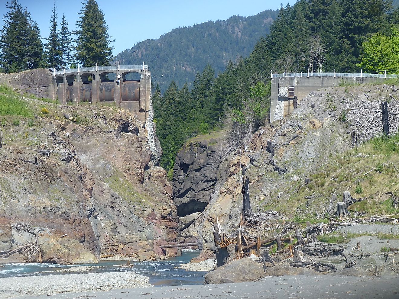
"When engineers pull the plug on a dam, the lake behind it does not just quietly fade away. A reservoir is an artificial, still-water (lentic) system, and removing the barrier that holds it back triggers a rapid shift back into a flowing (lotic) river. Of course the water drains, often in hours rather than weeks, and then the real transformation begins as decades of trapped sediment, submerged tree stumps, and buried riverbed start to reappear. In the United States, more than 2,300 dams have come down since 1912, according to American Rivers . . . . Below, the process is broken down step by step, illustrated with four of the country's largest and most closely studied dam removals."

 
Then there are the legal issues. Who owns the land that was under the former reservoir?

A hydro-electric dam in Ellsworth, Maine, has lost it's generating license. One of several reasons is that the dam kills too many fish. The owners may be required to remove the dam. The shore has some public land, but much more private land. Who owned the land under the reservoir and who inherits that land? A recent article in a local newspaper said the resolution can be "very complex".
 
thanks for posting this. Very relevant for all river runners.
I have made runs on the Klamath River in California 3 times, the second largest river in California. Last trip the put in was right below Iron Gate Dam in 2023.
The effects of multiple dam removals has been dramatic in the last 2 years.
The anadromous fishery has responded quickly. Salmon have already traveled up stream past all of the dams and made their way across the enormous Klamath Lake. Fish are already spawning in the Williamson and Sprague Rivers well up into Oregon. I will be camped on the Williamson River next week.

There were plenty of naysayers that said that this would never work. The large winter discharges in a river this big, have moved tremendous amounts of sediment downstream and out into the Pacific past the river mouth. The river already has more or less normal clarity. Big success story. More to follow. The Elwha River in Washington got the ball rolling some years ago.
 
Last edited:
What I don't understand, because I've never researched the subject, is what happened to the original purposes for which the 2,300 removed dams were originally built.

They weren't built as hobbies. I assume they were built for important (or seemingly important) purposes such as hydropower generation, flood control, capture of drinking water, capture of water for farming and other irrigation, improvement of navigation, and perhaps even recreation.

Did those purposes all disappear for all 2,300 removed dams, or were those purposes superseded by other means or technologies, or were those purposes never necessary in the first place.
 
Did those purposes all disappear for all 2,300 removed dams, or were those purposes superseded by other means or technologies, or were those purposes never necessary in the first place.
Yes. :)

Many of those 2300 dams were smaller dams that had become liabilities for the current owners. Dams have a lifespan and when they get old they become very expensive to maintain and/or they no longer serve their purpose. A dam built for flood control for example, may no longer hold enough water to mitigate storm events and now is a flash flood risk if it breaches. Same is true of dams built for other purposes.
 
Some of the dams (many of?) were put in just as economic stimulus for the area (sort of like the CCC kept some people employed during the depression), but there were many other reasons listed for a project just to help get the thing pushed through so the project would happen.

In the 1970s and '80s my parents lived on a small reservoir in Missouri, the Pomme de Terre Reservoir, the dam of which was on the Pomme de Terre River near the small town of Hermitage, north of Springfield, MO. Dam construction for "the Pomme", as it's locally called, was started in 1957 and finished in 1961, though normal pool for the reservoir wasn't reached until 1963. My father, a ranger at one of the Corps. of Engineer parks there as a summer job between school sessions teaching the rest of the year, told me that among the reasons listed for the Pomme de Terre Dam were power generation capabilities and flood control. Space and fittings were there for electrical turbines, but they were never installed because testing after the dam was operational indicated a design flaw that caused large water releases or even generating full power to inundate some of those same areas the dam was supposed to protect from flooding. One of the farms that would have been affected included the fields of the family of a girl my youngest brother married a little later on.

Then the Harry Truman Reservoir was constructed on the Osage River north of the Pomme de Terre with the dam near the town of Warsaw MO.

Construction was authorized for the Truman Dam in 1954, but not started until 1964 and not completed until 1979 because it took years to procure land, move people, towns, cemeteries, bridges, highways, etc., out of the flood zone. It actually forced the closure of one admittedly lightly used railroad line. Though one of the given reasons for the Truman Dam was flood control, it was constructed just a few miles upstream of high pool on the bigger Lake of the Ozarks downstream (dam completed in 1931, also on the Osage River), and when Truman Lake was filled it flooded the Pomme de Terre River to within just a few miles of the the dam on that river. Hmmmm... evidently a whole river system has to be flooded in order to prevent flooding?

Did you also notice I mentioned that the Truman Dam and reservoir system was authorized in 1954, which was three years before the Pomme de Terre Dam was started? Yup, flood control was a reason for the Pomme Dam even with plans already in motion for flooding most of what's there? Pork barrel politicking at it's finest! At least the Truman Dam does generate electricity as does the dam for the Lake of the Ozarks downstream. I don't know if any cows have been swept away by air conditioners in Kansas City or St. Louis. Maybe sharper pencils were available to those engineers.

As an aside, there's an old probable meteor crater that is indicated by the drainages in the upper end of the Truman Reservoir system. It's just a much smaller version of Recped's Manic 5 Costco chicken gorging trip described in another thread, though the water doesn't go full circle. You can check it out here:
It would be a heck of a portage to complete the circle. Carry a map and compass and a brace of pistols to protect yourself from moonshiners and other angry landowner sorts. Please don't tell 'em I sent yuh.
< Huge Grin >
 
Some streams were dammed up for log driving in the spring.
At least locally, those were splash dams that were broken periodically to wash the logs downstream in the resulting flood. I doubt that the amount of ecological damage that practice inflicted would be tolerated today.

Did those purposes all disappear for all 2,300 removed dams, or were those purposes superseded by other means or technologies, or were those purposes never necessary in the first place.
There have been some dams removed around here because they provided water for the cooling towers of some coal-fired power plants. Now that many of those generating stations have been shut down, the dams are no longer needed.

I also know of one hydroelectric plant where the generating equipment got pretty outdated and the dam was starting to require costly maintenance a bit too frequently. That generating station shut down and the dam was removed because the government was providing cash for solar and wind generation but not for renovations of aged hydro plants.

The power company simply followed the free money into the trendy parts of the industry (and probably got paid to remove the hydro dam as well).
 
What I don't understand, because I've never researched the subject, is what happened to the original purposes for which the 2,300 removed dams were originally built.

I'll bet the answer differs depending on where you are located. I my area (New England), dams were built as early as the 17th century to provide power for sawmills, grist mills, foundries, etc. The dams were small initially, but once they were built the damage was done to the river ecosystem.

The dams got bigger and even more numerous with Samuel Slater's construction of the first successful water powered textile mill in the US on the Blackstone River in 1793. Here is that mill today from below the Pawtucket Falls.


The Blackstone River (my home river) is a great example of what happened next. The lower Blackstone River from Blackstone MA to Pawtucket RI is about 15-miles. At one time there were 15 dams along that 15-mile stretch - each powered a textile mill. Four were removed over the years, but there are still 11 dams today.


These dams are small by western standards - a fall/drop of anywhere from 10 to 35 feet. Two of the larger dams have now been converted to hydro power, but most aren't big enough to justify the cost. They just sit there - holding back tons contaminated sediment from hundreds of years of industrial pollution. According to Google AI there are 300-400 dams within 25-mile radius of my house in Woonsocket, RI.

So what do you do with them? Removal is cost prohibitive. It is a couple of million dollars to remove even a small dam. The sediments behind them are also a huge problem, and there may be historical reasons to keep a dam in place (like at the Slater Mill site). These dams and the mill ponds that they create have also been at the center of many New England communities for hundreds of years.

That is the southern New England story. I know it is very different in other parts of the country - especially out west.
 
Last edited:
In the East, lots of small dams were built along the Fall Line to provide for water power. The Fall Line is the intersection of the Coastal Plain and the Piedmont Plateau. Many cities fall right on the line.

As dams age. they fill in with sediment and lose capacity. They become more expensive to maintain. Often their power generating capability is diminished or lost. Small dams do not provide much flood control.

Large reservoirs like the majority of those in the West were political decisions. They were sold to the public under the guise of flood control, power generation, irrigation and recreation. The classic boondoggle of all time is Glen Canyon Dam at Lake Powell, ,AZ. By now it provides little power, and no irrigation. It is a giant evaporation pond that put the magnificent Glen Canyon under water. Some day this dam will come out but it will be expensive.

Having worked as a hydrologist for many years, I was able to learn the details of a lot of large water projects mostly with the Bureau of Reclamation and the Army Corps of Engineers. The days of dam building in the US are mostly over. Now we are in the business of taking them out. In many hydrologic basins, water is best stored as ground water and pumped to the surface rather than stored in reservoirs. Fish and wildlife species benefit greatly from undisturbed rivers with no dams and irrigation diversions. ESA may ultimately be the driver to remove the dams on the Snake and Columbia Rivers.

Dan Beard, retired Director of the US Bureau of Reclamation wrote a very interesting book. "Damnation". He has a Ph D in hydrology from the Univ of Washington. I heard a presentation by Dr Beard recently and he is one of the first former bureaucrats to suggest that most dam construction is for political reasons rather than benefits to the public. Meanwhile hundreds of dams are coming out.
 
Last edited:
The classic boondoggle of all time is Glen Canyon Dam at Lake Powell, ,AZ. By now it provides little power, and no irrigation. It is a giant evaporation pond that put the magnificent Glen Canyon under water
Much to the dismay of David Brower.
 
The days of dam building in the US are mostly over. Now we are in the business of taking them out.
Just like the dams are different in different part of the country, the solutions to dam removals will be different as well. Again, in New England every river is dammed, often multiple times. Most of those dams are relatively small and have been in place for hundreds of years. The backwater and wetlands that they create have now become the natural ecosystem. The good news is that there has been some innovative work on reopening river access to migratory fish while not disrupting the wetlands that many of these dams create.

A great example is the Bradford Dam on the Pawcatuck River in RI. It was a 19th century stone and timber dam that provided power for a nearby textile mill. Like many at the time, the 6-foot dam was built on top of a natural waterfall and spanned the entire width of the river. Since removing the dam would drop the water level upstream by about 5 feet and negatively impact wetlands, the decision was made to leave the dam in place, but build a new rock-ramp structure on the downstream side to allow fish to get upstream.

The new rock-ramp includes 6 gradually ascending stone weirs, which serve like terraced steps. Pools between the steps give fish a place to rest on their way upstream. Gaps in the weirs create channels for water to flow and fish to swim, including the main current down the middle that forms a nice channel for paddlers. Here is a video that shows the old dam, and us running the new fish weirs.


It is a neat solution for a very specific situation that is pretty common around here. Access for fish, rapids for paddlers - its a win-win. Unfortunately, it is still expensive. This was a $2M project for a relatively small dam. Most of it was paid with federal flood control funds, and that money is not available anymore.
 
Last edited:
Just like the dams are different in different part of the country, the solutions to dam removals will be different as well. Again, in New England every river is dammed, often multiple times. Most of those dams are relatively small and have been in place for hundreds of years. The backwater and wetlands that they create have now become the natural ecosystem. The good news is that there has been some innovative work on reopening river access to migratory fish while not disrupting the wetlands that many of these dams create.

A great example is the Bradford Dam on the Pawcatuck River in RI. It was a 19th century stone and timber dam that provided power for a nearby textile mill. Like many at the time, the 6-foot dam was built on top of a natural waterfall and spanned the entire width of the river. Since removing the dam would drop the water level upstream by about 5 feet and negatively impact wetlands, the decision was made to leave the dam in place, but build a new rock-ramp structure on the downstream side to allow fish to get upstream.

The new rock-ramp includes 6 gradually ascending stone weirs, which serve like terraced steps. Pools between the steps give fish a place to rest on their way upstream. Gaps in the weirs create channels for water to flow and fish to swim, including the main current down the middle that forms a nice channel for paddlers. Here is a video that shows the old dam, and us running the new fish weirs.


It is a neat solution for a very specific situation that is pretty common around here. Access for fish, rapids for paddlers - its a win-win. Unfortunately, it is still expensive. This was a $2M project for a relatively small dam. Most of it was paid with federal flood control funds, and that money is not available anymore.
This tickles me.

Our paddling community here is largely (at least vocally) very much anti-dam. Except when it comes to the projects that are the opposite of your example. The city stretch of the Boise has several irrigation diversion dams - aka weirs. One of them was a hazardous low head with a recirculating drop, so after several drownings there the city developed a plan to redesign it. That plan morphed into a hideous mechanical wave shaper. The whitewater buttboaters and surf boarders love it. Everybody/everything else, not so much.

That proved so popular that they took out the diversion below it that looked like a smaller version of your current Bradford dam (which I spent many hours poling up and down) and put in another slightly less ghastly wave shaper.

Neither do anything positive for canoeing, or for river critters, near as I can tell.
 
Some rivers are hard to get information on. In the West some have few roads that allow observation. They are easiest to see and assess by driving upstream.
What that means is that all boaters need to be very vigilant about horizon lines that disappear. That means a drop, a falls or a diversion dam the original drowning machines. Out here there are few warning signs.

Good fish passage is not that easy to achieve. It works well on low head dams and sometimes boat passage can be built into the improvements. The South Platte River that flows through Denver is a good example. Modern re-engineering has allowed for really good boat passage.

On the large dams like those on the Snake and Columbia Rivers, fish passage has been a huge challenge. Enormous amounts of money have been spent to improve anadromous fish passage. The US Fish and Wildlife Service literally catches salmon at the base of some of these dams and moves the fish in an elevator above the dam. Their eggs and milt are often stripped on the way. This is a very labor intensive process that few people hear about. The Endangered Species Act is still a powerful piece of legislation in court.

Red Lake in Idaho famously has red salmon fish counts of a handful of salmon that successfully negotiate the route from the Pacific up the Columbia and up the Snake to the headwaters in what I think is the Sawtooth Range.
 
All the dams around me in the Midwest were built to run mills of various types which are all long gone. They're small concrete low head dams. When first built all those years ago they created small "ponds" in the upstream side but now they're all silted in.

Some were broken up, either intentionally or unintentionally, many years ago and are a bit of a jumble that allows water to pass through at all water levels. Other dams are still solid and taller. These have been being removed over the past few years.

They often install a series of rock bars upstream from the dam to stair step the water level after removal.

It doesn't make a huge difference for recreation but I'm sure the fish, and even more so the mussels, appreciate it.

A few small dams create small lakes near my house. I'd be happy to see the dams removed and the lakes go back to being shallow sloughs as the were historically. I doubt it will ever happen as I'm probably in the minority other than duck hunters.

Alan
 
Red Lake in Idaho famously has red salmon fish counts of a handful of salmon that successfully negotiate the route from the Pacific up the Columbia and up the Snake to the headwaters in what I think is the Sawtooth Range.
Redfish Lake. When I was young, the old timers had stories of the lake outlet so full of spawners that it was a solid stream of red/orange. Before the days of active game management, one could wade out and grab an armload of salmon.

Edit:...and then the dams happened.
 
Last edited:
When I think of what these dams have done to the salmon migration, it always leads me to the plight of the mom&pop commercial fishing community. I had family in that biz, and I can only imagine how much better they would have done with a healthy fishery - which we cannot have in this reality. In the bigger picture, I have to wonder at what point do we realize we're running out of seafood and killing off entire ecosystems. Remember the bison?
 
Bunch of dam stuff. I spent 27 years in the Pacific Northwest, and have lived the last dozen or so in CT.
Someone asked about how long it takes for a river to recover from a dam removal -
In 2005 or so, I did an art project for a Sandy River dam removal project. The Sandy drops of of Mt. Hood into the Columbia River... downstream of the lowest Columbia River Dam. At that time the experts did not know how long it would take for the river to return to a natural state. They estimated several months to a couple years. It reverted to a braided mountain river in 3 weeks!. Salmon returned with the first possible run. The trout guys at Western Rivers Conservancy were pretty happy.

I recommend reading about the Elwa Dam removals on your own. The process before, during, and after, was well documented.

The Columbia river runs 1500 miles from the Canadian Rockies to the Pacific. Grand Coulee Dam is near the midpoint and it has no fish ladders or any other bogus fisheries aids. So, when it went in in the 1930's, half of the river and all of the tributaries in that upper half ceased being salmon habitat. I remember looking at salmon count data matched with construction dates of Columbia River Dams and noticing that about 7 years after a new dam was completed, there was a step drop in salmon returns. 7 years is how long wild Pacific salmon stay in the ocean before returning to spawn. The surviving salmon run is a drop in the bucket of what it should be.

I canoed the Yakima River in 2010 and researched the stuff I noticed. The Yakima has several (I think 7) dams, which are mostly diversion dams for irrigation (with one that also generates a little power). The Sunnyside Dam is the very first dam that the Bureau of Reclamation built). Salmon counts in the early 1900's were about 900,000 fish for the year - 3 different varieties. The authorities are pretty stoked if they get 25,000 fish for the entire year, and the summer Chinooks are extirpated because irrigation draws and returns raises the river temperature above 20C, the point were salmon won't enter. They traded salmon for agriculture. If you eat Washington grown Apples, Peaches, Cherries there is more than a 50% chance that it came out of the Yakima. There is a 70% chance that the hops in your beer came from the Yakima. THe dams all have salmon ladders at this point, but they still have to clear 5 or 6 Columbia River dams to get into the Yakima.

Connecticut has over 4000 dams. Some (maybe most) of the pre-steam era are on ridiculously small brooks - (If you haven't seen the remains of the Parmalee Sawmill Dam ca 1855 on the East River in Guilford... kind of amazing that they built a 10 ft hig, 60 ft long stone dam for a brook that you can step across in the rainiest weather). Even the big CT dams are puny vs a western dam. Most of the ones we come across as canoeists are in place as a power source, or to preserve lakeshore property values. Our fish status is so goofed up with 300 years of overfishing and pollution that people aren't aware that the dams continue to interfere with migration of shad, lamprey and freshwater mussels and others (I'm not remotely a fish guy).

And as eckilson points out, Rhode Island has some of the most creative dam removal that I've seen in Bradford. I talked to a RIDEM guy one day and they're planning to do something similar at the next dam downstream from there.


LAST POINT -When a dam is removed, the natural state of that river might not be the free flowing stream that we see. In many cases the natural state of a large number of rivers was to be flowing into a beaver marsh or meadow.

 
Last edited:
Back
Top Bottom