• Happy Weed Appreciation Day! 🌱🌿🌻

The Millinocket Carry, Northern Maine

Joined
Dec 16, 2016
Messages
678
Reaction score
666
Location
Bangor, Maine
"Once the principal route between the upper Aroostook and the East Branch [Penobscot River], this carry was direct, and useable as long as streams were unfrozen. The southern half of the Millinocket Carry is abandoned and a challenge today ... It is a major loss."​
- Ron Canter, The Allagash and its Neighbors: Canoe Trails, Past and Present, Joining the NFCT to the Major Rivers of Northern Maine*​


As soon as I began reading this guide from Canter I knew that I had to attempt the Millinocket Carry. It has all the ingredients for a rewarding trip: solitude, history, scenic beauty, physical and navigational challenges. I've always enjoyed canoeing as a means of wilderness travel, in contrast to activities that only work downhill or downstream. Here is a connection that was once among the most significant in Maine, along with the Northeast Carry, Mud Pond Carry, etc., and it's now essentially forgotten to all but a handful of canoe trail history nerds.
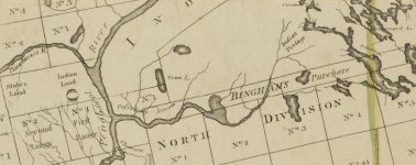
MC_Hubbard_1883.png
The Millinocket Carry on a map of 1883 (Lucious Hubbard)

As a practical matter, the area of the Millinocket Carry is within range of a long daytrip from my home in Bangor, making some pre trip scouting possible. I did that scouting in late summer 2021. The crossing from the East Branch Penobscot to Moose Pond is about four miles total, consisting of forest road walking, marsh / beaver pond paddling and over a mile of trackless bushwhacking.

No dates were open for a fall trip, so over the following winter a friend and I made plans for mid May.

Day 1: Grand Lake Matagamon and up the East Branch to Turner Brook.

My paddle partner for this trip, Hope, is a long time canoe tripping buddy and experienced backpacker. (She also happens to be a bona fide cartographer -- I'm only an amateur map nerd.) I'd been paddling whitewater all spring and she'd been hiking and running, so with maps, GPS waypoints and light(ish) packs, we felt pretty ready for a challenging trip.

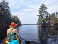
After driving up to the area and shuttling cars, we got on the water at about 1pm, starting from the boat launch at the Baxter State Park north entrance. The weather was warm and the wind calm, actually too calm for comfort, but given the size of the lake we didn't complain. Grand Lake Matagamon was originally two lakes which were connected when a dam raised the water level. We paddled toward Second Lake, the western arm, where both Webster Stream and the East Branch of the Penobscot enter. Most of the lake is part of Baxter State Park, and the campsites were well manicured. We stopped at Pine Point on Second Lake for a late lunch, and enjoyed the view south to the Traveler and the northern mountains of Baxter.
IMG_20220512_144502161.jpg
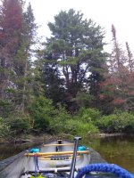
A Penobscot 16 headed up the Penobscot

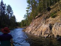
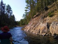
We saw a couple of fishermen in a small motorboat near the inlet; they waved hello and didn't ask us where we were going, which is fine, it would have taken some explaining. Just above the lake we passed the confluence with Webster stream and continued to the right up the East Branch proper. Given the Telos Cut, Webster is the greater river now. We were surprised how little water there was in the (mighty!) East Branch, it being May, but there was enough to float us most of the time. Although we were only about 4 river miles from our goal for the day, we knew we had a lot of work ahead of us. The river drops about 50 feet in this section, including rock formations similar to nearby Webster Stream's Grand Pitch.
IMG_20220512_154004007.jpg
IMG_20220512_161049634.jpg
In the boat when possible; No carbon paddles for rocky upstream

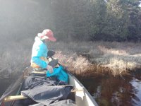
Above the Webster confluence, the East Branch descends through a series of discrete drops (I counted 6 of them) before reaching a deadwater. We worked our way up the stream methodically, paddling, tracking or wading as necessary (n.b., I didn't bring a pole, didn't want to portage it). One drop (#5 by my count) was particularly thorny, and we got out on our right (river left) to scout. The most scenic spots are usually the hardest to traverse. Eventually we found a stretch of old road on that bank, and used it to make a ~150 yard portage, trimming some alder to get back to the water's edge. (As an aside, I find pruning shears are the most useful tool to a bushwhacking canoeist.)

IMG_20220512_165051599.jpg
The glamour of portaging in blackfly season

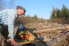
After reaching the deadwater, we had an easy but short paddle to a large log jam. We knew this was coming since it's quite prominent on aerial imagery. Of course the water was deep and all of the logs were floating -- where did I put my peavey? We dragged along a side channel for a while but then just pulled out our packs out of the boat and dragged it over the logs.
MillinocketCarry_May2022 (5).jpg
Log jam, I'm smiling because it's done and I'm about to get back in the boat

Above the log jam the smoothwater continued for a time, but gradually the river became steeper, necessitating more wading. Unlike the lower section which was mostly pool & drop, this was more like a long incline. Eventually we began to see rock instead of mud on the banks, and thankfully the first big ledge was our destination for the day.

We arrived at camp around 6:30. A note about travel times. My thumb rule for upstream travel without established portage trails is time for the distance (e.g., 1 hour for 4 miles), plus one hour for every 20 vertical feet of ascent. That would have been 3.5 hours in this case, and we were in that ballpark.

Although a secenic spot, the "campsite" at Turner Brook was not exactly posh. A sloped rock next to a ledge drop (class 3?) was the primary feature. It was pretty, but you couldn't cook there or you'd risk something rolling down into the water. There wasn't much room in back for tents, although we managed to find spots on thick moss -- lumpy and not at all level, but very soft. Since I'd remembered this place as a great campsite and perhaps oversold it to my tripping buddy, we called it Dubious Campsite, and the ledge drop Dubious Campsite Ledges.

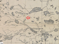
Note: I'm not sure of the name of the brook. One map (photo above) appears to say Turner Brook, another Bog Brook, and most don't mark it at all since it's quite small. There are too many Bog Brooks so I'm going with Turner Brook. Turner Brook flows into the East Branch at Dubious Campsite Ledges, and at that point there is/was/really should be a "trail" (also dubious) heading north.

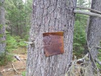
I'd previously reached Dubious Campsite from upstream in a scouting daytrip last August (that day was a skidplate stress test). I had a full-on religious experience when I saw this sign, since it confirmed that the site had been popular sometime in the 20th century and was almost surely the anchor of the historic portage trail.
IMG_20210807_120129458.jpg

The tree holding the sign was one of three huge white pines in or near the campsite, all wolf trees.

We found no fire ring, and given the thick pine duff and dry conditions, we took the sign's advice and made our dinners on camp stoves.
IMG_20220513_064048.jpg
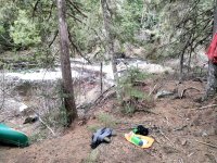
Wet socks removed, time for dinner

We ate up and retired to our tents, satisfied with our progress for the day. We were wise enough not to say it, but the day had basically gone according to plan. Tomorrow we would begin the portage.
IMG_20220512_195137.jpg

*This guide is unpublished and distributed informally. PM me your email and I'll send you a copy, or ask Karrie at the Northern Forest Canoe Trail, email at the bottom of this article. https://www.northernforestcanoetrail.org/adventuring-off-the-beaten-trail-with-ron-canter/
 

Attachments

  • IMG_20220512_154004007.jpg
    IMG_20220512_154004007.jpg
    215.4 KB · Views: 28
Day 2: East Branch Penobscot River to Moose Pond

We arose at a civilized hour for what we knew would be the most difficult day. We ate a quick breakfast, packed up and got on the "trail" around 9.

MillinocketCarry_May2022 (13).jpg
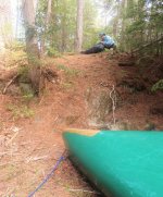
Looking up at the campsite from the landing -- the first 0.1% of the portage!

The crossing consists of four segments, from south to north:
  • 0.7mi bushwhack portage east of and parallel to Turner Brook to a put-in at the outlet of a bog, just above the present day 2 West Rd, which goes over the brook on a culvert. I'd done the most scouting in this area and had a route planned out, although I knew the terrain was steep in places.
  • 1.3mi paddleable section of the bog through a small pond (the heart shaped pond) and up over a few beaver dams.
  • 0.4mi bushwhack portage from the northwesternmost beaver dam to the Huber Rd (this was the least scouted section)
  • 1.3mi a road walk portage from the Huber Rd to a put-in on Moose Pond.
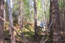
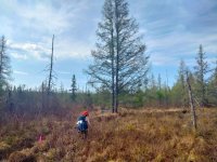
We planned a double carry, and since the first section was a bushwhack it was a no brainer to take our packs first. We had a pretty good idea of the route from prior scouting, but the terrain was difficult so our progress was slow. In addition to just getting through, we were trying to identify and partially clear a path for the canoe. The natural footpath avoiding thick vegetation went over a couple of hills.

MillinocketCarry_May2022 (18).jpg

In about an hour we made it to the road crossing and a further 100 yards to a put in at the bottom of the bog. Dropping our packs, we headed back south to pick up the canoe and paddles, etc, carrying hand tools and not much else.

We knew the way, but it took us more than an hour to return to the morning's campsite as we were still trying to refine the route. It seemed like the best route would skirt the hills on the west side (closer to the brook) following a contour line, but knowing this was little help. Every alternative path we tried was either clinging to too steep a slope or plowing through thick vegetation. Even with flagging, it was hard to take the same path twice. We named one stretch Confusion Hill. We could hear rushing water below; somewhere in the bush Turner Brook must make a nice waterfall.

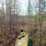
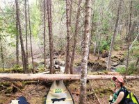
Heading north from our morning campsite, I carried the canoe and Hope carried paddles, PFDs, etc, leading the way. Considering this was our third pass through the same woods our progress was extremely slow. It wasn't a huge canoe -- 16'2" by 33", but there were enumerable places where it wouldn't fit amid closely spaced trees. With a GG Trad #4 pack I'm a pretty wide load, but I'm not 16 feet long; a hiker can pivot where a portageur can't. Where the route headed steeply uphill, dragging by a painter was exhausting but carrying on my shoulders was only possible at an awkward angle. This was the toughest part of the trip, and we didn't take any photos. Imagine a picture that would fit the caption "Here is a green canoe sliding down a hill while a man in a blue hat shouts obscenities".

The only real error of the trip was not bringing enough water on that portage. The temps were in the mid 80's and I was sweating buckets. Heading up the first hill ("hill with a mossy clearing"), I knew I'd need water before finishing the portage. Hope agreed to go ahead to our packs and return with water. I continued as far as Confusion Hill, and then took refuge in the shade. When she returned I immediately drank 1.5 litres before continuing.

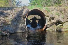
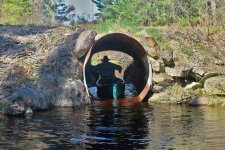
All portages do end, and after a long slog, we made it to the road crossing. Going under seemed a lot easier than going over, and the culvert was big enough. The paddles weren't handy, so I just used my hands.

MillinocketCarry_May2022 (21).jpg
Path of least resistance -- note that the grainy appearance is because the culvert is full of thousands of blackflies!

It always feels good to reunite canoe and packs. By then it was almost 4pm and we were tired, but the put in would have made at best a crappy campsite, and we still had a lot of portage ahead of us. Hope suggested we paddle to the top of the bog and then continue carrying only the packs until we reached a good camp, noting that we could walk the forest roads in dim light if necessary. We pressed onward.

IMG_20220513_160312.jpg
Finally back on the water

I don't believe this bog has a name. Canter notes that it has a heart shaped pond, and we called it "the bog/marsh with the heart shaped pond".

Getting back in the canoe was rejuvenating. The bog was really lovely, and the only obstacles were a few beaver dams. After a too-short paddle, we reached the northwesternmost beaver dam, where we had planned to begin the second bushwhack portage.

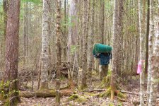
The edge of the bog was soggy but walkable. We tied the canoe to a distinctive two trunk tree and continued with our packs, pushing through the alder to reach the woods. We knew any roughly northern heading would take us to the Huber Rd, so we set out bushwhacking on a compass heading. Hope led and I followed, flagging periodically so we'd be able to find our way back to the canoe. The terrain was basically flat, gently sloping down to the bog, and we made good progress, reaching the road while we still had plenty of daylight.

MillinocketCarry_May2022 (26).jpg
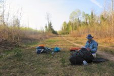
Taking a break between bushwhack and road walk

We knew there was a decent campsite at the put-in to Moose Pond, now only 1.3 miles away, easy miles on a dirt road. Canter notes that the forest road we followed is likely the route of the original portage trail. The height of land is a gentle rise on that road.

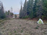
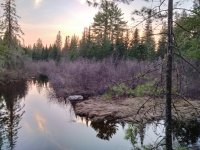
Our campsite was technically roadside, but given that it was between a washed out culvert and a large blowdown, we knew no wheels would be passing through anytime soon. There was a beaver marsh behind our campsite, draining into Moose Pond by a small brook. The washed out culvert where this brook crossed the road was a good place to gather water. The peepers were raging.

IMG_20220513_195757.jpg
Beaver marsh back from our campsite

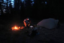
Hope volunteered to build the fire, and I was so tired I didn't even help! I was still somewhat dehydrated, and I sat there drinking water all evening, eventually cooking up some pasta. I even skipped the firewater.

MillinocketCarry_May2022 (29).jpg

While we still had to go back for the canoe, we knew that the worst was behind us, and that tomorrow we'd be paddling on a nice lake.
 

Attachments

  • MillinocketCarry_May2022 (20).jpg
    MillinocketCarry_May2022 (20).jpg
    268.4 KB · Views: 5
Day 3: Moose Pond to Millimagassett Lake

I literally awoke refreshed. The previous evening I was totally spent, but food, water and sleep brought me back.

We were on the trail, heading south back to the canoe, at a quarter to 8. Our fresh legs made quick work of both the road walk and the woods travel. We had no trouble retracing our steps to the canoe, still tied to that tree near the beaver dam.

IMG_20220514_083158.jpg
Canoe is still where we left it

As before, Hope led and found the path while I carried the canoe. The forest had its share of awkward blowdowns and trees 32" apart, but compared to Confusion Hill it was a good portage.

IMG_20220514_084203.jpg
Dragging through the alder

MillinocketCarry_May2022 (34).jpg
A walk in the park

The 1.3mi road walk section of the portage was long but uneventful. Once you get in the zone, you don't want to stop.

The theme of the back half of this trip was "defining adversity down". To get to open water on Moose Pond, we had to drag down a steep slope impeded by several large blowdowns and push through / drag over about 50 yards of dri-ki. This was so much less of a pain than dragging the canoe over Confusion Hill that it hardly even registered.

IMG_20220514_094712.jpg
Almost on Moose Pond

We were paddling again at 10:15am. I felt a great sense of satisfaction when the canoe was floating free on Moose Pond. We had made the crossing from the Penobscot to the Aroostook watershed. From here we were undertaking a "normal" canoe trip, on bodies of water at least mentioned in the AMC River Guide. It's all in the book.

There is a sporting camp on Millinocket Lake, and as we first emerged on the big lake we saw a float plane take off and head north. I wondered where they were going. Just a note on geography, this Millinocket Lake is unrelated to the one near the town of Millinocket, 50 miles or so to our south.

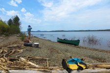
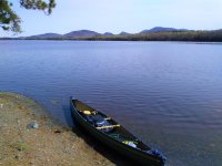
Moose Pond, Little Millinocket Lake and Millinocket Lake were all full of dri ki, and we saw few opportunities to make a rough camp or even a comfortable shore lunch. The exceptions were the passage between Moose and Little Millinocket and this gravel bar on the south side of the big lake.

MillinocketCarry_May2022 (36).jpg
Shore lunch on a Millinocket Lake gravel bar

Unlike the view from Matagamon, the mountains on the horizon here were unfamiliar. The pointy peak in the distance is Beetle Mtn.

Continuing east down the lake, we detoured into a deep cove to enjoy the scenery. OK, actually were were looking for the dam, and this wasn't it, but it was pleasant.

IMG_20220514_130322.jpg
This deep cove is not the outlet

We found the dam and the portage, not marked. It might also be a snowmobile trail. It was on the north side, up the hill, right then left, down to a landing, about 0.3 miles. One big blowdown, but still very low on the trip adversity scale.

IMG_20220514_140051.jpg
Easy put-in on Millinocket Stream

Descending Millinocket Stream through Millinocket Falls we had a fun whitewater run, adding another flavor to this already diverse trip. The book says Millinocket Falls is class 2, scout on the left. We felt fine just reading the river from the canoe.

We planned to finish our trip on Millimagassett Lake, so below the whitewater section we knew we had to make a right turn up Millimagassett Stream. I had a waypoint and we checked the GPS several times so as not to waste any effort backtracking. Note that heading up Millimagassett Stream there is a fork about 0.25mi above the confluence. Keep right to stay on the stream leading to the lake.

The ascent up Millimagassett Stream got our legs wet but was only nominal on the adversity scale. Not as hard as the East Branch or a portage. We were in good spirits as we knew we would get to camp at a reasonable hour.

We arrived at camp on an island in Millimagassett just before 4pm. (I'd previously camped on the island at the western end of the lake, this time we were on the one closer to the outlet.) Miller Time! From here we were only a short lake paddle and .3mi road carry from a vehicle.

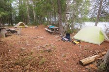
This was a real campsite, even noted on the DeLorme Maine Atlas. There was a big pile of firewood. It was not pristine, but a lot of the junk was decades old, so it had a lived in, dive bar vibe to it. There was a large if wobbly fire ring, two picnic tables and lots of open space. The good life.

MillinocketCarry_May2022 (42).jpg
Campsite on Millimagassett Lake

MillinocketCarry_May2022 (39).jpg
View west from camp; later the clouds closed in

Day 4 & afterward: Home from Millimagassett Lake

We arose to a misty morning and paddled out. Rain was in the forecast so we didn't wait around. We saw a couple of fishermen in a square stern canoe, the first people we'd seen since Matagamon. The quarter mile carry up to the parking area was easy, and soon we were on the road and on the way home.

IMG_20220515_095011.jpg
Back at my car on Matagamon

Looking back, this was a 4 day, 3 nite trip, less than 72 hours in the wilderness, and yet it seems like so much happened. I can't wait to do another. Still, I may need a cushy float trip to recover before taking another adventure from Canter's guide.

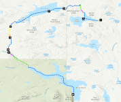
Have you ever finished an off-the-beaten-track trip and thought gee, wouldn't it be nice to have a map of that? Well, when you trip with a GIS expert, these things happen. Click on the map image for a slick "story map" with photos.
https://arcg.is/11PuP9
MC_map.png

Word of caution to novices: don't let the map give you the impression this is a tourist bureau approved water trail. It's an interesting historical route that can be followed with difficulty by determined paddlers.
 
Quite a journey! Very interesting and informative- I know that area generally and had no idea there used to be a “formal” way through. That interactive map is really impressive. Thank you for the great report!
 
Your trips never fail to amaze me. This is an extraordinary trip testing both physical and mental strength. I applaud both of your efforts and successes with this trip. The mapping and trip reporting (both interactive and your posted trip report) were enjoyable. Honestly I think I started sweating just a bit reading it while trying to envision the level of difficulty you experienced. Well done and thanks for sharing such a spectacular trip?
 
Interesting trip and great documentation! Loved the linkage of map and photos on arc site. Well done!
 
Wow, thanks for sharing. So many questions because I just posted a possible easy trip into Millinocket area.
1. What are wolf trees?
2. Can you explain dri ki? Thanks. Boy i too was thirsty thinking about that. Kudos to you both.
 
Thanks for reading!

Wolf trees are big trees that spread out horizontally. Sometimes there are wolf trees because of selective logging -- e.g., all the straight ones were cut down 100 years ago but a few irregulars were left since they would have been annoying on a log drive or in a sawmill.

This is a slightly fuzzy picture of a wolf tree (a white pine) at the outlet of Turner Brook, near the Dubious Campsite. I could reach about halfway around the trunk, so it would have been ~4' in diameter.

IMG_20210807_122927540.jpg

Dry ki is dead trees that are dried out and weathered, no bark, bonelike. You see a lot of it in places like Millinocket Lake where a dam raised the level of a lake inundating areas that were formerly floodplane.
 
Thanks. I’m now thinking about clusters of trees that looked like a fire broke out. It’s possible flooding and high water killed them off. I need to pay more attention and read up before going on certain trips. Thanks again.
 
Late to this thread, but WOW is it interesting and well-written with mapping technology I've never seen before!

What was the importance of the Millinocket Carry historically and why was it abandoned?
 
Late to this thread, but WOW is it interesting and well-written with mapping technology I've never seen before!

What was the importance of the Millinocket Carry historically and why was it abandoned?

As I understand it the Millinocket Carry was the easiest/quickest route between two large watersheds, the Penobscot and the Aroostook / St John. If a pre-road traveller wanted to get from Bangor/Old Town/Medway/Millinocket/etc (anywhere along the Penobscot) to a town in the St John Valley (e.g., Presque Isle), they would go up the East Branch (easy is relative!), across the MC, then down the Aroostook. The carry was also accessible from the Allagash headwaters lakes (and by extension, the West Branch Penobscot and Mooshead Lake) via Webster Stream.

As to why it was abandoned, that's a good question. It seems like most of Maine's historic portage trails are abandoned. Once the log drives gave way to mechanized harvest, there needed to be roads to move the timber out, and once there's a road, why shoulder a canoe? You can get almost anywhere in Maine in a 4WD vehicle; people now day trip (drive and short hike) to the famous locomotives at Eagle Lake in the Allagash. The portage trails that are maintained are in a few popular recreational areas, like the East Branch, the Moose River, the Debsconeags, the Allagash, etc. Nearly all recreation is downstream.

@Carp was just mentioning the Gassabias Portage. That's another key carry, connecting the Penobscot to the St Croix without ocean travel (Eastern Maine Canoe Trail). I haven't walked that trail yet, but it's good to know it still exists.
 
I've never heard of the term "wolf tree" before. Glad to know it now! I've seen many over the years and always theorized the environmental/commercial conditions necessary to produce them. Great post!
 
Great expedition and report, goonstroke. Thank you.
 
Let me second the "great expedition and report" comment. You may also enjoy Above the Gravel Bar: The Native Canoe Routes of Maine by David S. Cook along with Wabanaki Homeland and the New State of Maine: The 1820 Journal and Plans of Survey of Joseph Treat by Micah A. Pawling if you haven't read these already. The information at https://mainestatemuseum.org/treat-journal/#/ has a good summary. I went off on fun adventures to find Pamola's Rock in Mattawamkeag after reading about it in Treat's journal and Scalp Rock in Passadumkeag after finding a reference to it in another early document.

The portage between the Passadumkeag River and Upper Sysladobsis Lake as shown below on a Carleton map from 1802 might also interest you.

Benson


Portage.jpg
 
Last edited:
Thanks @Benson Gray. I've read David S. Cook's book but not Micah A. Pawling's. I didn't know about that portage to Dobsys. Now that I look at it on Google Earth, Upper Taylor Brook gets within a mile of the lake, so of course there should be one there. I've paddled Nicatous Stream / Passadumkeag Stream in that area but not all the way up to Taylor Brook.

In theory, that would open up a grand loop involving Dobsys, 4th Machias, Gassy, Nicatous Lake and Stream, Passadumkeag Stream, Taylor Brook. Intriguing! Still, I think the Gassabias Portage alone is enough to earn a triple ice cream cone.

(Hmmm, one could scout Upper Taylor Brook from the road down to Duck Lake ...)

Thanks again for winter stimulus!
 
Back
Top