• Happy National Rocky Road Day! 🪨 🇪 🛣️🍨

Leaving tonight - SPOT tracking page

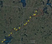
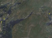
Alan is living the dream, I like to zoom in on his route in the Satellite mode to get a eagle eye view of where he has been each day. I'm with you, on the fishing though. I can close my eyes, an see a half dozen golden brown fillets, with cooking oil boiling around them in the big skillet!! Now, my taste buds are going wild.
I would be interested in one of the old original Woods packs also.
..........BB
 
Wow ! I wish I had half of Alan's navigation skills !

That is impressive !

Christy, track him down and take him some Ice Cream !​:rolleyes:
 
So, I have all the Manitoba topo's on my computer so as he moves I can plot his course on the maps and even log his mileage each day. It will be intriguing to see his route considering the Cochrane flows from the top of Wollaston then south into Reindeer Lake. So he jumps over the height of land to the Thlewiaza River and rides it to Neultin. It doesn't show up well on the topo's there is so much water up there.

I know he got this idea from reading Downes. There is a Downes Lake along the way which he may paddle through, which would be pretty cool.
 
Last edited:
Considering I am unable to access Alan's map, I'm just following on my topo's. If he went about yesterday based upon "Wilderness Rivers of Manitoba" routing, he travelled 28km with some major portages including the height of land to get moving towards the Thlewiaza River.
 
Something is up, Alan turned around already. I figured he could be at Neultin by the weekend and still have plenty of time to get back.
 
Has everyone been following Alan? Why did he just backtrack? I measured/guessed as best I could, looks like he doubled back 6 miles or so to near his previous campsite the night of 8/14...his canned message says everything is OK. Did he leave something behind that he had to pick up?

Edit: I guess we see how long it takes me to create a post!!
 
Not sure, but the day before and today there is a very long rapid set on that part of the river. Going downhill it starts as a class 2-3 and then goes into a 3-4. We are speculating on boat issues. If it were health, either him or Sadie, it would be closer to get out to Neultin where there is an airstrip for Neultin Lake Lodge and he could get help/flown out of there.
 
Not sure, but the day before and today there is a very long rapid set on that part of the river. Going downhill it starts as a class 2-3 and then goes into a 3-4. We are speculating on boat issues. If it were health, either him or Sadie, it would be closer to get out to Neultin where there is an airstrip for Neultin Lake Lodge and he could get help/flown out of there.

I would think he would change his message if there was a serious problem...
Maybe he just left some gear at the last campsite.
 
Running the numbers, he is running out of time. 15 days to here, he needs another 5 or 6 to get to Neultin, then he has only 16 days to get back all the way to Wollaston and it is all upstream. His original plan was 20 miles a day, he has only had 2 like that, yesterday was 6. We just have to wait until tomorrow to see which direction he goes.
 
Alan appears to be backtracking. Maybe a change in the route, side trip, or just heading back. Only he knows.

​ Interesting anyway !
 
He's booking now, maybe favorable winds, and he has a sail up. Fun to speculate anyway.
 
Alan's Father Roy here. his Mother just sent me an update on his route spot reports. the three spots in the cluster are next to each other right where he makes a big loop around. He started going right on the loop then back tracked and is following his loop around the other way. Had he lost his dog, a fear of mine, he would not be traveling but staying in the area. If he had kept going right around the loop he would have soon hit a spot marked with an airplane. Maybe he thought he should make the loop the other way so he would hit that spot last in case he needed a resupply or to fly out? i know he wanted to spend some time up there, if he sprung to fly-out , as Downe's did, he would have all the time and food he needed. We wait.(-:
 
No Title

Alan's Mother was good enough to stop in and put a couple of pictures of Alan's wanderings.
 

Attachments

  • photo5071.jpg
    photo5071.jpg
    518.8 KB · Views: 0
  • photo5072.jpg
    photo5072.jpg
    436.3 KB · Views: 0
He is doing the downstream leg of the loop first, then will come back up the Thlewiaza with less load. Shame he had to do that major rapid twice though.

The map from Roy is what I have been plotting on the topo's and I can track the actual mileage he does daily once he checks in.
 
Not to worry. As we used to say, no plan survives contact with the enemy. He is doing some freestylin is all.Once he gets bitten by the northern bug,he will keep returning over and over again. It is a very seductive land. After a month out there I would never want to come back.
 
It would be cool if someone familiar with Alan's route could interpet it for us !!

The dots on the map appears that Alan is spending time land based, and off the water. Must be something interesting to see.
 
Back
Top