• Happy Ascent of Everest (1953) & Birthday of Tenzing Norgay (1914-86)! 🏔️🧗⛏

Does flatwater need classifications similar to whitewater?

Joined
Oct 10, 2022
Messages
700
Reaction score
1,957
Location
New England
There's an interesting discussion regarding the definition of flatwater over at Paddling.com that raises the question: Does flatwater need a sanctioned classification system similar to the ratings for whitewater?

The International Scale of River Difficulty (ISRD) for whitewater uses classifications that are used by whitewater paddlers and provide a relative rating of difficulty/risk. But there doesn't seem to be any accepted classifications for flatwater paddling and maybe there should be, given the range of inherent risks when out paddling on "flatwater", including wind/waves (fetch?) and stream flow volume and current speed. Perhaps shoreline ruggedness for assessing beaching difficulty. Maybe even water temperatures should be included.

I found a few references to flatwater rating systems but they're not really applicable to canoeing or are incomplete or are DIY without sanctioning by a recognized organization.

The American Canoe Association has a five-level skills assessment for kayaks geared for ocean paddling and apparently there are three moving water classifications (From “Canoeing and Kayaking Instruction Manual of the American Canoe Association"; Laurie Gullion; c. 1987), including:
Class A Flowing under 2 m.p.h.​
Class B 2 to 4 m.p.h.​
Class C Greater than 4 m.p.h.​

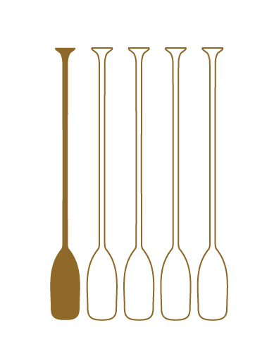
And here's an example (out of several I found) of a DIY rating system:

None of the rating systems I found provide a very useful means of assessing risk for flatwater canoeing because of limited scope, inapplicable levels of risk, or not providing an integrated and comprehensive rating system. I admit to not spending a whole lot of time searching online for flatwater classification systems because it appears that there really isn't one, otherwise I think it would have shown up rather prominently, like the ISRD system does. So should there be a risk classification system for flatwater? And what would it include?
 
It's an interesting question. I don't know how to answer, because I can't imagine how one would reliably determine it.

My local lake has somewhat restricted access, and is aligned pretty close to the prevailing wind. It's about seven miles long, so it doesn't take a really strong wind to build challenging waves with that fetch. I suppose one could base the rating by wind speed and direction, but then add two or three wakeboats in the mix and things can get really dicey (even on a fairly calm day, FTM). Given the randomness involved, I don't know how a usable system would work, but it would be helpful for some if one existed.

Personally, I can't think of anything better than accessing local info. In my case (Lake Lowell) there is a Facebook page dedicated to fishing on the lake, and since it's part of the Deer Flat wildlife preserve there is also the on site visitor center.
 
Given the randomness involved, I don't know how a usable system would work, but it would be helpful for some if one existed.
I guess it would have to be based on the potential risks and categorized by waterbody or stream size. Probably end up with a matrix of some sort, with factors like max/avg fetch and wind speed, stream volume and current speed, shoreline roughness, etc.

It could get complicated, though there might be some usefulness in having a chart of potential risk for broad categories. I think canoeists develop a sixth sense about the risks of canoeing but it takes years of trial and error to get good at recognizing it.
 
On the ww side there are 3 qualificions
1 is the ww 1 to 6
2 de us / rafting fron 1 to 10..
3 The one from corran adison that mixes;
How difficult is the line/rapid,
What are the consequences,
How good is access to healhtcare ect.

The example many times used;
Ferry above zambezi falls
DIffilcul no it si grade 1 if that
2 Death most probably
3 6 hours at the back of a moped to a hosputal that is questable

On flatwater
The matrix of corran is the biggest part of your assessment.
Things i look for as well is what boats are involved , shape materiall attached gear
Skillset of te crew paddling , non paddling skilks for example improved sailind and Rescue skills
Temp water and air and how the crew is geared to that.
 
I do a lot of out-n-back day trips on rivers in my area - both freshwater and tidal.
As everyone knows, current speed can vary greatly depending on the season and recent rainfall, and
tidal rivers change throughout the day, of course.

First, guidebook writers seem to assume that everyone is floating downstream. I also get the idea that most
guidebook authors run around visiting each route only once.

I use a simple ratio system in my notes. Time up river : Time down river. Plus seasonal, rain, river gauge notes, danger stuff etc.

Example - A stretch of the Farmington is usually 2:1 or less in summer, but 3:1 or more in spring. 3:1 is getting to be a
grim upstream grind while 2:1 is a pretty nice paddle. (And 4:1...if you can't wade it, just go home)

On the Connecticut River, my notes refer to the Hartford gauge if I am in the freshwater reach. If it's at 10ft or more, it's going to be
moving pretty good (3:1). Higher than that, I know that a start at Rocky Hill is a one way trip only, but the nearby tributary Mattebasset becomes a really fun huge flooded marsh and forest paddle with no current at all.

I do the same with tidal areas. The mouth of the Housatonic is 3:1 in worst case full ebb or full flood (it's quite the reversal flow).
But, by hugging the east shoreline one can use long eddies and slower water to make good progress against the current.
The hazards are a few floating docks in questionable repair as the current is strong enough to roll a canoe under.

Meanwhile, the nearby tidal East River never gets worse than 2:1 no matter what the tide is doing, although the unobstructed
wind in the lower tidal marsh might put the hurt on you. The only other note is that I have to wade a couple short spots at low tide.

Lakes are just noted by what they can become and how to duck the wind if necessary.
 
I'd say no. Any large body of water or even smaller ones have the potential to be hazardous when the wind is up. I think the danger level and the skills needed to paddle flat water change with the conditions, so it might make more sense to grade flat water by the conditions present. I would also hope that people do a little research on the particular lake they plan to paddle to see if there are any dangers that they should be aware of that aren't obvious. On one particular lake I've paddled that is prone to sudden high winds, there is also quite a bit of shoreline where you can't pull out on shore because of cliffs. On this lake it is especially important to check to weather forecast, but it is also a good idea on any large lake.
 
Whitewater rivers have certain aspects that do not change very often. such as gradient, type of rapid (rock jumbles, chutes, waterfalls, drop and pool), undercuts, and other stationary hazards. Although water levels change and present a slightly different run, the main features and hazards remain the same except during flood stage. The ISRD is based on the normal or average runoff for a stretch of water.

With true flatwater (still or slightly moving water) the physical features remain the same, with the conditional hazards such as wind and water level variations (depth and exposed bottom features) are what change. With the variable conditions dominating the changes on flatwater, what would constitute a "normal" level of risk on which to base the rating?
 
Last edited:
Initially, I confess to have been orthographically tortured for decades trying to decide whether flatwater is one word or two.

I will now settle on the one word formulation because I define flatwater as more encompassing than flat water. For example, a lake or ocean can be flat or different degrees of waviness. I also include in flatwater any flowing water that is smooth. Indeed, "smoothwater" was a noun used in the literature of one of the clubs I used to belong to, and that literature divided smoothwater into the A, B and C classifications @tketcham mentioned above.

I'll focus on grading flatwater that is smoothwater.

If we focus on smoothwater creeks or rivers of similar width, depth and CFS flow, there are clear differences in the difficulties of paddling them. At one end, there are completely unobstructed smoothwaters such as straight Florida spring runs. Some kinds of unobstructed rivers will be much twistier than straight-ish runs, such as marshy rivers with little gradient. These twisty, unobstructed rivers require greater paddling skills than straight-ish, unobstructed rivers, and should be rated as more difficult.

At the higher end of smoothwater difficulty are rivers such as some in the New Jersey Pine Barrens, for example. The most difficult of these rivers bend at least 90° every 50 yards or so. Between each bend can be 1 to 3 "must make" moves around, under, over or through some complex combination of sweepers, branches, logs, stumps, and/or bank bushes and thorns. This can go on and on, mile after mile. To paddle such a river cleanly, without significant damage to canoe, and without injury to person or dignity, requires a high level of experience and boat control. I'd equate such a river, if it were whitewater, to class IV.

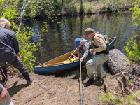
Even the takeout on such a smoothwater river can be Himalayan for septuagenarians and octogenarians — requiring multiple ropes and belayer assists.

1779937853887.png
 
Initially, I confess to have been orthographically tortured for decades trying to decide whether flatwater is one word or two.
I came to the conclusion that using flatwater works in the same way that whitewater does. The problem though, is that flatwater includes a range of paddling conditions not consistently used or described. As Steve (in Idaho) mentions above, locals know what "flatwater" means because they've shared a common history, but there isn't common understanding outside those localities or regions. That's why I was wondering if maybe it would be helpful to have flatwater terms and meanings that are commonly shared experiences. I'm thinking that's how the International Scale of River Difficulty (ISRD) came to be.

If we focus on smoothwater creeks or rivers of similar width, depth and CFS flow, there are clear differences in the difficulties of paddling them.
That's a good example of how flatwater categories could be decided. I think quickwater is a better term because smoothwater might be misapplied or misinterpreted as quiet water on lakes, ponds, and gentle streams. I think of quickwater as being a spectrum within the Class I category for whitewater. Your description of a Pine Barrens stream provides an example of higher level quickwater difficulty. The levels wouldn't be so much about a particular type of water, but more about what skills are needed to be relatively competent (enjoyable vs stressful) and the risks involved (unintended swim vs drowning).

So flatwater could be broken down into categories for slow or non-moving water with minor risk, slow or non-moving water with major risk, and moving water not considered whitewater, each with at least five ratings for difficulty and risk, similar to whitewater.

Here are some ideas for the full paddling spectrum (other than sea/tidal) that came to mind...

Quietwater - Lakes, ponds, and reservoirs up to xxxx acres and/or x miles of fetch, plus marshes and swamps, slow moving streams, etc.

Bigwater - Lakes, ponds, and reservoirs larger than xxxx acres and/or x miles of fetch, plus large, slow moving rivers.

Quickwater - Rivers and streams not considered as whitewater.

Whitewater - International Scale of River Difficulty (ISRD)
 
Last edited:
I came to the conclusion that using flatwater works in the same way that whitewater does. The problem though, is that flatwater includes a range of paddling conditions not consistently used or described. As Steve (in Idaho) mentions above, locals know what "flatwater" means because they've shared a common history, but there isn't common understanding outside those localities or regions. That's why I was wondering if maybe it would be helpful to have flatwater terms and meanings that are commonly shared experiences. I'm thinking that's how the International Scale of River Difficulty (ISRD) came to be.


That's a good example of how flatwater categories could be decided. I think quickwater is a better term because smoothwater might be misapplied or misinterpreted as quiet water on lakes, ponds, and gentle streams. I think of quickwater as being a spectrum within the Class I category for whitewater. Your description of a Pine Barrens stream provides an example of higher level quickwater difficulty. The levels wouldn't be so much about a particular type of water, but more about what skills are needed to be relatively competent (enjoyable vs stressful) and the risks involved (unintended swim vs drowning).

So flatwater could be broken down into categories for slow or non-moving water with minor risk, slow or non-moving water with major risk, and moving water not considered whitewater, each with at least five ratings for difficulty and risk, similar to whitewater.

Here are some ideas for the full paddling spectrum (other than sea/tidal) that came to mind...

Quietwater - Lakes, ponds, and reservoirs up to xxxx acres and/or x miles of fetch, plus marshes and swamps, slow moving streams, etc.

Bigwater - Lakes, ponds, and reservoirs larger than xxxx acres and/or x miles of fetch, plus large, slow moving rivers.

Quickwater - Rivers and streams not considered as whitewater.

Whitewater - International Scale of River Difficulty (ISRD)
Good vocabulary for describing different flatwaters!
 
the problem with classifying flatwater is far more extreme than WW will ever be simply because WW is generally graded either by the average or peak for a particular section or river, while flatwater can encompass every description known because you can literally have riffles, blowdowns, strainers, ledges, ponds, lakes, overgrowth, tides, and meandering bends, all within a few hundred yards. Add in current, wind funneling, wind fetch, and the human factor (crowds, fences, bridges, etc.) and it becomes a real dogs breakfast.
The river I paddle the most (and the reason it's my favourite) starts with a small lake, some riffles, a few tight bends, a railway and two car bridges, an old dam with a huge pond,, a ledge, gravel shoals, 60' tall claybanks which may or may not have strainers and no possibility of landing, multiple campgrounds and even some whitewater that can be anywhere from a 1 to a 4 or 5 depending on the water level, and speeds of 17cfm to over 400 depending on those levels.
that's all within a 5 mile segment from put-in to take out that at it's slowest is a 4 hour journey, and at it's fastest a 45 minute sprint...
I have no idea how you could possibly classify that other than with a detailed map or instructions because the type of water continually changes every few feet, sometimes 2-3 changes in a 30 foot span...
 
Flat water has no gradient but it can be as rough as you want.
Lake Tahoe has a surf club. Big lakes with long fetch can have enormous waves.

Salt water in places with islands and bays and narrows can have 12 knot current or more when the tide changes.
Nothing like paddling the San Juan Islands of Washington and watching 3 foot waves rise out of nowhere in the main channel.
The channel marker buoys can be underwater. Large whirlpools develop. You better bring a tide table or you can end up in places worse than the most difficult rivers.
 
Quickwater - Rivers and streams not considered as whitewater.
I see the problem with this as the same problem with "Class 1" designations. My local river has a ~15 mile stretch that is called class one by everyone who ever wrote about it AFAIK. Yet it is sometimes strewn with serious hazards - sweepers, strainers, powerful eddys, etc. Right in the first hundred yards, last year there was a 90° bend with a strainer on the outside. I've watched multiple "experienced" class 1 paddlers get in trouble there, including several swims and one pinned boat. This whole stretch is what I think of as quickwater, and in my estimation is closer overall to the lower end of class one.

The river I paddle the most (and the reason it's my favourite) starts with a small lake, some riffles, a few tight bends, a railway and two car bridges, an old dam with a huge pond,, a ledge, gravel shoals, 60' tall claybanks which may or may not have strainers and no possibility of landing, multiple campgrounds and even some whitewater that can be anywhere from a 1 to a 4 or 5 depending on the water level, and speeds of 17cfm to over 400 depending on those levels.
that's all within a 5 mile segment from put-in to take out that at it's slowest is a 4 hour journey, and at it's fastest a 45 minute sprint...
I have no idea how you could possibly classify that other than with a detailed map or instructions because the type of water continually changes every few feet, sometimes 2-3 changes in a 30 foot span...
Yes, that.

Yesterday's group daytrip is another example of how classifications can be a dangerous lure. The Snake, between Marsing and Homedale is a solid "beginner friendly" class 1. No rapids, no sweepers or strainers, not even any powerful eddys of note. It's flat, wide, and slow. The weather forecast was mostly sunny with light wind in the afternoon and a slight chance of thunder showers, beginning safely after we would take out. What actually happened with wind and weather was gale force wind that appeared without warning, not fifteen minutes after we all reached the takeout, and lasting more than an hour. Had we still been on the river, that tailwind would have bumped us up to what I would call a class two experience at least. If it was blowing upstream, we would have ended up where we started.

I sometimes think we might be better off classifying paddlers rather than waters. But the common practice of describing paddlers in terms of the ISRD doesn't really work for that IMO.
Anyway, when it comes to flatwater - in mountainous country anyway - difficulty level can be a crapshoot.
 
Back
Top Bottom