- Joined
- Aug 10, 2018
- Messages
- 1,974
- Reaction score
- 3,164
As mentioned previously in my Allegheny Islands report, 2025 has been unusually dry in Western PA and, by mid-October, we were in desperate need of rain.
I’d been working 6+ days most weeks since returning from Canada the previous July and, by mid-October, I was in desperate need of some time off.
I’d procrastinated all year while putting off home repairs that needed done before winter and, by mid-October, I was running out of time.
I definitely did not need all 3 issues to attempt resolution in the same week.
While not exactly rain on my wedding day, almost all of my planned activities involved work on the outside of my house. I was lamenting my ill fortune to a friend in South Carolina when she mentioned that the weather was really nice there, she was having trouble finding anyone reliable to do some repairs for her and I was seriously overdue to visit her anyway.
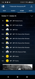
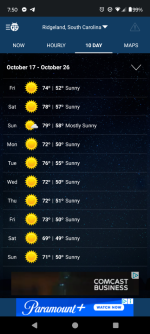
After a quick comparison of the 10-day forecasts, I resolved to make short work of cleaning the furnace and replacing the front door, procrastinate even further on fixing a hanging gutter, replace a few missing shingles instead of attempting the entire roof, and then go put some vacation back in my vacation.
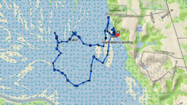
You see, without much of a detour, I would cross Lake Marion about an hour and a half North of her house, and the North end of the 110,000 acre expanse of Lake Marion contains 16,000 acres known as Upper Santee / Sparkleberry Swamp.
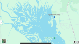
Just FYI, what this (Google Earth) map shows as open water isn’t.
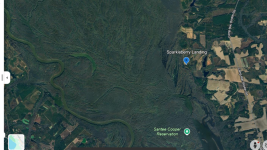
This is the Google Earth satellite imagery... yep. Lots of trees.
Lake Marion was created in 1941 by the construction of the state-owned Santee Cooper dam. Although it is among the largest lakes in the US in terms of surface area, its average depth is barely over 13 feet (about 4 meters).
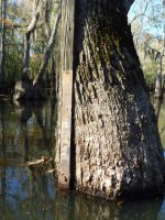
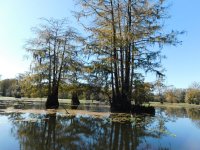
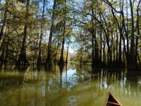
Because the area was not completely cleared when the dam was built, there are large expanses of Bald Cypress & Tupelo forest within its basin.
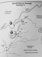
Although camping is allowed in the swamp and there are some established campsites and a few cabins (reportedly open for anyone to use) within it, there are no maps, the trees are supposed to be thick enough to easily disorient a paddler and every source I can find recommends either carrying a GPS device or hiring a guide if paddling there (there are a couple of outfitters who provide guide services).
I didn’t have much time to research or plan for camping within the swamp and wasn’t really sure how hard it would be to find my way around or how readily available dry ground would be once I launched, so I planned it out as a day trip, reserved a campsite at Poinsett State Park for Wed night (you really can’t beat $20 a night) and told Sally that I’d arrive around dark on Thursday.
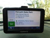
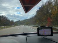
I threw some overnight gear in the car and was off on Wed morning. The drive went smoothly after an initial delay of buying an ez pass at the PA Turnpike office. (I typically avoid the PA Turnpike like the plague but SR43 to Morgantown & the 2 toll sections of I64 in WV would save over an hour of driving so I finally gave in)
For most of the drive, I was battling 35 mph (56kph) crosswinds while driving between 75 & 85 mph (120-140 kph) depending on how closely I felt the conditions matched the (still theoretical) speed limits. The end result was that the canoe was often moving side-to-side above me and I stopped repeatedly to check ropes until, finally, I decided that it was just going to dance a little up there but couldn’t actually get loose.
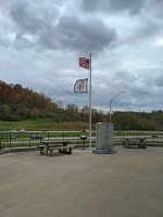
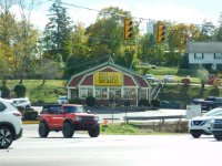
I made Summersville, WV just before 2 pm and made an obligatory stop at Tudor’s Biscuit World. Honestly, I’ve never figured out what biscuits have in common with the early Renaissance era English monarchy or the “sort of mistress that a man doesn’t bother to marry” but, then again, I don’t care.
Their "Mary B" breakfast sandwich is amazing.
If you consider Tim Hortons to be iconic Canadian, you must try Tudor’s when you’re in West Virginia.
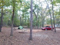
I finally arrived at Poinsett State Park around 9 pm and set up camp in the dark.
The following morning I realized that, in the darkness, I’d actually pitched my tent on the campsite's driveway but it was just hard-packed sand and I’ve become somewhat accustomed to camping on solid Canadian Shield rock so I slept well.
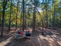
A cold breakfast, some hot coffee and a lukewarm shower later, I opened the Earthmate app on my phone to study the map.
My Garmin GPS had no idea where Sparkleberry Landing was so I zoomed in on the map, determined that I could probably find the launch from Camp Mac Boykin road and then set my destination accordingly.
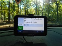
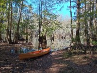
This strategy worked really well and I soon found that the launch was clearly marked.
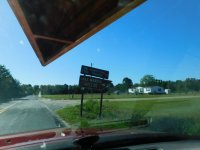
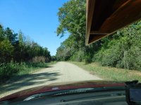
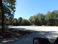
The dirt access road was much smoother and not nearly as wide as the roads I’ve followed for my Canadian trips and it soon led me to a very large parking lot with quite a few boat trailers already parked there. It certainly didn’t look like I would be alone on the water.
Directly across from the boat launch there was an opening in the trees but, as there was someone fishing there, I decided to allow him to fish in peace and paddled along the shore figuring that I could slip through the trees further upstream.
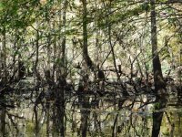
That didn’t really work out very well as the vegetation was thick enough that I couldn’t find a way through.
By the time that I’d returned to the launch, however, the fisherman was gone and I paddled through the narrow channel.
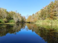
The far end of the channel was signed, although not quite as one might expect for a portage or passage marker.
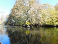
Once through the trees, there are deeper, open areas, many of which the locals have named with their own lake names. Although these were inviting, I chose to wander off once more among the trees so I noted the sun’s position, kept it over my left shoulder and paddled on.
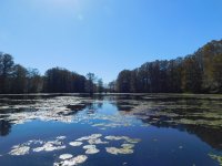
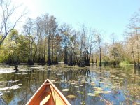
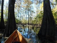
Cypress apparently spread by sprouting “knees” from their roots and there were places where I would hit some of those knees or old stumps and get hung up briefly or risk tipping.
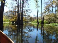
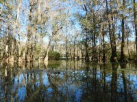
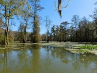
Even so, paddling through the trees had some advantages. It allowed me to get fairly close to some of the birds, completely eliminated other boat traffic and allowed me to slip from one open area to another without paddling around.
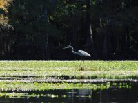
There were many places where trees were painted with either colored blazes or arrows but I’d urge caution in following them as there’s really no way to know where the trail would lead and some of them seemed to peter out after a bit.
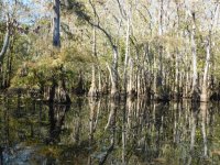
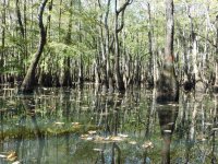
I am told that the water level was "about normal" during my visit and I had no trouble finding dry(ish) ground when I felt the need to go ashore. A few of the areas would have been high enough to allow camping even if the water were a few feet higher
(Note: Santee Cooper allows LNT camping throughout the swamp but specifically requests that no new permanent campsites be established.)
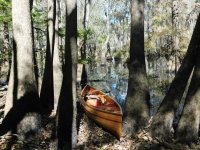
Another option for camping, although they are supposed to be harder to find, are cabins. Reports said that there are cabins within the swamp that are left unlocked and open for anyone to use and I was hopeful that I might find one.
Cutting through the trees seemed to pay off in that respect as I soon noticed what appeared to be a tiny house nestled among the trees.
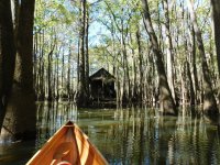
Upon inspection, I found that it was surrounded by extensive floating docks, was wired for electricity (if you bring a generator), included a full kitchen, air conditioner and a sleeping area that would accommodate at least 4 people.
It was, indeed, unlocked and seemed as if there would be no issues in spending the night there.
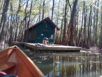
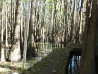
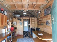
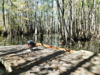
Well, at least no issues as far as the house builders were concerned. Sumter County, South Carolina seems to take a dimmer view of the cabin’s existence within the swamp and there was a notice stapled to the wall that ordered the cabin’s removal citing the Public Water Nuisance Abatement Act.
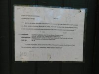
Personally, I found the cabin to be more of a convenience than a nuisance but it’s pretty easy to see how such activity could get out of hand. All the same, I wouldn’t hesitate to avail myself of the accommodations if it’s still there and unlocked on a future trip. I’d certainly feel safer in there than lying on the bank with alligators and feral hogs as neighbors.
I was really hoping to see an alligator on this trip but, like the moose & bears on my first trip North, they eluded me and the only wildlife I saw were birds and turtles.
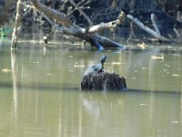
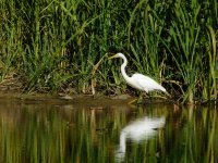
I continued paddling through open areas and flooded forest while catching glimpses of large white birds that appeared to be similar to Herons. They seemed particularly camera-shy, however, and I struggled to get clear pictures.
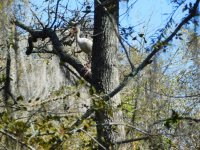
Although I wasn’t working hard to propel the canoe, the shade of the trees was welcome and the day was extremely pleasant as I paddled through the flooded forest.
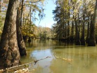
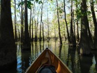
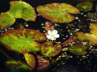
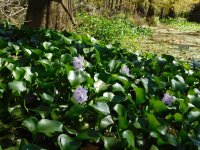
I turned toward the South and the forest started to open up more with masses of floating flowers and Spanish moss hanging from the trees.
One thing that would concern me at higher water levels are the pipes I found sticking up in the one creek. They were solidly anchored (I was told later that they were driven into stumps during low water and served to mark the location of the stumps) but the tops of most were really sharp.
I’m not one to baby my canoes but I would really hate to scrape over one of those in high water. (maybe it never gets that high… I’ll have to ask sometime)
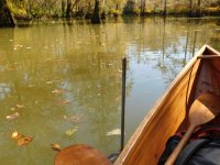
Shortly after the pipes, I saw my first human: an older guy (maybe my age) fishing from a motorized kayak. He said that he’d also launched from the Landing and I watched for a few minutes as he caught and released some of the shrubbery.
He caught a few pieces of flora but the fauna were eluding him so I put the sun in front of me to my right and started paddling back.
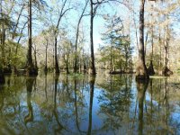
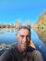
Although I take hundreds of pictures each trip, I despise pictures of myself but it has been suggested that I include a “selfie” once in awhile (blame @Robin) so I indulged that notion briefly as I neared the takeout. This is the best I could do.
Aaaannnd, that puts us up to the picture limit... (to be continued as soon as I transfer & reformat the rest into another post)
I’d been working 6+ days most weeks since returning from Canada the previous July and, by mid-October, I was in desperate need of some time off.
I’d procrastinated all year while putting off home repairs that needed done before winter and, by mid-October, I was running out of time.
I definitely did not need all 3 issues to attempt resolution in the same week.
While not exactly rain on my wedding day, almost all of my planned activities involved work on the outside of my house. I was lamenting my ill fortune to a friend in South Carolina when she mentioned that the weather was really nice there, she was having trouble finding anyone reliable to do some repairs for her and I was seriously overdue to visit her anyway.


After a quick comparison of the 10-day forecasts, I resolved to make short work of cleaning the furnace and replacing the front door, procrastinate even further on fixing a hanging gutter, replace a few missing shingles instead of attempting the entire roof, and then go put some vacation back in my vacation.
You see, without much of a detour, I would cross Lake Marion about an hour and a half North of her house, and the North end of the 110,000 acre expanse of Lake Marion contains 16,000 acres known as Upper Santee / Sparkleberry Swamp.

Just FYI, what this (Google Earth) map shows as open water isn’t.

This is the Google Earth satellite imagery... yep. Lots of trees.
Lake Marion was created in 1941 by the construction of the state-owned Santee Cooper dam. Although it is among the largest lakes in the US in terms of surface area, its average depth is barely over 13 feet (about 4 meters).
Because the area was not completely cleared when the dam was built, there are large expanses of Bald Cypress & Tupelo forest within its basin.
Although camping is allowed in the swamp and there are some established campsites and a few cabins (reportedly open for anyone to use) within it, there are no maps, the trees are supposed to be thick enough to easily disorient a paddler and every source I can find recommends either carrying a GPS device or hiring a guide if paddling there (there are a couple of outfitters who provide guide services).
I didn’t have much time to research or plan for camping within the swamp and wasn’t really sure how hard it would be to find my way around or how readily available dry ground would be once I launched, so I planned it out as a day trip, reserved a campsite at Poinsett State Park for Wed night (you really can’t beat $20 a night) and told Sally that I’d arrive around dark on Thursday.

I threw some overnight gear in the car and was off on Wed morning. The drive went smoothly after an initial delay of buying an ez pass at the PA Turnpike office. (I typically avoid the PA Turnpike like the plague but SR43 to Morgantown & the 2 toll sections of I64 in WV would save over an hour of driving so I finally gave in)
For most of the drive, I was battling 35 mph (56kph) crosswinds while driving between 75 & 85 mph (120-140 kph) depending on how closely I felt the conditions matched the (still theoretical) speed limits. The end result was that the canoe was often moving side-to-side above me and I stopped repeatedly to check ropes until, finally, I decided that it was just going to dance a little up there but couldn’t actually get loose.


I made Summersville, WV just before 2 pm and made an obligatory stop at Tudor’s Biscuit World. Honestly, I’ve never figured out what biscuits have in common with the early Renaissance era English monarchy or the “sort of mistress that a man doesn’t bother to marry” but, then again, I don’t care.
Their "Mary B" breakfast sandwich is amazing.
If you consider Tim Hortons to be iconic Canadian, you must try Tudor’s when you’re in West Virginia.

I finally arrived at Poinsett State Park around 9 pm and set up camp in the dark.
The following morning I realized that, in the darkness, I’d actually pitched my tent on the campsite's driveway but it was just hard-packed sand and I’ve become somewhat accustomed to camping on solid Canadian Shield rock so I slept well.


A cold breakfast, some hot coffee and a lukewarm shower later, I opened the Earthmate app on my phone to study the map.
My Garmin GPS had no idea where Sparkleberry Landing was so I zoomed in on the map, determined that I could probably find the launch from Camp Mac Boykin road and then set my destination accordingly.

This strategy worked really well and I soon found that the launch was clearly marked.

The dirt access road was much smoother and not nearly as wide as the roads I’ve followed for my Canadian trips and it soon led me to a very large parking lot with quite a few boat trailers already parked there. It certainly didn’t look like I would be alone on the water.


Directly across from the boat launch there was an opening in the trees but, as there was someone fishing there, I decided to allow him to fish in peace and paddled along the shore figuring that I could slip through the trees further upstream.

That didn’t really work out very well as the vegetation was thick enough that I couldn’t find a way through.
By the time that I’d returned to the launch, however, the fisherman was gone and I paddled through the narrow channel.

The far end of the channel was signed, although not quite as one might expect for a portage or passage marker.

Once through the trees, there are deeper, open areas, many of which the locals have named with their own lake names. Although these were inviting, I chose to wander off once more among the trees so I noted the sun’s position, kept it over my left shoulder and paddled on.


Cypress apparently spread by sprouting “knees” from their roots and there were places where I would hit some of those knees or old stumps and get hung up briefly or risk tipping.
Even so, paddling through the trees had some advantages. It allowed me to get fairly close to some of the birds, completely eliminated other boat traffic and allowed me to slip from one open area to another without paddling around.

There were many places where trees were painted with either colored blazes or arrows but I’d urge caution in following them as there’s really no way to know where the trail would lead and some of them seemed to peter out after a bit.


I am told that the water level was "about normal" during my visit and I had no trouble finding dry(ish) ground when I felt the need to go ashore. A few of the areas would have been high enough to allow camping even if the water were a few feet higher
(Note: Santee Cooper allows LNT camping throughout the swamp but specifically requests that no new permanent campsites be established.)

Another option for camping, although they are supposed to be harder to find, are cabins. Reports said that there are cabins within the swamp that are left unlocked and open for anyone to use and I was hopeful that I might find one.
Cutting through the trees seemed to pay off in that respect as I soon noticed what appeared to be a tiny house nestled among the trees.

Upon inspection, I found that it was surrounded by extensive floating docks, was wired for electricity (if you bring a generator), included a full kitchen, air conditioner and a sleeping area that would accommodate at least 4 people.
It was, indeed, unlocked and seemed as if there would be no issues in spending the night there.


Well, at least no issues as far as the house builders were concerned. Sumter County, South Carolina seems to take a dimmer view of the cabin’s existence within the swamp and there was a notice stapled to the wall that ordered the cabin’s removal citing the Public Water Nuisance Abatement Act.

Personally, I found the cabin to be more of a convenience than a nuisance but it’s pretty easy to see how such activity could get out of hand. All the same, I wouldn’t hesitate to avail myself of the accommodations if it’s still there and unlocked on a future trip. I’d certainly feel safer in there than lying on the bank with alligators and feral hogs as neighbors.
I was really hoping to see an alligator on this trip but, like the moose & bears on my first trip North, they eluded me and the only wildlife I saw were birds and turtles.

I continued paddling through open areas and flooded forest while catching glimpses of large white birds that appeared to be similar to Herons. They seemed particularly camera-shy, however, and I struggled to get clear pictures.

Although I wasn’t working hard to propel the canoe, the shade of the trees was welcome and the day was extremely pleasant as I paddled through the flooded forest.


I turned toward the South and the forest started to open up more with masses of floating flowers and Spanish moss hanging from the trees.


One thing that would concern me at higher water levels are the pipes I found sticking up in the one creek. They were solidly anchored (I was told later that they were driven into stumps during low water and served to mark the location of the stumps) but the tops of most were really sharp.
I’m not one to baby my canoes but I would really hate to scrape over one of those in high water. (maybe it never gets that high… I’ll have to ask sometime)

Shortly after the pipes, I saw my first human: an older guy (maybe my age) fishing from a motorized kayak. He said that he’d also launched from the Landing and I watched for a few minutes as he caught and released some of the shrubbery.
He caught a few pieces of flora but the fauna were eluding him so I put the sun in front of me to my right and started paddling back.


Although I take hundreds of pictures each trip, I despise pictures of myself but it has been suggested that I include a “selfie” once in awhile (blame @Robin) so I indulged that notion briefly as I neared the takeout. This is the best I could do.

Aaaannnd, that puts us up to the picture limit... (to be continued as soon as I transfer & reformat the rest into another post)
Last edited:

