I’m having a hard time finding a good online source for NTS maps. I know I once had a good source, but can’t find the site. Anyone have a good current source?
-
Happy Johnny Cash Performance at Folsom Prison (1968)! 🎤💽🚂
You are using an out of date browser. It may not display this or other websites correctly.
You should upgrade or use an alternative browser.
You should upgrade or use an alternative browser.
Source for Canadian Maps
- Thread starter Black_Fly
- Start date
I would use CalTopo where you can easily print out map sections at any scale and size that you want. You can add waypoints and other info before you print.

If you want full size copies of the old Canada Topo's the government no longer prints them but there are third-party services that can.
You can find a few of them on this page, pretty sure there are others.
 natural-resources.canada.ca

Map the Backcountry with CalTopo
Map your world with CalTopo. Backcountry or your backyard; research, plan, share, and take maps with you on your mobile device. View real time data, choose layers that suit your needs, print maps, record tracks and more.
caltopo.com
If you want full size copies of the old Canada Topo's the government no longer prints them but there are third-party services that can.
You can find a few of them on this page, pretty sure there are others.
Certified Map Printers - Natural Resources Canada
- Joined
- Aug 21, 2018
- Messages
- 1,812
- Reaction score
- 4,586
You might try this. They do have nts topo maps.
Map Town is a retailer of local, regional, national, continental and world maps for hiking, travel, leisure and work. We sell topographic maps, travel guide books and hiking and travel maps for the entire world. Finally, we have a great selection of
Map Town is Canada's largest map store. Map Town has maps and travel guides for every country in the world. Map Town is a retailer for the Etopo Digital Maps. Map Town has a bricks and mortar location in Calgary, Canada. We specialize in Canadian Topographic Maps, Covering the provinces of...
www.maptown.com
Which ones are you looking for?
Try this one: https://ftp.maps.canada.ca/pub/nrcan_rncan/vector/index/index_pdf/,and https://ftp.geogratis.gc.ca/pub/nrcan_rncan/raster/canmatrix2/ You can download full maps and (maybe?) print them at a printer. A friend formats them for more reasonable printing in Photoshop.
I've had excellent service from GoTrekkers.
 gotrekkers.com
NRCAN Topographic Maps (Canada) | Shop Topographic Maps Online at GoTrekkers.com
Shop online for all Canadian topographic / topo maps printed at 1:250000 and 1:50000 scale. GoTrekkers is an official topographic map printer, certified by the Canadian government CMP.
World of Maps in Ottawa is great to deal with, great people and they ship all over.
- Joined
- Nov 30, 2017
- Messages
- 1,132
- Reaction score
- 3,279
I just placed an order with GoTrekkers. I found their website a bit mystifying but finally got it. Their mailing address is Laronge and their office to pick up maps is in Missinipe. I could have stopped at both had I known when I did the Cree.I've had excellent service from GoTrekkers. https://gotrekkers.com/nrcan-topographic-maps-canada/
Im looking for the Armstrong 1:50,000 NTS map. Seems to be unavailable from World of Maps, Maptown, etc. Sad if paper topo map products are going away.Which ones are you looking for?
Im looking for the Armstrong 1:50,000 NTS map. Seems to be unavailable from World of Maps, Maptown, etc. Sad if paper topo map products are going away.
Not gone away just switched to Print On Demand, nobody wants to stock all 22,000 1:50 topos in pre-printed form. Even just the popular ones would be several thousand.
"Armstrong" is the name of the 1:250,000 topo map sheet 52J.
All 16 of the 1:50,000 topo map sheets in the 52J area - none of which is named "Armstrong" - are listed on the map world website here:
They are also available free online using the sites referenced by Mason above.
All 16 of the 1:50,000 topo map sheets in the 52J area - none of which is named "Armstrong" - are listed on the map world website here:
They are also available free online using the sites referenced by Mason above.
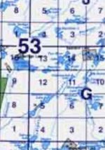
Yeah, it’s numbers 52, 53 in the Armstrong area"Armstrong" is the name of the 1:250,000 topo map sheet 52J.
All 16 of the 1:50,000 topo map sheets in the 52J area - none of which is named "Armstrong" - are listed on the map world website here:
They are also available free online using the sites referenced by Mason above.
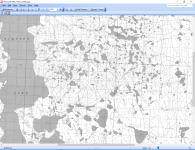
GoTrekkers has an Ontario base map that looks like this when zoomed in on the Armstrong area.

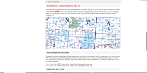
If the Canadian topographic index map provided below is not detailed enough for you to find the map you wish to purchase, please Click here to view our extremely detailed Canadian topographic index map. This will open up a new webpage where you can identify the map you wish and will be able to return to this page and add the particular map(s) to your shopping cart.
Hope this helps.
You can download the Index Maps in multiple formats here:
 open.canada.ca
Indexes of the National Topographic System of Canada - Open Government Portal
Topographic maps produced by Natural Resources Canada conform to the National Topographic System (NTS) of Canada. Indexes are available in three standard scales: 1:1,000,000, 1:250,000 and...
- Joined
- Nov 30, 2017
- Messages
- 1,132
- Reaction score
- 3,279
I just used this provider. It was relatively easy and I could see the river and lakes , etc clearly.GoTrekkers has an Ontario base map that looks like this when zoomed in on the Armstrong area.
View attachment 147428
If the Canadian topographic index map provided below is not detailed enough for you to find the map you wish to purchase, please Click here to view our extremely detailed Canadian topographic index map. This will open up a new webpage where you can identify the map you wish and will be able to return to this page and add the particular map(s) to your shopping cart.
Hope this helps.
world of maps came through by telephone. Index didn’t work on my Apple. I’ll definitely check out some other sites.
I’ll try with my laptop. Neither of my phone’s browsers will work on this link.GoTrekkers has an Ontario base map that looks like this when zoomed in on the Armstrong area.
View attachment 147428
If the Canadian topographic index map provided below is not detailed enough for you to find the map you wish to purchase, please Click here to view our extremely detailed Canadian topographic index map. This will open up a new webpage where you can identify the map you wish and will be able to return to this page and add the particular map(s) to your shopping cart.
Hope this helps.
Last edited:
Similar threads
- Replies
- 5
- Views
- 712
- Replies
- 11
- Views
- 847


