• Happy Weed Appreciation Day! 🌱🌿🌻

Not quite the BWCA

Joined
Dec 17, 2014
Messages
991
Reaction score
326
Location
Pickwick, MN
Click image for larger version  Name:	P7120083.JPG Views:	0 Size:	481.1 KB ID:	126476

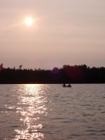
Five miles from the BWCA where on the day we went there were over 200 groups and probably over 1,000 people entering, here - not so much. Also, no permits, no fees and picnic tables at every campsite.
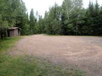
Click image for larger version  Name:	P7120084.JPG Views:	0 Size:	685.0 KB ID:	126477

Here's my favorite picture of the trip - the parking lot at our entry point! We saw NOBODY!

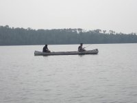
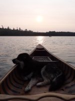
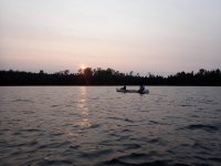
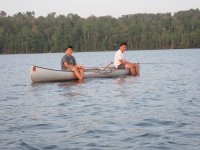
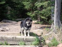
Here's some more pics, didn't catch any fish large enough to keep but we didn't do much serous fishing.
Click image for larger version  Name:	P7120083.JPG Views:	0 Size:	481.1 KB ID:	126476 Click image for larger version  Name:	P7120083.JPG Views:	0 Size:	481.1 KB ID:	126476 Click image for larger version  Name:	P7120083.JPG Views:	0 Size:	481.1 KB ID:	126476 Click image for larger version  Name:	P7120083.JPG Views:	0 Size:	481.1 KB ID:	126476 Click image for larger version  Name:	P7120083.JPG Views:	0 Size:	481.1 KB ID:	126476 Click image for larger version  Name:	P7120083.JPG Views:	0 Size:	481.1 KB ID:	126476 Click image for larger version  Name:	P7120083.JPG Views:	0 Size:	481.1 KB ID:	126476 Click image for larger version  Name:	P7120083.JPG Views:	0 Size:	481.1 KB ID:	126476 Click image for larger version  Name:	P7120083.JPG Views:	0 Size:	481.1 KB ID:	126476
 

Attachments

  • P7120112.JPG
    P7120112.JPG
    650.4 KB · Views: 2
That looks great. Lots of hidden gems up there, most of which I'm clueless about (like this one).

Have you ever done the Big Fork River? I've been on it three times and haven't seen another soul (9 days total). That might not be normal since the first time was very early spring and the second time was near flood stage. Doesn't seem to get heavy travel though. Nice camp sites and passes through a couple small towns where you can walk in for a burger (if the cafes haven't shut down). The lower 2/3 of the river seem especially scenic and it passes through some nice cedar swamps. The last 1/3 as it approaches the Canadian border wasn't quite as nice but maybe that's just because I covered it in one long day trying to beat the rain.

There's a nice guy in Big Falls that runs the hardware store, rents boats, and does shuttles.

Supposed to be good smallmouth, pike, and musky fishing but I wasn't fishing on the 1st two trips and on the last one the river was nearly flooded with no fish action.

Alan
 
Start in Big Falls and about 3 days to Rainy River?

I did Big Falls to Rainy River in one day. That was the day I was trying to (and did) beat the rain. Actually I started at the next campsite down from Big Falls but it was still about 45 miles. One that trip I started at Dora Lake and did the whole river. Took 5 days if I remember.

Second trip was just an over nighter somewhere in the middle.

Third trip was 3 days on the river late last summer. Put in at one of the bridges, paddled to Big Falls, and took the shuttle back.

Funny thing about that long day of paddling that ended at the Rainy River. I hadn't seen another person and was very surprised to find a full parking lot at the boat access. It was well after dark (late April) and as I beached the canoe a DNR officer came walking down to meet me. He got a better look at my boat (14' Wenonah Vagabond) and exclaimed, "You've been out sturgeon fishing in that!?"

Seems it was the season opener and that's what everyone else was doing there.

Alan

Alan,

I've never done the Big Fork or the Little Fork, I'm guessing by water levels that I saw at this point this year they are too low. There is a lot to explore outside of the BWCA in NE MN. Looking at a fall trip to do some more.

I am getting really annoyed with all the issues on this site these days, most days, like today, I can't sign in on my phone and I'm rarely in front of a computer screen anymore.
 
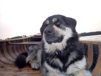
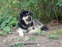
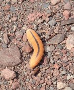
Looks like fun, and always good to see a canoe pup. Do you know what exactly that caterpillar guy is?
 
First time I have been able to log on to this site in months... Stayed on Frear lake in July of 2017. Was actually fairly full and got bussed by some drunk people in motor boats on Elbow Lake. The fishing was not good for us either, but we saw our first moose. She came out of the bush at 8 or so in the morning. Sounded like a freight train. Stood there eating for 10 minutes, great family memory.
 
First time I have been able to log on to this site in months... Stayed on Frear lake in July of 2017. Was actually fairly full and got bussed by some drunk people in motor boats on Elbow Lake. The fishing was not good for us either, but we saw our first moose. She came out of the bush at 8 or so in the morning. Sounded like a freight train. Stood there eating for 10 minutes, great family memory.
I think it's used less now because the Forest Service blocked off the logging road that folks used to drag boats into Elbow on, pretty much only canoes now. That said, we might have just been lucky.

Glad this site is back up and running.
 
Woo hoo first post on the “new” site- thanks to all for your hard work behind the scenes to bring us back!

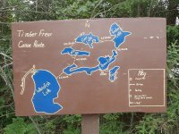
Way off paddling topics but I’d really like to know about the map board posted in original post.
Who the devil measures portages in rods? As a surveyor I’m used to seeing all kinds of archaic measurements on old plans of survey- chains and links, leagues, furlongs, perches and rods- but I am surprised to see it still in use.

any idea who made map and why they measured in rods?

just curious 🤨

Brice
Brice,
Don't know why, probably a hold over from old logging days, but all portage's in northern MN are measured in rods.
 
Woo hoo first post on the “new” site- thanks to all for your hard work behind the scenes to bring us back!

Way off paddling topics but I’d really like to know about the map board posted in original post.
Who the devil measures portages in rods? As a surveyor I’m used to seeing all kinds of archaic measurements on old plans of survey- chains and links, leagues, furlongs, perches and rods- but I am surprised to see it still in use.

any idea who made map and why they measured in rods?

just curious 🤨

Brice
I started canoeing in the BWCA and now when I have a map that isn't in rods, I convert in my head to rods to better grasp how long the portage is. McKenzie and Fisher maps of BWCAW and Quetico at least are in rods.
 
I talked with a old paddling friend from back in the good old days, he told me that you could walk across the rocks at the Big Fork Falls where Highway #71 crosses the Big Fork River in Northern Minnesota. Little Tamarack River East of Upper Red Lake at Waskish, MN is just mud, it has been a pretty dry summer in that part of the world. Summers and winters are pretty brutal in that country, glad I moved to Alaska when I did.
Portages in Minnesota have been in Rods (16.5 feet or 5.026 meters) since I was a kid, for a long time before that too I suspect, since the English started traveling in the area.
Portages in Minnesota are called Port-ages not the French way of pronunciation although I prefer the French myself. How is it pronounced in your neck of the woods? I know in Maine it is called a Carry.
 
Last edited:
Back
Top