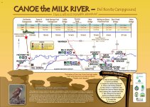
Recently got back from a trip on the Milk River in southern Alberta. The Milk River starts in Montana, makes an arc into Alberta and then flows back into Montana. We went from the Del Bonita Campground to Writing on Stone Provincial Park.
Sunday, July 10, 2022
We left home about 8:00 a.m. and got to the campsite on the North Milk River near Del Bonita about 4:15 p.m. The rest of the crew was already there and doing some last minute organizing. We had previously arranged for a shuttle with Karen’s Canoe Service (403) 758-6683. She lives close to the campsite. We met her at her place at 6:00 p.m. and followed her down to Writing on Stone Provincial Park. The shuttle, there and back, took about 2.5 hours and cost $95.00.
We had arranged with the staff at the Visitors’ Center at Writing on Stone Provincial Park (403-647-2364) to leave our vehicles in their overflow parking area for the duration of our trip. There is no charge for the parking but they want to have a record of licence numbers of vehicles and they want to know how long you will be parked there. I’m assuming that if you don’t show up on time they will alert the authorities but I don’t know that for sure. We also booked Poverty Rock Campsite for one night through the Visitor Center at Writing on Stone. There is no charge for using the Poverty Rock campsite but they do want you to register. We had also booked two campsites for out last night of the trip at Writing on Stone by using the Alberta Parks Website: (https://www.albertaparks.ca/albertaparksca/visit-our-parks/camping-in-albertas-parks/online-reservations/
Book early for campsites at Writing on Stone.
In addition, we had booked two campsites at Gold Springs Campground (1-403-647-2277) for Wednesday night.
When the drivers returned to the Del Bonita campsite, the wind was blowing briskly and the temperature had dropped so it was a cool evening. The coolness had some of us worrying about clothing choices but this was the last time we were cold. The weather was hot for the rest of the trip. We retired to our tents early and had a good night.
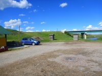
Campground and bridge over the North Milk River near Del Bonita, Alberta
Monday, July 11, 2022
We started from the bridge near the tiny community of Del Bonita, Alberta. The campsite has two shelters, one older one that is close to the river and the road and close to two older outhouses and a newer shelter that is further from the river and road and close to a newer outhouse and a playground. The newer camp shelter had a supply of wood for fires although we did not have a fire. I would hate to see a grass fire start in that windy, dry area. There are two hedgerows of shrubs with space between them that will help block the wind. There are no trees in the area. The grass in the campsite had been mowed fairly recently and tenting was fine. I would call the campsite “rustic” but everything was clean and there was toilet paper in the outhouses. There may be limited or no cell service here.
We were up before 7:00 a.m. and on the water by about 9:30 – not too bad for the first day when you are fitting everything into the canoe and tying everything down. The river is narrow at the campsite and the current is quite fast with few eddies. Even in places that looked like there should be an eddy there seemed to be significant downstream current. The river winds back and forth across the valley with banks increasing to small and medium sized cliffs on outside bends. Most stopping places had muddy landings for the first step or two but then the banks leveled out and the footing was good. Two consistent features of the North Milk River and later the Milk River are the strong current and the meandering oxbows. On this trip, the river volume at the Town of Milk River station (https://rivers.alberta.ca/) started at about 19.5 cms and ended at about 17 cms. We found this to be a good level for paddling.
The scenery was grassy hills in a fairly wide, fairly deep valley. We did not see anyone else on the river during the 5 days of our trip. At first, there were almost no shrubs and there were no trees at all. We did start to see a very occasional tree on the second day but they were very few and very far apart. On some north facing slopes and deeper coulees there were some low shrubs. We saw a few mule deer, antelope and coyotes. We saw many swallows starting at the first bridge and on every outside bend where there was a steep bank – it seems a good idea to wear a broad brimmed hat. We also saw some Canada geese, Brewer’s blackbirds, red-winged blackbirds, killdeer, meadowlarks, some ducks, some mergansers and an assortment of small birds.
For first hour to hour and a half, the swift current continued around many tight corners. About this time, the gradient increased, there were more rocks to dodge and the tight corners became more challenging. Finding the deep water channel required quick decision making because it was often hard to see very far downstream and the current wandered from side to side in the channel. In many places there was a vertical one to two foot bank along the edges and, as we went downstream, the banks on the outside of the bends became medium to large cliffs. All of these things made for a busy but enjoyable paddle.
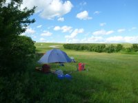
Just before the first and only bridge between Del Bonita and the Town of Milk River, we encountered a sharp left hand corner with large rocks on the outside of the corner. We assumed that the rocks were placed to protect the bridge. This difficult corner caused problems for all of us but one boat was swept into the large rocks and capsized. We discovered that it was hard to rescue people, boats and things in a narrow, swift river with few eddies and almost no gravel bars. The two swimmers received some bumps and scratches while being swept along in the fairly shallow, rocky water until they could be rescued. Their boat was also hard to rescue because of the speed of the current and the scarcity of eddies. Fortunately it was a warm, sunny day and, once the two paddlers and their boat were rescued it didn’t take too long until they were dry and warm. We all had a snack/lunch break and they reorganized their boat. Even though most of their gear was tied into the boat, some items floated away but, amazingly, we found everything except one travel mug. Some of the found items were a number of kilometers downstream from where the upset occurred. We continued on our way with lots of rock dodging, channel finding and tight corners. We had no further incidents and stopped to camp about 4:00 after having paddled about 32 km. We found a very nice campsite on river left, put up a large tarp for shade and went for a dip in the river to cool off. The water was not very cold and it felt great to get wet and to cool down.
Tuesday, July 12, 2022
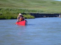
We were up early because there are no trees and when the sun hits a tent it doesn’t take long before the tent gets too hot to be in. The first half of this day was similar in nature to the first day with strong current, some fairly tight corners, rocks to dodge and deep water current to try to follow. The river continues to wind across a treeless valley with grass growing right to the edge of the river. The second half of the day brought a slightly slower current and less rocky rapids but the oxbows continued.
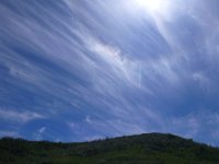
Prairie skies
We were about to start looking for a campsite when we encountered a large herd of cattle which had access to both sides of the river. We couldn’t stop to camp along this stretch with the cattle because we weren’t sure how they would treat tents and tarps and people. They seemed fascinated and frightened by the people in canoes because some of them followed us for a long distance. After a while we were rescued from the cattle by a fence that was on both sides of the river which stopped the cattle from following us. We were able to find a campsite not too far downstream from the fence. We paddled about 46 kilometers on this hot day so we were glad for the shade of the tarp and for the opportunity to get wet in the river. This evening we had a long discussion about the rapids still to come between the Town of Milk River and Writing on Stone Provincial Park. A friend had done the trip from the Town of Milk River to Writing on Stone Provincial Park about two weeks before our trip so his information was quite current. He was particularly concerned about the first “landslide” rapid above Gold Springs Park where a fairly recent landslide came down from River Left and constricted the current toward River Right. Just below the constriction is an island which divides the river into a left and right channel. He was particularly concerned about the strong current in the right hand channel which would take paddlers toward an undercut bank. He had given detailed instructions about how to approach the landslide section so that you would be able to get into the left hand channel and avoid the undercut bank in the right hand channel. As we were discussing the strategy, we focused our instruction on the least experienced pair of paddlers. The next morning they said that, knowing about the number and difficulty of the rapids ahead, they would be getting off the river at the Town of Milk River because they did not feel that they had enough experience to safely navigate that stretch of river.
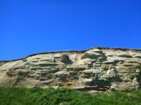
Raptor's nest
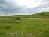
Second camp
Wednesday, July 13, 2022
We arrived at the Town of Milk River at about noon and stopped at the campground that is on river left. If you need or want anything, it is a short walk to the Town of Milk River. The pair who were concerned with their ability to cope with the rapids pulled their canoe out here. After talking with some people at the campground, they managed to get a ride to their vehicle at Writing on Stone. We had lunch together and the two remaining boats set off.
After the Town of Milk River the river has several rocky rapids which gradually got more numerous and more difficult as we approached Gold Springs Park Campground. At “landslide” rapid we had no difficulty due to the information from our friend but we could see that it would be challenging to avoid the undercut bank in the right hand channel. The rock-dodging and channel-finding continued to Gold Springs.
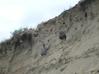
Owls along the banks in several places
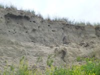
Gold Springs Campsite (1-403-647-2277) is very nice. There is road access which would allow for starting or stopping a trip here. We had previously booked two campsites and we had two large tenting campsites along the river. We landed our canoes just below our campsite and we were able to bring our gear up the short steep bank. There were lots of trees in the rest of the campsite and many of the campsites were situated in those trees. There is also a large, ox-bow shaped “lake” which is stocked with trout and where people can swim. There are hot showers to be had for loonie and toonie coins. There are also a number of clean porta-potties situated around the campsite so it’s never far to get to a toilet. There is a camp office/store with limited hours.
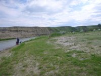
River front at Gold Springs Campground
Thursday, July 14, 2022
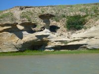
Hoodoos along the way
The paddle from Gold Springs Park to Poverty Rock has many rapids. Some are marked and named on maps of the river. There are many rocks to avoid, sometimes in fast current. Finding the deep water channel is also a challenge.
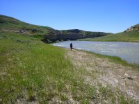
Minor rapid at a lunch stop.
My assessment is that all paddlers who attempt the parts of the Milk River downstream from the Town of Milk River to Writing on Stone Provincial Park should be able to maneuver competently in fast water. We were traveling with loaded canoes with all of our camping gear and we were carrying drinking water. Loaded boats don’t respond quickly. For most of the rapids, finding the deep water channel was the most difficult part. In those rapids, it was usually fairly easy to follow that current near the outside of the bend, however, in some of the rapids it was necessary to be able to follow that channel back and forth across the river while avoiding the rocks. For some of the rapids, it was necessary to take quick, decisive action to avoid boulders, boulder bars and/or ledges and to avoid being swept into undercut cliffs. At times there were long stretches of water where maneuvering was required. Having said all that, it was a very interesting and entertaining section. We found the campsite at Poverty Rock to be very nice. It has a nice shelter, a number of picnic tables, mowed grassy areas for tents and a fairly new outhouse. Note that there is no public road access to this site.
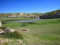
Poverty Rock backcountry campsite - no public road access - river access only
Friday, July 15, 2022
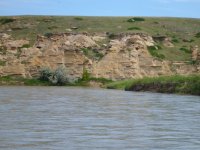
After Poverty Rock the river slows down and there are less rapids. The landforms along the river are fascinating hoodoos and strangely shaped rocks and cliffs. We arrived at Writing on Stone Campsite at about 2:00 p.m., had an ice cream from the Office/Store, picked up our camping passes and booked a guided tour of some of the sites. Two of our group walked up to the overflow parking area up by the Visitors’ Center to get our vehicles. We parked them close to the canoe landing ramp and loaded our gear and boats and went to our campsites. Since it was hot we all decided to put on our swimming gear and PFDs and go for a float around the peninsula on which the campground is located. We floated from the canoe landing ramp to the beach area. It was great to cool down. We went for a hot shower and then walked up to the Visitors’ Center to meet the guide for our tour. The guide was very knowledgeable about the Rock Art in the Archeological Preserve at Writing on Stone. After a great tour we had supper and went to a drama presentation at the Amphitheatre. It was an informative and amusing show. A great way to end our trip.
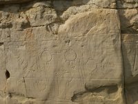
Writing on Stone
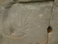
More Writing on Stone
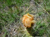
Cactus
Some Random pictures:
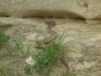

Sunday, July 10, 2022
We left home about 8:00 a.m. and got to the campsite on the North Milk River near Del Bonita about 4:15 p.m. The rest of the crew was already there and doing some last minute organizing. We had previously arranged for a shuttle with Karen’s Canoe Service (403) 758-6683. She lives close to the campsite. We met her at her place at 6:00 p.m. and followed her down to Writing on Stone Provincial Park. The shuttle, there and back, took about 2.5 hours and cost $95.00.
We had arranged with the staff at the Visitors’ Center at Writing on Stone Provincial Park (403-647-2364) to leave our vehicles in their overflow parking area for the duration of our trip. There is no charge for the parking but they want to have a record of licence numbers of vehicles and they want to know how long you will be parked there. I’m assuming that if you don’t show up on time they will alert the authorities but I don’t know that for sure. We also booked Poverty Rock Campsite for one night through the Visitor Center at Writing on Stone. There is no charge for using the Poverty Rock campsite but they do want you to register. We had also booked two campsites for out last night of the trip at Writing on Stone by using the Alberta Parks Website: (https://www.albertaparks.ca/albertaparksca/visit-our-parks/camping-in-albertas-parks/online-reservations/
Book early for campsites at Writing on Stone.
In addition, we had booked two campsites at Gold Springs Campground (1-403-647-2277) for Wednesday night.
When the drivers returned to the Del Bonita campsite, the wind was blowing briskly and the temperature had dropped so it was a cool evening. The coolness had some of us worrying about clothing choices but this was the last time we were cold. The weather was hot for the rest of the trip. We retired to our tents early and had a good night.

Campground and bridge over the North Milk River near Del Bonita, Alberta
Monday, July 11, 2022
We started from the bridge near the tiny community of Del Bonita, Alberta. The campsite has two shelters, one older one that is close to the river and the road and close to two older outhouses and a newer shelter that is further from the river and road and close to a newer outhouse and a playground. The newer camp shelter had a supply of wood for fires although we did not have a fire. I would hate to see a grass fire start in that windy, dry area. There are two hedgerows of shrubs with space between them that will help block the wind. There are no trees in the area. The grass in the campsite had been mowed fairly recently and tenting was fine. I would call the campsite “rustic” but everything was clean and there was toilet paper in the outhouses. There may be limited or no cell service here.

We were up before 7:00 a.m. and on the water by about 9:30 – not too bad for the first day when you are fitting everything into the canoe and tying everything down. The river is narrow at the campsite and the current is quite fast with few eddies. Even in places that looked like there should be an eddy there seemed to be significant downstream current. The river winds back and forth across the valley with banks increasing to small and medium sized cliffs on outside bends. Most stopping places had muddy landings for the first step or two but then the banks leveled out and the footing was good. Two consistent features of the North Milk River and later the Milk River are the strong current and the meandering oxbows. On this trip, the river volume at the Town of Milk River station (https://rivers.alberta.ca/) started at about 19.5 cms and ended at about 17 cms. We found this to be a good level for paddling.
The scenery was grassy hills in a fairly wide, fairly deep valley. We did not see anyone else on the river during the 5 days of our trip. At first, there were almost no shrubs and there were no trees at all. We did start to see a very occasional tree on the second day but they were very few and very far apart. On some north facing slopes and deeper coulees there were some low shrubs. We saw a few mule deer, antelope and coyotes. We saw many swallows starting at the first bridge and on every outside bend where there was a steep bank – it seems a good idea to wear a broad brimmed hat. We also saw some Canada geese, Brewer’s blackbirds, red-winged blackbirds, killdeer, meadowlarks, some ducks, some mergansers and an assortment of small birds.
For first hour to hour and a half, the swift current continued around many tight corners. About this time, the gradient increased, there were more rocks to dodge and the tight corners became more challenging. Finding the deep water channel required quick decision making because it was often hard to see very far downstream and the current wandered from side to side in the channel. In many places there was a vertical one to two foot bank along the edges and, as we went downstream, the banks on the outside of the bends became medium to large cliffs. All of these things made for a busy but enjoyable paddle.
Just before the first and only bridge between Del Bonita and the Town of Milk River, we encountered a sharp left hand corner with large rocks on the outside of the corner. We assumed that the rocks were placed to protect the bridge. This difficult corner caused problems for all of us but one boat was swept into the large rocks and capsized. We discovered that it was hard to rescue people, boats and things in a narrow, swift river with few eddies and almost no gravel bars. The two swimmers received some bumps and scratches while being swept along in the fairly shallow, rocky water until they could be rescued. Their boat was also hard to rescue because of the speed of the current and the scarcity of eddies. Fortunately it was a warm, sunny day and, once the two paddlers and their boat were rescued it didn’t take too long until they were dry and warm. We all had a snack/lunch break and they reorganized their boat. Even though most of their gear was tied into the boat, some items floated away but, amazingly, we found everything except one travel mug. Some of the found items were a number of kilometers downstream from where the upset occurred. We continued on our way with lots of rock dodging, channel finding and tight corners. We had no further incidents and stopped to camp about 4:00 after having paddled about 32 km. We found a very nice campsite on river left, put up a large tarp for shade and went for a dip in the river to cool off. The water was not very cold and it felt great to get wet and to cool down.

Tuesday, July 12, 2022
We were up early because there are no trees and when the sun hits a tent it doesn’t take long before the tent gets too hot to be in. The first half of this day was similar in nature to the first day with strong current, some fairly tight corners, rocks to dodge and deep water current to try to follow. The river continues to wind across a treeless valley with grass growing right to the edge of the river. The second half of the day brought a slightly slower current and less rocky rapids but the oxbows continued.

Prairie skies
We were about to start looking for a campsite when we encountered a large herd of cattle which had access to both sides of the river. We couldn’t stop to camp along this stretch with the cattle because we weren’t sure how they would treat tents and tarps and people. They seemed fascinated and frightened by the people in canoes because some of them followed us for a long distance. After a while we were rescued from the cattle by a fence that was on both sides of the river which stopped the cattle from following us. We were able to find a campsite not too far downstream from the fence. We paddled about 46 kilometers on this hot day so we were glad for the shade of the tarp and for the opportunity to get wet in the river. This evening we had a long discussion about the rapids still to come between the Town of Milk River and Writing on Stone Provincial Park. A friend had done the trip from the Town of Milk River to Writing on Stone Provincial Park about two weeks before our trip so his information was quite current. He was particularly concerned about the first “landslide” rapid above Gold Springs Park where a fairly recent landslide came down from River Left and constricted the current toward River Right. Just below the constriction is an island which divides the river into a left and right channel. He was particularly concerned about the strong current in the right hand channel which would take paddlers toward an undercut bank. He had given detailed instructions about how to approach the landslide section so that you would be able to get into the left hand channel and avoid the undercut bank in the right hand channel. As we were discussing the strategy, we focused our instruction on the least experienced pair of paddlers. The next morning they said that, knowing about the number and difficulty of the rapids ahead, they would be getting off the river at the Town of Milk River because they did not feel that they had enough experience to safely navigate that stretch of river.

Raptor's nest

Second camp
Wednesday, July 13, 2022
We arrived at the Town of Milk River at about noon and stopped at the campground that is on river left. If you need or want anything, it is a short walk to the Town of Milk River. The pair who were concerned with their ability to cope with the rapids pulled their canoe out here. After talking with some people at the campground, they managed to get a ride to their vehicle at Writing on Stone. We had lunch together and the two remaining boats set off.
After the Town of Milk River the river has several rocky rapids which gradually got more numerous and more difficult as we approached Gold Springs Park Campground. At “landslide” rapid we had no difficulty due to the information from our friend but we could see that it would be challenging to avoid the undercut bank in the right hand channel. The rock-dodging and channel-finding continued to Gold Springs.

Owls along the banks in several places

Gold Springs Campsite (1-403-647-2277) is very nice. There is road access which would allow for starting or stopping a trip here. We had previously booked two campsites and we had two large tenting campsites along the river. We landed our canoes just below our campsite and we were able to bring our gear up the short steep bank. There were lots of trees in the rest of the campsite and many of the campsites were situated in those trees. There is also a large, ox-bow shaped “lake” which is stocked with trout and where people can swim. There are hot showers to be had for loonie and toonie coins. There are also a number of clean porta-potties situated around the campsite so it’s never far to get to a toilet. There is a camp office/store with limited hours.

River front at Gold Springs Campground
Thursday, July 14, 2022

Hoodoos along the way
The paddle from Gold Springs Park to Poverty Rock has many rapids. Some are marked and named on maps of the river. There are many rocks to avoid, sometimes in fast current. Finding the deep water channel is also a challenge.

Minor rapid at a lunch stop.
My assessment is that all paddlers who attempt the parts of the Milk River downstream from the Town of Milk River to Writing on Stone Provincial Park should be able to maneuver competently in fast water. We were traveling with loaded canoes with all of our camping gear and we were carrying drinking water. Loaded boats don’t respond quickly. For most of the rapids, finding the deep water channel was the most difficult part. In those rapids, it was usually fairly easy to follow that current near the outside of the bend, however, in some of the rapids it was necessary to be able to follow that channel back and forth across the river while avoiding the rocks. For some of the rapids, it was necessary to take quick, decisive action to avoid boulders, boulder bars and/or ledges and to avoid being swept into undercut cliffs. At times there were long stretches of water where maneuvering was required. Having said all that, it was a very interesting and entertaining section. We found the campsite at Poverty Rock to be very nice. It has a nice shelter, a number of picnic tables, mowed grassy areas for tents and a fairly new outhouse. Note that there is no public road access to this site.

Poverty Rock backcountry campsite - no public road access - river access only

Friday, July 15, 2022
After Poverty Rock the river slows down and there are less rapids. The landforms along the river are fascinating hoodoos and strangely shaped rocks and cliffs. We arrived at Writing on Stone Campsite at about 2:00 p.m., had an ice cream from the Office/Store, picked up our camping passes and booked a guided tour of some of the sites. Two of our group walked up to the overflow parking area up by the Visitors’ Center to get our vehicles. We parked them close to the canoe landing ramp and loaded our gear and boats and went to our campsites. Since it was hot we all decided to put on our swimming gear and PFDs and go for a float around the peninsula on which the campground is located. We floated from the canoe landing ramp to the beach area. It was great to cool down. We went for a hot shower and then walked up to the Visitors’ Center to meet the guide for our tour. The guide was very knowledgeable about the Rock Art in the Archeological Preserve at Writing on Stone. After a great tour we had supper and went to a drama presentation at the Amphitheatre. It was an informative and amusing show. A great way to end our trip.

Writing on Stone

More Writing on Stone

Cactus
Some Random pictures:


