• Happy National Apple Pie Day! 🍎🥧😋

May 2017 Bowron Lakes Solo

Joined
Mar 8, 2017
Messages
93
Reaction score
4
Location
Cariboo Mountains, British Columbia, Canada
I'm going to type in a trip report over the next couple of days with a couple of dozen pictures. It was a quick, cold 4 day trip, but a great one.

I arrived at the parking lot just before noon on the 10th, and was on the portage shortly after. There were four other vehicles here, all from BC. The park doesn't open for another week or so.
 

Attachments

  • photo6847.jpg
    photo6847.jpg
    178.5 KB · Views: 2
  • photo6892.jpg
    photo6892.jpg
    44.9 KB · Views: 2
  • photo6893.jpg
    photo6893.jpg
    37.9 KB · Views: 2
Last edited:
No Title

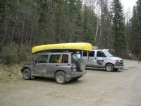
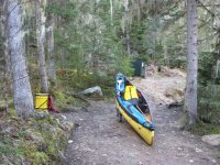
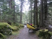
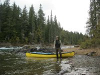
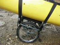
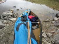
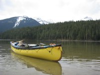
So I forgot my straps for holding the canoe to my cart. I use rope to tie the canoe to the roof, but rope is crap for a cart. I made do with the rope.

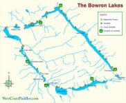
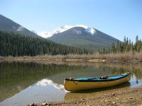
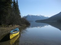
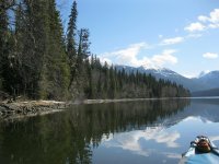
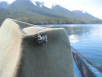
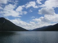
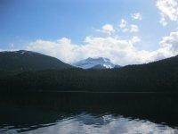
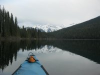
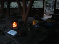
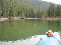
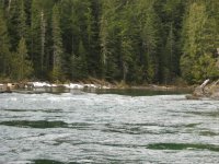
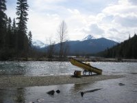
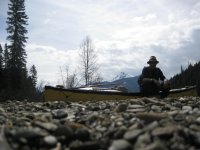
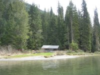
I saw a nice grouse on the trail. Not sure what kind. It was black with white tipped feathers and a cute little red hat on his head. I always go hard through this portage. It is the longest at 2.5 km, is mostly uphill, and I like to get it done quickly. Kibbee lake was a nice paddle. You start out in a winding slough and make your way into the lake. After about 2 km you are at the next portage. This one is 2 km and stars off steeper than the last and has lots of huge muddy wheel sucking potholes. Fortunately it levels out and the potholes diminish. There is a little downhill section before you come to a small sandy beach at Indian Point Lake. This is a really nice lake, and I decided to enjoy it by paddling the south shore. I had never done this before, and I think I like it more than the north shore. I really wanted to push on to Issaac Lake, but I was tired, cold and dark clouds were moving in next door. So I decided to stay at the old log cabin at the end of the lake. I pulled in about 5 pm, ate and went to bed early. There are 5 old log cabins around the circuit that you can sleep in if you can stand the mice. There doesn't seem to be any mice around in the spring though. I was fine all night.

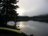
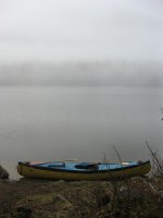
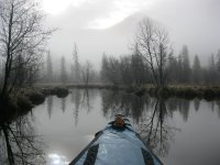
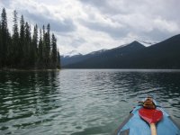
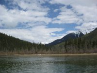
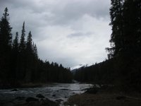
Up at 6 and on the water at 7. This day looked promising. Mist and clouds everywhere, but I could tell the clouds were thin. There were 5 swans, 3 geese, and about 20 ducks on the lake near the cabin this morning. They were all hanging out together, chatting away.
 

Attachments

  • photo6849.jpg
    photo6849.jpg
    200.1 KB · Views: 3
  • photo6850.jpg
    photo6850.jpg
    178.3 KB · Views: 3
Last edited:
No Title

At the end of Indianpoint you travel up a small stream into a pond before the Isaac portage. This is a beautiful area and I wish it was longer. The mist, the sun, and the hundreds of birds singing was a nice way to start the day.
 

Attachments

  • photo6851.jpg
    photo6851.jpg
    295.2 KB · Views: 5
  • photo6852.jpg
    photo6852.jpg
    499.8 KB · Views: 5
No Title

The portage to Isaac went well. It is shorter again at 1.5 km. As I approached the lake the last bit of mist burned off and the sun was gloriously roasting me. I packed up and took a couple of pictures. If you arrive at Isaac Lake and it looks like this, consider yourself very lucky. This lake can have insane weather. On my 1st trip in 2007, a storm came up behind my friend and I that all we could do was hang on and be blown ashore. We were trying to make it around a small point to escape the wind but it was hopeless. Waves were coming in over the stern into my lap. We aimed the canoe, half full of water, straight at shore and rammed into the bushes. We hacked our way into the forest with our machetes ( always keep one ready to go ) and pulled the canoe in as far as we could. A half an hour later the sun came out and we moved down to a small beach to dry out. That was a fun trip.

Anyways, this part of the paddle was pretty amazing. Along this 7 km west arm I saw 3 bald eagles and an osprey. And again there were hundreds of tiny birds along the shore singing away. Also a huge fish came up out of the water just a few feet away from me. Scared me!

If you fish this is the lake for you. I have heard many stories from friends and locals about the monster fish in this lake.
 

Attachments

  • photo6853.jpg
    photo6853.jpg
    301.5 KB · Views: 5
  • photo6854.jpg
    photo6854.jpg
    258.9 KB · Views: 4
  • photo6855.jpg
    photo6855.jpg
    310.2 KB · Views: 5
Last edited:
No Title

I also picked up this little fellow out of the lake. He rode along on the canoe for an hour or so until he dried off. After a couple of failed attempts to fly ashore I just brought him in myself and put him on a log. Or her!.
 

Attachments

  • photo6858.jpg
    photo6858.jpg
    197.2 KB · Views: 2
  • photo6859.jpg
    photo6859.jpg
    220.2 KB · Views: 2
No Title

2 more pictures after I crossed the lake, came around the inside corner, crossed the lake again and stopped for lunch. I like to have a beer with lunch everyday regardless of the weather.
 

Attachments

  • photo6860.jpg
    photo6860.jpg
    281.8 KB · Views: 2
  • photo6861.jpg
    photo6861.jpg
    237.3 KB · Views: 2
Last edited:
No Title

This 1st photo is about half way down the lake approaching a wider area where Betty Wendle creek flows in. The 2nd photo is looking east up the creek.

The Wendles ran a guiding business here almost a hundred years ago. They had a summer house on Bowron Lake and a winter house in nearby Barkerville. Joe Wendle was also a gold miner and Betty was known for her marksmanship and was a painter.
 

Attachments

  • photo6862.jpg
    photo6862.jpg
    172.6 KB · Views: 2
  • photo6863.jpg
    photo6863.jpg
    180.5 KB · Views: 2
Last edited:
No Title

Looking up an avalanche chute down the lake a little. I believe this is Mt. Amos Bowman. He was famous in in the 1800's for his amazingly detailed and accurate maps of the local regions. Barkerville has some of his maps.

And another mountain on the other side from Betty Wendle Creek. I think it's Mt. Faulkner.
 

Attachments

  • photo6864.jpg
    photo6864.jpg
    210.5 KB · Views: 1
  • photo6866.jpg
    photo6866.jpg
    169.7 KB · Views: 1
Last edited:
No Title

This was a long day. Indianpoint cabin to the end of Isaac Lake is 40km. That's if you don't go into most of the bays and inlets like I do. So maybe a 45km day. It was nice to finally get to the mountains at the end of the lake. It took 13 hours to get here. 7 am to 8 pm.

There were 4 new shelters built about 5 years ago and I stayed in one for my 2nd night. Had a big supper and read in front of the fire for awhile.
 

Attachments

  • photo6865.jpg
    photo6865.jpg
    192.6 KB · Views: 3
  • photo6867.jpg
    photo6867.jpg
    159.4 KB · Views: 3
Last edited:
No Title

This is my entire kitchen setup. The bowls fit into the pot. The metal mug is always changing. Like many of you, I also have a collection of enameled mugs that I love to use. The plastic jar is to put the stove in. On a longer trip I would take a larger fuel bottle. Also I use a Steripen to treat my water. It stays in a pocket on the back of my pfd.

The rain poured down all last night and this morning while I made breakfast and packed up. I relaxed and took my time. When I was ready to paddle the rain stopped. Nice. Hit the river at 9 am.
 

Attachments

  • photo6868.jpg
    photo6868.jpg
    274.2 KB · Views: 3
Last edited:
No Title

After paddling on the Isaac River for a while you have to portage around some nasty rapids and small falls. The portages along this river are amazing. This part of the park is in the northern tip of B.C.'s interior rain forest. It is a rare ecosystem.

The second picture is putting in for a little more river travel. As I was packing up the boat, what do I discover on the ground neatly rolled up? A new set of straps left just for me.
 

Attachments

  • photo6869.jpg
    photo6869.jpg
    525.4 KB · Views: 3
  • photo6870.jpg
    photo6870.jpg
    418.1 KB · Views: 3
No Title

This 1st picture is looking back up the river.

The 2nd is a rapid I played around in for a while. My whitewater skills could definitely use improvement, so any chance to practice is always welcomed.
 

Attachments

  • photo6871.jpg
    photo6871.jpg
    210.8 KB · Views: 3
  • photo6872.jpg
    photo6872.jpg
    368.8 KB · Views: 3
No Title

After the straps are on and tight, I tie my bow and stern lines to them and crank those tight. This portage has some rough downhill sections to get down to McLeary Lake and the Cariboo River.
 

Attachments

  • photo6877.jpg
    photo6877.jpg
    303.5 KB · Views: 2
  • photo6878.jpg
    photo6878.jpg
    190.5 KB · Views: 2
Last edited:
No Title

This is where the Isaac River flows into McLeary Lake, which is really part of the Cariboo River. It's water level is always the same as the river. Sometimes the meltwater from the Cariboo Glacier increases with the hot sun during the day, and McLeary rises up and can carry your beached canoe away while you are having lunch or off doing whatever. I always tie off to something.
 

Attachments

  • photo6882.jpg
    photo6882.jpg
    215.5 KB · Views: 3
  • photo6883.jpg
    photo6883.jpg
    235.5 KB · Views: 3
No Title

Freddy Becker ( no relation to Becker's Lodge on Bowron Lake ) was an old trapper who spent a lot of his life out here. This is one of his cabins.

This 2nd picture is on a shallow part of McLeary.
 

Attachments

  • photo6884.jpg
    photo6884.jpg
    173.9 KB · Views: 5
  • photo6885.jpg
    photo6885.jpg
    258.5 KB · Views: 6
Back
Top