• Happy Cinco De Mayo! 🇲🇽🎸💃🪅🌶️

Marshall Lake 2015

I like the looks of that detour. Faubert might be a pretty lake to explore.
Last week I was looking over the route and wandered further down the Kap. I'm wondering if you could possibly turn south from Little Current L and head up the Little Current River to reach O'Sullivan L for a long loop? I can only guess how long this route would take. 2 full weeks?
 
No travelling upstream on that part of the Little Current. I've come down it from Osullivan, it is a prime white water trip. Ports haven't been cleared back there since 1993, and there are quite a few.

Depending on water levels, the Kap after Stewart Lake has quite a bit of white water. It's a very nice trip, grade A fishing. To get from the Ogoki Rd.Bridge to Terrier Lake, the closest area for pickup, would be an awesome trip as well, but more technically challenging, with a 1.5 mile port at the end. A fair amount of rapids that have to be shot or lined as well, with the lining usually verging on difficult. Think it took us six days the last time we opened it up, but we were pushing hard. With fishing and wind days, it would be a very nice ten day trip. That's real wilderness back there though, once you paddle past Stewart Lake you are committed.
 
Faubert looks to be like the headwaters for the Kap, although it appears there are two good rivers coming into the lake. N/W is a large clear cut area but it doesn't appear to come to the lake, although the google maps photo's could be old. It also looks like not ports up into Faubert. Could be nice wilderness that is untouched fishing wise.
 
Looks like Faubert might be an easy upstream ride from the bridge over the Kap for a motor boat or is there something I'm missing.
 
I'm pretty excited about it too! If everything works out with the school trip, we will have it scouted and a good camps site located and developed.
 
Hope it passes muster and has that special feeling!

DSC01985.JPG
 
So, a rough guesstimate could place us on Faubert L for about days 5 & 6? (Marshall -day 1, Gripp -days 2&3, Summit or Powitik -day 4) I'm not planning, only pondering. The resupply might be around day 7? Esker Hilton day 8...oh oh. I'm running out of time here.
I'm sure we'll fit it all into 10 days somehow. I don't worry one way or the other what the itinerary looks like. Just looking for good health and good weather. We'll all take care of the rest.
 
Last edited:
Faubert looks much like a widening in a River or a bunch of small interconnected lakes. The river that flows in from the N/W has potential for a day trip especially considering your map shows a waterfall upstream. If it is a significant inflow it would be one of the places to go fish at.

Now we have to wait until June for the intel, that is, if you have ice out by then. :eek:
 
Last edited:
"Looks like Faubert might be an easy upstream ride from the bridge over the Kap for a motor boat or is there something I'm missing."


Yup, three ports and two sets of rapids. One never knows about the temerity of fishermen though!


Ha, after looking at my maps I was reminded there are those 3 ports downstream of where the Powtik joins the Kap...I had forgotten all about them. I can just taste those Pickerel coming out from those falls now Mihun.
 
Yes, Brad, your projections are about right, although reaching bridge on day 7 will probably call for some dedicated masochism. Probably depend on the beer supply and whether or not everyone is out.
 
So we'll be resupplying around day 8 for the final 2 days spent at the all inclusive esker resort?
 
Last edited:
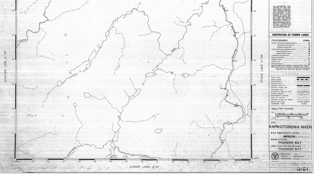
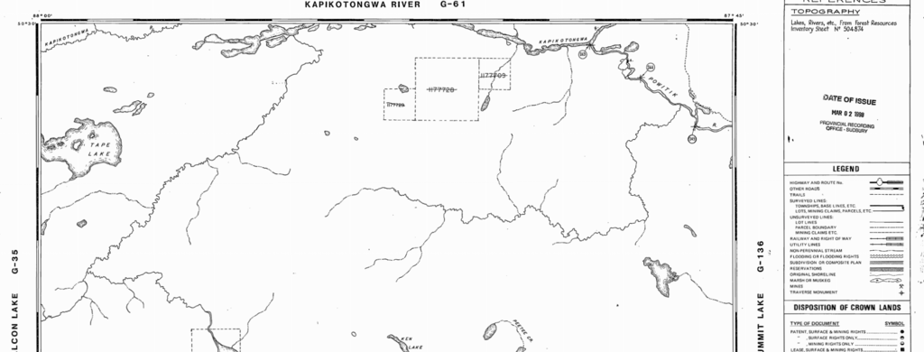
I’ve been looking on-line for info on Faubert lake, even talked to a few locals, no-one seems to know anything about it. I looked up the old mining maps for the area. It’s at an uncomfortable junction of two maps, but between the two, it does give some info. On the Junior Lake map, it shows a rapid on the Kap just before Faubert, but I’m doubtful. On the Kap River map, it shows a rapid immediately after the junction of the Powitik and the Kap, and I know there is no rapid there. Those old mining maps are usually pretty accurate. I guess we’ll find out. If there is a rapid, we’ll cut a port around it in June.

Link is here if you want to peruse further http://www.geologyontario.mndmf.gov.on.ca/website/historic_claim_maps/J/Junior Lake.pdf


Last edited:
If we have to paddle upstream in rapids I'll bring a 3rd Beavertail paddle to help resupply all the non believers whose wimpy lightweights fall apart when the going gets tough...hahaw
 
Been thinking about why there is a lack of information on Faubert Lake. It could be much like it is here, with the Wallace Lake entry to Atikaki. The rivers are just a means to an end, meaning, the Wanipigow east or west and the Broadleaf north are just thoroughfares on the way to the Bloodvein. People pass through but never stop to smell the roses so to speak. We use these rivers to go and explore the lakes on the river systems as well as the lakes just a bushwhack off the system. Obukowin Lake is again, just a part of the river system to get to the Gammon/Bloodvein, and yet it is a giant lake with good fishing and tons of wildlife.

Faubert is upstream from the thoroughfare of going downstream on the Kap. Most people in your area have motor boats as you said and nobody is going to portage a boat and motor upstream to an unknown lake on the chance the fishing might be outstanding. Too much work for most people and boaters are not out to explore, they seek the most convenient access to meet their needs.

Google earth and your maps also indicate Faubert as a widening of the Kap system, possibly with a rapid/falls at the outlet to form the lakes. Someone at some point was there to name the lake. The fact there is little information on it locally just adds to the mystique and the need to go explore what might be unexplored land despite the existing maps. That is what draws us out, to go explore the off the beat places. Whether the Kap is navigable upstream is also something to consider. Is it possible to find a put in further upstream towards the headwaters and navigate the entire river?

Google earth also shows many clear cuts to the N/W of Faubert and with it being mostly an unused water shed it is possible the cutting went all the way to the waters edge. Time will tell.

It is decidedly an enticing prospect for us.
 
Back
Top