The plan was to bypass a rough section of the Cedar by carrying to Unknown pond and bushwhacking from the outflow back to the Cedar. If the roads were open to the north, we also would have tried a through trip, exiting via the Essex Chain Lakes.
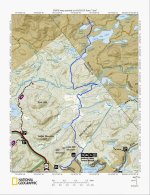
We put in at the Benton Rd site, the former Indian Lake town beach, we even met the 84 year old former lifeguard!
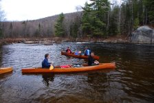
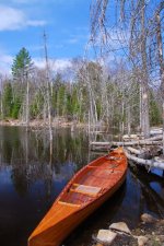
We paddled downstream to the Unknown Pond trail crossing, views back upstream were dominated by Snowy Mt. The trail to unknown was 1.5 miles of blowdown and deadfall, and plenty of up and down. Two of us old men went ahead with just backpacks and cleared the way. As the rest of the gang followed with their gear and boats, we 2 old men returned for my buddy's 54 lb wood strip comp cruiser.
A quick paddle down the beaver swollen (thanks, beavers) outflow brought us to an 8 ft tall and 150 long beaver dam.
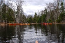
I took a compass reading and we headed NNE through the brush to intersect the Cedar River. There were many spruce thickets an several fens to avoid in the .25 mile straight line distance. There is no trail and no evidence of prior travel by humans, but there was much moose sign.
We arrived at the banks of the Cedar River in between the 1st and 2nd rapids downstream from Elm Island. We made camp in a cedar grove. Views downstream were dominated by Dun Brook Mt.
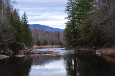
Try as we might, we couldn't manage to find a way to negotiate the 3rd set of rapids...the problems being multiple: flat water hulls that don't turn well, wooden boats, water too cold to line on a return trips, shore too dense to comfortably carry back upstream, current too strong for upstream return.
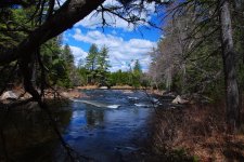
So we played and stayed between sets of rapids...weather was perfect and it was too soon for black flies!!
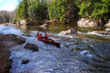
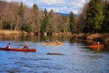
Return trip a few days later tracing the same route...
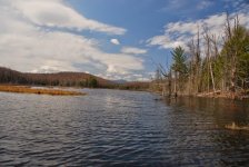
Views were a bit better SW when we paddled the outflow of Unkown Pond, with Panther Mt filling the horizon.
And that was that! We would have preferred a longer bunch of paddling, but this is what we do...go in places where others rarely travel. There's no substitute for boots on the ground and paddle in the water recon. A return could be feasible in higher water with different boats, or in warmer water (to allow lining) as a through trip to the Essex Chain Lakes. The route still has potential to become a classic canoe route, but carry trails would need to be DEC approved and cut.

We put in at the Benton Rd site, the former Indian Lake town beach, we even met the 84 year old former lifeguard!

We paddled downstream to the Unknown Pond trail crossing, views back upstream were dominated by Snowy Mt. The trail to unknown was 1.5 miles of blowdown and deadfall, and plenty of up and down. Two of us old men went ahead with just backpacks and cleared the way. As the rest of the gang followed with their gear and boats, we 2 old men returned for my buddy's 54 lb wood strip comp cruiser.
A quick paddle down the beaver swollen (thanks, beavers) outflow brought us to an 8 ft tall and 150 long beaver dam.

I took a compass reading and we headed NNE through the brush to intersect the Cedar River. There were many spruce thickets an several fens to avoid in the .25 mile straight line distance. There is no trail and no evidence of prior travel by humans, but there was much moose sign.

We arrived at the banks of the Cedar River in between the 1st and 2nd rapids downstream from Elm Island. We made camp in a cedar grove. Views downstream were dominated by Dun Brook Mt.

Try as we might, we couldn't manage to find a way to negotiate the 3rd set of rapids...the problems being multiple: flat water hulls that don't turn well, wooden boats, water too cold to line on a return trips, shore too dense to comfortably carry back upstream, current too strong for upstream return.

So we played and stayed between sets of rapids...weather was perfect and it was too soon for black flies!!


Return trip a few days later tracing the same route...

Views were a bit better SW when we paddled the outflow of Unkown Pond, with Panther Mt filling the horizon.

And that was that! We would have preferred a longer bunch of paddling, but this is what we do...go in places where others rarely travel. There's no substitute for boots on the ground and paddle in the water recon. A return could be feasible in higher water with different boats, or in warmer water (to allow lining) as a through trip to the Essex Chain Lakes. The route still has potential to become a classic canoe route, but carry trails would need to be DEC approved and cut.
