• Happy International Mermaid Day! 🧜🏼‍♀️

BWCA Round Lake loop

Day 4

My daily routine appeared to be: wake up, debate a layover day and then decide to move “a little”. Then, several hours later (like 8 or 10), decide that the next open campsite will do just fine and that tomorrow will, almost certainly, be a layover day.

I soon discovered that the camera didn’t survive the previous day. While not hermetically sealed in a dry bag, I had tried to make sure it stayed dry but either I was not diligent enough or it was too flimsy to be suitable for my purposes so I removed the batteries and sealed it in a spare dry bag. I would try it a few more times during the trip but, as I write this, it is on its way to a service center to see if it was water intrusion that killed it or if there is something defective in the camera itself.

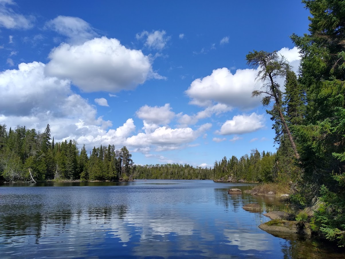
After the light rain stopped mid-morning, the day was absolutely beautiful and the only people I saw were a pair that I had seen on the way into Frost lake. They said that they had spent an extra day fishing there and had done pretty well. One of them (or perhaps it was a group from the previous day) lost a naglene bottle on a portage and I picked it up. Before the trip was over, I would eventually add half of a broken ugly stick fishing rod, a couple of rusted lighters and an entire stuff sack full of garbage (that some lazy… let’s say “idiot”...) didn’t feel like carrying to my pack while only losing a lighter of my own in the process.

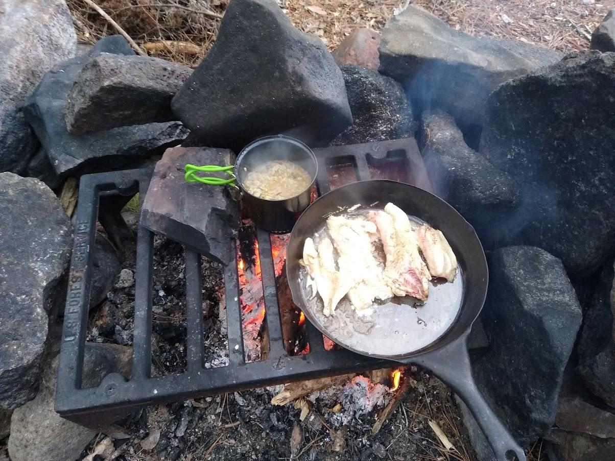
The bottle was a boon for fish suppers as it solved the problem of how to easily transport the filets. I carried it empty until I caught fish and, once cleaned, the filets were stuffed through the large opening of the bottle and the bottle was filled with fresh lake water. I would change the water periodically if it was a while before camping then simply rinse the bottle after supper.

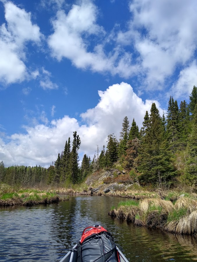
The Frost river was a slow meandering body of water that was often only as wide as 20-25 feet and wouldn't be deep enough to paddle if not for the proliferation of beaver dams. It was reminiscent of the lazy river at any water based amusement park I’d ever been to except that the scenery was far more beautiful and other people were non-existent.

SBYoNmJMpoMlhRoZAoSZt9D0DGUBcbAboPlLVuEgsIhZ8qYdnzA6sbAnqTh2oCNSrbpGmUDXhIadLIOeofhw8ZKlnKa01BVujSfFGd_aOgaIahYqW6Qboc7i5TR9wkfo-CKo5p-L


There were fewer portages than beaver dams on this day and it seemed that the preferred method of navigating a dam was to get up a decent head of steam and plow right over it. Almost all of the dams were fairly small and the drop in elevation was rarely more than a foot or two. I can only remember one place that was high enough to dissuade me from sliding over and, in that case, I stood on the dam and lifted the canoe over instead of portaging around.

While I suspect that the beavers may not view sliding over the dams in the same manner that I do, I can certainly say that it was a fun afternoon to paddle, ram & slide my way down such a gorgeous and pristine area of the forest.

AbfCYfChaW_d7efJRnFTofsDaiadZqZu0lvqQUYb4q3iuRMfITqe9F3o3lOFyX_EZ2Jqddk3pPVgb_9CgX-xN2nfmMoqTXFscxD7ThvKGy5SwdHG8cJCHBCpcQWi5QgfNxmOdVjT


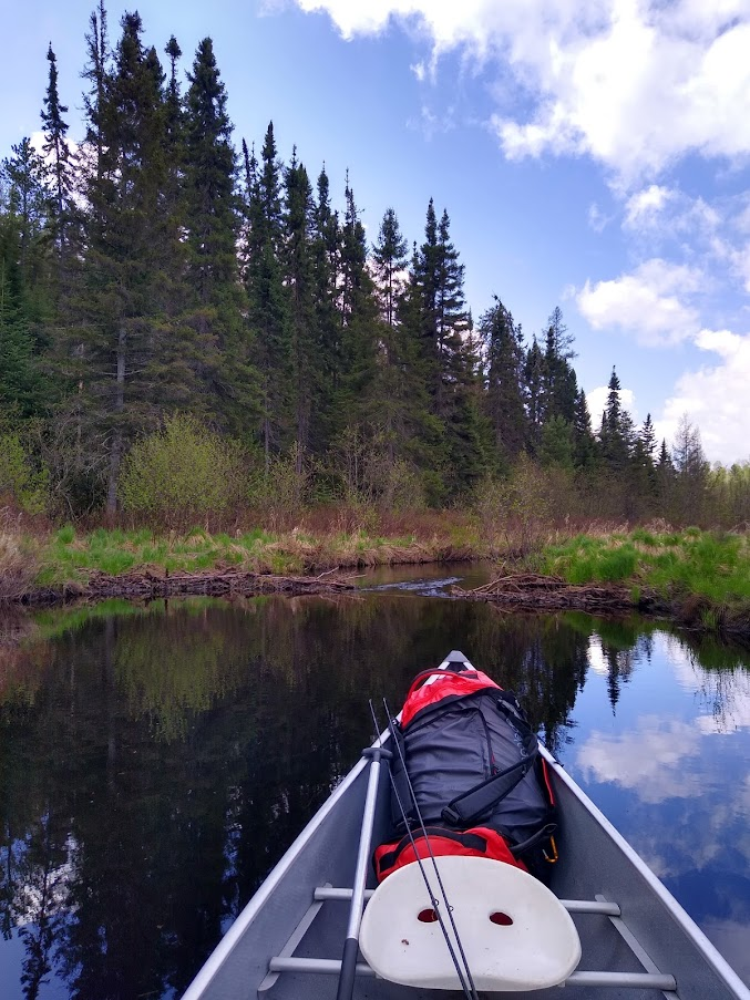
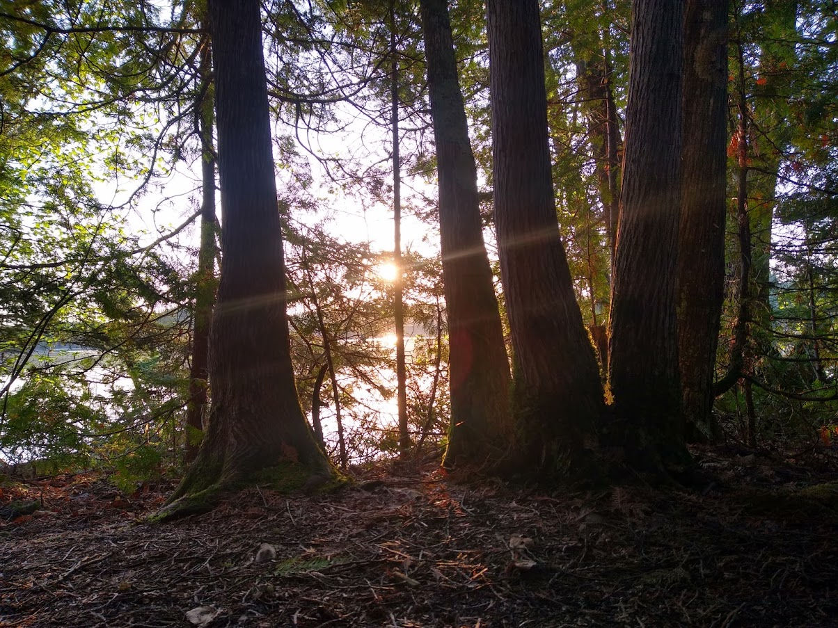
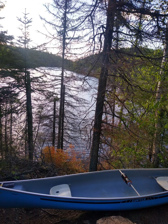
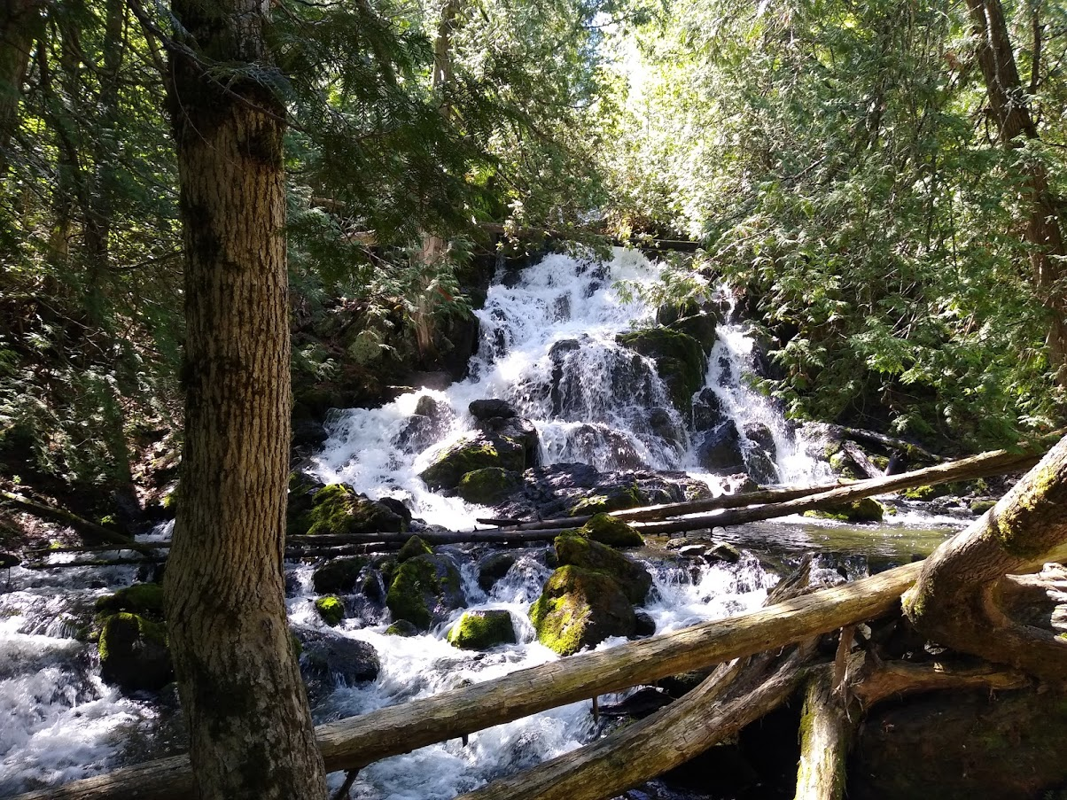
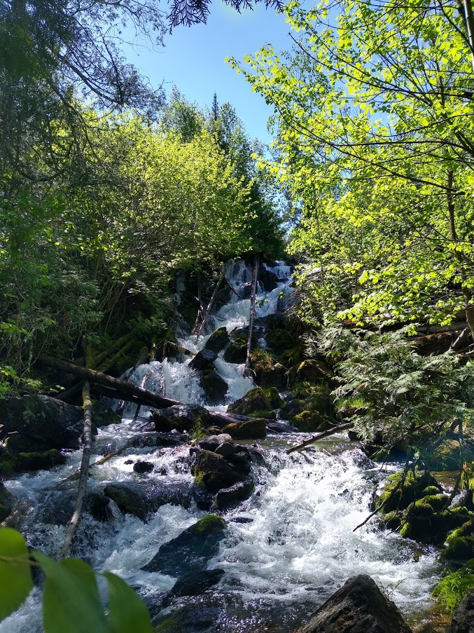
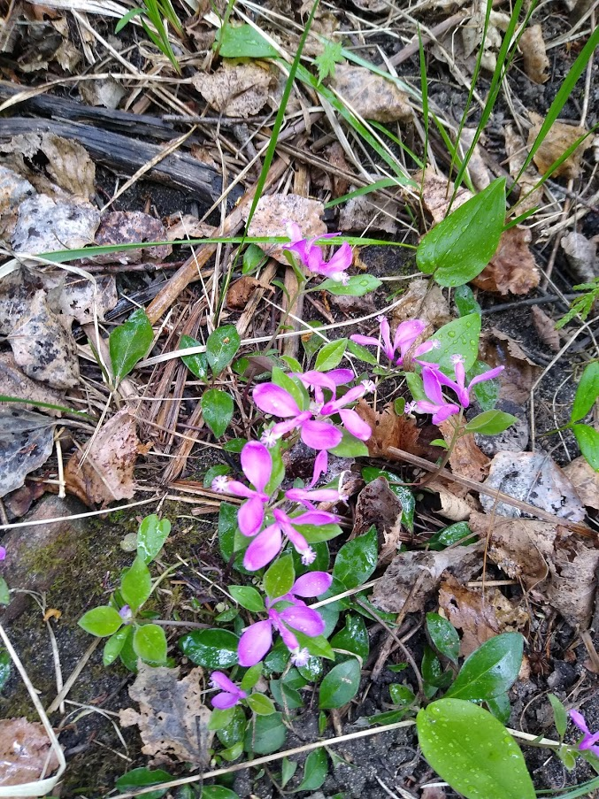
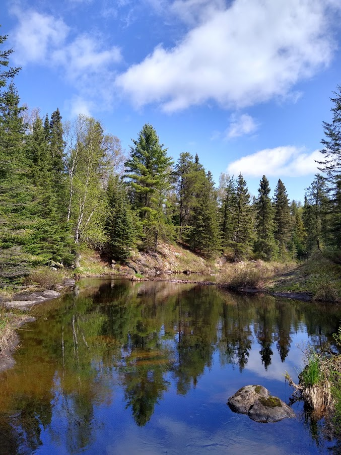
In fact, it was so pretty that I had a hard time selecting photos for this report and I’ll include an extra here if you’ll pardon the interruption of the narrative

YYt4SFocWy5_8SBAEmFz4fAh5zVar5ArHUvRDBf7bAl80_OL6upDXdQF5WPD3KTZ5WASyur8Y9AOEbRzjWKUTg_AuI_VKrOwGqnSLCMkvOe9rJH5HNpmho6O3poYIN101ge4-xuK


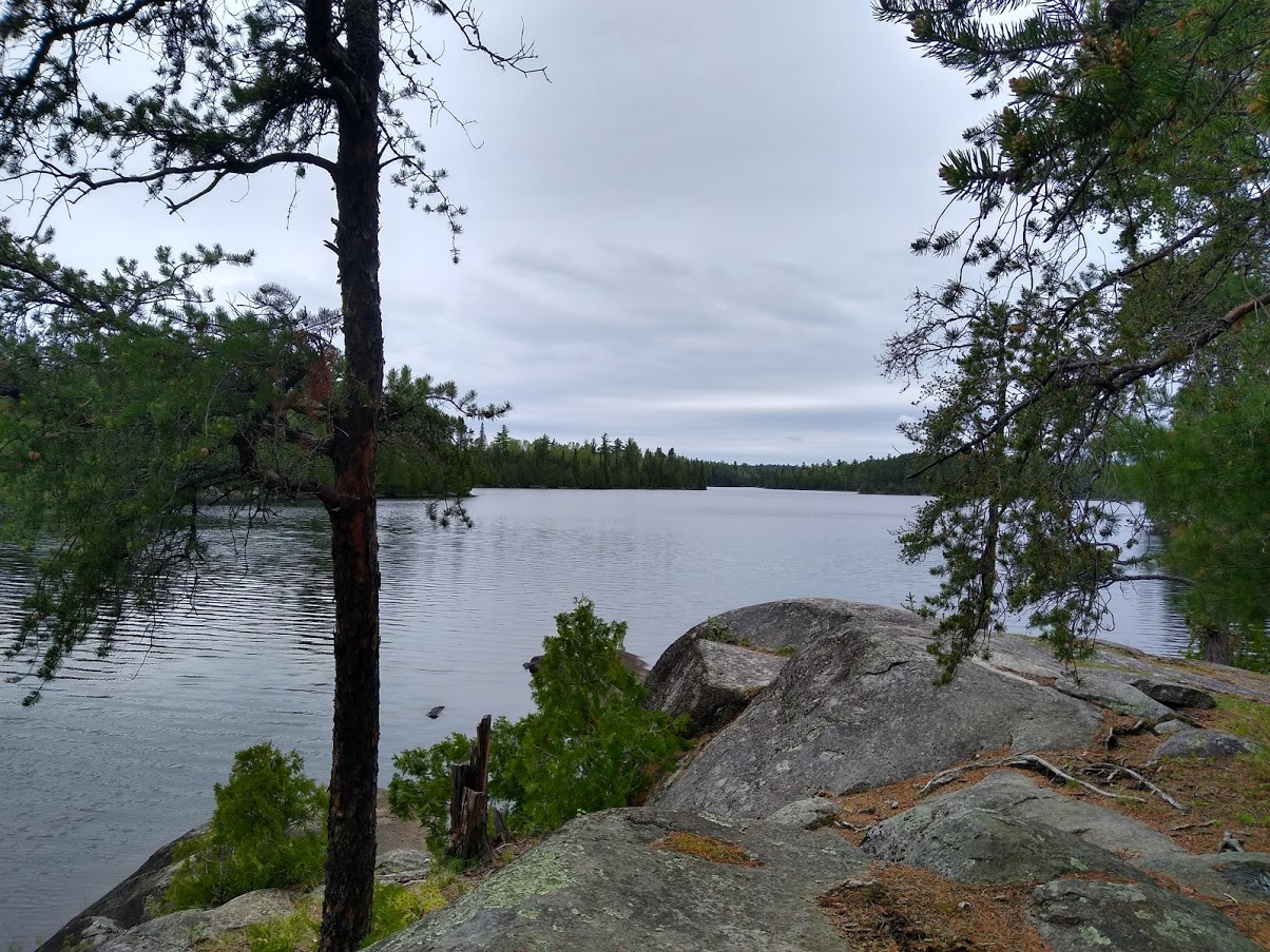
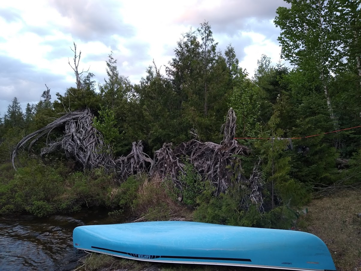
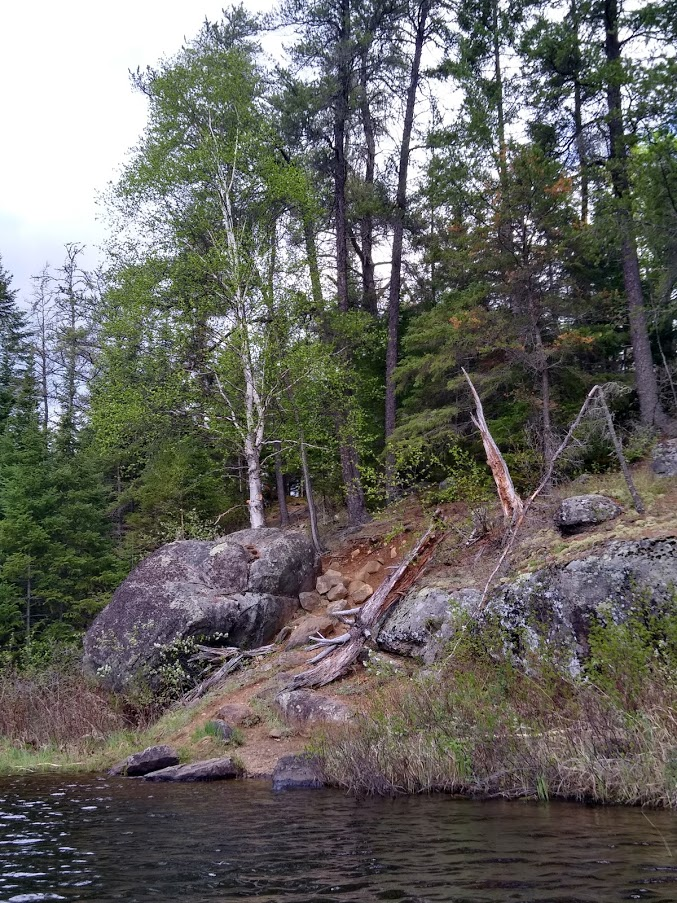
I checked out the campsite (#2226 on PP) at Whipped lake on the way past and it appears to be open (has a fire grate and thunderbox… what more could someone want, right?) but the large widow makers that were overhanging every nice tent pad would have me sleeping in the canoe.

PHKYnWZwj7PobWIuDXyzHS6vHPtqVX5aFf-srssL5ZVyXmBj6EQq7qwDTMI4IbMEbToZBzfOFtyly6EwMICYBMDYE7lSYcQQcwBTQEXhyEezD2RTNHJ8jop5PWsn9ZDyuSbraiG8


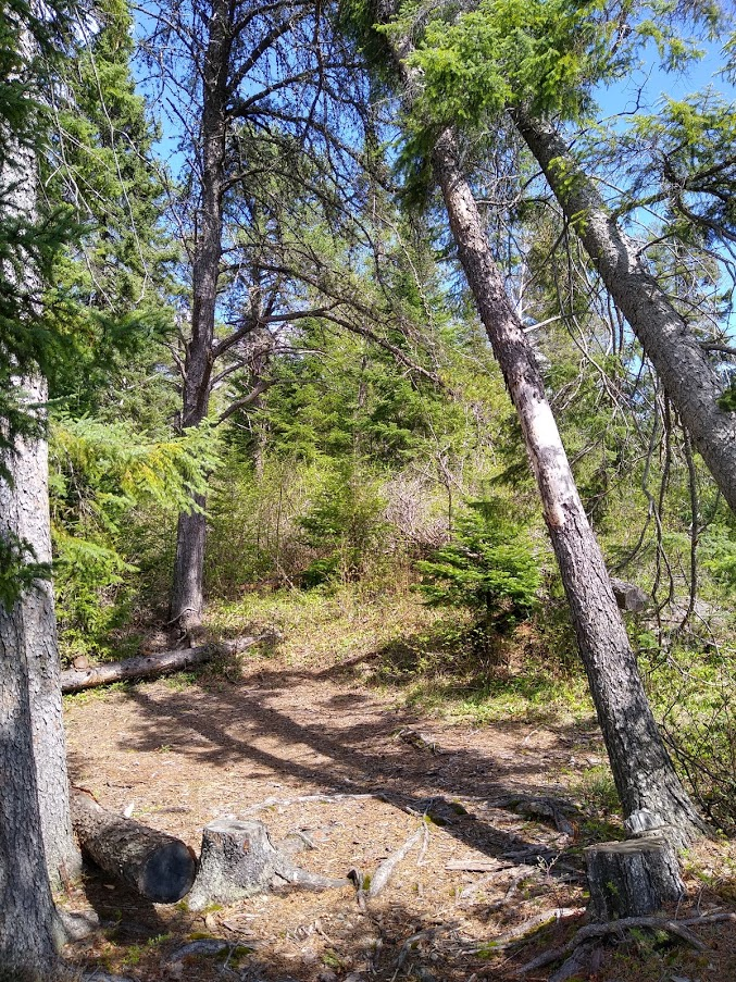
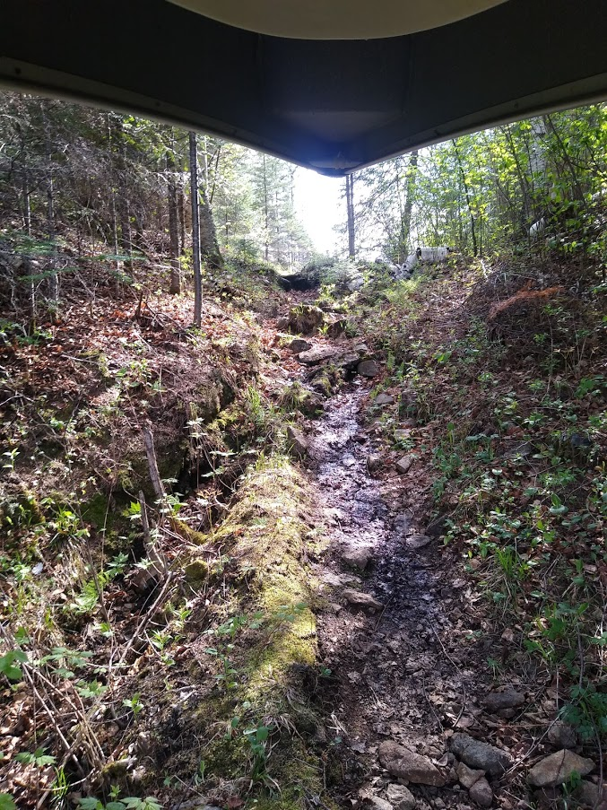
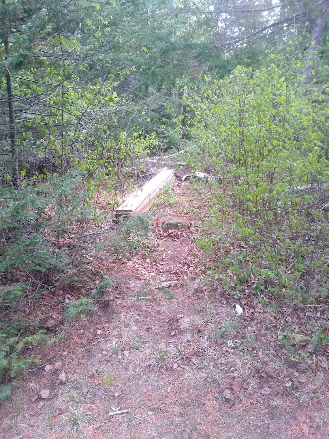
Shortly after leaving that campsite I learned that short portages did not always mean easy portages… Honestly, the carry from Afton to Fente, although listed as only 25 rods, was probably the most difficult portage of the trip. It started out going up an extremely steep, 2 part, climb that I would guess to be 50 or 60 feet up (total) and then an even more treacherous descent which, I would think, would be nearly impossible if it were raining and the rocks were slippery. (I read later that it is sometimes possible to line through the rapids but this didn’t occur to me at the time)

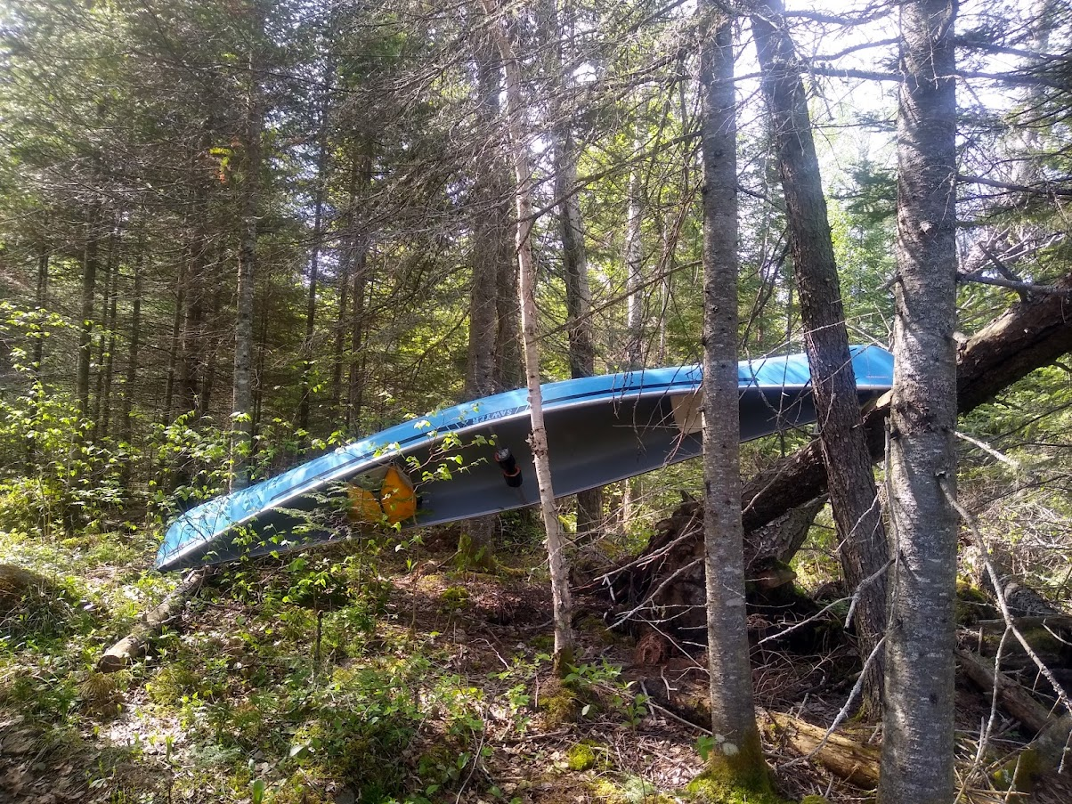
I will say that there was a lot of paint on the rocks where people had either dropped canoes or simply slid them down the grade. I, trying to keep as much paint on the canoe as possible, was extremely careful on this portage and still managed to fall on my butt about ½ way down. With the canoe landing on top of me, however, no light blue paint was added to this particular location.

M3y_SOT1N_EeYr7Kc1LGg0E0mVX1UpKR0H54sPODUjnwmc2wAO22hO7f9HL2iSKl6tgrdenM_14D4hHilEPlD4CcnM9nGS6lSqlE8WVxWOhV8qS1wL_eYfrP5wuznlpxNidCQDMJ

Up. (destination is the opening just above the top right corner of the large rock)

UX_yvYTi4mXp1Xz8IrIDn1PmVlPHP6etJaHLdRbDbhFcJxogoq-m8A3VZWUnLIrt8ITF93gn_nXBCcwpogdk4xKXO6U7T3xvFHEwsa4g2viJUb_RyogbIzcu-Xn5mQC8AYEiTno8

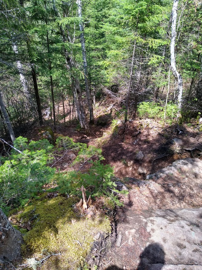
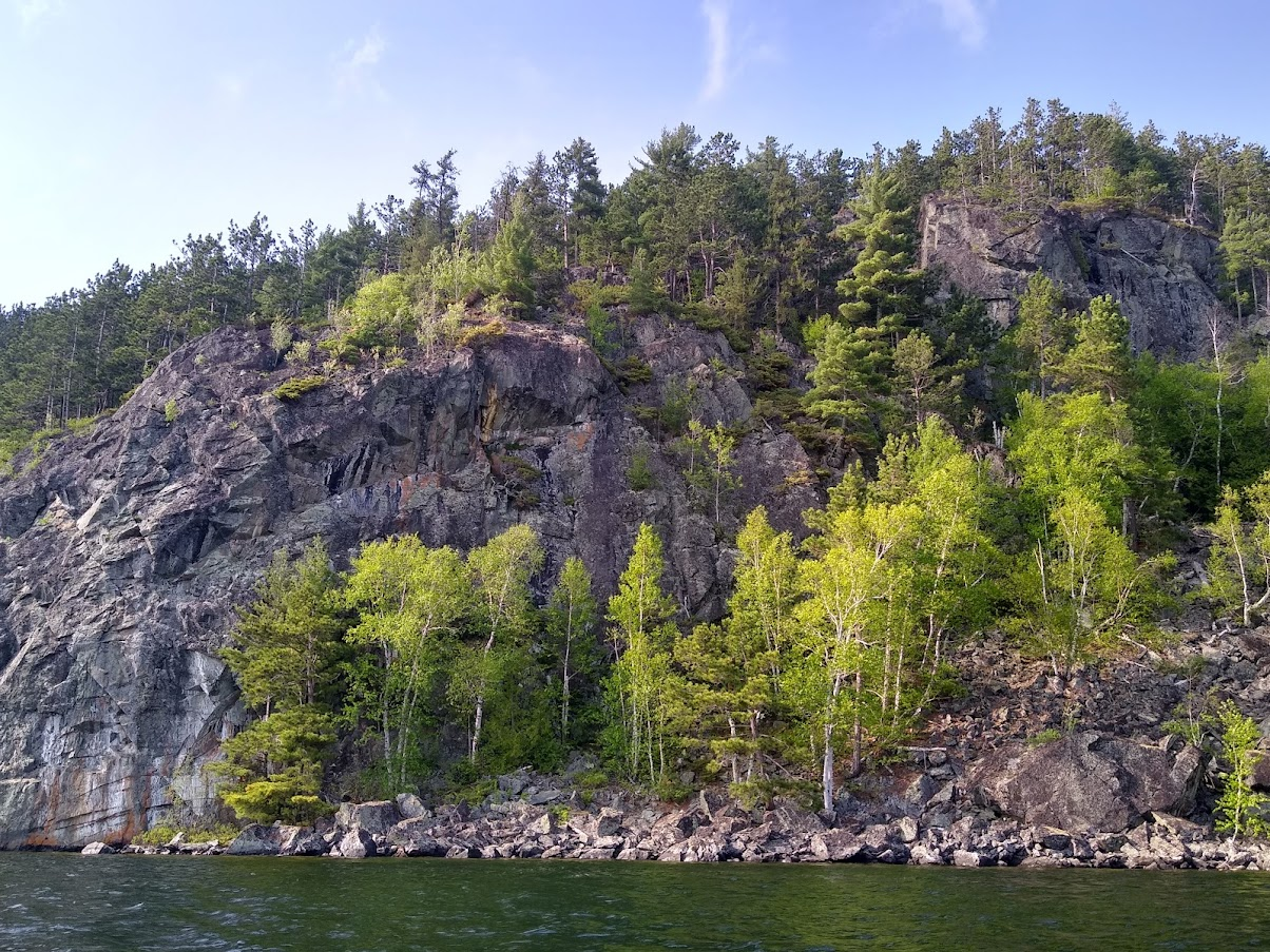
And over. (pictures just do not do this one justice)

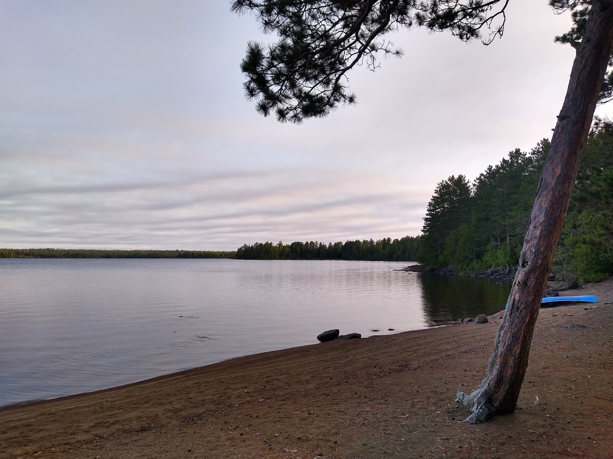
The remainder of the day was uneventful but remarkably beautiful. The portage out of Afton, however, had taken a toll and I was thankful for the first open site on Mora. (#527 on PP and a huge site that would be great for a larger group). I hung out a clothesline, rinsed the clothes I was wearing and hung them in hopes that I might have dry clothes in the morning.

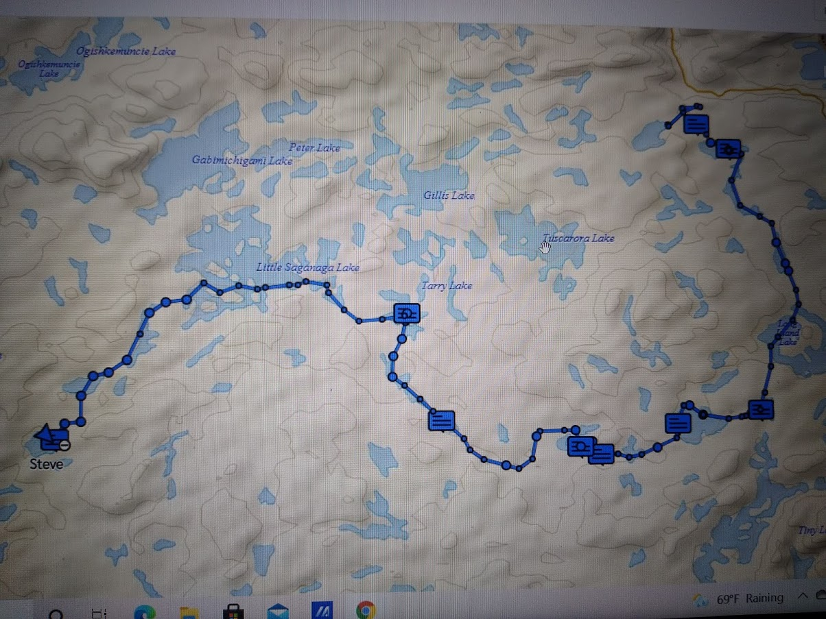
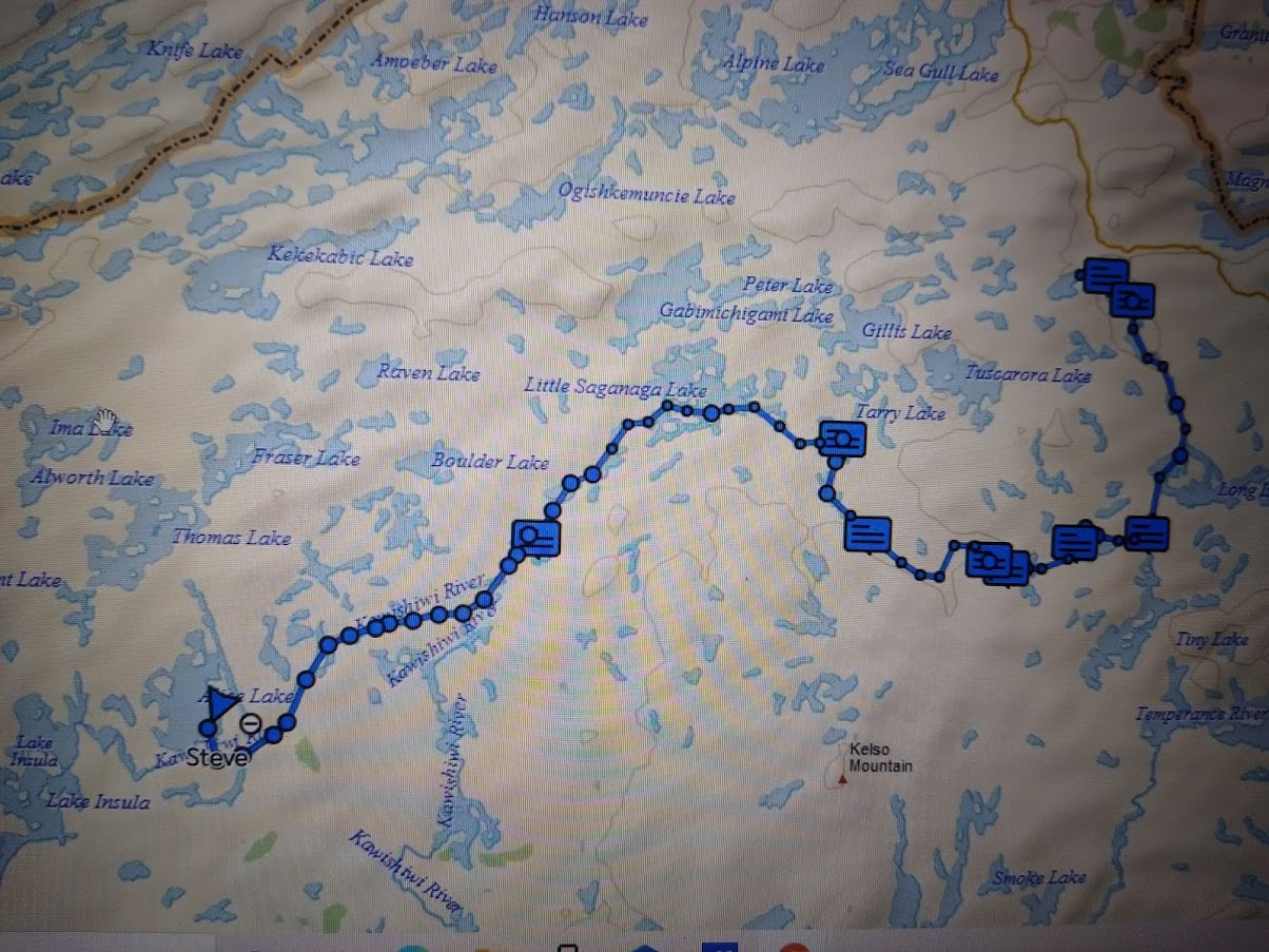
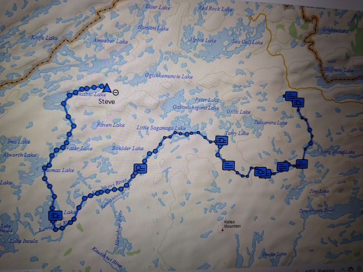
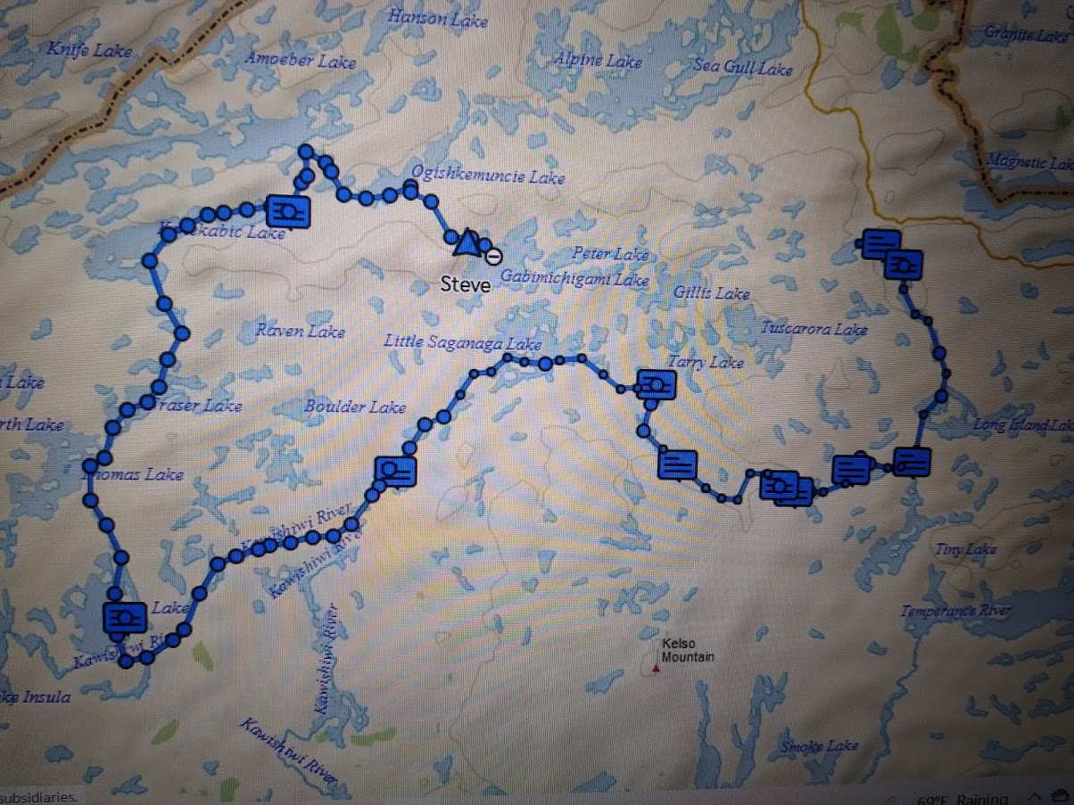
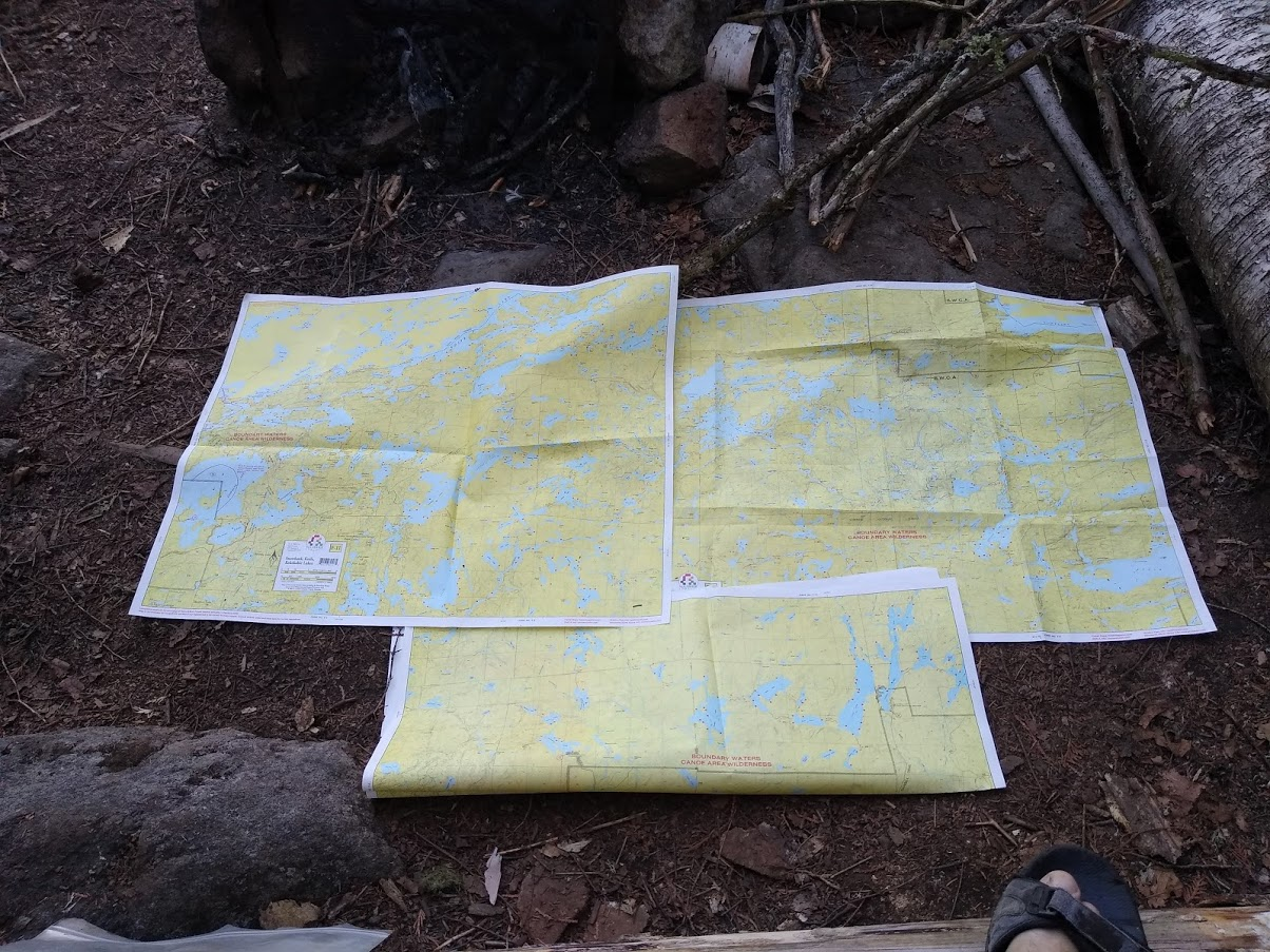
I think it was around this point that I scrapped the idea of bailing early on my planned route although I did study the maps closely that night to see if I could minimize the lengths of the portages.

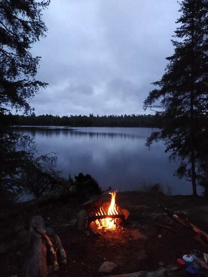
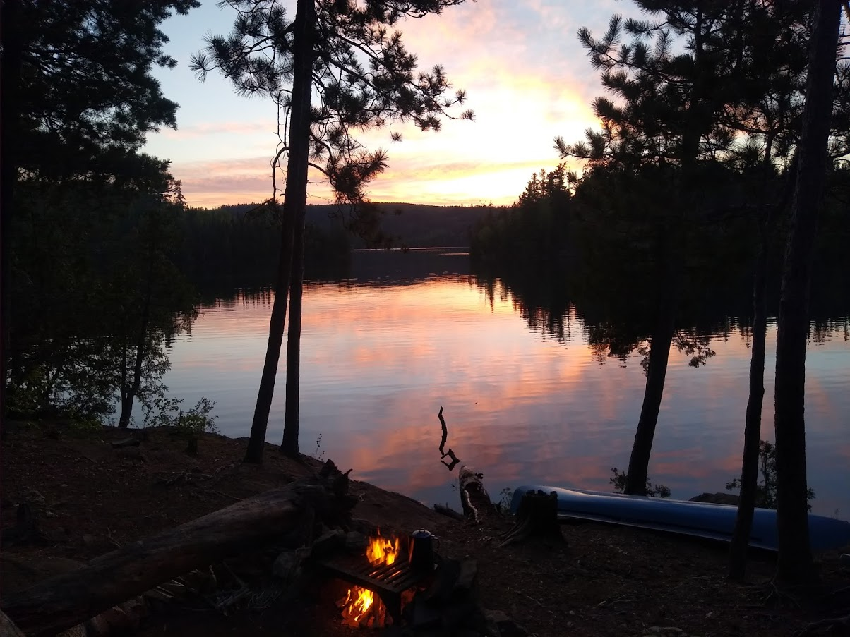
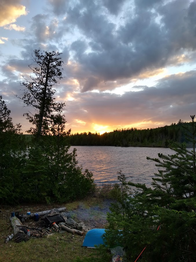
The weather was perfect that night and I couldn’t ask for more. The “I’m OK” message went out at 8:15 and I was out not long afterward.

8-JThAiVjTkyAU8t1WtpvSnIlZgJpiju7QObWGMoO7zWUw415GN2ynHFYIPfL-0bd1stULeMCS1DP2DA63F0ZsT-HKKqeTztCGSEKu2VwI5Td4hXDgg2VIVHXirJx_j9aj-2tPMb

U4qhmpgI0uWpFiKaumrK6VUxNymaQq3UiZR4iXnJo7ooIGn1g3idFUR5J07DLwi_-y2ZyV2oVRjxzI9qOQ5GXQGWuF-IgnQ9Y7Djl260O2IlkVKnJiJ1OxGhMgQ1Nrz7557u-GRd

fTUe-IV0d2-XPcfNPJYuA7jrjQauGFCWds0Sk-IdiTfmlMT0pSFavknhQZNZ-AugIw7xaSIDDSN-SfQ-CMjvZnlSpf0s6d9pxCIx59K29lRsRfSs5omaf82CppyE9IlPRE8GED0f
 
Day 5
2Y8_IZivD8QYzERZEJ1QqOW0kDZueiNYbJUKh7WF08JzCKYbEq-C-FKj7InHn5Bn84qHxVZ6WeuaynaJLs_VRj8i2XxUYkxKlrAddpiCf7-mX5jf-xw3_U5Eo9hi7VlD8isin6jV


I was awake at dawn and the day promised to pick up right where the previous day had left off with spectacular weather. I decided to follow through with the original route and strike out in the direction of Fishdance lake.

I portaged into Little Saganaga which is by far the largest lake I’d been on this trip and I can easily see how someone might lose their bearings with all of the islands. I was having some difficulty myself as every time I looked down at the map, the wind would take over boat control and I would have to fight it back to the desired direction. I wound up paddling like crazy to the lee of an island or behind a point, checking my heading, spotting the next location to be targeted and paddling like crazy again.

I checked out a nice campsite (#531 on PP) at lunchtime just to take a break from paddling and to stretch my legs, then headed toward Elton via the short ports & small ponds route. This is almost certainly not the typical route as the portages did not seem to have as much wear and, on the last portage into Elton, I picked up 14 ticks. (I had stopped hosing myself with deet and this was one of the few places in the BW that I found any of these repulsive vermin.) I picked them off my pants legs & threw them in the water as fish food. Hopefully that act reduces the population somewhat for subsequent years (but I’m doubtful).

lbx-6_BKtThZ8dB0lihw4qzD5JZaMuLO4v8NK0IoCnlV4iCubN_DaraEDOFCjTiQBCGFTDN5ggLb3zs0vJAKzPDbnUsFOWRfObt3oKW_nzf2Q4O1mvyrDmRnKbJx3hu-3lg3HPai

The wind started to pick up on Elton but I pressed on to Makwa where it turned into a real nightmare with the wind seemingly determined to drive me into the bank. I paddled like heck, sneaking up the bank to the campsite (#983… looked OK and seemed not overused) when the wind died down quite a bit so I struck out for the portage to Panhandle. Predictably, the lull did not last long enough to make the crossing but there was an island to hide behind around the ½ way point and I rested while watching a loon bob along in the wind as if it were anchored there. As is often the case, I suspect that there was far more going on beneath the surface than what was visible. (Doug D: sorry if I encroach...)

Panhandle lake was next and presented a new twist. I found what appeared to be the portage easily but I was a bit surprised by how rough it was, including a wet foot crossing of a stream. It was obviously not a game trail but neither was it typical of the portage trails that I’d gotten used to.

Upon arrival at Pan lake, I saw another trail leading away from the landing to my right. I checked the map, found no other lakes in that direction so I decided to investigate. It turned out that this trail was the actual portage and was in far better shape but there was no way to walk the shoreline to get back to my canoe.

Back down the trail to Pan, I picked up a paddle and took the bushwhack trail back to the canoe, then paddled to the North end of the beaver dam and took the better (and actual) portage trail to the landing at Pan lake.

By this time, the sky was ominous, the wind had really gotten serious and Pan had been whipped into whitecaps. I debated setting up the tarp on the landing instead of trying to go further. Instead, I decided to sneak along the shoreline to the 1st campsite (#1047). If it was empty, it would be home for the night. If not, I would allow the wind to push me back to the landing and I would sit it out there until I could safely cross Pan.

I made it to the campsite and found it unoccupied just as the skies opened up into a really impressive downpour. Thoroughly soaked even before I could get the rain gear from my pack, I set up camp only to have the rain stop around the time that I finished.

I gathered wood, set up a clothesline under the tarp, caught a few rock bass and called it a day. I had only seen 2 other people and they had been several hundred yards away and headed in the other direction.

The tree configuration wasn’t ideal for a tarp and there was a slight slope. As I drifted off, I remember wondering if the tarp was oriented correctly to remain dry and if the ground was level enough to keep from sliding off of the groundsheet...
cgWAFaF9BHEiwlYkgwflOUbmEr_sPM_O_RdCDxhWxrUD6r91TJoZN6lAV3oZZ_7t410GRdsR7HIFrnVnz-xPZkg8SOsz5wVo30lPSveYl9yksI6Akg-isa8Mx8dT7Bk9_hfkvnpr

bpOE7mVFqcFmORFXN8Jl6ykHLAH0legJKWSM4YXi_w-hxAtrvGs9fHgxKzY3HFNQKUTAHO6RcFSuCDC7vF6NDdBQKCjhfgISOuEvyIQtkNdWr993Y1JUdbSV_o2_1fqg-JD1sZDU

4S50EFe_ctEce7et0gJO7T0NtEHMYONonAhxAMd-4FQfRYl2Z3Wc0AjB6ZXQXf-PQdcXfB07DxT91g_TjcMYeebRSb9eby0OWsxQLQfp7MpSguBf293GYL8c7KsCIlGKOmr9PXkL

EbG0MAn_VHkFVJnr4zRNtoqvSgpO8_ClPJ5rnn06tilKIKtPX2yQs6n3kFQggDh9djr7xf_NlYs5kZBc6Tt2Q-hxhZpVP6vNRcFA7efhJagbba_ptKoyRj5xiSXbuJn9lpkHy-mA
 
Day 6

As one might expect, both concerns of the previous night turned out to be valid. The wind shifted during the night and I was awakened by the rain blowing in and the combination of nylon ground cloth plus plastic, inflatable sleeping pad and slippery sleeping bag had me sliding around a good bit. For the first time there (even when worried about wolves), I can say that I did not sleep well.

After breaking camp, I took a little time to modify the pool noodle “carry yoke” so as to keep it further from the back of my neck. I cut some noodle off of each end & taped it near the center so there was a double layer except for about 6 inches in the center of the thwart. I was reasonably pleased with the result as it was far more comfortable but I ran short of duct tape and had to hope that it was secure enough to hold.

QU-zEX1COjKpgz4YcQflaYH6CkVgYD3SZzaMinAjawRYz74GF2UodnfDPlTKBDcVw2IQ_WWG7nRzP-s_e7T2D27HzbL5XksA-fPt4XkiTwE-1uxK0MQqjW-AKtC1RoUD9WlamSRa


The morning was cold, dreary and breezy and I felt sure I’d be warmer if moving, so I packed up and headed for Fishdance to see if I could find some pictographs. I’d heard they were faded and hard to see so I decided that only a cursory inspection was in order and I would try to get as close to the 240 rod portage into Thomas as I could before stopping for the night.

The day ended as it started (just plain COLD!) but in the middle was some really good stuff.

For most of the way down the Kawishiwi river, I seemed to have the place all to myself and it was both beautiful and peaceful.

IFzt0X7eVHAg0188kh9pq1JFE3Fwf2MIdOUt5lNn0zW3iKff4wwpJXzWkenHRiZj9kbZLFe_Q2QBo-YfP8681bzzK-WNQPjk9jdJaI7x-B-6CXA-Z-a2VUaS_d4zuRZqwv0LL2bd

Nice island site (#1969) on the Kawishiwi river

I saw a total of 3 people along the river and arrived at Fishdance around 4pm (I’ve noticed, looking at my Mapshare that I didn’t get out of camp very early in the mornings, which was fine as I had no schedule to keep, but it seemed like I was on the water earlier than that). I looked a bit for the pictographs but, without knowing what I was looking for or which cliff they were on, I didn’t have much luck and wound up taking a few pictures of mineral stains instead. (my Archaeologist daughter is so proud).

Note: I have since learned that the locations of the paintings are clearly marked on the Fisher maps although, in my defense, Fishdance Lake is split onto 4 different maps. (hey, a poor excuse is better than none, right?) ANYHOW….

-zWp1SLu-sBmFxIvvbqxhkZB34aRfhG-NQbEldhIm29Vj-4TUdkmXLadBBNGc6sdVdtmpyenSH-aRrgVGJZXeYfP8nkwyD06A0wysGkJRu8OdhbYejo2LBQNNxu82fRe8qB8r5Ik


NOT pictographs... (who knew, right?)

Blissfully unaware of my photographic failure, I headed off to Alice and met a rather large group at the portage… native Minnesotans by the sound of them. They were base camped on Alice and portaged into the surrounding lakes to fish and said they were headed into Thomas the next day also (I’m unsure why they would want to tackle a 240 rod potage twice in the same day but a couple of the younger men looked pretty strong and to each his own I suppose…)

They were very friendly, remarked (as many did) about the old Sawyer I was carrying and I mentioned modifying the pool noodle & running out of duct tape in the process. One of them immediately started digging in his pack and produced a small dollar store roll, told me to keep it and refused any offer of payment. It stabilized the pool noodle “yoke” quite well and, if by some chance one of them should read this, I offer one more sincere “thank you” for the kindness.

I ported out of Fishdance, caught a couple of nice smallmouth in the riffles below, cleaned them, gathered a few armloads of firewood and then realized that I had one more portage before Alice. I had no intention of portaging firewood so it got stacked neatly near the end of the portage for someone with more energy.

Alice was big water as well but the wind was moderate as were the waves and I found a nice, though heavily used, site (#1167) about 1/2 way to the Thomas portage. It was blessed with a huge sand beach and the sand extends well up into the camp so that rocks in the sleeping area was a non-issue and one could place about as many tents here as desired (note: group size in the BW is limited to a max of 9 people and 4 watercraft).

BUrw85lV0-gs6L8QU89v5HLaNKU-kDQnNogFR7yofeUBJQbBe76iB96hZeGwEEkSvrrPpFMnoLdTz_5A6lQUda7nWKXVJolAF4ITewHXfwUATdfhRjsQ0WE99O_J3j1vvdwSgTdp


There was not a stick of wood to be found in the woods immediately adjacent to the campsite but, as with everywhere that I traveled on this trip, it was plentiful along the shores within a short paddling distance and there was absolutely no need for splitting tools as I didn’t have to cut anything larger than my wrist the entire trip. (potential pack weight reduction on a return trip: leave the hatchet at home).

I unloaded my gear on the beach, paddled a few hundred yards north to find a nice landing (also sand), went into the woods far enough to be out of sight from the water (freshly sawn deadfalls are remarkably visible), and the canoe was soon filled with branches and small, dead cedars. I set up camp, fried fish and kept the fire going awhile just for the warmth and enjoyment.

The InReach can receive messages as well as send them and it was here that my oldest daughter messaged that one of the cats was not doing well. I was, at this point, about as far from the truck as I would get on this trip so I instructed her to not hesitate to contact our veterinarian (a personal friend as well as a horse shoeing customer) and I would settle up with her upon my return.

I turned in with the feeling that I’d best not dawdle regardless of how wonderfully warm the sleeping bag felt in the chill of the morning.

rnkhU3ty1p52vuyT95IRCWqFFPoRQeR7ntcZ58V-pkGh5olzBg34ow1yrjQIkeOdXA_BX55sSS-OBu787SHY-u0BIIG8Ic8wfVgSJCd66RSCupMdJaM7oQ3RlTcYHGjtKc3wN-K5
_1kidPDOLmZ5rONaaq1Ty3-YgF1qACxduvOtvBnXctdR-lUuYcetyOTmLsky2Ir38JCZdU4zJTD9TIQrJPQJa256eqmM-Yh-cIXyzYXlMkatM0LoyeSKyALwjnJNL-rwvteqNlZz


3G2k6yRqTBlsVP8r1vaXslwIOO6CV5YiTIoxf_CgbvVQInjXPZshy36F3AZqlWIa87cCGQ23VGRi83nlPlNMqXb1nk9mKJCQh8vPYQwnEeXmPdXI4GVBEcUnNhYYVtlmVaTTuqZ5
 
Very aggressive route for your first canoe trip! Sounds like you handled it better than most, especially without a tent. I'm not sure about that portage 'yoke' though. Interested to see where you went from here, you have one of the most remote areas of the BWCA between you and your truck. Thanks for the report.
 
I was going to say that it was a very ambitious trip for your reintroduction to tripping but Zac beat me to it. I'm sure you will be better prepared for your next one, but I don't think I'd leave the hatchet at home.
 
. I looked a bit for the pictographs but, without knowing what I was looking for or which cliff they were on, I didn’t have much luck and wound up taking a few pictures of mineral stains instead. (my Archaeologist daughter is so proud).
Gamma,

i wasn’t there, so I can’t be sure about what you mean by mineral stains. Are you referring to the red markings? They could very well be lichens, which often form on bird droppings below sheltered, rocky outcrops. We have often seen these below raptor nests or perches on our canoe trips.

Here is a Wikipedia link.

 
Zac & Al, It was suggested early in the planning to plan an aggressive route and make in game decisions as needed. I was figuring about 100 miles and that's only 10 miles a day... That's nothing on a backpacking trail but I would have more gear and, of course, a canoe.

I've always been a fan of the "Go big or go home" philosophy and I did leave "go home" as an option at Mora... (we'll get back to this in a couple of days)
 
Last edited:
Michael, The colors on the rocks could very well be lichens. I'm afraid I'm almost as good at Botany as I am at Archaeology.

Glad you're enjoying the narrative. I'm trying to get somewhere close to the works that you have posted here (they're still the gold standard IMO)
 
Some common lichen is easily mistaken for the red ochre of rock paintings. See for yourself.
https://inaturalist.ca/observations...-fungi-of-ontario&place_id=any&verifiable=any
Another challenge is the changed water levels due to dams built in the last century to facilitate floating out harvested timber. Some pictographs may be "drowned" as a result.
Those are some nice looking campsites Gamma. They could quickly become favourites were I to trip there.
 
This is a great TR ! Nicely worded, and interesting content !

Funny the tricks the Mind plays on one when packing for a trip. Age doesn't help !

The 94, and no rust ? Don't they have Salt in Pennsylvania ! You can't beat an Old Truck to take an adventure with !
And Blue is my favorite color too !


Thanks ! Patiently waiting for more !

Jim
 
Day 7

The day dawned sunny & beautiful and by 6:30 it was already warmer than it had been the day before. It was to be a day of big portages and big water and I‘d already found out that I was not a fan of either.

It turned out that I was not nearly ½ way to the portage when I camped the previous night as there was a very long, and very picturesque chute to paddle through once I found the opening to get behind the barrier islands.

NjdS1djAK2gT24VC4bq_GA5y1ymVch_Em66hFvbZviKPUfGzKSYh64weIgJ2pH11BNTH_AiR4sPbQ9zsy1qbAOPJxYMJZCQCWBAO2yPrMopBvXeSiPn_DfgKITk4k51FWuD5YW2q


The portage out of Alice was brutal but probably not as bad as I had anticipated. At 240 rods (¾ of a mile), I had been dreading this portage since the drive up. The carry itself would not have been too bad except that beavers had gotten busy on the Northern end and the trail was flooded about knee deep. In hindsight, I suppose I could have dropped the pack at the beginning of the flooded portion, brought the canoe up and paddled across but that (unfortunately) did not occur to me until the 2nd trip when I had the canoe. (fun fact: no shoe is waterproof when the water is higher than the shoe)

fkK4UU5yaNObk62CSDOWfNhxkylCb1skiLh4zH2DRUOYEDckSbw1tHg6OEFBr-l7kBmvRe6Zv7RxdTD5vrp-x-7INeEuByyAu61nF8FNOommy5gw5khSxq9W8-3CaOT0ROANNFIJ


At the Thomas end, I found a pile of boards so I suspect that the Forest Service is planning a boardwalk through the flooded portion but I’m quite sure that transporting enough boards to a location that is that far from any of the entry points is a monumental task. (But I will admit to wondering if they’d hire me to help)

Vg9AaK9Xs1iXwXJ-mMGVlvNTJbHeiayuXB7RwC4YNlwsT9ovDEo0_Y0OzaRZdOxgmxOea8FuTetfQDTCmZFkFFwVKFmUXLgQqhbT0AlPXEGZK77IMuxj4Jl19R8BWZZzLCJ-zlaX
tTREE9-oQVJWcw7LedQVvA3UcHRAeWe4ehPD3V_m2HDCEK3K9vUwvwttTYjMeIYVHRMP0tsNmB5HYdAvWWpgbZmj8Xwji4M-_slL_LjcwkFQFyZGA912ci6Mm3LzRTwu4f1yGe0q


When planning this trip, I was particularly concerned about carrying a canoe through the woods for long distances and I was relieved when I read that the Forest Service provided rests along some of the longer portages so that one would not have to lift the canoe again. I had also read that these rests were not being maintained lately so I wasn’t really sure what to expect. As it turned out, I never did see any evidence of rests, either in disrepair or otherwise but I did manage to find enough places where one could catch a breather without setting the canoe down.

1o_v4jqsyi1WpbUUFJD2LqalvbkzpB6pwy5mU0wrT0bW6gz-EAT3wDR0iTMxJThP_M9cxSVyc_w_Ul-rWVZhUltg-geaALj2Cj7WeWeW9AMNbEueppHv0LoPHDhvdW2_O3Qmxa7b


Thomas lake was big, beautiful and calm that morning with a number of islands to paddle around and enough visual distractions that, since I was busy gawking at scenery and not paying close enough attention to the compass and map, I had a bit of trouble locating the narrows from Thomas to Fraser (pretty cool to paddle through instead of portage)

oLHmF4iWhw2eIMaNDN3tPnRlgm_nS_OmDqfKoSt7_SqF3voKlA_AHgq-MKDVYRmvY3xzgz89ACKzOV0aGtFKETtHYnNEMTL2ovrD9vQR1kMcCh8l3rhr1TPkmczvZ5l8jSKC1eSm


but, other than that, it was a fairly uneventful 2 hour paddle into a headwind that had me longing for the next carry.

People were more abundant that day as well. About ½ the sites I passed on Alice were occupied. I saw a few fishermen on Thomas & Fraser and met a couple of guys from Chicago on the portage out of Fraser who assured me that I’d have the wind at my back on Kekakabic. There was a large group base camped on the cliff site on Wisini (#1909) and I passed a group of four coming out of Kekakabic and headed for Fraser.

On the portage into Kekakabic, I crossed the North Country National Scenic Trail

Wi8F61luCd5tvVL-Plb9rUPGHVS9zOaBu_Jd4890EGNIyX_QTGMUN9F6SyZruAH0xtaqZfDs6hqMba0jYVOCQzBsvWc3FX2zzigaVo0iNHbipdhvT7tguGKBwHJEg2YjMomFHx0u

which runs on top of the Kekakabic trail here. This was cool for me as I do volunteer work with the Butler, PA chapter of the North Country Trail Association. Unlike the snowmobile trail, I did not mistake it for the portage and I continued straight across.

I started up Kekakabic lake with the wind at my back (nice change of pace) and all was good... Until it started raining... It wasn’t raining hard and the day was warm so I passed the scattering of campsites at the Southwest end and headed East in search of pictographs.

I’m not sure if I found the pictographs or just mineral stains (perhaps lichens?) on rocks but by mid-lake the wind had picked up to produce a pretty good chop, and had shifted so it was quartering from the rear. Suddenly, the boat was paddling like it was made of stone.

I spotted something on the North shore and paddled my stone boat across the lake (twice, quartering the wind both directions to avoid taking waves broadside) to get a few pictures, figuring my daughter could tell me if I got pictographs or just wasted a bunch of energy.

ecd3BcD9L0lyMi2nIOobuSH9GTcLmnIpRAQ20dNpGAfBlFP726yVBGpQ4yhPemf51ZCk1ZsmfbK-f3Pc8Vt9DV1loBzjAm7ZFcQ9Ony-y-dxP9bFwjQnfn7f4Lx6g9M1bmHIlFJb


Either way, the rain stopped during the double lake crossing and I found a nice campsite (#1426) tucked into a cove on the East end. Someone had gone to a ton of trouble to cut and split a mountain of firewood but it was early and someone else might not have the time or weather so I gathered what firewood I’d need from the shoreline and made one of the dehydrated meals for supper.

QM6QgzrTqowaa-EqmEhiY6mfXl1tFFsHZYjfg09LGtlCvPEv8iDueKnQCF0zDtxdd_LOAulMDW7gH0lUX0fhK0A7aZ8DVaZ-9XV0RpZ-HqinpLdf3S-wz11rbAm0kY0ZSONBXHHe


According to my journal, I thought, if I pushed hard, I could make Round lake the following day but, given the long drive, the better plan was to get close, camp and leave the following day. It just didn’t work like that....

n_Ixlfam2Yy25G3wnVUvK4i1GkmwVpLJgxvyzNp68kNkFpD5oW551-5bhVkKBl7dYofzoL5MfojiMICfH4gCyLyfBOugvuNTActKncI1kl0qzg3wCIOBpEZFRsKilhCt3nnXnrrX
tjcnGnGyPbL_i7f8pU_3hnY_F5B39xh1a5EEm-Pw9wqGUSvRTKnVR7MhtcD7YzFh8-w8LnZECI5TJtJ9RbNZGp67z_W_X7L4EgBM52vSe3fzxKOkJySGlV-MS2sqxc9M0jE_hCp0
qtW5FO8M8EU0d7KFcB91XKz1JucfL8Y65J5NwE6wkQTdjbXM2gRGslN_4KT8V6TD8sLiBspN2XCe1WU0_HKOQL9FqKIynBN68JqkX2Sj3G7JuaS__KN_3GKSF5513fO96JVBgGeW
 
Day 8

The morning was cool and the routine continued comfortably: Dress, start the fire, drop the bear bag, start coffee, tear down the “tent”, check the fire periodically while packing, cook breakfast when coffee was ready and then linger a bit before lifting the canoe off of the bank and beginning the day.

Up to that point, the daily goals had been pretty loosely defined but now, as the trip was winding down, I decided that I’d loop North to see the falls by the Eddy lake portage (into the South arm of Knife lake) then drop South to Gabimichigami, through Peter to Gillis and try to end the day about a half day’s travel from Round lake & the truck.

g-bVh35gJwUj4f4qhGhSZL-_5uXvOTkKDBXKFVN1WvoA2ZGRf9We2NyGYpoY9q1JOUjjcAzqSQ8oRzxAo3m9mu-94Xp7GlxomFpAdAHezoTDY9n_YzogbpM3ED6ue75l8wXxfL0S


This turned out to be one of the most memorable days of the trip and I’ll apologize in advance for the length of today’s report. I saw quite a few more people than I had in previous days and four were quite memorable.

As so often happens when meeting at portages, one exchanges pleasantries and there are a few, seemingly obligatory questions: when/where did you come in?, where have you gone?, how much does that boat weigh?, where are you headed / how long do you plan to stay out?

Somewhere in the Kekakabic ponds, I met 2 guys on the same portage. The first, Mark, was barefoot and packing even more gear than I was although his boat weighed about half as much as mine. He said that he had come in in April, had left once to resupply and typically stayed out until circumstances forced him to return to civilization.

As one might expect, he was extremely knowledgeable of the area and said that he collects old maps of the BWCA as they show older, now unmaintained but often still usable, portages into some of the lesser traveled lakes and through some of the primitive management areas.

He mentioned 2 trails to overlooks: one starting from behind the ranger station on Kekakabic and one from the cliff campsite on Wisini, where you can see for miles around and I regretted not having this information when I paddled past both the previous day. I would have checked out the ranger station trail for sure. The other; probably not as there was a large group camped at the cliff site and, without a better idea of where the trail started, that might have been a bit intrusive.

He had some truly amazing pictures including a nice close-up of a bull moose in velvet and a picture of a storm where the colors were unbelievably vivid and the scene just looked surreal. He was a bit shocked at my “portage yoke” and told me that the pictographs on Fishdance were actually some of the most vivid while the ones on Kekakabic had fewer colors and had not weathered as well.

We chatted far too long as he showed me an edible plant that grows along the waterline of nearly every lake and makes a peppery, and delicious, seasoning for fish and he also offered some advice on the trip out to Round: He said that most people seemed to exit through Peter lake and I might find better campsites and less traffic by going through Virgin, West Fern and Powell.

As we were finishing our conversation, another solo paddler came down the portage. I failed to ask his name but we chatted about gear and canoes a bit. He was toting the smallest portage pack made by Cooke Custom Sewing, said he loved it but that he was after them a little to make one slightly smaller.

Like the barefoot fellow, he was carrying a boat in the 30 lb range and I mentioned that I’d been trying for the past 2 years to get everything in order to build a dedicated solo strip canoe. We talked over some options for a few minutes and he highly recommended the Freedom solo from Bear Mountain. While I acknowledge that he is likely biased (he said he helped design it), he made a strong enough case that I will be ordering plans as soon as I can find (or build) a heated shop.

The day also included one of the easiest portages of the trip…

RTE12CD5nI7ElIO1czAL3QRwtDCx2sylfUS7phJ9eiR6oIKOJQlipIZb_32VnaPel3OXrEtWNfVKZ17zVTsMLbEAFIA032CvYRPNj-zsNGVXhGgwu0kl_U_XgPiWUFoHY7YERPn0


And a few of the most picturesque waterfalls. The falls out of Eddy lake were fantastic and there was an amazing amount of water flowing over them

RACqFfOGDMLu8r7QeMETJFvpXUB8CyUKSwm_bFeRqkQkBEHRoS1gEhuL4n8gjPprlP_Z-TXqZnLrwOXltEa381uLnnM41MkiJ5DXrUOv95vsdiRbymoO31TWAsmWtpqmD5rN9tHo


there is a small side trail that one can take (almost a bushwhack) which offers a view of the middle of the falls too

lZnyNCdYMFP_fMJKE5Owge_pNZxnpKNmOIB6cvBNlhe9iiQKQRZWovk9z0kSWD5GfYU51XOxdMGchSSzSaADGb_bOASVlFE0EtNeBKw1t3hu3i5Sanqte3WeQGOIknuwjxdIhnGZ


After the falls, I turned South through Jenny lake and at the portage to Mueller I met Chris and Jack, a father and son tandem from Chicago. The trip was Jack’s 16th birthday present even though he was now 17 (he too had gotten the trip pushed back due to the whole covid thing) and, even though they were a couple days into the trip, his enthusiasm had not waned and he was obviously in his glory while Chris, being a bit less agile was, understandably, more subdued but seemed thrilled nonetheless to be able to share the trip with his son.

He noticed my InReach and said that he had rented one from his outfitter but he was a bit concerned that the battery seemed to be fading faster than he would have liked and he was down to 30% in just 2 days. He had a battery pack of suitable capacity but lacked the USB cord to link the two.

Among the extra items I had packed happened to be an extra USB cable that fit neither my cell phone nor my Garmin and, although Chris needed a bit of convincing in order to believe that it was, indeed, merely an extra that had somehow managed to be included in my pack, he tried it. His InReach was able to recharge and they headed North toward Eddy Falls and the South Arm of Knife.

From Mueller lake to Agamok I once again crossed the North Country Trail and I was sure to tuck the canoe out of the way of other travelers before I started my gear carry and likewise set my gear well out of anyone’s way at the Agamok end. This allowed me to hike just a bit on the NCT without feeling I was plugging up the portage and when I reached it again I headed East for about ¾ of a mile to see the steel bridge that I’d heard about and seen pictures of in the newsletters.

x_ihcJbhGNPCZklVIRhFA5AwoQ12DH2MJ1UM7bVVQnewqQOOsslpGmLPYGtZlWwpysk58tOc16t7r-_tnjDmBs3ca2816rDlGh_AsNSN9m7vQunWYmhEHP4aannG6v3lpF9J9xx7


From there it was off to Powell lake & a fish dinner… until the wind got going. Some of the strongest wind yet and it seemed to be coming from every direction but mostly from behind.

By the time I reached Gabimichigami lake I was very hesitant about the crossing but the Sawyer had proven extremely stable and seaworthy in the past and I started across. This was, apparently, not acceptable to whomever was controlling the wind and the waves as I had only gotten across the lake far enough to think I’d gotten in over my head when the wind increased even more and I had whitecaps intermittently breaking over the gunwales. I leaned back as far as possible in an attempt to get the wind to catch the bow, turned as quickly as I could and paddled like heck back to the safety of the shore.

I knew the campsite nearest the portage was occupied so I retreated into the wind and now a light rain to the first open site (#1847). With 2 or 3 large cedars laying on top of the best tent pad this site gets little use and I may have been the first here in quite awhile.

aYPa3Gmm0hwwkAgmRlt1NtmMNHnieJ4im0_HhlMUm7eFZJMWOFelgXey-FZT_tOjVqrqsdPUtUFZ6TgbakR9MVCwmbhkaatUjH_qbMhzDe_WelLpAycvBxi4nj5MQ4LFJJKY8AfH


One oddity was the fire grate. Every other site that I’d been to had a grate that was marked with “Superior National Forest” cast into it but this one was “Minn. Dept. of Nat. Resources''. I assume it's from an earlier era but perhaps someone here can confirm or deny...

A-yAYYpFX18QZflyRV6lNEw5clTmLh1SXSCNuQMnaMRTIx_xnUuyiVII_4tYy0qXvFccpFl6-tpqCkUqbRYUoIsvhelZzb62dZ89lq1rvDnlPXnhb2MfJV4ZIeOD0xFOscbTUgSe


Because this was a recent burn area, most of the trees were smaller and I was forced to get creative with tent support. There were very few options for tent location and the best remaining one was pretty close to the fire. I tucked the tarp up against a row of cedars which helped break the wind and tied off at the rear to a decent sized tree. The front was then tied around the handle of a paddle and secured to the oddly marked grate with a rock protecting the paracord from the heat.

nR7rPjBnl3vWhhJJ5h_LTay_ly7TOthu7fll02yRloEOLy4QLIIZTbBMoTVOmRWsozCQ83MYLd-E0_70jt_kpFHKD1vrjrWRMkz862NqxlAo13THIDWXJT7wJkGw9imaBRpa_N3O


The lack of larger trees also made hanging the bear bag impossible. In addition to hanging, all food, toiletries and any other items that had unusual odors were stored in odor proof zip lock bags (I use Opsak brand). I had tested them in the backyard with some bacon where the neighborhood cats ignored them but I wasn’t sure about just leaving them on the ground for a hungry bear (is there any other kind?) to sniff around. Without any other options, however, I scattered the bags a bit outside the campsite & turned in.

Overall, the site didn’t work too badly. It was certainly small but there was firewood everywhere (I didn’t venture back onto the water to gather it away from camp as I’m supposed to as I’d had quite enough of that nonsense for one day), the row of trees did a nice job of slowing the wind that continued to rage even as it was getting dark and I wound up with a couple of really nice pictures as the rain slowed and eventually stopped.

I did not, however, get my fish for supper so I shredded the last of my bacon into some wild rice and finished off the last of my (contraband) Lays potato chips. (for any unaware, plastic is only allowed in the BW in the form of reusable containers and my blue sleeve of salty indulgence... well; it just did not qualify).

fqdC--TP9buhbAcrn5NcGWWdB0naC37UgKvnjT7WXPMr6Y3tkjoyntPJAk3MACeGE6MMen9txrFyw9cMzKHub_empD2JzYIX8NP0U_MQuy2jxtYDLquGPQcWFFftQKbb6fyMZ7AP

c_u2fMRQUv46pUHb02b8hS1jbfZ6yzX4LnkWKuLRAHwq3bAlTsYWWm1Tfr635QK4SXVzgAqM6rLqKW17U4yuU4AyBCwNdacwKiCoev9LDrMo12a2ybRo8Lc_goO7SVZo4vYUwLF4


5VB0aXtKO4jpnupU1PSNzK7Lvhf_Pca5-6-MW4QiQPS2UUw8TMyEsqYSLNFSJRcdHgTlr3y8WjosPbx4b8t9jVmX9dZq05o16Z1A6cJiSqyAtFHJhRYirOi5L-owJECUNz5WLCxx
 
As much as I try to avoid human contact on trips chance meetings on portages have been memorable. That bare footed fellow is living the dream, mine and perhaps many others', spending an entire soft water season nonstop tripping. As the ties that bind wax and wane as we grow older they're no easier to ignore for a whole season of "me time" in the backcountry. There's no way I could've made good on my threat to get away from it all spring thru fall in my 20s, family ties being as they were, now that it's practically more doable 40 years later I'm feeling less driven and able. Thanks to this TR from Gamma from this day forward anyone emulating this bare footed tripper shall be described as "pulling a Mark". Marking? Park Marking? Anyway, truly getting away from it all for many weeks on end remains an unrealized dream for most.
 
Back
Top