G
Guest
Guest
The mentions of Hammocks Beach in another thread got me to search for one particular photo (found bunches more). One of the most intriguing things I’ve ever witnessed at Hammocks Beach, or elsewhere.
I was quietly resting in, yes, a hammock, shady strung below a live oak, when I heard a crashing and splashing accompanied by loud, oddly variant birdcalls, and got up to see what the raucous ruckus was about.
It was a mixed flock of shorebirds, soaring in from all over, working together beating wings, driving a school of small fry into the shallows at low tide. The various calls and water slap of wings was amazing.
 PA301471 by Mike McCrea, on Flickr
I’ve seen that action before, but not as instantaneously developed, and never with a half dozen different species intermixed on a single mission to feast. A bizarre, privileged-to-see-it barrier island memory that stayed with me
I love barrier islands. I enjoy walking the shoreline of tidal bays and marshes. Eastern shore watermen call that activity “progging”, just walking the shoreline looking for interesting stuff. The birding is always rewarding, and there is usually other interesting stuff.
Like this; Diamondback shells deposited in an old Osprey nest built atop the ruins of a duck blind. Probably Eagle predation according to an ornithologist friend.
 IMG011 by Mike McCrea, on Flickr
Given the choice between walking the ocean beachfront - looks just the boring same walking up as walking back – or progging the marsh edge at low tide I’ll take the marsh edge every time.
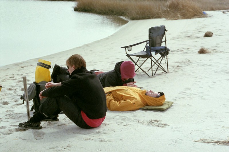
Even better, day paddle a few miles away from camp to some little visited peninsula or cove and wander about from there. Bring some creature comforts; sit, watch and listen.
 IMG009 by Mike McCrea, on Flickr
Or even bring a friend, if you can keep him out of your chair.
 IMG006 by Mike McCrea, on Flickr
If you paddle off for a daytrip explore I recommend doing so close to low tide, so that after puttering about for a few hours you’ll have enough water to paddle back to camp. “Do we have any beer left?”
 IMG024 by Mike McCrea, on Flickr
If you have never tripped behind a barrier island I highly recommend it. Very different from the usual lake/river trips, with new challenges; tides, wind, shade, potable water. Did I mention wind?
 IMG015 by Mike McCrea, on Flickr
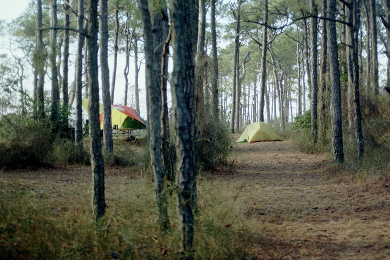
Camp just behind the dunes, or back in the piney woods
 IMG024 by Mike McCrea, on Flickr
Even back in the woods it is occasionally time to batten down the hatches, including a side panel wind block on the dropped edge tarp as the front passes through.
 IMG013 by Mike McCrea, on Flickr
Off-season at any barrier island beach can be windswept chilly.
 IMG005 by Mike McCrea, on Flickr
Or, rarely, calm enough even for friends who pack more gear that even me.
 IMG012 by Mike McCrea, on Flickr
I believe there was an entire (still frozen) turkey and a Webber grill under that load. And maybe a few beers. BTW, don’t follow him, he will overshoot the campsite by five freaking miles before noticing that he’s gone too far. Isn’t that so Doug?
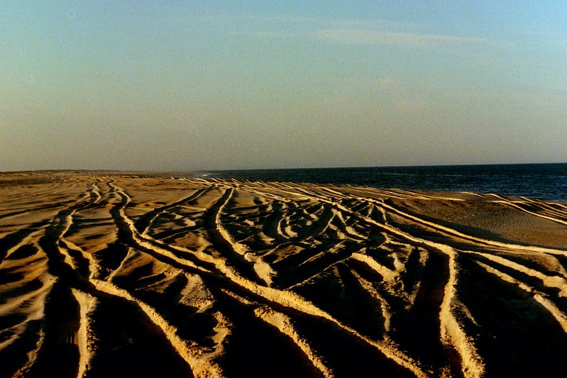
But the shallow sandy beaches are a visitor’s daytrip delight.
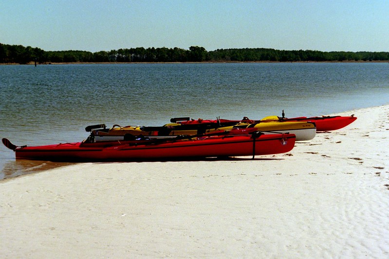 IMG012 by Mike McCrea, on Flickr
Obviously I enjoy the oddities and challenges of coastal tripping, and would love to find new venues. There are rocky island opportunities in Maine, and plenty of stuff in Florida, but along mid-Atlantic coast I only know of a few paddle-in barrier island venues.
Chincoteague Bay behind Assateague Nat’l Seashore in MD/VA, Hammock Beach State Park in NC, False Cape State Park in VA (never been, heard kinda “meh”), maybe (not exactly “mid-Atlantic”) Cumberland Island Nat’l Seashore on the GA/FL border. That one perhaps better for can’t-bring-your-car take the passenger ferry over camping (or backpacking northwards up the island).
Any other publically-owned coastal canoe-in possibilities?
I was quietly resting in, yes, a hammock, shady strung below a live oak, when I heard a crashing and splashing accompanied by loud, oddly variant birdcalls, and got up to see what the raucous ruckus was about.
It was a mixed flock of shorebirds, soaring in from all over, working together beating wings, driving a school of small fry into the shallows at low tide. The various calls and water slap of wings was amazing.
PA301471 by Mike McCrea, on FlickrI’ve seen that action before, but not as instantaneously developed, and never with a half dozen different species intermixed on a single mission to feast. A bizarre, privileged-to-see-it barrier island memory that stayed with me
I love barrier islands. I enjoy walking the shoreline of tidal bays and marshes. Eastern shore watermen call that activity “progging”, just walking the shoreline looking for interesting stuff. The birding is always rewarding, and there is usually other interesting stuff.
Like this; Diamondback shells deposited in an old Osprey nest built atop the ruins of a duck blind. Probably Eagle predation according to an ornithologist friend.
IMG011 by Mike McCrea, on FlickrGiven the choice between walking the ocean beachfront - looks just the boring same walking up as walking back – or progging the marsh edge at low tide I’ll take the marsh edge every time.
Even better, day paddle a few miles away from camp to some little visited peninsula or cove and wander about from there. Bring some creature comforts; sit, watch and listen.
IMG009 by Mike McCrea, on FlickrOr even bring a friend, if you can keep him out of your chair.
IMG006 by Mike McCrea, on FlickrIf you paddle off for a daytrip explore I recommend doing so close to low tide, so that after puttering about for a few hours you’ll have enough water to paddle back to camp. “Do we have any beer left?”
IMG024 by Mike McCrea, on FlickrIf you have never tripped behind a barrier island I highly recommend it. Very different from the usual lake/river trips, with new challenges; tides, wind, shade, potable water. Did I mention wind?
IMG015 by Mike McCrea, on FlickrCamp just behind the dunes, or back in the piney woods
IMG024 by Mike McCrea, on FlickrEven back in the woods it is occasionally time to batten down the hatches, including a side panel wind block on the dropped edge tarp as the front passes through.
IMG013 by Mike McCrea, on FlickrOff-season at any barrier island beach can be windswept chilly.
IMG005 by Mike McCrea, on FlickrOr, rarely, calm enough even for friends who pack more gear that even me.
IMG012 by Mike McCrea, on FlickrI believe there was an entire (still frozen) turkey and a Webber grill under that load. And maybe a few beers. BTW, don’t follow him, he will overshoot the campsite by five freaking miles before noticing that he’s gone too far. Isn’t that so Doug?
But the shallow sandy beaches are a visitor’s daytrip delight.
IMG012 by Mike McCrea, on FlickrObviously I enjoy the oddities and challenges of coastal tripping, and would love to find new venues. There are rocky island opportunities in Maine, and plenty of stuff in Florida, but along mid-Atlantic coast I only know of a few paddle-in barrier island venues.
Chincoteague Bay behind Assateague Nat’l Seashore in MD/VA, Hammock Beach State Park in NC, False Cape State Park in VA (never been, heard kinda “meh”), maybe (not exactly “mid-Atlantic”) Cumberland Island Nat’l Seashore on the GA/FL border. That one perhaps better for can’t-bring-your-car take the passenger ferry over camping (or backpacking northwards up the island).
Any other publically-owned coastal canoe-in possibilities?