No Title
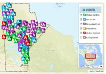
Continuing to move West on our tour of Canadian Wildfires, the first thing of note is the fact that every province uses it own mapping version so no two are the same and you have to learn them all. Manitoba's icons are too large to actually show fire sizes but other provinces have less information about individual fires when clicking on the icon.
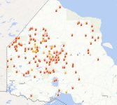
On the west border of Manitoba is Saskatchewan. All their fires are in the north and of note, if Alan were doing his trip this year, he would have had several fires to deal with along the way.
It shows the number of fires to date on the map which is very small in comparison as Ontario has had 602 to date and Manitoba is at 435, BC is at 1,034 fires to date.
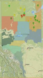
Alberta has the least, but most of it burned last year, or, because the Tar Sands projects means removing all the trees, there is less to burn.
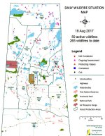
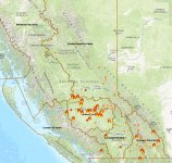
BC is still very active but less than NW Ontario or Manitoba. Only one fire in the Bowron Circuit and most of the fires are more southerly where all the people live.
All of this will lessen the need for a softwood lumber deal since we won't have any trees left to sell.