• Happy National Audubon Day! 🐣🐦🦅🕊️

Coppermine river

Joined
Aug 21, 2018
Messages
1,681
Reaction score
1,782
Location
Preeceville, Saskatchewan Canada
Robin suggested that images hosted by Google uploaded to our site without having problems with apostrophes. I'm trying this to see if it works. This is a continuation of my previous topic of Winter Lake to Point Lake. We're now on our first full day on Point Lake. We're taking a lunch break on the Canadian Shield, whose rocks form the nucleus of the North American continent. The Himalayas are 35 million years old; the Rockies are 60 million years old; but this eroded core of former mountains was created between 2.5 and 4 billion years ago, during the Precambrian Period. They are among the oldest rocks on earth.

Note the three apostrophes in my text above. If would be great if this post loaded, without being truncated. If if does, I owe in all to Robin!


bRt8idh9hhrsJZubdTh2bvvVPeZiCi2ucyLo-m6_yjaxKhbLwBPSD7Sy83Lc0hK317NwqI2LiGNgDut0wDE4e9w0avBr-H29ZeuWUWNB5a7495724E_sezHYN6zWWErez_t7TUYXyjzAyVN0JZT8wx-05y3NrqyE8gEI1HHr2gJLNRHsI-UNA60dR7UCdtz28C6QzzNaVl8rDVKYIirfZJU2etSKMLomgKh8-4-2cye1BWtVOovWsBB863ix7pn2YRrRoALaVnFPiJFUyW1gqXIKi4A0502lij-p0DBriEtI8PxLJ0JW_IWzHEeLyFDBBU2wy0UQ-7wdOftchqzBokt3bK2Z5kn1uaMEaZktjFmLaRMmUNqeBz_ZC436HOdmbTxhPfkyVfJKbGOe2J1RGFQ8k7kcWJuwjcuRoP6Vx25hZOy8yqljApe1TslolFZmrKmZ8oQfz208PQQD4M9K61CG1qSNd1MdPYtKc0PTCit8mO8VWAYe7b3DGHCa0I4WvSyniL71Si5h7dKgShE-e98Noxf88wIBLa_n9MtEqAzzxp4ASaQrntGJ9mzrZM6W7RL20vseAP0HSsgNwErHrmrjhL_obS9cHd0FzXbE8REIlrvJhH7Rb7VkjfWuoVw=w1324-h876-no
 
That's the same problem I sometimes have with Google photos, it will be there for you but no one else can see it. I always click on the photo I want to share, then hit the little "share" figure at the top right of the page, then hit the google figure, then close the box. Did this work, it should?
MmI-VkYOXMQ-tl91kITBoHLzVC4ed9pUrCAIqhP4YaKx-q4f_hyA9Z-FlO-RhEjGq8tA203oYZlCKgf9AMOpFka8dgsuDRyx5vTeW-pBb9wRju60G9CgXNFqjJ9Q2nsf1sDDLfwB2twJ0F3bxBcwebVb64kQluEHFyIyr3yj6EJ3owpaPyamQx517y5YeHT84RqJHdc_bmcOWurKCPGGVWefBzsVwOfhip-hMab1Jwp2HZD8O_i2G-0hG7z6NadEQ2Whil5h2UDC-RDndNpOG_K0s0Yj9qdBO2bhzC0qfApqG_AT8w7NoBILuRPA28gA8DI0J9N2oc0uzjmt3v8Jx-3KUph5DknMvzMCWwUOYmPS8TxNC2B4HJw2BXd8aZkt_8CpQ71OoenzyX8DTMrRxlQkPbJEP-N6etZTXh4WC-ZS8hFyQ3ABsJNldZcTVJTf1IkllHghygoF5J-s2oltxx2S5cbWHTppViweZ4XA-iPAD5Q7NFoeBTvzRo8q7yOtIzn5_J6iakztbNNvjWhv_Au2zcHJOhaEkfbFlk0JhaZ58MIrrxf1-8W3NgORFrqByqUP60h20m3atT2BlOTXdnimX_cOmfXb4mYqjUty9djyZg4P6oHNPS1gSZ0m0Kg=w640-h480-no
 
I'm trying again. Did the image come across this time? This is a continuation of my previous topic of Winter Lake to Point Lake. We're now on our first full day on Point Lake. We're taking a lunch break on the Canadian Shield, whose rocks form the nucleus of the North American continent. The Himalayas are 35 million years old; the Rockies are 60 million years old; but this eroded core of former mountains was created between 2.5 and 4 billion years ago, during the Precambrian Period. They are among the oldest rocks on earth.

Coppermine055.jpg
 
Last edited:
I have posted a few more images, just to make sure I have the process figured out.

You might remember that this topic is a continuation of our overland trip from Fort Enterprise, in the topic Winter Lake to Point Lake.

The Canadian Shield was recently covered by ice up to 5 km (three miles) thick. The ice receded about 6,000 to 7,000 years ago, leaving behind giant pieces of granite scattered across the landscape.

Coppermine056.jpg


The glacial advance and retreat scoured depressions in the hard, surface. Some depressions are small, and provide moist homes for dwarf plants such as net-veined willows

Coppermine058.jpg


On our fourth morning on Point Lake, we looked forward to completing the last of our 120 km (75 miles) of travel on this large, exposed lake. We had been paddling directly into strong head winds for most of the last three days. We put on the water early, hoping to reach the more protected Redrock Lake before the wind arose. But the wind came up soon after we began paddling, and we didn't reach Redrock Lake until late in the day.


Coppermine059.jpg


As we paddled down Redrock Lake, this rather impressive cluster of buildings appeared on the east shore. We were surprised, as our maps didn't indicate that any structures existed on Redrock Lake, and no brochures suggested that any lodges occurred here.

Coppermine060.jpg
 
Last edited:
I'm seeing the pics now in your most recent post (but not in Robin's test post).

Hope you continue on with the full story, Coppermine is on my list of "at some point" and I would be considering the same type of "overland" approach.
 
Yes, recped, i will continue on. Kathleen and I used to give a lot of slide shows when we lived in Vancouver. But there is very little opportunity in rural Saskatchewan. So this is fun for me.

Last night I saw Robin's test post image on both my iMac and my iPad. This morning I can see it on my iMac, but not my iPad. Go figure.

There's also something else I hope somebody can help me with. When I posted images through Flickr, I could do a return below the image, and then present the caption. Posting through Google Photos doesn't let me put the text below the image. I can hit a return only above the image. This means the caption is above the image, not below. This also means that I have to enter the last imageof the post first, and then proceed upward to the first image of the post. Not ideal. Any suggestions?
 
Getting to stay with the legendary Max is cool....no pics showing for me......:(
 
44501267552_1eb9923689_b.jpg


I have deleted the previous posts that were not working so well. I have also gone back to Flickr, which was working more consistently for me than Google Photos.

Before returning to that cluster of buildings on the east shore of Redrock Lake, I would like to show this image of our camp on Point Lake, which, as you can see is quite large. We met our first group of paddlers of the trip on Point Lake. Two canoes, on a guided trip, having lunch in their canoes, huddled up against a bank to stay out of the wind. Do not know where they started their trip, but they looked tired. After chatting a few minutes, we paddled away, and never saw them again. As you can see, it is easy for groups of paddlers to separate from each other on Point Lake.


30679409198_01b09af3b1_b.jpg


A power boat approached, and we were invited for hot coffee and showers. I was initially hesitant. We still needed to find a campsite. Even though this was our day 16 since landing at Winter Lake, I did not want to unpack and then repack just to have a shower.


44549770341_2cf33c8e81_b.jpg


The rest of the group was more excited about the invitation, and we soon found ourselves at the summer home of Max Ward, founder of Ward Air. Max and his wife Marjorie were entertaining a group of family and friends for the week, in their personal retreat called Rock Haven.


30679411198_4e4510d987_b.jpg


We were then invited to spend the night in this large tent, and to use their washing machines. After our shower, they said Happy Hour is at 6:00, followed by dinner at 7:00. After showering, I stepped on the scales, and was surprised to see that I had lost 12 pounds since leaving Winter Lake. I looked forward to stuffing myself.


44549768861_ce9f79ae3c_b.jpg


Chairs were a real treat. As we sat looking out at the wind, though, it was difficult to connect to the world that we had lived in for the last two weeks. Kathleen looks a bit weather beaten. Do not tell I said that, though. Max was entertaining business associates, primarily from Toronto. There were multiple tables seating six. And the four of us were seated separately at a table to regale his guests with our adventures. Max regularly looks for paddlers to invite in as entertainment.

We enjoyed a gourmet dinner served on china. As I sat with Max at dinner, I asked him why he chose to build his summer retreat here. He told me that he especially remembered Redrock Lake from the days when he flew bush planes. He often invited his friends from Boeing to join him for fishing holidays.

Max is in his nineties now, and does not visit Rock Haven anymore. So you probably should not paddle the Coppermine just on the hope of hooking up with Max and Marjorie.


44549767341_de174cedae_b.jpg


The next morning we were asked what we would like for breakfast. No menu. Just order anything you want.

We paddled through the outlet of Redrock Lake, and drifted around a river bend back into our world. Although I certainly enjoyed the interlude at the Ward lodge, I much preferred the beauty and serenity of our riverside camp.
 
43831809664_2564f954e8_b.jpg


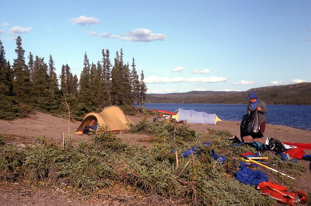
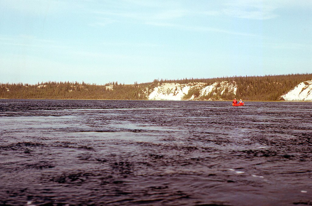
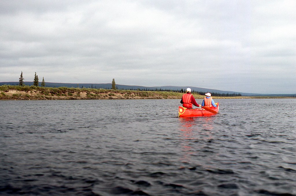
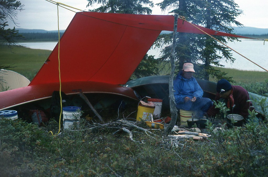
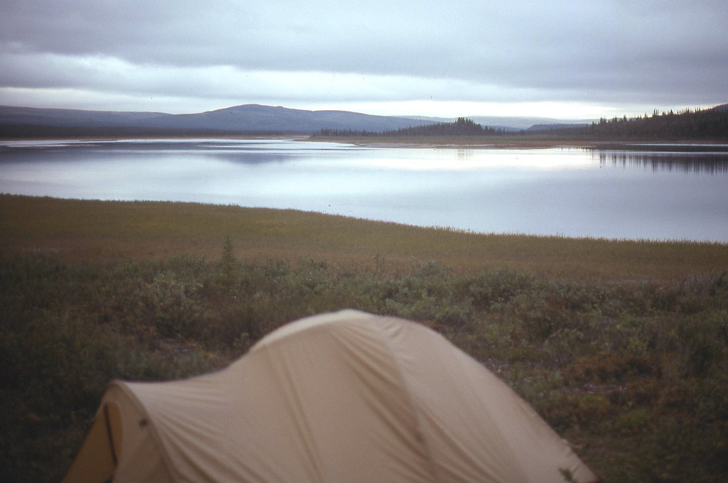
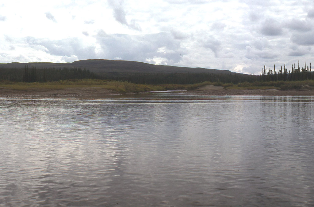
Camp 25 km (15 miles) north of (below) the Napaktolik River. According the the Paddling Guide to the Northwest Territories, near the confluence of the Coppermine and Napaktolik is a set of four rapids over an 8 km (five mile) stretch that is the first real white water challenge on the Coppermine. We ran the first three fairly easily, although the water was pushier than I expected.

The real difficulty for us occurred in the Class III rapid in the west trending portion of the Coppermine, about 5 km (three miles) below the Napaktolik River. As we approached the rapid from up against the left bank, Carey suggested that we back around a very large rock jutting out from shore. The rock outcrop was large enough that we could not see what lay behind. Our experience had virtually always been, however, that an eddy lies behind such large rocks projecting into a river.

The Coppermine is a big river, with impressive hydraulics. We backed around, quite nicely, I might say. But there was no normal, calm eddy behind the boulder. Instead, as the Coppermine raced around the boulder, it filled the void behind the boulder by reversing its current. We were immediately thrust back out into the main current and were now headed toward the middle of a rapid that did not look like anything Kathleen and I would ever want to run. Particularly on a wilderness canoe trip. This did not look good.

I know people often exaggerate their exploits, but I am telling you the truth. Huge holes and diagonal waves reared up to greet us. There were no downstream Vs or any apparent routes through. We would just have to wing it and hope for the best. Kathleen and I plunged over a ledge and into a hole that seemed like a 1.5 m (four feet) drop. We powered out of the hole but were slammed by a diagonal wave that spun the canoe around. We were still upright, though.

I turned my head around to see that we were hurtling toward another hole, perhaps larger than the last. As you can imagine, we did not like the idea of plunging into holes or over ledges going backward. Our stern was now passing by a wide boulder with a somewhat calm eddy behind it. Calmer than the current, anyway. That was all we needed. I plunged my paddle into the eddy, held on, and the boat swung around, like swinging around a fulcrum. We were now going bow first. That was very good. The bow glanced hard off the edge of a boulder and plummeted into a huge hole below. Our spray skirts blew off the cockpit coaming, and water poured into the canoe.

Still upright, though. We could see Carey and Janice, on river left, up against a cliff bank. They were bailing water in a very small eddy, perhaps no wider than a canoe. We headed over, hit the eddy (in the normal way), and bailed the water out of our canoe.

We looked downriver. We were only about halfway through the rapid. Janice looked at Carey and said, I am not getting back in the boat.

I do not remember if Carey replied. Did not really need to. Everyone had to get back in the boat. We were up against a steep, high cliff. There was no real shore that we could walk on to line the boats. The only way out was to paddle the rapid.

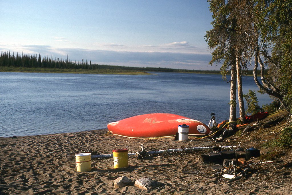
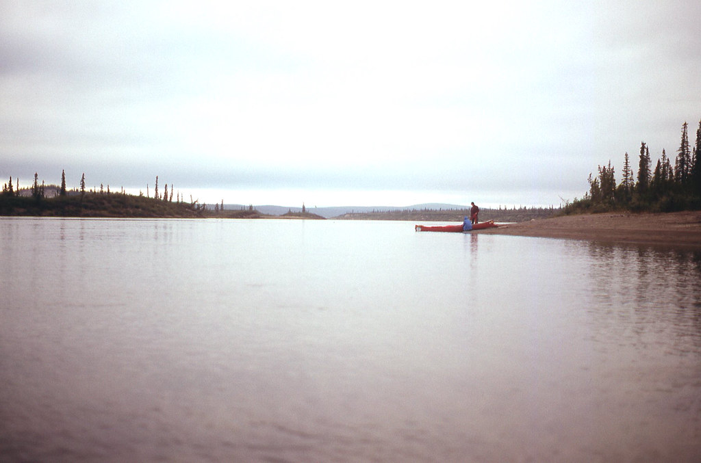
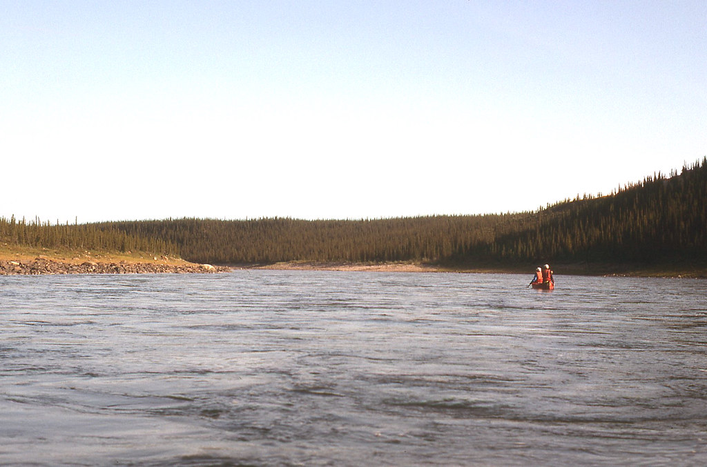
We forward ferried 100 m (100 yards) across the river to put ourselves beyond the huge haystacks at the bottom of the drop. We then turned down and finally reached calm water on river right. We beached our canoes and got out to rest our nerves. Janice was shaking, claiming that it was the most horrendous rapid she had ever run. And that was saying something. On many day trips with our Beaver Canoe Club, we had seen Carey and Janice paddle stuff that Kathleen and I only sat on shore to watch. This rapid is one of the three times I have actually been worried on a northern canoe trip.


43831818644_2e8e4f7b0d_b.jpg


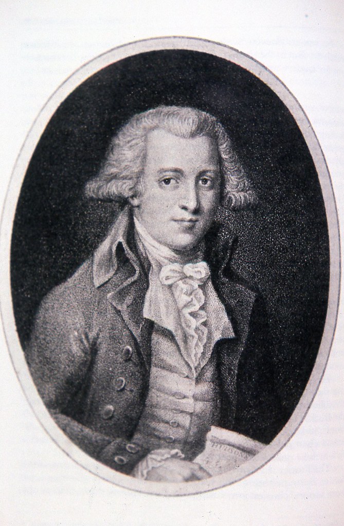
Samuel Hearne was the first European to travel to the Coppermine, reaching Bloody Falls in 1771. He had tried and failed on two previous occasions to reach the Coppermine River from Fort Prince of Wales on Hudson’s Bay.

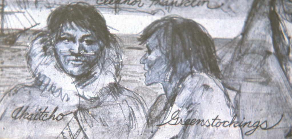
For his third attempt, Hearne arranged to be led by the native hunter Matonabbee, who was shocked to hear that the British did not travel with women. Matonabbee explained his position.

For when all the men are heavy laden they can neither hunt nor travel any distance. And in case they should meet with some success in hunting, who is to carry the produce of their labour? Women were made for labour. One of them can carry or haul as much as two men.


43831812214_292bf140ed_b.jpg


They also pitch our tents, make and mend our clothes, keep us warm at night. In fact there is no such thing as traveling any considerable distance without their assistance.


43831810414_32062cfebb_b.jpg


More than this, women can be maintained at trifling expense, for as they always cook, the very licking of their fingers in scarce times is sufficient for their sustenance.


I like to believe that the perspective held by Matonabbee reflected the immeasurable value of women to the success of nomadic societies. European diaries, written by the expedition leaders such as Franklin, largely ignored the contributions of people who did most of the work, and who provided all of the local knowledge and expertise.
 
44549761411_83c1b90c20_b.jpg


We are now opposite the White Sandy River, where the Franklin Party had camped. A shiny object lying on the beach had attracted our attention.

43831808044_b7e4f24b7a_b.jpg


This aluminum canoe was the second destroyed boat we had seen on our trip. We felt a great deal of empathy for its owners, who, like us, sought only a canoeing holiday and adventure. Instead, the Coppermine River brought disaster and disappointment. Were they inexperienced? Were their white water skills inadequate for the boulder strewn, Class 3 rapid in which we had nearly capsized yesterday? Who, if anyone, came to help them?

Note the footwear for Kathleen. For most of our northern canoeing, with cold water, we wore wet suit booties (neoprene socks) with over sized, inexpensive tennis shoes for traction when dragging, lining or tracking. The shoes lasted one season, but the neoprene socks lasted for many years.

44549760631_1b283dc3d0_b.jpg


We paddled away in a more sombre mood.

43648752865_a607934773_b.jpg


The moderating effect of the river keeps the permafrost deeper below ground so that trees grow along the river banks.

43831805374_9801f8779b_b.jpg


The next 130 km (80 miles) is a stretch of slow-moving water. The paddling should be easy, without worry or anxiety about rapids or portaging.

44549711941_02e1305097_b.jpg


Northern Grass of Parnasis growing delicately along the marshy shores of this slow stretch of the Coppermine River.
 
43831803714_3d5474fe04_b.jpg


We had brought the diaries of Richardson, Hearne and Franklin. We spent these days matching locations to descriptions in their journals, as we drifted and paddled ever northward to the Beaufort Sea.


44549758281_1188f86032_b.jpg


Many locations that we pass seem unchanged since the diaries were written 174 years before us.


43831802364_139a75523e_b.jpg


We have enjoyed very good weather since we left the wind on Point Lake. We float lazily beneath the warm afternoon sun. The Coppermine is one of the few rivers that crosses the Arctic Circle, at which there is exactly 24 hours of daylight on the Summer Solstice. We are at this moment paddling across the Arctic Circle.


29611619027_ce4365bef9_b.jpg


Our days pass pleasantly. We focus mostly on paddling at least 6-7 hours, and then finding a spot to camp that has a sandy beach and plenty of firewood.

43841342954_f9f85c9377_b.jpg


We continue to paddle every day, though, and have not yet taken a rest day, other than those imposed by poor weather as we struggled over the height of land from Winter Lake. We maintain a tight regimen. Up at 6:00 to put on the water at 9:00. We have only 11 days left to reach Kugluktuk, still nearly 250 km (150 miles) away.
 
I know I've said this before, but WOW !
I'm just imagining the big Smile on Alan Gage's face, as he enjoys your trip reports !
I'm smiling too !
Thanks ! I raise my canoe paddle to you !

Jim
 
29611618527_4e3504e8d5_b.jpg


We began to see caribou on the banks, for the first time since we left the Starvation River.


30679396468_0b146fd5f1_b.jpg


A few minutes later, a larger herd approached from the left bank.


44549754761_8ee7dd5a4d_b.jpg


Despite our presence, they entered the river, and swam across right in front of our drifting canoes.


43653425525_3f6e45e011_b.jpg


They then stood on the right bank, shook the water from their coats, and continued their journey to the east.


43844505794_2cf73190e0_b.jpg


Because we were on the river during late summer, most of the birds had already departed for their winter homes in the south. We did, though, scatter a small group of Tundra Swans, that circled overhead, and then flew southward.
 
29611616157_728c5fe49b_b.jpg
wAAACH5BAEKAAAALAAAAAABAAEAAAICRAEAOw==


Carey was a master at erecting tarps. I am certain that he could put up a tarp in a vacant parking lot. I learned every thing I know about putting up tarps from Carey.


43660807225_be0ac8d57f_b.jpg
wAAACH5BAEKAAAALAAAAAABAAEAAAICRAEAOw==


Kathleen and I usually retired to the tent soon after dinner, particularly on Fridays, when we enjoyed our weekly ounce of brandy with fruitcake.


30679392438_3059a50f95_b.jpg


Early the next morning, as we floated down river, we noticed a large, dark object lumbering slowing along the shoreline. If you look very closely, you will see it on the right bank, near the shore.


30679391828_0bd4d6298d_b.jpg


Samuel Hearne was the first European to see and describe the Muskox. The Franklin Party commonly shot these animals, as well as caribou, which they depended on for food as they travelled to the Arctic Ocean.


44521452602_35c17cdf1d_b.jpg


This was such an enjoyable part of the trip. We passed through narrow twisting channels, with scenic banks and no rapids. Also, we have not been harassed by mosquitoes for several days now, and didn’t see any during the final 10 days of our trip. Janice and Carey hate bugs, and we purposefully began our trip later in the year, hoping for a killing frost. We are now paddling in the third week of August.


​​​​​​​
 
43664525195_70cc9bd729_b.jpg


We enjoyed our afternoon gorp breaks with tea, in the canoe, as we floated leisurely north.


44524703212_b766c33710_b.jpg


We floated by the Hook River, leading to Great Bear Lake. It was here that Franklin met with Hook, one of the hunters, led by Akaitchko, who were supplying food for the expedition. Franklin arranged for Hook and his men to meet him at Great Bear Lake should the Franklin expedition return by that route.


43664767695_ea9eaf9545_b.jpg


Akaitcho shared his family supply of meat when Franklin and the surviving members of his party arrived back at Fort Enterprise in the winter of 1821. Otherwise, Franklin would surely have died in that cabin perched on a frozen esker ridge west of Winter Lake.

Robert Hood and George Back were members of the Franklin Expedition. Both were young men, and competed for the affections of Greenstockings, daughter of Keskarrah, one of the guides of Akaitcho, whose group provisioned Franklin during his first winter in 1820. During that winter, Greenstockings eventually shared her passions with Lieutenant Hood. Only 24 years old when he was murdered by Michel in the vast, cold emptiness near Starvation Lake, Hood likely never knew that his brief liaison with Greenstockings produced a daughter.


44549748171_33256555df_b.jpg


It is now 22 days since we left Winter Lake, and we paddle in a morning fog, which adds to our tension. We are now approaching the section of river that contains four rapids difficult enough to be named by Franklin. Rocky Defile, Muskox, Sandstone, and Escape. Before noon we will reach the Rocky Defile.


29621470797_c3182c1a27_b.jpg


The fog lifts, the suns appears, but our apprehension increases as the current quickens with each bend in the river.


44549746401_9505155142_b.jpg


We have arrived at the Rocky Defile Rapid, which from here appeared most runnable on river left, as we could paddle to the large eddy, where we could get a better look downstream. We decided to scout first, however.
 
Back
Top