• Happy Marine Mammal Rescue Day! 🐳🐬🦭🦦

Steel River loop- Cheating the Devil

Joined
Aug 10, 2018
Messages
948
Reaction score
1,066
Location
Blairsville, PA (about 30 mi E of PGH)
The Background:

Ever since returning from my BWCA trip, I've been wanting to get out on another extended wilderness solo. I wanted something even more remote where I might not see people for days at a time and it had to be a loop so I could do it without arranging shuttles. Initially, I was set on Wabakimi... taking the train to Allanwater bridge, looping up to Whitewater lake, seeing the Wendell Beckwith cabins (or what's left of them) and then back to my car in Armstrong via Caribou lake ... all good, right?

Maybe not... I talked to Bruce at Wabakimi Outfitters and he advised against the Allanwater river unless I was a very experienced whitewater paddler and also discouraged doing it solo regardless of experience. Bummer.

I found plan B before I got kicked off of Facebook (they still haven't said why) in the form of a page about the Greenstone area canoe routes where the admin for the page is a fellow canoetripping.net poster known as Memaquay. Mem has a long track record of helping facilitate canoe trips in that area and some of my favorite YouTube creators credit him with providing maps. For me, it came down to his Marshall Lakes loop or the Steel River loop.

I eventually hope to do both but, for 2023 (for better or worse), I chose the Steel River and I had a local print shop print the maps that he sent on 12x17 inch (30.5 x 43.2 cm) waterproof paper so they fit nicely in my map bag.
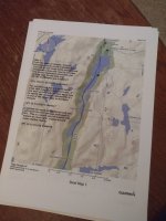
IMG_20230807_210427814 (1).jpg

Steel River Provincial Park is located in NW Ontario, North of Lake Superior and, more or less, between the city of Terrace Bay and the town of Longlac. It is considered a non-operating park, is administered by the Ministry of Natural Resources office (Nipigon Cluster) in Terrace Bay and is what is known as "Crown Land". Unlike the US, only 11% of the land in Canada is owned privately and 89% is owned by either the Federal or Provincial governments. These lands are free for any Canadian resident to use (with some, but not many, restrictions) but non-Canadians must apply for a permit which, in my case, cost about $9 (US) a day. Permits are available here.

The route (170km / 106 miles) is remote, lightly traveled and may be most famous for having what is renowned as one of the most difficult portages in Ontario: The Diablo Portage. This portage, listed at 1.2 km (3/4 of a mile) and an elevation gain of 100 meters (330 feet) features 45 degree inclines, ankle twisting holes hidden amongst ferns and some of the roughest terrain anyone could cut a portage trail through. Although I knew it would be brutal, I considered it to be the price of admission to the loop and vowed that I'd get through it.

It seems that most YouTubers put in at the southernmost end of the loop on Lake Santoy and paddle about 8km (5 mi) North to access the portage on day #1 but Memaquay's maps started near the northernmost point in Eaglecrest lake, ran down the Steel river and returned to the truck via Diablo, Cairngorm and Steel lakes. This route made a lot of sense to me as it would allow me avoid a huge lake (never been a fan of huge lakes) and would give me some time to get my portage routine figured out as well as getting rid of some weight in the food bag before taking on Diablo.

It would also allow me to actually meet Mem in person, thank him for his help, show him the Freedom Solo strip canoe that I'd built for the trip and, perhaps, get a test paddle in my next build as he prefers the Raven designed by Martin Strep. Plans were laid for July 15th and Mem would (likely) paddle out onto Eaglecrest with me the first night then return home as I went downriver.

DSCN1839[1].JPG

Due to the fire bans, however, I didn't actually schedule vacation at work (they lifted the fire bans in Ontario on July 11th so I could have gone) and the trip got kicked back until September. By this time, Mem had been pressed back into service at the teaching job from which he'd retired (twice, I believe) and the water level in the river had dropped dramatically. I was assured that I'd get through but the new boat would take a beating so on the Sunday preceding Labor Day, I hopped in the truck & headed north.
DSCN1417.JPG
DSCN1423.JPG
 
Last edited:
The Drive:

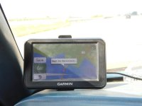
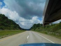
According to MapQuest, the fastest route to Longlac, Ontario was 15 hours and 40 minutes via Sault Ste Marie. The Garmin GPS that I use for work every day was of no help as it only includes US roads and I briefly considered paying for the Canadian maps until, on a whim, I entered the destination into my 26 year-old Garmin GPS. Lo & behold, it includes all of North America so, as long as the roads didn’t change much in the past 26 years, it should work just fine.

Only problem was that the older GPS thought the fastest route was through Buffalo, NY (not even one of the three options on MapQuest) so I programmed my newer Garmin to the US border crossing in Sault Ste Marie and figured I’d let the older GPS take it from there.
DSCN1414.JPG

This strategy actually worked really well; I again avoided the PA Turnpike and I was making great time across the state of Ohio... until I met a police officer. Perhaps I should (not?) mention that I don’t get overly excited about speed limits and I view them as theoretical. It’s always seemed reasonable that such limits are the speed at which some group of bureaucrats feel that the average person can safely traverse the highway under average conditions and, in reality, someone with above average driving ability and/or better than average conditions can safely travel that road at significantly higher speeds.

IMG_20230903_153450_01.jpg

Police officers, however, often have a different view of speed limits and I feared that might be the case with this Ohio State Policeman. He asked if there was any reason that I was 18 mph (29km/hr) over the (theoretical) speed limit and seemed less that impressed when I explained that I hadn’t been paying much attention to speed as I really didn’t believe the old Ranger could go that fast.

He then asked about my lack of seat belt… I didn’t have any real explanation for that and told him so. I had simply failed to put it on after fueling up at the last stop. He asked a few more questions, seemed to completely ignore the wood strip canoe adorning the roof (I couldn’t get lucky enough to get pulled over by a canoe enthusiast, right?) and, after a few minutes, came back from his car with some paperwork.

Perhaps he recognized my superior driving ability or shared my view that speed limits shouldn’t be so limiting but he explained that he wasn’t going to write me a ticket for exceeding the speed “limit”.

He seemed to take a dimmer view of my failure to strap into any impending wreckage, however, and said that he was ticketing me for the seat belt violation. I thanked him for not throwing the book at me, he stood by my door until I was properly seat-belted, I tossed the ticket onto the passenger’s seat and sped away. (As I write this, it occurs to me that, I should probably find that ticket and see where I send the payment)

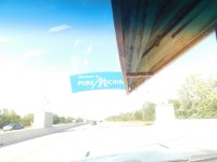
The rest of the drive was uneventful, I crossed the border, restarted my phone to use the Canadian towers, switched GPS units and found my way to the Trans Canadian Highway without much trouble.

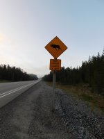
I cruised along the eastern shore of lake Superior and past warning signs that made moose seem like nighttime freight trains ready to destroy passing cars until, around 1am, in the area of Batchwana Bay, I noticed a sign that said “last gas for 180km” but the station was closed. I admire Canadians their ability to convert km to miles and vice versa but I’m not as adept. I looked at the fuel gauge at ¼ tank, thought that was likely to be about 50 miles and decided that 50 miles was probably significantly less than 180km.

DSCN1803.JPG

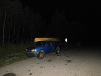
I had just passed The Chicken Shack motel which showed vacancy but the office didn’t appear to be open and I didn’t want to bang on anyone’s door at 1am so I drove south about a mile to a picnic area along the roadside and decided to sleep in the truck.

DSCN1438.JPG
DSCN1426.JPG
DSCN1816[1].JPG
 
Day1

I slept well and awoke at 6:30, drove back to the closed gas station and decided to wait until 8:30 to see what time they opened. I dozed a little and walked around the area until, finally, I lost patience at 8:15 and knocked on the door of the Chicken Shack motel next door.

I was greeted by a very nice lady who said that the station wouldn’t open “until later” but there was another (Voyageur's) about 10 minutes south that was open by now, would have gas, coffee and really good apple fritters… What more could I want, right?

She also said that “up here”, I should treat ½ tank as empty and start looking for the next gas station.

As it turned out, she gave great advice; the coffee was good, the fritters were excellent and I was back on my way to Longlac by 9am.

DSCN1452.JPG

The old GPS took me down a terrible gravel road that Mem said was impassable this past Spring but I made it to Longlac around 2:30 where I met him in the parking lot of Robin’s Donuts. We compared canoes, discussed the need for a bear barrel as he doubted suitable hanging trees would be found along the river, seemed to agree that the odor-proof sacks should be sufficient in that area as the bears were not at all habituated to think of humans as anything other than “avoid at all cost”.

He did, however, hand me a half dozen bear bangers, said that the blueberry crop had been terrible that year and that the bears were likely to be unusually hungry (better safe than sorry). I followed him to Catlonite road where we unloaded a couple of Cherry & Sassafras boards that I’d brought along for him to make some paddles (those woods, not being native to his area are harder to come by while, near my home, they’re ridiculously cheap and readily available), he gave me directions to Sun Road South and I was off again.

DSCN1454.JPG

Catlonite road was interesting. 4-5 times as wide as any dirt road around home, it had a theoretical speed limit of 70km/hr. I didn’t really need to do any math to determine that I would not be exceeding that speed as it was so badly wash-boarded that the Ranger was getting sideways at 35 mph. I had seen the pictures of logging trucks roaring down these roads in a cloud of dust but, as it was Labor Day, the only truck making dust that day was mine.

He had said that Sun Road South was about 30 miles down on the left but I’d neglected to look at the odometer when we parted so I drove for awhile and started watching. Well over an hour later I figured I’d certainly missed it so I messaged Mem from the inReach and asked him to check my location. While waiting for a response, I started looking at apps on my phone (I’d downloaded a Canadian maps app) and, for whatever reason, I opened the Earthmate app.

As it turns out, this is the inReach’s app and I was able to pull up a map that showed my location as well as the names of the lakes in the vicinity. I located Eaglecrest, started back North and soon after received a message from Mem that said it looked like I went about 15 miles too far.

(Note: I’d never really dug into the perks of synching my smartphone to the inReach but played around with it quite a bit on this trip and found that the Earthmate app is also the means by which one can type and send messages just like texting on your phone)

DSCN1456.JPG

I soon found the road I sought (Lat: 49.419867, Lon: -86.698455) and it was, indeed, signed but the sign was much more easily seen when coming from the south. It was a bit sketchy-looking but not wash-boarded like Catlonite.

I made my way to the launch by the bridge, parked out of the way of anyone that might want to use the campsite there (purposely leaving the doors unlocked so that any miscreant who came along might skip breaking a window) and loaded the canoe for the adventure ahead.

DSCN1458.JPG

This access uses, I believe, the Little Steel River and was basically a meandering stream that was teeming with small beaver dams and blowdowns but, as expected, had very little water at this time of the year.

There were more than a few places that required lift-overs but I arrived at Eaglecrest lake around 6pm and began paddling into the wind (my BWCA trip had previously taught me that portages and campsites are always into the wind).

As I neared the first campsite, I was a bit disappointed as it appeared to be taken and I was a bit concerned that I could make it to the second campsite before dark but, as I got closer, I realized that there were just tarps covering firewood and the site was, in fact, open.

I was a bit too tired to bother with a fire and couldn’t find either of my backpacking stoves so I had a trail mix supper and went to bed figuring that I’d have to allow extra time throughout the trip to build and douse cooking fires. There was, however, a suitable tree for the bear bag and I sent the “all clear” message on the inReach at 8:10pm.

DSCN1404 (1).JPG
DSCN1408.JPG
DSCN1409.JPG
DSCN1828[1].jpg
 

Attachments

  • DSCN1827[1].JPG
    DSCN1827[1].JPG
    82.1 KB · Views: 7
  • DSCN1458.JPG
    DSCN1458.JPG
    138.9 KB · Views: 7
Last edited:
Thanks again for the boards, the cherry is currently in the process of being made into three one piece paddles and one laminate, that was quite a board! The In reach app has pretty much replaced my GPS in many instances, it is a good program.

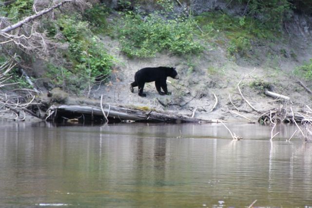
Gamma and I had a good conversation about bears, where I told him not to bother hanging anything, and to keep his food right in the tent, so he could share with the cute little fellas. Perhaps he is foreshadowing about an ursine experience.....
Here is a pic of a Steel River bear, cute little guy, ran away before i could give him a rub on the head.
 
Glad the Cherry is working out; 4 paddles is awesome (I've gotta try a few myself this winter).

Although I could have used the warmth of an ursine cuddle buddy on a couple of nights, none were invited into the tent on this trip.
 
Well over an hour later I figured I’d certainly missed it so I messaged Mem from the inReach and asked him to check my location.

First, it's nice that this site has allowed trippers to meet and visit each other and to help each other out, especially in the vast reaches of Canada.

Second, my ignorance of electronic devices causes me to ask how Mem could determine your location from a message you sent him?

In any event, it's fun to read another interesting "cliffhanger" trip report in the genre of Michael Pitt, the Perils of Pauline, and now Erica and Gamma.
 
While in Longlac, I had sent him a link for map sharing. With that link, anyone can see the location of the device in real time (as long as it's turned on). My youngest daughter, although she won't camp without a hot shower & flush toilet, loves the feature and pulls up the map on her phone multiple times a day to see where Dad is.

I think Recped posted a link to his mapshare on the site once. I seem to remember watching his progress on one of his far North trips (maybe the one to retrieve the canoe / gear?)
 
Day2:

I slept well, made a small fire, started coffee and oatmeal and packed up while the water heated. I was on the water by 10am, portaged once and paddled about 6.2km (4 miles) to the junction of the Little Steel and the Steel rivers where I took some time to explore the campsite there. It had been my destination before taking a 30 mile(ish) detour past Sun Road South the day before and I regretted not having made it as it was a very nice campsite complete with a new picnic table, some shovels, rakes & implements of destruction, a pair of binoculars (of questionable utility) and a large sign identifying the site as “Camp Chugabrewski”.

DSCN1488.JPG
DSCN1489.JPG
DSCN1492.JPG

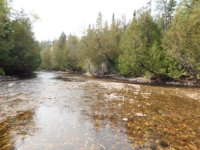
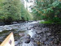
Leaving this site, my maps indicated that I would enter the Steel River proper and would shortly encounter some fast water, swifts, etc. which I quickly found to be true. Only problem was that the water level was so low that they couldn’t be run and I was soon walking the boat through every one of the shallows where, in July, I would have probably had a very enjoyable ride. I doubt that it was the first, but it would certainly not be the last time that I would lament the delayed start date.

DSCN1509.JPG

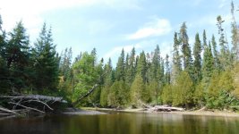
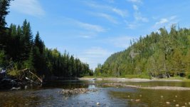
In between the swifts, the Steel widened out into deeper sections of lakes where I could paddle but only into a fairly brisk headwind. Despite this, the day was warm and sunny and the scenery was outstanding. At times it seemed that I spent more time with a camera in my hands than I did holding a paddle.

DSCN1410.JPG
DSCN1418.JPG

There was also wildlife to be found in abundance as I saw the usual ducks, loons and such, some evidence of beavers and otters (maybe minks?) and, coolest of all, in my opinion, owls.

Owls have always been a favorite of mine and I saw several in the early afternoon. Most seemed pretty camera-shy but I finally got a (somewhat) decent picture on the 3rd or 4th bird. Even this one did not pose long enough to try more than once and soon flew silently into the forest.

DSCN1515.JPG
The map indicated that there was good fishing below all of the swifts and rapids and I tried a few casts at several of them without much luck. To be accurate, I did get some bites but, in every instance, I wound up either breaking off or having the fish throw the hook and I came up empty. (I’ve never gotten the hang of fishing moving water as trout in PA aren’t [in my opinion] even worth catching. They don’t offer the fight that a smallmouth bass does and, because the State stocks them in every stream, they typically taste like the dogfood that they’ve been eating. I’ve often wished they’d stop stocking and see if the native smallmouth populations would re-establish themselves but I know that will never happen). Oh well, back to the story...

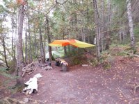
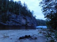
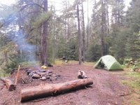
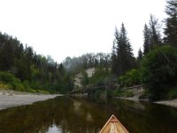
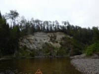
I splashed through the shallows (slopping water into the canoe while doing so) and fought headwinds until 7:15 when I arrived at a very scenic site across from some huge cliffs. There was a nice, sandy beach, a bench by the fire pit and it was nicely sheltered from the wind. With no chance of making it to the falls, I quit for the day, took a swim and set up a tarp by the fire pit because the forecast had rain arriving around 10pm.

DSCN1435.JPG

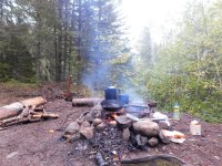
I hadn’t taken much time to fish below the swifts and I tried a few casts from the camp but I, again, came up empty so I built a small fire, made supper and turned in as the night started to become chilly ahead of the rain.

I also vowed, that night, that I’d have to get better at sealing dry bags and minimizing the amount of water that got into the boat as several items got wet that weren’t supposed to: most noticeably, my journal and the copy of Trail of the Lost that I’d brought along. The book, while damaged, wasn’t ruined but I’d have to keep my journal electronically on my phone from here on out.

DSCN1436.JPG
DSCN1437.JPG
DSCN1416.JPG
DSCN1829.JPG
 
Last edited:
Too bad the water was so low. Dragging a canoe seems like drag.

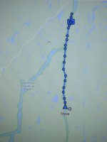
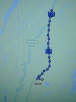
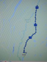
Could you elaborate the map symbols. What's the yellow circle with the dash in near the bottom of the route, and the rectangular symbol near the top? I assume what looks like an overland route was actually the initial part of the trip on the Little Steel.
 
What appears to be overland was the twisty stream (I think the Little Steel river) used to access Eaglecrest lake. The rectangles show where I sent a message... usually a "just checking in- all is well" to friends & family at home before turning off the inReach for the night. This was sent every night just prior to turning in and the inReach was both on and on my person at all times while moving. I felt that, leaving the message indicator on the map for the TR was handy for showing where camps were and tracking daily progress.

I have no idea what that little circle means. Might be the "message sent" indicator while I was still at that location.

And, yes, water levels were a PIA and the trip was a slog much of the time (but more on that later).
 
Last edited:
Oh man - do you actually have any idea how nice you have it with you? Such a huge country with "real" nature and wilderness. Fantastic.
Here in Germany everything it is small, narrow and regulated.

Thank you for your report.
 
Wow, camp "Chugabrewski" seems to have undergone some real estate development since I was there. That's too bad. Probably means the fish are getting hit pretty hard there. When you came over that first port, did you notice if there were a bunch of boats cached at the end?
 
Mem: There was one canoe cached at the far end but that was it. From appearance (and another item that we'll get to), I suspect that "Chugabrewski" is used about as much as the Eaglecrest site. I did fish the rapids upstream & around the corner from it and came up empty there but that is just as likely to be my lack of fishing ability as it is the area being fished hard. Besides, I didn't put a lot of effort into it... I was in "explore" mode and headed downriver.

Kahel: Yes, I am very grateful to live where I do and to be within easy driving distance of such areas. I don't think I'd be happy if I couldn't easily escape civilization and disappear into the woods.
 
Portages have always been one of my favourite things (to complain about). But what has really put me off the Steel Loop idea wasn't the Diablo but log jammed river sections (according to some trip reports I'd read). I'll patiently wait and see how your trip goes and wish you well.
 
Day3

The rain came as expected and it rained hard most of the night. I got up and found that I’d also need to work on my tarp skills as there was a huge puddle of water trapped in the tarp. Happily, the folks at Cooke Custom Sewing do a nice job and I was actually pretty impressed that, given the weight of the water collected, all seams and attachment loops (they don’t use grommets) were still in great shape.

DSCN1525.JPG

The campsite was wonderfully shaded for a summer trip but, on that morning, was just cold, damp and dreary so I broke camp while the coffee was brewing and I managed to get the tent & sleeping gear stowed before the rain started again.

When I carried gear to the beach, I was relieved to see that the water level of the river had risen by what I estimated to be about 3 inches overnight and I was hopeful that I’d now be able to run the swifts instead of constantly hopping in and out while tracking water into the boat.

I paddled into a light, intermittent rain and checked out the next campsite shown on the map. It was listed as having some old plywood tables in an old Cedar grove but someone (I’ve since found out who but hesitate to mention in case the MNR would find offense) had been busy upgrading the accommodations.

DSCN1535.JPGDSCN1534.JPG

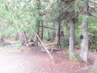
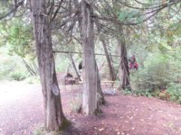
Gone were the old plywood tables and, instead, there was a huge steel / treated wood table under a massive tarp frame. Firewood racks, tools, folding lawn chairs, a fish cleaning station, at least 2 skillets and a huge firepit completed the camp and it certainly seemed that one could be at home here for an extended stay. (I’m told the table donor and friends stay at this site for 5 days at a time once or twice a year, fishing the surrounding river and disrupting the serenity a little). Almost within sight of the previous night’s camp, I think this was the superior of the two even though it seems that all YouTubers stop at the cliff site.

I paddled on downriver and the increased water level helped with some of the swifts although I was still walking most of them. I almost didn’t realize when I came to what the map listed as a “problematic” rapid with no port. The recommended procedure was to line down river right until I could hop in and run the haystacks below the rapid but it was such a boulder garden that I opted to portage in the riverbed instead.

I triple-carried as it wasn’t far enough to bother attaching the paddles and launched well below the non-existent haystacks.

DSCN1442.JPG

I continued working my way, from map to map, downstream through the light rain with, wonder of all wonders, a tailwind and, although the day was dreary and didn’t photograph well (especially since many of the pictures show water droplets on the camera lens), it was a very pretty section of river.

I checked out an island campsite on map #6 and decided that it would work but it was not comparable to some of the others I’d visited.

DSCN1556.JPG
DSCN1558.JPG

Shortly after leaving that site, I changed maps and started watching along river right for portage signs. The notes warned that I was approaching Rainbow Falls and warned me not to miss the portage as the falls were very large and going over them was extremely unlikely to end well even at these water levels.

I became a bit more concerned when I saw a “warning, falls ahead” sign on a tree in an area of the river that widened to the size of your typical baseball field. Naturally, this caused the water to become extremely shallow so I waded it dragging the canoe and keeping well to river right so I wouldn’t get caught on the wrong side of the river.

These precautions were unnecessary, however, as the sign was posted well upstream of any real danger. I hopped back into the canoe, paddled just a bit further, clearly heard the falls as I approached them and saw the portage sign above a small, sandy landing.

DSCN1591.JPG

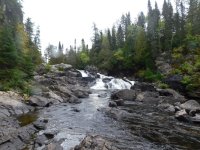
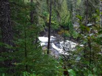
About 2/3 of the way down the port, as advertised, I found a very nice campsite so I dropped my pack, grabbed my water filter and headed back for the canoe. I hung the filter on the portage sign, carried the canoe through the entire portage and returned to the beginning to retrieve the filter and photograph the falls.

DSCN1586.JPG
DSCN1599.JPG
DSCN1600.JPG

That being accomplished and still having a few hours before dark, I grabbed my fishing rods and tried my luck below the falls. I had 2 spinning rods along, one with 6 lb flourocarbon line and one with some very lightweight braid that I’d spooled up for this trip and, while lure selection seemed adequate, line was certainly not and I broke off on a half dozen fish before finally landing a smallish pike who accompanied me back to camp for supper.

DSCN1603.JPG

I ate very well that night and turned in early, setting the alarm on my phone for 5:30am as the maps noted that tomorrow would be a long day.

DSCN1606.JPG
DSCN1583.JPG
DSCN1443.JPG
DSCN1830.JPG
 
@Odyssey: OK, here we go... :)

Day 4

I was awake early and broke camp shortly after 6:30 in anticipation of a very long day. The map notes said that Deadhorse bridge was a 2 hour paddle and, after that, camping opportunities were limited until I’d reached the beaches of Santoy lake.

DSCN1635.JPG

Realistically, I knew that, given the low water levels, decent sandspit camping would be more readily available than normal but that every mile would be more difficult to complete. In all, I was hoping the early start would equate to a long but satisfying day that ended on a beach within sight of Diablo.

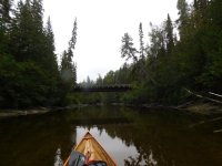
The rains of the past 2 days again helped a little with water levels and I donned my last pair of dry socks in hopes that I could stay in the canoe most of the day and, in fact, I was able to run most of the swifts at that point. It still took me 2 hrs and 45 minutes to reach Deadhorse bridge which the map indicated was the last chance to escape to civilization.

DSCN1640.JPG

As I passed under the bridge, aka the point of no return, (what?… I suppose you were expecting Kansas… well, I think that was spelled differently)...

Anyway… as I passed under the bridge, it occurred to me that Memaquay had said he’d once paddled the whole loop in 3 days… I’ve got to remember to ask what paddle he uses…

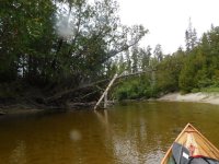
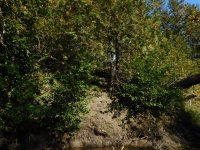
The map notes indicated that the nature of the river changed dramatically below the bridge and, as expected, this was correct. The stone cliffs had given way to sand mounds that seemed to intermittently collapse into the river carrying with them whatever trees were unlucky enough to be growing upon them.

DSCN1636.JPG

The slower, deeper sections were also gone and the river became a shallow, meandering waterway with dead trees at every twist and turn. On the bright side, the rocks that had been scratching the hull for the past few days were also (mostly) gone and I figured that the river here might actually start sanding out some of the scratches for me.

DSCN1654.JPG

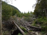
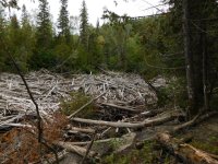
The dead trees would also periodically collect in areas where they would wedge themselves into the banks and I was warned to be prepared for anything but that I was likely to encounter 4 logjams that I would have to portage around.

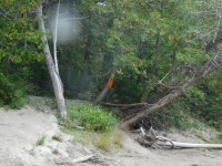
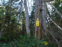
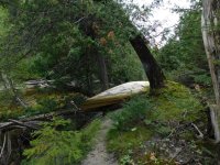
I found the first of these with the sign well above any visible logjam but with a nice beach upon which to land so I beached the boat, grabbed my pack and followed the signed trail into the woods. I hadn’t gotten far, however, before I’d lost the trail but, looking toward the river, I also saw no evidence that the logjam was really obstructing the waterway.

DSCN1658.JPG

Unable to relocate the portage trail, I bushwhacked my way down to the water at a reasonable place and returned for the canoe. Just to be sure the river was blocked, I paddled downstream to look for the blockage and soon arrived at my pack. The first logjam was missing!

I picked up my pack, continued downstream and soon found the logjam as it was plastered onto the upstream end of the second logjam shown on my maps.

The maps warned that both the take-out and the put-in for this port were steep and, boy, were they ever. Someone had left a rope hanging over the bank at the take-out and I found it helpful in hauling me and my gear up the sandy incline but, the canoe... I simply dragged it up by the stern painter while standing at the top of the bank.

DSCN1671.JPG
DSCN1680.JPG
DSCN1686.JPG

This portage trail was easier to follow although it, at times, seemed to run perilously close to the edge and there was one spot where a particularly nefarious (perhaps simply mischievous) old Cedar pushed my canoe toward the river causing me to lose balance and I nearly joined the melee below. As one might expect, the tree probably thought it was funnier than I did but I clawed my way back up the bank, reshouldered the canoe (out of reach of the tree) and resumed my portage.

DSCN1692.JPG
DSCN1694.JPG

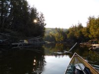
Some distance downriver, I saw another large, white portage sign atop a steep bank on river left but, looking downstream, there was, again, no sign of any logjam. Having some experience with this scenario, I continued paddling.

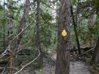
Before long, there was a second, badly beaten-up, white portage sign hanging from a tree above a steep bank but, again, no logjam in sight. I paddled by wondering if I’d missed another logjam or if I would need to return upstream because the banks become less stable but it turned out that neither was true and I soon came to a newer, smaller, yellow sign above a sandy beach with a gentle slope up into the woods and a whole bunch of dead trees clearly blocking me from paddling further.

DSCN1715.JPGDSCN1721.JPG
DSCN1720.JPG

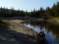
The portage ended on another sandy beach with a relatively gentle slope down from the woods but, by this time, the sun was starting to sink lower and I knew I wouldn’t be camping on Santoy that night.

DSCN1726.JPG

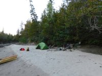
I started looking for a level sandspit and soon found one that didn’t seem to have many moose tracks or active game trails. I hung a clothesline to try again to dry out some gear and decided against making a fire pit as I’d found my backpacking stoves in my pack during the stay at the falls.

There were, again, no suitable bear bag trees here but there was one set of bear tracks (looked old but hard to tell in the sand) so I tucked the bear bag against a log near the tent, peed all around it and trusted that the combination of odor-proof sacks inside the bag and man scent all around outside might be enough to dissuade any curious Ursus Americanus that may wander past.

Most of the day was colder (cold enough to see your breath for much of it) and most of my gear was between damp and outright wet but the rain had stopped and my sleeping bag was among the driest of the gear. Surprisingly, I wasn’t cold even though I was in shorts (I’d unzipped the pants legs as they’d just get soaked any way). I’m a huge fan of merino wool and I found that a t-shirt, a mid-weight long sleeved shirt and the rain jacket were sufficient.

I wore all but the rain jacket to bed that night and also wore my driest pair of socks in hopes that, even if they didn’t dry out overnight, at least they wouldn’t be cold AND damp in the morning.

DSCN1731.JPG
DSCN1723.JPG
DSCN1705.JPG
DSCN1832.JPG
 

Attachments

  • DSCN1723.JPG
    DSCN1723.JPG
    248.6 KB · Views: 2
Back
Top