• Happy Marine Mammal Rescue Day! 🐳🐬🦭🦦

Smartphone or tablet as GPS?

Glenn MacGrady

Administrator
Staff member
Joined
Oct 24, 2012
Messages
5,052
Reaction score
3,039
Location
Connecticut
I've had a waterproof Garmin mapping GPS for 20 years (two of them), which I have clipped in front of me on three of my canoes, using standard holding devices for automobile dashboards.
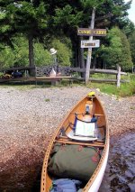
SRT with GPS.JPG

I've now heard that folks are using their smartphones or small tablets in airplane mode as GPS's. Is this as good as a dedicated mapping GPS? What are the pros and cons?

In particular, for a phone or tablet, I don't know:

- Whether I can load in USA and Canadian topo maps as I can with my Garmin.
- Whether I can load in satellite photos as I can with my Garmin.
- How long the phone or tablet batteries will last. I like to keep my GPS permanently on while paddling, and my Garmin can last about 40-45 hours with two lithium AA batteries. Would I need to have a power bank for the phone or tablet?
- How much less waterproof my phone is than my Garmin. I know it has a lower IP rating.
- Whether I can receive phone calls (or voice mails) and take pictures while the phone is in airplane mode.
- Whether I can leave waypoints and breadcrumb trails with a phone as GPS.
- Whether I need an app for the phone/tablet to do some or all of the above, or how much they can do natively.
 
1. You can load your phone up with a mapping app, there are a few good ones out there to choose from, but in my opinion, none as good as what you can do with the Garmin. The maps in my app are similar to the basecamp topo maps on my Garmin, but not as good.

2. You can have sat photos on your phone, but not sure if you can do overlays on the mapping apps. The one I have is fairly simple, and that's not an option. My buddy who worked as a crew boss for the Forest Fighters had a more evolved app on his phone, perhaps the name will come to me before I finish typing.

3. You would probably get one day of travel off your phone, so you would need to have a few charging banks with you on a multi day trip. Charging banks tend to weigh a lot more than the number of lithium AA's you would need. Another thing that many phones do..when they overheat, they shut down. If they get too cold, they shut down. The overheating is a real problem, I use mine to play music at outdoor parties, if I leave it in the sun, it always overheats and then - dead till I get it cooled down again.

4. You would have to have your phone encased in some kind of water proof, floatable container. Phones are delicate by nature, they won't take the same abuse your Garmin does.

5. You don't need to be in airplane mode for the mapping software to work. So if you are in cell phone range, you can still receive and send texts or calls. However, I usually only use my phone for a gps when I am out of a service area. In this situation, of course you will not receive or send any calls or texts. You can always take a picture, your phones camera does not depend on data.

6. I have the earthmate program on my phone, it is a part of the satellite texting app that pairs with my inreach. Waypoints are quite easy, and I believe there is a way to leave tracks, but I have not used it.

7. You have to have an app.

My choice for a multiday trip in an area without phone service will always be the Garmin. I only use my phone app in odd circumstances.
For instance, last year I went on a last minute skidoo trip to try to find a lake I had canoed on in the summer. There was a series of new logging roads cutting up the terrain, and I became dubious as to my location. I hauled my phone out just to show me my location.

Similarly, I have used my phone when I have been on day trips in areas I thought I knew quite well, but after taking a wrong turn on a branchy lake, I have used my phone to check my position. Sometimes when I am exploring a new lake in the area, I will use my phone too, just to see how much further I can go, stuff like that.

But for serious trips, especially when I am documenting a trip for future maps, and also for the purpose of submitting GPX files to the Ministry of Natural resources for canoe protection purposes, it's always the garmin.
 
That was a very thoughtful and thorough reply, Mem. Thanks. Any differing or additional takes are welcome.
 
So I started playing with Avenza today, a mapping app you can download for your phone. If you upgrade to the Pro version, about 50 loonies, there are some really cool features. I'll try to get to it next week, see if I can import gpx files.
 
Gaia GPS is a superb mapping app for a smartphone. Intuitive map downloads. It's plenty for my type of tripping. But if you are a heavy GPS user out in the bush for weeks, battery life of the phone would be an issue.
 
When we go hiking I carry a GPS while my wife uses Avenza on her phone, I also have and occasionally use Avenza on dry land.
When we're on the water our phones are in small dry boxes that are inside of our dry bags. If our phones were to be somehow damaged by water we'd lose, at least temporarily, much more than just a device.
I also really enjoy working/playing with a seperate GPS unit more than I like using a phone.
 
Today, I hiked with John S, who was using a Garmin. I was a Garmin user for many years, but an older model: 76csx. WillDerness had one, too, and he loved it. The device was fantastic, but I found the user interface torturous. WillD thought it was fine. So, I mentioned this to John, who told me the user interface is still torturous, but really cool once you figure it out.

I ditched the Garmin once cell-phone capability caught up to the Garmin, around iPhone6, I think. Phones have only gotten better and now they are even highly water resistant. Mine's been swimming many times, but never very extensive. During Covid times I'd wash the phone in the kitchen sink. That felt wrong but never affected it. On the phone I use Gaia.

Battery life is just something I deal with. In Airplane mode the battery will last multiple days, depending on how much I look at the phone's display. The big, bright display becomes the big battery drain. I carry a juice pack and cable. Perhaps the juice pack weighs more than AA batteries, but consider you would probably have to pack more batteries for your camera, not to mention the weight of a separate camera.

To answer the OP's question, I think a phone is as good as a dedicated GPS device.
 
I used to use a Garmin GPS. Past 5 years I've just been using my smartphone with Google Earth. Really I still prefer to use a good paper map and compass on long trips. But the laziness in me, makes it to easy to just pop open the screen on my phone and see my currently location without carrying a separate device.

I have never kept my Garmin or phone on, or sitting in front of me to watch my current location. I've always kept them off and stowed away within arms reach to periodically check my location / progress as need be.

If you have a google account (which most of us are defaulted into having anyway) you can drop pin points / waypoints on Google Earth and they will appear on the downloaded offline map. Just have to make sure the area is downloaded for offline site use.

I have not tried the 50+ other mapping systems out there on my phone - due to goggle earth not letting me down yet.

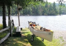
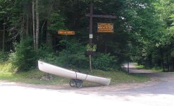
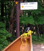
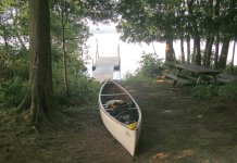
Glenn, in your picture is that the Landing for the Forked Lake Carry Road? = Raquette Lake to Forked lake?
 
Glenn, in your picture is that the Landing for the Forked Lake Carry Road? = Raquette Lake to Forked lake?

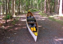
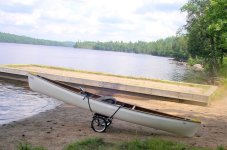
Yes. Below is the rest of the carry.

Forked Lake Carry2.JPG

Forked Lake Carry3.JPG

Forked Lake Carry4.JPG

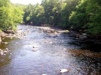
I don't care for Raquette Lake much, but I like Forked Lake a lot. I'd like to return there just to spend more time exploring it. I wanted to paddle the outlet of Forked Lake down the Raquette River to Long Lake, but the water was too low in the river.

Raquette River outlet from Forked Lake.JPG

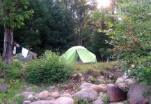
I had to wheel the whole thing miles in 90° F (32° C) heat on the roads to the Deerland lean-to area, near which I set up camp. My Garmin GPS was helpful snugged on the bow deck during the wheeled carries.

Forked Lake to Long Lake carry.JPG

Deerland Lean-to carry.JPG

Campsite near Deerland lean-to.JPG
 
Knew I recognized that landing.. I feel the same as you - don't really care for Raquette Lake but Forked Lake is a little gem of a place. However I have spent some great nights at Tioga Point in the off season.
 
Last edited:
I have spent some great nights at Tioga Point in the off season.

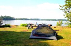
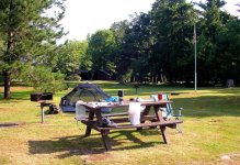
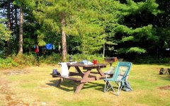
My trip was a six day, five night trip from Blue Mountain Lake to Tupper Lake. I stayed at Tioga Point my first night. It was the only pay and "fancy" campground with facilities that I stayed at.

Tioga Point1.JPG

Tioga Point2.JPG

Tioga Point3.JPG

Tioga Point4.JPG
 
Raquette River is a great trip in High water. I've run the entire river three times, starting at Raquette Lake South Inlet and ending at the St. Lawrence River. All three times I did the trip the last week of May.

Chilly but bug free
 
Last edited:
Yeah sorry to go off on this tangent from your picture. 1st time - Two weeks with 2 planned relax days for the choosing. 2nd time two weeks with no rest days. 3rd time, ever shallow which extended the trip by 2 days. All in all I think its like 22 portages and some lining. The longest being Raquette Falls and the Colton Dam. Lots of dam jumping in the reservoir area (Carry Falls Res. - Stark Falls Res. - Blake Falls Res. - Rainbow Falls Res - Five Falls Res.) into Colton. Last time I ran it the water wasn't to high as we didn't get a lot of snow that year and took a few extra days to reach Rooseveltown.

Water is usually moving pretty good in May

1st time I did it 2004, it was fast with a lot of back paddling and questioning (raised eyebrows) running some of the rapids
2nd year 2010 not as fast - had to line some rapids to avoid rocks - slow enough to take away any relax days
3rd time - 2021 - shallow, boney and really cold. I too had to portage from Forked Lake to Long Lake and I did NOT bring wheels. - Lucky me, as I came out of the park at Forked Lake shouldering a canoe and pack, a pick up truck passed just as I hit the road and offered me a ride "wow that was lucky. " Due to it being a dryer year it ended up being longer then 14 days by adding two more days.


So back to to OP - Smartphone.. Since I'm bring the phone anyway, and it pretty much does what the Garmin can do, plus make calls and takes pictures I've left the Garmin home.
 
Last edited:
Back
Top