-
Happy World Tessellation Day! 🏁⬡⬢⬡
You are using an out of date browser. It may not display this or other websites correctly.
You should upgrade or use an alternative browser.
You should upgrade or use an alternative browser.
Photo of the day
- Thread starter memaquay
- Start date

We took a BWCA trip two weeks ago, a loop from Sawbill to Little Saganaga, Polly, and back along the Phoebe River. The water levels were very low. Here is a photo of the big rock at the south end of Malberg and a photo of the rock from 2014. As last year, with all the chatter about overcrowding and trashed campsites, we did not experience that. Between last year and this we stayed and looked at about 15 campsites. All were pristine, some were used heavily, though.
 https://flic.kr/p/2mhyyVk https://www.flickr.com/photos/133956285@N05/
 https://flic.kr/p/2mhuBQu https://www.flickr.com/photos/133956285@N05/
https://flic.kr/p/2mhyyVk https://www.flickr.com/photos/133956285@N05/https://flic.kr/p/2mhuBQu https://www.flickr.com/photos/133956285@N05/Omaha Beach campsite on the Debsconeag Deadwater, Debsconeag Wilderness Area, Maine.

Had to test the new site! Upper Noatak River, Alaska, July of this year.
I bet that solitary scratch hurt! It gets better......Omaha Beach campsite on the Debsconeag Deadwater, Debsconeag Wilderness Area, Maine.
View attachment 126927
It's had a lot worse, including a few holes. I just patch it and revarnish the whole thing every couple of years.I bet that solitary scratch hurt! It gets better......
I'd like to hear about your trip Mason, it's been on my list a long time.Had to test the new site! Upper Noatak River, Alaska, July of this year.View attachment 126928
It was a good trip, though pretty wet towards the end. We took a very leisurely trip, as we wanted to do a lot of hiking (both in the upper section shown, and stop anywhere on the river that looked interesting). We spent 31 days lollygagging on the river, but you can do it much quicker (our 6 week trip in Canada got nixed due to Covid, so we figured we'd stretch it out). The scenery is pretty spectacular, as well as the wildlife (we expected to see more, but we did see wolf, moose, grizzly, lynx, caribou, Dalls sheep, muskox--I guess we're jaded!). We put in as far upstream as we could land, and ended up about 15 miles from Kotzebue Sound--403 miles I think. Dan Cooke, who was a few days behind us, paddled all the way to Kotzebue across Kotz Sound in stellar conditions--we didn't have those conditions.I'd like to hear about your trip Mason, it's been on my list a long time.

Last edited:
Deleted
Last edited:
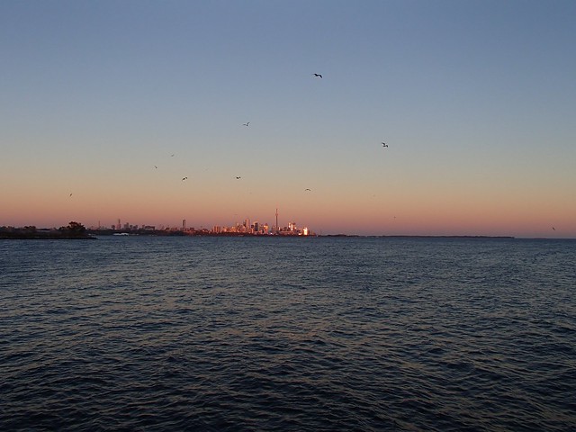
...test photo... Toronto...
Well not the same as before with Flickr, photo will not appear. Try again later.
Well not the same as before with Flickr, photo will not appear. Try again later.
Last edited:
OK... figured it out.
Nothing special. Just trying out my pic posting skills or lack of !https://hosting.photobucket.com/alb...a-dda5-49a7-a8bb-262726f081c2_zps83068a56.jpg
try try again.Nothing special. Just trying out my pic posting skills or lack of !https://hosting.photobucket.com/alb...a-dda5-49a7-a8bb-262726f081c2_zps83068a56.jpg
Got it ! Thanks any way!

Beach campsite, Lac canoetaicane, northern Quebec

- Joined
- Aug 21, 2018
- Messages
- 1,812
- Reaction score
- 4,615
That’s beautiful, Robin! I’m very envious.
Wow, nice beach, Robin.
G.
G.
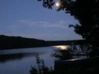
Was just about to load up and head out when this picture of perfectly calm Thomas Pond in Maine presented itself. 
Similar threads
- Replies
- 18
- Views
- 1K
- Replies
- 31
- Views
- 3K