Robin, I hope you don't mind, but I am posting a duplicate trip report, with most of the pics taken out, and an emphasis on the maps and portage information. I'm doing this as part of a community service for a group that provides some funding for our club, to give them an online reference. Tried posting it on another canoe site to avoid duplication, but would have had to resize everything. My apologies for the redundancy. On the other hand, it is an excellent reference for anyone contemplating this trip.
Onaman Lake, Northern ON
Overview of the trip
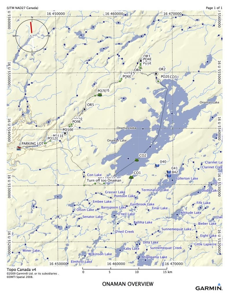
My buddy Rob L. started telling me last year that we needed to reopen the Onaman River. It had last been done by our Outers Club in 1999. He remembered it as a tame little river with lots of small rapids. The route starts at Onaman Lake, about 50 kilometers up the Kinghorn Road (around Jellico, N.ON), and eventually flows to Lake Nipigon. Due to shuttling concerns, we were ending the trip at Conglomerate lake, a few kilometers above Lake Nipigon.
Our group consisted of myself, solo in my Raven, Rob L. in his Kevlar prospector, and Rob’s dad and his friend Dave in a Bell. Rob’s dad is 74, and he’s still going strong.
The Onaman area is steeped in history. Rob’s dad Edgar told me that Onaman was the Ojibway word for the red substance they used for painting petrographs on rocks. It is also an area where there was extensive penetration by non-native people as well. I found a copy of a 1925 mining sheet that shows the whole area in detail.
http://www.geologyontario.mndmf.gov....34G/ARM34G.pdf
The portages and rapids shown on the 1925 document are extremely accurate, the only difference being that in 1925, the portages probably existed, and were used quite a bit. We were about to find out that this was not the case anymore.
The maps show portages as PO1, PO2, etc, standing for Portage Onaman plus the number. All portages are around rapids. Rapids without ports are indicated as OR1, OR2, etc.
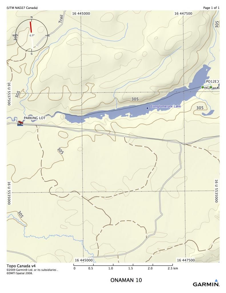
Onaman is a vehicle restricted lake, so the only way in is to carry everything down a 2 kilometer port.
PO1 Access road off of the Kinghorn, 1.96 Kilometers 16 U 456582 5530380
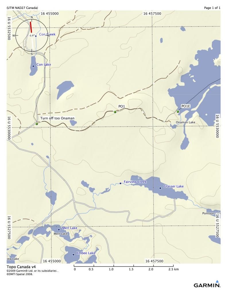
The walk in is good, as fisherman maintain the 2 K port. There are even some boardwalks over the swampy parts. Here are several places to launch. The first decent campsite is a small island about 7 kilometers down the lake (CO2). There is also a site in the west bay that is good, but would involve backtracking(CO1).

Onaman is a very large lake. From the end of PO1 to the beginning of PO2, it is almost 25 K. Care must be taken on the lake with wind.
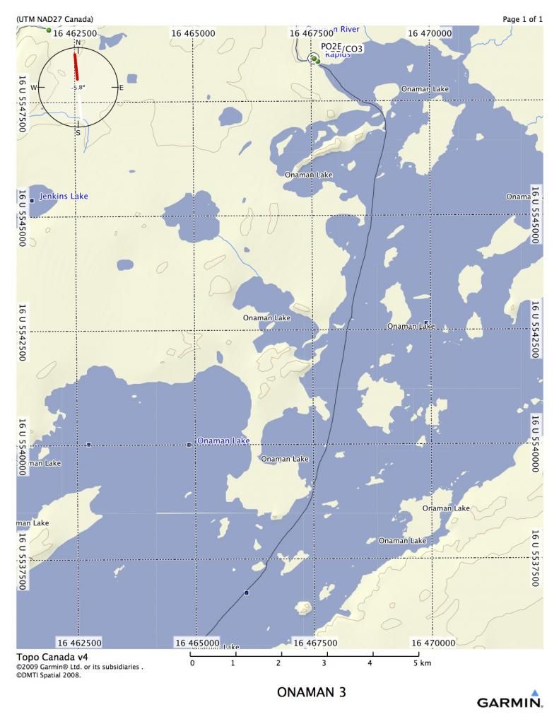
Once we reached the end of the lake, we began port clearing, and the labour was intense. Almost all ports had completely disappeared, so the procedure of finding, flagging, cutting and clearing began in earnest.
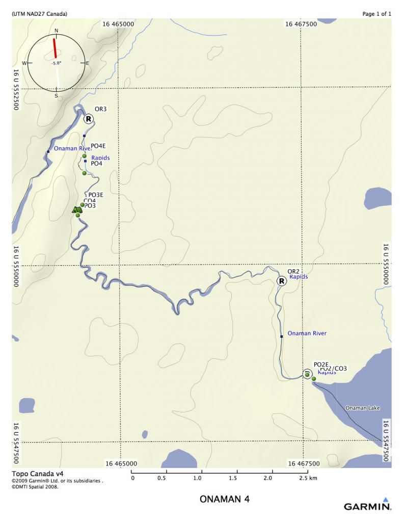
Blow-up of PO2 and OR1
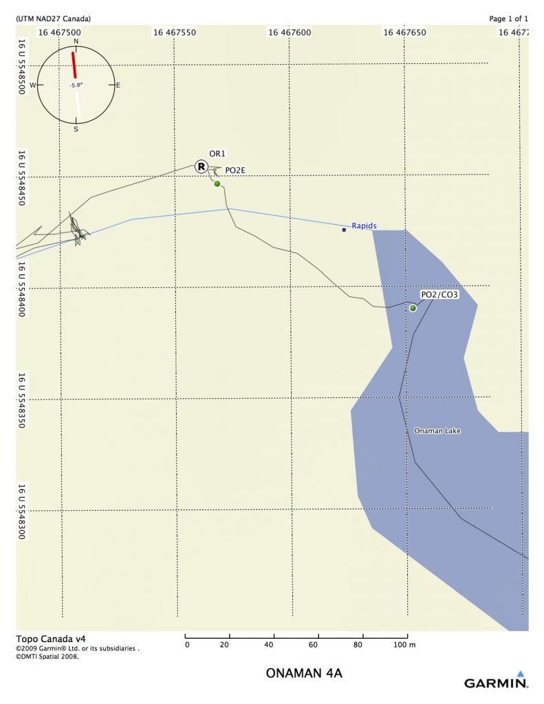
Leaving the lake, a small set of rapids is reached. There is a decent campsite at the head of the rapids that requires some windfall removal. Although we cleared the port, the rapids can be easily shot. You will notice on map 4A that the canoe track doesn’t always follow the shown river or land. There must be some discrepancies in the GPS, because I tried both NAD 83 and 27, and it made very little difference. However, I didn’t attempt to fix it, as the track gives a true view of where I travelled.
PO2 111 meter (RL) 16 U 467653 5548391
OR1 is an easy Class 1 rapid with a few rocks in it.
Expanded view 4AB
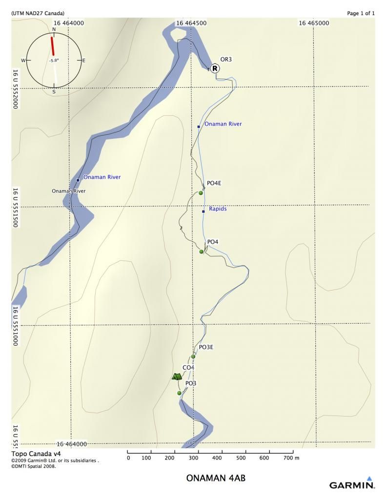
PO3 was only a short port of 193 meters (RL) 16 U 464444 5550715, but involved a lot of cutting. It was getting late by this time, so we made a desperation camp in the middle of the port on some high ground.
We set off the next morning and almost immediately hit PO4. I scouted all these rapids to see if they could be run, but they were meatgrinders. Very small shoots with tons of rocks and a very strong current. No eddies and some blowdown as well. This type of rapid was characteristic of the entire river.
PO4 was 350 m on RL 16 U 464538 5551311.
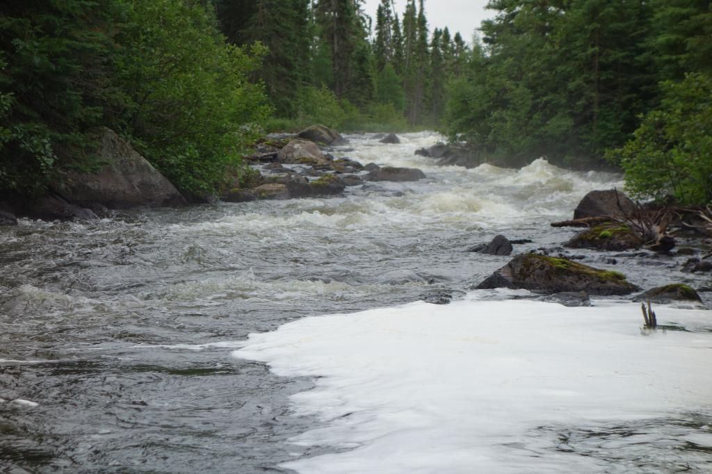
Typical rapid that had to be portaged.
OR3 was a small chute that could normally be run, but it had some bad logs stuffed into it. We did a carry-over on the rocks RL.
OR4 is a long chute with some difficult boney rapids in it, We decided to shoot it because the port probably would have been 600 meters to cut out. The port was indicated on RR, but there were no traces of it, and by this time we realized that we might run out of gas for the chainsaw if we didn’t start running and lining everything possible. All three canoes made it down, with only a few bumps. Stick to RR, very close to the shore for a clean run.
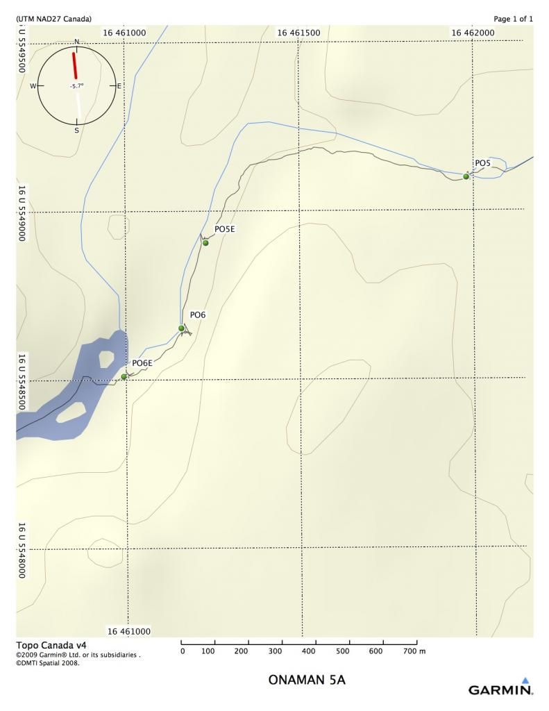
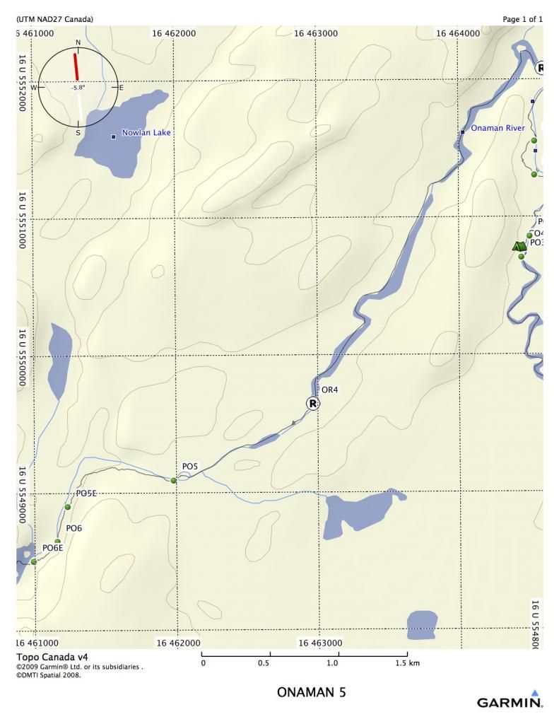
Although we had not travelled very far this day, we had done a lot of work. When we arrived at PO5, it took over two hours to scout and flag the port. We decided to camp right at the start of the port (one of the worst places I have ever camped, definitely hammock country). We got up the next morning and cut PO5, 950 m port (RL) 16 U 461982 5549100.
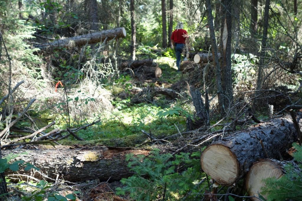
Typical cutting on the Onaman ports.
It took us three or four hours to cut and port all of our gear. Our maps had a lot of bad information on them, and we thought we might actually get to paddle for a half hour or so, but five minutes down the river brought us to PO6 on RL, 243 meters 16 U 461161 5548656. Once again, lots of finding and cutting and sweating.
We finally reached a stretch where we got to paddle for about a half hour. We were now in the area that had seen mining from the 1920’s through to the 40’s. Evidence was around us, with very old road beds and old bridges over the river. We camped in a big mossy spot beside an old washed out winter road.
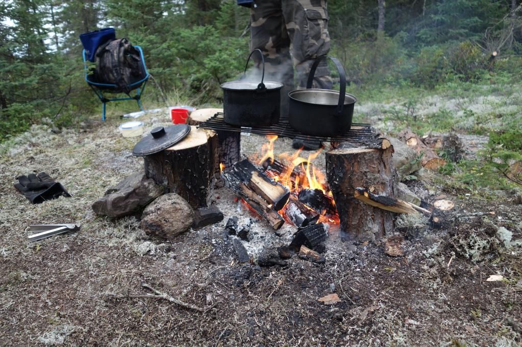
Supper time at the old road.
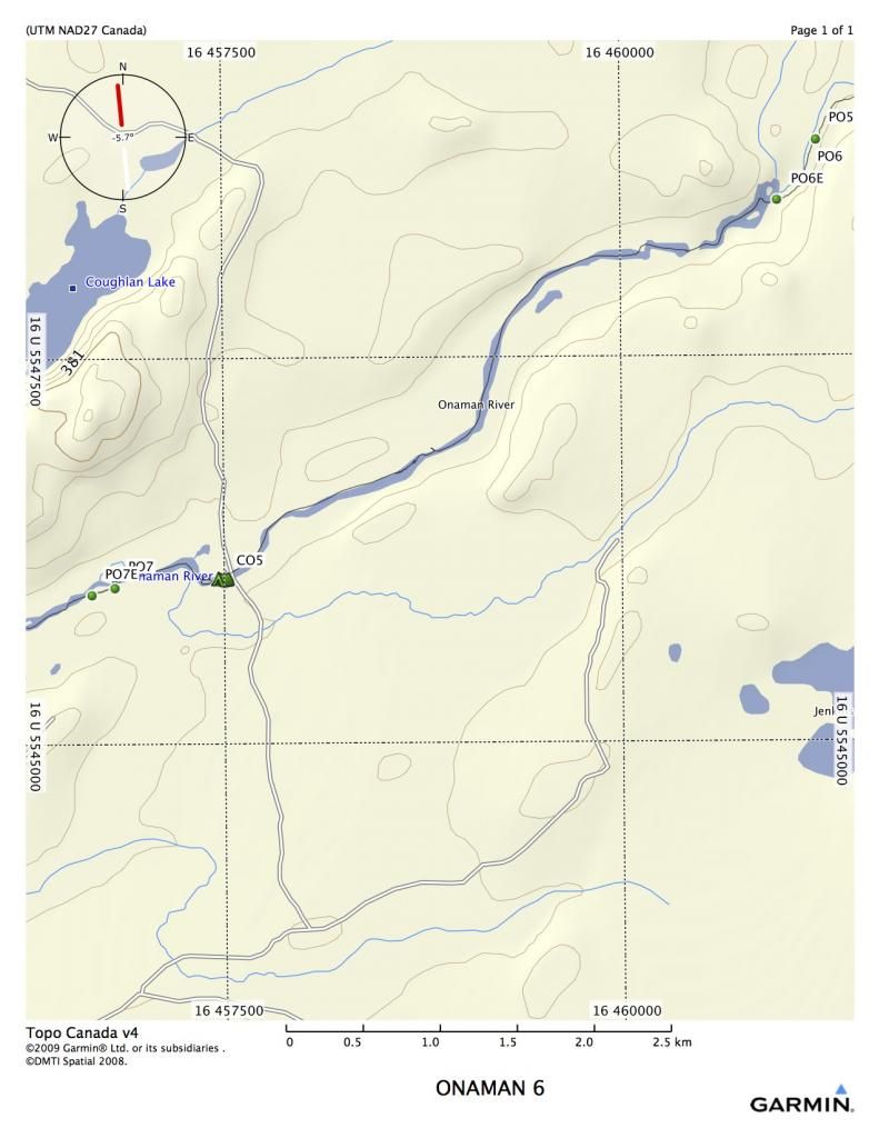
We left early the next morning and quickly reached PO7. More cutting, but PO7 was only 165 meters, RL 16 U 456816 5546026
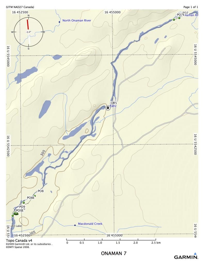
OR5 was listed as a falls, but all we found was a boney set of C1 rapids, which could be easily shot or walked.
Our biggest challenge of the day was PO8 that was coming up quickly. Our map information was very sketchy, and we really had no idea what to expect.
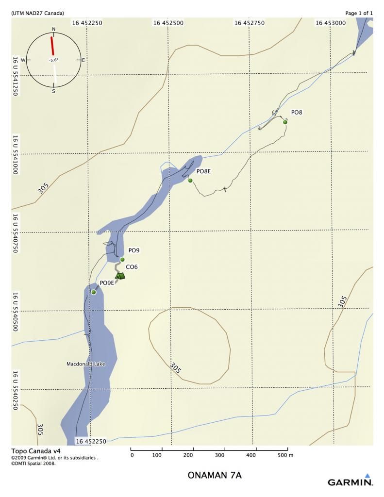
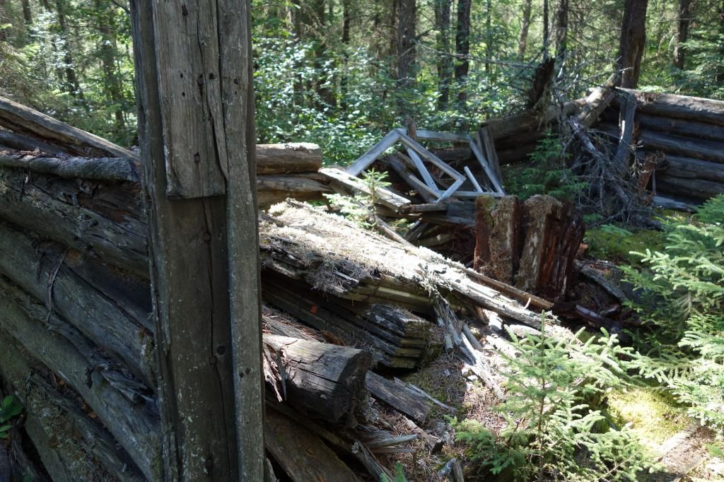
The original port started on RL where the whitewater began. We floundered our way through some of the worst country we had found yet, worrying about chainsaw gas and getting out of this trip. After a careful scouting of the river, it was decided that the first 350 meters of the port could be cut off by running the river down to a small pool. All three canoes were successful in doing this. Upon landing, we were in the middle of a jackpine stand with the remains of a very old mining camp surrounding us. There were several old log buildings, probably half wall structures, and a multitude of junk from the 1920’s. We flagged and cut the port in about two or three hours.
PO8 RL, first pool down rapids, 450 M 16 U 452860 5541098
We were getting tuckered out by this time. There was an old road with a washed out bridge about a kilometer from the end of PO8. My buddy cut the port, PO9, but I decided to shoot the rapids, which proved to be fairly harmless. We camped on the road bed, and although there was a lot of mining debris, the surface was flat. We had a frost that night, and it wasn’t even the middle of August.
PO9 168 M, RL, 16 U 452355 5540663
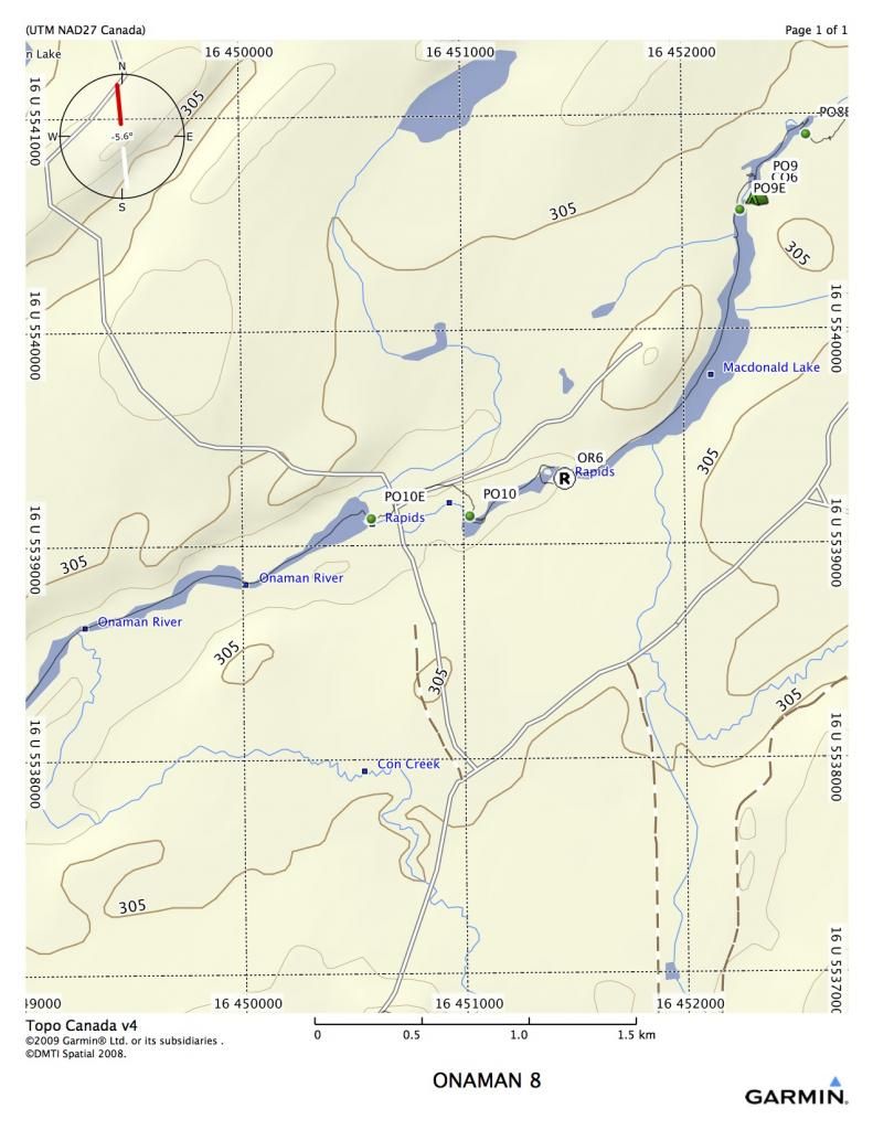
We were hoping that day 6 would be our last day. We set out around nine, and ran a few swifts before arriving at OR6. This was a short, nasty sort of rapid, but we were able to line it.
We shot a couple of shifts before arriving at PO10. My buddy Rob scouted up to an old logging road and cut a nice trail. It was good to not have to be cutting the whole length, as it turned out to be 650 meters. The port goes around a large set of rapids that crosses a road with an intact bridge and flows from MacDonald Lake back into Onaman River.
PO10 RR 650 M 16 U 451032 5539143
A short paddle brought us to P11, taken us around another set of impassable rapids. Although a short port, it was completely blown over, and took us some time to find, flag and cut.
PO11 137 M RL 16 U 448940 5538163
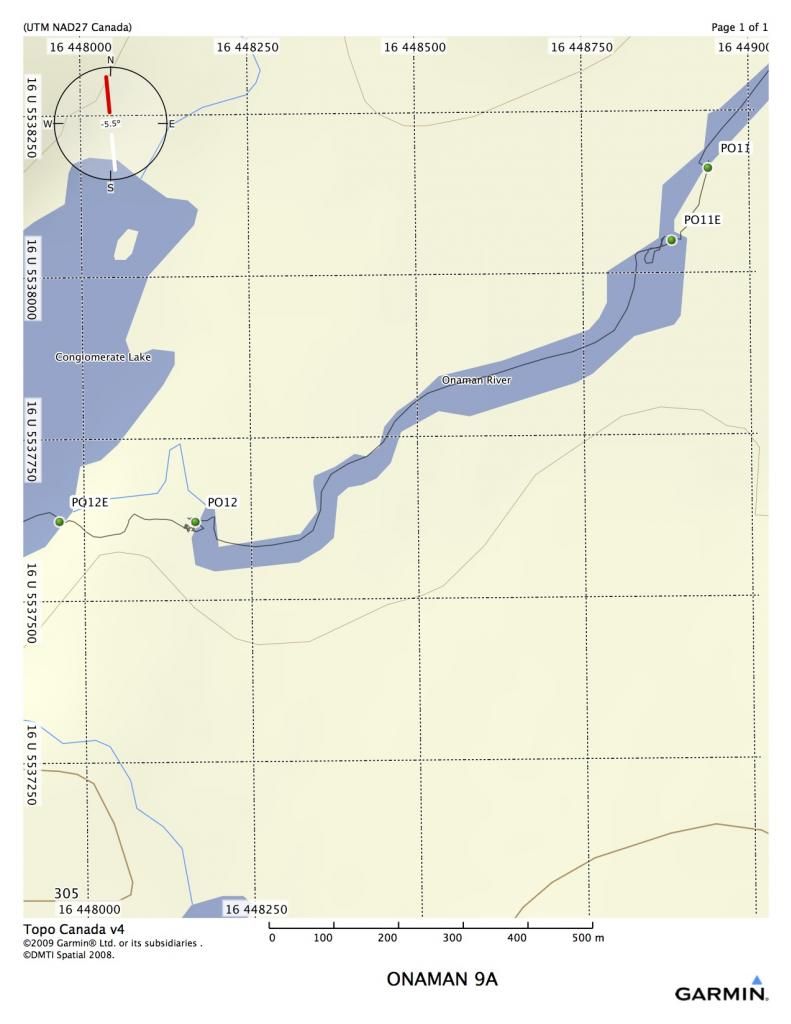
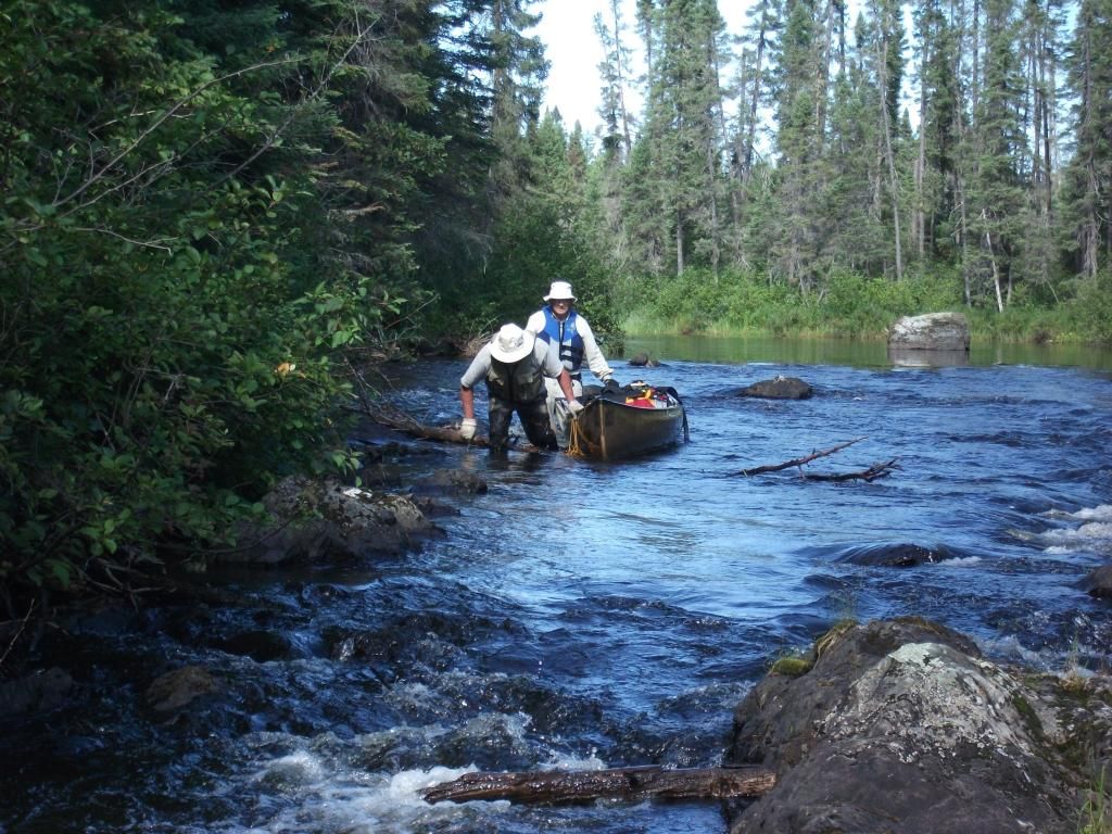
Shortly after clearing this port, we reached the last port of the trip, PO12. Once again, this port was missing, and basically had to be re-invented. We found the beginning and the end, but not the middle. Much cutting ensued, and the chainsaw finally used the last wisp of gas as we cut the last couple of logs.
PO12 RL 236 M 16 U 448167 5537624
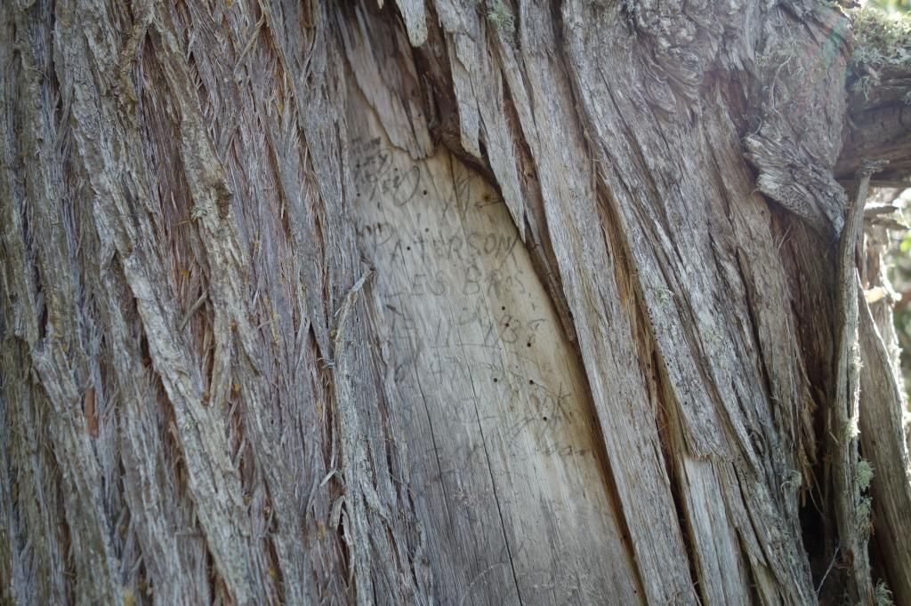
The end of the last port had an old cedar tree with a big blaze on it. The blaze had lots of writing on it, and half of the blaze had grown over concealing some of the writing. It was a very interesting piece of history, with the oldest date we could see on it being 1938, although I’m sure there were older ones under the part that was covered by the new growth.
We had to paddle down Conglomerate Lake in a head wind, but we all knew the end of the trip was near. At 5:13 we got the boat launch, about two K down the river out of Conglomerate. It was a very happy sight!
Onaman Lake, Northern ON
Overview of the trip

My buddy Rob L. started telling me last year that we needed to reopen the Onaman River. It had last been done by our Outers Club in 1999. He remembered it as a tame little river with lots of small rapids. The route starts at Onaman Lake, about 50 kilometers up the Kinghorn Road (around Jellico, N.ON), and eventually flows to Lake Nipigon. Due to shuttling concerns, we were ending the trip at Conglomerate lake, a few kilometers above Lake Nipigon.
Our group consisted of myself, solo in my Raven, Rob L. in his Kevlar prospector, and Rob’s dad and his friend Dave in a Bell. Rob’s dad is 74, and he’s still going strong.
The Onaman area is steeped in history. Rob’s dad Edgar told me that Onaman was the Ojibway word for the red substance they used for painting petrographs on rocks. It is also an area where there was extensive penetration by non-native people as well. I found a copy of a 1925 mining sheet that shows the whole area in detail.
http://www.geologyontario.mndmf.gov....34G/ARM34G.pdf
The portages and rapids shown on the 1925 document are extremely accurate, the only difference being that in 1925, the portages probably existed, and were used quite a bit. We were about to find out that this was not the case anymore.
The maps show portages as PO1, PO2, etc, standing for Portage Onaman plus the number. All portages are around rapids. Rapids without ports are indicated as OR1, OR2, etc.
Onaman is a vehicle restricted lake, so the only way in is to carry everything down a 2 kilometer port.
PO1 Access road off of the Kinghorn, 1.96 Kilometers 16 U 456582 5530380

The walk in is good, as fisherman maintain the 2 K port. There are even some boardwalks over the swampy parts. Here are several places to launch. The first decent campsite is a small island about 7 kilometers down the lake (CO2). There is also a site in the west bay that is good, but would involve backtracking(CO1).

Onaman is a very large lake. From the end of PO1 to the beginning of PO2, it is almost 25 K. Care must be taken on the lake with wind.

Once we reached the end of the lake, we began port clearing, and the labour was intense. Almost all ports had completely disappeared, so the procedure of finding, flagging, cutting and clearing began in earnest.

Blow-up of PO2 and OR1

Leaving the lake, a small set of rapids is reached. There is a decent campsite at the head of the rapids that requires some windfall removal. Although we cleared the port, the rapids can be easily shot. You will notice on map 4A that the canoe track doesn’t always follow the shown river or land. There must be some discrepancies in the GPS, because I tried both NAD 83 and 27, and it made very little difference. However, I didn’t attempt to fix it, as the track gives a true view of where I travelled.
PO2 111 meter (RL) 16 U 467653 5548391
OR1 is an easy Class 1 rapid with a few rocks in it.
Expanded view 4AB

PO3 was only a short port of 193 meters (RL) 16 U 464444 5550715, but involved a lot of cutting. It was getting late by this time, so we made a desperation camp in the middle of the port on some high ground.
We set off the next morning and almost immediately hit PO4. I scouted all these rapids to see if they could be run, but they were meatgrinders. Very small shoots with tons of rocks and a very strong current. No eddies and some blowdown as well. This type of rapid was characteristic of the entire river.
PO4 was 350 m on RL 16 U 464538 5551311.

Typical rapid that had to be portaged.
OR3 was a small chute that could normally be run, but it had some bad logs stuffed into it. We did a carry-over on the rocks RL.

OR4 is a long chute with some difficult boney rapids in it, We decided to shoot it because the port probably would have been 600 meters to cut out. The port was indicated on RR, but there were no traces of it, and by this time we realized that we might run out of gas for the chainsaw if we didn’t start running and lining everything possible. All three canoes made it down, with only a few bumps. Stick to RR, very close to the shore for a clean run.

Although we had not travelled very far this day, we had done a lot of work. When we arrived at PO5, it took over two hours to scout and flag the port. We decided to camp right at the start of the port (one of the worst places I have ever camped, definitely hammock country). We got up the next morning and cut PO5, 950 m port (RL) 16 U 461982 5549100.
Typical cutting on the Onaman ports.

It took us three or four hours to cut and port all of our gear. Our maps had a lot of bad information on them, and we thought we might actually get to paddle for a half hour or so, but five minutes down the river brought us to PO6 on RL, 243 meters 16 U 461161 5548656. Once again, lots of finding and cutting and sweating.
We finally reached a stretch where we got to paddle for about a half hour. We were now in the area that had seen mining from the 1920’s through to the 40’s. Evidence was around us, with very old road beds and old bridges over the river. We camped in a big mossy spot beside an old washed out winter road.


Supper time at the old road.
We left early the next morning and quickly reached PO7. More cutting, but PO7 was only 165 meters, RL 16 U 456816 5546026

OR5 was listed as a falls, but all we found was a boney set of C1 rapids, which could be easily shot or walked.
Our biggest challenge of the day was PO8 that was coming up quickly. Our map information was very sketchy, and we really had no idea what to expect.

The original port started on RL where the whitewater began. We floundered our way through some of the worst country we had found yet, worrying about chainsaw gas and getting out of this trip. After a careful scouting of the river, it was decided that the first 350 meters of the port could be cut off by running the river down to a small pool. All three canoes were successful in doing this. Upon landing, we were in the middle of a jackpine stand with the remains of a very old mining camp surrounding us. There were several old log buildings, probably half wall structures, and a multitude of junk from the 1920’s. We flagged and cut the port in about two or three hours.
PO8 RL, first pool down rapids, 450 M 16 U 452860 5541098

We were getting tuckered out by this time. There was an old road with a washed out bridge about a kilometer from the end of PO8. My buddy cut the port, PO9, but I decided to shoot the rapids, which proved to be fairly harmless. We camped on the road bed, and although there was a lot of mining debris, the surface was flat. We had a frost that night, and it wasn’t even the middle of August.
PO9 168 M, RL, 16 U 452355 5540663

We were hoping that day 6 would be our last day. We set out around nine, and ran a few swifts before arriving at OR6. This was a short, nasty sort of rapid, but we were able to line it.

We shot a couple of shifts before arriving at PO10. My buddy Rob scouted up to an old logging road and cut a nice trail. It was good to not have to be cutting the whole length, as it turned out to be 650 meters. The port goes around a large set of rapids that crosses a road with an intact bridge and flows from MacDonald Lake back into Onaman River.
PO10 RR 650 M 16 U 451032 5539143
A short paddle brought us to P11, taken us around another set of impassable rapids. Although a short port, it was completely blown over, and took us some time to find, flag and cut.
PO11 137 M RL 16 U 448940 5538163

Shortly after clearing this port, we reached the last port of the trip, PO12. Once again, this port was missing, and basically had to be re-invented. We found the beginning and the end, but not the middle. Much cutting ensued, and the chainsaw finally used the last wisp of gas as we cut the last couple of logs.
PO12 RL 236 M 16 U 448167 5537624
The end of the last port had an old cedar tree with a big blaze on it. The blaze had lots of writing on it, and half of the blaze had grown over concealing some of the writing. It was a very interesting piece of history, with the oldest date we could see on it being 1938, although I’m sure there were older ones under the part that was covered by the new growth.


We had to paddle down Conglomerate Lake in a head wind, but we all knew the end of the trip was near. At 5:13 we got the boat launch, about two K down the river out of Conglomerate. It was a very happy sight!
Last edited: