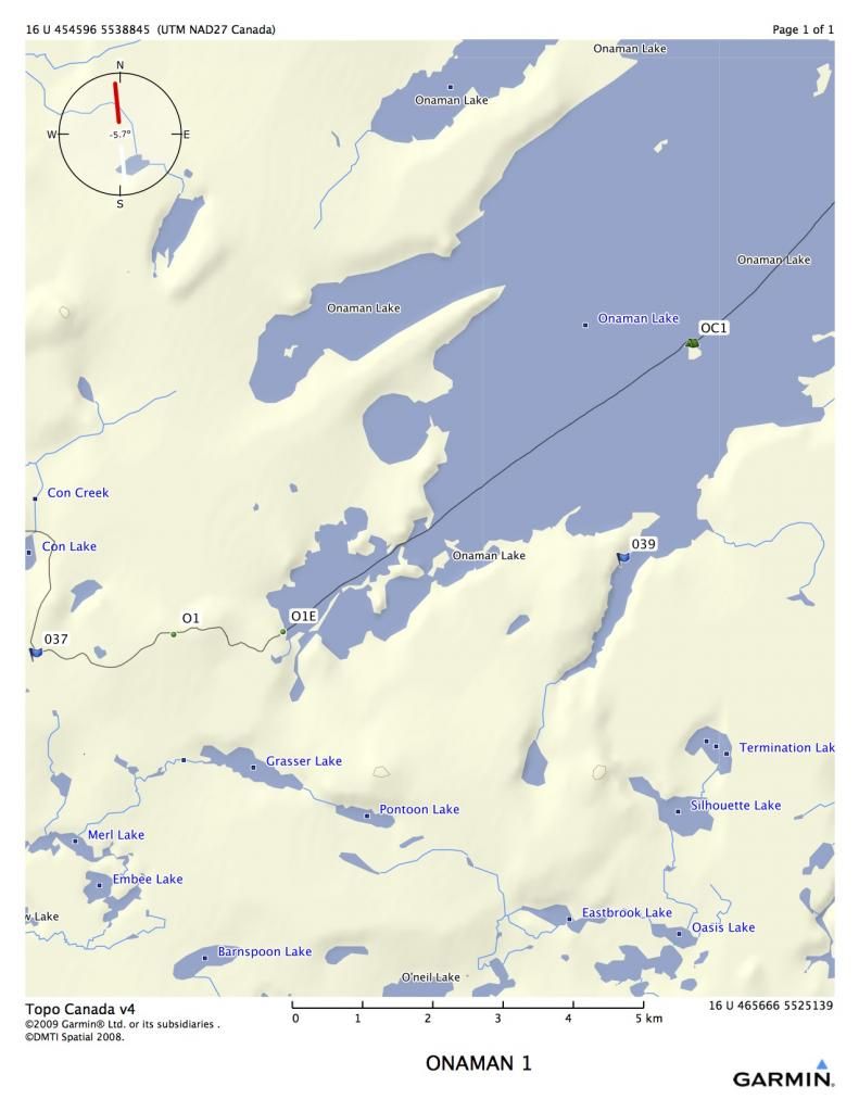
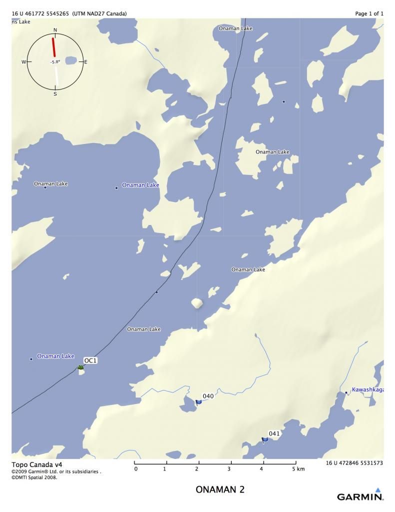
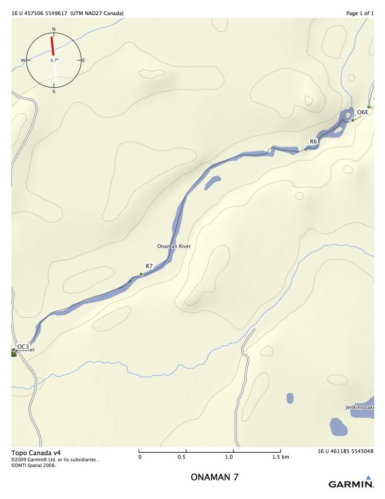
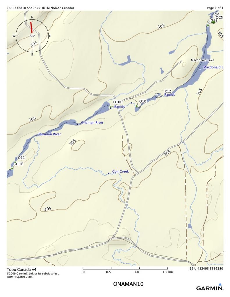
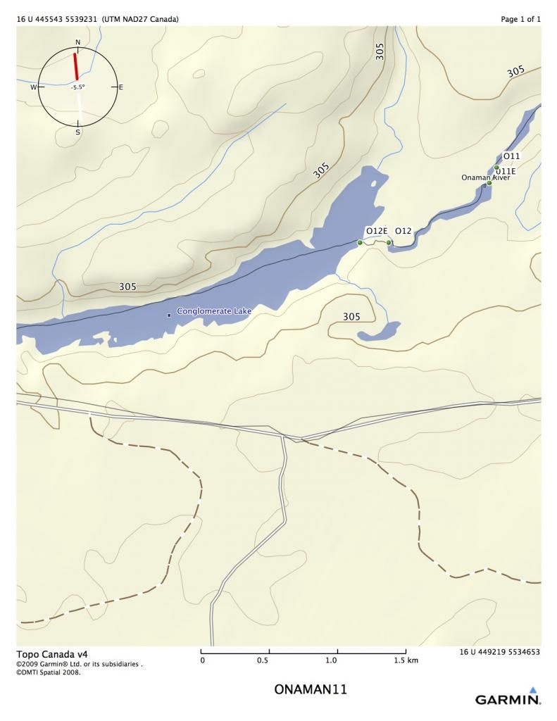
My buddy Rob L. started telling me last year that we needed to reopen the Onaman River. It had last been done by our Outers Club in 1999. He remembered it as a tame little river with lots of small rapids. The route starts at Onaman Lake, about 50 kilometers up the Kinghorn Road (around Jellico, N.ON), and eventually flows to Lake Nipigon. Due to shuttling concerns, we were ending the trip at Conglomerate lake, a few kilometers above Lake Nipigon.
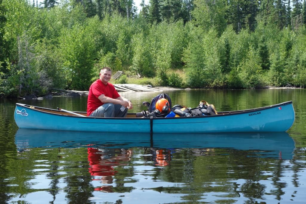
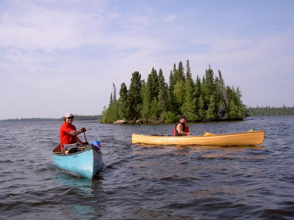
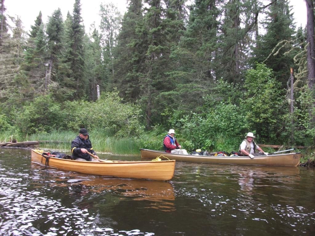
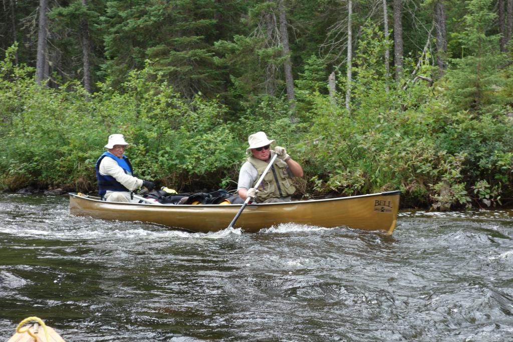
Our group consisted of myself, solo in my Raven, Rob L. in his Kevlar prospector, and Robs dad and his friend Dave in a Bell. Robs dad is 74, and hes still going strong. This was a very tough trip, and even as I write this, I am still quite sore.
The Onaman area is steeped in history. Robs dad Edgar told me that Onaman was the Ojibway word for the red substance they used for painting petrographs on rocks. It is also an area where there was extensive penetration by non-native people as well. I found a copy of a 1925 mining sheet that shows the whole area in detail.
http://www.geologyontario.mndmf.gov....34G/ARM34G.pdf
[URL=http://s906.photobucket.com/user/memaquay/media/Screen%20Shot%202018-06-26%20at%207.43.25%20AM_zpsnync4ppe.png.html]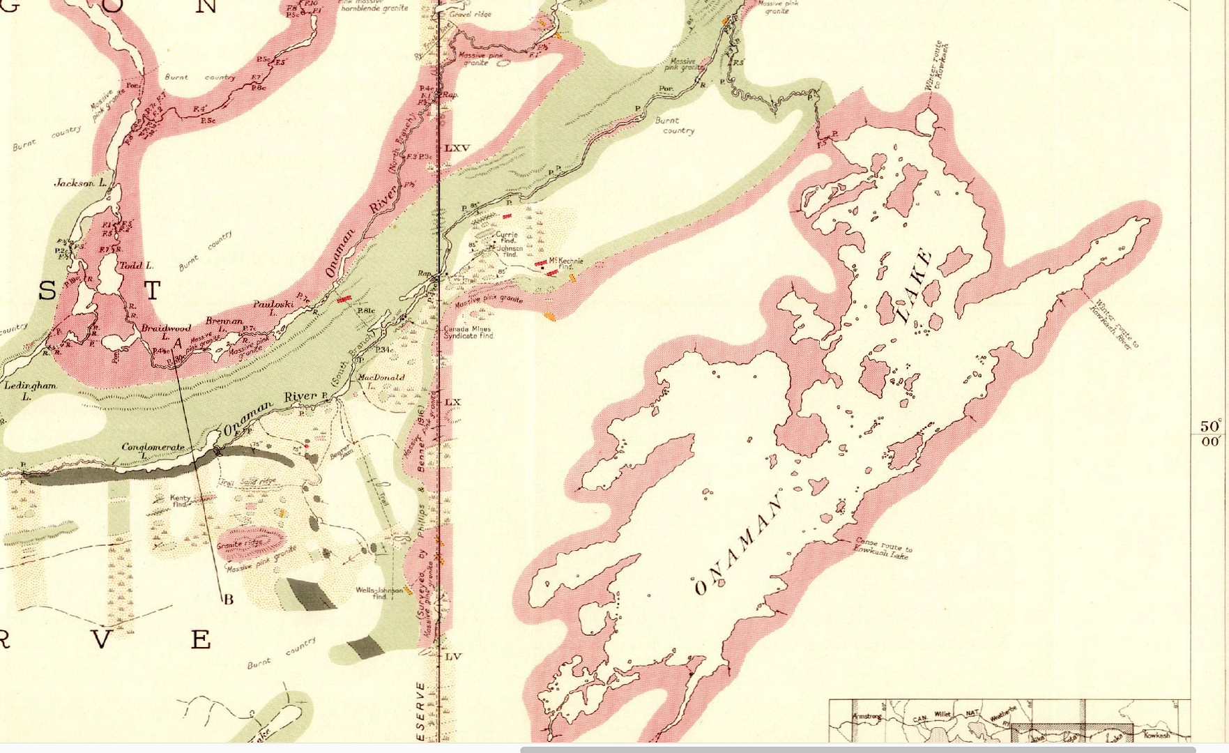 [/URL]
The portages and rapids shown on the 1925 document are extremely accurate, the only difference being that in 1925, the portages probably existed, and were used quite a bit. We were about to find out that this was not the case anymore.
DAY ONE
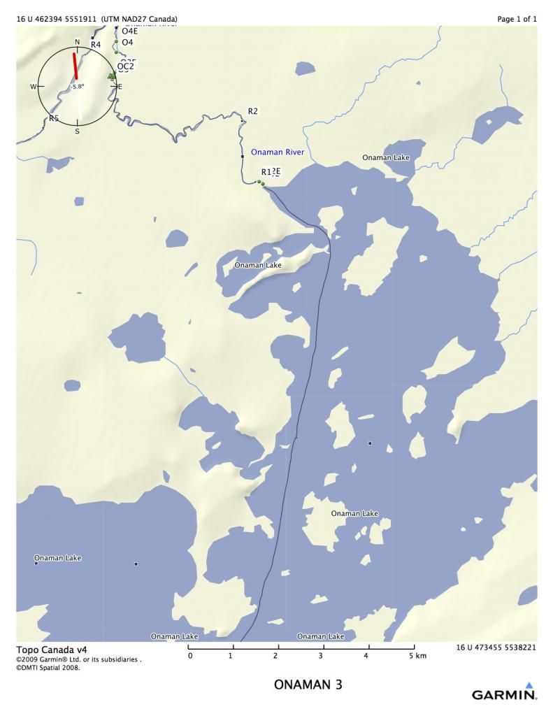
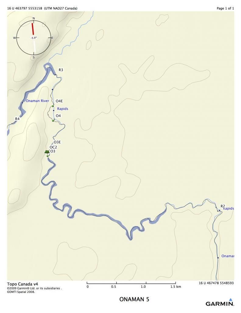
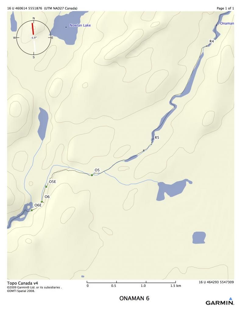
The mpas show portages as O1, O2, etc, standing for Onaman plus the number. All portages are around rapids. Rapids without ports are indicated as R1, R2, etc.
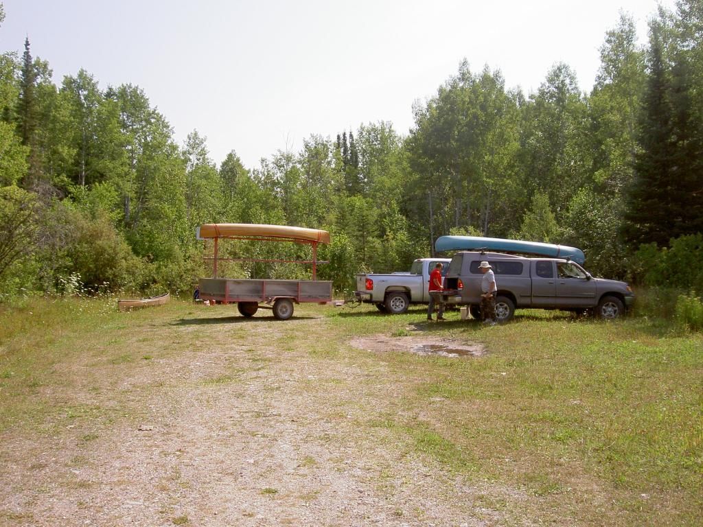
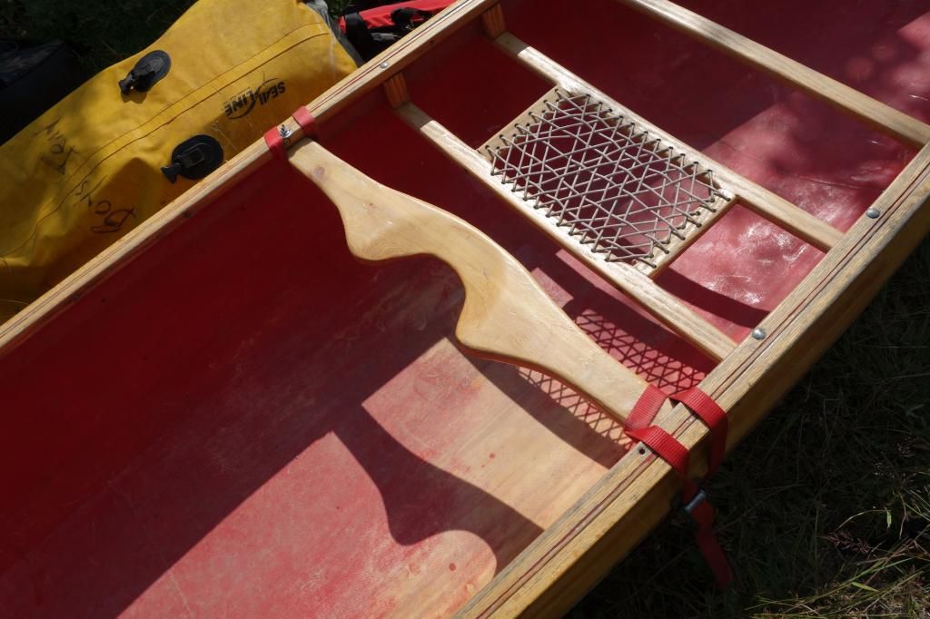
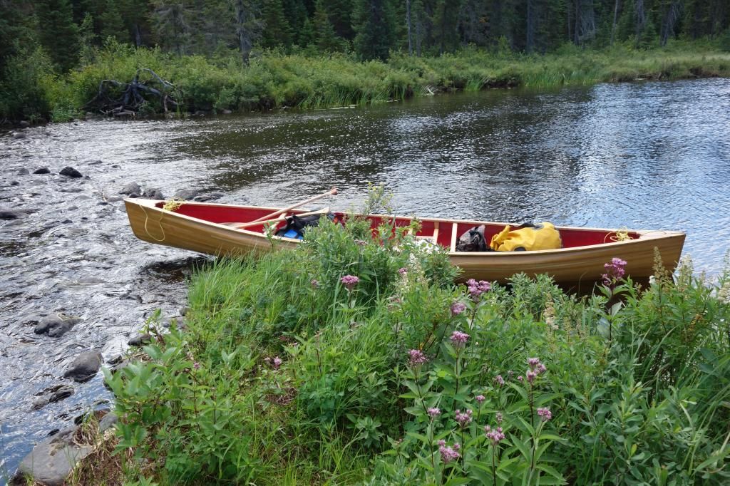
We completed the shuttling of the vehicles and began porting from the Onaman parking lot at around 1:00 PM.
Unloading at Onaman
Onaman is a vehicle restricted lake, so the only way in is to carry everything down a 2 kilometer port. It was around 30 C that day, and we cooked carrying in. We all had three trips each, so it was around ten K total before we were done. I was starting to regret that beer I was carrying.
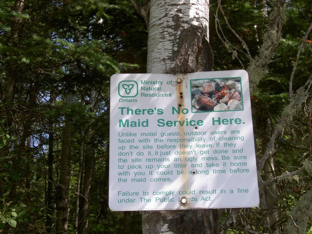
This was a standard MNR sign back in the day when part of their mandate was maintaining the wilderness. In the 70’s, the Junior Rangers used to keep all these canoe routes open. Sadly, it is a leaner, meaner world now, where governments only support activities that generate money.
The ride in shook the wingnut off my carrying yoke, and it was the one time I forgot extras, so for the rest of the rip, I was using this rig every time I portaged.
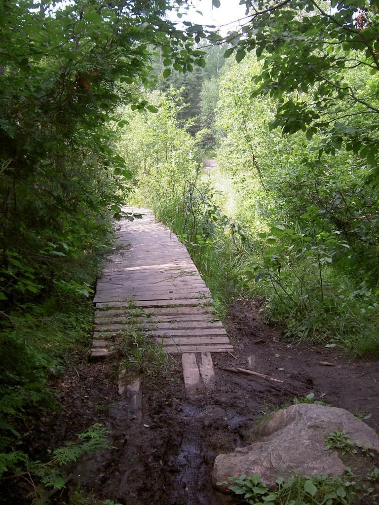
It was nice to see boardwalks over the wet parts, it is the only time I have ever seen anything like this in our neck of the woods.
Finished porting!
Rob L. ready to go.
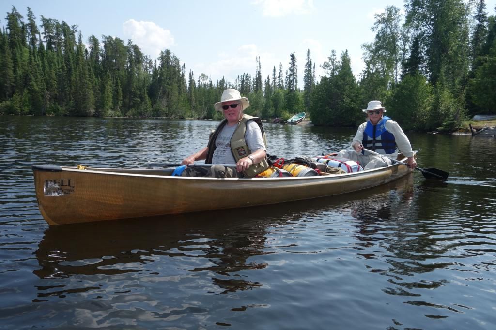
Dave and Ed in the Bell.
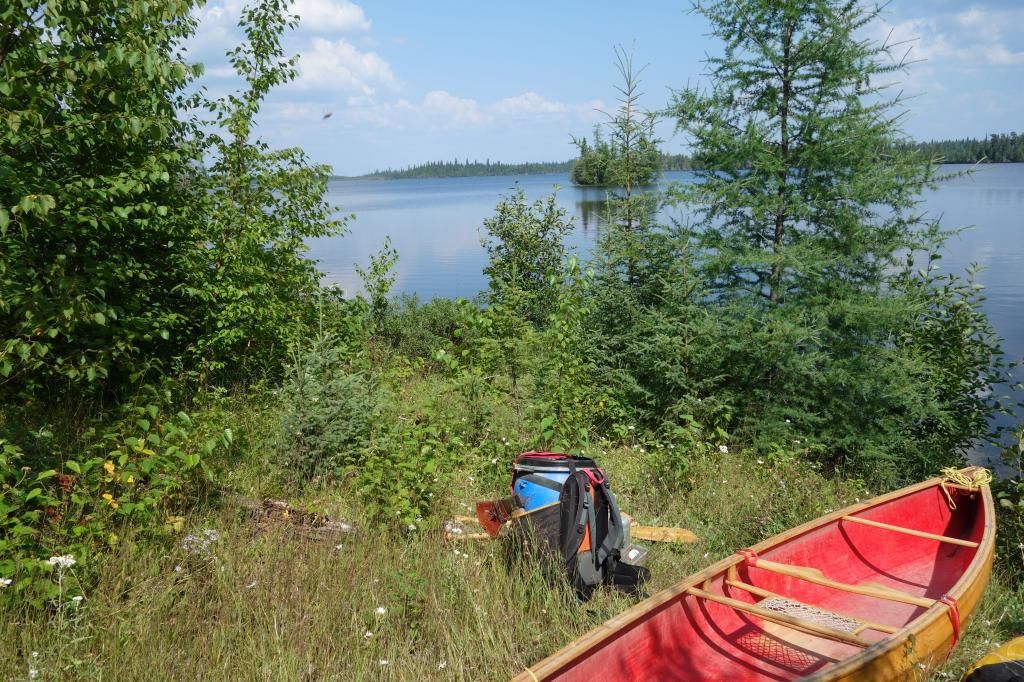
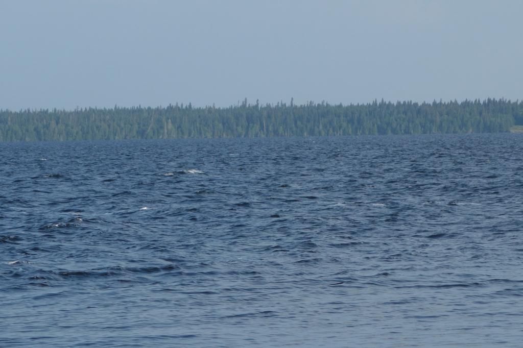
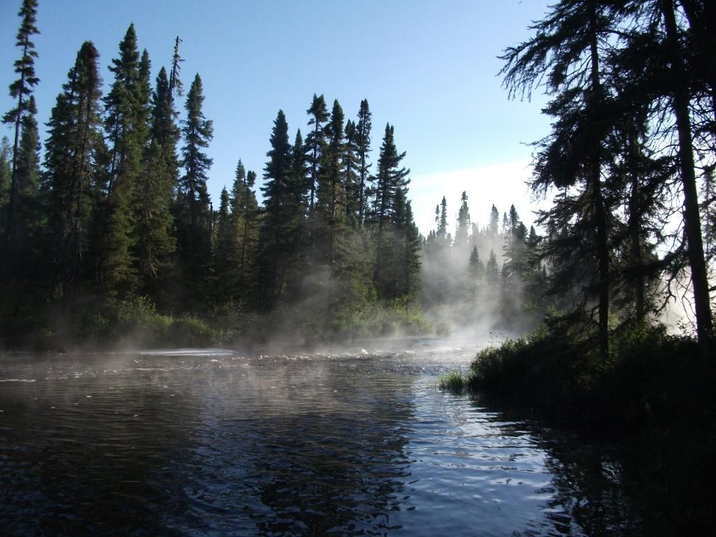
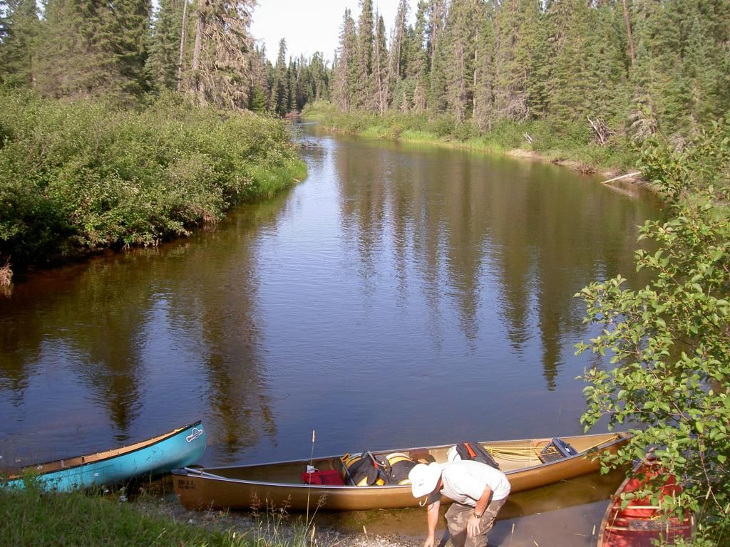
We started down the lake at about 3:30. Onaman is an enormous lake, roughly 25 K long and several wide. It is known for big waves, but today it was flat. We headed for and island about 7 kilometers away. It was a hot, sweaty paddle
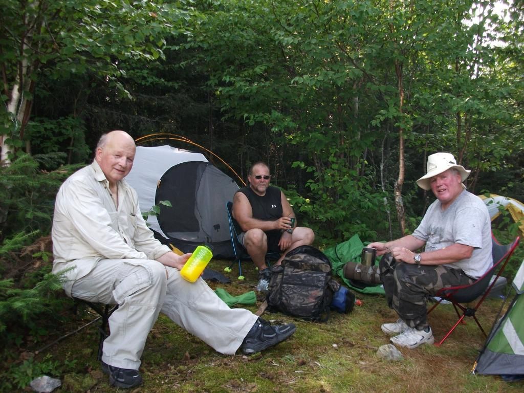
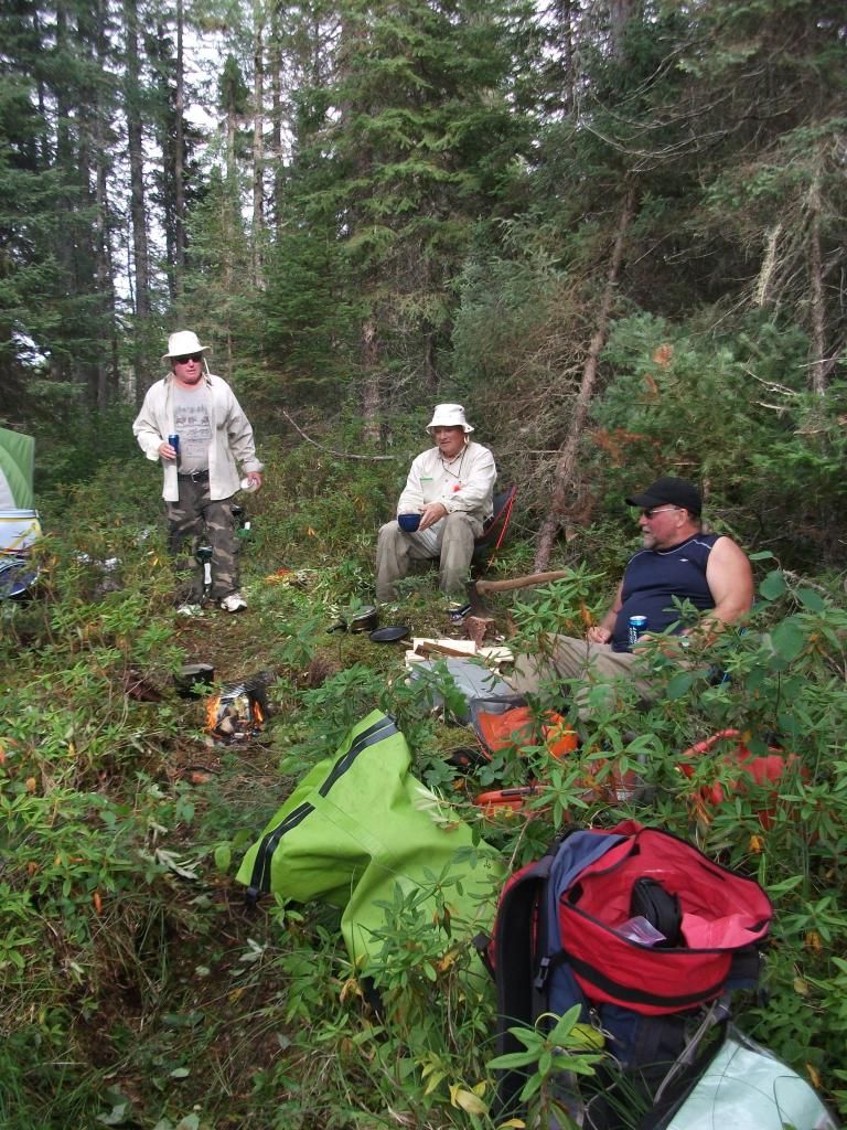
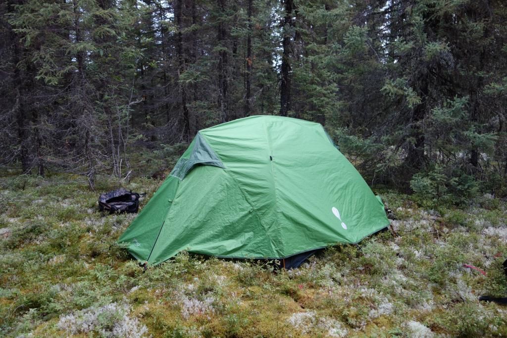
The island campsite is good, but a little dirty, as it is used by fisherman. We set up quickly and then enjoyed a few toasts, knowing that the worst port of the trip was behind us. Ha! If only that were the truth.
Re-hydrating!
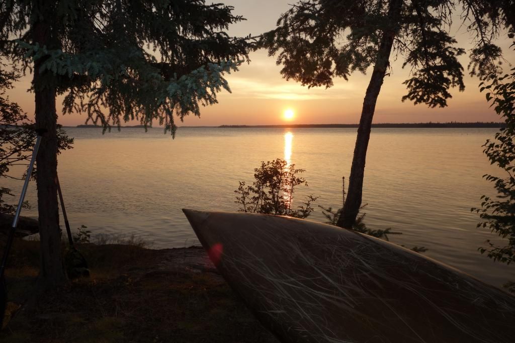
Our evening view
DAY TWO (two maps)
We got up at about 6:45 and were greeted with a different Onaman than the night before.
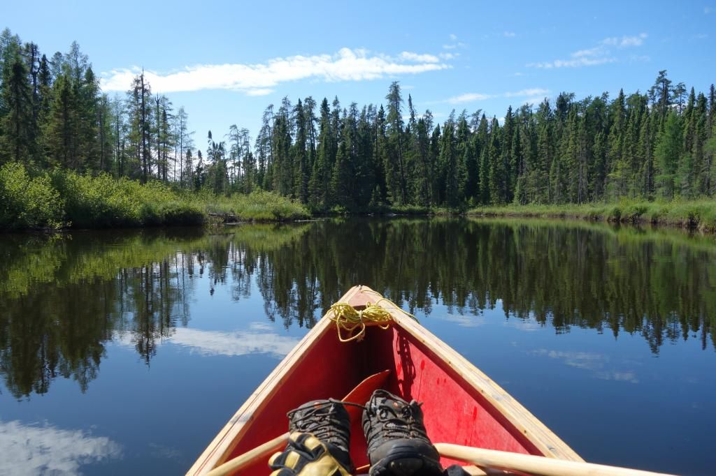
It was starting to whitecap. I was nervous, as I knew the further we got from our little island, the larger the waves would get. We launched around 8:45 and were soon into some large waves, probably three foot rollers anyway. I’m often nervous in waves this size when I’m really loaded heavy, as the aft of the canoe can have a tendency to slide out. However, the generous rocker in the Raven makes corrections work almost instantly. We were headed for a large island with an outfitter on it, and in a little over an hour we were sitting in the lee.
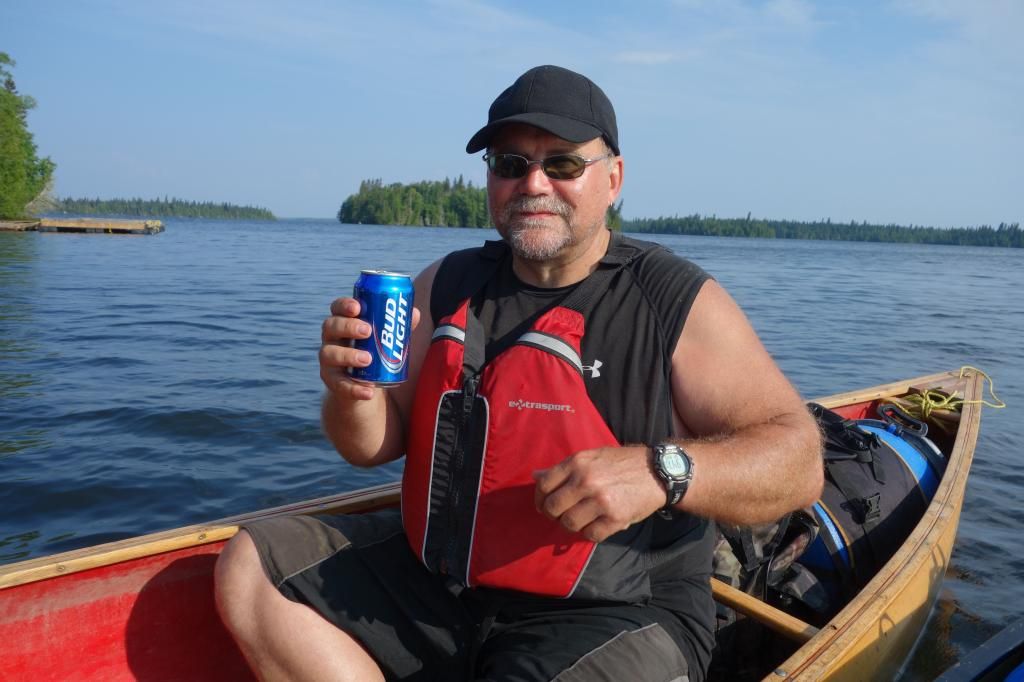
I had a Bud to celebrate a safe passage.
Although we still had many kilometers to paddle, the lake was now full of islands, and the wind was broken up a fair bit.
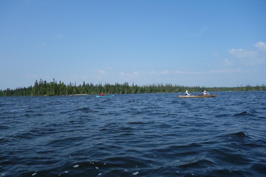
Finishing off the lake.
We arrived at the second portage of the trip around 12:30. It was a short port, 108 meters, and the trail was evident and only needed some cutting. This gave us all high hopes, as 15 years of non-use usually means that portages disappear up here.
The second portage.
We then negotiated two sets of small rapids before arriving at the next port.
The next port we arrived at, O3 (196 m), was not in as good shape as the last one. We spent some time actually finding it, and then after flagging it, Rob L. began the job of cutting. We located a clearing in the middle and called it home for the night. Rain began to fall and persisted in huge amounts all night.
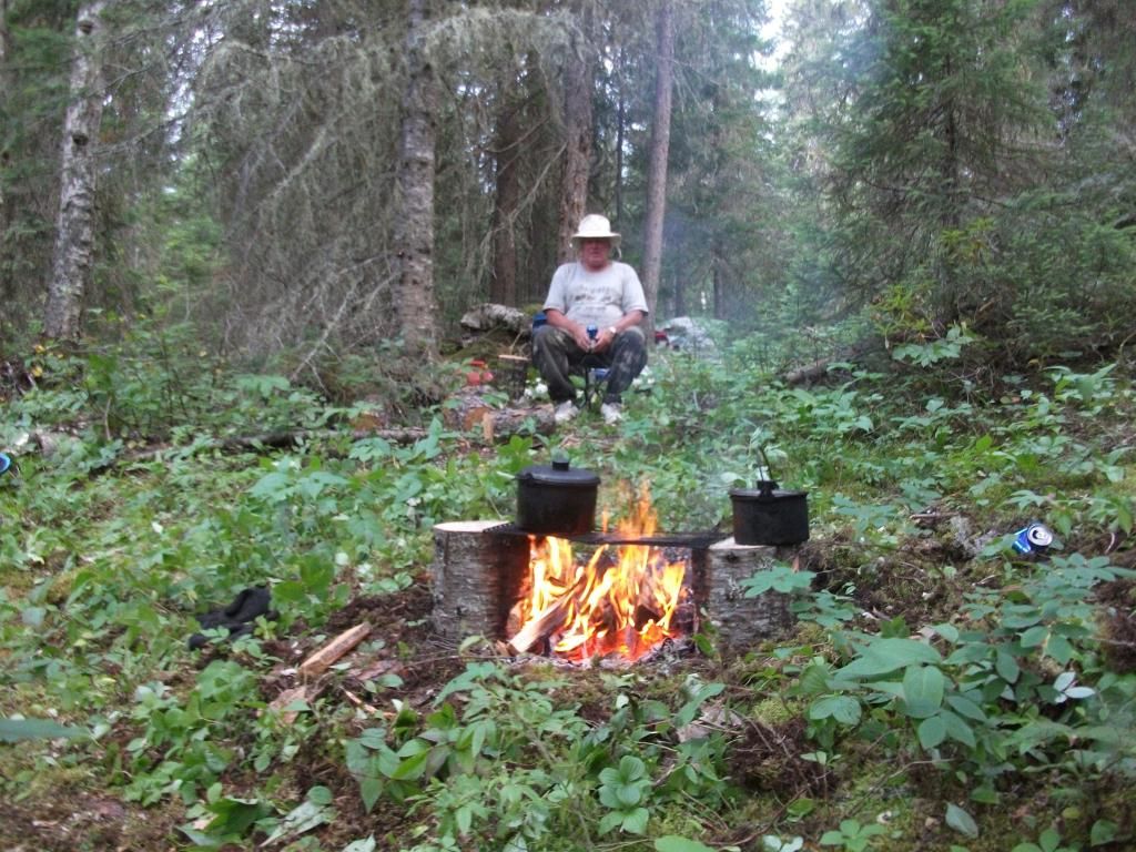
Rob L.’s stump fires were the best creation since Kevlar.
DAY 3
This was to prove to be a very challenging day. The rest of the river must have been hit with a blowdown at some point in the last fifteen years, as almost every port after this point was obliterated.
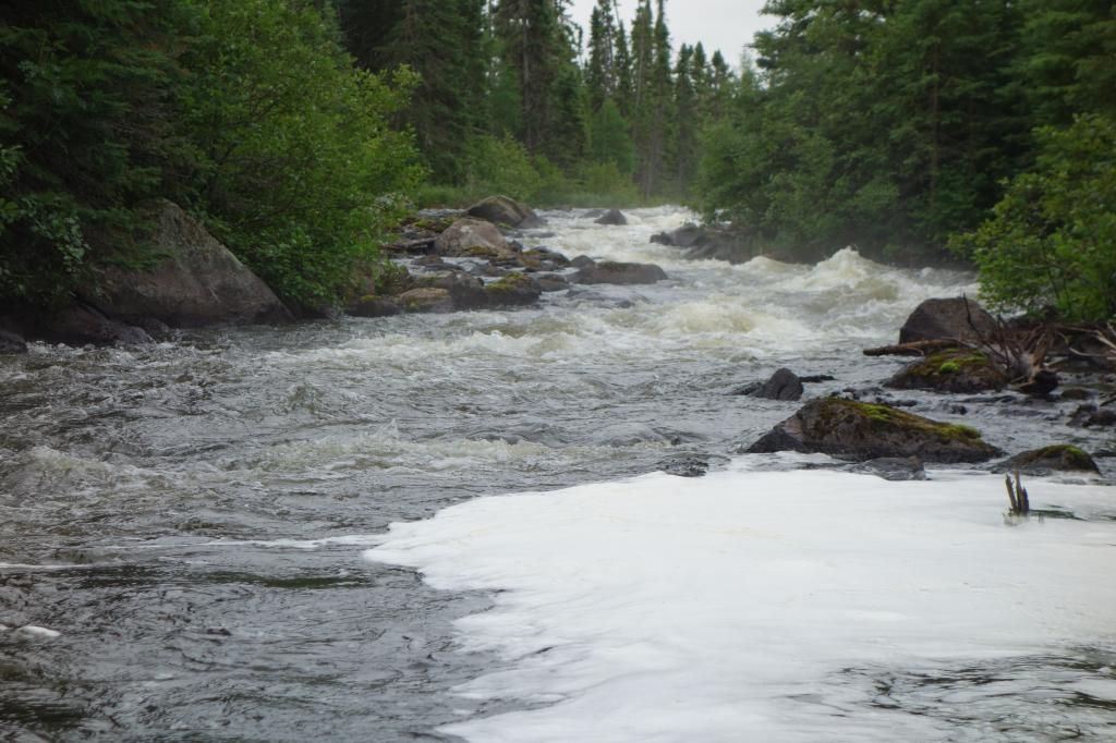
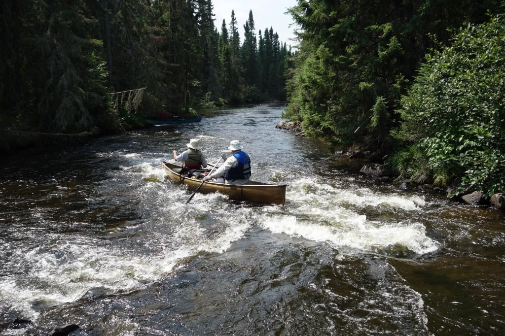
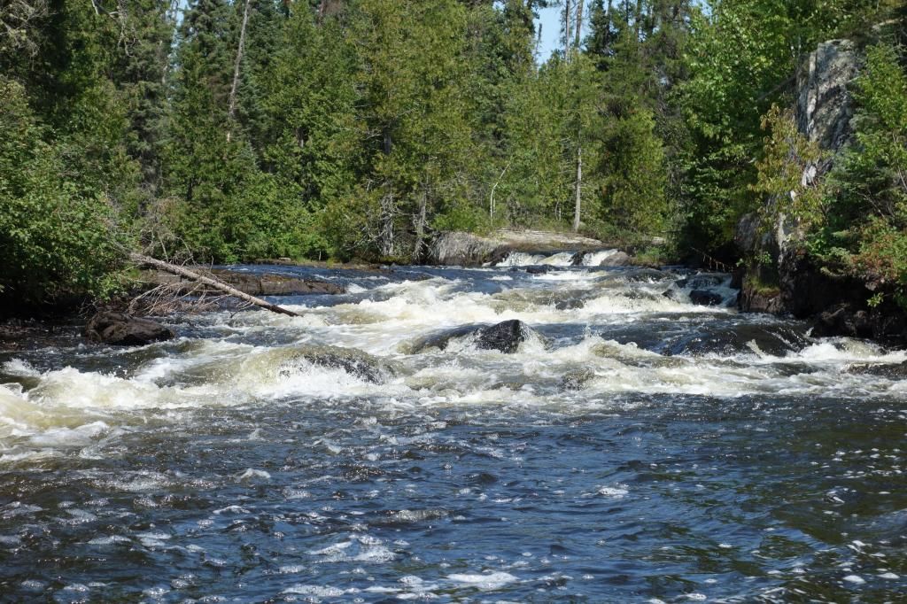
Typical rapids we ported around.
Heading out on day 3.
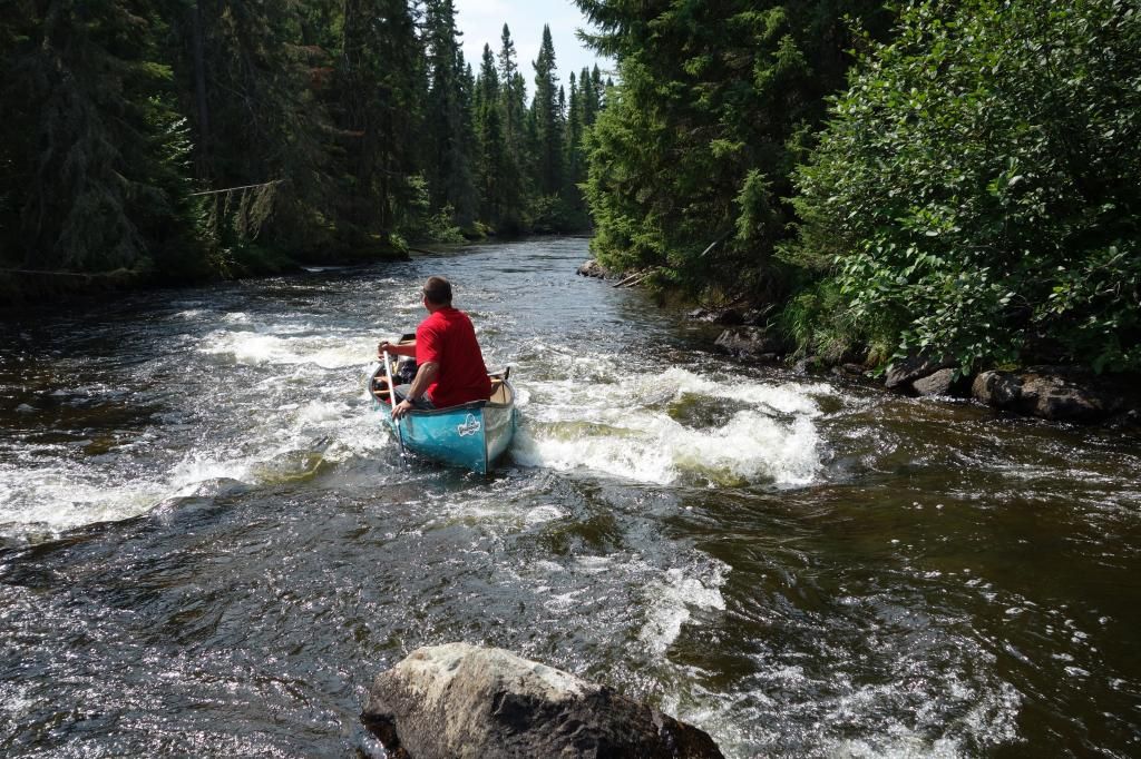
We actually lined this one RL, as there was a huge log stuck in the middle of the cascade.
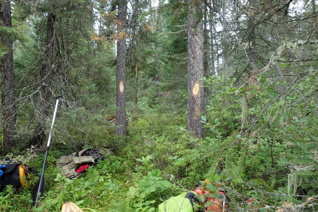
Port 4 was non-existant, but ended up being 350 meters once cut. It is exhausting work locating the ports, as one is crawling over blowdown, looking for evidence of old blazes or saw cuts, it can take hours. Fortunately, Rob L. is an expert in this area, and bounds through the blowdown like an enegizer kangaroo. He then has the energy to cut through massive blowdown at lightening speed.
More rapids were negotiated after port 4.
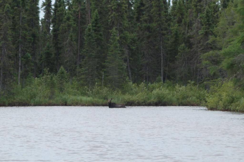
We only saw one moose on the entire trip, but the area is crawling in moose sign.
We arrived at port 5 at around 2:00 pm. For the next 2 ½ hours we scouted out a trail. It was a nightmare; no trail, tons of blowdown. When we got back to the beginning of trail around 5:00 we decided to call it a night. This was one of the worst areas I have ever camped in, with only small patches of semi dry ground for tents. Hammock country for sure!
The worst campsite ever, made tolerable by good company.
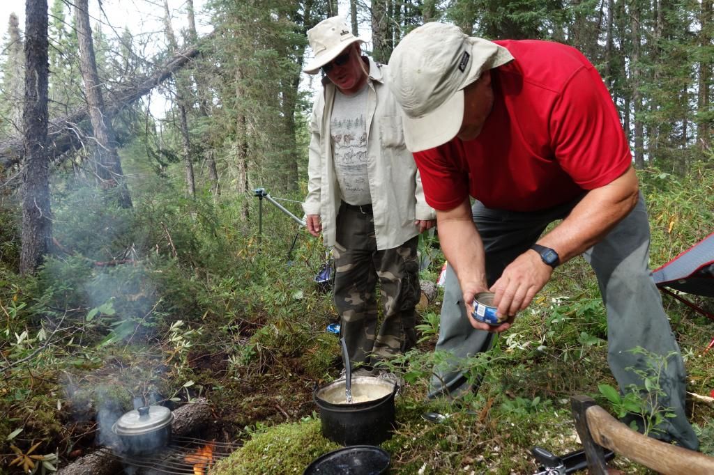
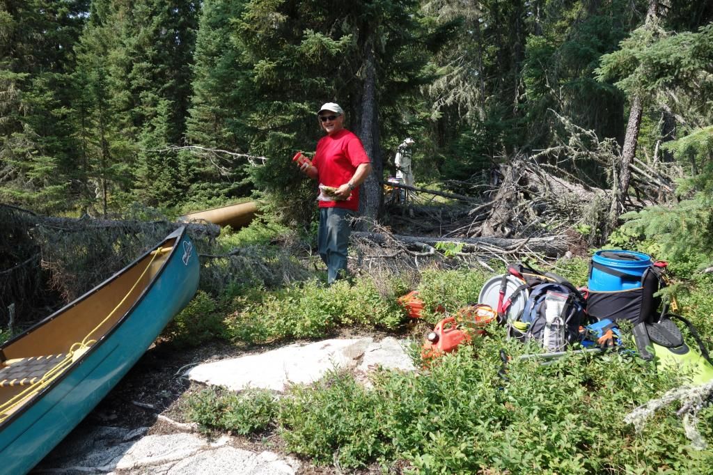
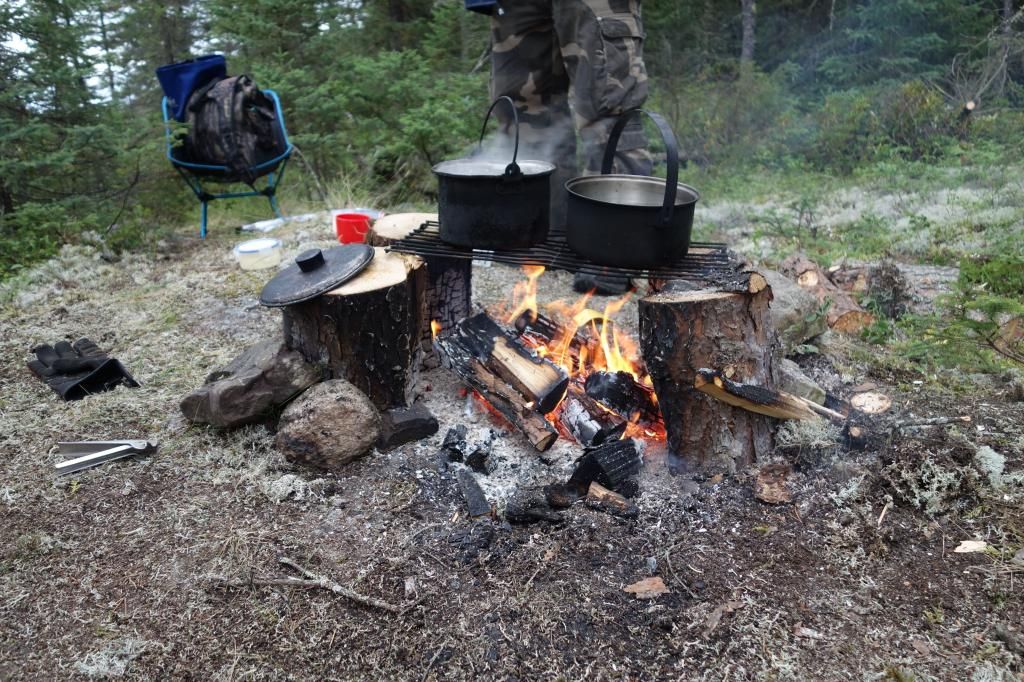
Rob L. is quite the cook, and made every supper on the trip. This was his shrimp linguine dinner which was delicious.
This is no country for hand saws. Chainsaw required!
DAY 4
It was very cold overnight, but we woke up to some nice scenery.
We started cutting and clearing the 950 meter port at around 9:00. By 2:30 in the afternoon, a new port existed, and we had all our gear on the other side. It had been an arduous morning. However, the river began to develop some scenic qualities.
The scenery only lasted for about ten minutes until we reached the next port, and more of the same occurred, finding, flagging, cutting and clearing. At least it was only 245 meters this time. We then ran and lined two more sets of rapids before getting to an old bridge that had existed in the 1920’s for a winter road that supplied the mining camps.
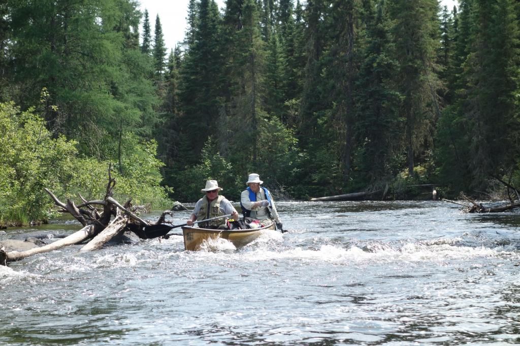
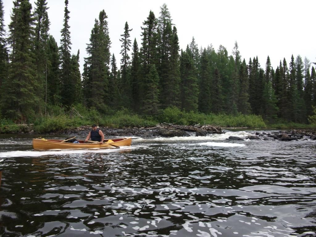
Walking a tough rapid.
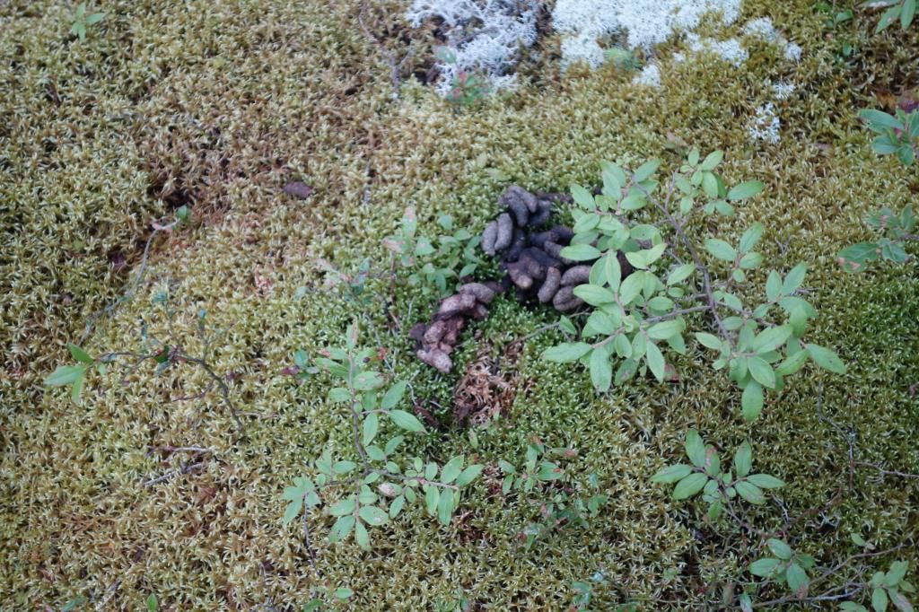
The campsite was off to the side of the old road, on a beautiful moss covered rocky area. The site had been used in 1999 by the Outers, and Rob L. found an old compass, still intact. When I went to set up my tent in a blueberry patch, the entire area was covered in partridge poop. I had to clear several piles off just to find room for my small tent. I’ll bet those partridge will be really tasty this fall.
Partridge feces.
Tent on top of partridge feces.
Rob L. made another stump fire and we had an excellent meal and actually managed to stay awake kibitzing around the fire until about 9:30. It had been a series of early nights for most of us, because we were exhausted at the end of each day.
Stump fire.
DAY 5
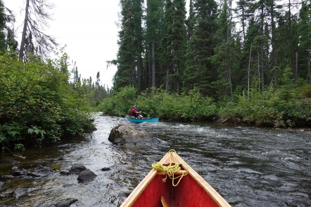
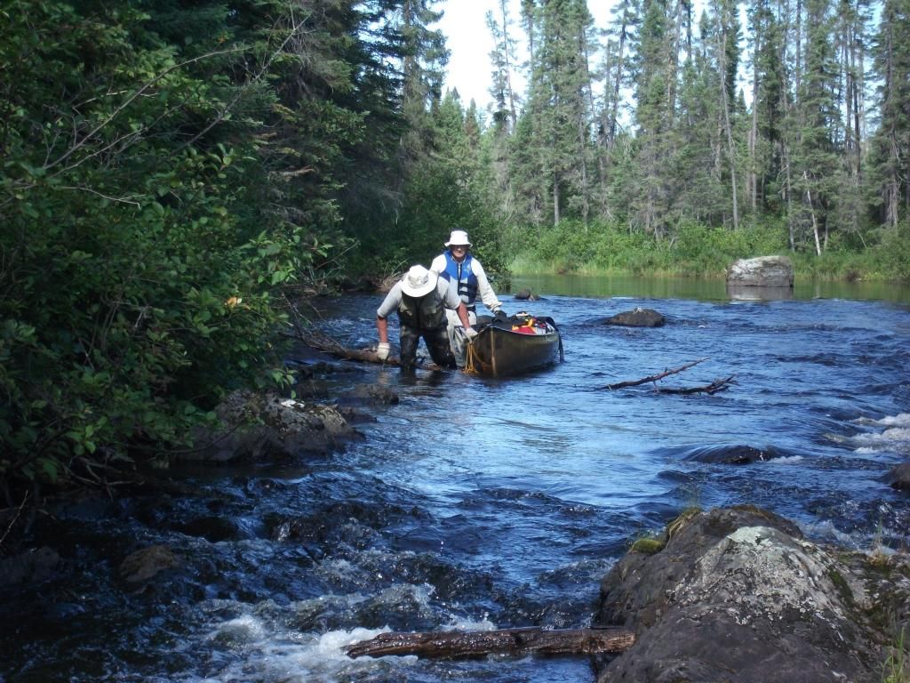
Our objective this day was MacDonald Lake. We knew that in order to get out in six days, we would have to make it there. It was a very challenging day, once again. We shot or lined rapids, and then arrived at the big port, indicated in our notes as 600 paces. We scouted the first 3 or 400 meters, and it was a disaster. There was no port apparent and the bush was impenetrable. After a careful scouting of the rapids, it was decided to shoot the first 400 meters and eddy out in a pool. This proved to be a great decision, as the port after this was easier to find.
We were greeted immediately with the remains of a very old mining camp. Ed is a local author and historian, and he figures it was from the 1920’s. It was fascinating to poke around in the remains, it looked like they suddenly decided one day to not come back. Stoves were left with tea kettles and frying pans still on them.
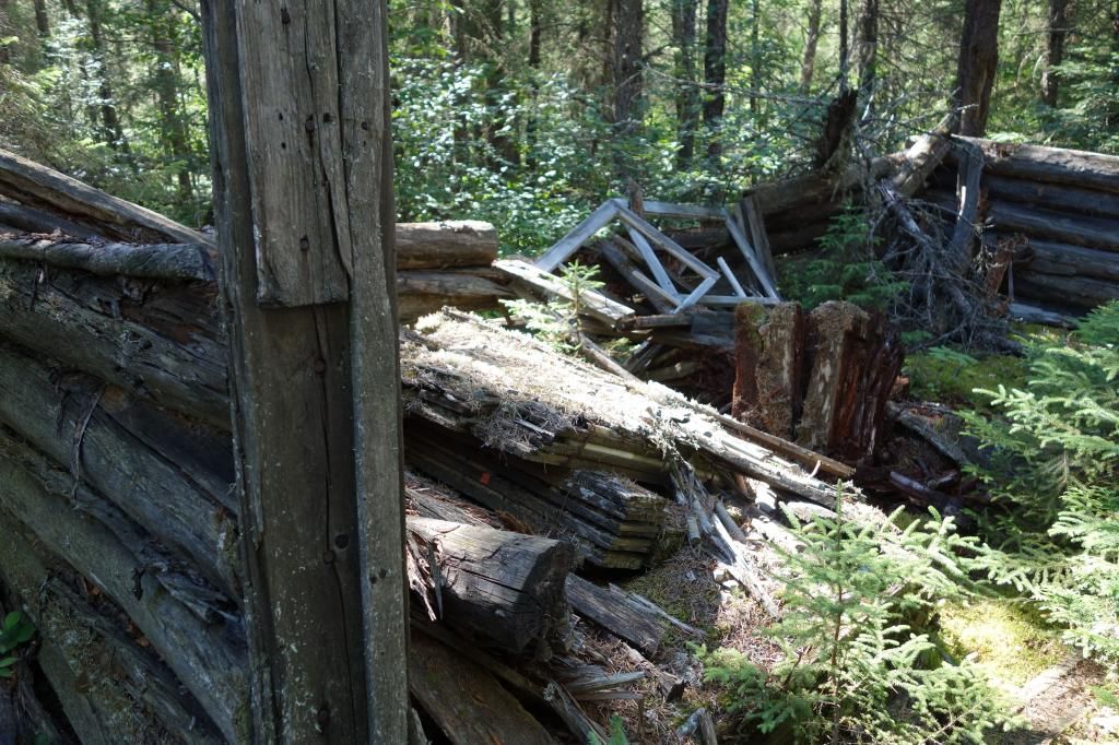
Core racks with the mining samples still on them were lying around too.
With all the interst in mining up here recently, I’m surprised someone is not back here again. The area is covered in quartz.
The port ended up being 470 meters long, which was considerably better than the 870 it would have been if we had not eased our way down the first set of rapids. However, there was still lots of cutting.
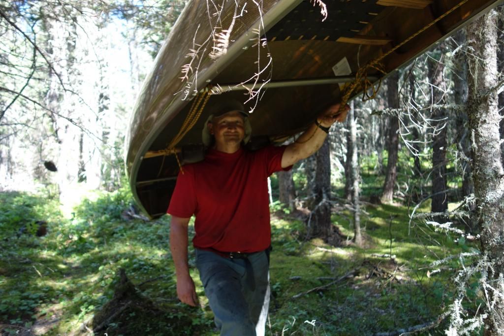
The ever cheerful Rob L. porting a canoe.
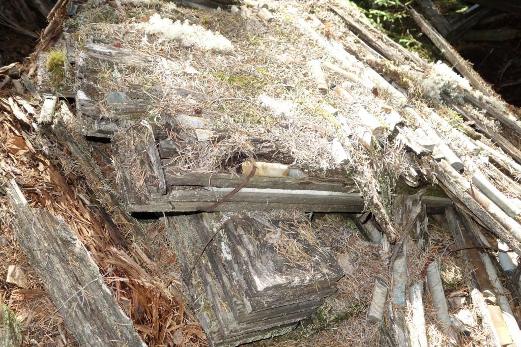
We stayed that night at an old mining camp in the middle of a port into MacDonald Lake. I shot the rapids, but the other guys ported. It was a messy sight, with more core racks and debris lying around, but we were grateful for the flat ground. The temperature began to drop quickly, but we stayed around the fire until about 10:30.
DAY 6
It had dropped to almost 0 degrees C overnight. Tents, lifejackets and water pumps were covered in frost.
Frost covered water pump.
We had a long day ahead of us, with three ports to clear. These were the worst ports of the trip, completely impassable and completely missing. 630, 117 and 230 meters respectively.
Rapids at end of last port.
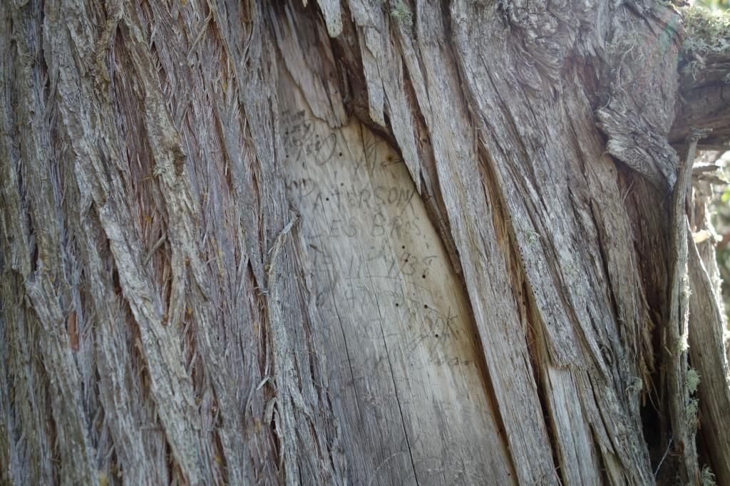
The end of the last port had an old cedar tree with a big blaze on it. The blaze had lots of writing on it, and half of the blaze had grown over concealing some of the writing. It was a very interesting piece of history, with the oldest date we could see on it being 1938, although I’m sure there were older ones under the part that was covered by the new growth.
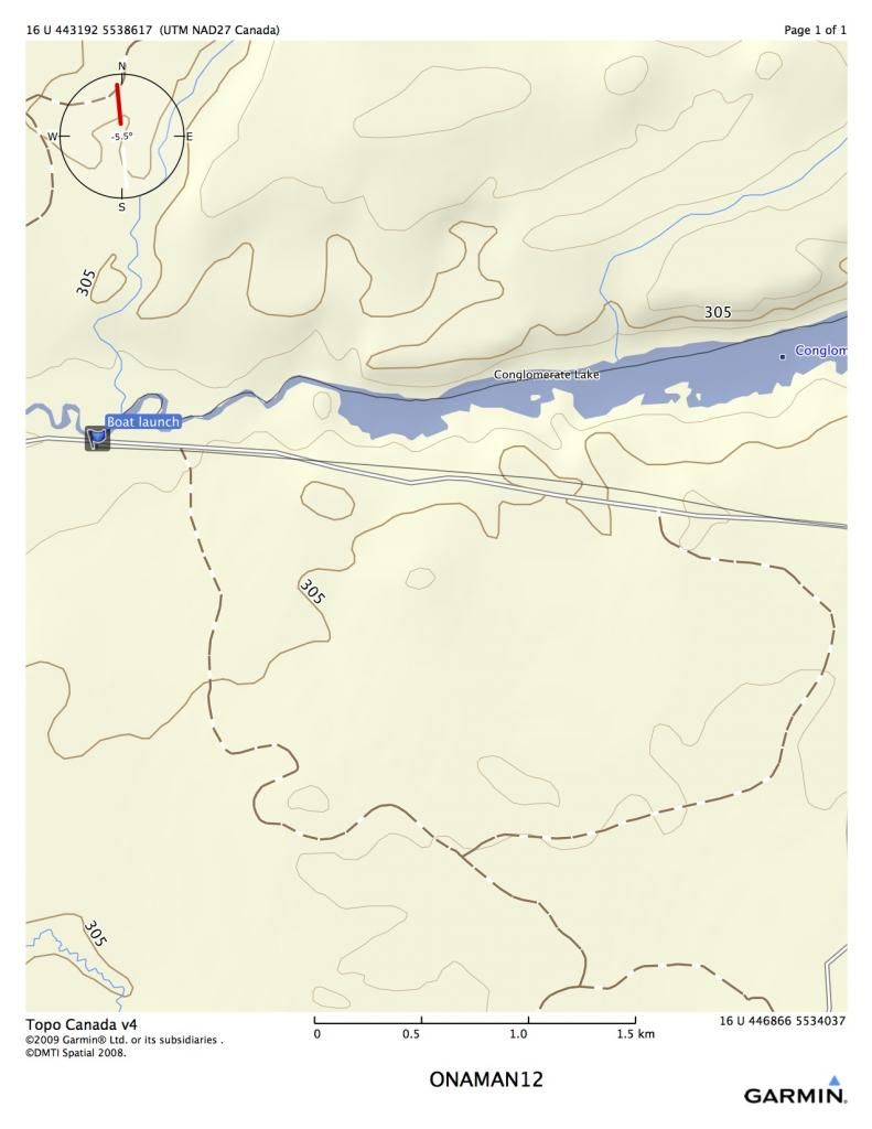
We had to paddle down Conglomerate Lake in a head wind, but we all knew the end of the trip was near. At 5:13 we hot the boat launch, about two K down the river out of Conglomerate. It was a very happy sight!
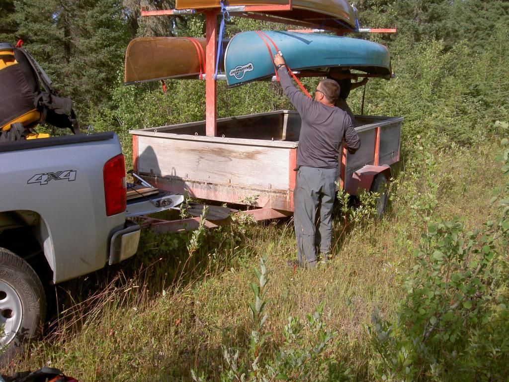
We loaded up my trailer and headed back to Onaman for the other vehicle.
I was very happy to see my new truck had survived unscathed, although on the way back to the highway, I blew a flat on a front tire. I’ve got to get some real truck tires, not those sissy city driving tires.
It’s difficult to evaluate this trip, as we worked so hard re-establishing ports. It just seemed to be disaster of blowdown after another. However, I think it is a nice trip, quite scenic, and could probably be done a lot easier now. The company was super, very nice tripping companions. We are thinking about opening up the Little Pic next summer.
Our group consisted of myself, solo in my Raven, Rob L. in his Kevlar prospector, and Robs dad and his friend Dave in a Bell. Robs dad is 74, and hes still going strong. This was a very tough trip, and even as I write this, I am still quite sore.
The Onaman area is steeped in history. Robs dad Edgar told me that Onaman was the Ojibway word for the red substance they used for painting petrographs on rocks. It is also an area where there was extensive penetration by non-native people as well. I found a copy of a 1925 mining sheet that shows the whole area in detail.
http://www.geologyontario.mndmf.gov....34G/ARM34G.pdf
[URL=http://s906.photobucket.com/user/memaquay/media/Screen%20Shot%202018-06-26%20at%207.43.25%20AM_zpsnync4ppe.png.html]
[/URL]The portages and rapids shown on the 1925 document are extremely accurate, the only difference being that in 1925, the portages probably existed, and were used quite a bit. We were about to find out that this was not the case anymore.
DAY ONE
The mpas show portages as O1, O2, etc, standing for Onaman plus the number. All portages are around rapids. Rapids without ports are indicated as R1, R2, etc.
We completed the shuttling of the vehicles and began porting from the Onaman parking lot at around 1:00 PM.
Unloading at Onaman
Onaman is a vehicle restricted lake, so the only way in is to carry everything down a 2 kilometer port. It was around 30 C that day, and we cooked carrying in. We all had three trips each, so it was around ten K total before we were done. I was starting to regret that beer I was carrying.
This was a standard MNR sign back in the day when part of their mandate was maintaining the wilderness. In the 70’s, the Junior Rangers used to keep all these canoe routes open. Sadly, it is a leaner, meaner world now, where governments only support activities that generate money.
The ride in shook the wingnut off my carrying yoke, and it was the one time I forgot extras, so for the rest of the rip, I was using this rig every time I portaged.
It was nice to see boardwalks over the wet parts, it is the only time I have ever seen anything like this in our neck of the woods.
Finished porting!
Rob L. ready to go.
Dave and Ed in the Bell.
We started down the lake at about 3:30. Onaman is an enormous lake, roughly 25 K long and several wide. It is known for big waves, but today it was flat. We headed for and island about 7 kilometers away. It was a hot, sweaty paddle
The island campsite is good, but a little dirty, as it is used by fisherman. We set up quickly and then enjoyed a few toasts, knowing that the worst port of the trip was behind us. Ha! If only that were the truth.
Re-hydrating!
Our evening view
DAY TWO (two maps)
We got up at about 6:45 and were greeted with a different Onaman than the night before.
It was starting to whitecap. I was nervous, as I knew the further we got from our little island, the larger the waves would get. We launched around 8:45 and were soon into some large waves, probably three foot rollers anyway. I’m often nervous in waves this size when I’m really loaded heavy, as the aft of the canoe can have a tendency to slide out. However, the generous rocker in the Raven makes corrections work almost instantly. We were headed for a large island with an outfitter on it, and in a little over an hour we were sitting in the lee.
I had a Bud to celebrate a safe passage.
Although we still had many kilometers to paddle, the lake was now full of islands, and the wind was broken up a fair bit.
Finishing off the lake.
We arrived at the second portage of the trip around 12:30. It was a short port, 108 meters, and the trail was evident and only needed some cutting. This gave us all high hopes, as 15 years of non-use usually means that portages disappear up here.
The second portage.
We then negotiated two sets of small rapids before arriving at the next port.
The next port we arrived at, O3 (196 m), was not in as good shape as the last one. We spent some time actually finding it, and then after flagging it, Rob L. began the job of cutting. We located a clearing in the middle and called it home for the night. Rain began to fall and persisted in huge amounts all night.
Rob L.’s stump fires were the best creation since Kevlar.
DAY 3
This was to prove to be a very challenging day. The rest of the river must have been hit with a blowdown at some point in the last fifteen years, as almost every port after this point was obliterated.
Typical rapids we ported around.
Heading out on day 3.
We actually lined this one RL, as there was a huge log stuck in the middle of the cascade.
Port 4 was non-existant, but ended up being 350 meters once cut. It is exhausting work locating the ports, as one is crawling over blowdown, looking for evidence of old blazes or saw cuts, it can take hours. Fortunately, Rob L. is an expert in this area, and bounds through the blowdown like an enegizer kangaroo. He then has the energy to cut through massive blowdown at lightening speed.
More rapids were negotiated after port 4.
We only saw one moose on the entire trip, but the area is crawling in moose sign.
We arrived at port 5 at around 2:00 pm. For the next 2 ½ hours we scouted out a trail. It was a nightmare; no trail, tons of blowdown. When we got back to the beginning of trail around 5:00 we decided to call it a night. This was one of the worst areas I have ever camped in, with only small patches of semi dry ground for tents. Hammock country for sure!
The worst campsite ever, made tolerable by good company.
Rob L. is quite the cook, and made every supper on the trip. This was his shrimp linguine dinner which was delicious.
This is no country for hand saws. Chainsaw required!
DAY 4
It was very cold overnight, but we woke up to some nice scenery.
We started cutting and clearing the 950 meter port at around 9:00. By 2:30 in the afternoon, a new port existed, and we had all our gear on the other side. It had been an arduous morning. However, the river began to develop some scenic qualities.
The scenery only lasted for about ten minutes until we reached the next port, and more of the same occurred, finding, flagging, cutting and clearing. At least it was only 245 meters this time. We then ran and lined two more sets of rapids before getting to an old bridge that had existed in the 1920’s for a winter road that supplied the mining camps.
Walking a tough rapid.
The campsite was off to the side of the old road, on a beautiful moss covered rocky area. The site had been used in 1999 by the Outers, and Rob L. found an old compass, still intact. When I went to set up my tent in a blueberry patch, the entire area was covered in partridge poop. I had to clear several piles off just to find room for my small tent. I’ll bet those partridge will be really tasty this fall.
Partridge feces.
Tent on top of partridge feces.
Rob L. made another stump fire and we had an excellent meal and actually managed to stay awake kibitzing around the fire until about 9:30. It had been a series of early nights for most of us, because we were exhausted at the end of each day.
Stump fire.
DAY 5
Our objective this day was MacDonald Lake. We knew that in order to get out in six days, we would have to make it there. It was a very challenging day, once again. We shot or lined rapids, and then arrived at the big port, indicated in our notes as 600 paces. We scouted the first 3 or 400 meters, and it was a disaster. There was no port apparent and the bush was impenetrable. After a careful scouting of the rapids, it was decided to shoot the first 400 meters and eddy out in a pool. This proved to be a great decision, as the port after this was easier to find.
We were greeted immediately with the remains of a very old mining camp. Ed is a local author and historian, and he figures it was from the 1920’s. It was fascinating to poke around in the remains, it looked like they suddenly decided one day to not come back. Stoves were left with tea kettles and frying pans still on them.
Core racks with the mining samples still on them were lying around too.
With all the interst in mining up here recently, I’m surprised someone is not back here again. The area is covered in quartz.
The port ended up being 470 meters long, which was considerably better than the 870 it would have been if we had not eased our way down the first set of rapids. However, there was still lots of cutting.
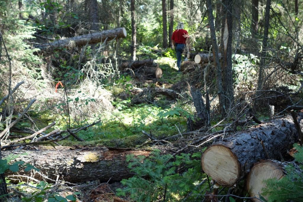
The ever cheerful Rob L. porting a canoe.
We stayed that night at an old mining camp in the middle of a port into MacDonald Lake. I shot the rapids, but the other guys ported. It was a messy sight, with more core racks and debris lying around, but we were grateful for the flat ground. The temperature began to drop quickly, but we stayed around the fire until about 10:30.
DAY 6
It had dropped to almost 0 degrees C overnight. Tents, lifejackets and water pumps were covered in frost.
Frost covered water pump.
We had a long day ahead of us, with three ports to clear. These were the worst ports of the trip, completely impassable and completely missing. 630, 117 and 230 meters respectively.
Rapids at end of last port.
The end of the last port had an old cedar tree with a big blaze on it. The blaze had lots of writing on it, and half of the blaze had grown over concealing some of the writing. It was a very interesting piece of history, with the oldest date we could see on it being 1938, although I’m sure there were older ones under the part that was covered by the new growth.
We had to paddle down Conglomerate Lake in a head wind, but we all knew the end of the trip was near. At 5:13 we hot the boat launch, about two K down the river out of Conglomerate. It was a very happy sight!
We loaded up my trailer and headed back to Onaman for the other vehicle.
I was very happy to see my new truck had survived unscathed, although on the way back to the highway, I blew a flat on a front tire. I’ve got to get some real truck tires, not those sissy city driving tires.
It’s difficult to evaluate this trip, as we worked so hard re-establishing ports. It just seemed to be disaster of blowdown after another. However, I think it is a nice trip, quite scenic, and could probably be done a lot easier now. The company was super, very nice tripping companions. We are thinking about opening up the Little Pic next summer.
Last edited: