I just returned from a short (3-day/2-night) solo trip to Maine's Jo-Mary Lakes, which are located south of Katahdin. Thanks in advance to BobMills for providing some info on the trip. I took my new-to-me Old Town Pack 12, and while the trip did not go as planned, it was still a great trip.
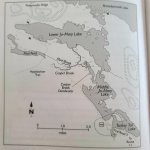
The plan was to put-in on Middle Jo-Mary and then transit by way of Cooper Brook and Mud Brook to Lower Jo-Mary, where I would camp for two nights and explore. Here's the map from the AMC Guide:

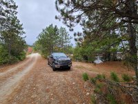
Note that you could put-in where the AMC guide indicates on Turkey Tail Lake, but there is not as much parking. Here's what it looks like looking northwest as if you were driving to Middle Jo-Mary. My truck is in the parking spot and the bridge is just beyond it.

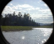
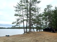
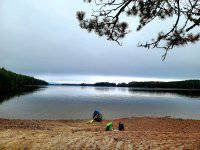
BobMills suggested parking on Middle Jo-Mary, and I have to say, it was one of the nicest put-in/parking situations I've come across! There are a number of camps at this end of the lake, but there is also plenty of parking very close to the beach. It's also worth noting that, while I had my pre-registration paperwork and money, there was no checkpoint on the way in. Here is the put-in on Middle Jo-Mary:

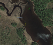
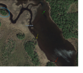
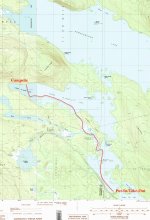
My plan, as mentioned above, was to move from Middle to Lower Jo-Mary by way of Cooper and Mud Brooks as opposed to "The Slot," which a short descent next to Buckhorn Camps at the northeast end of Middle Jo-Mary. Here's is my planned routing:

I was concerned about water levels before leaving, and I reached out to a bunch of people. I got pretty mixed messages, but the predominant sentiment was that I may have a hard time finding the entrance to Cooper Brook from Cooper Brook Deadwater, and that I may have to line or even carry for sections of Mud Brook. Undaunted, I loaded up and was paddling by around 2 pm. Crossing Middle Jo-Mary was uneventful, and I was rounding the point into the Cooper Brook Deadwater in no time. It is gorgeous up in there--just what I had hoped.
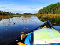

I made the big sweeping turn around the toe of Jo-Mary Island's boot, and was soon looking for the entrance to Cooper Brook. Not seeing a way in where I expected it (hugging the west bank of the Deadwater), I sought the deeper water along the east bank of the Deadwater and continued paddling. I made several probing attempts to get across the shallow muck through the reeds but to no avail. I even tried to find some solid footing to drag my boat, but the muck had no bottom. I paddled back down the Deadwater and then re-approached the west bank and finally was able to land. From there I hiked up the Deadwater toward the large white rock I had seen while studying satellite photos. I'm pretty sure the channel was here, but it was too shallow to get a boat across. I considered carrying along the shore and trying to put in higher on Cooper Brook, but it was now getting quite late, and I had a ways to go to get to camp. With regret (and a little apprehension), I paddled pack down the Deadwater to Middle Jo-Mary and crossed to Buckhorn Camps and "The Slot."
I was moving quickly now, as I was cognizant of impending sundown, so I didn't take pictures at the time (but you'll see one later in this report from my return trip), but "The Slot" was essentially dry. I hauled my boat into Lower Jo-Mary, and while I was worried about the time--it was 5:15 already--I had to stop and take some pictures as I rounded the point on Lower Jo-Mary and saw Katahdin in all her glory.


The goal was now to reach Antler's campsite, which is at the west end of the lake on the AT. It was a little under four miles away, and the sun was dropping fast....and I was in an Old Town Pack 12, not known as a "fast" boat. Luckily the wind was fairly light, and the scenery was stunning!
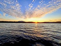

With the sun down, it was a little unnerving to paddle into the unknown. I was counting points and islands on the map, and I had a pretty good sense of where I was, but the dark shoreline was losing definition, and the growlers just below the surface gave me pause. At around 6:30, I finally made out a beach with long rows of stones that I had seen in pictures and gladly eased onto the beach and out of my boat. My plan had been to camp across the Lake, but at this hour, I was happy to stay at Antlers and plan to move in the morning.
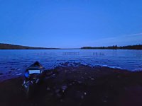

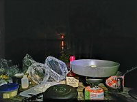
It was totally dark by the time I was set-up and making sweet and sour rice with pine nuts and raisins for dinner, so I didn't get a sense of how big Antlers is, but, as I would see the next morning, it's a pretty big campsite that sees a lot of traffic from the AT. There is a big double-seater privy up on the hill behind the campground and numerous sites. Signs indicated that fires are not allowed per MATC. Given my day, I had forgotten about the near full harvest moon rise, and only saw it over my kitchen table. I had meant to set-up a GoPro timelapse. Oh well.

The next morning dawned foggy. I lingered over my favorite backcountry breakfast (Ring of Sunshine!) and a couple cups of coffee. It was surreal watching the fog drift in and out of the boulders and the pines.
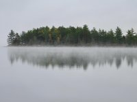

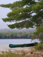
The paddle to the other site, which I think Bob had referred to as Caribbean-like, was short--really just across the lake. WOW! What a site.
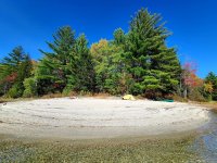

I spent the day exploring both on foot and by canoe (I also had some reading to do for work!). I doubt you could get around the edges of the lake had the water levels been higher, but with the low water we are experiencing, I was able to walk down "the beach" to Sandy Beach, which is off the AT and is another lovely beach. There is no privy at this campsite (don't be fooled by the bucket with toilet seat--it has no bottom), but there is an established fire ring and plenty of room for a tent.
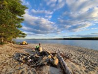

When the sun began to get low, I got to work making Gado Gado and toasting a great day with a dram (or three) of Maker's Mark. It was a lovely evening after a stellar day!
I woke early the next morning. The wind was supposed to pick-up to 3-4 mph by 9am and then increase throughout the day with rain forecast for later. I wasn't terribly concerned about the weather, but it was gorgeous and glass when I woke-up, so I decided to forego a hot breakfast and just get on the water.


The paddle across the length of Lower Jo-Mary was mostly a great one.
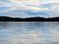

There were a few puffs of wind and a steadier and steadier headwind that surprised me a bit, given the forecast, but it was nothing really noteworthy. Katahdin was almost entirely socked-in and the horizon ahead was blanketed by dark clouds, but I made good time and was at "The Slot" by 9:30. Once I rounded the point, it was dead calm in the cove at the bottom of "The Slot." I paddled up as far as I could go and then lined through some shallow water until I eventually had to carry up into Middle Jo-Mary. For those of you who have dropped through "The Slot" on a normal water year, this is what it looks like in Fall 2020:


As I was making my way up into Middle, I was becoming aware of a freight train sound. Then I saw that Middle Jo-Mary was capping. Wow. This was unexpected. It was fine right by Buckhorn Camps, but I could it was snotty out on the lake proper. I paddled around in a couple circles and then nosed out into the lake. This was only my second trip in this boat, and while the Pack has frighteningly excellent primary stability, I knew little of what it could do in technical situations. I watched for a while, then stowed my camera and made sure everything was lashed down. I made a plan to paddle out and use the wind to kind of ferry across to the entrance to Copper Brook Deadwater. Deep breath and I was off...
By the time I made it to the entrance to Cooper Brook Deadwater, I'd decided the prudent move was to wait and see if things let up. I tied the boat to a tree and climbed up onto the point. Boy, was it honking! The little Pack had done great in the big water, but the period between the waves was erratic, and I was cognizant of how quickly things could go south if I took one of those waves over the side.
I took our my topo map and even thought about carrying to Fire Road #3, where I could then hike back and retrieve my truck, but it would have been an ugly carry. I thought about just staying put, but my wife was expecting me that night (although she knew not to raise the alarm until mid-morning the next morning). As I went through the various scenarios in my mind, I began to sense the wind might be backing off a little.
There was still a steady headwind and periodic whitecaps, but I made a plan to continue across the lake in a generally westerly direction and sneak into the lee of the west shoreline. While not without it's excitement (especially the concern for those growlers just under the surface!), my boat handled well, and I was soon inside the protection of the trees at the shore...
...and it was right about then that the wind pretty much stopped altogether....lol. I paddled the shoreline in a leisurely fashion and even took time to drift and finish my leftover Gado Gado from the night before. It was a wholly pleasant (if somewhat anticlimactic) end to a wonderful (albeit far too short) trip.

You can find more pictures and videos of the trip here: https://www.facebook.com/media/set/?set=a.10158213516722217&type=3
Last edited:

