• Happy Marine Mammal Rescue Day! 🐳🐬🦭🦦

Hiking trails on canoe lakes / routes

Joined
Dec 16, 2016
Messages
678
Reaction score
671
Location
Bangor, Maine
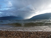
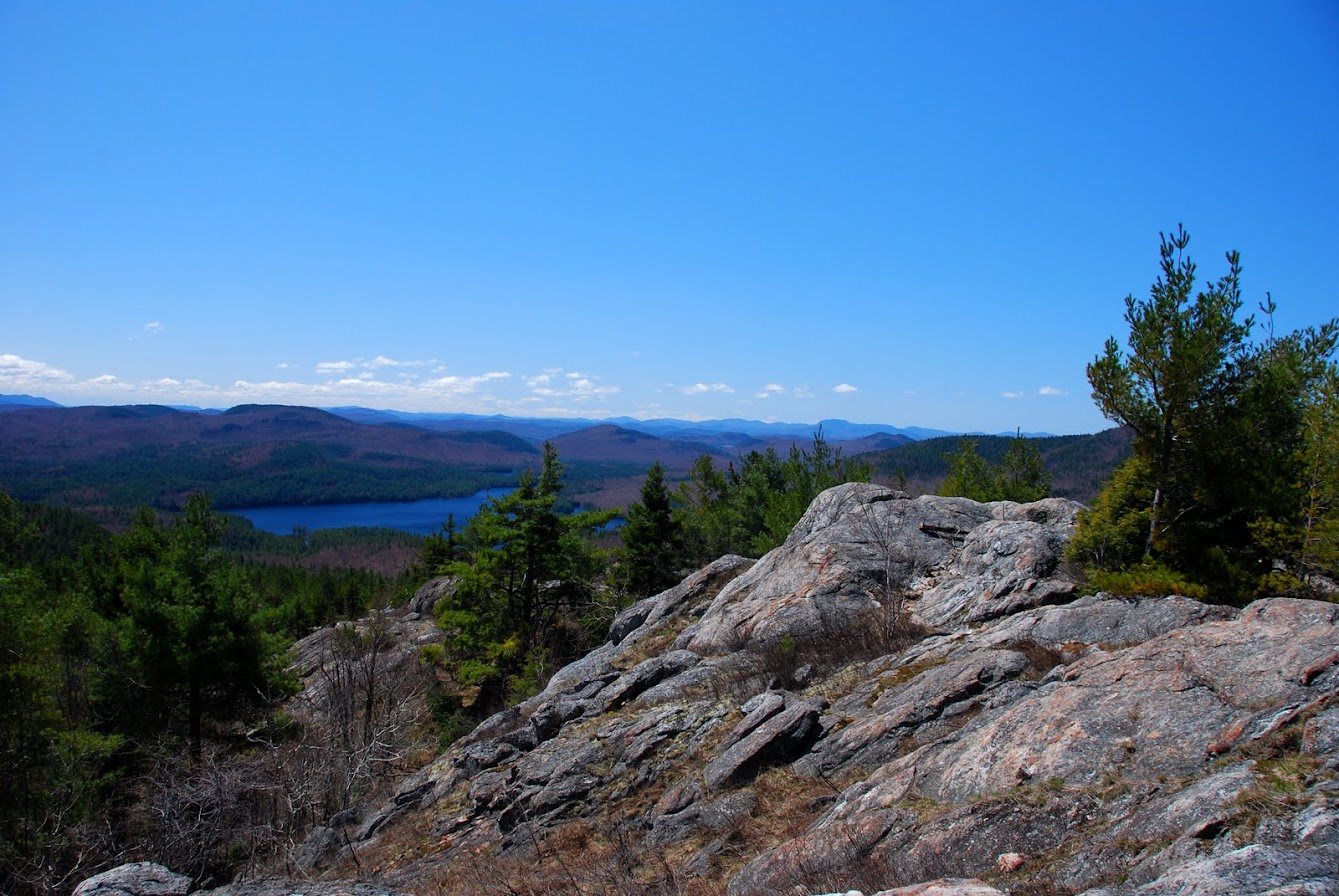
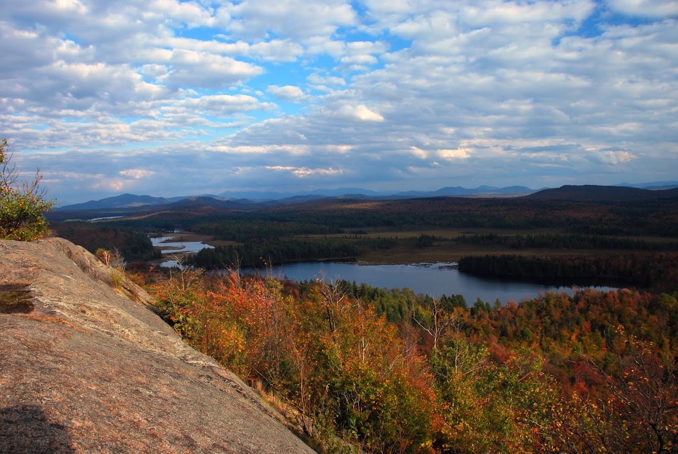
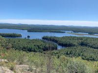
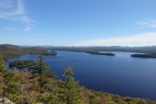
Sometimes I'm just trying to get to my destination, but when there's a hiking trail to an interesting place or overlook along a canoe route and I actually stop and do it I'm always glad I did. I can think of a half dozen such places in Maine, but just to call one out, here's the Owl's Head overlook on Scraggly Lake. (Note that yes, I do sometimes use my paddle as a walking stick -- that fibreglass Journey can take it.) What are some other good canoe trip side hikes? Extra credit for a photo and/or map snip.

IMG20230923140800.jpg
 
My dog Jake and I often like to climb large rock outcrops and ridges when on a trip. Sometimes we hike portage trails.

My wife, Jake and I are heading to Florida this Friday to paddle various springs and look for manatees. Our destinations on this trip include hiking trails . Hoping for about 7 days paddling and hiking. Looking forward to it.
 
@Bob B. says:
My wife, Jake and I are heading to Florida this Friday

You can paddle the Santa Fe River in Florida from Santa Fe Lake.

Santa Fe before it sinks.JPG

But after 44 miles you better stop and get out when you reach this bridge.

Bridge over Santa Fe to sink.JPG

Because the entire river soon plunges down a sink hole and goes completely underground for three miles at the Santa Fe Sink. Here is the explanatory sign.

Santa Fe River Sink sign.JPG

Here is the sink. I didn't want to find out whether I would get sucked down to the nether regions.

Santa Fe River Sink.JPG

If you drive a few miles on the nearby road, you will come to the trail to River Rise, the place where the entire river resurfaces.

River Rise trail.JPG

The end of the trail and a glimpse of River Rise. Don't swim!

River Rise trail and rise.JPG

The entire river emerges from underground and continues on for 35 miles until it meets the Suwannee River

Santa Fe reappears.JPG

The stretch to the Suwannee is extremely interesting, with many side springs, suck holes (mini sinks for part of the river), a naked man, headless floating deer, some nice campgrounds, and the beautiful Ichetucknee Springs tributary.
 
Years ago I was part of a seasonal course staff with SUNY Cortland, operating out of their outdoor center on Raquette Lake in the Adirondacks. The culmination of the class was a 6 day canoe trip. Each trip had a mountain included in the route so students could experience paddling, portaging, camping and hiking. Some of the trips were more rugged than others but all gave the students pretty much the same opportunities. Over the years, the mountains that became part of these routes included: Ampersand Mt. (off of Middle Saranac Lake), Long Pond Mt., Kempshall Mt. when the trail still existed (off of Long Lake), Blue Mt., West Mt. (off of Raquette Lake) and Black Bear Mt. (off of 7th Lake). Along with the mountains, there were opportunities to hike sections of the Northville-Lake Placid trail. Other than Kempshall Mt., all of these options are still available to the general public so there's a lot of hiking that can be combined with a paddling trip that spans from Old Forge all the way up to the Saranacs and into the St. Regis area.

That's all for now. Take care and until next time...be well.

snapper
 
One highlight of my BWCA trip was the portage from Mueller lake to Agamok. The portage crosses the Kekekabic Trail / North Country National Scenic Trail and I do volunteer trail maintenance with the Butler, PA chapter of the NCTA so I'd seen pictures of the steel & concrete bridge about 3/4 mile East that traverses Agamok falls. Well worth the delay IMO

IMG_20210525_155044458.jpg
 
Glenn,

A group of us from "up nawth" (Chicago area and Madison Wisconsin, plus points between) went down to Tennessee to run a section of Big Fiery Gizzard Creek (just because of the name) on I think it's the Cumberland Plateau. (Part of the Collins River watershed?) I also think there's a Little Fiery Gizzard Creek, but it's been too long since I've been there. This trip was in the later 1970s, like maybe spring of 1978. We met at the put-in, which had runnable water in it. From there we drove some vehicles to a take out to leave vehicles. At the take out there wasn't a drop of water in the river. It turns out that there's a sinkhole situation like you describe on the Santa Fe River in Florida. A few of us hiked in and found the sink here. Water just filters down into the gravel river bottom over a stretch of many yards, into the cracks of the limestone bedrock, then appears downstream like it does in Florida when the strata daylights at that level again. There's also a hiking trail along parts of the river. I don't have any pictures.

Here's a link to American Whitewater's description of a run early this century (21st):

Sounds like a really enticing run.

Here's a Wikipedia description of the hiking trail:

Anyone else have experiences like this?
 
I have two favorite peaks that I enjoy hiking while on paddling trips in the Adirondacks.

The first is an unnamed peak that overlooks Lows Lake and Grass Pond near the western end of the lake. It is just west of the summit of Grass Pond Mountain.

View of unnamed peak (on the left) from Lows Lake.
1708476773572.jpeg
1708477453654.jpeg
1708476105015.jpeg
1708476131423.png


My other favorite is Frederica Mountain on Lake Lila in the Willaim C. Whitney Wilderness.
1708476187631.jpeg

1708476227365.jpeg

1708476436075.jpeg
 

Attachments

  • 1708476267293.jpeg
    1708476267293.jpeg
    431.6 KB · Views: 1
  • 1708476737879.jpeg
    1708476737879.jpeg
    304.6 KB · Views: 2
A lot of hiking/portage trails, with a healthy pinch of bush wacking!
 
My grandson's first Adirondack "peak" was Mt. Frederica when I took him on a 3 day trip a couple of years ago. The smile on his face was all I needed to know it was an experience he'll remember forever. While I don't think I'll ever really need them, I'm glad I have some photos for when my mind begins to dim as I'll always be able to relive our time together.

That's all for now. Take care and until next time...be well.

snapper

PS - Sorry to get off track...
 
I always mean to stop and explore en route to my destination but oftentimes, once I find myself in the car with a fun destination in mind, I have a hard time stopping for more than a brief stroll to keep Sadie from revolting.

I'd love to do more foot based exploring when on canoe trips but most of my canoe trips have not offered that option with very dense and tangled growth.

We did do one trip further north that got us close to the tree line and that offered a lot more hiking options, which we took advantage of.

20160823_303 by Alan, on Flickr

20160827_368 by Alan, on Flickr

20160822_298 by Alan, on Flickr

Alan
 
Last edited:
Murtle Lake, British Columbia
Access is from Blue River, British Columbia via a logging road then a 2.5 km portage which is made to accommodate portage carts.
1708527939264.png

There are several hikes accessible from the lake. We've done a few of them so I thought I'd post a few pictures.

1708528448388.jpeg

1708528084528.jpeg
Near the start of the Central Mountain Trail.

1708528167926.jpeg
Near the top of Central Mountain Trail.

1708528306002.jpeg

1708528245732.jpeg
Strait Lake Trail

1708528607565.jpeg
Murtle Lake looking west from the eastern shore near the Strait Lake & Wavy Range trailhead.
 

Attachments

  • 1708528559349.jpeg
    1708528559349.jpeg
    103.4 KB · Views: 1
  • 1708528380297.jpeg
    1708528380297.jpeg
    121.7 KB · Views: 1
We did do one trip further north that got us close to the tree line and that offered a lot more hiking options, which we took advantage of.

Alan, rather than uploading that post's photos to our server, you have apparently copied/pasted from Flickr. That has left a bunch of metadata mumbo jumbo between the images and exposed links to your entire Flickr album. It's up to you whether you want to leave it that way or re-do it.
 
The Adirondacks are filled with paddle/hike opportunities.
Here's a view looking towards Pharoah Lake from Treadway Mt, a short hop from Puntam Pond area

ABLVV84zvOTfo4xO4ftX722v0NJwyCLjBLz2gVao3WdxoZ-FAL5_WcTRrSb9xziqlBUr2b9r1PtiZazp8ft3aCybU6c9ygpvqytIlEGcRo63U6veVHPtUTgibTbWq3sqCKX5Op7u2p7zldOaJGhpQ9x8R9k5oA=w1339-h896-s-no


Others have mentioned Grass Pond Mt above Lows Lake, but there's also Hitchin's Ridge, and the historic remains of the complex at Hitchins Pond

ABLVV85SIsPmXzg3wD2IrD2j0KMVD9J4J0JeZ-4YrkU7_JOZ_KMpEvpc8pvxkmS7IfrncJyTI4lJXXnbBBUIP8Ugz5d4sF6-MZ1psiwQ_wFVBTRlYbAPtZsYlfYs0ePF15jw8n5QBGk7pfKiFKF3qtMzvLkJR77USrm_3yJUbPg0XqtVjz1v-NkkDZZNrEYEMi9BokrLb0WF6MJ-SIrfkYhrOXS1Bf0ckEEfHwKbTDJFMkGk2G1hZ-Wi-_2OECz3d6fGZNHFLrGwppRQOuMBK_-XK4qc_KIr3T8nypAtPPcmomEsgKKbICdPfsLJmpjkig5bJa0sIgCEHkli2AVdCiJxUy_GRb8b1I9qalp-QKw0JPD201ai-rQBwzNZa_OcIjBHjIct4g8AIQXg8QSA8wUIkpez2fnvcfV87lXfOI2rE6FFMJDe-t_j2WsbjI4ME699vnQGhGD-uOG7NrCGDJvCtjbmk58VSCG4-ck9kxKzzajFc2Pnyb7AO7JOaRm2Sn0hsGRL0Q80AYZC1AJD-qSgDrAH6LTa4Eqwr6DVDH6ouhI6Xoy-UkJedEXnZkJ2SZvv3WNDgBrGLvMIjSkJ5-miCyvBVTuxN6vmlpqT_fcLca5117wH4hKUfYxt4n23vyU3RAV-uhmlT8Lgm9Klm7SHqouwGnTkmUBAeGHrAtxLd2gY7rhQu8dMn_h63TU6e2Pl9md0x4Az9ejbmp9osKpDhlZ_9lRtz6sKii4ODOUF_-0zbtMS1PelC8GJ9z3Qg7MHoUxzNejTHlIxyNUjw2OUXje2u-kFptW_0WZl8KY5C84f8pq82nIQBNfjSwjlkJ9q0mOodqI2M_QinykCgdNzEYRL1fe7eGgp4YSCtxyG1MOV7NaHHY0kkVmoYZfrRN8UAjDC3JLLOxG9giyOW3DWbUeHqQ=w1339-h896-s-no


ABLVV86x4hJn2lVXSEOYwnG6PdhGAlw6BF-cyTh_9W8UKI1IU5tPtO1DtBo8POoUxccrsLmBPl2cVsa0GRUyKjROR5HZ2dL4eywGkPJtPw1JTsdPXBCgDQ427Sf9bmzdgDoKKaM-vD7L9jMg_8TSi37nrVkV4AoPIEKQ61274GmYqldmDClC9LF7T0d_J5Z9rXp9TiznMK9Jeoy1s4bY5RooEl-YuH0_p6mmLvyyUj2hPCFAFTO9R_Cw9hyHn6rg-4zFvGlHBBDUz7iBOIjsnf3nQr6XC1-918XRyHA_gVM9cMuLT93TOqKGzLQlNJQx-3MvINg0cOAgE4qu2M2c30IV1GylQWUmDz3QBlf_wCtxRzwirHx3-4N3wEcs47YyALhWlztdc38BErXCHT05-JfOZPf7BqOAzDOiHRD-_ATj1wwAIK2vVDVLr4e58KAWe8Aw5gdY5dur44kfqITVsOMLbLP5Aw5IyiMpzTjIguK4Z0zc4ze05HgysqO3OBdvzgs0R7zmSVgBuuF35I-HZybOPHVdYgaX4bTAB887GL43iOeObUmWoK1Kgte8_Bwpy0MvKU0uo0UrpQ2T79gh1N6hJboALXm3kgrGFmd2y0Sy9kcvte6XOqeUQLrFbH5MmwckpiY39uNKz7Nr8-mquUWiZEMJA45TiH9hVVjfAMFv5YRCgBosvdskiWiA-exK-6U7xNW2AGUqq16_0qyqMUtMDBjrFDcbrr2pvM6ndP7Zgs_RZtMgtfCiMzGjGdDgsRIMs-rDcK1qEPW7uZ4SAjHc-xYPB8oU3gZUIANgRD7AMe7lRg4-o6eHc5b-nf_ibvcGsNFWYHJbz76-vW_VWrRWHWfdgYBVK9tSExW9mHkPcTvTLW_MBxdYJE2aRMJm10R1yvONI5yoNGoM6niwCjfEc0uYj_g=w1338-h896-s-no
Great photos Stripperguy! Thanks for sharing them.
 
Lila's Mount Frederica, Low's Grass Pond Mountain, and the Hitchens' Pond Overlook, already mentioned, are all nice short hikes from lakes/ponds.

One other I've done is Long Pond Mountain, off Long Pond in the St Regis. One I would like to do is St Regis Mountain, in the same area. This is Long Pond Mountain from a couple summers back.

Those are Long Pond near left and right, with Turtle, Slang, and Hoel Ponds in the distance.
20210625_110342.jpg
 
Back
Top