• Happy Weed Appreciation Day! 🌱🌿🌻

Carry Brook to the Aroostook River, Northern Maine

Joined
Dec 16, 2016
Messages
678
Reaction score
667
Location
Bangor, Maine
This trip was something of a sequel to the Millinocket Carry, same crew (me and Hope) and same watersheds (East Branch of the Penobscot and Aroostook). Immediately after this trip I had a furball of work/travel and didn't have a chance to write up a trip report, and then it was a warm fall and I was trying to sneak in another solo trip or two so it basically fell through the cracks. Conversation over in the MC thread re some Downeast routes reminded me about it, and I thought I should finally write it up. This trip was in mid August.

During the trip I was having some camera issues (new phone camera sucks, old phone went in the drink, etc) but Hope brought a real camera and between the two of us we have pretty good coverage. (Assume the good stuff in the photo pool is hers.) As usual, at the really tough times we weren't taking many pictures, but how many photos of muck, alder and spruce thickets does the world need anyway?

We knew this crossing was once a canoe route because of some dotted lines on the old 1950's topo map. Who can resist a "Carry Brook" that's so prominent it has both an East and a West branch? Said brook empties into La Pomkeag Stream, and thence into the Aroostook River. It isn't in Ron Canter's guide, probably because it's farther from the Allagash, but it's that kind of route. We figured the trails would be long gone and knew it would be a slog but there were some options with parallel logging roads so we deemed it feasible. Unlike the MC, I hadn't been able to do any scouting in the field, so all we had to go on were the old maps and satellite imagery.
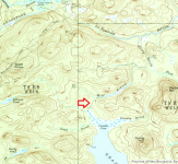
carry_brook_map.png
Trail to the West Branch of Carry Brook (1950's), catnip for canoeists. The large lake is Grand Lake Seboeis.

Day 0, 2022-08-11, Thursday

I'm calling this day zero since we didn't do much paddling -- only about half a mile.

The starting and ending points for this trip were a can't-get-there-from-here pair: Grand Lake Seboeis accessed from the road to Grand Lake Matagamon (i.e., one turns right/north on the way to the Baxter State Park north entrance), and a ramp on the Aroostook River off of the Oxbow Rd between Oxbow town and the NMW checkpoint (turn left on the way to Masardis). (Maybe we should call ourselves the Can't Get There from Here Canoe Club; need some decals.) We would have taken out in Masardis or Ashland, but we were a bit constrained on time and didn't know long the undocumented height of land crossing would take. Much of Thursday afternoon was consumed driving the long shuttle, while we watched the wet weather move in.
penobscot_aroostook.png
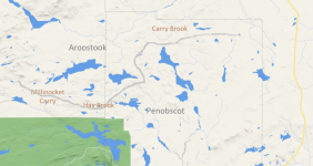
Three canoe routes from the Penobscot to the Aroostook

Excuse the doodle map above, but I wanted to give some context. The green area in the lower left is the northeastern corner of Baxter State Park, and the line at right is state highway 11. The gray freehand smear is the approximate watershed boundary. The Millinocket Carry, the Hay Brook / Beaver Brook route (trip report on the Northern Forest Canoe Trail site) and this route are all connections between the Penobscot and Aroostook watersheds.

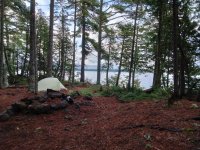
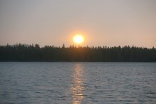
We began our trip at the access to Grand Lake Seboeis (also a campsite), paddling east across the lake to a pleasant campsite on a small peninsula. We had 270 degree views from there and Hope caught a sunset photo between bouts of rain. It did rain, but it was August so really who cares.
D0_8_IMG20220812071807.jpg
Campsite on the East side of Grand Lake Seboeis
D0_9_GrandLakeSeboeisCanoeTrip_Aug2022 (2).jpg
A break in the clouds at sunset

(More is coming but I'm on an airplane with sketchy wifi so I'm going to post this and continue. So far Xenforo is doing an admirable job of coping.)
 
Day 1, 2022-08-12, Friday

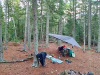
I'm not really a tarp guy, and you can tell that in the photo below. I like to be on the move; tarps are for hanging around camp lacing doilies. My current "tarp" is the footprint from a 10x10 car camping tent I seldom use. Maybe one of these days I'll get a real tarp, but it never makes it to the top of the gear wanted list. If the tarp sags, it's time to break camp.

D1_1_IMG_20220812071826.jpg
No prusik knots required

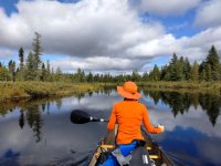
Grand Lake Seboeis is almost totally wild, with just a couple rough camps along its shoreline. We didn't see anyone as we paddled up to the north end of the lake, called Coombs Cove, and up the northwest inlet stream to a large beaver dam.

D1_2_IMG_20220812100641.jpg
A great morning for paddling

D1_3_IMG_20220812101523.jpg
Very bushy beaver dam

(Note the color difference between the above two photos, taken minutes apart under the same sky. There's some awesome AI in this new phone camera. I definitely need a real camera more than a real tarp.)

I was imagining this beaver dam take out would be like the one above the heart shaped pond on the Millinocket Carry trip, but no such luck. There was deep water both above and below. The dam was like a small version of some audacious Hydro Quebec project stitching together disparate valleys into a confusing reservoir. We wanted to find the firm ground at the east end of the dam, but there just wasn't any. The dam had been there a long time, and in many places walking it was impossible because of thick alder. After dragging above the dam, we cruised it back and forth looking for a decent landing, but there was nothing firm anywhere. We did find this cool floating bog, which we pushed out of the way as it was blocking the least lousy takeout.

D1_5_IMG_20220812103449.jpg
A nice floating bog, nature's Sit-On-Top

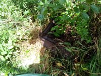
While we never found a decent takeout, Hope made a remarkable discovery that was a highlight of the trip. Stepping out onto the beaver dam, which at that point was a narrow causeway between an open pond and a wooded pond, her paddle found something curiously hard. It turned out to be a cast iron woodstove, mostly burried in the muck. It's hard to overstate how remote that place was, and yet it must have once had at least a cabin, a structure worthy of a real stove brought in from many miles away. Added to some dotted lines and one black dot on an old map, that made iron clad (ahem) evidence that we were near the start of the old carry trail.

D1_4_IMG_20220812103446.jpg
Best takeout we could find; at least it had a tree to tie off to

D1_6_IMG_20220812_103746752.jpg
A noteworthy artifact -- how many beaver dams have a cast iron woodstove?

We had a general ideal of where the carry trail was. Satellite imagery showed a linear "crease" in the forest canopy about where the old map suggested the trail should be. On the ground, the situation was mixed. After a couple hundred yards of difficult dragging through flooded forest/bog we reached dry forest, and from that point the going was good for maybe a hundred yards before horizontal forest closed off travel in that direction. We skirted to the east and then back but it never got clear again. Eventually after much hard bushwhacking we found that a skidder trail further east was the best route, and it took us to a prominent clearing along a logging road. We navigated primarily by compass heading, knowing that any route generally northeast would take us to that road. From the clearing to West Branch Carry Brook (Welcome to the Aroostook Watershed!) was an easy 100 yards through mature forest with only a minor blowdowns to skirt.

The usual rules of time and distance are irrelevant in that mode of travel. For reference, we reached the beaver dam at about 10:15 am and it was after 5pm when we got canoe and gear to the put-in on the brook, a distance of about 0.5 miles as the crow flies.

D1_8_IMG_20220812_125746826.jpg
The "trail"

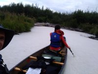
Although most of the day was tough sledding, the fact that we reached a navigable body of water before dinnertime made it all OK. The put-in looked like a possible campsite, not great but by far the best thing we'd seen since the lake, but we launched anyway to explore and see if we could do better. Travel by canoe in a deadwater is almost free. That stretch of the West Branch Carry Brook is really no more than a deep creek through a bog, but it's a lovely bog.

D1_8b_IMG_20220812_175249103.jpg
Finally, back in the canoe on the water

We paddled downstream (east) to the first obstruction, a wide log jam, scouting campsites, eventually returning to one about half a mile downstream of the put-in.

D1_9_IMG_20220812_GrandLakeSeboeisCanoeTrip_Aug2022 (21).jpg
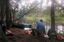
Cedar-style campsite on the brook

I love a campsite right next to the water. Although we packed fairly light we both had a place to sit -- me on a 3.5 gallon gamma seal food bucket plus ridgerest and Hope on a thermarest chair conversion accessory (not too close to the fire).
 
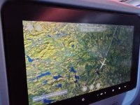
In an odd coincidence, I posted the above from an airplane, and a couple hours later the plane almost flew over Carry Brook. We passed within about 10 miles of Grand Lake Seboeis.

inflight_IMG20221226141305.jpg
Can they drop me at Umcolcus Lake instead of Boston Logan? JetBlue can call that EvenMoreMoose and charge me an extra $75.

(back to the TR ...)

Day 2, 2022-08-13, Saturday

We resumed our travels Saturday morning, well rested and full of beans. We paddled back to the log jam (beaver enhanced?) we'd observed the night before -- this is where the deadwater ends and the West Branch of Carry Brook turns north. The old map showed a trail here river left, so we took out and spent quite a bit of time looking for it. The forest was pretty bushy and we didn't have much luck. Neither the streamside thickets nor the more upland thickets (recently harvested) offered an attractive route.

D2_1_IMG_20220813_103328332.jpg
Most of the woods were thicker than this

From this point we had three options -- bushwhack uphill (west) to a forest road we knew was ~0.4mi away, bushwhack parallel to the stream, or make our way down the not-really-navigable stream as best we could. We chose the latter option.

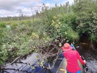
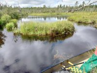
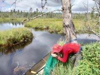
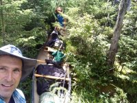
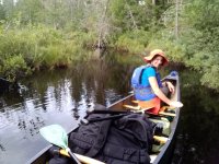
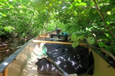
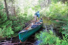
That stretch of the stream was a series of short segments -- tiny deadwaters where we could actually paddle (first picture below), alder tunnels (second picture below) and blowdowns. Still, it was better than a bushwhack portage.

D2_2_IMG_20220813_110810647.jpg
If you can paddle three boat lengths, why wouldn't you?

D2_3_GrandLakeSeboeisCanoeTrip_Aug2022 (29).jpg
When I'm not paddling it I store my canoe in a hedge

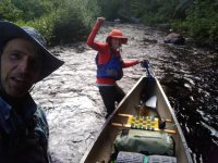
I like this photo because the posture suggests once-more-into-the-breach enthusiasm. At least we're not portaging.

D2_4_IMG_20220813_GrandLakeSeboeisCanoeTrip_Aug2022 (26).jpg
Full of motive energy or just leaning on the gunwhale?

After a couple hours or so of slow but steady progress we came to a point where the stream widened briefly before increasing its gradient. At left there was solid, open ground with an assortment of small stones. It just looked like a landing, although we didn't see any signs of recent human visitation. We explored the woods on that side of the stream and found them to be decent bushwhacking. Not far from the stream we found an old tote road that we'd seen on satellite imagery, and that quite likely followed the route of the old trail. However, it was already early afternoon and we were starting to be concerned about the time. Our travels down the stream had brought us closer to the road, and this stretch of woods was fairly open, so we decided to make our way up there. It was only 0.2mi or so, but straight uphill. We went with our packs first, leaving the canoe at the "landing".

D2_5_IMG_20220813_122114967.jpg
Me at the "landing" before starting the portage

The bushwhack wasn't too bad. We tried to keep to a more or less straight line even though there were some skidder trails coming in from the right in a comb pattern.
Once on the road we flagged the spot and continued north. We knew we could follow these woods roads to a crossing over Carry Brook (the whole brook, below the confluence with the East Branch). It was about 1.3 miles on the road, added to the 0.2 mile bushwhack.

We reached that crossing and found it to be rather underwhelming. I was hoping for at least a little bridge, but it was just a piddly culvert, and with ample bush on both sides of the road it would have been easy to miss it entirely. It definitely didn't scream "navigable". We ducked into the woods and scouted the first 100 yards or so of brook and it didn't look much better than the West Branch; a tiny stream, frequent blowdown and alder.

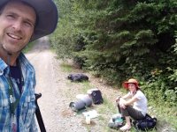
Here we are eating a snack on the road before heading back for the canoe. Smiles are a bit forced.

D2_6_IMG_20220813_143342756.jpg
We're having fun, really

Returning for the boat added another three miles of hiking. Getting the canoe up that hill was not a high point, but it did happen. I fell hard once when both my feet sank in a patch of mud, but no harm no foul.

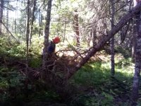
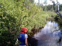
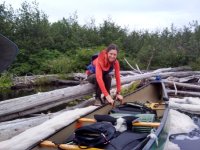
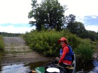
As an aside, our portage approach for these kind of trips is to double carry, first our respective packs, then the canoe and paddles/pfds/etc. On that second carry I take the canoe (OT Penobscot 16, 58lbs in the catalog) and Hope takes the paddles etc, and she walks ahead acting as pathfinder. Her orange hat is actually an important navigation beacon.

The second and third legs of the double carry -- 1.5 miles slack and 1.5 with the canoe/paddles/pfds -- brought us to the same point on the road at the culvert.

It was around 4pm, and while we still had some steam, we were starting to worry about the time. It was Saturday afternoon, and this trip was supposed to end Sunday. We both had obligations Monday. We knew we would pick up speed once we reached the Aroostook River, but to get there we still had to descend half a mile of Carry Brook to the La Pomkeag deadwater, then a few miles of possible rapids (stream crossed a couple 20' countour lines, class I-II?) on La Pomkeag Stream.

We seriously considered throwing in the towel and walking out of there. It would have been about a 10 mile hike on woods roads to the landing, probably three hours at a forced march. We could then drive back for the canoe, assuming the road wasn't gated. That would get us back to civilization on time, although it'd be a pretty crappy end to the trip. Either way we'd have to figure out where to camp for the night. We were both willing to bail if the other person wanted to bail, but neither one of us liked the idea enough to advocate for it. Thus, we continued, conscious of time and looking for a campsite.

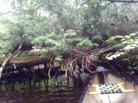
We put in about 100 yards below the culvert, a spot where we could paddle a few yards (every little bit helps) before an obstruction. It was still blowdown city, but we could make slow progress. By now it was feeling like "typical small stream bullsh*t", another day at the office, so to speak. Here's Hope managing to get under a big compound blowdown.

D2_6_IMG_20220813_162341869.jpg
Over, under or around

If this route were regularly traveled it would still be a slog, but the small blowdowns would be cleared and there would be ports around the big ones. The Carry Brook moniker is legitimate.

Ultimately Carry Brook opened up into a deadwater and met La Pomkeag Stream. (I'm assuming "La Pomkeag" is a mangling of an Abenaki word; "-keag" is a suffix on many Abenaki place names, but La Pomkeag sounds more like a salsa band than a Penobscot name.) La Pomkeag was a noticably larger water body, and we made good progress paddling along its deadwater. I was hoping the spot where the deadwater ends and the stream starts to descend would be a campsite, as it looked like there was once a bridge there, but on the ground it wasn't much but rocks, mud and grass.

Although it was August, the week leading up to the trip had heavy rain, and I was hopeful that the La Pomkeag descent would be lively. Although we did some paddling and might have made a few moves, for the most part it was more of a gravel grind than a whitewater run. That said, "typical summer low water bullsh*t" is much easier than "typical small stream bullsh*t", so we made decent progress. Our spirits were pretty high -- we were glad we hadn't bailed and hiked out -- however, it was getting late and we still had to find a place to camp.

D2_8a_IMG_20220813_175157908.jpg
Ready to bomb this (ankle deep) rapid

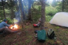
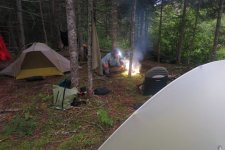
At a bend in the river Hope saw something blue up on the bank. Getting out to investigate, there were more blue blazes, and a nice flat mossy clearing up on the bank. Campsite! We couldn't believe our luck. We never did figure out what the blue blazes were for, they didn't seem to be marking a boundary line, trail or setback. In any case, it was a great campsite. There weren't many rocks, but I found a few, including one big one for a chimney stone, and made a medium-pizza-sized fire. I try to be as leave-no-trace as possible when building a fire in that sort of place. In this case I dug out some moss and soil down to the gravel layer and kept the fire small, filling the hole back up and dispersing the stones in the morning.

D2_9_IMG_20220813_GrandLakeSeboeisCanoeTrip_Aug2022 (33).jpg
A nice little fire

GrandLakeSeboeisCanoeTrip_Aug2022 (32).jpg
Another view of that campsite, we easily found flat spots for both our tents

We pondered our progress, and how far down La Pomkeag we still had to go to reach legitimately navigable waters, but the day had ended well.

Day 3, 2022-08-14, Sunday

We got on the water early the next day, our last day of the trip (we hoped). La Pomkeag was a friendly stream, all things considered, and while we got our feet wet soon enough we were making good progress. Around the time I was thinking of a second round of coffee we came around a bend and paddled into a giant cappuccino.

Seriously, sticks in moving water do accumulate foam of course, but this was the biggest mass of natural foam I'd ever seen, several boat lengths long and thick. It was held back by a big log jam, which turned out to be a difficult obstacle as the water was deep, but anyway that foam was so cool.

D3_1_IMG_20220814_080740956.jpg
Foam, lots of it

D3_2_IMG_20220814_080855296_HDR.jpg
More foam, see how it comes over the left rail like a fog bank?

The foamy log jam led to a confused patch of alder (pick a tunnel -- wrong!) then another log jam. Ho hum, another day on the stream. At 9am we reached the Oxbow Rd bridge and saw a truck go by, the first people we'd seen since Thursday. Shortly thereafter we reached the confluence with the Aroostook River. From there the trip was In The Book (in this case the AMC River Guide). The Aroostook River is a real river and with the recent rains it had great flow, we cruised the last 9 miles of the trip in a couple hours. There were a few named rapids on the map, but nothing that gave us any trouble. Normal downstream canoeing is such a breeze, before we knew it we were at the landing where we'd left a vehicle.

D3_9_IMG_20220814_112014584.jpg
Back at civilization at 11:20am

Another Can't Get There From Here trip in the books! All we had to do was drive that absurd shuttle again to get home.

Almost immediately (on the drive home) this became one of my favorite trips. It was challenging but not impossible, there were relics to tie in the history, we made the trip on a summer weekend and saw nobody until the runout. We had to make decisions in the field with limited information. We were never sure where we would camp, but we somehow ended up with three great campsites. Even counting driving this was only a four day trip, but it looms larger in memory. I can't wait to get out there again.
 
Very well-written and organized report, goonstroke. It's imbued with a palpable spirit of trial and error, of exploration and discovery. Too much muck and wood for my old bones, alone. Having a companion probably helped a lot.

Her orange hat is actually an important navigation beacon.

Glad you clarified which woman was Hope—the orange hat or the red hat.

I posted the above from an airplane

I'll call that a site first. You can be the inaugural member of the CTN Mile High Club.
 
Thanks for that nice report, it looked like a real grind. Just trying to get around, over, or under some of those blowdowns would have finished me at any stage of my paddling career. Now, I get tired just looking at the pictures
I car camped at your starting lake, Grand Lake Seboeis a couple of years ago, nice area, although the wind prevented me from getting up to the northwest inlet stream.
Well done, I enjoyed your trip.
 
Another great trip report! Thanks for taking the time to write it up so nicely. I admire your skillset, sense of adventure and capacity for struggle. The joy you experience out there comes through loud and clear. Really well done.
 
Thanks for another great trip report! I liked that you were both willing to quit but neither wanted to advocate for that option.

Hard to muster (even a forced) smile in some of those situations... Kudos to both of you.
 
Very well-written and organized report, goonstroke. It's imbued with a palpable spirit of trial and error, of exploration and discovery. Too much muck and wood for my old bones, alone. Having a companion probably helped a lot.
Thanks, and thanks for keeping this site going. If I post something here I know I can look back on it years later. Maybe when I'm retired I'll head back up there with more time and a big saw.

Glad you clarified which woman was Hope—the orange hat or the red hat.
So says the authoritative source (my old cracked moto phone). I can't say my memory is of much use after 4 months. Maybe that woman in the red hat works for OnePlus doing QA on their cheap-arse Android phones.

I think I've mentioned that Hope is a GIS expert. She did an awesome trip report in ArcGIS Story Map form:
https://arcg.is/0SizL00

She wrote that a few weeks after the trip, and I'm writing this a few months after, so they have different amounts of fermentation, which makes it fun for me to re-read now.

I'll call that a site first. You can be the inaugural member of the CTN Mile High Club.

No FAA regulations were violated! While I did the first pass in a text editor, I was pleasantly surprised at how Xenforo handled an intermittent connection while I was inserting photos.
 
Thanks for that nice report, it looked like a real grind. Just trying to get around, over, or under some of those blowdowns would have finished me at any stage of my paddling career. Now, I get tired just looking at the pictures
I car camped at your starting lake, Grand Lake Seboeis a couple of years ago, nice area, although the wind prevented me from getting up to the northwest inlet stream.
Well done, I enjoyed your trip.
Thanks. I read your TR then and that put the lake on my radar. Were you camped on the west side? There was a campsite where we put in, but I don't think it was yours, less open ground.

I doubt many people get up there. I'll definitely be back. The road isn't great, with some oil pan rocks to keep you alert, but I think it's worth it. Heck, it's even free, being just outside of North Maine Woods.
 
Were you camped on the west side?
Yes, I was at the northern site on the west side, a very nice site. My plan was to paddle over to the site on the eastern side of the lake but I just settled in where I was and had a good time.
That lake is loaded with pickerel, and some decent smallmouth, if you can get past the pickerel.
 
I enjoyed Hope's report as well (and really love that format). Just so you're aware: You DO realize that she presents it as "another in a series"... It sounds like you've got more bushwhacking in your future. (I know... tragedy, right?)
 
Thank you for this trip report. It went well with my coffee this morning.

In my youth, I spent a great deal of time in the area around Spider Lake. There is an old portage route through that neck of the woods too, leading from the Allagash Waterway east to the Aroostook River. If memory serves me correctly, Thomas Sedgewick Steele documented the route in, "Paddle and Portage". The route goes from Churchill Lake, up the outlet of Spider Lake (Grass Pond), through Spider, and the Portage Ponds, into Echo, Chase, Munsungun and the Aroostook River. I think it might be a tough slog, but it was apparently heavily traveled in its day.

I think Steele did it in bark with "canoe shoes".

Cheers,

Fitz
 
Pardon the thread drift please; Fitz, you have me thinking about the Steele route! I just marked it on my Google Earth site. Without following every twist and bend, it appears to be about 28-30 miles from Churchill Lake to the junction with the Aroostook River at Oxbow Rd. This is very close to the Libby Camps location on Millinocket Lake which can be accessed via Oxbow Rd and Maine Route 11 to arrange a pickup, or to leave a vehicle at the Libby Camp.

I've been planning a solo Allagash trip next summer in my restored Chestnut Chum, but maybe rather than a third trip down the Allagash, a trip on the big lakes then exiting from Churchill Lake via North Twin Brook and through the Steele route would be a better adventure! According to Google Earth there's a mass of blowdown trees on the half mile of N. Twin Brook into Grass Pond, then another third of a mile of blowdown between Grass and Spider ponds. Could be a heck of an exhausting trip.... it's hard to see what one might encounter in the woodsier spots where the satellite can't penetrate!

Thanks for the reference to the book; now I gotta read it.

Pat
 
I enjoyed Hope's report as well (and really love that format). Just so you're aware: You DO realize that she presents it as "another in a series"... It sounds like you've got more bushwhacking in your future. (I know... tragedy, right?)

Never any doubt! I mean I enjoy a gin & tonic float trip too, but these more difficult trips are much more satisfying.

Thank you for this trip report. It went well with my coffee this morning.

In my youth, I spent a great deal of time in the area around Spider Lake. There is an old portage route through that neck of the woods too, leading from the Allagash Waterway east to the Aroostook River. If memory serves me correctly, Thomas Sedgewick Steele documented the route in, "Paddle and Portage". The route goes from Churchill Lake, up the outlet of Spider Lake (Grass Pond), through Spider, and the Portage Ponds, into Echo, Chase, Munsungun and the Aroostook River. I think it might be a tough slog, but it was apparently heavily traveled in its day.

I think Steele did it in bark with "canoe shoes".

Cheers,

Fitz

That'd be a great trip. Ron Canter mentions it as well. I know Munsungun is sometimes used as a starting point for an Allagash trip. With enough time one could do a grand loop, Millinocket-Aroostook-Munsungan-Spider-Churchhill and then south through the headwaters lakes all the way to Telos, Webster Stream, East Branch, Millinocket Carry to Millinocket again. That would be epic.

Pardon the thread drift please; Fitz, you have me thinking about the Steele route! I just marked it on my Google Earth site. Without following every twist and bend, it appears to be about 28-30 miles from Churchill Lake to the junction with the Aroostook River at Oxbow Rd. This is very close to the Libby Camps location on Millinocket Lake which can be accessed via Oxbow Rd and Maine Route 11 to arrange a pickup, or to leave a vehicle at the Libby Camp.

I've been planning a solo Allagash trip next summer in my restored Chestnut Chum, but maybe rather than a third trip down the Allagash, a trip on the big lakes then exiting from Churchill Lake via North Twin Brook and through the Steele route would be a better adventure! According to Google Earth there's a mass of blowdown trees on the half mile of N. Twin Brook into Grass Pond, then another third of a mile of blowdown between Grass and Spider ponds. Could be a heck of an exhausting trip.... it's hard to see what one might encounter in the woodsier spots where the satellite can't penetrate!

Thanks for the reference to the book; now I gotta read it.

Pat

This is the good kind of thread drift, conversations over maps. North Twin Brook does look like a mess, but there's always a way. The Google Earth imagery I'm looking at is from 10/3/2013, so a lot of time for change, good or bad.

Whatever you do, write it up.
 
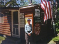
Me and Doug Doremus had great plans to ascend La Pomkeag and Carry Brook to Grand Lake Sebois once upon a very long time ago. It was mid June and the Aroostook was already drying up. Met an old-timer on the river and he laughed so hard he nearly split in two. "You'll be dragging your boats through mud and alders the whole way." Well we went up to the NMW gatehouse and met Lester Junkins. His Uncle Archie Junkins used to have a cabin up in there and he maintained the carry trail. Just might be you found his old woodstove! And thanks for letting us know it actually can be done.
Lester.Junkins.jpg
Lester Junkins knew stuff.
 
Another adventure in truly spectacular fashion! Very well written and exciting to follow along. I had google maps open the entire time that I read through this bruising trip report. I admire what you do and enjoy how well you document these trips. Thanks for sharing.
 
Back
Top