- Joined
- Aug 10, 2018
- Messages
- 2,167
- Reaction score
- 7,317
2025 has been an odd year for me in regards to getting out. My annual Canadian trip was preempted by my niece’s wedding in Oregon and the 2 week tour of the Western US that I’d planned on the way to and from her wedding was then canceled when my vacation time (and money) needed to be spent doing home repairs instead.
Local weather has also been terribly uncooperative this year as the Conemaugh River that runs past my hometown is extremely bony from the utter absence of rain this summer. It is, in fact, lower than I can remember ever seeing it.
All of this left me with a brand new Raven woodstrip canoe that had not been properly paddled as Fall was closing in. Finally, unable to stand it, I canceled all plans for Sunday, Oct 5th and decided to check Allegheny Islands State Park off my bucket list.
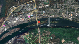
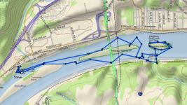
(Photo credit- screenshot from Google Earth)
Established as a State Park in 1980 and totaling just 48 acres, Allegheny Islands State Park consists of 3 islands and 7 shoals in the Allegheny River just North of Pittsburgh and is the only State Park in Pennsylvania that is accessible exclusively by boat.
The park sits upon 14 Mile Island; so named because it is 14 miles upstream of the “point” in Pittsburgh where the Allegheny and Monongahela Rivers join to form the Ohio. This island actually counts as 2 of the park’s 3 islands since it was bisected by the construction of the CW Bill Young Lock and Dam in 1932. I am told that very few people visit the upper island.
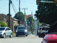
With the Raven strapped securely to the roof of the Fusion, I started making my way toward Pittsburgh opting to avoid the downtown traffic by taking the back roads. In hindsight, I should have checked what was going on locally as I got stuck in the traffic for the apple festival in Delmont which took well over an hour to get through.
I finally arrived at the Deer Creek launch in Harmar, PA around 1:30 where I had to wait while a few power boats who had arrived ahead of me got launched. Boat ramp entertainment was minimal as everyone seemed adequate at backing trailers and the line moved quickly. (Note: because the launch is maintained by Fish & Boat and I was planning to land on a State Park, I had to purchase a launch permit for the canoe. I will not, however, be sticking it on the hull & it remained in my pocket)
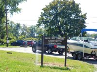
About 20 minutes later, I had the Raven, the pack and paddles at the river’s edge and the car stashed in the parking lot. As usual, I fielded a few questions about the boat and received many compliments about how nice it looked.
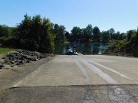
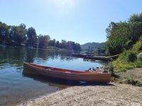
I paddled upstream along 12 mile island which is privately owned and covered in houses (even though it is also accessible only by boat) and the scenery was far different from what has become my norm.
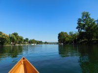
About 10 minutes of paddling brought me to the park where one small island seemed to be the focal point of socializing and there were several boats and jet skis beached on the sandy shore while quite a few people gathered around a rather large fire.
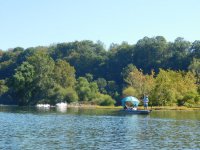
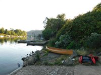
I continued along the island, landing a few times to look for trails and likely camping spots (dispersed, minimum impact camping is permitted on the islands).
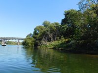
The island was thick with knotweed, an invasive plant that is especially difficult to eradicate here, not simply because it’s hard to kill but also because, having choked out most of the native plants, killing it would likely lead to erosion problems as there would be few plants left to hold the soil.
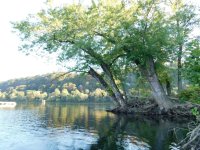
In places, it seemed that vegetation consisted solely of knotweed and huge Maple trees.
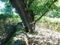
(for scale, that’s a 63 inch beavertail paddle)
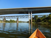
I paddled under the PA Turnpike bridge (built in 1951) and the Bessemer & Lake Erie Railroad bridge (circa 1918) and soon approached the dam which was built by the US Army Corps of Engineers to facilitate barge traffic along the river
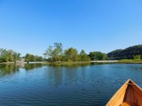
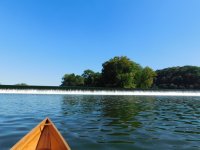
I turned toward river left & paddled along the dam until I reached the lock. I’d previously checked to see what the protocols were for portaging around the dam and the lock tender said that I was welcome to do so along the tracks behind the lock but why didn’t I just use the lock?
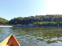
He indicated that I could call as I approached but that cell reception was sometimes sketchy on the river or I could “pull the rope”.
I wasn’t sure what he meant by that but, as I approached the entrance of the lock chamber, sure enough, there was an actual rope that one could pull to request passage.
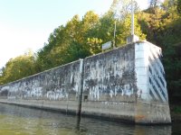
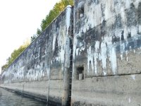
I pulled the rope and soon saw someone wave from the top of the lock. I paddled closer and he said that they were lowering the water in the chamber and that there were 2 power boats requesting passage as well. He then instructed me to allow them to enter the chamber and then follow them in.
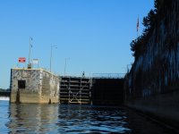
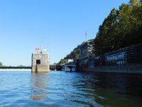
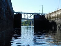
Once we were all in the lock chamber, the doors swung closed and the attendant tossed me a rope (he’d previously asked if I had one and, when I said I’d forgotten it, he’d said that they have loaners). I wasn’t certain why I would be needing a rope but he assured me that turbulence was minimal even though the chamber would fill completely in about 30 minutes.
As promised, turbulence was minimal as the water seemed to enter the chamber from various places under the far wall. The rope slowly piled up under my feet as the water within the chamber rose almost 14 feet.
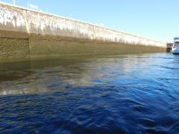
At that time, the upstream doors slowly swung open, the attendant came to collect his rope and I was free to paddle away. As he was aware that I was headed for the island, he cautioned me not to go past the buoy at the halfway point of the island as he didn’t want me going over the dam.
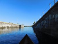
Looking downstream as I left the chamber, I was surprised that there were no buoys along the dam as there are in the Army Corps of Engineers flood control lakes. In fact, I thought, it would be reasonably easy to miss that the dam was there (if not for the huge stone lock, the signage upstream and the omnipresent roar of the water)
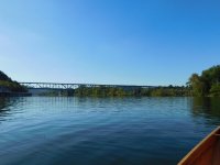
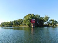
I paddled around the upstream end and down along the river right side of the island until I’d almost reached the downstream tip but there was no buoy on that side of the island.
Honestly, I was certain that the canoe could safely glide across the current above the dam but, with only 60 feet (20 meters) or so between the downstream end of the island and the crest of the dam and a 14 foot drop awaiting me if I was wrong, I turned around and paddled back upstream. (Besides, I had to face the lock attendant on the way back and he’d have 30+ minutes to berate me while I sat within his lock)
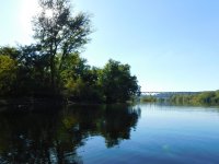
As it was, I wanted to get a good view of the crest of the dam so I paddled down the lock side of the island to the buoy, beached the canoe and bushwacked my way through the knotweed on a deer trail until I reached the downstream end of the island.
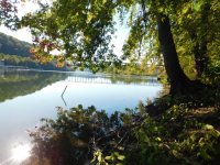
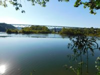
I was very pleasantly surprised (as I had been every time that I went ashore) by how little garbage there was on the islands. The islands flood regularly so that might account for some of it (as well as explaining the dock that’s sitting in the center of the upper island)
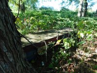
But, overall, there was far less garbage than we’d seen when my son & I had paddled the Conemaugh River from Johnstown.
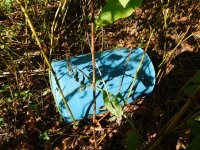
I did find one blue barrel but, as it was of the 55 gallon (208 liter) variety and of unknown origin, I resisted the urge to throw it in the canoe and spend the winter building a harness.
I returned to the lock, found & pulled the rope, dutifully donned my life jacket and waited.
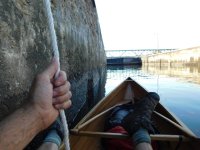
This time, I was alone in the chamber and, as the attendant again lent me a rope, I mentioned the fact that it felt weird to go to all that trouble for just me. He assured me that it gave him something to do and, besides, the water was free.
I paddled down the river left side of 14 mile island past quite a few ducks, a beached powerboat where people were sitting around a campfire and several fishermen who were lamenting their luck and was surprised to find pictographs under the Turnpike bridge.

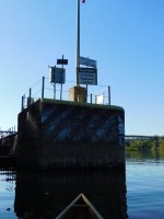
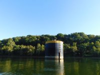
I also passed some kind of tower in the middle of the river and had to laugh as I noticed that someone had placed lawn chairs on the top. I had to wonder if they were trying to save a parking spot.
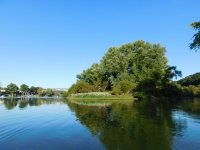
As I paddled past the downstream end of the main island, I saw a couple of powerboats passing through the channel between it and the smaller island where people had appeared to be partying, so I paddled through the other way to check out the beach area. Sure enough, it seemed that the party had broken up and there were only two jet skiers remaining on the island.
I spoke to them awhile (hey, they were age-appropriate, super friendly, very scantily clad & looked good… I mean, I’m not giving up extended, backcountry trips anytime soon but front country, day trips may actually have their perks...).
They informed me that, due to the sandy beach and lack of knotweed, the smallest island was where everyone met to hang out, drink & socialize (note: alcohol is forbidden in State Parks. And, no; sadly, they didn’t offer me any)
They also mentioned another island further downstream called Sycamore Island which they thought was an abandoned state park and which I’ll have to check out sometime in the future.
By that time, I was thinking about supper so I returned along 12 mile island on river right, pulled the canoe onto shore at the launch & retrieved my car.
The ride home was far less eventful than the ride down and, in an hour or so, I was standing in my kitchen making supper, searching Google for information on Sycamore Island and thinking that maybe day trips can be enjoyable too.
Local weather has also been terribly uncooperative this year as the Conemaugh River that runs past my hometown is extremely bony from the utter absence of rain this summer. It is, in fact, lower than I can remember ever seeing it.
All of this left me with a brand new Raven woodstrip canoe that had not been properly paddled as Fall was closing in. Finally, unable to stand it, I canceled all plans for Sunday, Oct 5th and decided to check Allegheny Islands State Park off my bucket list.

(Photo credit- screenshot from Google Earth)
Established as a State Park in 1980 and totaling just 48 acres, Allegheny Islands State Park consists of 3 islands and 7 shoals in the Allegheny River just North of Pittsburgh and is the only State Park in Pennsylvania that is accessible exclusively by boat.
The park sits upon 14 Mile Island; so named because it is 14 miles upstream of the “point” in Pittsburgh where the Allegheny and Monongahela Rivers join to form the Ohio. This island actually counts as 2 of the park’s 3 islands since it was bisected by the construction of the CW Bill Young Lock and Dam in 1932. I am told that very few people visit the upper island.
With the Raven strapped securely to the roof of the Fusion, I started making my way toward Pittsburgh opting to avoid the downtown traffic by taking the back roads. In hindsight, I should have checked what was going on locally as I got stuck in the traffic for the apple festival in Delmont which took well over an hour to get through.

I finally arrived at the Deer Creek launch in Harmar, PA around 1:30 where I had to wait while a few power boats who had arrived ahead of me got launched. Boat ramp entertainment was minimal as everyone seemed adequate at backing trailers and the line moved quickly. (Note: because the launch is maintained by Fish & Boat and I was planning to land on a State Park, I had to purchase a launch permit for the canoe. I will not, however, be sticking it on the hull & it remained in my pocket)

About 20 minutes later, I had the Raven, the pack and paddles at the river’s edge and the car stashed in the parking lot. As usual, I fielded a few questions about the boat and received many compliments about how nice it looked.


I paddled upstream along 12 mile island which is privately owned and covered in houses (even though it is also accessible only by boat) and the scenery was far different from what has become my norm.

About 10 minutes of paddling brought me to the park where one small island seemed to be the focal point of socializing and there were several boats and jet skis beached on the sandy shore while quite a few people gathered around a rather large fire.

I continued along the island, landing a few times to look for trails and likely camping spots (dispersed, minimum impact camping is permitted on the islands).

The island was thick with knotweed, an invasive plant that is especially difficult to eradicate here, not simply because it’s hard to kill but also because, having choked out most of the native plants, killing it would likely lead to erosion problems as there would be few plants left to hold the soil.
In places, it seemed that vegetation consisted solely of knotweed and huge Maple trees.

(for scale, that’s a 63 inch beavertail paddle)
I paddled under the PA Turnpike bridge (built in 1951) and the Bessemer & Lake Erie Railroad bridge (circa 1918) and soon approached the dam which was built by the US Army Corps of Engineers to facilitate barge traffic along the river


I turned toward river left & paddled along the dam until I reached the lock. I’d previously checked to see what the protocols were for portaging around the dam and the lock tender said that I was welcome to do so along the tracks behind the lock but why didn’t I just use the lock?

He indicated that I could call as I approached but that cell reception was sometimes sketchy on the river or I could “pull the rope”.
I wasn’t sure what he meant by that but, as I approached the entrance of the lock chamber, sure enough, there was an actual rope that one could pull to request passage.


I pulled the rope and soon saw someone wave from the top of the lock. I paddled closer and he said that they were lowering the water in the chamber and that there were 2 power boats requesting passage as well. He then instructed me to allow them to enter the chamber and then follow them in.


Once we were all in the lock chamber, the doors swung closed and the attendant tossed me a rope (he’d previously asked if I had one and, when I said I’d forgotten it, he’d said that they have loaners). I wasn’t certain why I would be needing a rope but he assured me that turbulence was minimal even though the chamber would fill completely in about 30 minutes.
As promised, turbulence was minimal as the water seemed to enter the chamber from various places under the far wall. The rope slowly piled up under my feet as the water within the chamber rose almost 14 feet.

At that time, the upstream doors slowly swung open, the attendant came to collect his rope and I was free to paddle away. As he was aware that I was headed for the island, he cautioned me not to go past the buoy at the halfway point of the island as he didn’t want me going over the dam.

Looking downstream as I left the chamber, I was surprised that there were no buoys along the dam as there are in the Army Corps of Engineers flood control lakes. In fact, I thought, it would be reasonably easy to miss that the dam was there (if not for the huge stone lock, the signage upstream and the omnipresent roar of the water)


I paddled around the upstream end and down along the river right side of the island until I’d almost reached the downstream tip but there was no buoy on that side of the island.
Honestly, I was certain that the canoe could safely glide across the current above the dam but, with only 60 feet (20 meters) or so between the downstream end of the island and the crest of the dam and a 14 foot drop awaiting me if I was wrong, I turned around and paddled back upstream. (Besides, I had to face the lock attendant on the way back and he’d have 30+ minutes to berate me while I sat within his lock)

As it was, I wanted to get a good view of the crest of the dam so I paddled down the lock side of the island to the buoy, beached the canoe and bushwacked my way through the knotweed on a deer trail until I reached the downstream end of the island.


I was very pleasantly surprised (as I had been every time that I went ashore) by how little garbage there was on the islands. The islands flood regularly so that might account for some of it (as well as explaining the dock that’s sitting in the center of the upper island)

But, overall, there was far less garbage than we’d seen when my son & I had paddled the Conemaugh River from Johnstown.
I did find one blue barrel but, as it was of the 55 gallon (208 liter) variety and of unknown origin, I resisted the urge to throw it in the canoe and spend the winter building a harness.

I returned to the lock, found & pulled the rope, dutifully donned my life jacket and waited.

This time, I was alone in the chamber and, as the attendant again lent me a rope, I mentioned the fact that it felt weird to go to all that trouble for just me. He assured me that it gave him something to do and, besides, the water was free.


I paddled down the river left side of 14 mile island past quite a few ducks, a beached powerboat where people were sitting around a campfire and several fishermen who were lamenting their luck and was surprised to find pictographs under the Turnpike bridge.

I also passed some kind of tower in the middle of the river and had to laugh as I noticed that someone had placed lawn chairs on the top. I had to wonder if they were trying to save a parking spot.

As I paddled past the downstream end of the main island, I saw a couple of powerboats passing through the channel between it and the smaller island where people had appeared to be partying, so I paddled through the other way to check out the beach area. Sure enough, it seemed that the party had broken up and there were only two jet skiers remaining on the island.
I spoke to them awhile (hey, they were age-appropriate, super friendly, very scantily clad & looked good… I mean, I’m not giving up extended, backcountry trips anytime soon but front country, day trips may actually have their perks...).
They informed me that, due to the sandy beach and lack of knotweed, the smallest island was where everyone met to hang out, drink & socialize (note: alcohol is forbidden in State Parks. And, no; sadly, they didn’t offer me any)
They also mentioned another island further downstream called Sycamore Island which they thought was an abandoned state park and which I’ll have to check out sometime in the future.
By that time, I was thinking about supper so I returned along 12 mile island on river right, pulled the canoe onto shore at the launch & retrieved my car.

The ride home was far less eventful than the ride down and, in an hour or so, I was standing in my kitchen making supper, searching Google for information on Sycamore Island and thinking that maybe day trips can be enjoyable too.


