G
Guest
Guest
Ferguson Section 9, NC 41 to Ennis Rd.
This is a non-destination recommendation for one section of river. And, eventually, a mini trip report.
We have paddled most of the South River, doing the upper sections 15 or more years ago, and have paddled some easy access sections repeatedly. The South, along with the nearby Black River, is as good a narrow, twisty blackwater paddling destination as exists in the mid-Atlantic. Great birding, great wildlife, few houses away from bridge crossings, few people period.
Other than two popular sections of the Black neither river sees much paddler use; outside those two sections of the Black, Ivanhoe to Beattys Bridge and Beattys to Hunts Bluff through the Three Sisters, I do not recall ever encountering another paddler. Jonboat catfishermen checking trot lines more than a few times, but rarely another paddler.
Hurricane Isabel back in 2003 put a lot of strainers in the water. North Carolina received disaster recovery money and spent some clearing downed river trees in areas where there was road access. But the State needed property owner permission to access areas between bridges via private roads. Some property owners said no, and there still some big, river spanning fallen cypress and oak from that storm years later.
The stretch between NC 41 and Ennis Rd where access was denied was especially tough, the little strainer branches were gone, but there was a lot of limbo and step-atop action getting under and over the big stuff. We last paddled that stretch in 2012, with only the loss of a single paddle. Er, double paddle. Er, carbon fiber double paddle.
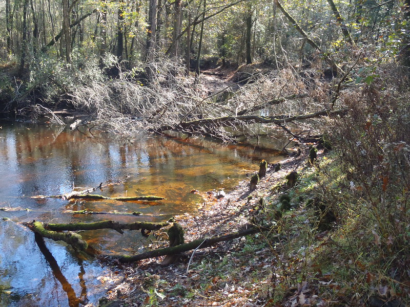
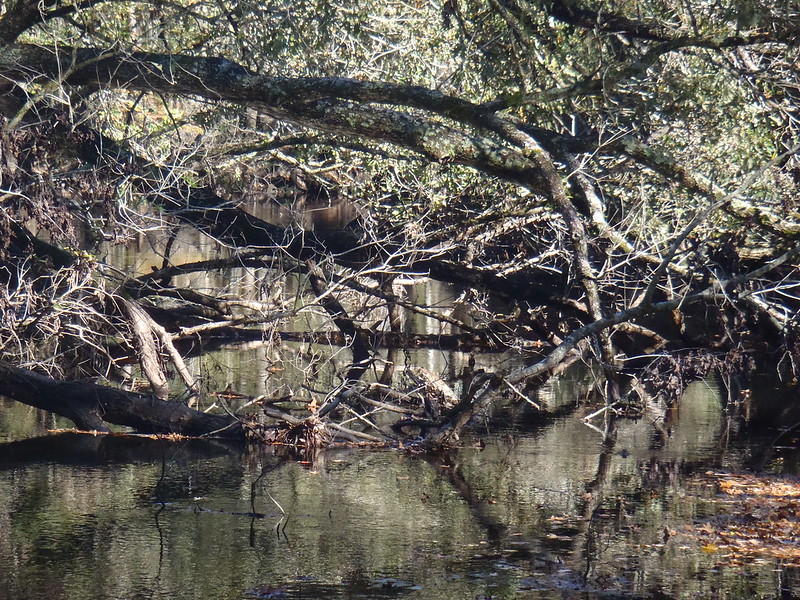
Hurricane Matthew in 2016 hit coastal North Carolina with a wallop. This was the view upstream and downstream, from a single vantage point midway along that section of the South.
 PB090010 by Mike McCrea, on Flickr
 PB090015 by Mike McCrea, on Flickr
Hiking upstream I did find one clear stretch of almost 50 yards, downstream was one nightmare after another. My days of enjoying the challenge of a daylong strainerfest from heck are long gone. NC 41 to Ennis Rd? Nope, no time soon.
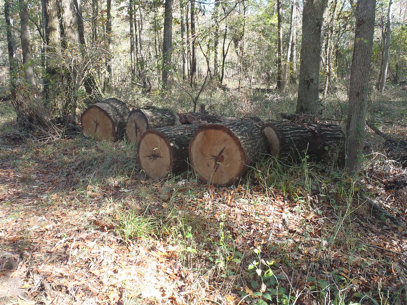
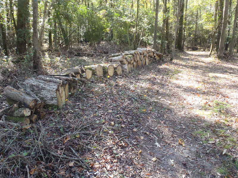
Some parts of the river access do look like Memaquay may have been there.
 PB090016 by Mike McCrea, on Flickr
 PB090018 by Mike McCrea, on Flickr
It was a nice end of a long dirt road locale to spend the day, flotsam wandering the banks, and comfy seated with beer and journal on a blackwater dock over the river. Utter quiet except for river gurgle and birdsong.
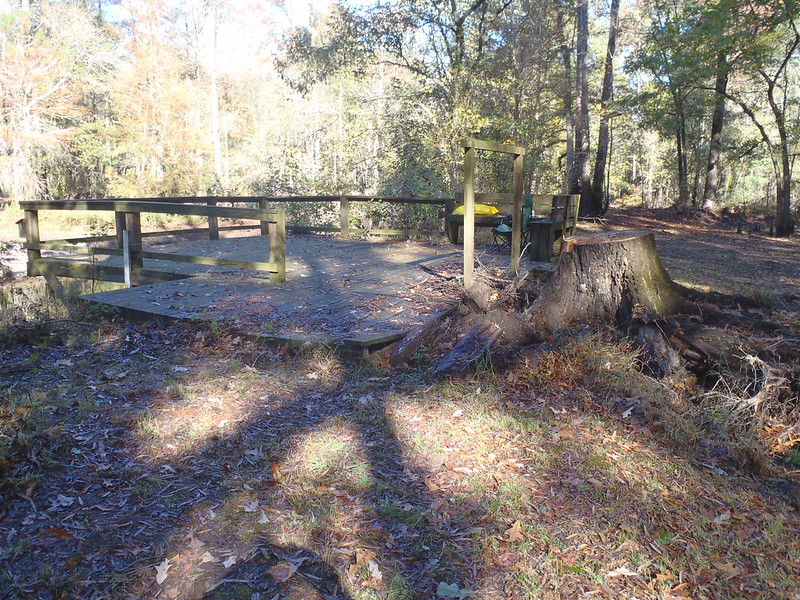 PB090006 by Mike McCrea, on Flickr
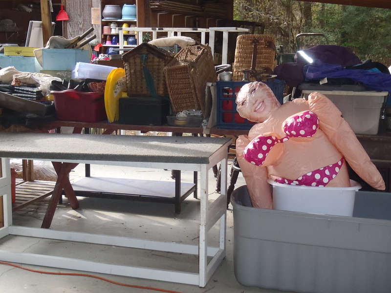
The usual NC fun was had away from the river.
 PB090003 by Mike McCrea, on Flickr
 PB060002 by Mike McCrea, on Flickr
I did manage to throw a boat in at Jones Lake State Park early one morning.
https://www.ncparks.gov/jones-lake-state-park/ecology
Jones Lake SP is peculiar, it is a State Park devoted entirely to coastal bay lakes and Pocosin Ponds. The lakes contained are not big, but those bay lakes are peculiar and particular in ecology and orientation. Salters is a superb and pristine example of a Pocosin Pond, and a Ranger needs to lead you back to the access, unlocking gates as he goes.
Jones Lake SP has a fascinating visitors center build around the ecology of bay lakes. The theories regarding the formation of those half a million oval bay lakes, all oriented northwest to southeast, is still unresolved.
I like the shattered meteor impact event theory.
To bring this back to Destinations, coastal North Carolina does a great job with paddler parks.
This is a non-destination recommendation for one section of river. And, eventually, a mini trip report.
We have paddled most of the South River, doing the upper sections 15 or more years ago, and have paddled some easy access sections repeatedly. The South, along with the nearby Black River, is as good a narrow, twisty blackwater paddling destination as exists in the mid-Atlantic. Great birding, great wildlife, few houses away from bridge crossings, few people period.
Other than two popular sections of the Black neither river sees much paddler use; outside those two sections of the Black, Ivanhoe to Beattys Bridge and Beattys to Hunts Bluff through the Three Sisters, I do not recall ever encountering another paddler. Jonboat catfishermen checking trot lines more than a few times, but rarely another paddler.
Hurricane Isabel back in 2003 put a lot of strainers in the water. North Carolina received disaster recovery money and spent some clearing downed river trees in areas where there was road access. But the State needed property owner permission to access areas between bridges via private roads. Some property owners said no, and there still some big, river spanning fallen cypress and oak from that storm years later.
The stretch between NC 41 and Ennis Rd where access was denied was especially tough, the little strainer branches were gone, but there was a lot of limbo and step-atop action getting under and over the big stuff. We last paddled that stretch in 2012, with only the loss of a single paddle. Er, double paddle. Er, carbon fiber double paddle.
Hurricane Matthew in 2016 hit coastal North Carolina with a wallop. This was the view upstream and downstream, from a single vantage point midway along that section of the South.
PB090010 by Mike McCrea, on FlickrPB090015 by Mike McCrea, on FlickrHiking upstream I did find one clear stretch of almost 50 yards, downstream was one nightmare after another. My days of enjoying the challenge of a daylong strainerfest from heck are long gone. NC 41 to Ennis Rd? Nope, no time soon.
Some parts of the river access do look like Memaquay may have been there.
PB090016 by Mike McCrea, on FlickrPB090018 by Mike McCrea, on FlickrIt was a nice end of a long dirt road locale to spend the day, flotsam wandering the banks, and comfy seated with beer and journal on a blackwater dock over the river. Utter quiet except for river gurgle and birdsong.
PB090006 by Mike McCrea, on FlickrThe usual NC fun was had away from the river.
PB090003 by Mike McCrea, on FlickrPB060002 by Mike McCrea, on FlickrI did manage to throw a boat in at Jones Lake State Park early one morning.
https://www.ncparks.gov/jones-lake-state-park/ecology
Jones Lake SP is peculiar, it is a State Park devoted entirely to coastal bay lakes and Pocosin Ponds. The lakes contained are not big, but those bay lakes are peculiar and particular in ecology and orientation. Salters is a superb and pristine example of a Pocosin Pond, and a Ranger needs to lead you back to the access, unlocking gates as he goes.
Jones Lake SP has a fascinating visitors center build around the ecology of bay lakes. The theories regarding the formation of those half a million oval bay lakes, all oriented northwest to southeast, is still unresolved.
I like the shattered meteor impact event theory.
To bring this back to Destinations, coastal North Carolina does a great job with paddler parks.