For the last three weeks out of four, MDB and I have been paddling and hiking around Piseco Lake.
I've already posted photos of Fall Stream...Here are some photos from a couple of calendar photo weekends.
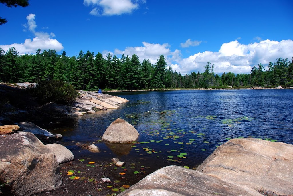
Clockmill Pond, yeah, it was a hike, but it will be included in a loop trip, paddling several seldom paddled waters. The pond itself has some beautiful shoreline, and would look much nicer from the seat of a canoe!
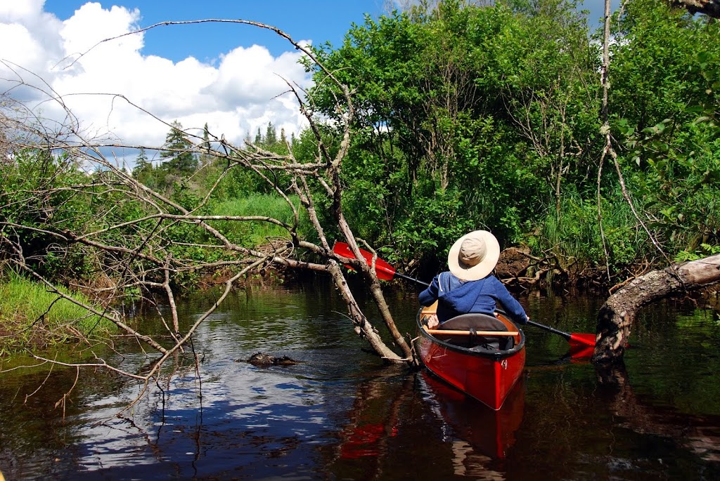
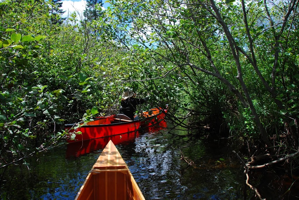
Here's My Darling Bride wiggling her way up Goldmine Stream, a tributary of the W Branch of the E Canada Creek.
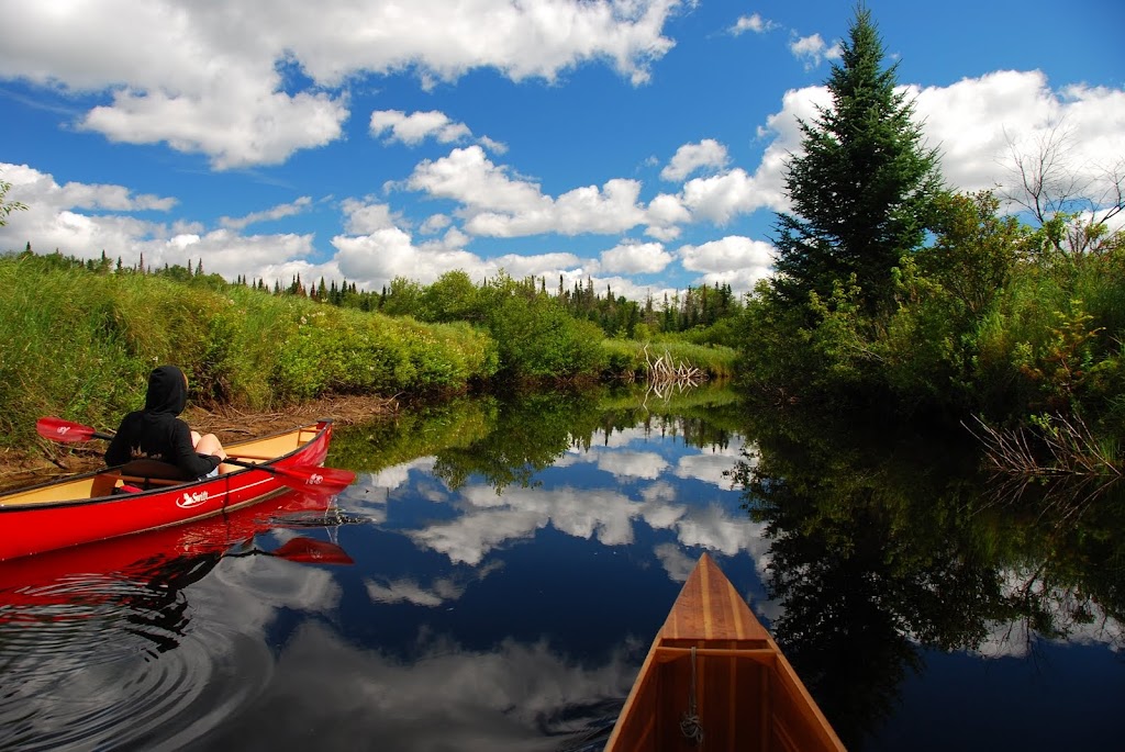
The following weekend, we returned to the W Branch of E Canada Creek, this time paddling downstream first, for a couple of miles, until we reached a rock garden. Below the rock garden was all rapids and waterfalls, none of it navigable at these summer water levels.
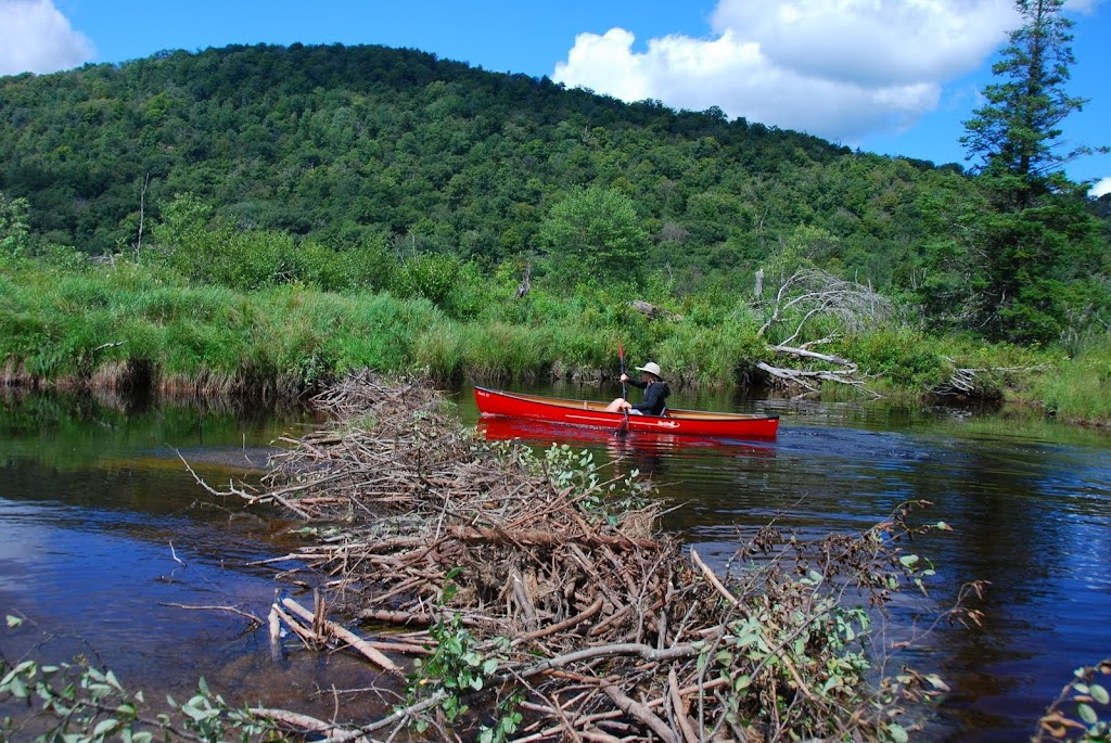
As I said, we had some calendar photo weather, a little cool to start, but by lunchtime it was just about perfect. Very few obstructions, and only 2 beaver dams, one runnable both directions, one not...
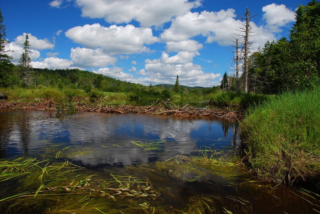
This is the not.
Here's a look at the 2nd beaver dam, with Goldmine Hill in the background.
After returning upstream to our put in, we continued upstream to paddle the main trunk of the W Branch...funny that the tributary is about twice as wide and open as the main creek!!
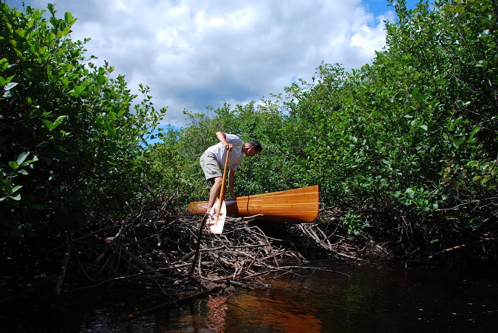
Here was the only beaver dam, but it's a tall one!
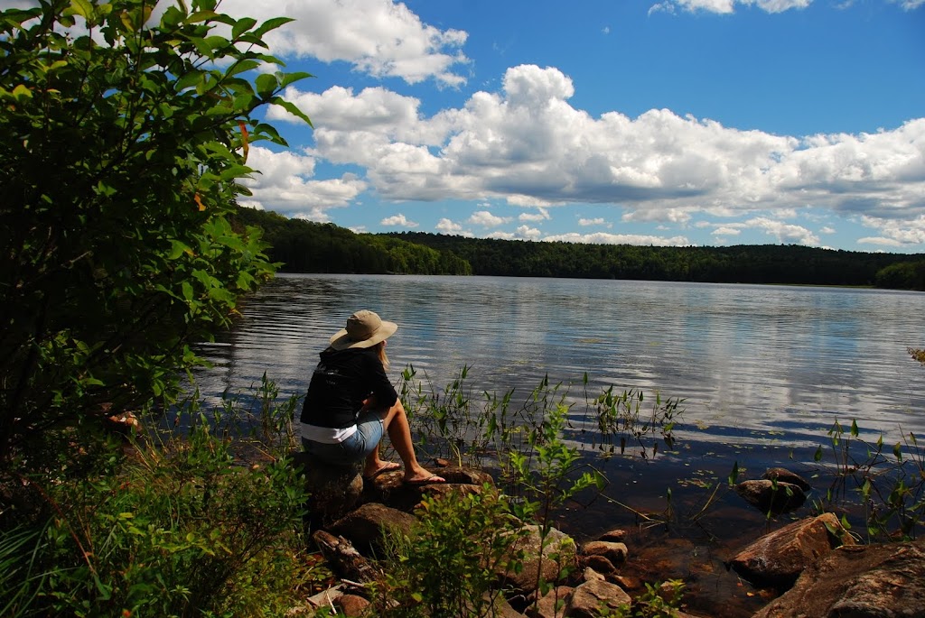
And lastly, here is Sand Lake, another body that will be part of that loop including Clockmill Pond. Someday, someday...
BTW, we saw not another person while we were on the water...
I've already posted photos of Fall Stream...Here are some photos from a couple of calendar photo weekends.
Clockmill Pond, yeah, it was a hike, but it will be included in a loop trip, paddling several seldom paddled waters. The pond itself has some beautiful shoreline, and would look much nicer from the seat of a canoe!
Here's My Darling Bride wiggling her way up Goldmine Stream, a tributary of the W Branch of the E Canada Creek.
The following weekend, we returned to the W Branch of E Canada Creek, this time paddling downstream first, for a couple of miles, until we reached a rock garden. Below the rock garden was all rapids and waterfalls, none of it navigable at these summer water levels.
As I said, we had some calendar photo weather, a little cool to start, but by lunchtime it was just about perfect. Very few obstructions, and only 2 beaver dams, one runnable both directions, one not...
This is the not.
Here's a look at the 2nd beaver dam, with Goldmine Hill in the background.
After returning upstream to our put in, we continued upstream to paddle the main trunk of the W Branch...funny that the tributary is about twice as wide and open as the main creek!!
Here was the only beaver dam, but it's a tall one!
And lastly, here is Sand Lake, another body that will be part of that loop including Clockmill Pond. Someday, someday...
BTW, we saw not another person while we were on the water...