MAP 1
How to Get There:
Follow Highway 11 until you reach the junction of Highway 584. Turn North on 584 and drive through the town of Geraldton. Follow 584 for approximately 65 kilometers until you reach the turnoff for highway 643, the Aroland Road. Drive through Aroland. There is a store at the end of the reserve which is your last chance to buy things. Highway 643 turns into a large dirt logging road. This road is usually in excellent condition, but can be very dusty when logging trucks go by.
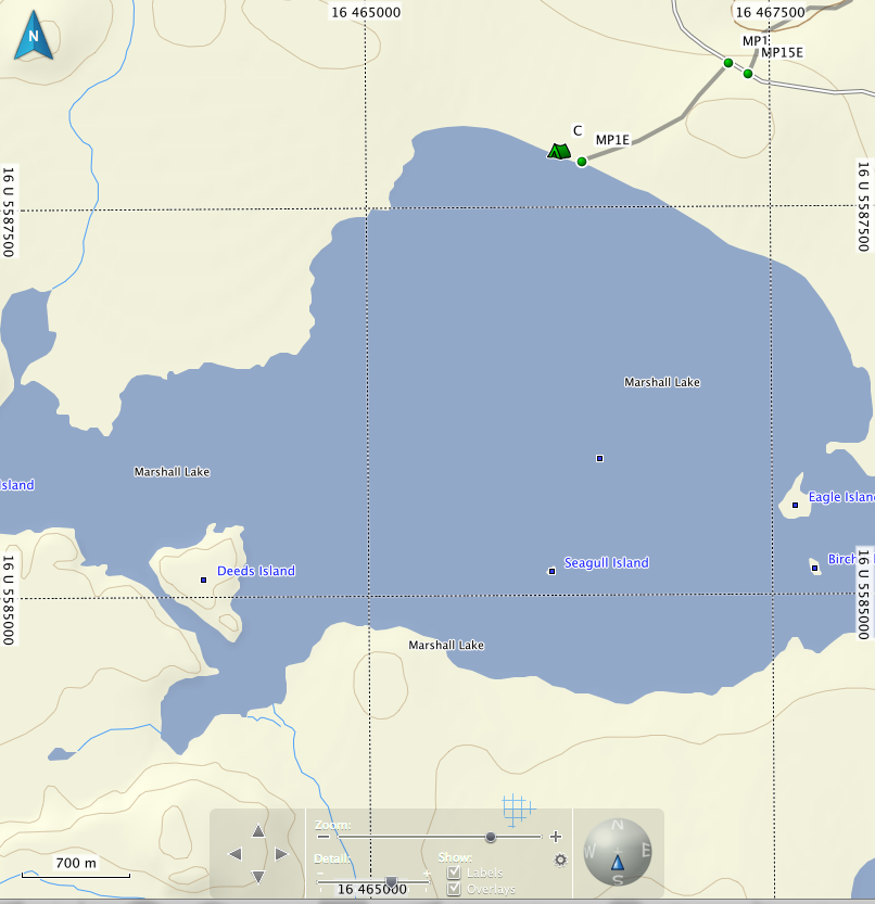
Port # MP1 into Marshall Lake is 67 kilometers from the junction of Highway 584 and 643. There is a large parking lot and a road that leads into the lake. The road is the port. You might be tempted to drive in, but keep in mind that Marshall Lake is not supposed to have motorized access, and you will be fined if you are caught driving in. If you are pressed for time when you arrive, you can camp at the beginning or end of the port, although it tends to be rubbishy....there is a very nice beach about a kilometer west of the end of the port.
MP1
UTM Start:
0467226
5588409
Finish
0466342
5587840
Length: 1203 m
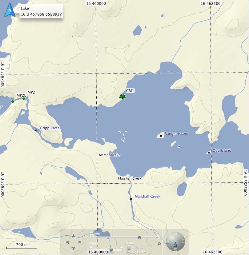
MAP 2
Map 2 takes one through Marshall lake and into Gripp lake. This is the beginning of very large tracts of wild rice and classic wetlands. Ducks, eagles, ospreys and moose abound. Later in the summer, you may find yourself following a narrow channel through the wild rice...It will twist and turn, with no end in site, but you will get there.
CM1 is a nice camping site with lots of room and firewood. There is an old mining camp on the south shore just before the exit. It has lots of building standing, and is not really recommended for camping, but it will work in an emergency. Travelling from Marshall to Gripp in one day is the usual for most canoeists, unless they want to spend additional time fishing Marshall.
MP2
Start: 0458402 Starts beside and old trapper's shack, river left
5586941
End 0458170
5586881
Length: 263 m
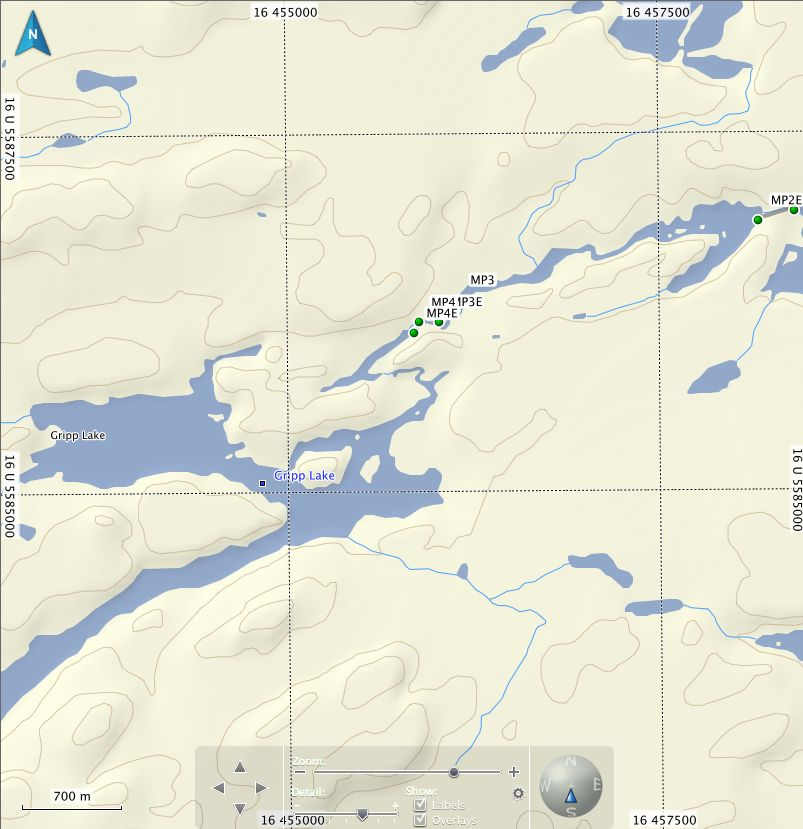
Map 3
MP3
Start: 0456153 Located river right at head of rapids
5586334
End: 0456025
5586186
Length: 180 m
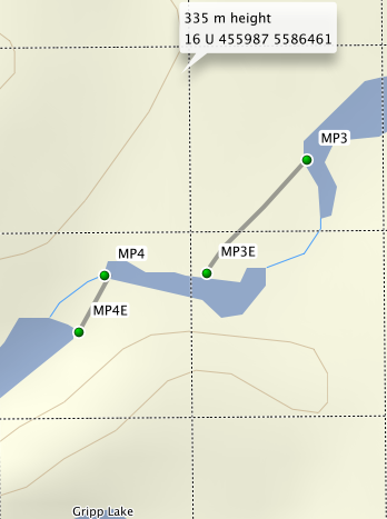
MP4
Start: 0455892 Located river left in small pond a short distance from port #3.
5586183
End: 0455822
5586106
Length: 102 m
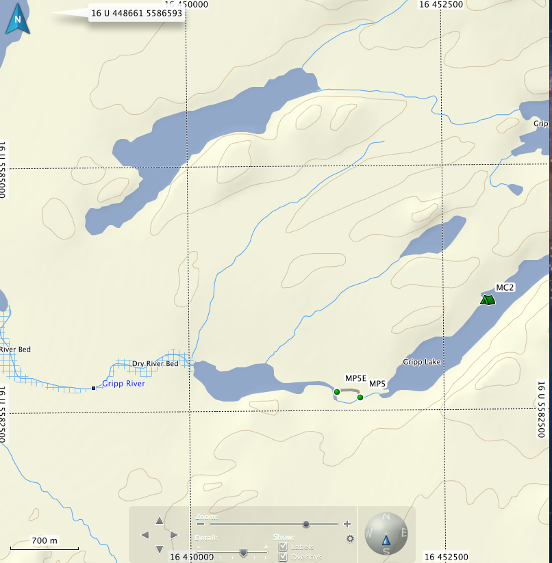
Map 4
MC2 Gripp lake 0452942
5583633
MP5
Start: 0451683 Paddle down the river out of Gripp lake for a few hundred meters.
5582644 The port starts in alder bushes marked with flagging tape on
End: 0451419 river right. The sign is inland on a tree.
5582694
Length: 290 m
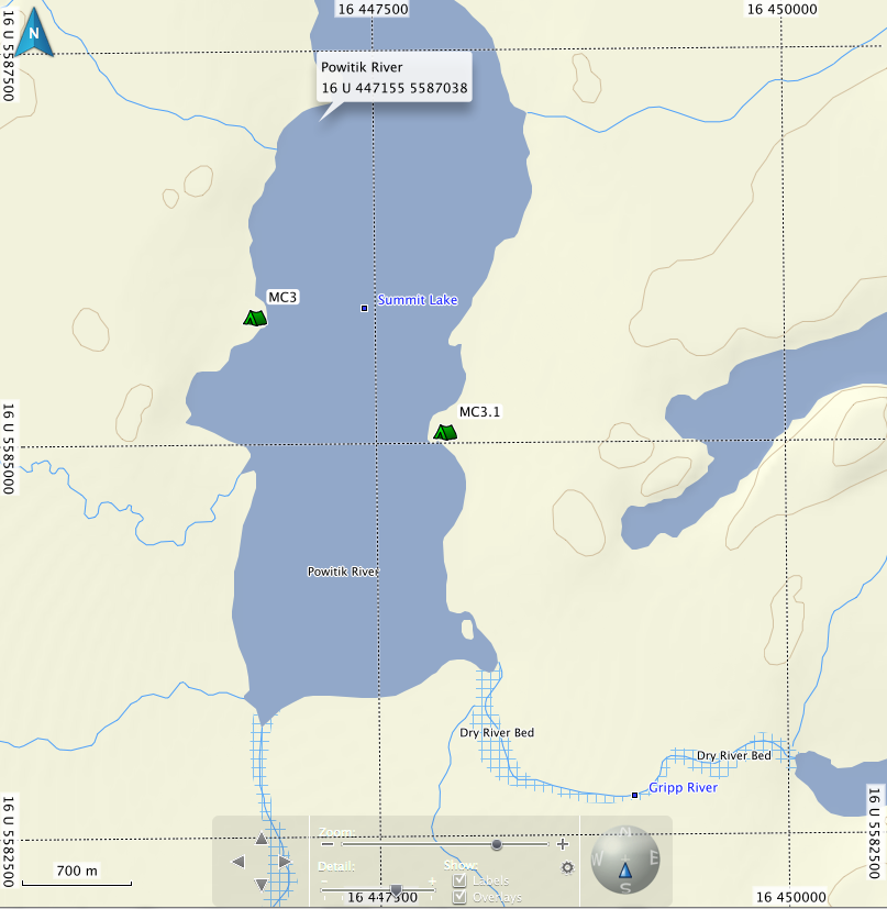
MAP 5
Summit is a height of land lake. Water flowing out of the north end goes to James Bay while water coming from the south end goes to the Atlantic (well, Lake Nipigon actually). It is a shallow lake with walleye fishing usually best just off camp MC3. Camp MC3 and MC3.1 are used by duck hunters and fisherman, so it may be garbaged. At the beginning of the Powitik, you may have to walk a few times if water is low.
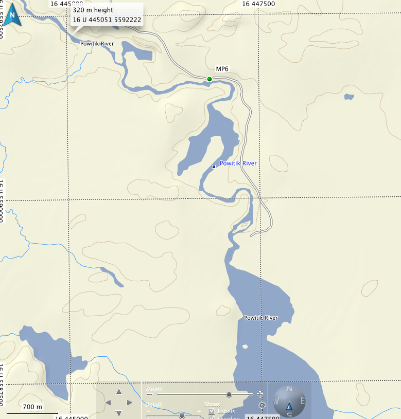
Map 6
There is an old port on RR as the Powitik leaves Summit, but I have never used it in the dozen or more times I have run this route. At high water you should be able to shoot this set of rapids, at low levels, it can be walked.
MP6
Start: 0446879 Located river right, just before rapids.
5591602
End: 0446825
5591589
Length: 60 m
These rapids can be shot if the water is high enough, or lined on RR.
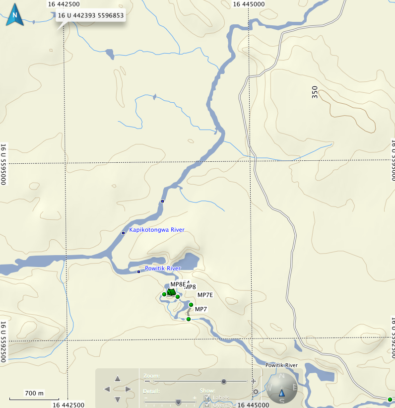
Map 7
MP7
Start: 16 U 444292 5592804
End: 16 U 444161 5592949
Length: 183 m
The landing is a clearing covered by alders and other small bushes, located river right. Rapids are an easy C1 until you turn the corner, where the necessity of the port becomes apparent. At medium-low
water levels I shot the first set and walked the second.
At higher levels, both sets can be shot, but it would be a very excellent idea to eddy out at the bottom of the first set to see if the second set is doable.
MP8
Start: 16 U 444036 5593161
Length: 60 m
The port is located at a clearing, river right, just before a water fall. There used to be an old trappers cabin here, but there is only an old stove and the clearing to bear witness. There are many camping opportunities at this site. Camp right by the falls, in the initial clearing, or follow a trail downstream from the falls and there is a large site with a port leading out of it. The pool at the bottom of the falls usually produces several nice walleye.
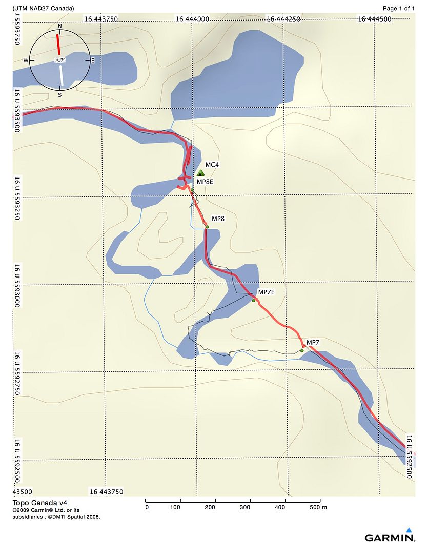
MAP 8
Shortly after Phillips Creek there is a straight forward C1 rapid that has never needed porting.
MP9
Originally reported to be on river right, but never found. The last time I was through, I found the remnants of a very rough port on RL, starting close to the head of the rapids by a very large cedar tree. It ends on a sandbar where there are still some rapids left, but the boney ones are above it. I have always shot this rapid, but be prepared to pick a very fine line between canoe wide rocks.
Map 9
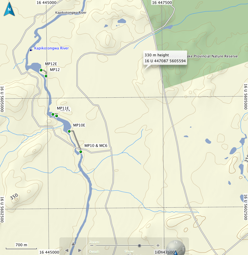
MP10 & MC6
Start: 0445697
5603759
End: 0445463
5604253
Length: 670 m
Located river right, this port goes around some knarly class 2/3 rapids, depending on water levels. I have shot them but it is not recommended unless you are a White Water Guru or you have a death wish. The port is wet in spots, particularly at the beginning, but otherwise good.
MC5 is located river left shortly after the rapids at P.11. It is a large rock face, suitable for two or three tents.
UTM coordinates: 0444915
5599754
MC6 is the landing for port 12. It is a large grassy area, not bad, but a real Bughole!
Port #11
Start: 0445204 Located river right.
5604559
End: 0445109
5604622
Length: 120 m
MP12
Start: 0444938
5605483
End: 0444879
5605641
Length: 155 m
Located river right at head of rapids. Starts with a steep hill. This is a "must-do" port, the end of the rapids is very bad, not recommended to shoot. It is a boulder garden with very large boulders and a very strong flow going over them. It chewed me up and spit me out when I tried it about ten years ago.
There is also a small area to camp on the top of this port.
MAP 10
I have changed the scale on this map because there is not a lot of info needed.
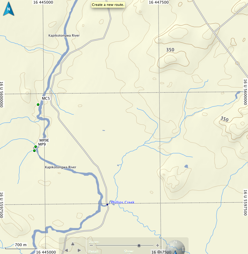
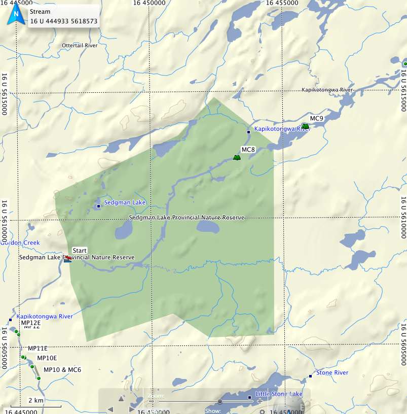
It is straight paddling on the Kap. You will pass under the bridge on the Ogoki Highway. There might be a fishing boat or two here, and there might be logging trucks hauling. MC8 is the only camp on this strectch. The MC9 otherwise known as the "Esker Hilton" is a nice beach site on a small un-named lake off the Kap. You will reach a large widening on the Kap that heads south....that's the un-named lake
MC8 0453253
5612391
MC9 (rough coordinates)
455874
5613511
MAP 11
Still at the bigger scale.
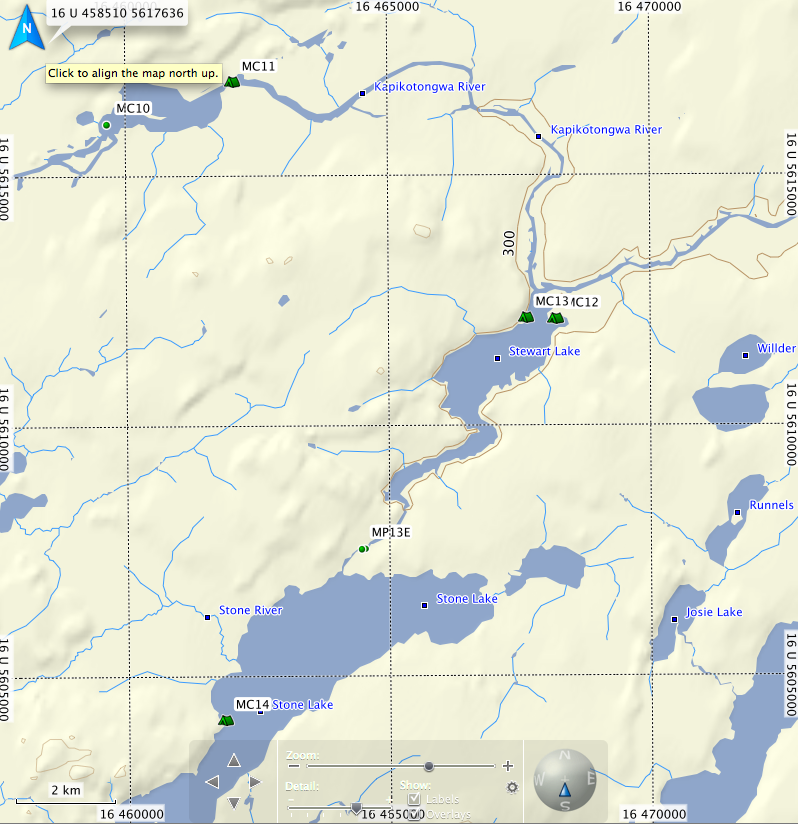
More paddling on the Kap. Berger Lake has a nice island campsite on the second island in the north channel entrance. (MC10) However, it is well used by hunters, and has quite a bit of garbage. When navigating into Berger, it helps to use a compass or GPS, as the channels can be a little confusing.
Stewart Lake has excellent walleye and pike fishing. There is a well used, large campsite in the northwest corner, (MC13) but it tends to be quite a bughole. The better campsite is behind some cliffs in the north east corner.(MC12) There are also a couple of sites on the islands. Stone can get some large waves on it with a south wind.
MC 14 on Stone Lake is a nice campsite on a rocky point. There are multiple camping opportunities scattered over the two or three rock faces. The fishing is great from the first point.
MP13
Start: 0464546
5607526
Length: 100 meters.
This a nice port but with a rocky landing. Avoids a set of rapids and windfall leading up to Stone lake.
MAP 12
(large scale)
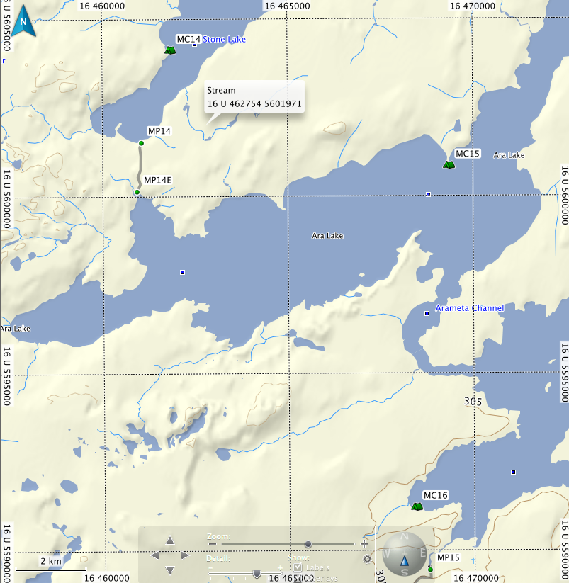
MP14 is quite challenging. It is a mile long and has some fairly bad wet spots early in the season. The launch at the end will entail dragging through some loon crap, but you'll be dirty by them anyway. Ara Lake is huge and picks up some enormous waves, so early morning or evening crossing are best. Camp sites on Ara are also limited. MC15 is an esker point site that will set you up for a good early morning crossing. MC16 is a good camping spot at the back of a bay on Meta Lake. You may want to avoid this spot from mid August till Ocotober, as it is also a bear baiting site. On the east side of this part of the lake there is a large Outfitter camp, and they have phone access if needed.
MP14
Start: 0461052
5601561
End: 0460934
5600149
Length: 1600 meters
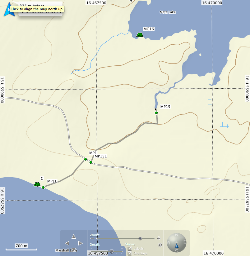
MAP 13
If you paddle Ara and Meta on the same day, you might think twice before attempting MP15. It is long and challenging. It has two or three wet spots, depending on the time of year. The majority of the port travels through mixed woods and jackpine stands. It is level and in good shape. It leads to a parking lot a couple of hundred meters from your start point. There is a skidoo trail that parallels the port - do not make the mistake of following the skidoo trail when you do a return trip...It is rough and wet.
MP15
START 0468797
5589464
END 0467383
5588364
LENGTH: 2200 meters
How to Get There:
Follow Highway 11 until you reach the junction of Highway 584. Turn North on 584 and drive through the town of Geraldton. Follow 584 for approximately 65 kilometers until you reach the turnoff for highway 643, the Aroland Road. Drive through Aroland. There is a store at the end of the reserve which is your last chance to buy things. Highway 643 turns into a large dirt logging road. This road is usually in excellent condition, but can be very dusty when logging trucks go by.
Port # MP1 into Marshall Lake is 67 kilometers from the junction of Highway 584 and 643. There is a large parking lot and a road that leads into the lake. The road is the port. You might be tempted to drive in, but keep in mind that Marshall Lake is not supposed to have motorized access, and you will be fined if you are caught driving in. If you are pressed for time when you arrive, you can camp at the beginning or end of the port, although it tends to be rubbishy....there is a very nice beach about a kilometer west of the end of the port.
MP1
UTM Start:
0467226
5588409
Finish
0466342
5587840
Length: 1203 m
MAP 2
Map 2 takes one through Marshall lake and into Gripp lake. This is the beginning of very large tracts of wild rice and classic wetlands. Ducks, eagles, ospreys and moose abound. Later in the summer, you may find yourself following a narrow channel through the wild rice...It will twist and turn, with no end in site, but you will get there.
CM1 is a nice camping site with lots of room and firewood. There is an old mining camp on the south shore just before the exit. It has lots of building standing, and is not really recommended for camping, but it will work in an emergency. Travelling from Marshall to Gripp in one day is the usual for most canoeists, unless they want to spend additional time fishing Marshall.
MP2
Start: 0458402 Starts beside and old trapper's shack, river left
5586941
End 0458170
5586881
Length: 263 m
Map 3
MP3
Start: 0456153 Located river right at head of rapids
5586334
End: 0456025
5586186
Length: 180 m
MP4
Start: 0455892 Located river left in small pond a short distance from port #3.
5586183
End: 0455822
5586106
Length: 102 m
Map 4
MC2 Gripp lake 0452942
5583633
MP5
Start: 0451683 Paddle down the river out of Gripp lake for a few hundred meters.
5582644 The port starts in alder bushes marked with flagging tape on
End: 0451419 river right. The sign is inland on a tree.
5582694
Length: 290 m
MAP 5
Summit is a height of land lake. Water flowing out of the north end goes to James Bay while water coming from the south end goes to the Atlantic (well, Lake Nipigon actually). It is a shallow lake with walleye fishing usually best just off camp MC3. Camp MC3 and MC3.1 are used by duck hunters and fisherman, so it may be garbaged. At the beginning of the Powitik, you may have to walk a few times if water is low.
Map 6
There is an old port on RR as the Powitik leaves Summit, but I have never used it in the dozen or more times I have run this route. At high water you should be able to shoot this set of rapids, at low levels, it can be walked.
MP6
Start: 0446879 Located river right, just before rapids.
5591602
End: 0446825
5591589
Length: 60 m
These rapids can be shot if the water is high enough, or lined on RR.
Map 7
MP7
Start: 16 U 444292 5592804
End: 16 U 444161 5592949
Length: 183 m
The landing is a clearing covered by alders and other small bushes, located river right. Rapids are an easy C1 until you turn the corner, where the necessity of the port becomes apparent. At medium-low
water levels I shot the first set and walked the second.
At higher levels, both sets can be shot, but it would be a very excellent idea to eddy out at the bottom of the first set to see if the second set is doable.

MP8
Start: 16 U 444036 5593161
Length: 60 m
The port is located at a clearing, river right, just before a water fall. There used to be an old trappers cabin here, but there is only an old stove and the clearing to bear witness. There are many camping opportunities at this site. Camp right by the falls, in the initial clearing, or follow a trail downstream from the falls and there is a large site with a port leading out of it. The pool at the bottom of the falls usually produces several nice walleye.
MAP 8
Shortly after Phillips Creek there is a straight forward C1 rapid that has never needed porting.
MP9
Originally reported to be on river right, but never found. The last time I was through, I found the remnants of a very rough port on RL, starting close to the head of the rapids by a very large cedar tree. It ends on a sandbar where there are still some rapids left, but the boney ones are above it. I have always shot this rapid, but be prepared to pick a very fine line between canoe wide rocks.
Map 9
MP10 & MC6
Start: 0445697
5603759
End: 0445463
5604253
Length: 670 m
Located river right, this port goes around some knarly class 2/3 rapids, depending on water levels. I have shot them but it is not recommended unless you are a White Water Guru or you have a death wish. The port is wet in spots, particularly at the beginning, but otherwise good.
MC5 is located river left shortly after the rapids at P.11. It is a large rock face, suitable for two or three tents.
UTM coordinates: 0444915
5599754
MC6 is the landing for port 12. It is a large grassy area, not bad, but a real Bughole!
Port #11
Start: 0445204 Located river right.
5604559
End: 0445109
5604622
Length: 120 m
MP12
Start: 0444938
5605483
End: 0444879
5605641
Length: 155 m
Located river right at head of rapids. Starts with a steep hill. This is a "must-do" port, the end of the rapids is very bad, not recommended to shoot. It is a boulder garden with very large boulders and a very strong flow going over them. It chewed me up and spit me out when I tried it about ten years ago.
There is also a small area to camp on the top of this port.
MAP 10
I have changed the scale on this map because there is not a lot of info needed.
It is straight paddling on the Kap. You will pass under the bridge on the Ogoki Highway. There might be a fishing boat or two here, and there might be logging trucks hauling. MC8 is the only camp on this strectch. The MC9 otherwise known as the "Esker Hilton" is a nice beach site on a small un-named lake off the Kap. You will reach a large widening on the Kap that heads south....that's the un-named lake
MC8 0453253
5612391
MC9 (rough coordinates)
455874
5613511
MAP 11
Still at the bigger scale.
More paddling on the Kap. Berger Lake has a nice island campsite on the second island in the north channel entrance. (MC10) However, it is well used by hunters, and has quite a bit of garbage. When navigating into Berger, it helps to use a compass or GPS, as the channels can be a little confusing.
Stewart Lake has excellent walleye and pike fishing. There is a well used, large campsite in the northwest corner, (MC13) but it tends to be quite a bughole. The better campsite is behind some cliffs in the north east corner.(MC12) There are also a couple of sites on the islands. Stone can get some large waves on it with a south wind.
MC 14 on Stone Lake is a nice campsite on a rocky point. There are multiple camping opportunities scattered over the two or three rock faces. The fishing is great from the first point.
MP13
Start: 0464546
5607526
Length: 100 meters.
This a nice port but with a rocky landing. Avoids a set of rapids and windfall leading up to Stone lake.
MAP 12
(large scale)
MP14 is quite challenging. It is a mile long and has some fairly bad wet spots early in the season. The launch at the end will entail dragging through some loon crap, but you'll be dirty by them anyway. Ara Lake is huge and picks up some enormous waves, so early morning or evening crossing are best. Camp sites on Ara are also limited. MC15 is an esker point site that will set you up for a good early morning crossing. MC16 is a good camping spot at the back of a bay on Meta Lake. You may want to avoid this spot from mid August till Ocotober, as it is also a bear baiting site. On the east side of this part of the lake there is a large Outfitter camp, and they have phone access if needed.
MP14
Start: 0461052
5601561
End: 0460934
5600149
Length: 1600 meters
MAP 13
If you paddle Ara and Meta on the same day, you might think twice before attempting MP15. It is long and challenging. It has two or three wet spots, depending on the time of year. The majority of the port travels through mixed woods and jackpine stands. It is level and in good shape. It leads to a parking lot a couple of hundred meters from your start point. There is a skidoo trail that parallels the port - do not make the mistake of following the skidoo trail when you do a return trip...It is rough and wet.
MP15
START 0468797
5589464
END 0467383
5588364
LENGTH: 2200 meters
Last edited: