• Happy International Museum Day!🏛️ 🖼️🏺

Great Slave Lake

43605868624_22ee0951f8_b.jpg


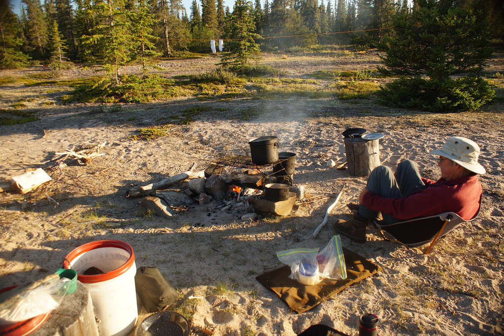
Last Christmas, Kathleen bought two Helinox ground chairs as presents for her and for me. She says she doesn't want to sit on rocks or buckets any more. Says it hurts her back. I am still happy sitting on rocks and buckets, but I have to admit these chairs are very comfortable. Excellent back support, and you can extend your legs out, like having a foot stool. And they fold down into a small stuff sack. And no, I am not a distributer of Helinox ground chairs. I just think they are a very nice addition to our tripping gear.


29387139517_980c9300bd_b.jpg


The next day, we paddled along granite cliffs adorned with fireweed. Still mostly calm conditions. You gotta like that. We are pretty much on the hard Canadian shield. Not many boggy areas, which means not as many bugs as you might think. There were only two occasions on the entire trip when mosquitos were annoying.


29387151757_41cd17461c_b.jpg


Mew Gulls protecting their babies harassed us all afternoon. One particularly agitated parent flew directly at Kathleen in the bow of the canoe. The gull lifted up at the very last second, and let out a truly horrendous shriek. Hard to believe that such a small bird could sound so intimidating and fearsome. You should try paddling by a Mew Gull rockery someday. I guarantee that you will be impressed. We began searching for a sandy beach in the mid-afternoon, but it took us nearly two hours to find this very pleasant site, west of Bigstone Point, a little after 5:00 p.m.

44323217751_03a38f0b04_b.jpg


We began the next day, as on most days, with bannock, cooked perfectly to a golden brown. Making bannock for breakfast is one of my very favourite activities on canoe trips. Sometimes I even consider myself a bit of an expert when it comes to cooking bannock. I am proud of my work, and just had to show you this picture. I hope you don’t consider me too boastful. We packed up and paddled away at 9:10 a.m


42515461280_80cd21e56b_b.jpg


We reached the Barnston River in two hours, yesterday’s destination on our itinerary. Loons yodelled throughout the afternoon, which featured periods of calm, wind, rain and sun. Several times during the day, when we approached the shore, we felt the warmth of the cliffs greeting us, releasing their heat to the wind blowing across the Canadian Shield—true blasts of warmth in an otherwise cool breeze.At 3:30 p.m., we began looking for a campsite. Nothing. Thirty minutes later, nothing. At 4:30 p.m., nothing. A little after five, we found a narrow, short sandy beach. Not too inviting, but we took it, as the wind began to intensify. The flat beach was not very high above the water. “You know, Kathleen, if the wind shifts, and blows directly toward us, even a little bit more strongly, we could be flooded out.” Photo taken at 7:10 p.m.

43606052274_c6c40f08fa_b.jpg


A few minutes later, waves started rolling up onto the beach. Not good. We threw all our gear into the bush. We barely squeezed and forced our tent into a cramped spot, half in the bush, and half on the highest, shelf-like portion of the beach, which was now awash in rollers. Fortunately, the water didn't come up any higher. Photo taken at 8:24 p.m.


30457274008_629e3556a7_b.jpg


We woke up at 6:30 a.m., probably because the wind was just starting to pick up again. We were both still sleepy, and would have preferred to stay hunkered down in our sleeping bags. But we had to get going, so we paddled away from our very low, narrow beach at 9:15 a.m. The shoreline had numerous points projecting out into McLeod Bay. And each time we rounded a point, the paddling conditions became progressively more challenging. There were still only a few whitecaps out on the bay, but deep rollers buffeted our canoe from the side. Paddling conditions were not only challenging, but also unpleasant. After an hour of struggling, we pulled off at the beach just a few hundred metres (yards) below the mouth of the Waldbon River. In addition to the .308 rifle, we also carry bear spray and a bear banger. In our lives we have seen, on the ground approximately 100 black bears, 40 grizzly bears and five polar bears. We have never been charged or threatened, but the polar bears didn't run away. (To be continued.)
 
I have been loading more images, with captions, but they disappear when I post. Only the first image, with a truncated legend remains. It seems like it's trying to go onto the next page. Any suggestions? I am stuck here.
 
I'm really enjoying this trip report !
I'm sure others are also ! Thanks !

Jim
 
44276092672_2c663a7b5e_b.jpg


I think maybe I have discovered the problem. I read elsewhere that this site does not like apostrophes. If you note my last image above, the caption truncated just where the apostrophe was supposed to appear. Below is the new caption without the apostrophe. Hope this works!

An hour later, paddling conditions seemed slightly better, so we shoved off from the beach. As we neared the point, I angled out from shore to quarter into the rollers.We did not want to be too close to the shore, where waves were crashing up onto the point. We also did not want to be parallel to the rollers coming at us, as the canoe would wallow, and perhaps overturn in the troughs. This meant that we were actually heading farther out into McLeod Bay. Eventually, though, we cleared the point, and we turned back sharply into the shoal-filled gap between the point and the off-shore rocks. With that strong tail wind, and rollers pushing us from behind, it was just like running a rapid.

Moments later we canoed around the point and enjoyed the relative calm of our lee position. We paddled down the small bay and pulled out on a very large, beautiful, open sandy beach. Many people had camped here before. Sawn firewood throughout the site. Geological sample cores. Old bed springs. Wood stoves for wall tents.

At 1:00 p.m. we decided to stay. We enjoyed our scheduled rest day one day early.
 
43418377775_1454149d13_b.jpg


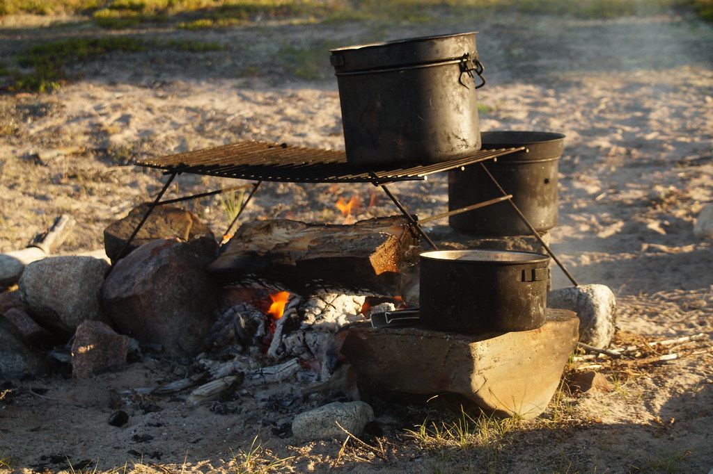
In the afternoon, we sat around the campfire eating gorp and sipping tea. Before supper we strolled across the sandy beach in our bare feet. A beautiful day. With good paddling conditions tomorrow we would reach the Mountain River in five hours to be back on schedule. I was very hopeful, as the wind had slackened considerably by 7:00 p.m.

43607152024_d1161725a8_b.jpg


We very much enjoyed sitting around our large, morning campfire, courtesy of all that sawn firewood left behind for us. We were reluctant to leave. I could have easily been induced to stay for a week. But we had to get to the Mountain River, so we packed up and left at 9:30 a.m.


42516542800_dfd2952357_b.jpg


We reached the Mountain River at 4:30 p.m. No camping. We paddled by. The headwind intensified, and we paddled hard to make progress. We rounded the bend where we expected to see sand, but there was no sand. Very disappointing. We could see nothing camp-able along the shore, even far ahead of us.

The wind grew stronger, and Kathleen suggested that
 
42516542800_dfd2952357_b.jpg


I am putting this image in again. As you can see in the previous version, the caption truncated right where opening quotation marks were going to appear. This site does not seem to like punctuation. I will post again, without the quotation marks, and see what happens. Wish me luck.

We reached the Mountain River at 4:30 p.m. No camping. We paddled by. The headwind intensified, and we paddled hard to make progress. We rounded the bend where the topo map suggested that we might see sand, but there was no sand. Very disappointing. We could not see any good camping along the shore, even far ahead of us.

The wind grew stronger, and Kathleen suggested that maybe we needed to reconsider what is a good campsite. She said that perhaps we could just pitch our tent on large, flat rocks. Not really wanting to camp on rocks, we paddled on. We now faced a very strong headwind, and worked hard work to make any forward progress. At one point we seemed to be going backward.

After about 20 more minutes of struggling into the headwind, we rounded a point leading to a small, somewhat sheltered cove, and discovered a beautiful sand beach. Sometimes canoeists in the wind just get lucky.
 
43418483225_b1af9c802d_b.jpg
wAAACH5BAEKAAAALAAAAAABAAEAAAICRAEAOw==


I am entering this image again, as in the previous version, the cation truncated right where the hyphen was going to appear. This site truly hates punctuation.

The next morning, after another great bannock breakfast, we put on the water at 9:20 a.m. A stiff breeze with a chop quickly turned into a strong wind with rollers. A headwind, of course.

44276306612_18ede90100_b.jpg
wAAACH5BAEKAAAALAAAAAABAAEAAAICRAEAOw==


Off the water at 10:45 a.m., to rest, and to wait, hopefully, for calmer conditions. The waves crashing off the next point seemed very unwelcoming. We lounged on the warm rocks, and after 30 minutes or so, convinced ourselves that the wind had slackened. We pushed off the beach and headed toward the point. Thirty minutes later we cleared the point, into a larger expanse of open water. The headwinds were now even stronger. We struggled west across the bay, toward its lee shore, where we stopped for a lunch of salami, soup, melba toast, cheese, dried figs and dried pineapple rings.

44324542901_839cdcf3a7_b.jpg
wAAACH5BAEKAAAALAAAAAABAAEAAAICRAEAOw==


After lunch, while I dozed in the sun, Kathleen photographed very appealing lichen-covered rocks.

29388333077_240f6b0144_b.jpg
wAAACH5BAEKAAAALAAAAAABAAEAAAICRAEAOw==


And cotton-grass, one of our favourite plants.
 
Last edited:
43418670815_3dfaaa96c1_b.jpg


Back in the canoe, we paddled along for an hour or so in increasingly calmer conditions. Paddling became pleasant again. As we stroked toward the end of an island just off the tip of Sosan Island, though, we entered open water, with a long fetch across McLeod Bay. We were now directly exposed to a strong wind, with the biggest waves we had encountered on the entire trip. Some of the waves were irregular and breaking. Not good. Nowhere to land on the steep, rocky shore. Really not good.

We paddled as hard as we could for about 15 minutes to clear a point into a wide bay that offered a little protection from the wind and waves. Even so, the paddling remained very challenging.

We stopped halfway down the bay to inspect an open site with large, angular, unstable rocks. I suggested that maybe we could portage our gear up onto the large flatter rocks above the beach. We got out, but could not even stand up on the slimy, slippery shoreline rocks without falling down. And we were not even carrying any gear or packs.

We thought we could see a very small sandy beach at the foot of the bay, and paddled over to have a look. The beach was indeed very small. Just big enough to pitch our tent, even though we staked out only one of the vestibules. We liked our new home, though.

44276447092_be35abd98d_b.jpg


Shortly after 5:25 p.m. we sat in our ground chairs snacking on gorp, followed by smokies and beans for supper. Two Common Loons loafed 100 m (100 yards) off our shore. We had endured a difficult paddling day, but had progressed 15 km (nine miles). We were only ten km (six miles) short of today’s destination on the itinerary. I think it was fair enough to claim, that after eight days on the trip, we were In the Vicinity of our schedule.

Kathleen dehydrates all of our food before canoe trips. These beans rehydrated very well! The smokies were vacuum packed.


43607711424_df6e219b93_b.jpg


The next morning we set out at 8:20 a.m. When we reached the mouth of the cove, we were quite surprised to encounter a stiff headwind. Much calmer than last night, though. With quick, strong strokes we made good progress. A little after noon we stopped for lunch at a point on the north shore. The wind was picking up, but conditions remained quite paddleable. Before heading away from our lunch spot, we donned our paddling jackets and enclosed our spraydeck cockpits. Black clouds, accompanied by rain, raced toward us from the north. We went to shore twice to escape thunder and lightning. An hour later, a northwest gale arose, producing the most difficult waves of the trip, becoming progressively worse, literally by the minute. We struggled to round the points safely. Up ahead, just before the next point with crashing waves, we spotted a sandy, flat beach. We turned the canoe to head straight to shore, with the wind chasing directly behind us. The canoe rose up each crest of the wave, and then slid back down into the trailing trough. This was no fun at all.

When we were now only a few strokes from shore, I waited for the crest of the wave to pass beneath the canoe, and then stroked hard before the next wave reached us. We followed the leading wave onto the beach, and both of us jumped out to grab the canoe. A little after 3:00 p.m, and we were safely on shore.

At 8:00 p.m., the wind persisted, and the surf still pounded. Thirty minuets later we retired to the tent for celebratory brandy. We hoped for calmer conditions tomorrow. We were now about 15-20 km (9-12 miles) behind our itinerary. Maybe we were no longer even In the Vicinity.
 
I'm enjoying this very much. Great Slave Lake has been on my radar for the last couple years. I've done a couple trips into somewhat remote areas of Canada and sometimes I have to pinch myself when I'm cooking bannock on a rocky point of a beautiful lake knowing there isn't a person within days of me. I have no idea why anyone would want to go to the Caribbean and sit on a beach with nothing to do. The beaches you're experiencing are much more pleasant to my mind.

Thanks for sharing,

Alan
 
43607200794_c517de337b_b.jpg


Stormy and pounding surf all night. Same for most of the day. We generally hung out in the tent, or strolled along the beach when it was not raining. Now is a good time to tell you about our new approach to sanitation, based on what we had learned from some friends in our canoe club. For comfort, we now used a Reliance toilet with collapsable legs. Much easier than squatting on the ground. You will also note the yellow dry bag, which contained a garden trowel, toilet paper, mosquito repellant and bear spray. We dug a hole beneath the toilet and then shovelled in soil after each use. This created a neat and tidy appearance for the next user. The dry bag also contained small paper bags for used toilet paper. When full, we burned the paper bag in the campfire. This approach, in our opinion, was odour free, sanitary and environmentally friendly.


30457866948_e3e19a34cf_b.jpg


We retreated to the tent at 4:45 p.m. We planned to leave very early in the morning if conditions were calm. We were now 45-50 km (27-30 miles) behind schedule.

We had also purchased a larger, four person tent for this trip. Despite being behind schedule, and confined to the beach for the entire day, Kathleen looked very content. She said that she was much more comfortable on this canoe trip than any other. Said it was just so much better to be a able to sit up, on the Helinox ground chair, with plenty of headroom in the tent. Much easier to read a book and to drink tea, she said. Waiting out the storm is not so bad at all, she said.


43607795494_247faabb59_b.jpg


Kathleen, I and the sun all rose around 3:00 a.m. It had been calm since 8:00 p.m. last night. We hoped it would hold, but decided to get going while conditions were good. We ate a granola bar, quickly broke camp, and paddled away a little after 4:00 a.m. We planned to stop somewhere along the way to cook our morning bannock.
 
43607909044_6bb5214902_b.jpg

We were now in Hearne Channel, looking for a beach on which to cook our morning breakfast. The shore was completely overgrown, with a shallow, rubbly foreshore. Perhaps the most uninspiring, unappealing and uninteresting shoreline of the entire trip. At 8:15 a.m. we stopped to stretch our legs on a marginally open spot of large, broken shards of unstable rocks.

We paddled on. Nowhere to stop for our necessary and wonderful bannock breakfast. We were actually fortunate that strong wind and waves had forced us to that sandy beach two days ago. It was now 10:00 a.m. We had been paddling for almost six hours, and had seen nowhere to cook breakfast, let alone a place to set up a reasonably comfortable camp.

We paddled into a small bay for salami, cheese and crackers. The wind had now picked up again. We agreed that we had to stop as we were in last bay before heading down the open coast toward Sachowia Point. We preferred not to paddle five kilometres (three miles) down an open coast with high cliffs, particularly since we have not seen any good camping sites all day. We were worried that we might not be able to get off if the wind really started blowing strongly. We would not want to be hanging onto the boat while balancing on a cliff face.

So we stopped here, on The Rock, which Kathleen still refers to as the worst camping site of the trip. The tent site sloped somewhat precipitously in two directions, with a large hump in the middle. Kathleen slept curled up in a little ball at the bottom of one hill, while I kept having to pull my sleeping bag back up to the top of the other hill.

44324843941_0fea9d5e3d_b.jpg


The wind did slacken that afternoon, and The Rock provided a good place to stand and fish. It took a long time, though, 30 minutes, before a caught an Arctic Grayling for dinner.

43607876044_b44bdcc8bf_b.jpg


As soon as they saw me fishing, the Herring Gulls and Mew Gulls flew in to battle each other for the scraps. The Rock was the only place were we saw another paddler, a lone kayaker from Winnipeg. He had paddled from Yellowknife, to the east end, and then up Pikes Portage, leading to the Barren Grounds. He was now paddling back to Yellowknife. Now that is an adventure. During our trip, we also paddled by three fishing lodges, and four times had seen Native People out fishing in aluminum boats. For two days, we also saw a sail boat far out in McLeod Bay. This was helpful. When its sails were down, we knew the wind was calming. So Great Slave Lake is not a completely isolated trip, even though it often seemed so.
 
42517150800_f19888861c_b.jpg


The next morning, Kathleen and I paddled away from The Rock in a following sea. It seemed to take forever to get around Sachowia Point. Just before 4:00 p.m., we stopped to rest on a narrow, partially sandy beach, interspersed with small stones. We pitched our tent on an open patch of Kinnickinnick and lichen. We then sat in our ground chairs, munching on gorp, with the waves lapping ever so gently up onto the beach. Warm, calm and sunny. Great views and no worries. We had escaped The Rock, and had rounded Sachowia Point without any real difficulty. The best day in a long time. Tea and quesadillas for supper. On a beach. Not on top of a somewhat flattish point. We planned to get up late tomorrow morning. We were about 20 km (12 miles) from Narrow Island, tonight’s destination, and 50 km (30 miles) from McKinley Point, tomorrow’s destination. But we still had two rest days in reserve on our itinerary to make it up. We celebrated with two ounces each of brandy in the tent. Common Loons wailed nearby. A perfect ending to a perfect day.

44324930431_d328e2633f_b.jpg


The next morning, we slept late, until 7:00 a.m. We sipped hot tea in perfectly calm conditions. Islands sat serenely between us and the opposite shore. Waves still lapped ever so gently up onto the beach. Loons wailed up and down the shoreline. A fantastic moment that made all the struggle with wind worthwhile. This was why we came.

We pushed off the beach at 9:40 a.m., and spent most of the day struggling with wind and waves crashing off points, as we were now in a section of Hearne Channel with more exposure to the wind.

At 5:30 p.m. we stopped at a narrow gravel beach, with a steeply sloping hillside behind. The stones were smallish, flat and smooth. We could pitch the tent on them. We moved in, happy to have found it. As Kathleen noted, it was better than The Rock.

We had recently purchased a 16 foot Wenonah Prospector canoe to replace our 16 foot Mad River Explorer. The Wenonah was actually a smidge shorter that the Explorer, and a little more rockered. Gear did not fit as well or as easily. Our food bucket did not fit in front of the bow seat. Plus the new and bigger tent no longer fit in the top of our canvass pack, and would not squeeze between the hulls. We had been having trouble getting everything to fit so that the spray deck lay flat. We had finally figured out where everything should go, and took this picture to remind ourselves for the next trip. Note that the beach is quite narrow and short, with steep cliffs behind. This left no privacy for trips to the Reliance toilet.


44324944161_a33335245b_b.jpg


But only a fairly short scramble up the hill provided one of the best views ever from a toilet!
 
42517251990_36d66c7e0f_b.jpg


I woke at 3:30 a.m. The wind was beginning to blow. Gently, yes. But it was blowing. I didn’t like the trend. I nudged Kathleen awake. Let’s just pack up and go. We can make our bannock on the road.

On the water at 5:15 a.m. McKinley Point was only 10 km (six miles) away. We should make it in two hours. We reached the approach to McKinley Point a little after 7:00 a.m., and pulled out on a rock-strewn beach for our bannock. We had paddled in mostly calm conditions, but a following sea, with widely-spaced swells was developing. We wondered if we should have cleared McKinley Point before eating breakfast, as the waves were definitely starting to look worse.


43419144525_46f652c2d8_b.jpg


We paddled out and rounded the first of four points that made up McKinley Point. Definitely uncomfortable. We went to to shore to rest, and to see what the wind was going to do. We were not at all eager to round the next point, which was curving backward into the wind and waves. The water would be rough. Worse than that last point.

Ten minutes later we put back on the water. As we approached the backward-curving point in deep waves, rollers crashed off the point back toward us, causing the canoe to pitch, bow to stern. The canoe also wallowed from side to side between the crests and the troughs of the waves. We had cleared the point, and it was time to turn. I was paddling on the left, on the windward side, doing forward strokes alternated with strong sweeps. This should have turned the boat, But the canoe kept going straight, farther away from, and beyond the point. I can’t get the boat to turn, Kathleen.

What do you want me to do?

Nothing.

Our new arrangement of gear was not perfect, and we were slightly bow heavy. This caused the stern to lift just a little bit out of the water. The wind, on the left, caught the stern like a weather vane, pushing it toward shore, but pivoting the bow of the canoe out from the point toward open water and larger, breaking waves.

Again I told Kathleen that I was having trouble turning the canoe.

Again, What do you want me to do?

Nothing. I just wanted to tell you.

In fact, I didn’t want her to do anything differently. She was putting in good forward strokes that I could anticipate. I didn’t want her to do something that would add more uncertainty about my own strokes.

Now I was sterning and steering based mostly on reaction. Pitching. Wallowing. Rolling. I struggled to control the angle and direction of the canoe. I sometimes felt tempted to put in a bracing stroke when I felt that the canoe might roll over in one of the deep troughs. That would have stalled the canoe, though, relinquishing control to the wind and waves. I could have also yelled out change sides. Kathleen would then be paddling on the left, and I would be paddling on the right. I could then put in J strokes or River Js, which would more easily turn the boat toward the point than my current combination of sweeps and forward strokes. Switching sides, though, meant that both our paddles would momentarily be out of the water. I did not want that. Not even for only a second. We needed to maintain momentum.

Eventually I finally managed to turn the canoe, and the waves thrust us past the backward-curving point, where we easily slipped into the lee water behind. We got out to rest. I did not enjoy that at all, and had actually been worried that we might have capsized. There would not have been any good outcomes to a capsize.

The rest of the day went much better. We essentially paddled down a straight coastline without bays or relief. The small points all faced away, nearly parallel to the coast. We just rode the following sea right on by. In the early afternoon we paddled into a cove, and were stunned to see a beautiful, large campsite. Many people had camped here before. We began unpacking the canoe at 2:00 p.m. We lounged in our ground chairs, snacking on gorp, and wriggling our bare toes in the pea gravel. Good to rest early in the day.

I later learned that this well developed campsite probably served as base camp for the Thor Lake Mine, which contains large deposits of light and heavy rare-earth element ore. We were about 30 km (20 miles) from our pickup spot at Pauline Bay. With good paddling conditions, we could be there in six hours.

This campsite was also where we encountered our first bear of the trip. While I was cooking the bannock, Kathleen heard rustling behind her, and turned to see a black bear five to six metres (five to six yards) away, sniffing at our blue barrel, which contained all of our food. Kathleen and I both stood up, and the bear backed off two or three steps. But he did not turn to leave. I grabbed my rifle that was leaning against a nearby tree. Kathleen retrieved the bear banger from the tent. We launched the banger, and at the loud explosion overhead, the bear quickly ran up the rocky slope without looking back. Sorry I do not have a picture, but we were more focused on the bear than on photography.
 
44325078531_50f1d5734f_b.jpg
wAAACH5BAEKAAAALAAAAAABAAEAAAICRAEAOw==


We finished breakfast, and then broke camp, paddling away from the beach at 9:20 a.m. Still completely calm. At around noon we reached Francois Bay, at the foot of which was the Winter Road, today’s original destination. Francois is a large bay, about four kilometres (2.5 miles) deep, and about the same width at its mouth. We paddled down the east shore of Francois Bay until we rested opposite a large island, about two kilometres (one mile) away across open water. A smidge longer than I like. I am not a risk taker. But we preferred not to paddle all the way to the bottom of Francois Bay, and then back out again. It was calm. Had been all day. We decided to cross.

Almost exactly halfway to the island, a strong headwind sprang up out of absolutely nowhere, producing a very unwelcome chop. We worked hard to reach the island, and even harder as we hopped from that island to succeeding islands. We stopped for lunch on the west shore of Francois Bay, and studied our topo, which indicated four coastline projections between our current position on the west side of Francois Bay, and Pauline Bay, our pickup spot. We rounded the first projection into a headwind and side rollers. On the tolerable side of our comfort level, though. The second point proved to be a very different story. As we began to round, we immediately encountered deep closely-spaced rollers. Our bow usually did not clear one roller before the next one swept upon us. Very much on the intolerable side of our comfort level.

Up ahead, at top of this small bay between the second and third points we saw the the rollers became less threateningWe struggled to get to that shore, with the canoe pitching precariously,
but finally pulled out in a snug, little, sheltered cove at 3:00 p.m. We beached, intending to wait for the wind to stop. Just in case the wind persisted, though, we searched around and found a reasonable spot to camp, above the beach, on low shrubs of Common Juniper and Buffaloberry.

44277097262_e22c808b6d_b.jpg


We gave up all hope three hours later and set up camp. Kathleen made tea and turkey cabbage soup, with lots of parmesan cheese. We were in a pleasant spot. Better than just make do. Certainly much better than The Rock. If it is calm in the morning we will just pack up and go, and make our bannock breakfast at the pickup spot in Pauline Bay.
 
Last edited:
43610014594_3dd9d793e4_b.jpg


I woke at 4:15 a.m., and could hear only a slight overhead breeze. I shook Kathleen awake to tell her that the water was calm, but the overhead breeze worried me. We packed up and left at 5:20 a.m. Didn’t even take time to eat a granola bar. We easily cleared the next two points, and reached Pauline Bay in less than two hours. We paddled deep into a side bay, and then headed around to the western point where Stephen had indicated we would be picked up. We called Stephen on the sat phone, and he indicated that Mike was already out picking up two kayakers. It would be a while before we would be picked up. Kathleen said she did not really care how long to wait. She knew the plane was coming some time today, and she was just happy just to sit on these warm rocks and wait.

29390939097_67d8dc8383_b.jpg


I pointed over to the point at the western mouth of Pauline Bay. Finally, Kathleen, a point that we do not have to paddle around. It was calm, though. It might have been easy.
 
Last edited:
30460251908_e16f88c771_b.jpg
wAAACH5BAEKAAAALAAAAAABAAEAAAICRAEAOw==


The plane from Ahmic Air appeared in the sky a little before 2:00 p.m.

44327159321_d464f48b3c_b.jpg
wAAACH5BAEKAAAALAAAAAABAAEAAAICRAEAOw==


And we were soon approaching Yellowknife. The cost for the charter from Pauline Bay to Yellowknife was $928.20 CAN. About $715.00 U.S. This allowed us to avoid the large fetch returning all the way back to Yellowknife by canoe. We had flown to Old Fort Reliance on July 7, and returned on July 23, two days earlier than scheduled. Our Great Slave Lake adventure was over, but the challenge of returning home still lay in wait.
 
Back
Top