• Happy Weed Appreciation Day! 🌱🌿🌻

Allagash 2019

Here's the topo map. I don't remember the large backchannel in the stream but the campsite is east of the Gravel pit (ARROW). There is what starts out, a muddy section on the backside of the Ciss Stream copy.JPEGcampsite but dries up as soon as elevation is made. I was able to use my cart on the west side of the pit all the way to the dam.
 
When I was there I was all full of beans and in a royalex boat, so my plan was to stay on the water and wade/bash/stomp/line as required. Also, I saw another party on Black Pond who had been unable to find the portage trail, so I figured it wouldn't be obvious. All that said, the flow rate was pretty high for summer (seemed to me at the time), and it was some tough sledding, so if I had it to do over again I'd look for the trail.

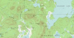
Funny, I stopped at the campsite Sweeper mentions to look for a makeshift pole (didn't find anything suitable), but I didn't know that was the start of the portage trail! I was using the National Geographic Trails Illustrated map (Allagash Wilderness Waterway South), which is a nice scale but a bit of a cartoon, and it didn't show the trail extending that far downstream. I did eventually pick up a trail on river right about 100 yards downstream from the big drop. I imagine it's more often used in the downstream direction by people who don't want to run that drop. I attached a doodle on a Google Earth image. Red dots are my approximate route, but my advice is don't follow me, follow Sweeper.

Re: fees, when I came to the checkpoint I explained what I was doing to the gal on duty. The fees are the same for AWW and PRC, but she actually wrote down something slightly different than my actual itinerary so she'd only have to fill out two forms and not three. She did say she wanted to make sure PRC got their fair share -- apparently they're the poor cousin of AWW. I actually spent one night in a NMW campsite, which probably means I was a rogue camper, but no black helicopter came. It's all by the book up there!

In addition to the trailhead campsite there is also one where Scott Brook enters Black Pond, and that wasn't on either of my maps.

Chesuncook Village would be a potential starting point. I don't know what the parking situation is there as I've only paddled by.

Anyway, I never wrote up a trip report, partly because my camera was misbehaving so I have very few pictures. However, the trip was memorable so I'm happy to ramble on about it!

Caucomgomic_Horserace.jpg
 
I have decided that I will be doing this route as one of my trips this summer or late Spring. This trip excites me with the challenges and remoteness of it all. The other thing that I need to decide on is which canoe will I take. The Wabnaki (if the build is complete) or the Mad River canoe. Still unsure about the water levels on Allagash Stream and how much rock dodging is required. Royalex is much more forgiving than a cedar strip canoe.
 
You can ditch your canoe cart at the bridge that crosses Allagash stream then drive there to pick it up
 
I love a good canoe controversy! Two relevant facts you won't learn until later: the water level and how much your Wabnaki weighs. If you do the trip counterclockwise you can portage all the downstream whitewater. That wouldn't be as much fun, but it might be safest for a pretty boat.

Strictly speaking I believe it would be illegal to drop gear at that bridge, FWIW. You could also drop it at the gate on the way to the Allagash Lake ranger station, although that would require some extra walking.

I didn't bring a cart, but one would be useful for Round Pond to Allagash Lake and a nuisance on Mud Pond Carry.

I would more than likely pass on taking a cart with me. I would go old school and go O’manual. I realize that the Round Pond Carry would be great with a cart, but like you said Goonstroke I would rather not deal with the nuisance of Mud Pond Carry. Just trying to understand the stream a bit more because all in all I believe the Wabnaki would be a great choice with the exception of the stream. Having paddled the Allagash the end of this June from Umsaskis to Allagash Village we only saw Class 1 and Class 1+ maybe brief Class 2’s. What is the real character of Allagash Stream?
 
A cart is also useful to avoid dragging your canoe up Caucomogomoc Stream. Who's going to know or care if you ditch a cart at the bridge. I don't see anything in your link that has to do with the bridge on Russell Stream Rd.
 
A cart is also useful to avoid dragging your canoe up Caucomogomoc Stream. Who's going to know or care if you ditch a cart at the bridge. I don't see anything in your link that has to do with the bridge on Russell Stream Rd.

I don't think anyone would know or care. But my understanding of the rules is that you can only access the waterway by motor vehicle (including loading, provisioning, etc) at the 8 locations listed there. Probably if you asked a ranger he'd roll his eyes and say "well ..." (the kind of "well" that has 2-3 sylables).

The rulebook makes good bedtime reading when you're camping at an undesignated site ...
 
So why wouldn't you take the Wabnaki if it's ready? I haven't done that loop, but it's on my bucket list and I've read the descriptions and I believe the Wabnaki will have no problem handling any of it with ease. You will obviously carry Little Allagash Falls and, if going counterclockwise, I'd probably portage the Horserace on Caucogomoc Stream because my paddling skills are not where I'd like.

Unless you take the Wabnaki off the strongback and immediately and permanently hang it on a wall, I guarantee it will get scratched and dinged and maybe even worse the more you use it. That's just part of ownership of these cedar strip canoes. These battle scars mostly disappear with varnish and the ones that don't are badges of honor. They are easy to repair unless you wrap or pin a cedar stripper on a rock in fast moving water, which will turn it into kindling. And I can't see anything on that loop that is likely to end in a wrap (again, see caveat about running the Horserace, which can be carried).

So it comes down to weight and the intangibles.

As to weight, what does your Mad River Royalex canoe weigh? Does it weigh more or less than 65 lbs? The Wabnaki will probably come in right around 65 lbs, which is its design weight, plus or minus a couple of pounds depending on your construction choices. Mine weighs exactly 65 lbs and (1) I put a second layer of 6 oz s-glass in the football area, both inside and out and (2) used slightly thicker wood for my seats, gunnels, yokes and decks. I saved weight by making my hull strips a tick (1/32nd") under the standard 1/4" thickness off the saw. If I had it to do over again, I'd stick with the design thickness for the seats, gunnels, yokes and decks. But I would still strongly recommend the s-glass reinforcement in the football area if you will be tripping with this canoe. It's cheap insurance against accidents. And I recommend putting it both outside (where most people put reinforcement) and the inside because rock encounters put the hull into both compression (on the outside) and tension (on the inside).

As for the intangibles, I suspect that once you build a cedar stripper, you won't ever want to paddle a Royalex canoe again. For any given hull shape/length, a cedar stripper should paddle better than Royalex because the cedar stripper flexes less. Aesthetically, and I know this is personal opinion, I think the cedar strippers are the most beautiful canoes out there and since you will be seeing it a lot, why wouldn't you want to paddle a beautiful canoe while you are in a beautiful wilderness? Last, but by no means least, there's also a sense of pride and accomplishment that you experience in completing one of these trips in a a canoe you built with your own two hands that can't be described or understood until you experience it.

Royalex's well known advantages are in the durability department. Royalex will spring back after a wrap that would reduce a cedar strip canoe to kindling and Royalex is more puncture resistant. It will also flex and slide its way across some rocks that might stop a cedar stripper in its tracks because varnish is grippy. I've used Royalex on the Allagash and St. John on guided trips. For me, with limited whitewater skills, it was a lot of peace of mind when I bashed my way down Chase Rapids for the first time in low water and accidentally paddled over a couple of barely submerged rocks in Big Black Rapids. But when I looked over and saw my guide in his antique 20 foot Old Town cedar canvas canoe missing every rock (standing up all the way down Chase Rapids and most of the way down Big Black), I knew that the limitation on using my cedar strip canoe on Class II or even Class III trips like those was in me and the result of my lack of whitewater paddling experience and had very little or nothing to do with what my canoe was made of. I got proof of that in September 2018 when I went down some unexpected Class II+ rapids on the West Branch just above pine stream that were exposed by record low water. My cedar stripper capsized (my fault) and the boat fully filled with water and went down bumping off rocks for a half a mile. We paddled it two more days no problem. When I got home and went to put it away, I noticed there were a couple of spots where the fiberglass de-laminated on the inside. Didn't even notice them when we paddled the last 2 days of the trip because the canoe was still water tight. It was damage that was easy to fix.

Summary: You don't need to baby these cedar strip canoes, but in my case I need to learn to paddle better!
 
The Wabnaki it shall be! Without a doubt the fear of damaging something that is or will take so long to build has been weighing on my mind. I will take the Wabnaki. My anticipation to feel that sense of pride when I accomplish the trip in my own hand built canoe is already building.
 
Any of you fellas ever been into "Frozen Ocean"? It is north of Poland Pond and west of Allagash Mountain. I have never seen a description on how this particular body of swamp got its name and have often wondered if it is worth a trip in.
 
Fitz are you talking about the NW corner of PP where Pine Brk runs into?

I was in there 2010ish but only made to a downed log blocking the way. It was getting dark and we turned back. PP with its acoustics is always worth the paddle and that corner does look interesting.

We also paddled up Wadleigh Stream until it entered the woods. Lots of Brookies in it.
 
Hi Sweeper:

It is east of Wadleigh Stream and dumps into the northeast corner of Poland Pond. The name, "Frozen Ocean", always intrigued me.
 

Attachments

  • photo13948.jpg
    photo13948.jpg
    226.7 KB · Views: 1
I don't think we noticed that stream when we were in there. We paddled almost to the Jeep Tr until we ran out of water, there are a few beaver dams/log jam most likely just below where those streams come together.
 
Back
Top