- Joined
- Dec 25, 2025
- Messages
- 32
- Reaction score
- 231
For life reasons that nobody cares about, I’ve been trying hard to get back into canoe camping this summer after a winter that wasn’t very fun. The capstone of my plan has been a solo trip down the river half of the Allagash Wilderness Waterway. I got 5 days off and planned to spend 4 nights taking a slow route down the river.
There’s a million accounts of running this river and this account will not add much, but since I’m prone to word-vomit, let’s write it anyways. I think it’ll have to be in two posts. I’ve attached a number of pictures, but in retrospect I was too busy to take very many good ones: if the water was moving I didn’t have a free hand to open the camera case and aim.
Since I’m goal oriented, here’s the goals for this trip:
1. Find some solitude. This is why people do solo trips, right?
2. See a moose. I've been here twice before and not seen any moose.
3. See a loon and tell people about how much I like loons. Loons!
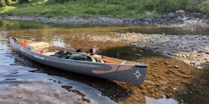
4. Use my own composite solo boat and don’t ruin it.
5. Don’t camp at any of the campsites I’d stayed at before and hated, like Lost Popple or Housa B.
Going into this trip, I was concerned about two things: the water levels and the level of crowds.
The Allagash Wilderness Waterway is extremely accessible; a dozen different outfitters will shuttle you to the entry points and the camp sites are luxurious by backcountry standards. The only barrier to entry is really a slightly long drive from major cities… but honestly not that long. That’s great for making the winderness accessible, but with no real barrier to entry I’m worried it’ll be quite busy in July. I’ve run the Allagash twice before, when I was considerably younger, in August. In that timeframe there were very few people on the river; we really never had to race for a campsite and the only people making noise were us. I was a bit concerned that in the middle of July, this would not be the case.
You can read across the internet that the Allagash flow rate should be greater than 300, 500, 700, or 1200 cf/s, depending on the source. Consensus seems to be that 1200 is perfect, 700 is alright, 500 is dragging territory and 300 is impossible. Going into this the water level was 700 and dropping.
I really wanted to run my own boat, a Northstar Northwind Solo in IXP. It’s agile, fast, comfortable, and reasonably light. It should be able to take a hit… although I’ve never tested that. But that means I’m nervous about dragging. We’ll see how that goes with 700-and-dropping.
In any case, I drove up from the Boston area on Sunday. I’d scheduled a transport on Monday morning with Tyler Kelly Camps, largely because I liked where their takeout was at the confluence with the St. Johns. There might be cheaper arrangements available for a solo but I didn’t really care and was determined to keep my small car and thin tires off the logging roads. The drive north was unremarkable. I had dinner in Ft. Kent (at a surprisingly nice restaurant that was for-sure not there 10 years ago).
Just looking at the St. John’s river it was obvious the water levels were lower than I’d seen before.
I camped at Kelly’s place on Sunday night. Pro-tip for anyone considering that: the one working street light in Allagash is right in front of that place.
Other than that, things went smoothly and met the driver (Hilton) in the morning. Had a really fun chat as we drove south on the logging roads. I mentioned that I’d been up here twice before and in the past trips, never seen a moose. Then:
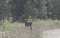
Is that bigfoot? Yeah, the picture sucks because we were driving fast and it’s a phone camera but that’s a moose.
2. See a moose. Done!
I put in a Bissonette bridge. I’d run Chase Rapids twice before in a tandem, but this time wasn’t excited to do that. In retrospect I think this was too cautious; the boat took hits just fine. But I didn’t know that yet.
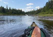
Then it was off into the river. Bissonette is below almost all the rapids, but there’s a few just-short-of-rips left to do. On the downside, the Solo doesn’t turn very quickly; you basically need to do a bow jam to spin enough to eddy-out, and the boat likes to flip when you bow jam. On the upside, it’s beyond easy to drawstoke or scull sideways, so I mostly do that. It was easy to see the line in these not-even-rips and this all went very very smoothly.
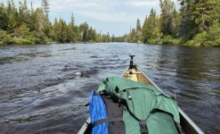
A great way to start the trip (but I should have done Chase).
Then its into the meadows. I start to get into the rhythm of paddling and take a bunch of pictures. There are literal scores of ducks, dragonflies on my boat, a fish jumps out of the water next to me. Apparently this is a thing for some sort of river fish. I'm not a fish expert. It was wild. The kept happening here; you could catch them with a net if you had the reactions of a ninja. This area was super peaceful.
But… this is where my personality problems begin to surface. I’ve planned to spend time exploring the side-channels, looking at wildlife, finding peace and solitude. But I’ve got a double-bladed paddle in my hands, and I’m here to paddle and so… I put the paddle in the water. I’m through onto the lakes before I even know what I’ve done. The Solo boat is fast and there’s nobody here to tell me to slow down.
I’d planned to spend hours trying to find back channels in the long grass here. The timestamps on my pictures say that 45 minutes after starting I’m coming around the corner into Umsaskis.
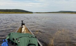
There's wind, but the wind means nothing to this low, well-trimmed boat.
Then Umsaskis flies by. I recall seeing that several camp sites were already taken; a west wind of maybe 15 MPH picks up and gusts are higher. Not quite whitecaps but the wind is clearly blowing other groups to river right. I pass a couple who looks like they’re pulling into Ledges, a group that’s windbound on river left, another large group that’s just not going as fast as I am. I just keep paddling; this is the environment this canoe is made for; with a good trim and a double bladed paddle the wind is basically no factor.
I come to Long Lake; my plan is to find a campsite here and enjoy an early day with my book, and enjoy a night with loons on the lakes. I’m getting hungry and tired, and make myself slow down. I’m rewarded with a loon call:
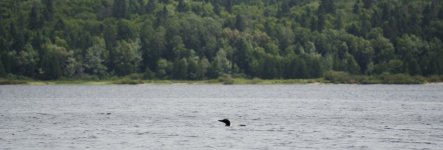
Not a great picture, but there's loons on Umsaskis and Long Lake. I really love loons. This is not a unique thought; I think lots of outdoorsmen like loons but really, loons are great. Have we covered that? I think we’ve covered that.
3. See a loon and tell people about how much I like loons. Done!
We're really powered through these goals.
But then things turn a little bit sour. After a snack stop, I start noticing that, including the group pulling into Ledges, every camp site I’ve seen for a bit has been taken.
Sandy Point is taken. Pines is taken.
Ok, fine, I’ll get the next one… but Grey Brook is taken.
A little bit of easy paddling to cross the open water and… Jalbet is taken.
Some harder paddling back against the headwind to Sam’s which is… taken.
I'd like to stop on Long Lake, not because I'm any good at slowing down, but because I want to see and hear more loons. But... the sites are all taken.
Across Long Lake, the river turns back into a river and it’s meadows and marshes again for a bit. I manage to slow down a bit, bury my frustration, and am rewarded:
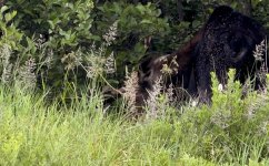
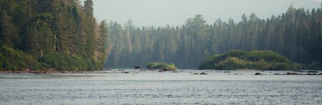
2. See a moose. Done! Again!
This is a phone camera again and not well-posed, but that's a moose, and it’s close. It's right next to the waterway and totally ignores me. This was super cool and would be a highlight of the trip.
But otherwise, it’s afternoon now; I’m getting hungry for some real food, I’m getting tired. I’m getting a little bit grumpy at racing people for camp sites and that my plan to spend the night on the lakes isn’t going to happen.
It starts raining. I decide I’ll stop at the next available site, which is the set of sites across Harvey Pond.
If you know the AWW map and how dramatic irony works you already know what the next available site was.
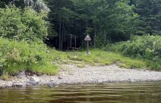
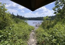
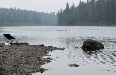
That blurry picture says "Lost Popple".
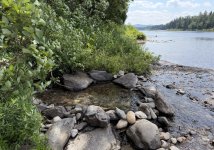
I hate this site. It’s small, it’s extremely buggy, it gets muddy. I think people like it becaues of the availability of firewood and the well water from a historical well back in the woods. But I hate it.
But I’m tired, so I setup my tent and make an early dinner. I’m annoyed at how crowded the lakes were.
Apparently I’m not the only one. Two or three groups pass me as I’m making dinner and seem quite annoyed I’ve gotten to Lost Popple first, in the rain. Some teenager with poor impulse control even yells at me about it like I’m in downtown Boston.
Let’s call this goal failed.
5. Don’t camp at any of the campsites I’d stayed at before and hated, like Lost Popple or Housa B. Fail.
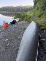
On the other hand, the view is nice enough, and the giant sleeping mat I’ve packed means I sleep well.

Overall, I scrapped one rock in the rips and two shallow spots in the meadows somewhere and the bottom of my IXP boat only has the three new scratch. Feeling pretty good about that “don’t ruin it” goal. 633 cf/s is the reading at Allagash for this day. We’ll come back to that.
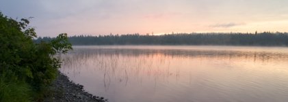
The big advantage of solo trips is I can do a truly lazy breakfast while breaking camp and loading the boat and making coffee (real coffee, with a grinder and an aeropress) all in less than an hour, or half that if I’m not being lazy. I get on the water during the rain around 6am.
It’s raining. It’s early. I’m running a wood paddle to not make too much noise, because every site a pass has sleeping groups on it.
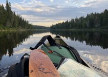
I burned a map of the Allagash into this paddle. I’ve been looking forward to this trip for a long time. So far, maybe a mixed bag?
The morning, though, with the warm weather and all the other groups sleeping through a light rain is really lovely. I packed a substantial rain jacket and I just leave it in the bag and paddle. I think I’m rewarded with some ducks and some scenery.
I decide I’m not going to wake people at Long Lake Dam and either run it or line. I scout it on the left and frankly I do not see any sharp nails or broken lumber on river left, but I’m solo and composite boat, so I line it. This goes fine, although I don’t win any awards for gracefulness doing it.
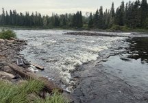
Only after I’m done do I notice at least a couple of people at the site were watching. If I’d known I’d had an audience I just would have run it. Really, almost all of river left looked safe enough.
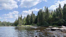
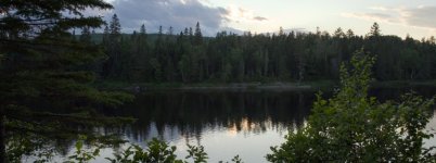
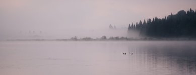
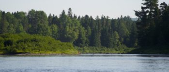
I don’t have that much to say about the first half of the paddle between Long Lake Dam and Round Pond. It was very nice. There was wildlife. There were some ripples, some winding lazy river sections, a lot of quiet. I just really enjoyed this section and was too busy paddling to take pictures. Except this one:
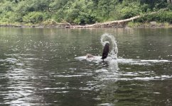
I feel bad because I want to write more words about how lovely this part was but I don’t really know what to write here. My advice: this section is best done in the morning with no people around and in the rain, because it was magical.
Maybe about 3/4s to Round Pond, I started to have a very small problem. There are “rapids” marked on the map here, but they’re not really rapids for the most part. What they are is rips leading into shallows.
What you have to do here, basically, is find the downstream V that tells you the line though the rips (which is fun enough) and then guess which side of the river is actually going to have water in it. I don’t know it, but we have about 600 cf/s of flow at the USGS sensor today.
The problem is: you can’t really see which side it is until you’re on it. I can’t stand very well in the Northwind Solo, and when the wind picks up you can’t really see the riffles that might give you a hint. I guess wrong a few times and at least once have to hop out of the boat and drag a few feet to deeper water. No big deal, but this happens a bunch of times. Maybe 5-6 new scratches. Fine. A small price to pay for some brief and fun but not challenging “white” water.
I pull into Round Pond.
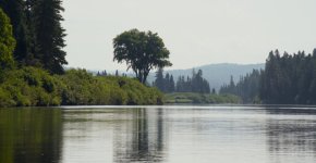
There's the tree. I wasn't not going to get a picture of the tree.
A little bit into Round Pond, I run into the Ranger, and my plan for the day changes. The forecast, he tells me, is for a thunderstorm and possibly a very severe one. We chatted for a while and I think this is the forcast he was looking at, at the time:
I'm fairly experienced, if rusty, but 70 MPH winds and 1cm hail sounds pretty bad.
I decide that I want to get to a campsite and get under cover early. With a 6am start time, I’ve done hours of paddling already and I decide my plan is that starting at noon, where-ever I am, I will take the first available campsite.
But before I get one, there are more “rapids”, which are really rips into shallows. I make another wrong call and scrape on the side of the river. And again.
And again.
And again.
And again.
And again.
It starts to rain again.
If you know how dramatic irony works you already know what camp site I come to.
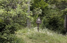
I really want to skip it, but I think the thunderstorm is coming. I havn’t heard thunder, but the winds are 20+ MPH at this point. It’s not dangerous; I’m on the river section again, but rain+ high winds is ominous. So, I don’t skip it.
5. Don’t camp at any of the campsites I’d stayed at before and hated, like Lost Popple or Hosea B. Fail. Again.
Part 2 Below, because my word vomit is over the character limit.
There’s a million accounts of running this river and this account will not add much, but since I’m prone to word-vomit, let’s write it anyways. I think it’ll have to be in two posts. I’ve attached a number of pictures, but in retrospect I was too busy to take very many good ones: if the water was moving I didn’t have a free hand to open the camera case and aim.
Since I’m goal oriented, here’s the goals for this trip:
1. Find some solitude. This is why people do solo trips, right?
2. See a moose. I've been here twice before and not seen any moose.
3. See a loon and tell people about how much I like loons. Loons!
4. Use my own composite solo boat and don’t ruin it.
5. Don’t camp at any of the campsites I’d stayed at before and hated, like Lost Popple or Housa B.
Going into this trip, I was concerned about two things: the water levels and the level of crowds.
The Allagash Wilderness Waterway is extremely accessible; a dozen different outfitters will shuttle you to the entry points and the camp sites are luxurious by backcountry standards. The only barrier to entry is really a slightly long drive from major cities… but honestly not that long. That’s great for making the winderness accessible, but with no real barrier to entry I’m worried it’ll be quite busy in July. I’ve run the Allagash twice before, when I was considerably younger, in August. In that timeframe there were very few people on the river; we really never had to race for a campsite and the only people making noise were us. I was a bit concerned that in the middle of July, this would not be the case.
You can read across the internet that the Allagash flow rate should be greater than 300, 500, 700, or 1200 cf/s, depending on the source. Consensus seems to be that 1200 is perfect, 700 is alright, 500 is dragging territory and 300 is impossible. Going into this the water level was 700 and dropping.
I really wanted to run my own boat, a Northstar Northwind Solo in IXP. It’s agile, fast, comfortable, and reasonably light. It should be able to take a hit… although I’ve never tested that. But that means I’m nervous about dragging. We’ll see how that goes with 700-and-dropping.
In any case, I drove up from the Boston area on Sunday. I’d scheduled a transport on Monday morning with Tyler Kelly Camps, largely because I liked where their takeout was at the confluence with the St. Johns. There might be cheaper arrangements available for a solo but I didn’t really care and was determined to keep my small car and thin tires off the logging roads. The drive north was unremarkable. I had dinner in Ft. Kent (at a surprisingly nice restaurant that was for-sure not there 10 years ago).
Just looking at the St. John’s river it was obvious the water levels were lower than I’d seen before.
I camped at Kelly’s place on Sunday night. Pro-tip for anyone considering that: the one working street light in Allagash is right in front of that place.
Other than that, things went smoothly and met the driver (Hilton) in the morning. Had a really fun chat as we drove south on the logging roads. I mentioned that I’d been up here twice before and in the past trips, never seen a moose. Then:
Is that bigfoot? Yeah, the picture sucks because we were driving fast and it’s a phone camera but that’s a moose.
2. See a moose. Done!
I put in a Bissonette bridge. I’d run Chase Rapids twice before in a tandem, but this time wasn’t excited to do that. In retrospect I think this was too cautious; the boat took hits just fine. But I didn’t know that yet.
Then it was off into the river. Bissonette is below almost all the rapids, but there’s a few just-short-of-rips left to do. On the downside, the Solo doesn’t turn very quickly; you basically need to do a bow jam to spin enough to eddy-out, and the boat likes to flip when you bow jam. On the upside, it’s beyond easy to drawstoke or scull sideways, so I mostly do that. It was easy to see the line in these not-even-rips and this all went very very smoothly.
A great way to start the trip (but I should have done Chase).
Then its into the meadows. I start to get into the rhythm of paddling and take a bunch of pictures. There are literal scores of ducks, dragonflies on my boat, a fish jumps out of the water next to me. Apparently this is a thing for some sort of river fish. I'm not a fish expert. It was wild. The kept happening here; you could catch them with a net if you had the reactions of a ninja. This area was super peaceful.
But… this is where my personality problems begin to surface. I’ve planned to spend time exploring the side-channels, looking at wildlife, finding peace and solitude. But I’ve got a double-bladed paddle in my hands, and I’m here to paddle and so… I put the paddle in the water. I’m through onto the lakes before I even know what I’ve done. The Solo boat is fast and there’s nobody here to tell me to slow down.
I’d planned to spend hours trying to find back channels in the long grass here. The timestamps on my pictures say that 45 minutes after starting I’m coming around the corner into Umsaskis.
There's wind, but the wind means nothing to this low, well-trimmed boat.
Then Umsaskis flies by. I recall seeing that several camp sites were already taken; a west wind of maybe 15 MPH picks up and gusts are higher. Not quite whitecaps but the wind is clearly blowing other groups to river right. I pass a couple who looks like they’re pulling into Ledges, a group that’s windbound on river left, another large group that’s just not going as fast as I am. I just keep paddling; this is the environment this canoe is made for; with a good trim and a double bladed paddle the wind is basically no factor.
I come to Long Lake; my plan is to find a campsite here and enjoy an early day with my book, and enjoy a night with loons on the lakes. I’m getting hungry and tired, and make myself slow down. I’m rewarded with a loon call:
Not a great picture, but there's loons on Umsaskis and Long Lake. I really love loons. This is not a unique thought; I think lots of outdoorsmen like loons but really, loons are great. Have we covered that? I think we’ve covered that.
3. See a loon and tell people about how much I like loons. Done!
We're really powered through these goals.
But then things turn a little bit sour. After a snack stop, I start noticing that, including the group pulling into Ledges, every camp site I’ve seen for a bit has been taken.
Sandy Point is taken. Pines is taken.
Ok, fine, I’ll get the next one… but Grey Brook is taken.
A little bit of easy paddling to cross the open water and… Jalbet is taken.
Some harder paddling back against the headwind to Sam’s which is… taken.
I'd like to stop on Long Lake, not because I'm any good at slowing down, but because I want to see and hear more loons. But... the sites are all taken.
Across Long Lake, the river turns back into a river and it’s meadows and marshes again for a bit. I manage to slow down a bit, bury my frustration, and am rewarded:
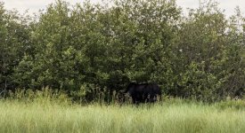
2. See a moose. Done! Again!
This is a phone camera again and not well-posed, but that's a moose, and it’s close. It's right next to the waterway and totally ignores me. This was super cool and would be a highlight of the trip.
But otherwise, it’s afternoon now; I’m getting hungry for some real food, I’m getting tired. I’m getting a little bit grumpy at racing people for camp sites and that my plan to spend the night on the lakes isn’t going to happen.
It starts raining. I decide I’ll stop at the next available site, which is the set of sites across Harvey Pond.
If you know the AWW map and how dramatic irony works you already know what the next available site was.
That blurry picture says "Lost Popple".
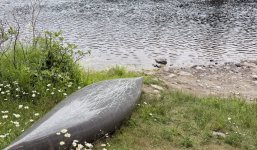
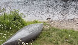
I hate this site. It’s small, it’s extremely buggy, it gets muddy. I think people like it becaues of the availability of firewood and the well water from a historical well back in the woods. But I hate it.
But I’m tired, so I setup my tent and make an early dinner. I’m annoyed at how crowded the lakes were.
Apparently I’m not the only one. Two or three groups pass me as I’m making dinner and seem quite annoyed I’ve gotten to Lost Popple first, in the rain. Some teenager with poor impulse control even yells at me about it like I’m in downtown Boston.
Let’s call this goal failed.
5. Don’t camp at any of the campsites I’d stayed at before and hated, like Lost Popple or Housa B. Fail.
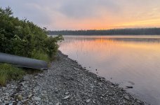
On the other hand, the view is nice enough, and the giant sleeping mat I’ve packed means I sleep well.
Overall, I scrapped one rock in the rips and two shallow spots in the meadows somewhere and the bottom of my IXP boat only has the three new scratch. Feeling pretty good about that “don’t ruin it” goal. 633 cf/s is the reading at Allagash for this day. We’ll come back to that.
The big advantage of solo trips is I can do a truly lazy breakfast while breaking camp and loading the boat and making coffee (real coffee, with a grinder and an aeropress) all in less than an hour, or half that if I’m not being lazy. I get on the water during the rain around 6am.
It’s raining. It’s early. I’m running a wood paddle to not make too much noise, because every site a pass has sleeping groups on it.
I burned a map of the Allagash into this paddle. I’ve been looking forward to this trip for a long time. So far, maybe a mixed bag?
The morning, though, with the warm weather and all the other groups sleeping through a light rain is really lovely. I packed a substantial rain jacket and I just leave it in the bag and paddle. I think I’m rewarded with some ducks and some scenery.
I decide I’m not going to wake people at Long Lake Dam and either run it or line. I scout it on the left and frankly I do not see any sharp nails or broken lumber on river left, but I’m solo and composite boat, so I line it. This goes fine, although I don’t win any awards for gracefulness doing it.
Only after I’m done do I notice at least a couple of people at the site were watching. If I’d known I’d had an audience I just would have run it. Really, almost all of river left looked safe enough.
I don’t have that much to say about the first half of the paddle between Long Lake Dam and Round Pond. It was very nice. There was wildlife. There were some ripples, some winding lazy river sections, a lot of quiet. I just really enjoyed this section and was too busy paddling to take pictures. Except this one:
I feel bad because I want to write more words about how lovely this part was but I don’t really know what to write here. My advice: this section is best done in the morning with no people around and in the rain, because it was magical.
Maybe about 3/4s to Round Pond, I started to have a very small problem. There are “rapids” marked on the map here, but they’re not really rapids for the most part. What they are is rips leading into shallows.
What you have to do here, basically, is find the downstream V that tells you the line though the rips (which is fun enough) and then guess which side of the river is actually going to have water in it. I don’t know it, but we have about 600 cf/s of flow at the USGS sensor today.
The problem is: you can’t really see which side it is until you’re on it. I can’t stand very well in the Northwind Solo, and when the wind picks up you can’t really see the riffles that might give you a hint. I guess wrong a few times and at least once have to hop out of the boat and drag a few feet to deeper water. No big deal, but this happens a bunch of times. Maybe 5-6 new scratches. Fine. A small price to pay for some brief and fun but not challenging “white” water.
I pull into Round Pond.
There's the tree. I wasn't not going to get a picture of the tree.
A little bit into Round Pond, I run into the Ranger, and my plan for the day changes. The forecast, he tells me, is for a thunderstorm and possibly a very severe one. We chatted for a while and I think this is the forcast he was looking at, at the time:
The National Weather Service in Gray Maine has issued a * Severe Thunderstorm Warning for... Northwestern Somerset County in west central Maine... * Until 145 PM EDT. *
At 1250 PM EDT, a severe thunderstorm was located 29 miles north of Jackman, moving southeast at 60 mph.
HAZARD...70 mph wind gusts and nickel size hail.
SOURCE...Radar indicated. '
IMPACT...Expect considerable tree damage. Damage is likely to mobile homes, roofs, and outbuildings.
I'm fairly experienced, if rusty, but 70 MPH winds and 1cm hail sounds pretty bad.
I decide that I want to get to a campsite and get under cover early. With a 6am start time, I’ve done hours of paddling already and I decide my plan is that starting at noon, where-ever I am, I will take the first available campsite.
But before I get one, there are more “rapids”, which are really rips into shallows. I make another wrong call and scrape on the side of the river. And again.
And again.
And again.
And again.
And again.
It starts to rain again.
If you know how dramatic irony works you already know what camp site I come to.
I really want to skip it, but I think the thunderstorm is coming. I havn’t heard thunder, but the winds are 20+ MPH at this point. It’s not dangerous; I’m on the river section again, but rain+ high winds is ominous. So, I don’t skip it.
5. Don’t camp at any of the campsites I’d stayed at before and hated, like Lost Popple or Hosea B. Fail. Again.
Part 2 Below, because my word vomit is over the character limit.
 Goal for next time.