July 20-31 2026
Route Map: https://caltopo.com/m/F1PDGQB
115 km map distance, including 14.5 km of portages (but I double carried all portages, so it wound up closer to 145 km of actual travel)
Day 1 (Gamble – South Fork Lady Evelyn)
Route Map: https://caltopo.com/m/F1PDGQB
115 km map distance, including 14.5 km of portages (but I double carried all portages, so it wound up closer to 145 km of actual travel)
Day 1 (Gamble – South Fork Lady Evelyn)
- Shuttled to Gamble by Francis from Smoothwater after spending the night there
- Rain and headwinds began almost immediately (foreshadowing!), and though the rain let up after half an hour or so a headwind just stiff enough to blow me upriver if I stopped paddling persisted.
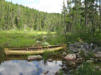
- Made my way down the North fork, to/through the portages to the portages to the South fork. Portages had been very recently cleared – clean chainsaw shavings which still had a strong aroma present on 2nd portage.
- Was struggling lining up white rock rapids when I realized I had barely had any water that day due to it being cool and cloudy – sat down for a rest and a bunch of water and things immediately got easier after that.
- Camped at the site 1km or so south of white rock – it’s in a massive blueberry patch, which made my day (and the next, as it turned out).
- Light rain in the morning almost baited me into moving on, but I decided to trust the forecast of thunderstorms and stay put which wound up being the right choice.
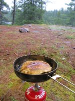
- Blueberry pancakes for breakfast.
- Spent the day reading, and wandering out during breaks in the weather to pick blueberries.
- Waited out the rain in the morning, pushed off around 10 and headed to Florence.
- Headwind made me work for it, though it shifted to an almost-tailwind once I made it to the lake.
- Met a couple headed the opposite direction on the Florence River doing the big loop starting/ending at the Sturgeon River access. Didn’t know it then, but I would not see anyone else until Obabika.
- Camped on the little peninsula on the W shore 2km south of the cabin. Absolute gem of a campsite, one of my favorites of the trip. I did carry over the narrow isthmus so I could approach the site from the south, because by that point the wind had made the N side of that peninsula the choppiest part of the lake.
- Finally fully mentally and physically settled into the trip. Doubts and apprehensions melted away, replaced by genuine happiness and gratitude to be so fully immersed in such a beautiful place. Didn’t even mind the headwind that continued building as I paddled down Florence.
- So of course I immediately fell waist deep into a bog on the first portage. But I had a good laugh about it once I managed to extricate myself. (If you’re headed from Florence to Bluesucker, when you get to the ludicrously pretty open bog section and there’s 3 logs across the small flow of water, the log on the left has *far* more flex/give than the 2 logs on the right).
- Finished the other 2 portages and paddled across Bluesucker to the campsite at the mouth of the outlet. Not the best campsite for a tent, but more than nice enough and nicer than the one directly opposite it on the lake. Also has a really nice view and a blueberry patch. Would be a perfect site for hammock campers.
- Due to the constant stiff headwind, my bog dip, and other factors, it somehow took me longer to travel Florence-Bluesucker this year than it did for me to travel Florence-Pilgrim last year.
- At the obstacle between the first 2 portages (the 2 little rips at the twin peninsulas), while I was pretty sure I could run the first one and then duck into the deadwater between the peninsulas, I wasn’t positive I would execute it as needed, and decided to instead just carry over all of it since I was so remote and on my own. This took a while, as there’s no easy path to do so, but there’s also no risk of pinning the boat so it was the much more attractive option in my mind.
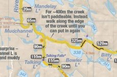
- Just enough water to float through the lower 2 10m portages, and enough water in Mudchannel Lake so that it did not live up to the name. Very thick with aquatic vegetation, though.
- Opted to skip Talking Falls due to losing a day earlier to weather, and because I was already realizing that I’d be back in this region for my next Temagami trip, whenever that might happen.
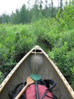
- Could not locate portage from Mudchannel to Bowler, but wound up not needing it. I did see something that may have been an old blaze, but it was further North than I was expecting so was going to come back to it if I needed to, but while poking around the inlet I saw a submerged cut log and some other evidence that it had been navigated previously and decided to send it. It is very serpentine and eventually gets very narrow, to the point that the blade of my paddle spent more time pushing land than it did water, but it remains deep the entire way through. Other than needing to lift over 3 beaver dams, I was able to stay in the boat the entire way through. Did see the portage marker on the East side, but did not investigate to see where it led.
- Bowler/Unnamed/Bitty/Akick are all very pretty little lakes. While the portages from Bowler over to Pinetorch were the most obstructed I encountered on my trip, they were all passable with a little work with the saw, and the Bowler to Upper Pinetorch region was my hands down favorite. An even more beautiful (to me, anyway) little corner of an already beautiful region, with the obstructed portages giving me the sense (accurate or not) that I was one of the first/few to travel through it this year.
- Stopped to camp on Pine Lake.
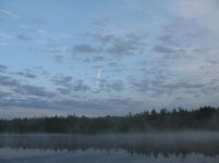
- Was treated to a misty morning sunrise. The mouth of Ames Creek is incredibly pretty – I was tempted to paddle up it but I knew I didn’t have the time, so decided that my next trip will be planned around paddling up there to camp at Ames Lake.
- By this point in the trip, my feet were shredded. The insoles in my shoes for some reason had little wing wall type deals along the inner edge at the arch, and by the time I had noticed what was happening (somewhere around Bowler), they had worn open sores on my feet. So I took the morning to cut the wingdings off and then use some of the 80 grit sandpaper from my repair kit to really smooth them out to a more sensible profile. My feet started slowly healing after this modification, but they would bother me for the rest of the trip, and I had to really take care to frequently clean and monitor them to make sure they didn’t get infected and make an unpleasant situation a bad one. I’m not sure if it was stupid design on the insole, or my abnormally wide/flat feet causing the issue, or some combination thereof, but the shoes (Astral Techyak) performed really well aside from that.
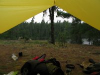
- The portage from Pine – Pinetorch was heavily obstructed, and it took me a couple hours to clear a path and get through it. By the time I made it to the campsite on Pinetorch where I thought I might have lunch, I could see that rain was headed my way and the campsite was so nice that I knew I’d be spending the night there despite how little progress I’d made. This was my favorite campsite of the trip – just a textbook perfect example of a backcountry campsite. Big trees, nice bed of pine needles on the ground, plenty of clear flat spots of ground to choose from, pretty lake, easy water access, the works. I loved it. Spent the rest of the day under the tarp alternating between reading and just soaking it all in, all the while giving my feet a much needed rest.
Attachments
-
 IMG_1518.JPG157.1 KB · Views: 30
 -
 IMG_1581.JPG146.5 KB · Views: 29
 -
 IMG_1580.JPG111.7 KB · Views: 29
 -
 IMG_1575.JPG208.3 KB · Views: 29
 -
 IMG_1570.JPG285.5 KB · Views: 30
 -
 IMG_1566.JPG177.2 KB · Views: 31
 -
 IMG_1565.JPG143.1 KB · Views: 31
 -
 IMG_1561.JPG65.9 KB · Views: 33
 -
 IMG_1550.JPG270.8 KB · Views: 33
 -
 IMG_1547.JPG129.7 KB · Views: 34
 -
 IMG_1540.JPG269.9 KB · Views: 31
 -
 IMG_1536.JPG137.6 KB · Views: 29
 -
 IMG_1531.JPG161.8 KB · Views: 28
 -
 IMG_1519.JPG197.8 KB · Views: 28
Last edited: