Summary of Week One
It's been an exciting week but not without some downsides. It's been cool for mid-July, overnight temps were down to single digits (celcius) for the first few nights. During the day we had comfortable temps for paddling.
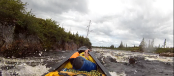
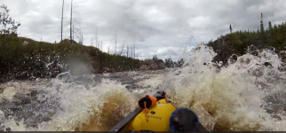
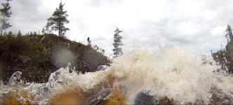
Winds which were almost always from the west and in out face were strong, this negated the river current somewhat, made rapids a bit more of an adventure but on the positive side did a great job keeping the black flies at bay while on the water.
Rain, lots of it, the bulk of it after sunset with some relatively brief periods during the day and at some point
Bugs? Yes we had a few, mostly black flies during the day, mosquitos pretty much only at camp in the evening and overnight. The Pod is a floorless shelter, hard to keep it 100% bug free so pic coils were used some nights.
The flood outs were not a totally new experience for me, I've had some issues in the past but they were all related to tides. On rivers 2000ft above sea level and hundreds of KM's from the nearest salt water maybe a dam release could generate a rapid change in flow, but no dams on the Tichegami. I've often seen river rise due to rainfall but a few inches at most not the 2 - 3ft we had over the course of three days. On the positive side all that extra water has changed the rapids in a good way
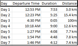
We do have one nagging concern, our progress has been pitiful, about 54km so far. At this rate it would take 6 weeks to finish, we were planning for 16 days with 2 extra is required. To get a little behind in the early days often happens, always time to pull out the "we will make it up later" or "we'll get going earlier" or "some long easy stretches coming up"...........
It's been an exciting week but not without some downsides. It's been cool for mid-July, overnight temps were down to single digits (celcius) for the first few nights. During the day we had comfortable temps for paddling.
Winds which were almost always from the west and in out face were strong, this negated the river current somewhat, made rapids a bit more of an adventure but on the positive side did a great job keeping the black flies at bay while on the water.
Rain, lots of it, the bulk of it after sunset with some relatively brief periods during the day and at some point
Bugs? Yes we had a few, mostly black flies during the day, mosquitos pretty much only at camp in the evening and overnight. The Pod is a floorless shelter, hard to keep it 100% bug free so pic coils were used some nights.
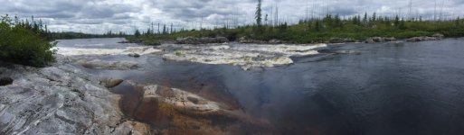
The flood outs were not a totally new experience for me, I've had some issues in the past but they were all related to tides. On rivers 2000ft above sea level and hundreds of KM's from the nearest salt water maybe a dam release could generate a rapid change in flow, but no dams on the Tichegami. I've often seen river rise due to rainfall but a few inches at most not the 2 - 3ft we had over the course of three days. On the positive side all that extra water has changed the rapids in a good way
We do have one nagging concern, our progress has been pitiful, about 54km so far. At this rate it would take 6 weeks to finish, we were planning for 16 days with 2 extra is required. To get a little behind in the early days often happens, always time to pull out the "we will make it up later" or "we'll get going earlier" or "some long easy stretches coming up"...........