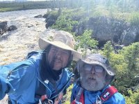
We've decided that we should provide a sort of executive summary here, and then (inspired by Erica) create an episodic trip report that we can dole out a bit at a time.
So...
Tichegami - Eastmain - Moon - Rupert. July 13 - August 1, 2026.
I started investigating this route after seeing Brad Jennings' video "Where the Waters Begin" and realizing that this piece of river has not been very accessible for very long. There is scant info on the upper Tichegami river - we did get Brad's maps, and we were able to glean some sense of things from satellite imagery. The lower section, from Lac Badeau down, has been paddled by a handful of groups, typically they come in from Lac Albanel/Mistassini. Moe Baxter left a detailed account on MyCCR of his portage route into the Moon on a low-water trip prior to the dam built on the Rupert. Another fella, Sam Brakeley, has done a few trips more recently that included the lower Tiche and the Moon, though he suggested a different path than Moe took. But we believe we are just the second documented group to descend the Upper Tichegami, and perhaps the first to follow it to its end.
We knew going in that it would be no walk in the park. There would be plenty of big ledge drops and falls to line or portage around and there would be little in the way of paths or established campsites. On the other hand, there would also be lots of runnable whitewater, and the unadulterated landscape was appealing. It had been hot and dry leading up to our trip, and the first access point would mean starting with about 15kms of boney C2/3 rapids. We knew that Brad's starting point (the third possibility) would also entail super low water. In the middle of the two was a branch of the Tiche that flowed under the 167 bridge and met the river 5kms further on. This seemed like our best bet. Though we started the trip dragging our boats through a rocky stream bed, we received some amount of rain for eight or ten days following the first day, and the river continued to rise until it was quite a torrent.
The Upper Tichegami is not for novices. The whitewater we experienced ranged from simple riffles to technical rock gardens, complex sets of ledge drops to massive wave trains to full-fledged falls. Catching eddies, and being able to read and run or judge blind corners is essential, as you are running un-scoutable rapids that go for hundreds of meters. You must know when and how to line, when to eddy hop, and when to portage. Leaving the river for side channels can be more time consuming or even leave you in the position of running creeky ww in a loaded tripper (fast and fun but easy to pin a boat). Leaving the river for land routes entails hacking your way through a dense wall of alders, then walking through endless thickets of knee or waist-high shrubs, often with the remains of the last burn cast about to trip you up at every step. Campsites must also be cut out of the overgrowth, though I think with lower water levels, more beaches and sandbars would appear. Also, the prevailing winds are from the west, so while there is significant current in the river, often it seemed like the river was flowing upstream at us. However, aside from a plane or two, we did not see one sign of human presence on the Upper Tichegami until we reached Lac Badeau (where there is a Cree fishing camp/complex with multiple buildings).
The Lower Tichegami is wider and less steep, has denser walls of alders, is more prone to affect from the headwinds, and has easier sets of rapids. The final rapid on the lower Tiche is a doosey - I think probably generally runnable, but not at our water levels. Again, we saw no signs that people had been there before us.
The 10kms of the Eastmain passed quickly. It is a huge river in that section with sweeping vistas that are in stark contrast to the tight mountain walls of the Tichegami that we had been moving through. There are no rapids of any kind in this section. The side channel that breaks off flows southwest for about 30kms to create Lac Maree. We followed this channel to its end and to the other source of the lake, which is a small creek at the far southern end. Since there was plenty of water, when we reached it, we had no trouble paddling up this creek - less then 6' wide in most places, but there was a deep channel that twisted its way for about 3kms. Just when we reached the point where we needed to get out and pull the canoes thru ankle deep water, we found the portage, and it was not hard to follow the footsteps of previous groups in the moss.
Portaging up over a steep hill, into and across a small pond, then up another, smaller hill, and down a gentle slope dropped us in the Moon River. Now, the "Moon River" is so called because some camper kid thought it looked like the moon and started calling it that 50 years ago and the name stuck. It is actually Misticawassee Creek - which I think is more indicative of its nature - it is not much of a river - it is a creek connecting small lakes or ponds for most of its journey. At the top end, it is ankle deep and the connections between ponds are alder-choked and beaver-dammed. As it gains more water from its valley it becomes a bit more robust, ending with a grand finale falls that has no runnable exit route - just a tumble of van and bus size rocks. The Moon is gorgeous though - with fascinating rock formations everywhere you turn and some magnificent cliff faces. The confluence with the Rupert River dam backwater is about 45 kms from the takeout. We paddled the backwater in 11 hours (wind and rain), then drove back to Chibougamau, arriving at our motel at 4:30am.
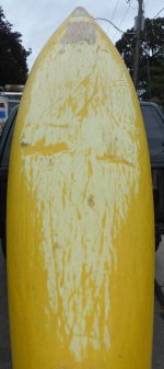
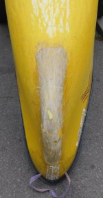
We took 20 days and nights to do the route, inclusive of one layover day we took too early in the trip, and not counting the 2 days of driving and shuttling on either end. We were not dawdling. We had one unintentional swimmer, but he self-rescued (mostly) and didn't lose the pie. We experienced more rain than I ever had on a trip before. I almost left the wetsuit at home, thinking it would be a balmy July trip - I wore it every day for the first half of the trip. Wish I had packed my merino long johns. We played croquet only once, and we had no fires. We ate both MIAB and fresh cooked meals. I brought a rod and hardly had time to throw a cast. There were two camp flood-outs, two tent lift-offs, a dishwashing swim, a broken camp chair, brutal portages, rodeo-style whitewater, white-knuckle driving, and some seriously small rations of scotch by the last week. Fuddle was, as usual, of little help and received an appropriate amount of abuse for his lackluster efforts. I have inhaled so much PIC coil fumes, I should be mosquito-proof for life. Our boats and bodies are leaner and in poor repair. We were both more exhausted by this trip than anything we had ever done before...
But all those are stories for the trip report. This is just the executive summary.
Stay tuned for The Tichegami Odyssey - a new series streamed only on CanoeTripping.net