This is another installment in a series that might be called "Small Beer Canoe Trips". In this case it was a two night trip, Saturday through Monday, Labor Day weekend. I'd love to be doing longer trips, but you know how it goes, so I splash around as much as I can in a weekend.
The Moose River Bow trip is short (~34 miles) but classic, and it's been one of my favorites since the first time I did it in 2011. I have to almost restrain myself from going up to Jackman and doing it over and over again. I love loop trips, and I even like a certain amount of portaging ("lying or crazy" you decide). As a pool & drop river with a lot of natural storage (bog and marshland) in its watershed, it's marginally navigable even late in a dry summer. With no shuttle to arrange, why not just do it (again)?
Since I had three full days and wanted to do some exploration, I decide to do the trip "backwards", heading up the Moose River from Attean Pond to Holeb Pond and portaging back to Attean. Also, I wanted to avoid the usual claque at Attean landing, which is also the front door for a resort/lodge on Birch Island, so I decided to start from the town landing on Wood Pond in Jackman. That added about 5 miles total to the trip.
I was moderately concerned about finding campsites, given the holiday weekend and Covid-enhanced enthusiasm for the outdoors, but I figured I could improvise if necessary. As a solo traveller I don't need much space, and on this trip I wasn't even planning to build any campfires.
Day 1
The boat ramp at Wood Pond was easy, there were only a few cars and there was plenty of space. A young couple were launching a small fishing boat for a day trip.
As I launched at the not-at-all-early hour of 11:30 there was a fresh breeze out of the west. That was the forecast for both Saturday and Sunday, with the wind supposed to shift around to the south on Monday. That meant I would probably do Wood Pond once and Attean twice with winds abeam. I had a Plan B of doing the trip in the classic direction if the wind direction became too much of a problem.
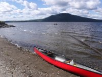
Heading down Wood Pond I started out SW then turned SE toward the outlet. The stream between Wood and Attean is pleasant and punctuated with a few boulders. This was upstream travel, and the water level was low, so I did have to hop out and drag in a couple of places, but the river bottom was a good walking surface and it wasn't a big deal.
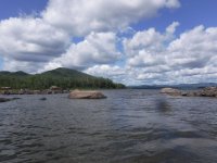
Once on Attean and out of the sheltered outlet cove I had to deal with that west wind again. Attean is about 4 miles wide, so the waves do come up, but fortunately it's peppered with very helpful (not to mention scenic) islands. I hopped my way vaguely south, taking a quartering angle SW or SE in more exposed areas.

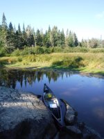
Once I got down to the SE corner of Attean I found the channel of the Moose River, hiding behind a patch of grass.
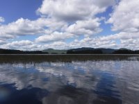
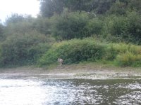
Not far upriver I saw this this duck on the bank. She kept an eye on me but didn't move.
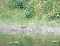
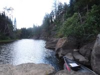
The short stretch of the Moose River to Attean Falls (really a pair of short rapids) was uneventful. When I reached the lower rapid I considered wading, but the level was very low and I knew there was a good portage trail, so I went with that. Between the two rapids there was a brief paddle of a couple hundred yards to the next carry. Both trails were in good shape, as were the four campsites (two along each portage trail).
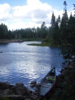
The put-in at the upstream end was easy, a mud landing but firm mud. Although it was litter free and pleasant enough, this landing smelled vaguely of piss. Thinking of the usual Bow Trip route, that made sense, as it's about 6.5 miles to this point from Spencer Rips, with no decent place to stop for a break.
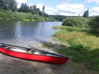
When in Rome, as they say ... so I took a leak, loaded up, and continued paddling upstream. This stretch is through a big fen where you generally can't see anything beyond the bushy "mangrove" banks. Doing the Bow Trip in the usual way I'm normally coming down this stretch in the afternoon and planning to camp at Attean Falls, and I can report that it's equally nondescript in either direction. Are we there yet?
Paddling along with not much to look at I noticed a round object in the water near the right (river left) shore. I wasn't sure if it was the end of a log or a rock. As I got closer I saw that it appeared to be a rock ... an unusually brown rock, with hair and flies. OK, the rock appeared to be a dead deer floating in the stream. No obvious cause of death, but given that it stank even at max zoom range I didn't investigate. Still, check "Charismatic Macrofauna" off the list. Wildlife counts even if it's dead.

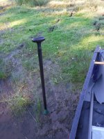
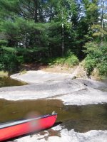
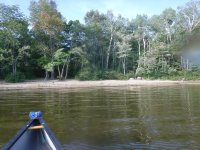
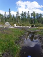
Old maps of the Bow Trip show a campsite about halfway between Spencer Rips and Attean, and I've always been curious about it. One time I asked Karl, the guide at Attean landing who seems to be the Bow Trip raconteur general, and he said it was a crappy campsite that faded away due to lack of interest. I've looked for it before and not found it, but this time I looked harder and I think I located it. Doesn't it look glorious? Maybe an otter would consider it a decent campsite.
It seemed like the stretch to Spencer Rips took forever, but I did stop for some photos (of dead animals and crappy abandonded campsites), and it always seems to take a long time anyway. Along this stretch I also encountered the first paddler I saw on the river, a solo guy in a plastic kayak who put in at the landing on Holeb. He was fairly energetic and seemed interested in doing the whole trip (with the 1.25mi portage between the lakes) next time, possibly in a canoe since they portage easier than kayaks (his observation).
I would later observe that there seemed to be a lot of "shuttlecocks" (as the mountain bikers sometimes call them) doing the downstream part of the traditional Bow Trip. I think it's good that people are outside and giving some business to local outfitters (lots of Cry of the Loon rental boats, in this case). I don't care what anybody says, shuttlecocks are OK. Pretty much. At least for the first time. Some of my best friends are shuttlecocks.
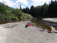
I finally got to Spencer Rips around 4pm. I was getting a little tired, and I was glad that there was just enough water that I could line the drop.

On the way up to Mosquito Rips I saw another party, two women in an Esquif who looked like the knew what they were doing (I had some wannigan envy). There were a few drops I had to line, before getting up to the official rips, all short with plenty of exposed rock to walk on. Now it's 5pm and I'm starting to think about a campsite and dinner.
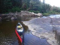
There are a couple of campsites at Mosquito Rips, and both were unoccupied. In hindsight I should have taken one. But I knew Holeb Falls was just around the corner (less than a mile) and I wanted to get past that portage today if possible. I wasn't too worried about finding a campsite as I'd only seen 3 people in two parties all day. In fact, I was wondering where all the people were. I would soon learn the answer -- they were all at Holeb Falls! Apparently if you put in at the landing on Holeb and paddle at a leisurely pace you end up at Holeb Falls late in the afternoon of the first day. Many people did so!
When I got to the downstream end of Holeb Falls I could see a large party was camped at the main site there. I checked out the site at river right (just across the water), but it looked seldom used and rather bushy. That could be a nice site, but being 100 yards downriver from the portage I suppose it's too close to and yet too far.
I paddled to the downstream end of the portage trail and took out. There were a number of canoes there -- it took me a few minutes to figure this out but there was actually a party doing the portage distinct from the people camped there. The portaging party said they planned to camp at Attean Falls(!) (12 miles away, and it's nearly 6pm). I told them about the two parties ahead of them and where they were going (Attean and Spencer), and mentioned that the Mosquito Rips sites were open. Maybe the reopened the mud pie campsite, I dunno. The interesting thing about "salmoning" a popular trip is you see everyone on the river, but only once in passing.
I knew there was a decent (but not great) site at the upstream end of the portage, so I figured I'd go up there and have a quiet dinner. I did go up and set up camp, but it turned out another party showed up for a late-in-the-day portage. They were a large party, or maybe there were two, but anyway for the next hour there was an awful lot of traffic through my modest campsite. These folks seemed self-equiped and were in diverse, non-rental canoes. All nice people, but lots of them. I did see one Merrimack at the upstream landing when I was dropping off my canoe, but the owner wasn't there so I didn't have a chance to ask about it.
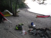
Soon enough the student body of Ohio State was done triple carrying through my campsite and I could settle in for dinner. I'm more of a paddler than a camper, so I eat simple meals when I'm out in the woods. My dinner was just tuna mac & cheese prepared backpacker style (no milk, olive oil instead of butter).
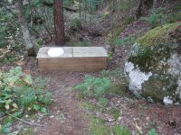
Although the campsite itself was modest, it had an outstanding thunderbox, a one hole double. The top panels (one with a seat and one without) were held in place by gravity only -- apparently you're supposed to switch sides when the pile gets a little high? Maybe this was an NFCT upgrade. In any case, it was an excellent crapter. What do you call these things, a flip flop? Single pole double throw?
[That's the end of Day 1 -- I'll post the rest tomorrow.]
The Moose River Bow trip is short (~34 miles) but classic, and it's been one of my favorites since the first time I did it in 2011. I have to almost restrain myself from going up to Jackman and doing it over and over again. I love loop trips, and I even like a certain amount of portaging ("lying or crazy" you decide). As a pool & drop river with a lot of natural storage (bog and marshland) in its watershed, it's marginally navigable even late in a dry summer. With no shuttle to arrange, why not just do it (again)?
Since I had three full days and wanted to do some exploration, I decide to do the trip "backwards", heading up the Moose River from Attean Pond to Holeb Pond and portaging back to Attean. Also, I wanted to avoid the usual claque at Attean landing, which is also the front door for a resort/lodge on Birch Island, so I decided to start from the town landing on Wood Pond in Jackman. That added about 5 miles total to the trip.
I was moderately concerned about finding campsites, given the holiday weekend and Covid-enhanced enthusiasm for the outdoors, but I figured I could improvise if necessary. As a solo traveller I don't need much space, and on this trip I wasn't even planning to build any campfires.
Day 1
The boat ramp at Wood Pond was easy, there were only a few cars and there was plenty of space. A young couple were launching a small fishing boat for a day trip.
As I launched at the not-at-all-early hour of 11:30 there was a fresh breeze out of the west. That was the forecast for both Saturday and Sunday, with the wind supposed to shift around to the south on Monday. That meant I would probably do Wood Pond once and Attean twice with winds abeam. I had a Plan B of doing the trip in the classic direction if the wind direction became too much of a problem.

Heading down Wood Pond I started out SW then turned SE toward the outlet. The stream between Wood and Attean is pleasant and punctuated with a few boulders. This was upstream travel, and the water level was low, so I did have to hop out and drag in a couple of places, but the river bottom was a good walking surface and it wasn't a big deal.

Once on Attean and out of the sheltered outlet cove I had to deal with that west wind again. Attean is about 4 miles wide, so the waves do come up, but fortunately it's peppered with very helpful (not to mention scenic) islands. I hopped my way vaguely south, taking a quartering angle SW or SE in more exposed areas.

Once I got down to the SE corner of Attean I found the channel of the Moose River, hiding behind a patch of grass.

Not far upriver I saw this this duck on the bank. She kept an eye on me but didn't move.

The short stretch of the Moose River to Attean Falls (really a pair of short rapids) was uneventful. When I reached the lower rapid I considered wading, but the level was very low and I knew there was a good portage trail, so I went with that. Between the two rapids there was a brief paddle of a couple hundred yards to the next carry. Both trails were in good shape, as were the four campsites (two along each portage trail).

The put-in at the upstream end was easy, a mud landing but firm mud. Although it was litter free and pleasant enough, this landing smelled vaguely of piss. Thinking of the usual Bow Trip route, that made sense, as it's about 6.5 miles to this point from Spencer Rips, with no decent place to stop for a break.

When in Rome, as they say ... so I took a leak, loaded up, and continued paddling upstream. This stretch is through a big fen where you generally can't see anything beyond the bushy "mangrove" banks. Doing the Bow Trip in the usual way I'm normally coming down this stretch in the afternoon and planning to camp at Attean Falls, and I can report that it's equally nondescript in either direction. Are we there yet?
Paddling along with not much to look at I noticed a round object in the water near the right (river left) shore. I wasn't sure if it was the end of a log or a rock. As I got closer I saw that it appeared to be a rock ... an unusually brown rock, with hair and flies. OK, the rock appeared to be a dead deer floating in the stream. No obvious cause of death, but given that it stank even at max zoom range I didn't investigate. Still, check "Charismatic Macrofauna" off the list. Wildlife counts even if it's dead.

Old maps of the Bow Trip show a campsite about halfway between Spencer Rips and Attean, and I've always been curious about it. One time I asked Karl, the guide at Attean landing who seems to be the Bow Trip raconteur general, and he said it was a crappy campsite that faded away due to lack of interest. I've looked for it before and not found it, but this time I looked harder and I think I located it. Doesn't it look glorious? Maybe an otter would consider it a decent campsite.

It seemed like the stretch to Spencer Rips took forever, but I did stop for some photos (of dead animals and crappy abandonded campsites), and it always seems to take a long time anyway. Along this stretch I also encountered the first paddler I saw on the river, a solo guy in a plastic kayak who put in at the landing on Holeb. He was fairly energetic and seemed interested in doing the whole trip (with the 1.25mi portage between the lakes) next time, possibly in a canoe since they portage easier than kayaks (his observation).
I would later observe that there seemed to be a lot of "shuttlecocks" (as the mountain bikers sometimes call them) doing the downstream part of the traditional Bow Trip. I think it's good that people are outside and giving some business to local outfitters (lots of Cry of the Loon rental boats, in this case). I don't care what anybody says, shuttlecocks are OK. Pretty much. At least for the first time. Some of my best friends are shuttlecocks.

I finally got to Spencer Rips around 4pm. I was getting a little tired, and I was glad that there was just enough water that I could line the drop.

On the way up to Mosquito Rips I saw another party, two women in an Esquif who looked like the knew what they were doing (I had some wannigan envy). There were a few drops I had to line, before getting up to the official rips, all short with plenty of exposed rock to walk on. Now it's 5pm and I'm starting to think about a campsite and dinner.

There are a couple of campsites at Mosquito Rips, and both were unoccupied. In hindsight I should have taken one. But I knew Holeb Falls was just around the corner (less than a mile) and I wanted to get past that portage today if possible. I wasn't too worried about finding a campsite as I'd only seen 3 people in two parties all day. In fact, I was wondering where all the people were. I would soon learn the answer -- they were all at Holeb Falls! Apparently if you put in at the landing on Holeb and paddle at a leisurely pace you end up at Holeb Falls late in the afternoon of the first day. Many people did so!
When I got to the downstream end of Holeb Falls I could see a large party was camped at the main site there. I checked out the site at river right (just across the water), but it looked seldom used and rather bushy. That could be a nice site, but being 100 yards downriver from the portage I suppose it's too close to and yet too far.
I paddled to the downstream end of the portage trail and took out. There were a number of canoes there -- it took me a few minutes to figure this out but there was actually a party doing the portage distinct from the people camped there. The portaging party said they planned to camp at Attean Falls(!) (12 miles away, and it's nearly 6pm). I told them about the two parties ahead of them and where they were going (Attean and Spencer), and mentioned that the Mosquito Rips sites were open. Maybe the reopened the mud pie campsite, I dunno. The interesting thing about "salmoning" a popular trip is you see everyone on the river, but only once in passing.
I knew there was a decent (but not great) site at the upstream end of the portage, so I figured I'd go up there and have a quiet dinner. I did go up and set up camp, but it turned out another party showed up for a late-in-the-day portage. They were a large party, or maybe there were two, but anyway for the next hour there was an awful lot of traffic through my modest campsite. These folks seemed self-equiped and were in diverse, non-rental canoes. All nice people, but lots of them. I did see one Merrimack at the upstream landing when I was dropping off my canoe, but the owner wasn't there so I didn't have a chance to ask about it.
Soon enough the student body of Ohio State was done triple carrying through my campsite and I could settle in for dinner. I'm more of a paddler than a camper, so I eat simple meals when I'm out in the woods. My dinner was just tuna mac & cheese prepared backpacker style (no milk, olive oil instead of butter).
Although the campsite itself was modest, it had an outstanding thunderbox, a one hole double. The top panels (one with a seat and one without) were held in place by gravity only -- apparently you're supposed to switch sides when the pile gets a little high? Maybe this was an NFCT upgrade. In any case, it was an excellent crapter. What do you call these things, a flip flop? Single pole double throw?

[That's the end of Day 1 -- I'll post the rest tomorrow.]

