• Happy Weed Appreciation Day! 🌱🌿🌻

Land of Light - Canada's Northern Oasis

Joined
Aug 21, 2018
Messages
1,662
Reaction score
1,713
Location
Preeceville, Saskatchewan Canada
Kathleen and I have often given a slide show on our expeditions in northern Canada, with an emphasis on natural and cultural history. Many of you will have seen some of these images in my previous trip reports, but the emphasis here is quite different. I hope you enjoy it. Glenn suggested that this presentation of best presented in this forum, so that's what I have done. Throughout this thread, I speak in regular font, while italics represents Kathleen's part of the presentation. So here goes.

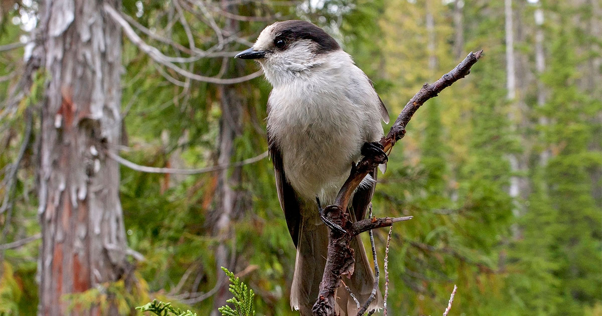
We are very happy to be here to talk about our experiences travelling throughout the far north of Canada from 1990 to 2019. It is a landscape that we truly love -- and love to talk about. It’s also a landscape that is largely unknown, and regrettably, undervalued, even by most Canadians. We look forward to sharing with you this region’s natural history: its plants, animals, geology, beauty, isolation, and history. We feel particularly fortunate that we have had the opportunity to enjoy this almost uniquely Canadian experience in summer by canoe, and in winter by snowshoes.

LoL001.jpg


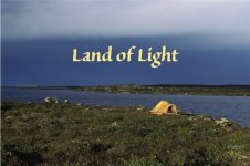
We also hope that we can convey the satisfaction of being alone in this landscape, which to us in so many ways represents a 'Land of Light'

LoL002.jpg

Even more importantly than the light and beauty, however, we find that we are irresistibly drawn to the peace and renewal that we find in 'Canada's Northern Oasis.'
LoL003.jpg


The Northwest Territories comprises approximately 1,200,000 sq. km (465,00 sq. miles). Nunavut; almost 2,000,000 sq. km (775,000 sq. miles). This is 5.5 times the size of Saskatchewan, and in all this land, in 2020, there were only 84,000 people. By comparison, the combined population of just Prince Albert and Moose Jaw also equals nearly 84,000 people! During our presentation, we will present a collage of images collected across northern Canada, including the Seal River down to Hudson Bay, the Coppermine River and Anderson Rivers to the Arctic Ocean, the Snowdrift River along tree line east of Great Slave Lake, and the Thelon River, which flows across the Barren Grounds. We will also describe the return of Spring from our vantage point in a small cabin at Colville Lake, just north of the Arctic Circle, which, at 66.5 degrees north, is the lowest latitude at which the sun remains above the horizon for 24 hours.


LoL004.jpg


Water is a major component of Northern Canada. Fresh water comprises 21% of the area of Nunavut and 13.5% of the area of NWT. The canoe, besides being a most practical way to travel through this land, also offers the most historically satisfying experience, because it played such a vital part of Canadian heritage.

LoL005.jpg

The late Pierre Trudeau wrote an essay when he was 25 years old in which he says. "What sets a canoeing expedition apart is that it purifies you more rapidly and inescapably than any other. For it is a condition of such a trip that you entrust yourself, stripped of your worldly goods, to nature… For throughout this time your mind has learned to exercise itself in the working conditions which nature intended".

LoL006.jpg
Tonight we invite you join us to experience the joy and isolation of travelling along the rivers and lakes of Northern Canada.

LoL007.jpg

But, rivers and lakes run free for only 4-5 months. Most of the year they remain frozen. One needs to follow the winter trail to truly understand and know the character and soul of Canada's vast, seemingly limitless northern landscape. We begin our presentation on the winter trail.


cabin loop.jpg

In 1999 we rented a cabin just beyond the Arctic Circle at 67 degrees north at the north end of Colville Lake. We flew away from Inuvik in a Twin Otter on January 31st at -400 C. We landed in this cove 200 m (200 yards) from our cabin, which we had never seen before. We had flown to this place with the simple faith that we would find a comfortable home. The pilots began to unload our food gear onto the ice. I was anxious to see what the cabin was like. I put on my snowshoes, and began walking toward the point on which our cabin stood.

LoL009.jpg

I was so happy find that our 14 x 14 foot cabin was very well-made, cozy, and inviting. We would indeed have a very comfortable home for the next 4 and a half months.

LoL010.jpg


During that first week in February we spent a lot of time organizing gear and hibernating. We usually slept late, and then lingered by the fire, enjoying our oatmeal, sipping tea, and toasting bread on the wood stove. The morning sun streams through the south-facing window, and we bask in its light. At temperate latitudes the sun rises in the east and sets in the west. We all know this generality. In the arctic, however, in mid-winter, the sun first rises nearly due south near mid-day, and sets soon afterwards, also nearly due south.

LoL011.jpg

We commonly saw small groups of caribou wintering near our cabin. Caribou are superbly adapted to winter. Because the heat of out-flowing arterial blood is exchanged with veinous-blood heat, caribou body temperatures remain at 40 degrees C (104 F). even though leg temperatures fall to only 10 degrees C (50 F). Caribou subsist mostly on lichens, which they are able to digest with the enzyme lichenase. Lichens are low in protein, which is useful for caribou, because a low-protein diet requires little water for digestion.

LoL012.jpg

Feb. 22. The sparkling white lake, the white spruce spires reaching into the deep, blue sky, and the branches of the aspen trees, delicately white-covered with hoarfrost, make for a breathtaking scene. And ALL of it is ours to enjoy.

LoL013.jpg


Hoarfrost forms when the air is completely saturated. That is, when there is more moisture in the air than the air can carry. If the air is sufficiently dry, moisture can remain suspended in the air at temperatures well below zero degrees. In fact, pure water can remain suspended in clean at temperatures close to minus 40 degrees.

LoL014.jpg

Our canoe waits for Spring break up, when we will paddle 4 weeks and 550 km (350 miles) down the Anderson River to Liverpool Bay on the Arctic Coast.

(Note: I will post more tomorrow.)
 

Attachments

  • LoL001.jpg
    LoL001.jpg
    117.6 KB · Views: 3
Last edited:
Just as a heads up, there are 136 images in this presentation. I thought I would post 14 or 15 a day, to keep it more manageable, both for me, and for readers. Bite size to enjoy with your morning breakfast.

LoL015.jpg

Kathleen and I are likely the last two people on the North American continent, in a 300-km-wide (200 miles) swath between Inuvik and Paulatuk, in all of that isolated 550 km (350 mile) distance north to the polar sea.

Lol016.jpg

Approximately 90 people live 40 roadless km (25 miles) to the south, in the community of Colville Lake. These Hareskin Indians, living at tree line, were called "people at the edge of the world" by the other Dene.

LoL017.jpg
Even at the edge of the world, though,
we weren't lonely. We had each other and I had been feeding a Gray Jay, who seemed to like me. He followed me around and talked to me. Once when we had been away for a few days there he was 'chattering' away and when I stopped to talk to him he came right down to the branch by my face and 'went on-and on', changing sounds; puffing himself up. He sure had a long story to tell!

LoL018.jpg

April 1. Despite the temperature falling to minus 40 degrees last night, sections of the river are already beginning to break up. The water seems to laugh with joy, as it sweeps past us on its way to the Arctic Coast. Now that the days were getting longer, I felt a tad restless. I am ready to wander, to saunter, to hear the call of the loon, to feel the warmth on my face, to stoop over a flower of spring.

LoL019.jpg
Only five weeks later, on May 8, the Herring Gulls suddenly appeared! Spring is definitely arriving. Even before lighting the wood stove this morning, the cabin was plus 8 C (45 F) degrees.

LoL020.jpg
After dinner Kathleen and I paddled around the "point" and down the river, which has opened up much more in the last two days. Sun glistened and sparkled on the nearly smooth water. A mink ran along beside the canoe; we could hear the splash of paws in icy slush, and periodically he broke through the thin ice. American widgeons flew upward from our canoe at the last moment, squeaking like plush toys as they fled.

LoL021.jpg
May 18. We stood outside at 11:00 pm, listening to the ice sigh and crack, like rifle shots, as it expanded when the temperature fell back below zero C (32 F). When the ice talks to you, can Spring really be so very far away?

LoL022.jpg
Finally, on May 23, we saw the first flower of Spring today - prairie crocus (Anemone patens) on the south-facing knoll. A beautifully bold blue statement of confidence that Spring has arrived.

LoL023.jpg
I don't think we could have a better place to spend this winter. We sit on some of the first open water and are surrounded by ducks, geese, swans and birds. It has been such fun to watch these creatures day by day, and to learn their personalities. There is a Bonaparte's Gull that staked out a small, shallow bay. We have been able to observe his breeding behaviour, which includes yelling very loudly if any intruders, including us, enter his territory.

LoL024.jpg
The arrival of birds from the south was exciting and explosive. Four species arrived on May 8. Another 12 landed within the next week, followed by 16 more species by May 28. Thirty-two species in 20 days! Like our flight of faith last January thirty-first, these birds returned with the faith that open water will exist. The Yellowlegs spent most of the evening in courtship. During consummation they are brashly noisy and unashamed, loudly proclaiming their union to the entire world.


LoL025.jpg
May 29. I stayed awake most of the night, enjoying the birds and the fantastic lighting. So interesting to remember that on our first morning last February 1st the sun rose due south at 10:00 a.m. The sun now sets and soon rises again nearly due north at 1:30 a.m.

LoL026.jpg
June 6. We paddled down our river, about 2 km (1 mile), to the top of a long, swift, shallow rapid. We beached and walked along trails, perhaps traditional, native travel routes. Wood Anemones (Anemone quinquefolia) bloomed along the upland edges of marshy sites, and a Glaucous Gull, white as ivory, flew up-and-down the river.


LoL027.jpg
We are becoming eager to paddle to town at the south end of Colville lake, especially since the ice is gone from the river and the narrows around the cabin. But a large ice sheet still covered the main lake section. As soon as leads developed along the lee shore we set out for town on June 9.LoL028.jpg
Paddling through the candled ice of a new spring was quite entertaining. In mid-winter, the surface of the snow is colder than lower in the profile. As the days become warmer in spring, the temperature gradient in the snow cover reverses; the surface is now warmer, and melts during the heat of the day. Water then drains down through channels in the upper snow crystals, which turn into long, vertical cylinders called ablation needles. The result produces a musical tinkling when these prism-shaped needles rub against each other. It is though we are sitting in a giant field of wind chimes, as we sway back and forth in the gentle breeze.

LoL029.jpg
Unable to make headway against harder pack ice, we beached and made supper. We weren’t tired, and didn’t want to make camp. Richard, a Hareskin native from town, had told us that if a man is all alone of the winter trail, that he can whistle for the Northern Lights to come down closer. Well, if Richard can whistle for the northern lights, then maybe I can whistle for the wind to blow the ice away. I whistled, and moments later, just after 11:00 pm, the wind shifted to blow from the southeast, and the entire shoreline opened up as the pack drifted out from land. (Note: Kathleen says that she had prayed at the same time for the wind to blow the ice away, so the experiment was completely confounded.)


Anyway, we packed up and paddled to town with the midnight sun shining upon our backs. At 2:00 a.m. we approached the headlands of town, which lay encased in ice. There was no route through. We beached 1.5 km (1 mile) from town, and started unloading the canoe to begin our 1st portage of the new paddling season.
 
Great experience and story-telling. I’m looking forward to subsequent postings.
 
Thanks, Erica. Here comes Chapter 3.

LoL030.jpg
We spent 4 days in Colville Lake arranging for our winter equipment and clothing to be shipped home. We stayed with Bern and Margaret Brown who were our landlords at our cabin.

LoL031.jpg

June 15. We paddle back to the cabin encountering no ice. We actually didn't even see any ice, where we had been trapped only 6 days ago. It is now 30 C (85 F). Winter turns to Summer very abruptly here.

LoL032.jpg

When we arrived back at the cabin, we discovered that trembling aspen (Populus tremuloides) and balsam poplar (P. balsamifera) have leafed out in our absence. Balsam poplar is the most northerly tree on the continent, growing on gravely shores of lakes and rivers draining into the Beaufort Sea. Its highly aromatic fragrance drifts through our cabin windows, which now remain open during the day.

LoL033.jpg
C
hange was now occurring all over the north, from the boreal forest, and beyond, to the tundra. Blocks of ice and torrents of water burst across the land. By the middle of June, the tumult and carnage of spring renewal had subsided. The grand rivers again flowed stately between majestic banks. Like the seductive siren of Greek mythology, the immortal Arctic summer calls out to us. We can do nothing else than immediately answer the sweet summons. We load the canoe and head down the Anderson River; north to the Polar Sea.

LoL034.jpg
Camped on this island, we are happy in the middle of what seems like our own backyard. We feel so very fortunate to have such easy access to incredible beauty, isolation, and serenity.

LoL035.jpg
We are able to live with the plants, birds and animals. We enjoy a family of Northern Flickers (Yellow-shafted form) in a tree cavity adjacent to our morning campfire, as our bannock toasted slowly.

LoL036.jpg

My first northern pike (Esox lucius), which can feed on fish half its size, and has been known to hunt ducklings and lemmings. I also learned an important lesson – never stick your fingers in a pike’s mouth, even if you do want to see how sharp its teeth are. (Note my bloody fingers!) The Hareskin people of Colville Lake had told us how to fillet a pike. We ate the whole fish in one sitting.

LoL037.jpg
The boreal forest of Canada was buried in ice as recently as 6,000 - 10,000 years ago, which filled the landscape with beautiful and abundant glacial lakes

LoL038.jpg
The boreal forest extends around the northern hemisphere, and comprises the world’s largest vegetation type. Most of the boreal forest still remains unbroken by human cities and highways.

LoL039.jpg
We love hiking on the esker that snaked away from our camp on the Seal River, seemingly endlessly, through the boreal forest. Eskers are rivers running below the surface of the melting glacier. The tube in the glacier fills with gravel and sand, and when the glacier finally melts, the esker is left as a ridge raised above the landscape, and provides travel corridors for both people and caribou.

LoL040.jpg
Historically, the boreal forest burns every 50-100 years, and rarely does a stand exceed 150 years old. This fire occurred along the Snowdrift River in 1994.

LoL041.jpg

By 2001 the land was already recovering, as fireweed (Epilobium angustifolium), willow (Salix spp.), birch (Betula spp), green alder (Alnus viridis), common horsetail (Equisetum arvense), and bluejoint (Calamagrostis canadensis) all grow thickly and luxuriantly.

LoL042.jpg

Also in 1994, a wildfire on the Seal River burned 250,000 ha (600,000 acres), and both destroyed and renewed life. Only 3 years later, bunchberry (Cornus canadensis) was growing vigorously among the blackened spruce stems killed by the fire.

LoL043.jpg
And everywhere above the rocky beach, pink corydalis (Corydalis sempervirens) sprouted through the ash-covered soil. The seed can persist for centuries in the soil, waiting for the next fire to release it.

LoL044.jpg
We always plan for multiple layover days on our canoe trips -- there is never any reason to rush. We take time to enjoy and to photograph plants.
 
LoL045.jpg
The leaves of the large-flowered wintergreen (Pyrola grandiflora) on the Anderson River remain green all winter, This allows last years leaves to photosynthesize with the first warm weather in spring, before the new year's leaves have time to develop.

LoL046.jpg
We saw Northern grass of Parnassus (Parnasia palustris) growing in damp, moist areas along the shores of the Coppermine River. It has an interesting adaptation to increase the chance of cross pollination by flies. The anthers mature first and later when the stigma opens, most the flower's own pollen is gone.

LoL047.jpg

This wolf, curious about our business, followed us along the shore of the Seal River for nearly 1 km. The Hudson’s Bay Company trader Samuel Hearne, in his diary, reported that the Chipewyan Indians believed that the wolf did not eat its prey raw, but by a wonderful wiseness, peculiar to itself, has devised a method of cooking its food without the aid of fire.

LoL048.jpg
Farther down the Seal River, we are approaching a raised peat plateau, likely formed between 5,000 to 10,000 years ago. When the peat from decaying vegetation becomes thick enough, it fails to thaw in summer, and a permafrost slab begins to rise as the frozen water in the peat expands. The dome keeps rising because the core becomes colder as more heat is lost in winter than is gained in summer.

LoL049.jpg
Eventually, however, the rising dome of peat becomes better drained, and begins to dry in summer. Its surface cracks, rain and warm air reach the frozen core, and the centre thaws. The whole structure then erodes and collapses.

LoL050.jpg

Cloudberry (Rubus chamaemorus) prefers these acidic, peaty soils.

LoL051.jpg
Northern Labrador Tea (Ledum palustre) is also common on peaty soils.

LoL052.jpg
We were especially excited to reach Hudson Bay at the mouth of the Seal River, because of its important part in the European history in Canada. It was on this immense body of water, in 1670, that the “Company of Gentlemen Adventurers of England Trading into Hudson Bay” were granted exclusive trading rights in the region specified “as that drained by rivers flowing into Hudson Bay.” The tides in the Bay go out 10 km (6 miles). When we arrived here yesterday the water was lapping at the base of the plants where we are now standing.

LoL053.jpg

During the ice age the land was compressed and the Hudson Bay shoreline is still rebounding at the rate of 0.5-3 metres (2-10 feet) per century.


LoL054.jpg

The Hudson Bay lowlands are quite scenic, particularly if you take time to look at the many vibrant flowers, including marsh ragwort (Senecio congestus),

LoL055.jpg
and seashore chamomile (Matricaria ambigua), which is confined to sea shores, and like most white and yellow flowers, is pollinated by flies.

LoL056.jpg
Paintbrush (purple; raupii or elegant; elegans), whose striking colour comes from the bracts, not petals.

LoL057.jpg
Looking up from our botanizing, we were a little surprised, and quite excited to see our first polar bear. We stayed in a small cabin at the mouth of the Seal River owned by Jack Batstone. He picks canoeists up in his boat to take them to Churchill. As he says the cabin is so 'You don't get eaten by a Polar Bear'.

LoL058.jpg
From the mouth of the Seal River, we paddled 6 km (4 miles) north to a naturalist’s lodge.
Through the binoculars, the lodge looked very inviting. Even though the lodge was 6 km away, it seemed to tower above the rock-strewn mudflats. Like a sky scraper. The following explanation is provided by E. C. Pielou in her book A Naturalists’ Guide to the Arctic:

Light travels slightly faster through warm air than through cold, causing a light ray, as it passes from cooler to warmer air, to curve back toward the cooler air. To somebody observing a distant object through air that is warmer above than below…it will be elongated vertically, making it seem taller than it really is. This is a superior image, seen across a cold surface, and the kind likely to be seen in the Arctic.
 
Last edited:
LoL059.jpg
We reached the lodge without any trouble, timed to arrive exactly at high tide. The polar bear is a true predator, and does not run from people. It is actually drawn by curiosity to investigate anything new that it finds.

LoL060.jpg
The polar bear evolved (split off) from the grizzly bear approximately 200,000 years ago. Primary food is seals, comprising about 85% of the diet.

LoL061.jpg
The Churchill polar bears are the only population that leaves the ice during summer, but this is because the ice melts. There are no seals to eat so the bear's metabolism slows dramatically, nearly as in hibernation. They eat little, for several months, until the bay freezes over again in the fall.

LoL062.jpg
The shallow waters here are warm, and provide a preferred calving grounds for Beluga whales.

LoL063.jpg

The Hudson Bay Company's Fort Prince of Wales, located near the present town of Churchill was the largest fort in North America when it was built between 1733 and 1771. Together with nearby Fort York, Fort Prince of Wales served as Canada’s economic centre for almost two centuries.

LoL064.jpg

A few km south of the fort, we stop to view a highlight of the trip for me -- Samuel Hearne’s signature, carved into the rock of Sloop Cove in 1767.

LoL065.jpg
We’d like to talk a little bit about the term tree line, which is so important in terms of plants, animals, and human culture. Tree line is commonly defined as the northern boundary of dense forests, but is actually not a distinct line as is often portrayed on maps. Note that tree line dips down as it approaches Hudson Bay. (A friend of ours made this image. Unfortunately, the Arctic Circle dotted line is a bit inaccurate, as it actually goes through the northern tip of Great Bear Lake.)

LoL066.jpg

Hudson Bay actually remains frozen for nearly 9 months of the year, so is like a huge ice field 1450 km (900 miles) long and up to about 965 km (600 miles) wide.

LoL067.jpg
The Bay exerts a profound influence on tree line, which is not determined by winter cold. In reality, the coldest temperatures in North America occur in forested country. Rather it is the lack of summer warmth that determines tree line. Trees need a particularly long summer to produce wood. The nearer to Hudson Bay, however, the shorter the summer, and the less opportunity for photosynthesis. Tree line retreats south accordingly.


LoL068.jpg
The tree line has shifted over the years, and was 150 to 250 km (90-150 miles) farther north as recently as 9000 years ago in the western arctic and 3000 years ago in the eastern arctic. Some stands of spruce beyond current tree line are actually remnants of a warmer time.

LoL069.jpg
Glacial moraines often provide an oasis of relative warmth, with an extended growing season. Like eskers, moraines provide a coarse-textured soil, where water drains away quickly. The permafrost is deep under ground, the active layer is thick, and the surface soil is warm, loose, and dry. This allows spruce trees to grow beyond the “normal” limit of tree line.

LoL070.jpg

This is a beautiful example of a krummholz (German for crooked wood) tree. Only those branches insulated by a layer of snow grow and survive. We are at the northern limit of trees on Hudson Bay at only 59 degrees north.

LoL071.jpg
Tree line on the western Arctic Coast of Canada, at the mouth of the Anderson River, far from Hudson Bay, is nearly 70 degrees north.


LoL072.jpg
Nearing the Arctic coast on the Anderson River, we encounter the same plants we saw on the shores of Hudson Bay. A beautiful campsite covered in lush grass and flowers, including the same species of paintbrush.

LoL073.jpg
And seashore camomile (Matricaria ambigua), again growing close to salt water.


LoL074.jpg
Tall Jacobs Ladder (Polemonium acutiflorum?) grows primarily in the western arctic, likely surviving the last glacial advance in the Beringia refugium, which remained free of ice. Several northern species of Jacobs Ladder likely survived the ice age in this refugium, and have spread eastward since the ice melted.

LoL075a.jpg

Siberian phlox (Phlox alaskensis) also survived in the Beringia refugium. It occurs on both sides of the Bering Straight, but has not spread into the central and eastern Arctic after the ice melted.
 
Pitt,
I like the sound of the old slide projector. I can show my old slides and it has that satisfying clunk.

I do a dog and pony show about forestry, fire, forest management, logging, and bringing the native landscape into people's yards. I can tailor the presentation to fit the group. I have presented to service groups, high school science class and made one show at the Gold Hill Hotel, one of the oldest hotels in Nevada up near Virginia City. We talked about historic logging to build homes, run all of the steam powered equipment and the railroad. 2 million cords of wood.
 
Once again, great pictures and commentary. My knowledge of plant identification is very basic and gets "relearned" most years (therefore very little progress is made) so I really appreciated your plant pictures and information. Thanks again and keep posting.
 
LoL075b.jpg
The tree line also forms the boundary between human cultures and distribution. Traditionally the Dene lived south of tree line, while the Inuit lived north of tree line.

LoL076.jpg
One evening on Whitefish lake east of the Snowdrift River, we camped across the channel from an esker bathed in sunlight. This esker has occupied its position for 6,000 years. For much of that time it has been used by the Dene as a base from which to hunt caribou that annually cross Whitefish Lake here, in water only one metre deep. As many as 10,000 native artifacts have been discovered here, which is an enduring cultural site much older than any of the grand edifices of Europe. Older even than the Great Wall of China. Older by half again than the pyramids of Egypt.

LoL077.jpg
Caribou were a very important food item for First Nations People, and also provided skins for clothing, bones for tools, and fat for cooking.

LoL078.jpg
Caribou form large groups during calving and the annual spring and fall migrations. They are constantly on the move, and are harassed throughout the year by hordes of mosquitoes and parasites such as warble flies, and nose bots.

LoL079.jpg
The cloudberry (Rubus chamaemorus) was one of the favourite fruits of northern people, second only to blueberries. The sweet berries do not last very long, but were often preserved in caribou, seal, or walrus fat and oil.

LoL080.jpg
Nearing the Arctic Coast on the Anderson River, where we have caught up to a group of 8 Danes as they wait for their pick-up by float plane tomorrow. We enjoy conversations of the river, and the opportunity to sit around the campfire with a group of young Europeans who truly value the still pristine beauty of northern Canada.

LoL081.jpg

A few km downstream we arrived at the site of Fort Anderson. Built in 1861, and named for a chief factor of the Hudson's Bay Company. It was intended to take the business with the Inuit away from the American whalers along the Alaska coast. Up to 600 Inuit and Dene were living in the Anderson River area before European exploration.

LoL082.jpg
The business scheme really didn’t succeed. The death of 64 sled dogs in 1864 due to distemper, and a scarlet fever epidemic in 1865, in which many Inuit hunters and traders died, caused Fort Anderson to close in 1866. Very little of the fort now remains, just an obvious clearing in the surrounding forest of spruce. The site, at one time so much an integral part of Canada’s European commercial history, and now simply so much Northern Labrador tea and Crowberry.

LoL083.jpg

Approximately 20 trappers lived and worked along the Anderson River in the 1st half of the 20th century, until the last one abandoned their lines in 1956.

LoL084.jpg
There are still a few people living along the Anderson River in Summer. Just below Fort Anderson, we encountered an Inuit hunting and fishing camp.

LoL085.jpg
At the camp we meet Jorgan Elias, his daughter Roseanne, and friend Mary. Jorgan is Margaret Brown’s cousin. Margaret was our landlady at the cabin. A small world on the Anderson River.

LoL086.jpg
Off in Jorgan’s power boat, to travel approximately 18 km (11 miles), east along the Arctic Coast to the site of Stanton. Stanton was established as a Roman Catholic mission in 1937. Several small cabins were built of driftwood at the mouth of a small stream. Originally only one white trapper and his family lived there but later 5 Inuit families came to live at Stanton. Jorgan and Margaret were both born here at Stanton.

LoL087.jpg

Jorgan suggested we have a fish fry. In only a few minutes with their nets, our new friends caught several fish, including this “Connie.” The first Europeans to see this fish were Alexander Mackenzie and his French Voyageurs in 1789. The Voyageurs called this fish "inconnu,", French for “unknown.” "Connie" (Stendous leucichthys) occurs only a short distance east of the Mackenzie Delta.

LoL088.jpg
The sun never came close to setting that night, as we roasted our fish right on the fire at 2:30 in the morning.
 
LoL089.jpg
Our favourite area in northern Canada is the Tundra beyond tree line, called the Barren Grounds by the first Europeans (Thelon River).

LoL090.jpg
I have read that the ancient Greek athletes performed in the nude so that the competitor’s muscles and strength were in full display. Similarly, every ripple and nuance of the tundra, unclothed by trees, is readily and dramatically visible (Thelon River).

LoL091.jpg
Barren Grounds not barren. There are millions of mosquitoes, as we enjoy our evening on The Thelon river bank covered with arctic lupines (Lupinus arcticus) .

LoL092.jpg
Blueberry, only 10-15 cm (4-6 inches) tall, (Vaccinium uliginosum) in spring bloom on July 2. Members of the heather or Ericaceae family are very common in the Arctic mainland of Canada.

LoL093.jpg

Mosquitoes pollinate many tundra plants. Another member of the heather family, bog laurel (Kalmia microphylla) in bloom, with anthers held in petal pockets, spring up to dust the mosquito with pollen.

LoL094.jpg
The delicate rock cranberry (Vaccinium vitis-idaea), also a member of the heather family, is only 2-5 cm (1-2 inches) high; nodding, urn-shaped flower traps warm air within, raising temperature and speeding development of fruit.

LoL095.jpg
Its tart fruit seems overly-large for the small leaves and stems scattered over dry scree banks.

LoL096.jpg
The fruit overwinters, and is still on the plant as this year's flowers first emerge. Rock cranberry forms an important source of early food for animals. Note last year's fruit in centre of image.

LoL097.jpg
In early July, on the Snowdrift River, long before there were any of this year’s berries ready, we came across this fresh bear scat composed of rock cranberry seeds. Seeing bear scat always sharpens your senses. But, I don't think this bear is real!


LoL098.jpg
But - this one is! We encountered this barren ground grizzly on the Thelon River when we beached for a snack break. In our travels we have seen approximately 40-50 grizzly bears on the ground, but have never been threatened or harassed.

LoL099.jpg

This bear followed our retreating canoe into the water a short distance before turning back toward the willows, where he had probably been napping. Grizzly bears are still very common on the tundra and in the arctic islands.

LoL100.jpg
On most paddling days, though, we simply drift through lazy mornings, and enjoy leisurely lunches, this time across from a beautiful white sand esker.

LoL101.jpg
Our twelfth
anniversary on the Thelon River. First rest day after seven long days.
I told myself that I would try only 10 casts, and then head back to make breakfast. After the tenth unsuccessful cast, I saw Kathleen taking a picture. So I decided to cast again. The 12th cast produced.....

LoL102.jpg
a 78-cm (31-inch) lake trout. We didn’t want to have fish in camp, so for the next two-and-a-half days, we ate nothing but lake trout. I didn’t fish for another ten days or so, as the Thelon River fish seemed too big for canoeists on the move.
 
Last edited:
As always, awesome pictures and narrative... I'm curious how you kept the fish safe to eat (and safe from bears) for 2 days.
Thanks Gamma1214,

We cooked up the entire fish right after I cleaned it. I don’t remember for sure, but we probably stored the uneaten fish in a Tupperware container that we normally used to rehydrate our dehydrated suppers. It would last a fairly long time, I think.

We had other food with us that could probably be smelled by bears: cheese, peanut butter, salami, gorp that included chocolate. There were no trees to hang food, but we always maintained a clean camp. Our tent, food preparation/eating area, were always separate. At night we stored all gear and food under the canoe, also separate from tent and cooking areas. it’s the best we could do, and it has seemed to work on all of our canoe trips. We have never had a bear rummage through our stuff.

Enjoyable, as always.

I much appreciate the time you're taking to post these.

Alan
Thanks Alan,

Some of the images are also in my Trip Reports, but it’s nice to see them within this natural history context, I hope.

Michael
 
Last edited:
Back
Top