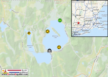
On Sunday, September 7, 2025, the NW CT group from this site met for our second day trip. It was on Twin Lakes in the the northwest corner of Connecticut, which are connected by a double-bridged channel and then drain down Schenob Brook.
The paddlers were: Alex (@Tsuga8) in his new-to-him Wenonah Advantage; Scott (@ScottS) and his tandem partner Martha, sporting a brand new (since the previous Sunday trip) 17' Swift Keewaydin in green Kevlar Fusion with carbon gunwales; and me in my Swift Keewaydin 15 in Carbon Fusion. Alex tried out three of the bent shaft paddles I had brought—a 48.5" ZRE bent, a 50" Sawyer Manta single bend, and a 50" Mitchell Leader double bend—plus my 57" ZRE straight. We also traded boats for 20 minutes, requiring some rocky shore gymnastics because of my aging legs.
At 10 am, ready to rock and roll, we arrived at the state boat launch, which is down a 1/4 mile dirt road.
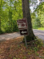
Unfortunately, there had been mini-tornadoes in the area the previous day, and what the . . . .
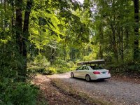
The dirt road to the free boat launch was completely blocked by two downed trees. Impassable by vehicle and not clearable by us.
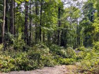
So, we decided to go half a mile down the road to O'Hara's Landing, which is a marina with a boat ramp and restaurant. Martha negotiated the $20 per boat launch fee down to $40 total for all three canoes. We launched into East Lake.
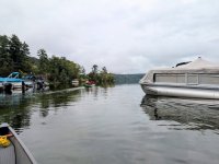
The clouds were low and gray and the water was calm, sometimes glass.
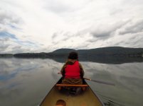
To the left of Martha's head in the above photo is an island, Isola Bella. Since 1964, Isola Bella has been a summer camp for deaf children. It contains the famous Alvord's Tower, which was built in 1912 after the style of stone towers on Italian islands.
But first we explore the shallow north cove of East Lake, which has very clear water and a vegetated surface and bottom (perhaps hydrilla?)
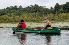
Paddling along the shore of Isola Bella we pass the boathouse of the camp.
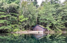
We round the tip of the island and in the distance espy the tower.
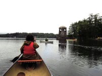
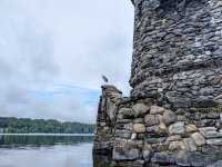
I paddle in front of the tower not noticing something perched on a parapet above me.
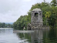
Finally noticing the perched heron, I paddle closer to the tower to get a picture of it.
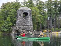
Alex takes a picture of me taking a picture of the heron.
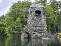
My picture of it.
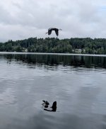
And then it flies away, wrinkly reflecting in the calm water.
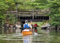
Paddling southward on East Lake we come to the first bridge over the channel that connects East Lake to West Lake. Martha ducks.
I paddle under the first bridge . . .
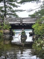
. . . and as I emerge, I present as a study in green and gray.
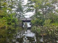
The connection channel between the two bridges and two lakes is very marshy and intimate.
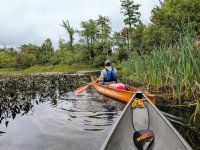
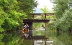
Alex and I transit the second bridge and emerge into West Lake, which is smaller, shallower and more wildernessy than East Lake.
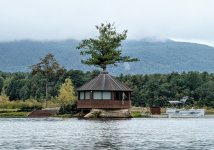
There are a few very interesting and expensive buildings on West Lake. Here is a gazebo-like building, sporting a hanging skeleton, which sits at the end of an old railroad spur, which was built before the Revolutionary War. The railroad, which operated from the early 1700s to the 20th century carried the famous "Salisbury iron ore," which was mined from the hills around Twin Lakes.
I decide to take a five minute break by a mansion's dock, and Alex (a poler) decides to get a better vantage from his Advantage.
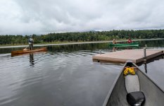
We approach the northwest corner of West Lake, which squeezes down into a narrow channel between two small spits of land.
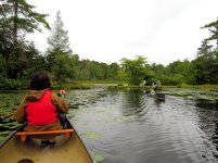
We are now in Schenob Brook, the downstream drainage basin of which is described as follows: "The largest continuous calcareous seepage swamp and the finest examples of calcareous fens in southern New England are located here."
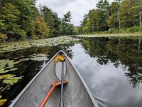
The water was so glass in the brook channel that, other than the presence of my hull, it was hard to tell up from down. Lov-er-ly!
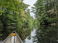
Except for the very occasional intrusions of strangely mechanized civilization. What's THAT?
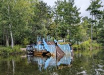
It's a "weed eating" machine of some sort to chomp up aquatic vegetation. We saw two of these contraptions.
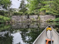
Schenob Brook finally terminates (at least for us) in an old stone dam by a road.
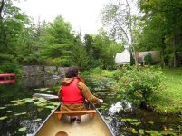
The dam has manual gates, which are checked every day and opened if necessary by a gentleman who also works at O'Hara's and who took the gastronomic picture of three of us at the end of this report.
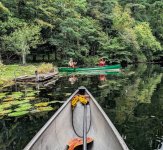
Turning around to paddle back up the brook, Scott and Martha stop to take pictures before they collect some errant, floating boat cushions and deposit them on the nearest dock.
Back on West Lake, we pass a stone guest house with stunning architecture. A man on shore there tells us about the railroad and iron ore and highly recommends the pancakes at O'Hara's restaurant.
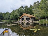
Just after that, Alex and I switch boats. He's never paddled a Swift Keewaydin 15 and I've never paddled an Advantage. That's why he's in my canoe as we paddle back under the bridge back into East Lake.
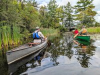
I'm too unfamiliar and uncomfortable (mainly psychologically) in the 22"-wide gunwales of the Advantage to make the deep water crossing of East Lake back to O'Hara's, so Alex and I do our balance beam act on wet rocks again to switch back to our own canoes.
And we take off across the middle of the lake, still relatively calm as the clouds are lifting and sun peeking out.
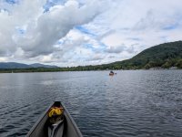
It's so calm, in fact, that I can't help but notice the becalmed sailboat limned against the background of the southern Berkshire Mountains.
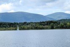
Sated by an unexpectedly lovely and interesting trip, we arrive back at O'Hara's.
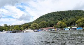
The trip was nine miles, which took us 3 hours and 40 minutes at an average pace of 2.5 mph (4 kph).
Alex had to hustle home, but the other three roques were not so sated that they would pass up a late lunch on the porch of O'Hara's restaurant.
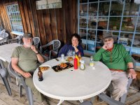
But it was too late for pancakes.
Maybe next time.

The paddlers were: Alex (@Tsuga8) in his new-to-him Wenonah Advantage; Scott (@ScottS) and his tandem partner Martha, sporting a brand new (since the previous Sunday trip) 17' Swift Keewaydin in green Kevlar Fusion with carbon gunwales; and me in my Swift Keewaydin 15 in Carbon Fusion. Alex tried out three of the bent shaft paddles I had brought—a 48.5" ZRE bent, a 50" Sawyer Manta single bend, and a 50" Mitchell Leader double bend—plus my 57" ZRE straight. We also traded boats for 20 minutes, requiring some rocky shore gymnastics because of my aging legs.
At 10 am, ready to rock and roll, we arrived at the state boat launch, which is down a 1/4 mile dirt road.

Unfortunately, there had been mini-tornadoes in the area the previous day, and what the . . . .

The dirt road to the free boat launch was completely blocked by two downed trees. Impassable by vehicle and not clearable by us.

So, we decided to go half a mile down the road to O'Hara's Landing, which is a marina with a boat ramp and restaurant. Martha negotiated the $20 per boat launch fee down to $40 total for all three canoes. We launched into East Lake.

The clouds were low and gray and the water was calm, sometimes glass.

To the left of Martha's head in the above photo is an island, Isola Bella. Since 1964, Isola Bella has been a summer camp for deaf children. It contains the famous Alvord's Tower, which was built in 1912 after the style of stone towers on Italian islands.
But first we explore the shallow north cove of East Lake, which has very clear water and a vegetated surface and bottom (perhaps hydrilla?)

Paddling along the shore of Isola Bella we pass the boathouse of the camp.

We round the tip of the island and in the distance espy the tower.

I paddle in front of the tower not noticing something perched on a parapet above me.

Finally noticing the perched heron, I paddle closer to the tower to get a picture of it.

Alex takes a picture of me taking a picture of the heron.

My picture of it.

And then it flies away, wrinkly reflecting in the calm water.

Paddling southward on East Lake we come to the first bridge over the channel that connects East Lake to West Lake. Martha ducks.

I paddle under the first bridge . . .

. . . and as I emerge, I present as a study in green and gray.

The connection channel between the two bridges and two lakes is very marshy and intimate.

Alex and I transit the second bridge and emerge into West Lake, which is smaller, shallower and more wildernessy than East Lake.

There are a few very interesting and expensive buildings on West Lake. Here is a gazebo-like building, sporting a hanging skeleton, which sits at the end of an old railroad spur, which was built before the Revolutionary War. The railroad, which operated from the early 1700s to the 20th century carried the famous "Salisbury iron ore," which was mined from the hills around Twin Lakes.

I decide to take a five minute break by a mansion's dock, and Alex (a poler) decides to get a better vantage from his Advantage.

We approach the northwest corner of West Lake, which squeezes down into a narrow channel between two small spits of land.

We are now in Schenob Brook, the downstream drainage basin of which is described as follows: "The largest continuous calcareous seepage swamp and the finest examples of calcareous fens in southern New England are located here."

The water was so glass in the brook channel that, other than the presence of my hull, it was hard to tell up from down. Lov-er-ly!

Except for the very occasional intrusions of strangely mechanized civilization. What's THAT?

It's a "weed eating" machine of some sort to chomp up aquatic vegetation. We saw two of these contraptions.
Schenob Brook finally terminates (at least for us) in an old stone dam by a road.

The dam has manual gates, which are checked every day and opened if necessary by a gentleman who also works at O'Hara's and who took the gastronomic picture of three of us at the end of this report.

Turning around to paddle back up the brook, Scott and Martha stop to take pictures before they collect some errant, floating boat cushions and deposit them on the nearest dock.

Back on West Lake, we pass a stone guest house with stunning architecture. A man on shore there tells us about the railroad and iron ore and highly recommends the pancakes at O'Hara's restaurant.

Just after that, Alex and I switch boats. He's never paddled a Swift Keewaydin 15 and I've never paddled an Advantage. That's why he's in my canoe as we paddle back under the bridge back into East Lake.

I'm too unfamiliar and uncomfortable (mainly psychologically) in the 22"-wide gunwales of the Advantage to make the deep water crossing of East Lake back to O'Hara's, so Alex and I do our balance beam act on wet rocks again to switch back to our own canoes.
And we take off across the middle of the lake, still relatively calm as the clouds are lifting and sun peeking out.

It's so calm, in fact, that I can't help but notice the becalmed sailboat limned against the background of the southern Berkshire Mountains.

Sated by an unexpectedly lovely and interesting trip, we arrive back at O'Hara's.

The trip was nine miles, which took us 3 hours and 40 minutes at an average pace of 2.5 mph (4 kph).
Alex had to hustle home, but the other three roques were not so sated that they would pass up a late lunch on the porch of O'Hara's restaurant.

But it was too late for pancakes.
Maybe next time.
