• Happy Scream Day! 😱

Anderson River, Northwest Territories, 1999

Joined
Aug 21, 2018
Messages
1,681
Reaction score
1,781
Location
Preeceville, Saskatchewan Canada
39833683313_22da6dcc5a_b.jpg


This trip report is a continuation of a previous and recent trip report, "Our Winter of Content in Canada's Western Arctic," which is listed in "Winter Camping" on this site. In case you have not read that report, I would like to give a brief summary for context.

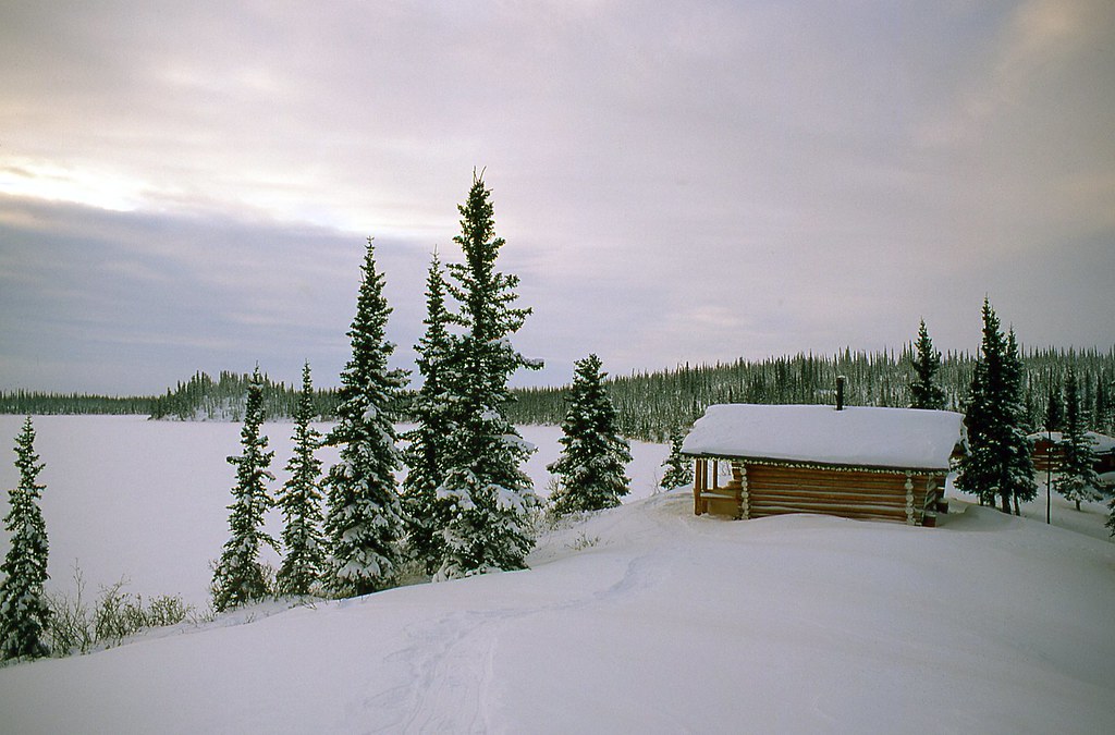
Kathleen and I began our Anderson River trip hunkered down on the frozen shores of Colville Lake, 100 km (62 miles) north of the Arctic Circle. We had arrived by Twin Otter on January 31, flying out of Inuvik, Northwest Territories, at -40 C. We unloaded our gear and supplies onto the metre-thick ice just 100 m from the one-room cabin that would be our home until the ice went out of the lake in mid-June.

(Note: -40° C exactly equals -40° F. How beautiful is that? You should also note that I ofter refer to metres in this TR, as Canada is metric. I referred to m above. If you prefer Imperial units, just substitute yards for metres. A metre is just a little more than three inches longer than a yard. For example, when I say that a saw a grizzly approaching from 250 m upstream, I didn't actually measure the distance. Two hundred and fifty yards might have been more accurate than 250 m anyway.)


39833942593_fbc435ff7d_b.jpg

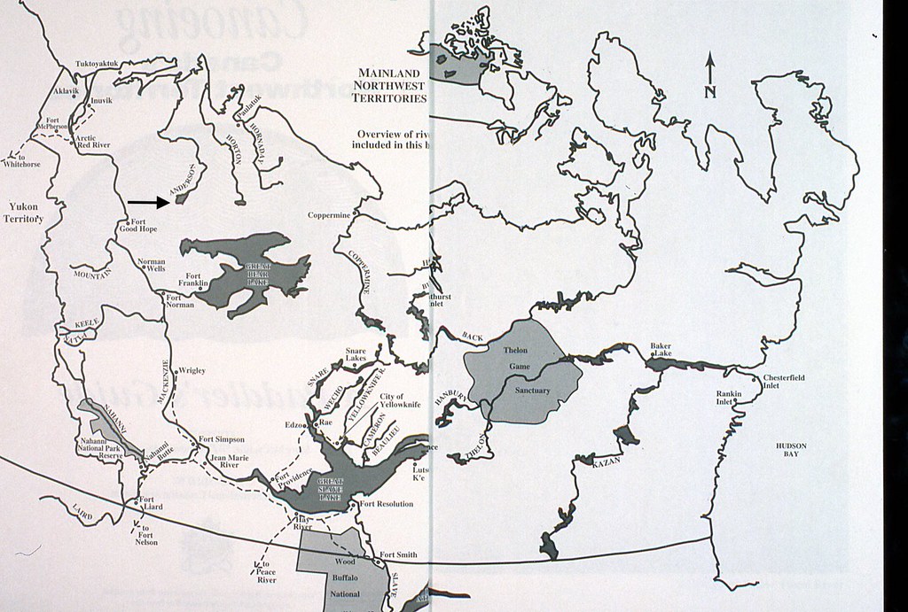
Diagram from Mary McCreadie's book, Canoeing Canada's Northwest Territories.


We had come to escape the crush of urban noise, concrete, and congestion. The nearest community of Colville Lake, with a population of only 90 people, lay 40 roadless km (25 miles) to the south. Otherwise, Kathleen and I were the only inhabitants in a 200-km (120 miles)-wide swath stretching 500 km (300 miles) north to the Arctic Ocean. This immense, silent world was ours alone to enjoy. We spent the next five, glorious months reading, sipping tea by the wood stove, snowshoeing, and revelling in the beauty of the unbounded boreal forest. We also looked forward to being the first people to paddle down the Anderson River that year (Note arrow in upper left).

32923267998_1dfb651fa8_b.jpg


For the first 2 ½ months we saw only 7 people and only for a few hours.


32923267198_d19defaea5_b.jpg


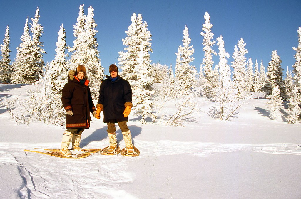
The world was ours and we spent the days traveling on our snowshoes, sipping tea by the fire, just enjoying the solitude and beauty.


44672342190_7b01cb9ea4_b.jpg


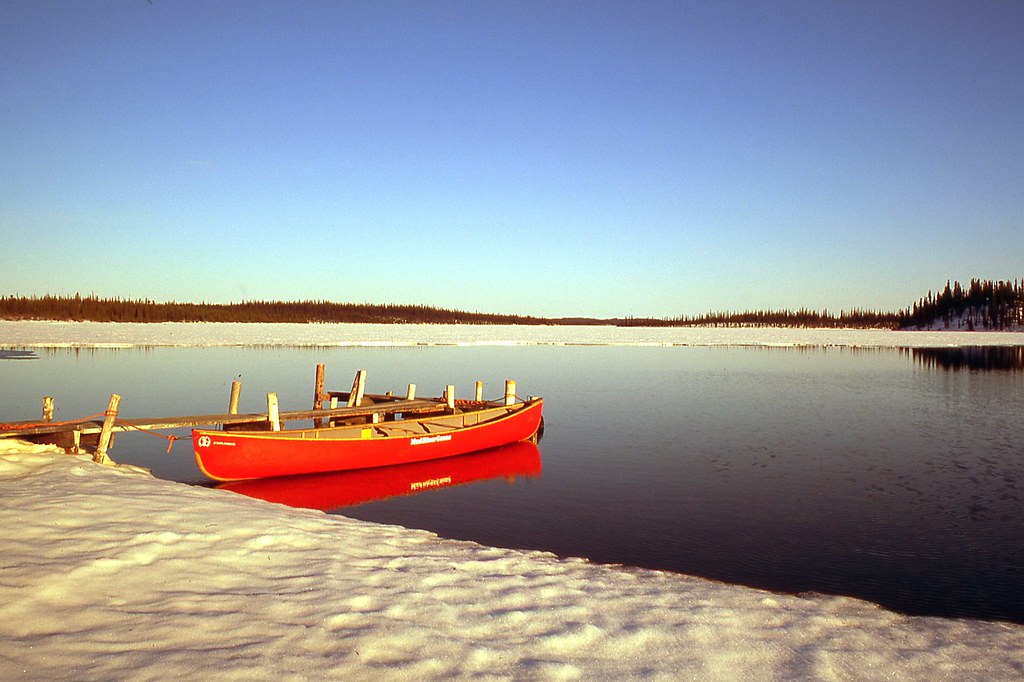
Nine p.m., May 9, plus 5 degrees C (41 F). Break-up is beginning to happen, and we paddle more and more each day.


46799099911_2a6b7a6287_b.jpg


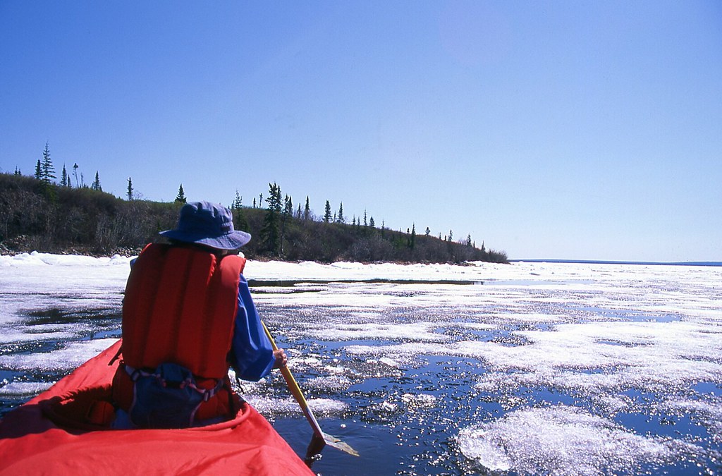
Eventually, as the sun’s warmth returned, and he snowpack began to shrink. On June 11, we paddled to town through shifting pack ice to make final arrangements for shipping our winter gear back to Inuvik.


46074103824_b93df8b391_b.jpg


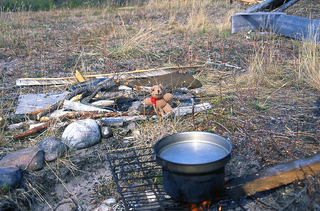
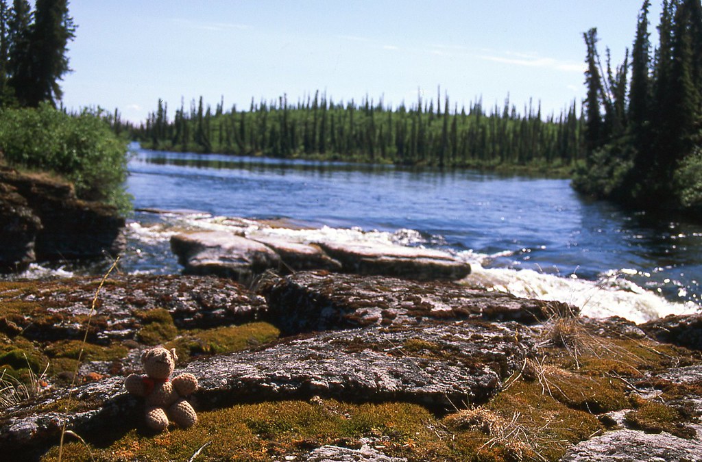
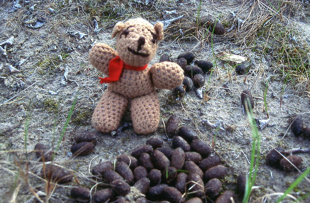
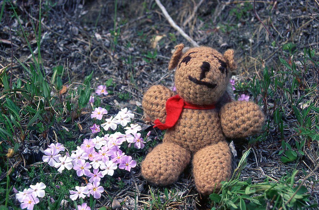
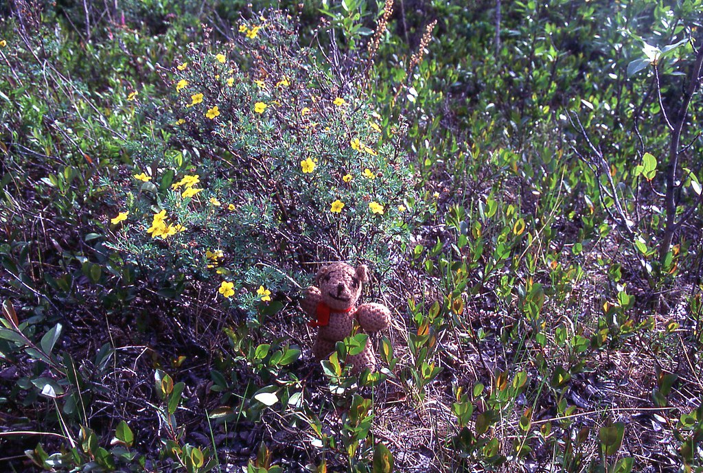
We stopped to camp at 1:00 am the first night heading to town. Now maybe it was the cold of the winter. Or maybe it was our isolation from other people. But after a few months at the cabin, Kathleen’s crocheted bear, Beency, taken as a reminder of home, began to join in on our conversations. He was pleasant to have around, and was always joking. Whenever it was minus 40 he would remind us that it was his idea to have gone to Bermuda for the winter.


46799099411_929233abf4_b.jpg


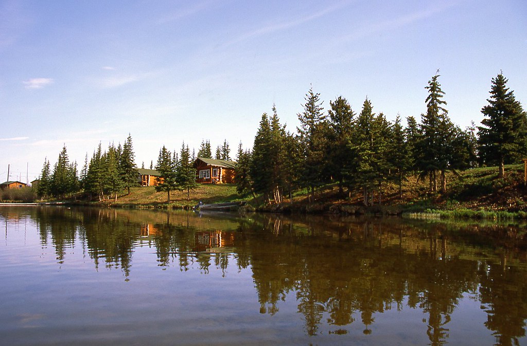
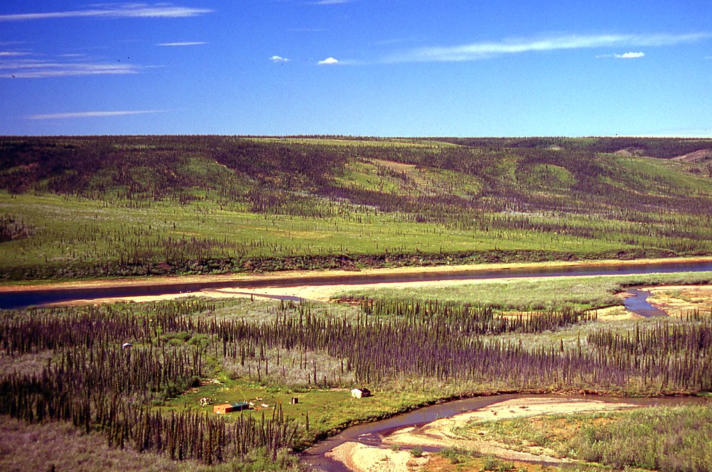
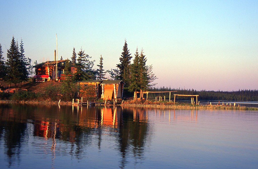
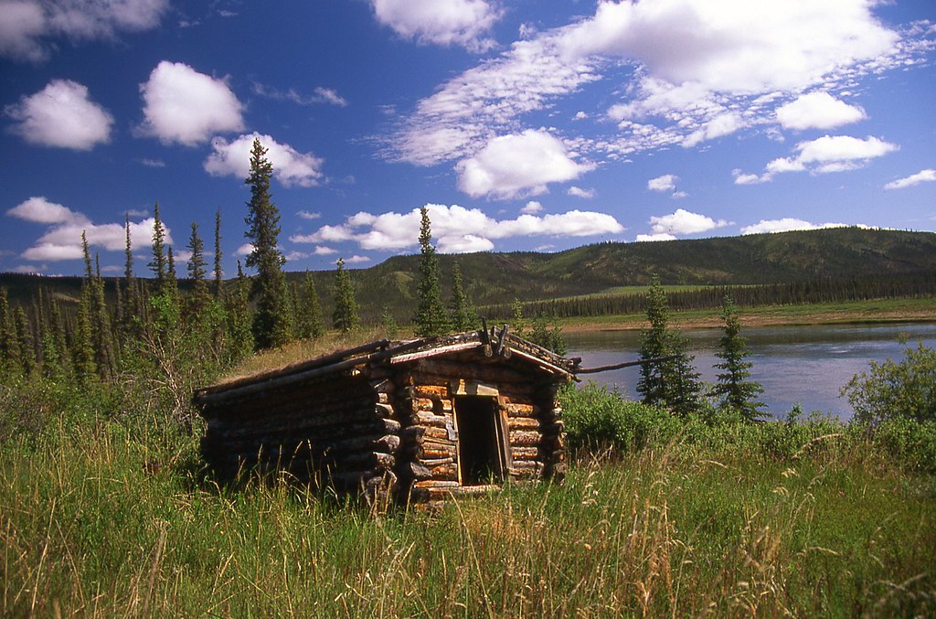
The town of Colville Lake was built entirely of logs from the surrounding area. Colville Lake is populated primarily by Hareskin Indians. Approximately 90 people lived in town. Flying into Colville Lake is most people’s first stop to canoeing the Anderson River.


46758065441_ca610a8e94_b.jpg


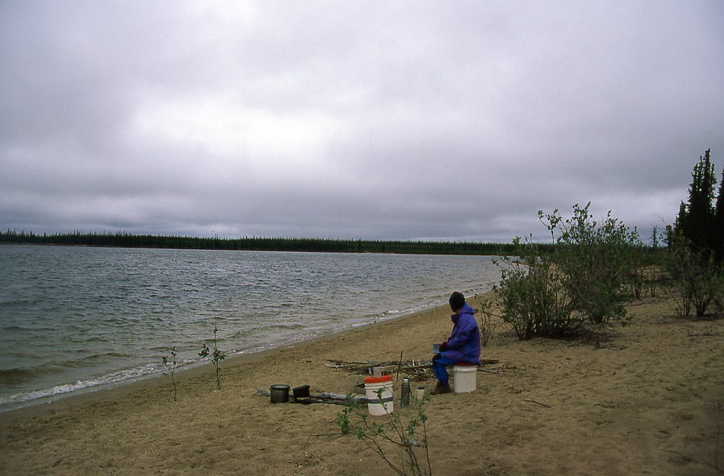
After completing our business in town, we paddled back to our cabin on June 16. About half way back we found a great camping spot. You might keep this in mind if you ever paddle down the Anderson River. We stopped for dinner in the 30-degree (86 F) heat of the afternoon sun. There is no sign of the ice that clogged this route only 5 days ago. Summer has arrived instantly.


46799098431_1a71227f6c_b.jpg


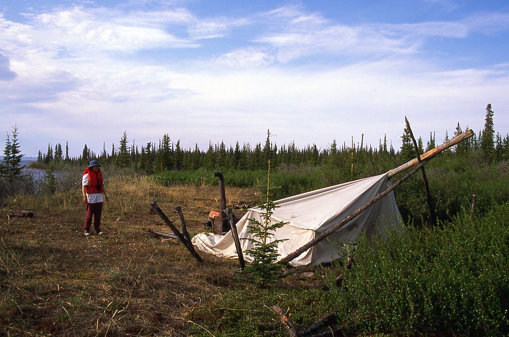
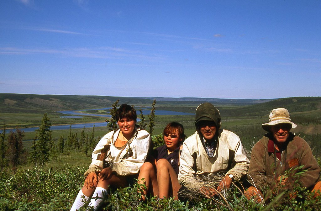
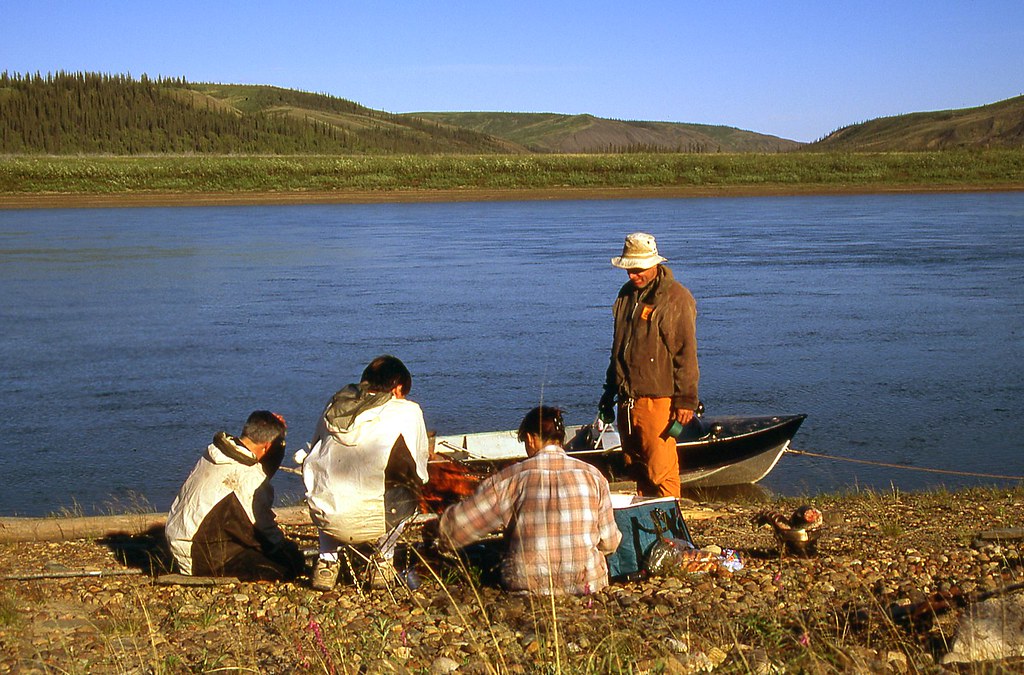
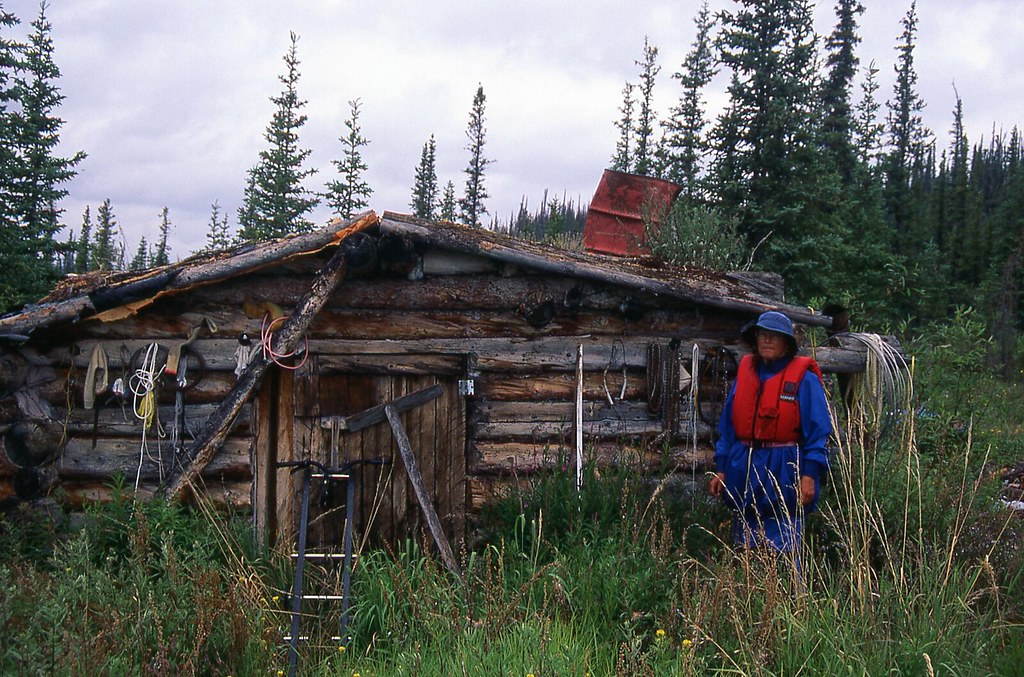
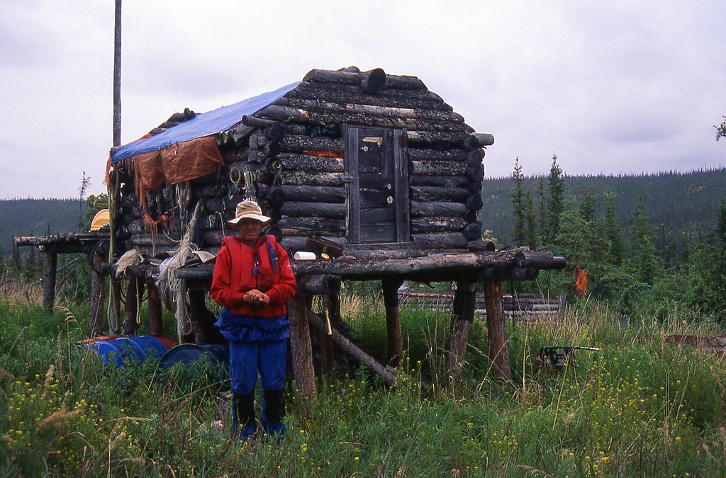
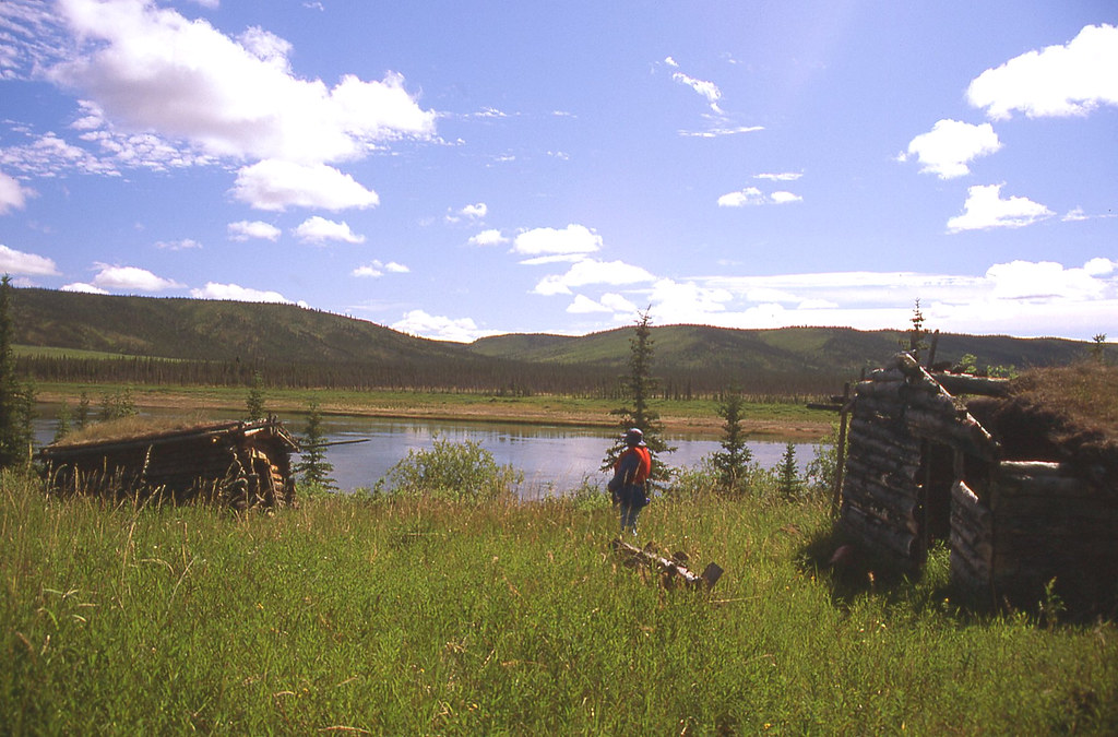
Near the north end of Colville Lake, we encountered a summer camp that had just been established by the Hareskin Indians, many of whom still followed a traditional lifestyle. During the past month, we had met many Colville Lake residents during their spring hunts for ducks and geese.

46074102574_93d75c4bb0_b.jpg


On June 19, at about 11:00 p.m., Richard and Charlie Kochon stopped by our cabin, in their powerboat, on their way to Legetentue Lake, about 35 km downriver. They intended to scout the area for moose, and do a little hunting.

“Would you like some tea?”

“Yep.”

They asked if we still planned to leave tomorrow, and wondered where we intended to camp. I spread out the topographic maps and pointed out the places on our intended itinerary, including our first camp in the “narrows” at Ketaniatue Lake. In fact, “Ketaniatue” means “Narrows Lake” in the local language.

“That’s not a good place for camping,” Richard said. “Willows too dense and tall.”

Richard pointed to another spot, on a point about 4 km (2.5 miles) beyond the narrows. “This is the first good spot for camping. You should camp here.”

We drank a few more cups of tea, and said goodbye to Charlie and Richard just after midnight.

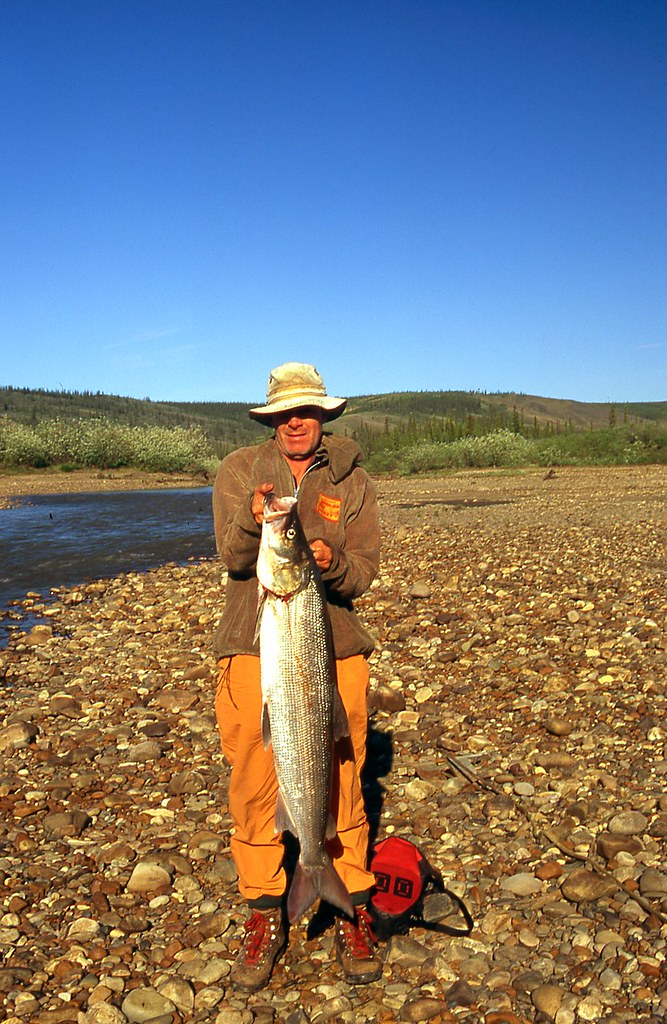
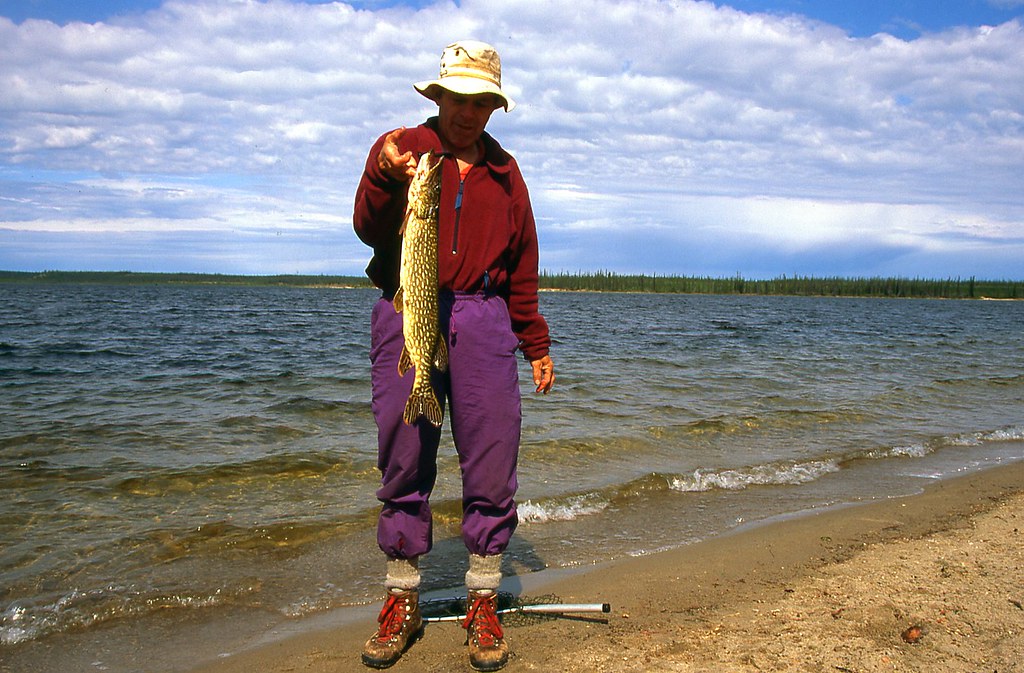
I stood alone and silently as their boat vanished into the golden glow of a buoyant sun that floated softly on the northern horizon. A Bald Eagle soared majestically above Colville Lake. A beaver swam confidently through the narrows of the outlet. A northern pike broke water aggressively in the shallow warmth off our north dock.


46758065881_4236611f30_b.jpg


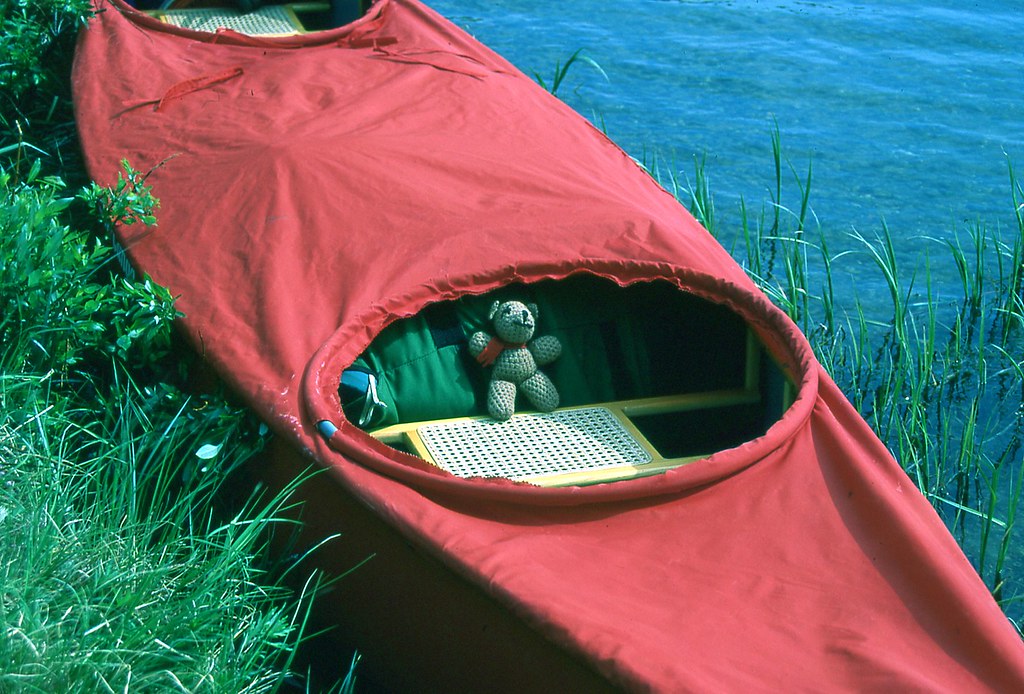
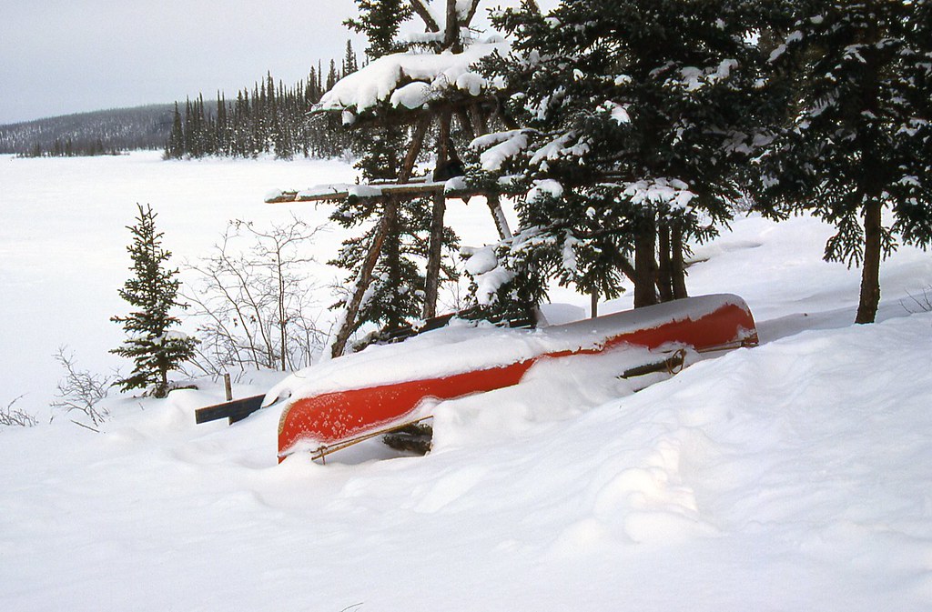
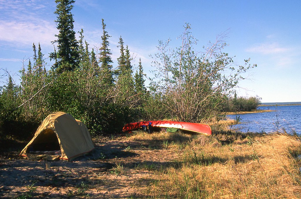
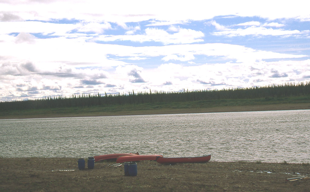
Late the next afternoon, we were finally packed, and ready to descend the river. Beency insists that he wants to go with us. We have enjoyed our winter at the cabin, and will miss our life here. We are also very eager to begin paddling.


46787989161_67a6ba8ddd_b.jpg

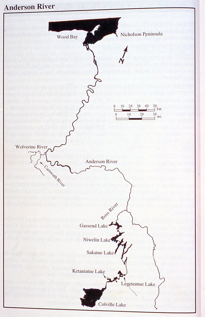
Diagram from Mary McCreadie's book Canoeing Canada's Northwest Territories.


We plan four weeks to paddle550 km (340 miles).


46074100584_0495b903c0_b.jpg


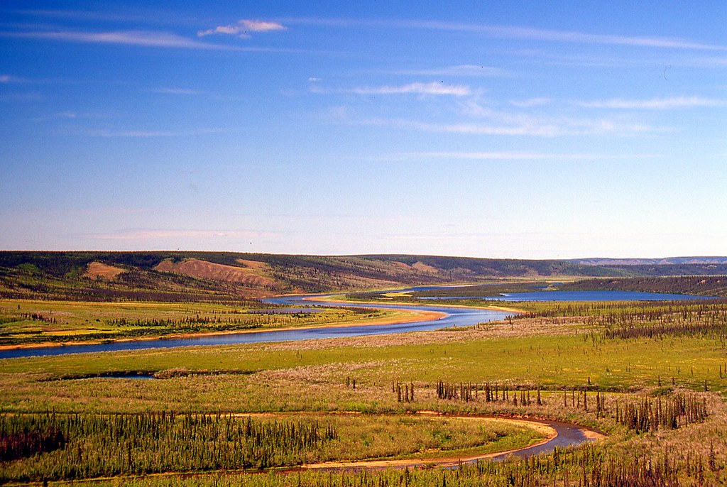
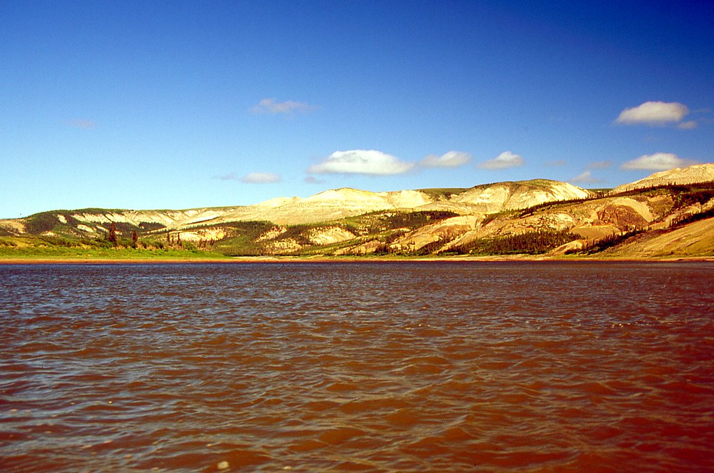
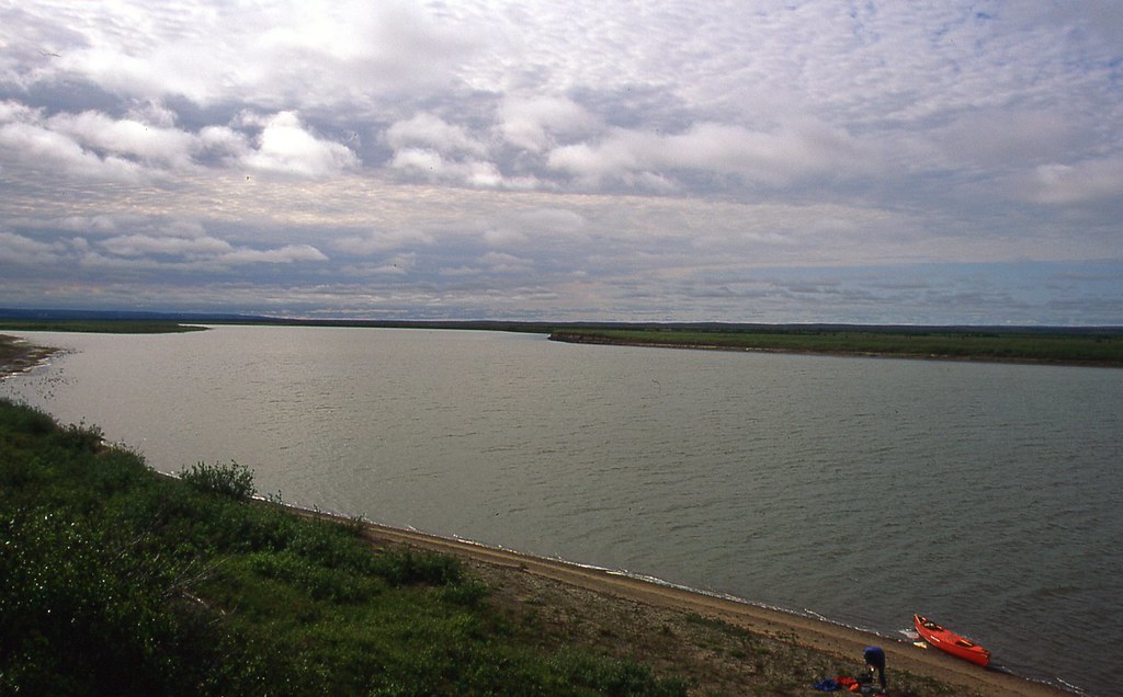
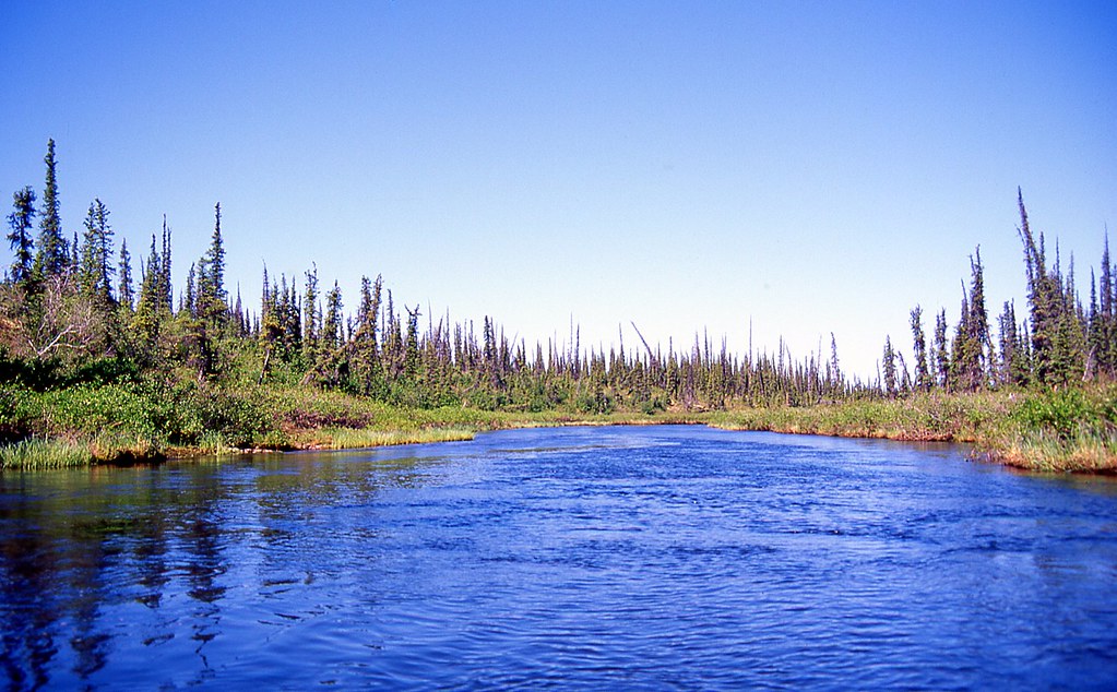
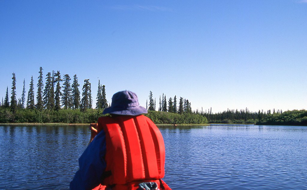
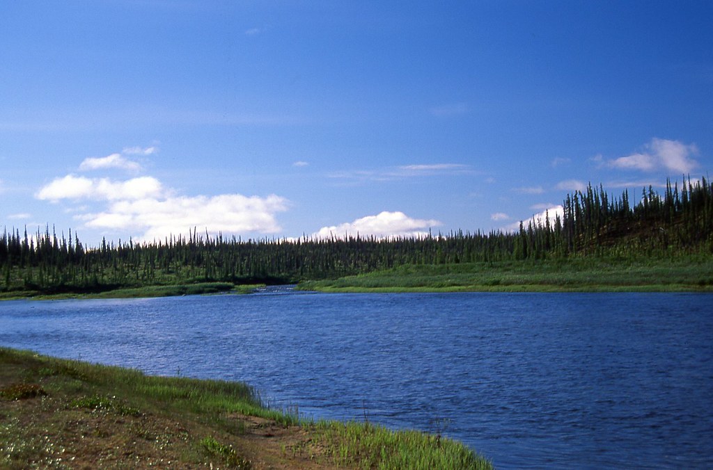
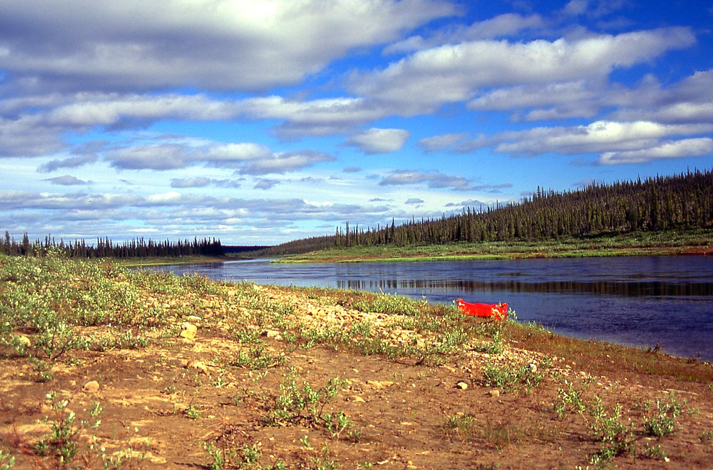
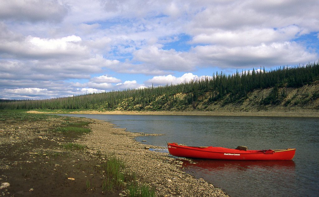
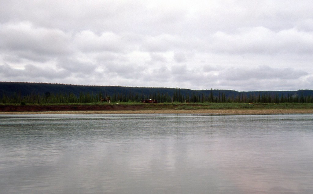
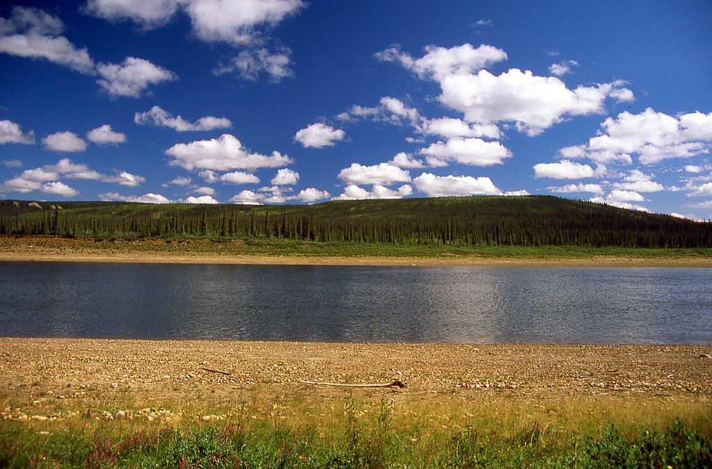
Change had been occurring all over the north, from the boreal forest, and beyond, out onto the tundra. During the first two weeks of June, blocks of ice and torrents of water had burst across the land. By the middle of June, the tumult and carnage of spring renewal had subsided. The grand rivers once again flowed stately between majestic banks. Like the seductive Siren of Greek mythology, the immortal Arctic summer called out to us. We could do nothing else than answer the sweet summons. Kathleen and I stepped into our canoe and paddled away from Colville Lake, down the Ross River towards its confluence with the Anderson River, which would take us north to the Arctic Ocean.

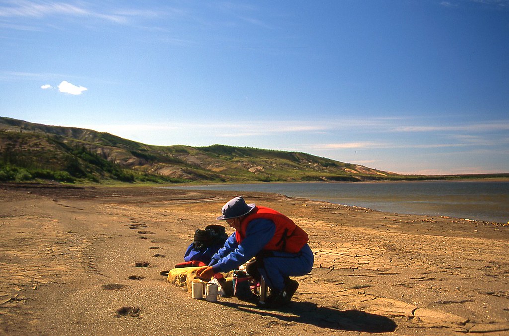
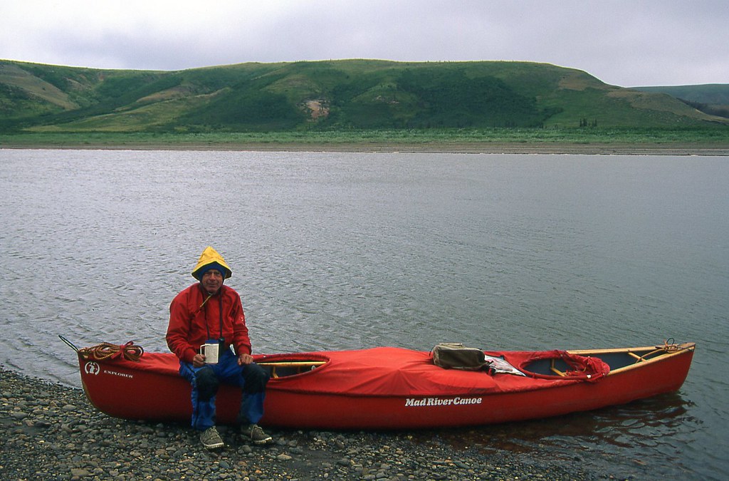
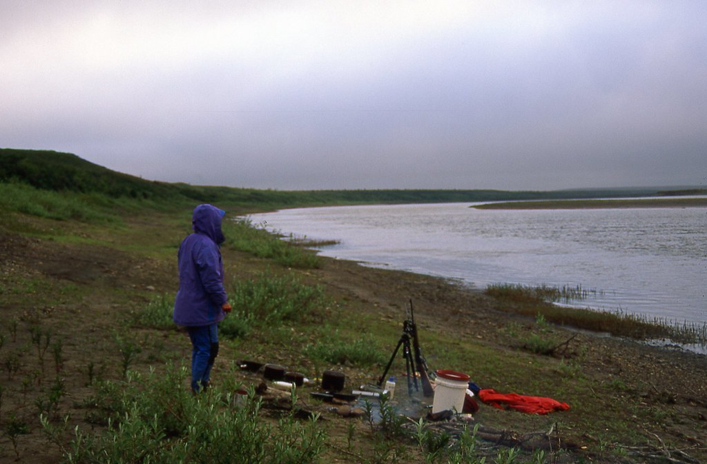
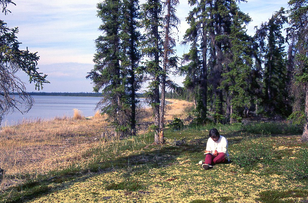
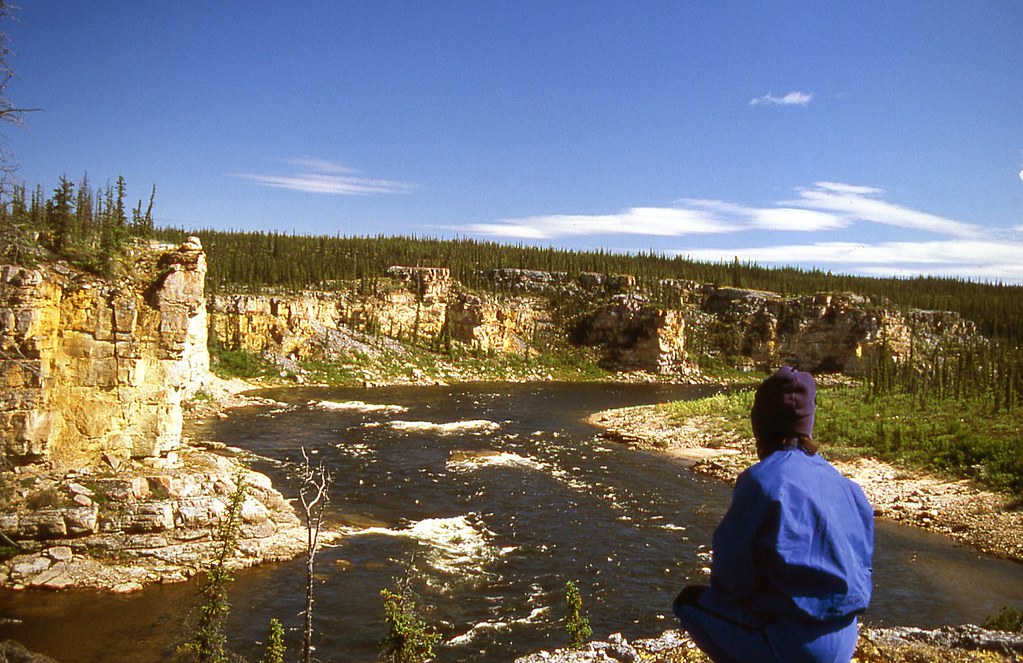
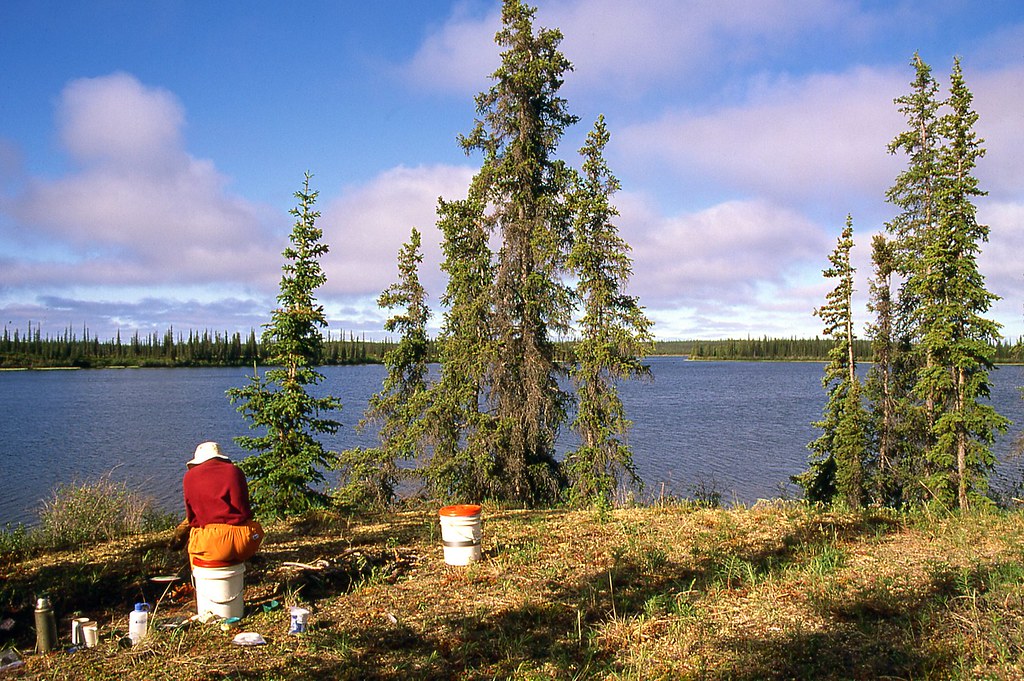
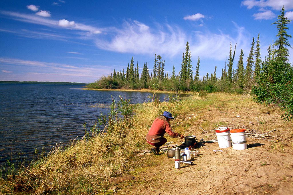
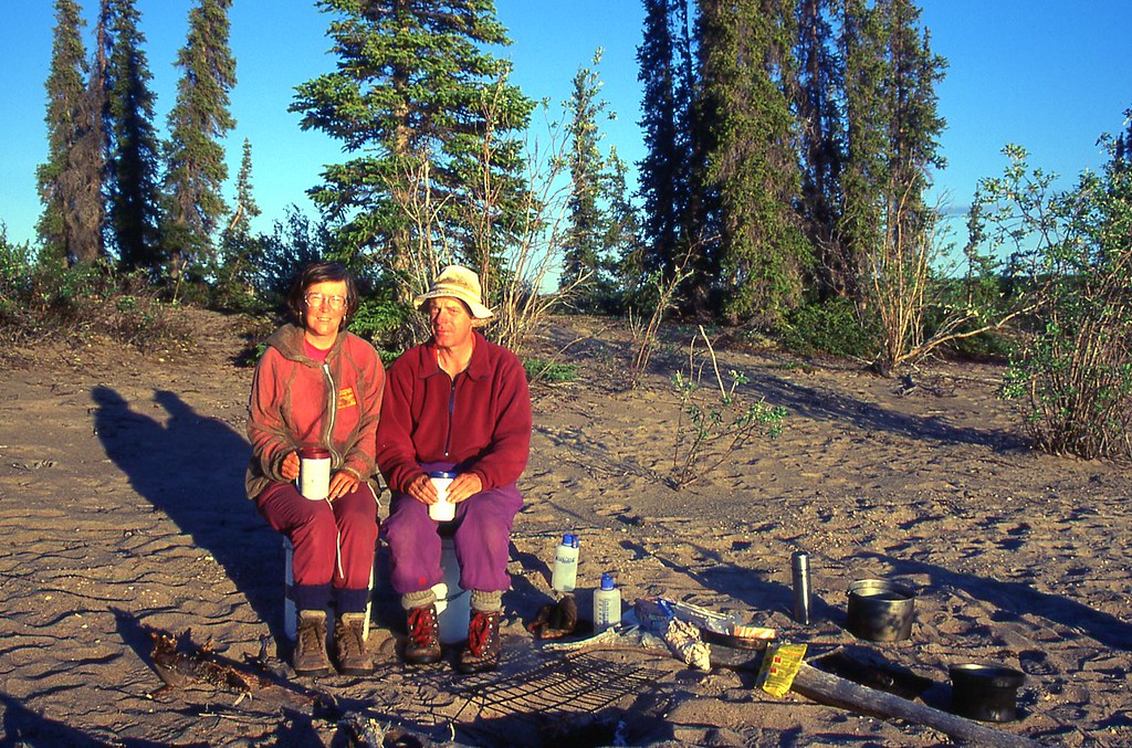
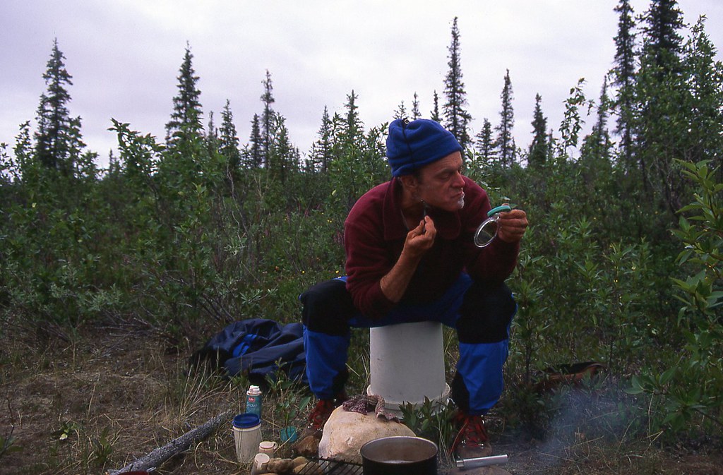
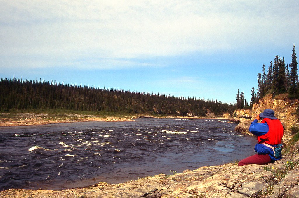
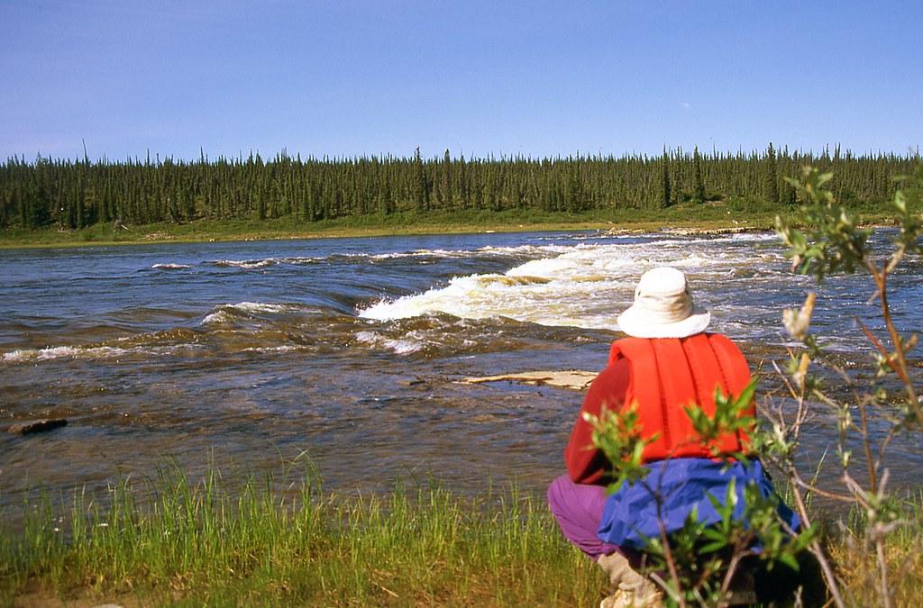
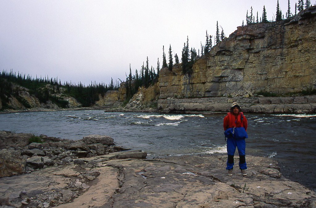
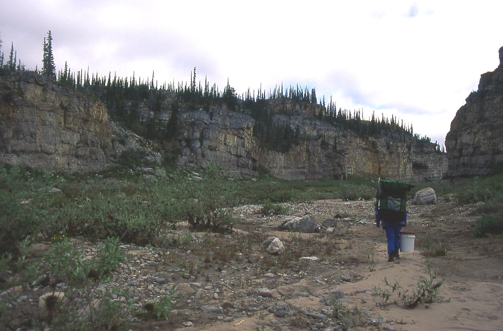
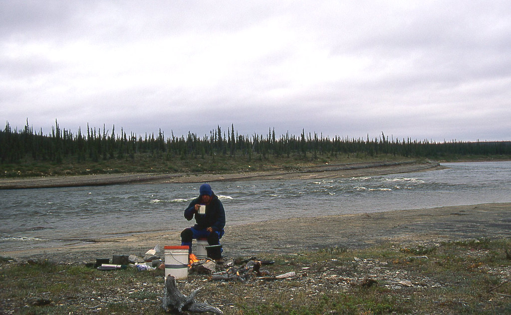
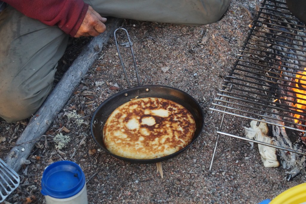
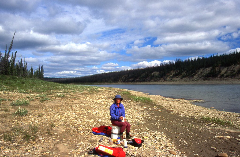
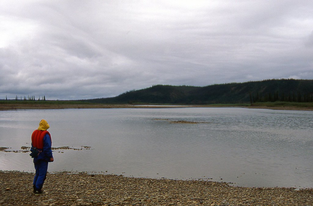
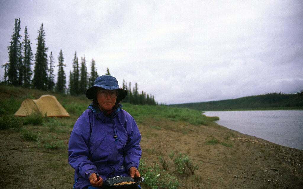
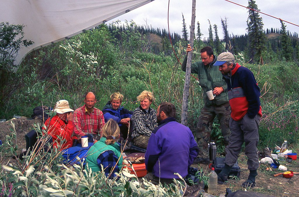
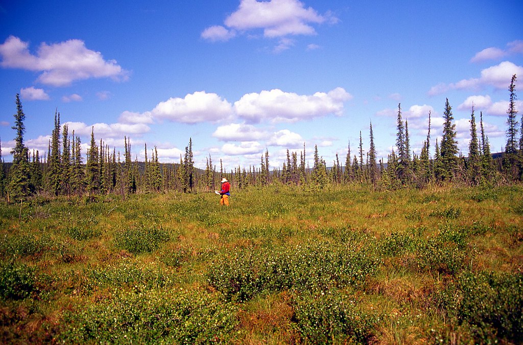
(Note: This is Kathleen at lunch, above the entry to Falcon Canyon. We are not actually there, yet. I just think the image goes nicely with the words above!)


46799094821_4516b6c3c3_b.jpg


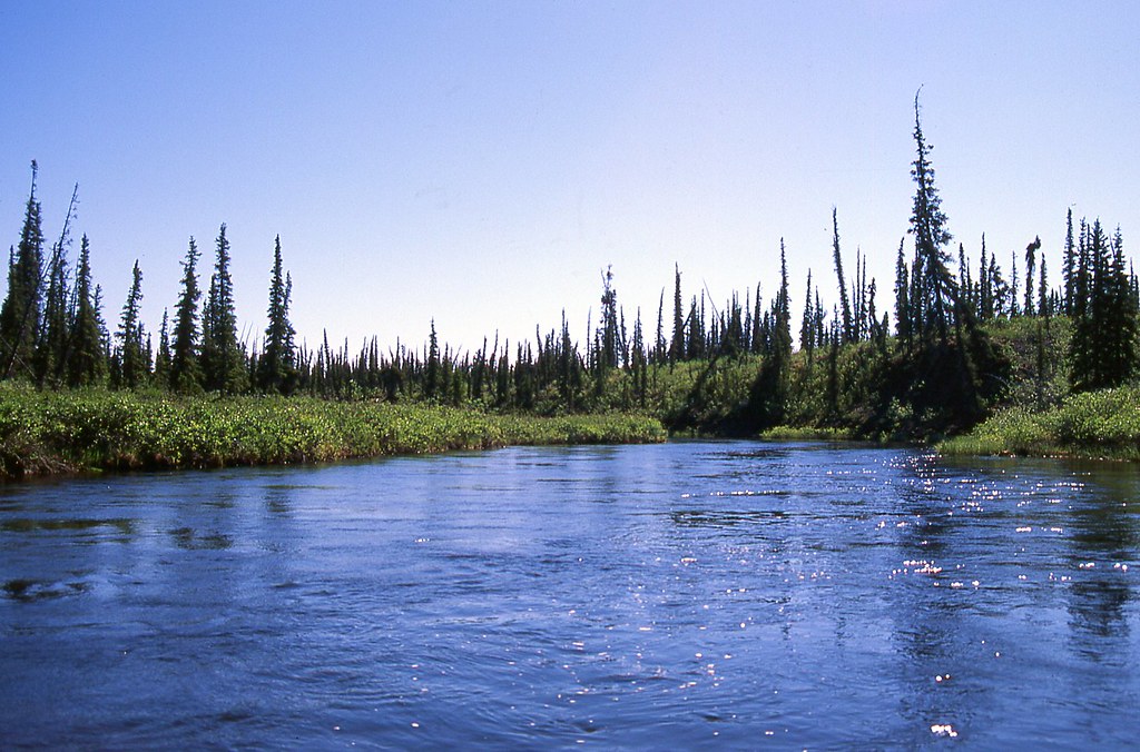
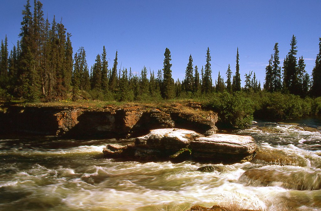
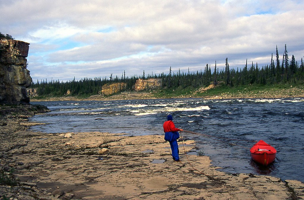
We soon reached swiftly flowing water with two shallow rapids.

“I think we should head right, to the outside bend, where the deep water is.”

“Me too. How far right?”

“All the way up against the bank.”

“Well done. Now let’s head back left.”

Not bad for our first moving water since last September. It was nice to warm up with some easy Class I.

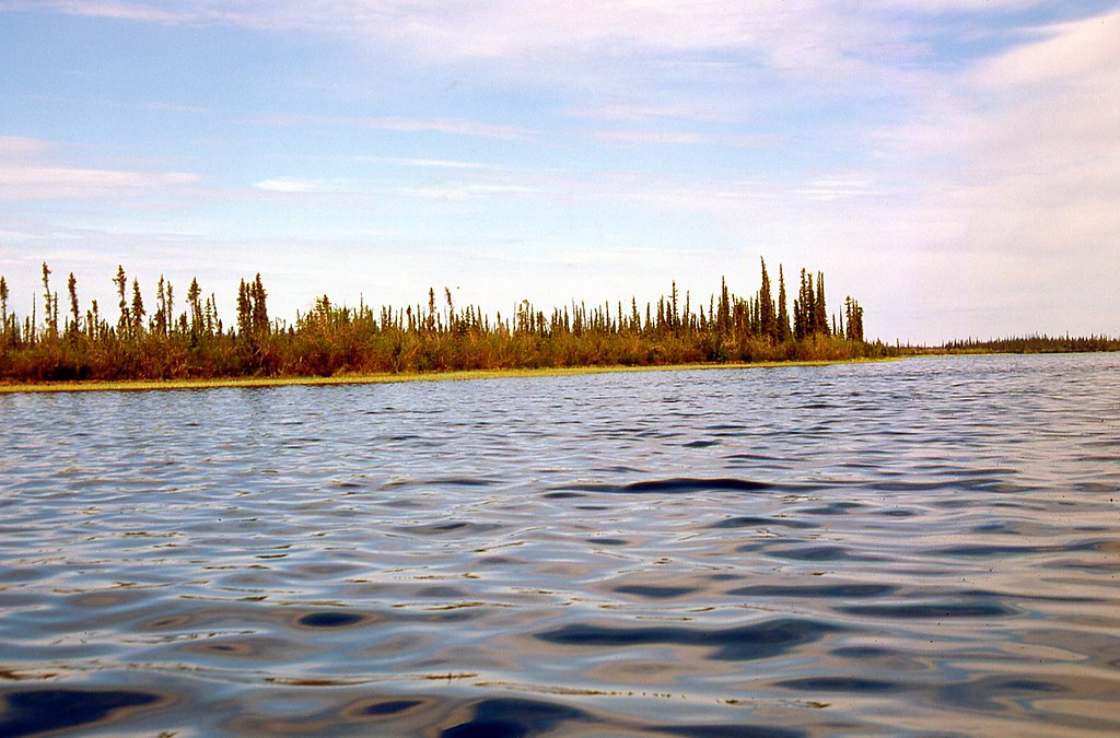
We rounded a point into Ketaniatue Lake, directly into the northeast wind, perfectly aligned with our route. Why do all northern canoe trips seem invariably to begin with a strong headwind? We paddled hard along the southeast shore, confirming Richard’s advice about the lack of camping. Willows grew thickly right from the water’s edge to the very top of the low ridge.

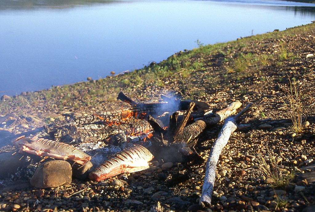
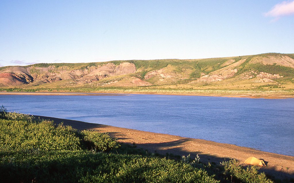
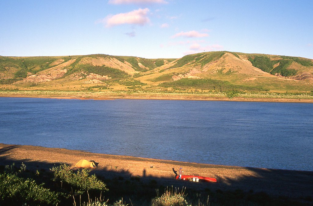
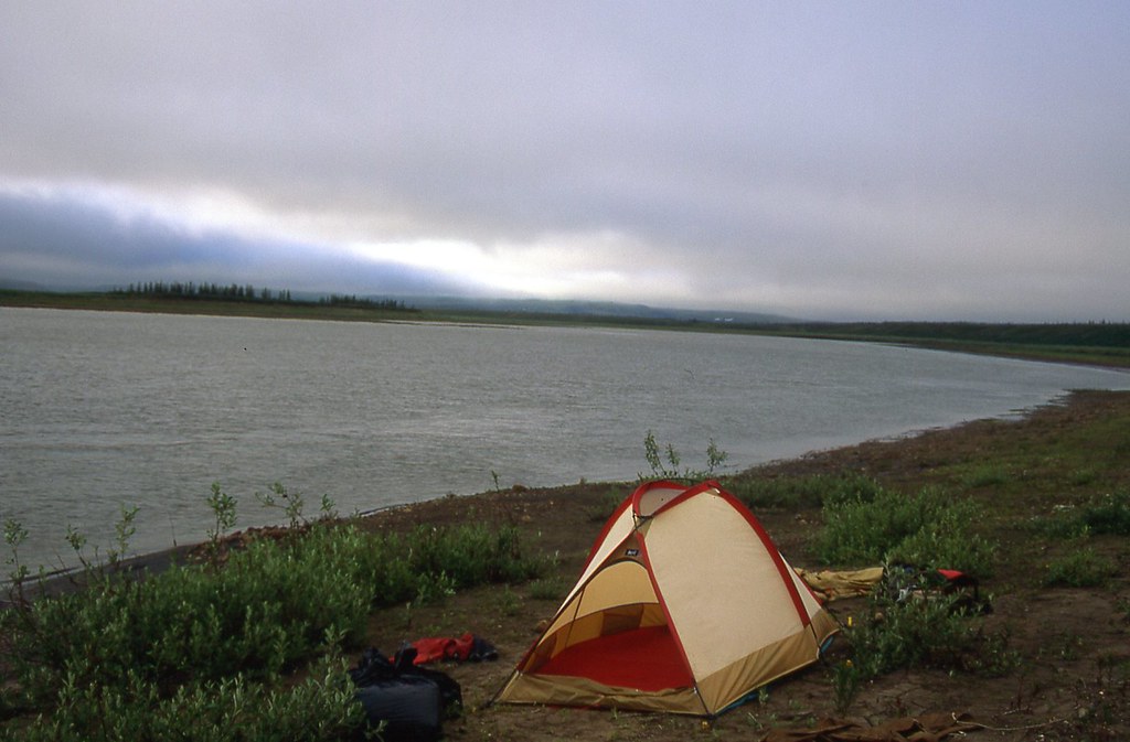
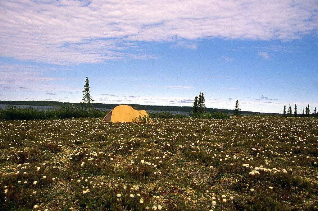
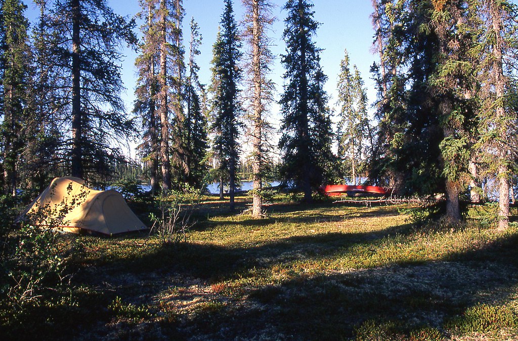
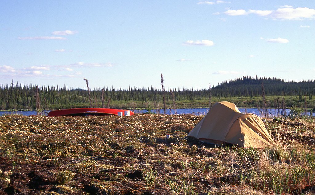
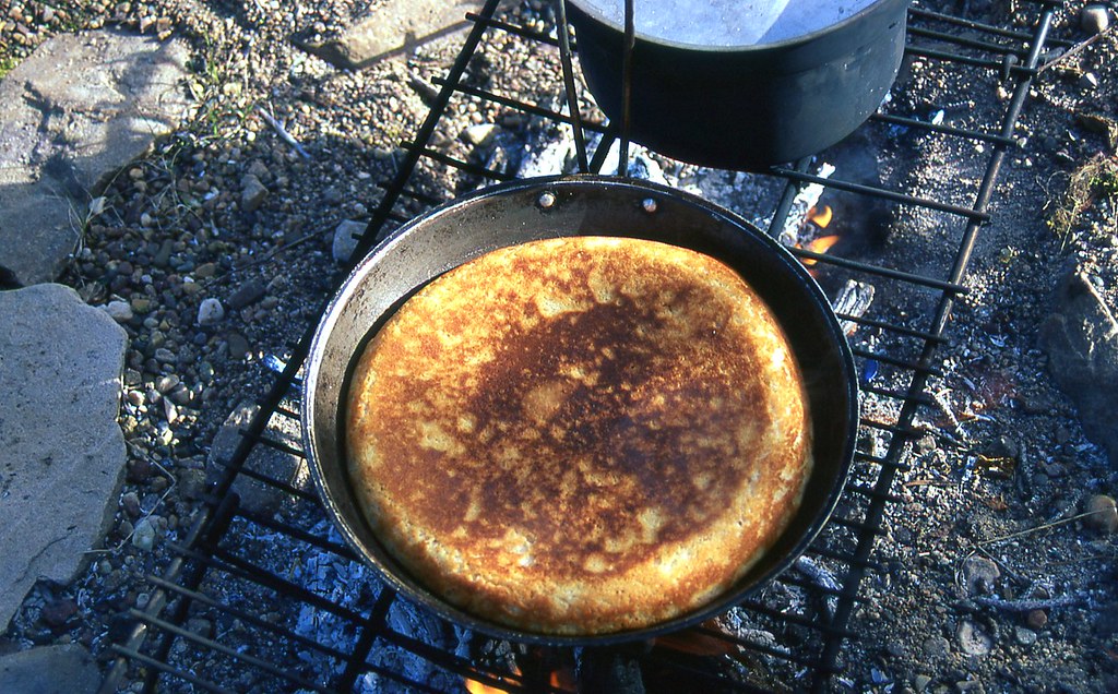
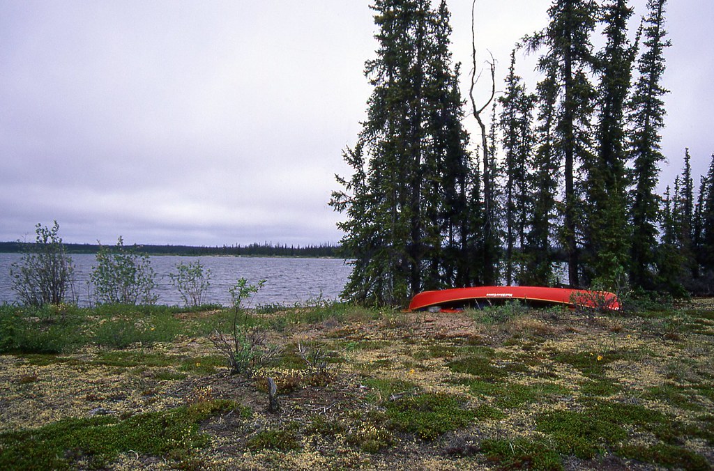
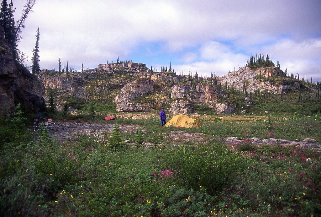
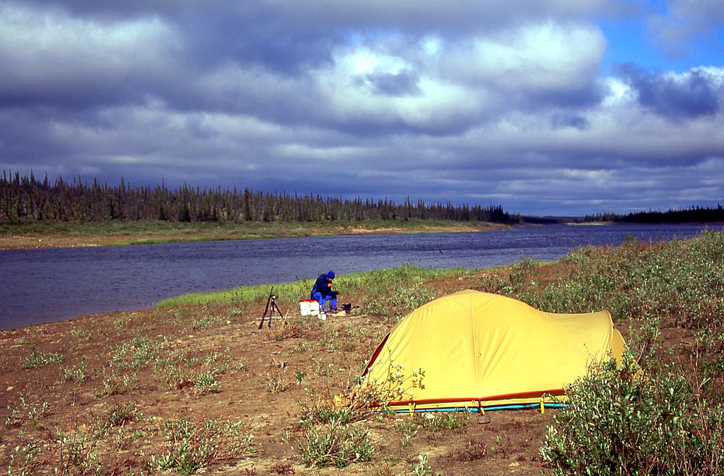
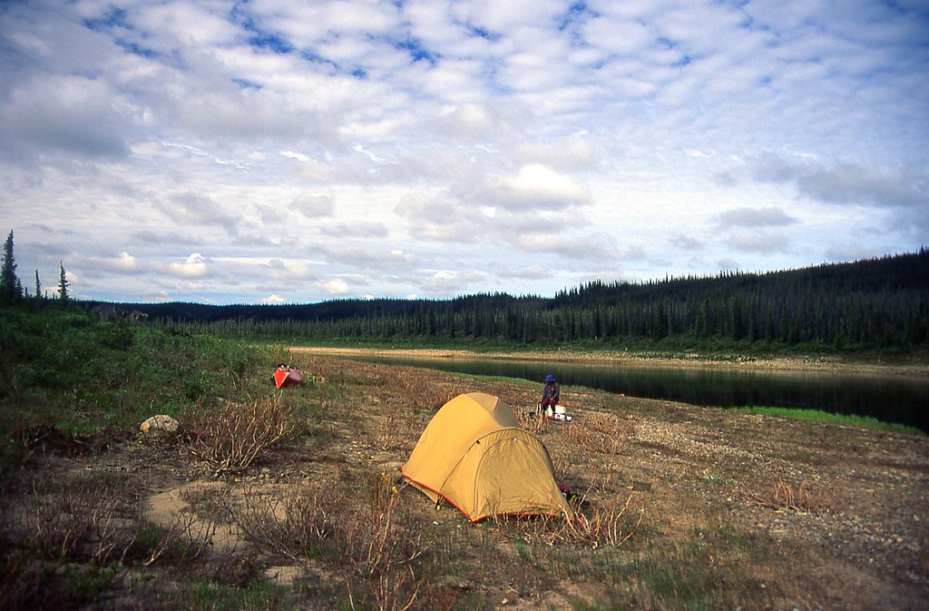
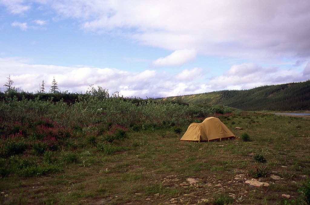
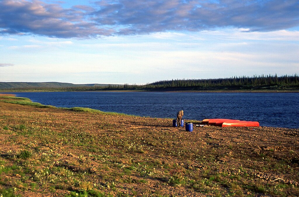
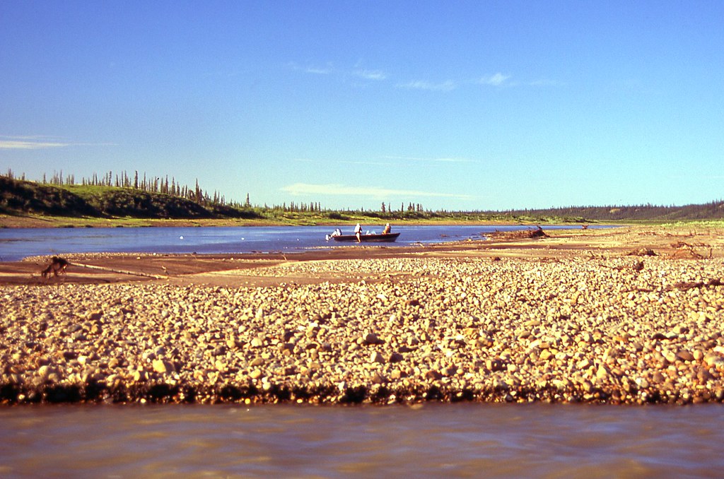
We drifted through the narrows, where a moose browsed nonchalantly, unaware of our downwind approach. Nearly 4 km (2.5 miles) later, on the first point of a horseshoe bay, we finally found a good camping spot, just where Richard said it would be. We dragged our gear up onto a peaty, tundra ridge. The continuing wind had now become our ally, as it kept all the bugs grounded. We gathered a few sticks of willow and birch for firewood to boil tea water, and to cook our pasta supper.

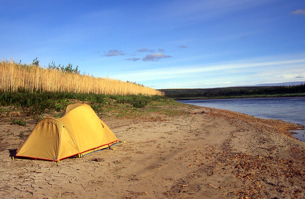
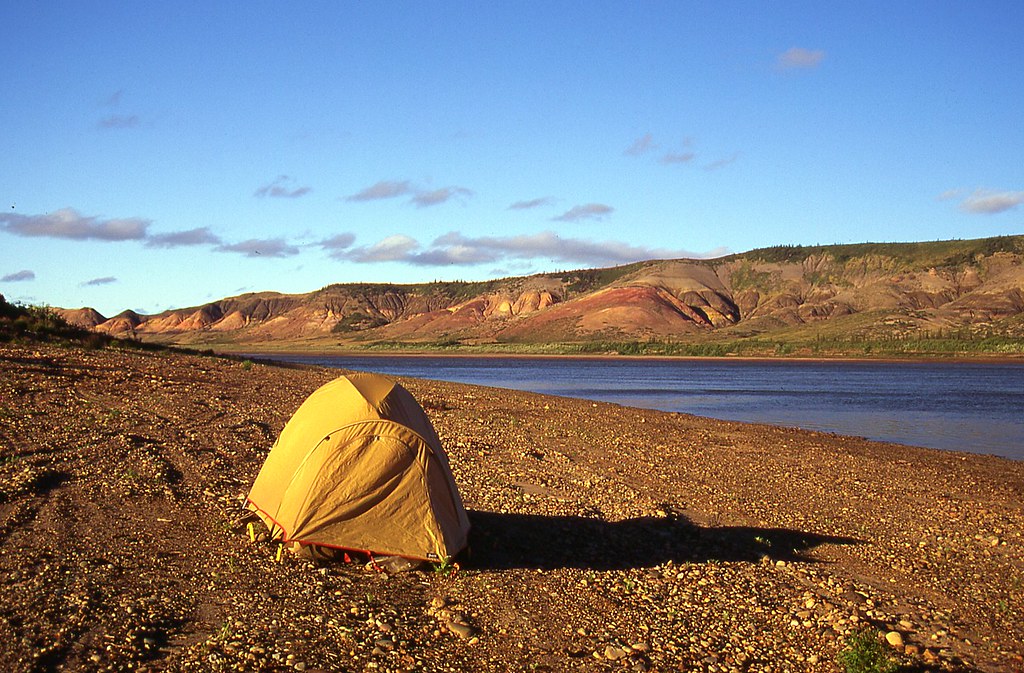
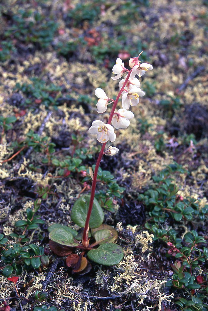
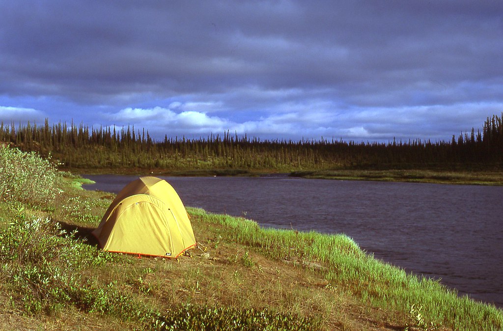
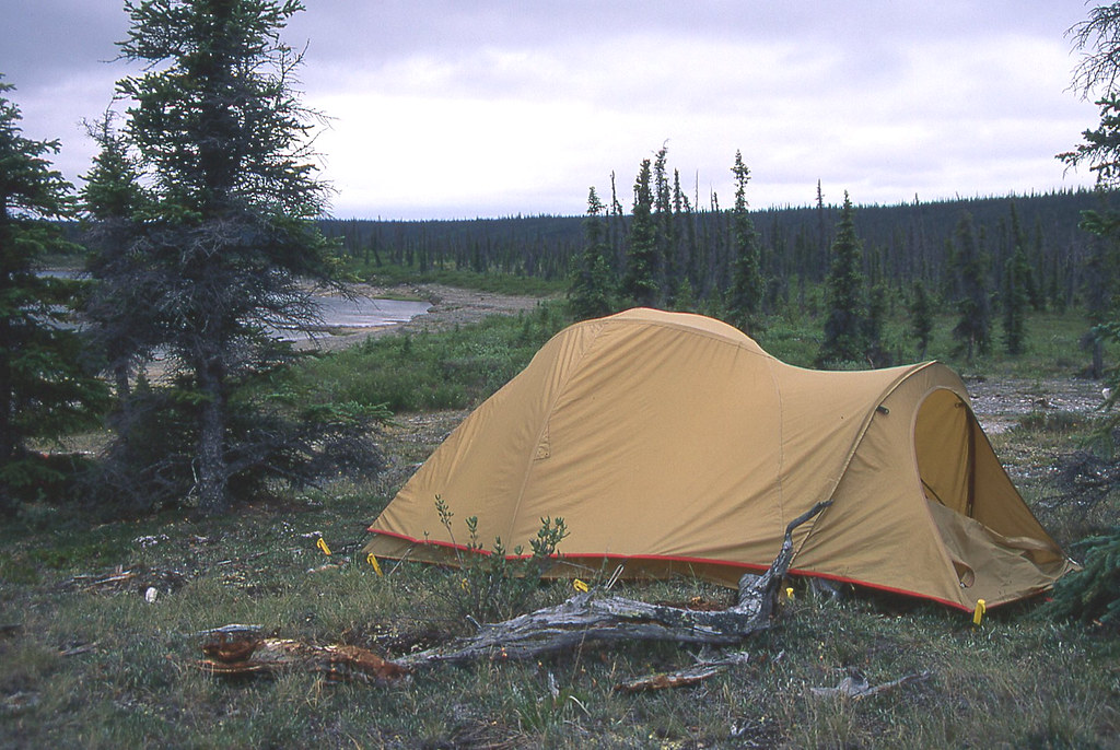
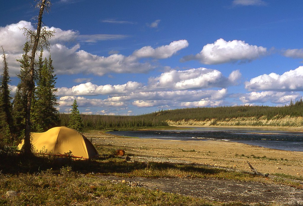
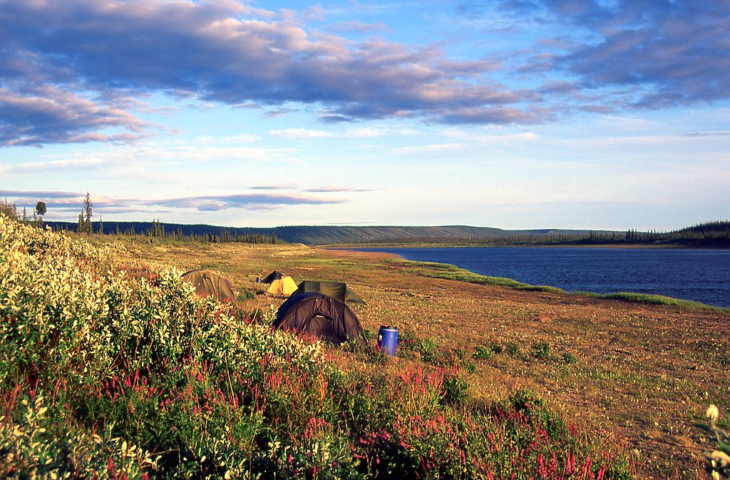
At 11:30 p.m. we lay in the tent, with a splendid view south, back up the lake. White blooms of Labrador Tea dominated the foreground tussocks, interspersed with pink splashes of Bog Rosemary. The showy white flowers of Cloudberry emerged from moist crevices. It had been a very satisfying day. We were 4 km (2.5 miles) ahead of schedule, snug in our tent, looking forward to the constant light that would accompany us for the next 4 weeks. In some sense, I felt that I was paddling and camping in my own backyard. We had lived in this country for nearly five months. Its vast horizons and endless purity made me happy just to be alive. Kathleen and I drifted to sleep, listening to the wind, and enjoying the sweet scent of Labrador Tea.
 
Last edited:
Wow, thanks for the dedication, wasn't expecting to see this for a few weeks! Had to stop a netflix binge to check it out! (-45 this morning without windchill).
 
46074099974_ea89c61eb4_b.jpg


Up late the next morning at 10:30 a.m., which is almost like a rest day. We put on the water at 12:45, once again heading into a strong wind. We soon gained the lee protection of the north shore, and headed east, calmly and serenely down the picturesque outlet of Ketaniatue Lake. Up ahead, riffles marked a drop into the last small bay, and we exchanged our wooden paddles for our whitewater paddles.

We turned north, following two Common Mergansers into the shallow, rocky riffles leading to Legetentue Lake (Frozen Fish Lake). Four kilometres (2.5 miles) of sun-drenched Class I. We enjoyed a nearly bucolic landscape as streamside willows and spruce slipped serenely behind us.

“Just keep to the outside bend,” Kathleen advised. “We need the deeper water, and there’s no sweepers. It’s beautiful to be paddling again.”

All too soon, though, the current slowed as the narrow channel opened wide to where hundreds of Bonaparte’s Gulls alternately soared, floated, and dove, feasting on small fish and insects.

We paddled east along a peninsula, rounded its point and turned west, heading toward a narrow opening between two opposing projections of land extending several kilometres (couple of miles) into the lake. Thirty minutes later we set up camp on a small island that featured a narrow, index-like finger of land pointing toward an esker ridge. An extraordinarily beautiful spot—such a contrast to the mud and dense brush that we had paddled past throughout the day. Our evening home was open and park-like. Dry and sheltered. Almost no bugs, even though the air was calm. Plenty of firewood. A gentle breeze drifted through the treetops. Robins chirped, creating a feeling of backyard suburbia. We set up our tent on a soft carpet of Crowberry and Rock Cranberry. We expected to sleep very well that night.

Kathleen and I much prefer to paddle wilderness rivers alone. We could get up late if we wish. Or, if we so desired, we could paddle late in the never ending light. We were living emancipated from anyone else’s time. We could ignore even our own schedule if we wished.

(Note: Before each of our canoe trips, I estimate the distance to be travelled on each paddling day by using the “three times forefinger-drag method.” Let me illustrate. Suppose that I am using 1:50,000 maps. Gridded squares on these Canadian topographic maps are all 1 km × 1 km. I place my right forefinger at the starting point and drag it along the map, usually next to the shoreline, to get my best estimate, 1 km at a time, for the day’s journey. I do this for the entire tentative itinerary, writing down the daily distances as I go along. I then hide this piece of paper and repeat the process after I have forgotten the recorded distances. It usually takes only a few minutes for me to forget. I then repeat the process a third time, and assume that the average of the three numbers is my best estimate of the distance.

The gridded squares on 1:250,000 topographic maps measure 10 km × 10 km. For these larger squares, I use the same “three times forefinger-drag method” but estimate distances in 5-km chunks.

I prepare this tentative itinerary to determine approximately how long the trip will take. I don’t necessarily expect to be exactly where the tentative itinerary suggests on any particular day. While on the trip, however, I frequently refer to the tentative itinerary to make sure that I am making reasonable progress. Falling too far behind the tentative itinerary suggests that longer days, or fewer rest days, might be necessary.)


46799093971_0864a7af70_b.jpg


We woke at 9:00 a.m. The Yellow-rumped Warblers fluttering above us sounded so very much like little wristwatch alarms. The Robins were still singing, as they had throughout the sunlit night. We slowly cooked a hot bannock for breakfast over our morning campfire.


46074099334_ce9acb3b32_b.jpg


A family of Northern Flickers (yellow-shafted race) followed our movements from the safety of their cavity in a camp-side dead spruce tree. A single Tundra Swan broke the morning silence with deep, bold wing beats.

“So what do you want to do, Kathleen? Our itinerary calls for a rest day. But this is only our second morning on the river. Do you want to paddle or stay?”

“I like it here. Let’s just stay.”


46799092901_c10cf8c1c6_b.jpg


The day was, indeed, marvellously relaxing—sunny and warm at 24 C (75 F). Although the air hummed with mosquitoes, we were generally comfortable without bug jackets and with only a little repellant dabbed on our hands and faces. We were alone and happy on our island, in the midst of what might as well be considered our very own land. Kathleen and I are so fortunate to have such easy access to this incredible beauty, isolation, and serenity.


46074098474_72ffdbe6cd_b.jpg


The next morning, we put on the water at 8:30 a.m. Another sunny morning, although the mosquitoes forced us to put on our bug jackets as soon as we crept out of the tent. The river was again bucolic as we ran from outside bend to outside bend. All Class I, and very shallow. Because we were paddling so soon after spring breakup, we had expected deeper, swifter water. The river corridor teamed with birds, including Mallards, Long-tailed Ducks, Tundra Swans, and Scaups. A Canada Goose encouraged us to chase, to lure us away from its mate and goslings snugged up tightly against the shore. Bohemian Waxwings darted from both sides of the river as they hawked for insects just above our heads.

46799091771_1dd716cc7c_b.jpg


We had planned to paddle only about 19 km (12 miles) today, intending to set up camp about halfway down the narrow, winding river flowing out of Legetentue Lake. The river, however, meandered as though through an estuary—slow, buggy and very boggy. Except for a few scattered spruce trees, dense willows covered the riverbanks. Although we occasionally beached the canoe to search, we found no suitable campsites. We paddled on.

46799091041_6c2235a492_b.jpg


After the next lake (unnamed), we paddled south nearly five more kilometres(three miles) to another unnamed lake, where the topographic map suggested we should encounter rapids. There were no rapids, though, and still nowhere to camp. We paddled on.

46074097344_8f3ddeb39b_b.jpg


Finally, after paddling about 48 km (30 miles), we set up camp at 7:30 p.m. on a burned-over island at the south end of the unnamed lake east of Sakatue Lake. Despite a landscape of charred peat, blackened spruce stems, and hordes of bugs, the site offered the best camping we had seen all day.

We thought we saw three seals today. They briefly lifted their heads out of the river, and then immediately submerged when they saw us. This sighting seemed so very unlikely to us. Bearded seals and ringed seals occur in the Anderson River delta, but we were such a long way (450 km by river) from the ocean. Moreover, we had not heard or read of any reports of seals on the Anderson River. We were not paying very much attention at the time, just paddling in the heat of the day. Almost dozing, really. Perhaps we were mistaken. Maybe we hadn’t really seen seals. But they looked like seals. They acted like seals. What else could they have been other than seals? We know seals when we see them. Still, though. We were such a long way from the ocean.

We finished today way ahead of schedule. Even though we didn’t intend to be way ahead of schedule, we now had a cushion. Cushions are good. You never know when you might need a cushion. You can always go slower if you want. But, you can’t always go faster whenever you might want to.


46799089801_5ba9578acb_b.jpg


The next day, June 24, we were up at 9:00 a.m., on the water at noon. A perfect headwind. Not too strong to make paddling difficult but strong enough to force the mosquitoes out of our faces and into the lee of our backs. The land was so empty of people––the Common Loons, Tundra Swans, White-winged Scoters, and Mallards seemed completely at ease.

Kathleen and I paddled silently, thrilled with the beauty that surrounded us, but still concerned about the lack of suitable campsites. How far will we be forced to paddle today? So much water. Amazing to contemplate that this complex, interconnected, serpentine route will eventually become the Anderson River that will carry us swiftly to the Arctic Ocean.

Late in the afternoon, a quick current carried us the last 2 km (1.2 miles) into Sakatue Lake. Quite surprising to find this quick current, as the topographic map indicated that Sakatue and the previous lake both lay at 216 m above sea level. Two lakes at the same elevation should have no current between them. Yet there was more current between these two lakes than what we found yesterday where the topographic map showed four rapids. I love topographic maps, but their accuracy can change over time and with water levels. The rapid into Sakatue Lake was an easy Class I. Only riffles, but very welcome.

We found some sandy beaches just south and north of the inlet into Sakatue Lake. Both beaches were small, surrounded by dense willows, and not inviting enough to camp. Anyway, it was only a little after 5:00 p.m., and we weren’t tired. We paddled out of Sakatue into the river leading west to Niwelin Lake. A lone moose on the south bank stood staring at us. We pulled our canoe out of the water on the north bank to hike 1 km (0.6 miles) to the Dene village of Soka, where we found only decaying log cabins.

The location of this village, so far from the river, initially seemed incongruous to us. Why wouldn’t the village be on the banks of the river? After we thought about it for a few minutes, it occurred to us that there was no need for the village to be on the banks of the river. For most of the year, the river was frozen. In fact, all of the countryside remained frozen for more than half of the year. The village of Soka was likely in the best location for hunting and trapping. Proximity to the river would be only a secondary consideration, or so it seemed to us.

Back on the river, Kathleen and I paddled on a gentle current, looking forward to camping on one of the sandy beaches on Niwelin Lake, which are described in Canoeing Canada’s Northwest Territories: A Paddler’s Guide.

The Paddler’s Guide gave no information on exactly where these sandy beaches were, however. Perhaps there would be a sandy beach right where the river flowed into Niwelin Lake. That would be convenient, as we could enjoy a relatively early end to our paddling day. We found no sandy beach there, though—just dense brush.

As we paddled west, down Niwelin Lake, the wind intensified and soon brought rain. We stopped to put on our rain gear before rounding a point, heading north. Every once in a while, we stopped to look for the promised sandy beaches but only ever found dense willows, bogs, and bugs. We began to regret that we had rejected the sandy beaches on the east shore of Sakatue Lake. Sure, those Sakatue Lake beaches were small and not overly inviting. But they were camp-able. We’d take them now.

Somewhat discouraged, we continued to paddle north, stopping in a clump of reeds at 8:00 p.m. for a gorp break. We assured ourselves that this day would eventually end. We would, at some point, be in our tent resting. We just sucked it up and paddled o
n.


45883936575_b7c8650456_b.jpg


We coasted northeast along the lake’s eastern shore, and finally spotted a narrow strip of sand. This was it. Good enough. Sixty minutes later, we sat in front of our fire, sipping tea, and stirring a bubbling pot of Spanish rice. A Common Loon yodelled only a few metres away. The sky cleared. The sun shone. We felt calm and so content to sit on the shore of this pristine lake. So far from everywhere—yet we felt very much at home. Another long paddling day, into head winds, where we covered 30 km (20 miles) of lake water.

45883935875_2a12f02f5a_b.jpg


We woke at 10:00 a.m. to a mid-morning serenade of White-crowned Sparrows. Alarm calls of Lesser Yellowlegs rolled down the beach to envelop our tent in fluid, piccolo-like tremolos.

A beautiful, clear, calm, sunny morning. Six American Widgeons landed only 1 m off the beach in front of our campfire. We leisurely sipped tea, followed by a steaming bannock smothered in margarine and jam. Overhead, Arctic Terns soared and dove for insects. We appreciated any effort on their part to keep our camp nearly bug-free. Because we paddled so late yesterday and were ahead of schedule, we decided to take our tentative rest day 2 days early.

Just before noon, the bugs returned in swarms, which often indicates an approaching storm. Moments later the sky turned grey. With tea cups in hand, Kathleen and I retreated to the tent, where, an hour later, we lay listening to the soft, pleasant patter of large raindrops on the nylon tent fly.

After the brief storm, we heated water for laundry and bathing. An evening offshore breeze drove the mosquitoes to cover, and we relaxed in front of the fire, on the east shore of Niwelin Lake, until retiring to the tent at 10:30 p.m.

46799086851_c936a4c5eb_b.jpg


Up at 9:00 a.m. Once again, we began our day with bannock—sweet, sweet bannock. At 11:00, we set off on a placid lake, with a gentle headwind. We stopped a few kilometres (couple of miles) later to inspect a fine sandy beach on the east shore, where the lake narrowed. So. Good camping does indeed exist on Niwelin Lake, just like the Paddler's Guide claimed. We spotted another beach just north of Niwelin Lake’s outlet on the west shore. If you ever paddle the Anderson River, you might want to keep these potential campsites in mind.


46799086041_4f6597d3fe_b.jpg


We entered the outlet of Niwelin Lake and paddled casually down the winding river approximately 1 km (0.6 miles) to the rapid marked by only a single line on the 1:50,000 map. The Paddler's Guide advised that “the rapids/falls should be portaged.”

Now, when I see the word “should,” I assume there is some leeway in the recommendation. “Should portage” means that some paddlers might portage, while other paddlers might run. “Should” means strong consideration rather than a command.


46799084001_21ffa6effd_b.jpg


I have read a more recent TR where some people ran this drop. Not a chance for us, though. Boulders guarded the entrance, with large standing waves and reversals at the bottom of the drop. We packed our gear along a well-defined trail on river left and completed what I considered a must portage by 3:30 p.m.

39833660673_96e8b50fc4_b.jpg


We then enjoyed lunch perched on the rocks above the falls. Squadrons of Cliff Swallows feasted on swarms of bugs. We wished the birds much success in their hunt. Beency proved to be pretty useless on the portage trail.

We put back on the fast-flowing water and headed downriver, admonished by a Peregrine Falcon who strongly objected to us entering its territory. Suddenly, whitewater, completely unexpected, appeared ahead. We enjoyed 2–3 km (1.2 to 1.8 miles) of Class II water, with boulders and rock gardens that required some manoeuvring—more than just running from inside bend to inside bend. We actually had to make collective decisions about the best route. A very pleasant surprise, as this entire stretch, like the “rapids/falls,” was marked by only a single line on the topographic map. The Paddler's Guide made no mention of these rapids.

All too soon, the fun ended as we floated into an evening of pure magic on Gassend Lake. The water’s surface was like glass. Or perhaps it was like a millpond. Or perhaps it was like polished marble. You know what I mean, so feel free to choose your own favourite simile or metaphor. Just make sure your selection indicates a lake that is absolutely still. Common Loons dove, surfaced and called all around us.


46799082621_ebd0c7ae85_b.jpg


We finally beached the canoe at 10:00 p.m. on a beautiful sandy shore at the end of the peninsula pointing northwest toward Gassend Lake’s outlet. As we strode up the beach looking for a campsite, an outraged Arctic Tern immediately dove, landed on my head, and started pecking away. What the heck was this all about? I swatted at the tern with my hat, and it flew up just out of my reach—still very angry and still threatening more aerial strikes. The tern circled and swooped, while I crouched and swatted. It was then that I noticed the tern’s nest excavated in the sand only 1 m from the water’s edge. The small, obscure depression contained two dark eggs that I had so nearly trampled. I quickly moved away, and the tern quit attacking me.

Each year, the robin-sized Arctic Tern travels up to 35,000 km (20,000 miles) from the Arctic to the Antarctic and back again. The feat is even more remarkable, researchers say, because the bird almost never rests. It is constantly either in the air, diving for fish, or bringing food to its nestlings.


39833660173_401962453c_b.jpg


As Kathleen and I searched for the perfect campsite, we discovered footprints in the sand. People had been here before us! How could that be? These intruders, these cheaters, must have flown directly to Gassend Lake from the south. This was highly unfair. Surely Kathleen and I, after spending five winter months on the shores of Colville Lake, had earned the privilege of the year’s first descent. Oh well. Maybe we won’t see these interlopers. They might have left Gassend Lake days ago. If so, it was not likely we would catch them. Good. We didn’t really want to see anyone else on our wilderness river adventure, anyway.

The midnight sun glowed warmly. Light and isolation surrounded us. We remained content despite the proximity of other people.

Kathleen and I stayed up late, sitting in front of our midnight campfire, sipping tea and watching a moose browsing in the shallows at the end of the peninsula. Arctic Terns flew sorties to repel Mew Gulls seeking to plunder their eggs. These terns never get to rest.

39833659473_ca83154def_b.jpg


We woke at 10:00 a.m. to the sound of surf running swiftly up onto the beach. A strong wind blew toward us from the northwest. Not a good day for paddling. Sunny and warm, with no bugs, however. Absolutely perfect conditions to strip off our clothes for bathing, which we did. Driftwood for the fire was plentiful. While rummaging through this pile we

39833658903_f05458a467_b.jpg


came across 2 speckled eggs. We didn't see any bird on the nest. When I went back the next day there were 3 eggs. Our bird book says that some species don't start incubating the eggs until all are layed. There were either Greater and Lesser Yellowlegs around, and we believe this is their nest.

39833657923_9ea46282d9_b.jpg


Following a breakfast of bannock, Kathleen photographed a Large-flowered Wintergreen. The leaves of the Large-flowered Wintergreen remain green all winter. That’s why they call it wintergreen. This adaptation allows last year’s leaves to photosynthesize with the first warm weather in spring, before the new year's leaves have had time to develop.

39833657113_35cbf7e473_b.jpg


Kathleen then strolled down the beach to take pictures of the Arctic Tern sitting on its nest. I ambled in the opposite direction with my fishing rod. After only a few casts I returned to camp with a 60-cm (25-inch) northern pike. The pike is a voracious fish, which can feed on other fish fully half its size, and has been known to hunt ducklings and lemmings. This was the first pike I had ever caught. I was curious about how sharp its teeth were. I learned an important lesson that morning—never stick the fingers on your left hand in a pike’s mouth, even if you do want to see how sharp its teeth are. I discovered that its teeth are very sharp. Kathleen took pictures of my bloodied fingers, just to prove it.

By mid-afternoon the sky darkened, and we retreated from the developing storm to the haven of our tent. A few minutes later the rain began, and we spent the rest of the afternoon dozing and reading.

The wind and sporadic rain persisted into the evening. At 8:00 p.m. we concluded that we would postpone supper for better weather. After all, we would have enough light for cooking for at least another month no matter what time of day or night. At 9:30, the rain stopped, and we moved our cooking area to the shelter of a clump of spruce trees. Thirty minutes later, we had fried the pike to a golden brown on our Coleman Peak 1 stove.

Despite all the negative rumours about pike, we thoroughly enjoyed this fish—large, chunky fillets of firm flesh with the consistency of tuna. We had heard that pike are full of small bones, but the people of Colville Lake had taught me how to properly fillet a large fish to easily remove all the bones. Kathleen and I very much enjoyed eating our first northern pike. We liked it so much that we ate it all in one sitting. We looked forward to eating more northern pike.

I also looked forward to tomorrow. Only 2 km (1.2 miles) remained between us and the outlet of Gassend Lake. In only 2 km (1,2 miles) we could escape the winds that make lake travel so challenging. In only 2 km (1.2 miles) we could enjoy moving water for the remaining 420 km (260 miles) to the Arctic coast.


46799080311_38a3d50b15_b.jpg


The storm persisted, unabated, throughout the night. We decided against paddling in the morning, hoping for more comfortable weather. We breakfasted late (11:00 a.m.), squatting before the heat of our fire on the beach. We then returned to the shelter of our tent to read and play a few games of cribbage.

Wind, waves, and a very dark sky met our eyes when we peered out at 4:30 p.m. The northwest horizon showed no relief from the storm. All northern canoe trips include days when the wind blows relentlessly, confining canoeists to the small sanctuary of a nylon tent or tarp. Kathleen and I now felt little hope that we would ever paddle again. I know this sounds extreme, but we had been trapped at Gassend Lake for two full days. Despair naturally creeps in.

We knew, in our minds, if not in our spirits, that this wind would stop one day. The sun would, one day, shine again. We would someday pack up and head downriver. Golden sunlight would, one day, once again, drip from our paddles. Our arms, shoulders and backs would one day, once again, eagerly lean into the paddling stroke. Until then, we must be patient. Surely this wind would eventually stop. A slight respite at 7:30 p.m. permitted a quick supper of hot minestrone soup, salami, crackers and tea.

Bern Will Brown had told us that he likes to fly out over the Anderson River to visit with canoeists, and perhaps bring fresh fruit. You remember Bern Will Brown. It was Bern’s cabin that we had rented to overwinter at the north end of Colville Lake—the cabin from where Kathleen and I began this canoe trip down the Anderson River. Before we left Colville Lake, Bern promised to bring us any mail that arrived for us after our departure. Bern’s Cessna passed over our camp twice during the day, but he didn’t see our canoe stowed against the storm in a clump of spruce. Too bad. Although we had come to escape modern technology and comforts, it would have been very novel, even fantastic, to have received airmail delivery of gifts and letters.

At 8:15 p.m., a strong wind driving a cold (8 C; 46 F) rain sent us back to the comfort and warmth of our tent. We fell asleep listening to the surf pounding on the beach, pounding our spirits, pounding down our hopes of paddling tomorrow. Despite the imposed two-day layover, though, we remained almost exactly on schedule. The “cushion” we enjoyed only a few days ago had already turned out to be useful. I told you it might.


31857326637_6fb3400c5f_b.jpg


I lay awake most of the night, listening to the wind, listening to the surf. Most of all, though, I lay awake worrying. Worrying about the weather and if we’d ever get off this beach. Worrying about my academic career and the research funding I would need when I returned to UBC in August. Even the birds annoyed me. The Yellowlegs rattled away all night, and a White-crowned Sparrow practised seemingly infinite variations of its song just outside the tent. I finally fell asleep around 5:00 a.m.

We woke at 8:00 a.m. Grey sky. Cold. Threatening clouds. Persistent wind. Pounding surf. But no rain. “We gotta get out of here, Kathleen. Let’s cook breakfast and pack up.”

We shoved into the surf at 10:15. Only 2 km (1.2 miles) to the outlet of Gassend Lake. Only 2 km (1.2 miles) to moving water. Despite the last two days, I had enjoyed paddling on this series of small lakes. But I looked forward to a wide river, with a strong current, to carry me to the Arctic coast.

We struggled against the wind and breaking waves but managed to reach the outlet of Gassend Lake, where we glided, almost effortlessly, onto the current of the Ross River. More Cliff Swallows darted out from riverside limestone ledges. Rain soon began, and we stopped briefly to don our sou’wester rain hats, and to fit our spray skirts snugly over the coaming of the spray deck.


31857325987_906e373340_b.jpg


The Ross River carried us quickly to the Anderson River—approximately 25 km (15 miles) in less than four hours, with very little paddling on our part. In addition to the three rapids marked on the topographic maps, several more rapids made our descent quite enjoyable. All the rapids were fairly easy and straightforward. None required scouting, and none exceeded Class II. Most rapids consisted of standing waves created either by the river deflecting off points or the current spilling into calmer water. A few rapids provided fast, shallow, braided sections. Kathleen and I worked well together. Certainly one of life’s greatest pleasures is for you and your life’s partner to share the thrill and satisfaction of paddling rapids together, confidently and successfully. Fish continually jumped and surfaced during our descent.

Several kilometres (couple of miles) upstream from the confluence with the Anderson River, the riverside ridges became drier and less overgrown. Splotches of Shrubby Cinquefoil, Bear Root and Northern Sweet-vetch adorned the open stands of spruce. Nevertheless, no suitable campsites induced us to stop. “Suitable,” when one first starts looking for camp near the end of a paddling day, means sandy beach, open tundra ridge, and easy access.

Besides, we wouldn’t have wanted to camp with Bear Root, which is a favourite food of grizzly bears. On our Thelon River trip in 1993, Kathleen and I saw large patches of Bear Root that had been dug up for its edible and apparently very tasty roots.

We reached the Anderson River at 2:30 p.m., and just downstream from its confluence with the Ross River, set up camp on the first large island. We had found our suitable camp on a level, open terrace just above the water. The rain had stopped, and we took advantage of the interlude to put up the tent dry. The wind finally quit blowing at about 7:00 p.m., and the sky showed thin patches of blue at 9:30. We were finally on the Anderson River itself, which, at this point, had a strong, shallow current. We expected short, easy, unhurried paddling days. The water level had obviously been dropping quickly on the Anderson River, as the exposed mud and sand were still wet a full 1.5 m above the present waterline.


31857326357_bdc3b615f0_b.jpg


I always thought a real man wouldn't bring a compact mirror on a canoe trip. But I had been shaving twice a week at the winter cabin, and couldn't break the habit.

31857325567_258cd5ba72_b.jpg


We hiked briefly around our island, which showed obvious signs of moose browsing on the willows. Spring blooms adorned many plants, including Mountain Avens, Lapland Rosebay and Common Butterwort. According to our plant books, Common Butterwort, only 4–12 cm (2–5 inches) tall, consumes insects by trapping them in the greasy surface of its leaves, which are covered with small glands. The insects become stuck and are digested by acidic mucilage and enzymes.

31857325407_9aafeb70e2_b.jpg


We had seen quite a few moose on the trip. Beency chides us for not being able to get a picture of the moose itself: "You have two cameras and a tripod. And all you can get is a picture of moose poop?"

I am beginning to tire of his constant abuse. We should have sent him home with the winter gear.
 
I'll try and Keep up this time ! I will back up and catch up !

Thanks ! Got to love this !

Jim

PS. I'm going back to share your Winter Expedition with a Great friend and Retired Biology Teacher ! He Will love this ! as I do !
​​​​​​​ Jim
 
PP......
Iike your "Beency", my bride packed a plush stuffed little brown dog, named "Brownie" with us. As with all of us, Brownie begin breaking down. He started spending most all of his time in a zippered cotton bag. He got to spend nights doing double duty as added fill in her down jacket pillow. These days, like a urn on the mantle, full of ashes, he now rests in a wooden box of other treasures.
I have enjoyed many mugs of strong black tea while armchair traveling along with you on your adventures. I have thought I should try some of the Bannock also, but I do not have your recipe. Maybe you would be so kind as to provide us with it.
At one time, the Yukon Territories fishing regulations had directions for filleting Northern Pike to render them boneless. Fresh from cold northern waters pike are very good eating, cooked in many ways. On one of my first trips, one of the older men made his speciality from a large Northern Pike, "Finnish Fish Head Stew". He also made sure that I had a eye ball in my bowl of stew. I wanted to make a good impression on this well seasoned outdoorsman, so I bravely spooned the eye into my mouth, swallowing it whole.
Eagerly awaiting to see what is around the next bend on the Anderson River.
 
PP......
I have thought I should try some of the Bannock also, but I do not have your recipe. Maybe you would be so kind as to provide us with it.
.


Kathleen will post her recipe in the next little while.


31857323957_fb6e149a75_b.jpg


The next morning, June 30, We rose at 9:00 a.m. and put on the water just before noon. The Anderson River was moving very quickly, and almost immediately we arrived at a ledge extending out from the west bank on an outside bend. Plenty of room, though, on the inside bend. No problem.


31857323677_f4bfc3504a_b.jpg


About an hour after leaving camp, we reached the first rapid marked on the topographic map, and sauntered downstream to reconnoiter.

“Look, Michael. Footprints in the mud. Must be the same people whose prints we saw at Gassend Lake.”

“I hope they’re the same people. I wouldn’t like to think that we’re trailing two or more groups of paddlers down the Anderson River.”


31857323197_eeb54180db_b.jpg


The rapid swept sharply right—around a bend—and disappeared from our view. Kathleen and I are very cautious wilderness paddlers. We generally don’t paddle down rapids that disappear from our view.


31857322307_0d7db948af_b.jpg


So we climbed back into the canoe and ferried over to the left bank where we could more easily peer around the corner. We were surprised to discover footprints again, plus the bow marks of three canoes. Obviously, these Anderson River interlopers were also cautious wilderness river runners, just like us. Maybe they were not truly horrible people
.
  • We lifted over the entry ledge to the rapid, a short portage of only 40 steps.
  • We then ferried over to an island and hugged its west bank toward the 2-m gap that took us by the next ledge.
  • We then powered left to avoid the haystacks in river centre, making sure to stay river right of two more ledges extending out from the west bank.
31857321647_4a302bbcaa_b.jpg


We reached the next serious rapid only 10 minutes later, and first scouted on river left, where again we saw footprints in the sand. Ledges and pour-overs clogged the run on river left, so we ferried over to scout on river right, which seemed runnable. Back in the canoe, we ferried out to river centre to hit a 2-m wide tongue of water that flowed between a threatening, dropping trough of water pounding by an island on river left and a ledge on river right. After blasting by the ledge, we powered closer toward river left to bypass a second ledge projecting even farther out from the right bank.

We camped on the east shore, above the narrow entry just above Falcon Canyon. Very serious whitewater cascaded away immediately below our camp. The Paddler's Guide said that the Anderson “is not a river for paddlers seeking a wild whitewater experience.” Maybe not. Even so, moving-water skills, or a passion for portaging, were essential for this section of the Anderson. Indeed, the Paddler's Guide also indicated that “there are major rapids along the way.” These two statements in the Guide stuck me as somewhat contradictory.

The two rapids we scouted and ran today might not be considered major by the Paddler’s Guide, but both featured ledges, powerful hydraulics and high standing waves. The best route through, I believed, required scouting from shore. The rapid below our camp, with even more powerful water, showed no obvious route through—I would rate it as a (perhaps high Class III. Kathleen and I will likely be on the portage trail tomorrow morning.

31857321267_506346f92c_b.jpg


July 1 – Canada Day.We celebrated with an extra cup of tea before agreeing that we will portage the rest of this rapid.

31857321647_4a302bbcaa_b.jpg


We carried our canoe and gear 250 m along a fairly well-marked portage trail. Footprints in the mud indicated that our fellow paddlers had also chosen not to run this rapid. The footprints seemed fresh. I wondered if we would ever see these people.


31857319817_90c8ebbdcc_b.jpg


We celebrated the rest of Canada Day by running down Falcon Canyon in big, pushy water, all the while avoiding ledges, and then eddying out to scout the next bend and drop. We sometimes walked both banks to gain better views, and found footprints wherever we stopped. These people run the river just like us. It might even be nice to meet them, to compare our experiences.


32923247068_7891c7c960_b.jpg


At lunch, Kathleen and I climbed to the top of a ridge to enjoy a very scenic view of the canyon. We hiked through an open, dry forest, similar to an alpine environment, including botanical features such as the ground-hugging, pincushion-like Moss Campion. Interestingly, we spent only 40 minutes on the water to cover approximately 8 km (5 miles). Yet, because of all the time scouting from shore, we didn’t approach the exit rapid of Falcon Canyon until the end of the day. Despite the challenges, though, we ran all the rapids.

32923246748_a05226e4dc_b.jpg


Kathleen and I have reached the island where the 1:250,000 topographic map (Simpson Lake) showed two rapid symbols. Just this one rapid to go and we would be out of Falcon Canyon. We had pulled out, just above the rapid, in a small cove on river left, exactly where the bow marks of three canoes were clearly etched in the sand. Many footprints indicated that this group of paddlers had camped here, likely only a couple of days ago.

“I hope we get to see these people, Michael. It’s like we’re travelling together.”

I have to admit that I too kind of hoped that we would get to see them. I’m curious to know what they think about the Anderson River, which, you remember “is not a river for paddlers seeking a wild whitewater experience.”

The main channel of the rapid offered 1.5–2.0-m diagonal, curling waves in the centre, with ledges extending out from both banks. A total run of about 500 m. We considered scrambling downstream along the canyon wall to lower our canoe and gear with ropes over a 5-m cliff, just below the first two ledges on river left. We could then run down the left bank to more easily avoid most of the biggest water in river centre.

Lowering gear and canoe by ropes seemed like a lot of work, though. The alternative, to portage along the left bank, would be extremely difficult as the high canyon walls climbed straight up out of the surging river. What to do? We were already tired and didn’t want to make any rash decisions.


32923246078_856df46830_b.jpg


Beency says he’s feeling refreshed and exhilarated. "I thought you said your nickname was 'Big Water Mike.' Certainly we’re going to run this rapid aren’t we? Let’s not be whimps, Big Water Mike."

"It's not my nickname, Beency. It's just what I say when I want to be frivolous."


32923245658_b4dcbd0554_b.jpg


Kathleen and I set up camp, and agreed to postpone our decision until morning. Perhaps the best choice would be more obvious after we were well rested. Following supper, I strolled west, away from camp, into the side channel around the island. I felt somewhat depressed. I didn’t relish portaging along the canyon wall, and the rapid seemed beyond our skills to run successfully.

The side channel was mostly dry. Too bad, I thought. If the channel had water, we could paddle around the island and avoid portaging along the cliff or paddling the rapid. I fretted for a few moments before my mind stumbled upon the obvious. This was a side channel, Mike, you dimwit. The topographic map indicated that the channel circled around the island, on the back side of the cliffs. I fairly skipped back to camp to get Kathleen, and together we followed footprints down the curved channel 750 m to where it re-entered the Anderson River only a few metres below the end of the rapid. What good luck—a convenient and easy portage around a very difficult rapid.


46101596704_178ced4de3_b.jpg


The next day began cold, windy and overcast, with snowflakes early in the morning. We lingered in our sleeping bags. After breakfast, we completed the portage quickly and efficiently—three loads for me—only two for Kathleen. Normally, we both carry three loads on all portage trails.

We put on the water just as the sun burst through the gloom, as though it was happy and pleased that we had finally exited Falcon Canyon safely. Soon, though, the sky darkened and the northwest wind blew coldly, as it had for nearly a week now.

An hour later, on the right bank, we spotted our first grizzly bear of the trip. Even at 200 m, through binoculars, the grizzly looked darned impressive and formidable.


32923244158_8655c4d78c_b.jpg


We soon reached the limestone outcropping of Air Weave Canyon and stopped for lunch and to scout the first of four marked rapids. We alsofound 50 m of brand new rope. Must have been dropped by the footprint people. Perhaps they wished to befriend us. Of course, that was absurd. The footprint people didn’t even know we were on the river. Even if they did know, they likely would not purposefully leave brand new rope on the bank of the river, hoping that we would find it and appreciate their gift.

Just after pouring hot water into our cups of noodle soup, a second grizzly bear approached from about 250 m upstream, on river right, the same bank where we now sat. We gulped our soup, quickly stepped into the canoe, paddled down the right bank, and ferried across a small tributary that flowed into the Anderson River from the east. We then ferried over to the left bank of the Anderson River.

A brief scouting downstream confirmed a safe route through the first part of Air Weave Canyon right up against the left bank, adjacent to some very serious ledges. Very shallow water, however, prevented us from just paddling down the left bank from our current position. To get into water deep enough to float our canoe would require paddling out, and then downriver very near to a large hydraulic reversal. We would then have to quickly turn back and power hard to river left.

Kathleen and I could almost certainly make this move—almost certainly. But a mistake and capsize on the approach could have serious consequences, and would possibly send us capsizing over the ledges. We lined by.

We then ferried back over to river right to get a better view of what lay around the bend. We made our decision even before reaching the opposite shore.

“What do you think, Kathleen?”

“We can run this. Let’s go.”

We turned downriver, running slightly back toward river left and paddled out of Air Weave Canyon. We pulled out to congratulate ourselves, to let our adrenaline subside, and to enjoy the rest of our lunch. Hopefully, the grizzly wouldn’t show up, demanding a share of our peanut butter on crackers.

32923239338_ab07477a89_b.jpg


The sun reappeared, like this morning at Falcon Canyon, as though pleased with our success. We paddled and drifted a couple more hours in calm light before setting up camp a little more than 30 km (20 mile) upstream from the Limestone Steps, which had beenour original destination for tonight. Although behind schedule, we felt content to be beyond the canyons. We looked forward to a relaxing paddle tomorrow. The terrain and character of the Anderson River had changed completely since this morning. Mud banks had replaced sandstone cliffs. Bank Swallows had replaced Cliff Swallows.

32923238488_d835ebd75d_b.jpg


We were settled in a beautiful riverside camp, with Wild Chives blooming all along the i beach. Wild Chives have a slight onion smell and taste very much like the commercial green onions. They certainly added a pleasant seasoning to our camp stew. Our campsite was somewhat muddy from the rain and spring break up. We hope this isn’t a sign of bad camping to come.

46827067011_c361230773_b.jpg


Up at 10:50 a.m. the next day, and on the water at 1:20 p.m. to face a strong northeast wind. Only 8 C (46 F) during breakfast. Throughout the day, clouds raced toward us from beyond the horizon. We endured spatterings of rain, with only brief, periodic moments of sunshine and warmth.

We set up camp at 6:30, about 500 m above the Limestone Steps
,


31857314397_90a9cd81a2_b.jpg


which the Paddler's Guide warned, in capital letters, “MUST BE PORTAGED.”


46827211331_9e5b8079b9_b.jpg


Kathleen and I were now halfway (14 days) through our trip. All of the lake water, most of the rapids, and the longest paddling day on our tentative itinerary lay behind us. Things were going very well. I hoped that tomorrow would bring sun, warmth and calm conditions.


45912394445_00b08ef043_b.jpg


One of my favourite parts of all canoeing days is when Kathleen and I crawl into the tent to drink tea, to study our plant books and maps, and to review tomorrow's course down the river. We often don’t stay up much after supper is over, but retire to the tent right after the dishes have been washed and our gear has been organized for the night.
 
Loving it so far! Just wondering, have a look at my arrow in your pic below...IS THAT A GRIZZLY????????
​​​​​​
gK1q7tF.jpg
 
Sharp eyes, there, Mem! I think if it had been a grizzly that we would have noticed it. We are generally pretty aware of our surroundings. Particularly on days when we have already seen grizzlies. In my days I have seen many "bears" that when I got closer turned out to be large rocks or even stumps. But it is possible, I suppose, that your arrow points to a bear.


46775737942_3e8b1aed7c_b.jpg


And, Boreal Birch, here is the recipe that Kathleen uses to make Bannock. It is taken from The Hungry Hiker's Book of Good Cooking, by Gretchen McHugh.

You can see in the instructions above, that this mixture makes two-three pans of Bannock, depending on the size of the pan. Kathleen usually mixes about enough ingredients to make 8-10 Bannocks at a time. For a thirty-day trip, she does this three times, to give us 30 Bannocks.


46775738552_0eed45dd50_o.jpg


She then partitions the 30 Bannocks into their own plastic bag, sealed with a twist-tie. (Note: Our dog Shadow was very playful two days ago. Jumped up on Kathleen and scratched her lip. She was somewhat reluctant to look toward the camera.)

I prepare the breakfast Bannock on our canoe trips. I open the plastic bag, and pour in a cup or so of water. I close the plastic bag, and knead the mixture until the consistency is just right. Not too runny, but not too dry. I then cut off (or bite off, if no one is looking) a lower corner of the plastic bag, and squeeze the mixture into the skillet.

I cook the lower side until it seems done. This usually coincides with bubble beginning to dominate the upper side. I lift up slightly with a spatula to confirm. I then slide the Bannock out of the skillet onto a plate. Being very careful, I place the skillet over the top of the Bannock on the plate, and turn over the plate and skillet together. The uncooked side of the Bannock is now ready to cook in the skillet.

Hope this was clear.
 
46103807544_7dcc9e3110_b.jpg


I had forgotten that Kathleen took pictures of me demonstration my Bannock cooking technique when we were on Great Slave Lake in 2017. Here I am sliding the Bannock out of the skillet on to the pan. If one tried to flip the Bannock in the skillet it almost always comes apart. Note the bubbles on the top, and that the bottom appears done.


46103808014_56a9d5809e_b.jpg


Skillet is placed over the pan that has the Bannock.

46828968711_ff54c7782e_b.jpg


Skillet and pan are turned over together. First side is indeed done. Skillet now place back on fire to cook the other side. Total cooking time is about 15 to 20 minutes, over a low fire.

I cut the Bannock in half for us to share. We usually cut our half Bannock in half again, Our Bannocks are not as thick as many other people's Bannocks, but thick enough to slice between top and bottom. This gives Kathleen and me each four pieces to spread with margarine and jam. We have Bannock every day on canoe trips, unless the weather is bad, or we feel the need to get a quick start to the paddling day.
 
Michael, Thank you for posting that recipe and pictures. I'll be printing off the recipe and the pics. I've never made it but have been making homemade dough for 30 yrs now so I think I can make this. Think I'll make a small batch the first try. When I made my first dough I mixed up the salt and sugar portions! Turned out hard enough to make a hockey puck envious and the dang birds wouldn't touch it!

dougd
 
Thank you, Kathleen, in the next episodes we (at least I) will be joining you for tea & bannock.
 
wow, another epic episode. Photography is fantastic. Some of those look like fuji velvia slides to my eye, beautiful colors and contrast.
 
Some of those look like fuji velvia slides to my eye, beautiful colors and contrast.

Dang, deerfly. You are good! We both had our own camera. Kathleen had a Minolta, and shot Fuji Velvia. We liked how it captured the blues of water. Not many people would be able to recognize the original film of a scanned slide. Are you a professional photographer?

32923235788_41ea678889_b.jpg


The Limestone Steps were actually a series of three ledges, and each becomes successively more ominous and treacherous.

31857313477_02db4f61fb_b.jpg


On July 4, We rose at 9:00 a.m. and finished the portage on a well-marked trail past the Limestone Steps at 1:30 p.m. We found the approximately 1 km (0.6 mile) portage relaxing, actually, interrupted by tea breaks and photography.


46799058141_b988af5b83_b.jpg


Once again, Beency didn't help at all.

"What's the matter. Don't you like portaging, Beency?"

He just smiled from behind the Shrubby Cinquefoil where he was hiding, and said, "I'm with Bill Mason on this.. I heard that Bill once said, 'Anyone who says they like portaging is either crazy or a liar.'"


46799057471_e2550981d3_b.jpg


We then drifted downriver, ran a ledge, and then eddied out on river right to scout Flat Rock Rapids. The Paddler's Guidesuggested that this rapid “can be paddled or easily portaged.” Kathleen and I naturally discussed these two options. After all, there are never any more nor any less than these two options. We hemmed and hawed, and nearly decided to run. There was just a little too much pushy water, though, ending in a ledge. We portaged about 200 m.

We put back on the water, looking forward to some leisurely drifting, not expecting any rapids until those marked on the map about 10 km away. We paddled nonchalantly, slightly southwest, enjoying the scenery. We turned a bend heading back northwest and saw a line of white up ahead.

“What’s that, Michael. Have we reached the rapids already?”

“No, it can’t be. They’re still about 5 km (3 miles) away.”

I continued paddling.

Kathleen turned to look back at me. “I think we should get out. The white line goes all the way across the river.”

“I think it’s OK, Kathleen. Let’s just paddle down and have a look.”

“No. I want to get out now. It looks like a ledge to me.”

We paddled over to river right, tied the canoe to a shrub, and walked down to have a look. Yep. As always, Kathleen was right. A serious ledge stretched all the way across the river. Unmarked and un-runnable. We unloaded the canoe and headed down the portage trail. We found this portage, even though short, very unpleasant. No one likes to portage rapids that, according to the map, don’t even exist.

By comparison, we easily ran the three marked rapids 5 km farther downriver, even without scouting. We remained exactly on schedule and were pleased to have completed the longest portage of the trip, a distance of 1 km past the Limestone Steps. At least we think we had completed the longest portage of the trip. You never know when unmarked rapids might suddenly appear again.

Only 25 km (15 miles) to Juniper Rapids, tomorrow’s goal on the itinerary, and another potential portage. The sun shone brightly at 11:00 p.m. No wind disturbed the evening quiet. We felt as though we had entered a new space, both physically and emotionally. We felt as though we had gotten somewhere today. In celebration, after our chill supper, I even brushed my teeth and shaved before retiring to the tent.

(Note: I don't know why we didn't take any pictures of Flat Rock Rapids or the rapid that
doesn't exist. I guess it's because we are not photographers on a canoe trip. We are canoeists who have cameras, and periodically try to capture a good image or two. Our first canoe was yellow. Our second canoe was green. All of our subsequent canoes have been red, which makes a more striking image, in my opinion.)

31857311787_a04edd8984_b.jpg


Loud splashing in the river startled us awake at 1:00 a.m. Kathleen and I instantly thought the same thing—must be a bear. I grabbed for my rifle, and Kathleen reached for the pepper spray. We peered out cautiously to see a moose, knee deep in the river, wading along the opposite shore. Sensing our presence, he turned abruptly up the bank and disappeared into the willow and spruce. Glad it wasn’t a bear—it would have been hard to sleep afterwards. Even so, just the thought of a bear perhaps passing by while we slept made us uneasy as we lay in our sleeping bags—eyes closed but ears wide open.

46799056891_793298c863_b.jpg


Up at 9:30. On the water just before noon. We paddled into a day of sunshine, warmth, and a gentle breeze wafting up from the south. We drifted lazily toward Juniper Rapids. A Peregrine Falcon sat on the shore, tearing at the flesh of a gosling while its parents stood stoically nearby. A Bald Eagle sat elegantly on a riverside snag, ignoring us disdainfully as we floated by. Lunch and tea break.

31857311127_0081a301a6_b.jpg


We reached Juniper Rapids shortly after 4:00 p.m. We scouted and then ran the ledges in the upper portion of the rapid, and set up camp on the right bank. Our footprint friends had similarly scouted the upper ledges and had also camped in the same spot, perhaps as recently as last night. Another gift had been left behind for us—a highly useful butane lighter. I wondered what more prizes waited to be discovered.

The early evening remained very warm at 23 C (73 F). Surprisingly, there were nearly no mosquitoes, so we boiled three pots of water for bathing and laundry. Afterwards, Kathleen and I stood innocently naked, fresh, and clean beneath the Arctic sun. We had paddled nearly 300 km (185 miles) since leaving our cabin at Colville Lake and were more than halfway to the Arctic coast. We sat before the evening campfire, feeling very content. Both of us had our own “pokey stick” to rearrange the coals “just so.” Both of us poked silently—lost in our own thoughts of previous challenges, obstacles, and accomplishments. Both of us wondered about the unknown adventures that surely still lay before us, somewhere down the Anderson River.

The day had been idyllic and relaxing. We had pitched our tent on a rocky outcrop about 100 m from the water, in an open, park-like setting. We enjoyed a commanding view out over the Anderson River. We rested in our most beautiful campsite of the trip, which we were actually quite surprised to find. For most of the day, we had paddled past mud and willow flats with very poor camping conditions. As you remember, we left Colville Lake soon after breakup. We were early in the season. Water levels on the Anderson River were still receding, and the banks had recently been submerged. Mud dominated the landscape. Looking for campsites had been discouraging. Still, though, we needed only one good camping spot at the end of the day, and we had certainly found it.

(Note: We didn't take any pictures of us standing innocently naked. So don't ask to see any pictures to prove that we were actually cavorting around, in plain view, without wearing clothes.)


31857310607_f30c5ebcf8_b.jpg


On July 6, we rose at 9:00 a.m. for our bannock breakfast, and to break camp. We carried our canoe and gear 200 m past some pushy water and then ran by the last three ledges of Juniper Rapids. Based on our information, all the whitewater was now behind us. A few minutes later, we climbed a steep, muddy bank to an old, and apparently abandoned, trapper’s cabin. According to the Paddler’s Guide, approximately 20 trappers lived and worked along the Anderson River in the first half of the 20th century until the last one abandoned his lines in 1956.

46799055531_3732a31130_b.jpg


We seemed to be gaining on our footprint friends, who had now increased in number. We found four very fresh bow marks on the muddy bank below the cabin.

“Maybe we’ll see them soon, Kathleen. I kind of hope so, although I have grown somewhat fond of my new butane lighter, and I can always use more rope.” I often say that “you can never have too much rope on a wilderness canoe trip.”

31857309737_43685458c4_b.jpg


Soon after heading downstream, the sky began to spill rain, and mud surrounded us. The Anderson River now flowed shallowly, less than 25 cm (10 inches) deep, through a delta-like complex of gravel bars and wooded islands. Trees lay lacerated and uprooted from ice muscling its way downriver during breakup. We ran from outside bend to outside bend, trying to keep water deep enough to float the canoe.

Common Loons, Lesser Yellowlegs, Surf Scoters, Tundra Swans, and Arctic Terns appeared in large numbers. Mud everywhere. Finally, on the south bend of the river before the confluence with the Carnwath River, we set up camp at 6:40 p.m. in a relatively drier mire of mud.

A successful day, as we were now 38 km closer to the Arctic coast. We had portaged our last un-runnable rapid. We had paddled through our last known rapid. The longest day left on our tentative itinerary was only 30 km. All days from now on would be easier and shorter. If only we could find camps that weren’t so horribly muddy.

46799054971_2bfb93cd69_b.jpg


July 7 was another grey, sodden day. Tundra Swans flew before us—at first, so elegantly cumbersome as they lifted off. Eventually, so pleasingly graceful as they finally gained altitude. Pure white bodies and wings contrasting so beautifully against the dull background of grey sky.

For lunch, we stopped at an old trapper’s cabin at “Shantyville,” just upstream from the Carnwath River. As reported by John Stager in his article about Fort Anderson, most of the wood for Fort Anderson was cut at Shantyville and then rafted downstream to the fort on June 9, 1861.

For dessert after lunch, I sat munching on dried pineapple rings. I love these special treats on canoe trips and could easily dispatch a whole bag in a single sitting. This meal ended disastrously, however, as a particularly chewy and sticky ring of pineapple inexplicably extracted my brand new gold inlay.

“This is not good, Kathleen. I can fit my entire tongue in the hole. What’s the chance of finding a dentist out here?”

Beeny suggested that “Maybe one of our footprint friends is a dentist."

“Maybe. It doesn’t hurt, though. I’ll just chew on the other side of my mouth and hope for the best.”

46799054421_2a9a0b5dbb_b.jpg


It didn’t seem possible, but the banks of the Anderson River became muddier, seemingly with each bend in the river. When we pulled out at the end of the paddling day, we spent about 30 minutes walking up and down the beach looking for a non-muddy spot to pitch the tent. We finally came to the conclusion that we should just pitch it. No need to be picky—we’re already covered in mud. It doesn’t make any difference where we camp.

31857308787_8e49cf5059_b.jpg


While I began arranging rocks for a cooking fire, Kathleen was at the canoe, bending over a large pack. As she pulled on the straps to lift it out of the canoe, she slipped in the mud and fell flat on her back. I have learned not to laugh at situations like these, even though they are pretty darn funny.

“Are you all right?” I asked, with just the right amount of concern in my voice.

“You know,” she said, “I imagine everyone at home would think I was crazy, but I’m actually enjoying this trip.”

Despite my amusement and Kathleen’s apparent joy at lying flat on her back in the mud, today was generally unpleasant.


31857309107_550ce6ae98_b.jpg


Up at 9:00 a.m. Grey sky, but no rain. Strong, blustery wind. We opted for a quick breakfast of granola, which is when we learned our second lesson of the trip. Do you remember our first lesson of the trip? Yep. You’re right. “Never put your fingers in the mouth of a northern pike, even if you do want to see how sharp its teeth are.”

This morning’s lesson was: “Never put your fuel bottle in the same pack as your food, even if the food is bagged and the fuel bottle is apparently tightly closed.

Now, I should tell you that we have packed fuel bottles with food on all of our wilderness canoe trips. In fact, we had done so throughout this Anderson River expedition. Until now, there had never been a problem. I have no explanation for what happened this time.

Let me tell you, though, that granola, flavoured with white-gas fumes, is not the best way to begin a paddling day. You should have seen the look on Kathleen’s face. Until then, I had no idea that a human face could become so incredibly distorted. It was darned funny. Just like when Kathleen lay sprawled on her back in the mud yesterday. Even so, I chose not to laugh—at least not out loud. Good move on my part, I am sure. We ate quickly and put on the water just before 11:00. We gotta get going. I hate this mud.

The sky continued to clear throughout the day, and the strong current pulled us forward, against an ever stronger wind. In the early afternoon, we spotted a wolverine, loping, seemingly tirelessly, along the opposite bank. I had never seen a wolverine before. It’s gait and stance exuded pugnacious power and confidence. It moved with its head down, swaggering from side to side, so very much in character for this elusive, fearless menace of bush cabins and camps. It seemed to be spoiling for a fight.


46115737364_22f7ca9b92_b.jpg


In mid-afternoon, we noticed large splotches of brightly coloured objects—red and yellow and purple—on the beach up ahead. What could this be? Why would there be bright colours on the beach? We stared downriver. Some of the colours moved. It must be people down there. Gotta be our footprint friends!

31857308287_df892ce39a_b.jpg


We paddled harder and pulled out on river right to visit eight young people from Denmark—six men and two women. Kathleen and I were treated like welcome royalty. We shared animated, excited conversation. They gave us pancakes, coffee, whisky, popcorn, salami, and fresh bread. Did I mention the whisky? This was their takeout. Their plane was a day late and their radio wasn’t working. Even so, they were trying as best as they could to use up all of their remaining food and whisky. Kathleen and I were delighted to assist. Our new companions were equally pleased to recover their butane lighter and 50 m of brand new rope.

“Just out of curiosity,” I asked. “Do any of you happen to be a dentist?” They all shook their heads no, but commiserated with my predicament.


31857307667_ff38185dcd_b.jpg


Allan Mergen, a member of the Danish military, asked Kathleen if we had been surprised by the ledge that didn’t appear on the topographic maps. Apparently, none of us liked the surprise ledge at all. After hearing our story of overwintering at Colville Lake, one of the women told Kathleen that she was inspirational. It must be nice to hear one’s peers refer to you as inspirational. I wouldn’t know, though. I’ve never been called inspirational.

46799052531_c3a37ff3b2_b.jpg


Their leader, Joachim, was an experienced, skilled canoeist. He said that on day trips, he would paddle the Limestone Steps. Now that is very impressive. I would definitely like to see anyone run the Limestone Steps in a canoe. So, Joachim definitely had paddling credentials, and he considered the Anderson River, especially Falcon Canyon, to be one of the most dangerous rivers he has ever paddled, particularly for novice groups. At least two people had died in Falcon Canyon in the previous 7 years. Joachim believed, as I do, that someone on a later season trip likely prepared the Paddler’s Guide report for the Anderson River. As such, the report can be very misleading.

For example, according to data from the Water Survey of Canada, the water flow on the Anderson River when we entered Falcon Canyon on June 30, soon after breakup, was 241 m[SUP]3[/SUP]/s (8,500 ft[SUP]3[/SUP]/s), as measured just below the Carnwath River. One month later, it had dropped to less than half, at 115 m[SUP]3[/SUP]/s, and by August 15, it was only 80 m[SUP]3[/SUP]/s. Joachim said that he had paddled the Anderson River twice before, in August, and simply drifted through Falcon Canyon without getting out of the canoe to scout even once.

46799051901_133d46b106_b.jpg


I very much enjoyed being with the Danish group. I wondered if next time Kathleen and I should paddle with other people, to share the camaraderie and collective confidence and skills. Perhaps my perspective on wilderness canoeing was changing. These people all seemed so very nice. I thought it would have been a pleasure to have travelled in their company. Of course, one evening is not the same as four weeks. And it’s likely, perhaps probable, that even I am not very likeable after four weeks of daily contact.

Kathleen and I slept soundly and late, followed by a relaxing bannock breakfast with our footprint friends, who filed by in a line to shake our hands and wish us well as we pushed off from the beach a few minutes after noon. We paddled beneath a nearly cloudless sky, with almost no wind—warm at 22 C (72 F).


31857306467_8154d14779_b.jpg


We stopped around the next bend to visit an abandoned trapper’s cabin.

46788948952_5e6c5d9d82_b.jpg


It has been a perfect canoeing day. This good weather should also allow the Danes to be picked up. Most of them had connections that they needed to make within the next 24 hours.


46746378812_44987b6f87_b.jpg


We stopped again a few kilometres (couple of miles) later to stroll around the site of old Fort Anderson. Built in 1861 and named for a chief factor of the Hudson Bay Company, Fort Anderson intended to take away the fur trading business that the American whalers enjoyed with the Inuit along the Alaska coast. Up to 600 Inuit and Dene lived in the Anderson River area before European exploration.

31857304997_27ecc3564e_b.jpg


The business venture quickly failed, however. The death of 64 sled dogs in 1864 due to distemper, and a scarlet fever/measles epidemic in 1865, in which many Inuit hunters and traders died, caused Fort Anderson to close in 1866.

46746377342_cfdf03364f_b.jpg


John Stager’s article provides the latitude and pictures of the site of Fort Anderson. He also indicates that virtually nothing of Fort Anderson remained when he published his article in 1967. Kathleen and I found no certain remains of the fort. Just an obvious clearing in the surrounding forest of spruce. I was disappointed about not finding tangible evidence of Fort Anderson but was also pleased to see that the forest was gradually reclaiming its domain. I was satisfied to simply absorb the ambience and essence of what certainly was an active fur trading post, even if only for a few years. At one time, so very much an integral part of Canada’s European history in the far north, and now simply so much Labrador Tea and Crowberry.

46746376622_52fe17d7fa_b.jpg


Kathleen and I paddled downriver, enjoying the current and the scenic hillsides, which had become increasingly more open and bare during the past two days. A white wolf trotted along the right bank.

At about 7:30 p.m., I faintly heard the sound of a distant motor.

“Say, Kathleen. I think I hear a motor boat coming.”

“No way.”

“Well, there it is, nevertheless.”

An Inuit man with two younger women pulled up alongside our canoe to say hello.

“Are you staying at our place?” the man asked.

“We didn’t even know you had a place, or where your place is.”

“Where’s your map? I’ll show you. Make yourselves at home. We’ll be back later. You’ll see a boat on the shore. The cabin’s about a kilometre (half a mile) into the bush.”

“Thanks. We’d like to do that. There’s a group of eight Danes up the river. Just south of old Fort Anderson. Their radio is broken. Could you check to see if they got out today? If not, perhaps you could radio for them.”

“OK. We’ll be back in four to five hours. Just make yourself comfortable.”

Our new friends powered upriver, while Kathleen and I paddled down.
 
Last edited:
"Dang, deerfly. You are good! We both had our own camera. Kathleen had a Minolta, and shot Fuji Velvia. We liked how it captured the blues of water. Not many people would be able to recognize the original film of a scanned slide. Are you a professional photographer?"

lol, its like porn, you know it when you see it. :) Not a pro, been a photography buff since mid 70's tho. I also had a job for several years during the 90's where my hobby talents were commissioned to shoot a lot of fishing tournament and boat photo's that ended up in high gloss corporate catalogs and dealer printed materials. Shot hundreds of rolls of velvia, some sensia and quite a bit of kodachrome for people portraits or anywhere I needed the most natural and faithful color reproduction, Spent countless hours on a light table with a loupe picking winners and losers. Velvia when exposed right, especially during the golden hours of dawn and dusk, does wonderful saturated colors in all the right places without being over the top, but has a signature look I would call it. Haven't shot velvia since around 2007 or so when I took the digital plunge. I kinda miss film and kinda' don't, but velvia was really special.
 
Loved seeing all those old cabins and reading about the history of the river. Each one of those pictures gets the old dream factory working in overtime.
 
31857304017_c89f10172d_b.jpg


At 11:45 p.m., Kathleen and I sat at a table, eating cheese and crackers, wondering when our gracious hosts would be returning.

We crawled into our sleeping bags at 1:00 a.m., with still no sign of our powerboat friends. They finally arrived home at 4:00 a.m.—very tired and covered in mosquito bites. Kathleen and I got up to ask about the Danes.

“We found their camp. They were still there. We called Inuvik. Two planes will be coming first thing tomorrow morning to pick them up.”

“So what took you so long getting back?”

“Well, until we met you, we didn’t plan on going so far up the river tonight. On the way back, we ran out of gas.”

Our Good Samaritan hosts had spent much of the night hauling, lining and dragging their powerboat back downriver, thereby illustrating one of the many advantages of a canoe. Most important among these advantages? A canoe never runs out of gas.

31857303317_8292cf7f3a_b.jpg

The next morning, July 10, Jorgan Elias introduced himself, his daughter Roseanne, and Roseanne’s friend, Mary Gruben (far left). All three lived in Tuktoyaktuk, on the Arctic coast, but were spending time at Jorgan’s hunting and fishing camp. Surprisingly, Jorgan, Kathleen and I shared a common acquaintance. You remember Bern Will Brown, our landlord at Colville Lake? Well, Bern’s wife Margaret and Jorgan are cousins. Small world, as they say.

46746373822_cc286a0efc_b.jpg


We hiked to the top of the ridge above Jorgan’s camp to enjoy a spectacular view overlooking the Anderson River valley. Just to make casual conversation, I pointed toward a dark object on the right bank, perhaps 2–3 km (1-1.5 miles) downriver. “Perhaps that’s a bear,” I said.

“No,” replied Jorgan, “that’s a stump that washed up about a week ago.”

Jorgan did seem to know everything about the region, and shared his obvious affection for the Anderson River.

“God must have made Tuktoyaktuk on Saturday when he was tired. He made the Anderson River on Monday, when he was fresh and eager.”

I’m sure you know that God began his work of creation on Monday—fresh and eager. Saturday was his last day of work before resting on Sunday. This explains only part of Jorgan’s statement, however. You also need to know that Jorgan’s hometown of Tuktoyaktuk suffers from crime and alcoholism. In stark contrast, the Anderson River flowed so very strongly and nobly—north to the Arctic coast.

Kathleen and I normally don’t hike to ridge tops on our wilderness canoe trips. We paddle on wilderness canoe trips. At the end of the day, we rest in our riverside camp. You already know this if you’ve been reading these stories. On layover days, we sleep late, fish, wash, and rest in our riverside camp. You already know this if you’ve been reading these stories. This afternoon, however, Kathleen suggested hiking to the top of the ridge to commemorate her parents’ 75th year.

Joe and Terry, Kathleen’s parents, regularly sent us letters while we were at our cabin at the north end of Colville Lake. An April letter indicated that “both your mother and father are now 74 years old, and in their 75th year, sort of a milestone, which the dictionary describes as “an important event. Observance of 75 years is often called a jubilee or an anniversary thought of as a time for rejoicing. “

A subsequent April letter explained that “The Bible describes how the ancient Jews forgave debts in the Jubilee Years. We think that it is a good idea that all debts owed us by our (eight) children are hereby cancelled.

Now Kathleen and I didn’t owe any money to her parents. So there was no loan to forgive. But in early February, we had accidentally knocked Bern Will Brown’s barometer off our cabin wall onto the floor. It never worked again. And, before renting the cabin, we had accepted Bern’s condition that we would replace anything that we broke. Kathleen had written her parents asking them to please send a new barometer as soon as possible. The barometer arrived just before we left Colville Lake, and looked great hanging on the cabin wall. Terry and Joe cancelled our debt of one barometer.

I should emphasize that Kathleen wanted to hike to the top of the ridge to truly honour her parents’ 75th year by standing at the highest point, surrounded by magnificent grandeur. The barometer story is purely incidental. I hope you found it somewhat entertaining.


31857302217_efe58bd9d9_b.jpg


We decided to spend a second night at Jorgan's camp. In the early evening, he asked, “Would you like to have a fish barbecue for supper?”

“Sure. That would be great.” Who wouldn’t want a fish barbecue for supper?

31857301697_e881d0f9fb_b.jpg


Roseanne set out the nets and only a few minutes later had caught several fish, including a “conny.” This seemed like a very big fish to me, but Jorgan said, “This is just a small conny.”

The conny (Stendous leucichthys) occurs only a short distance east of the Mackenzie River delta. Alexander Mackenzie and his French voyageurs were the first Europeans to see this species of fish in 1789. The voyageurs called the fish “inconnu,” which, I believe, is French for “unknown.”

46746372132_a166449d36_b.jpg


Roseanne cleaned and prepared the conny for supper. Jorgan piled wood on the beach, sprinkled some gas on top, and threw on a match. Flames leaped upward. (Of course they leaped upward. Flames never leap downward, do they?) After the flames died down, Jorgan laid the conny fillets on a grate right on top of the embers and coals. “One” would have thought that this approach would produce burned fish. That’s what I thought, anyway. Well, “one” and I were both wrong. The conny was absolutely delicious. Also note the informal fire. Just available stuff dragged in, and then fed into the fire as needed, just as our Dene friends in Colville Lake had done when they were roasting ducks.

During the banquet, Bern Will Brown flew low overhead, still trying to deliver our fresh fruit and mail. Disappointingly, he again failed to see our red canoe, which, as always, had been pulled up and tied in the bush.

At around 10:00 p.m., Jorgan asked us if we would like to share a glass of whisky with him.

“Of course.” Who wouldn’t like to share a glass of whisky at the end of such an enjoyable day? We drank that glass.

“Would you like another one?”

“Sure.”

We drank that glass.

“Would you like another one?”

“If you’re pourin,’ I’m drinkin'.”

This went on for a quite a while. Well, it went on and on and on for a very long time. By 4:00 a.m., Jorgan and I were pretty darn drunk. Kathleen and I excused ourselves from the party and crawled into our sleeping bags. Well, Kathleen crawled in. I sort of oozed in. I certainly enjoyed the first few glasses of whisky. Getting plastered, however, is not why I paddle wilderness rivers. Getting hammered is not fun. “Why did you do it, then?” you might ask. Fair question.

In some sense, I was trying to be gracious. After all, a good guest doesn’t offend an eager host by declining his generosity. Also, Kathleen and I hadn’t brought any alcohol with us to our cabin at Colville Lake, and I was enjoying the whisky after a long period of abstinence. Anyway, whatever the reasons, drinking until 4:00 a.m. proved to be an unpleasant end to what had been a very enjoyable day.

You might be wondering about my spelling of whisky, without an “e.” I was wondering that myself. Shouldn’t it have an “e”? My spell checker didn’t indicate a misspelling. I inserted an “e” just to see what would happen. My spell checker was happy with that spelling too. Odd, I thought. How could both spellings be correct? An Internet search indicated that whisky is the proper spelling in Canada, Scotland and Japan. Whiskey is the proper spelling in the United States. A trip to the liquor store confirmed this. Whiskey bottles from the United States had an “e.” Whisky bottles from Canada and Scotland did not. Thought you would like to know, if you didn’t happen to know that already.


31857300977_e9067b0abf_b.jpg


Sounds of the ongoing, now very raucous party woke Kathleen and me at 8:00 a.m. After hot coffee and cold pancakes, we put on the water at noon. That afternoon we camped on a pleasant, sandy beach about 30 km (18 miles) downstream from Jorgan’s camp. Only 100 km (62 miles) to go. Maybe we could reach Krekovick Landing, at the coast, in two days. I was kind of eager to get there. Getting there in two days would mean we would arrive on July 13, three days ahead of schedule. This would give us five days at Krekovick Landing before our chartered plane came to take us back to Inuvik. Five days is a lot of time to spend in one spot. But we could stay in the abandoned Canadian Wildlife Service cabin, which might be comfortable. We could enjoy day trips, fishing, botanizing, birdwatching, and just hanging out. Who knows, we might even do some hiking.

Anyway, for the first time on any wilderness canoe trip, I was ready to reach the end. Perhaps all that drinking and partying last night soured my enthusiasm for being here. I was ready to reach the coast. One hundred kilometres was not so far. We had a strong current. We could very easily get there in two days. On the Thelon River in 1993, we once paddled 80 km (50 miles) in one day. On the South Nahanni River in 1990, we paddled from Kraus Hot Springs to Blackstone Landing in one day—a distance of 102 km. One hundred kilometres was not so far.

After supper, Kathleen and I snacked on popcorn, a farewell gift from our footprint friends. I hoped that we would have good paddling conditions tomorrow. I wanted to get to the coast.

31857300487_c5c914717e_b.jpg


The next day, July 12, we put on the water at 9:00 a.m. and spent much of the day paddling down long, seemingly unending stretches of the Anderson River. I never like it when I can see several kilometres (couple of miles) downriver. It seems like you’re never making any progress, particularly on a big river like the Anderson. Throughout the morning, we startled hundreds of Tundra Swans, most of them young, flightless goslings, which fled on foot from our canoe, along the banks, often for more than 1 km (half-a-mile) at a time.

31857300057_985eb3759c_b.jpg


We stopped for lunch on a very wet, muddy shoreline. Camping seemed to be getting worse. I looked forward to reaching Krekovik Landing at the coast.


31857299197_a99ba4521f_b.jpg


A strong, northwest headwind battered us for most of the day. We paddled hard, heads down, not saying much, just trying to paddle as many kilometres (miles) as possible. At least there were no bugs. We had to thank the wind for that.

46074059364_58669cccb4_b.jpg


At 7:00 p.m., Kathleen and I agreed to stop and look for a campsite. Nearly 10 hours on the water—battling the wind. We were both tired. We trudged up and down the gravel beach, looking for even a small flat, comfy spot. Trudge forth. Trudge back. Trudge forth again. Trudge back again. You can trudge back and forth only so many times before you finally realize that there are no flat, comfy spots.

46074058824_35490e2d76_b.jpg

We gave up and pitched our tent on a muddy, rocky, sloping site.

You might want to refer to the diagram of the Anderson River at the beginning of this TR. We were camped in what we believed to be Jorgan Elias’ Windy Bend. According to a paper by J. Ross Mackay, Windy Bend is the first of two very large east-trending bends in the Anderson River north of treeline. Husky Bend lies about 20 km farther downriver from Mackay’s Windy Bend. Mackay reported that both names are local terms. In fact, they do not appear on topographic maps or in the Paddler’s Guide. When we mentioned this to Jorgan, he asked to see our topographic map, and said that Mackay was incorrect. The “real” Windy Bend, according to Jorgan, is the first large bend to the west —just a little bit north of Mackay’s Windy Bend. Who to believe? Well, Windy Bend is a local name. Jorgan is local. I’m putting my money on Jorgan. We were camped in Jorgan Elias’ Windy Bend—the real Windy Bend.


46746367892_40c13e341d_b.jpg


For the first time on this trip, firewood was becoming hard to find. In fact, there was no firewood on our gravel beach. So, after organizing our gear for the evening, I climbed up onto the ridge to look for driftwood. What, I hear some of you saying. Why would you go up onto a ridge to look for driftwood? Well, during spring runoff, the Anderson River certainly ran much higher up the bank than it did now. After reaching peak volumes, the river dropped quickly, leaving the driftwood in long lines up above the shore. So there I was, up on the ridge, looking for driftwood for our campfire.


46074057594_b3f38c1dd1_b.jpg


I quickly gathered several armloads and looked up from my mundane task to see if Kathleen was close to having her “kitchen area” ready to prepare supper. The entire scene fell away before me, and I was stunned by its beauty and romance. The Anderson River flowed confidently north to the Arctic Ocean. Broad, undulating tundra stretched endlessly eastward. And there was my tent and my canoe in that pristine vastness. And there was Kathleen, my life’s partner, waiting patiently for me to return with firewood. Could this really be my life? I am so very lucky. Kathleen and I are so very fortunate to have this opportunity to live—free and open—on the Anderson River.


46074057084_98c845c3ba_b.jpg


After supper, Kathleen and I once again enjoyed footprint friend popcorn for dessert. We sat before our campfire watching the midnight sun arcing toward the northern horizon. Beneath its soft light, the Windy Bend cliffs, composed of iron and sulphur oxides, glowed magnificently red and yellow. Beautiful, indeed. Even so, our campsite remained very muddy. The wind still blustered away.

We had put in a long day for comparatively little progress—only about 33 km (20 miles) gained. We felt rested and hoped for calmer conditions tomorrow. It was still about 67 km (42 miles) to the coast. Probably still two more days to reach the coast if this wind keeps up.


46746367112_08b73e449f_b.jpg


The next day began cold (5 C; 41 F), wet and rainy. We lay in our tent, waiting for better weather. Today was listed as a rest day anyway, and we were already ahead of our proposed itinerary. Plenty of time to reach the Arctic coast. No need to rush. We could wait for better paddling weather.

The mist cleared and the sky lifted slightly at 10:00 a.m. We hurried through our breakfast of bannock and tea, broke camp, and put on the water at half past noon.

“Only 67 km (42 miles) to the coast, Kathleen. With good weather and a strong current, we could get there today.”

The northwest wind continued, driving the cold dampness into our unwilling bodies. Heads down, we concentrated on the immediate task of paddling.

We stopped only once, and very briefly, to collect broken fragments of red, yellow and pink ochre, the material that caused the Windy Bend cliffs to glow so magnificently last night. At approximately 5:00 p.m. we passed a sign that indicated we had reached the southern boundary of the Anderson River Delta Bird Sanctuary. After seeing multitudes of geese and swans during the past week, the sanctuary, for some reason, was nearly empty of birds. In the next hour, we saw just a few Tundra Swans, one Mew Gull, a couple of Arctic Terns, several Bank Swallows, and one caribou.

The wind intensified. We paddled on, still with our heads down, mostly in silence. Finally, after much prodding by Kathleen, I agreed to head for shore at 6:00 p.m. It went something like this.

“Aren’t you tired of this Michael?”

“No. I’d like to get to Krekovick today.”

“How far is it?”

“Looking at the map, it seems to be less than 40 km (25 miles).”

“That’s way too far. We started out this morning with 67 km to go. Are you telling me we haven’t even gone halfway? And we’ve been paddling for six hours? I’m going to shore to have some tea and warm up in the tent.”

Of course she was right. But I would have paddled on. We did have constant daylight, after all. And it would have been nice to spend the night in the cabin at Krekovick Landing.


46746366502_e0419106c8_b.jpg


We pulled out on river left and set up camp on a muddy bank. Beef stroganoff, tea, and then to the tent for gorp and more tea. I have to admit that I felt content to rest. It was also good to be warm after our cold day. As always, when I lay in the tent, I studied the maps to determine how far we had come during the day and how far we needed to go tomorrow. I turned toward Kathleen, who was reading the bird book as she lay snuggled in her sleeping bag.

“Only 38 km (24 miles) to Krekovick Landing, Kathleen. Just one good day’s paddling.”


46074056094_3653b6648c_b.jpg


Up at 6:30. a.m. the next morning. Still cold at 6 C (43 F). Still misty, but a trifle calmer. On the water at 8:30, hoping for fair weather. Hoping to reach Krekovick Landing today.


46746366212_8756919508_b.jpg


The headwind continued, blowing directly into our faces. Despite paddling hard, we were making very little progress. The cute little arctic ground squirrels, known by the Inuit as sik-siks, seemed amused by our struggles, as they scurried along beside us, darting in and out of their bank-side burrows. Red-breasted Mergansers flew away from our canoe. Tundra Swans bugled in the distance. Arctic Terns and Glaucous Gulls soared overhead. Northern Harriers glided low across the tundra.


46746365802_bf533b4398_b.jpg


The sky lifted and cleared by noon, but in the mid-afternoon the wind blew even stronger, and we stopped at 5:00 p.m., still 15 km (9 miles) short of our destination. In the far distance, though, we could see the point of Krekovick Landing (This image looks south, not north to Krekovick Landing).

(Note: The story is not quite over. Still a few more days left.)
 
Last edited:
Wow, what a way to open this chapter of the story! That picture of the valley/river is stunning! That fish feast reminds me of the northern pikes we saw dead on shore or caught on one of my trips as well. Huge!

When we got to the mouth of the Albany in the delta we got wind delayed for two days. Tried to get out onto the Bay while battling the wind only to make a 1/2 mile but did make it to the opposite shore. Wind finally abated around midnight so we paddled out into the Bay that night! Crazy stuff!

Really loving this part of the tale! Thank you for sharing!

dougd
 
Breath taking photographs! What an experience! I'm glad there are a few more days left!

(PS) I have been drunk on canoe trips more times than I care to remember, and have had some monumental sweat baths paddling away in the morning with a pounding head, wondering why I am so stupid. 4:00 AM beats me though, don't think I've stayed up much past 12 after having a snoot full on a canoe trip.

That fish looks like a huge whitefish with a huge mouth. Do you remember what it tasted like? Was it terribly boney?
 
Back
Top