• Happy Weed Appreciation Day! 🌱🌿🌻

Allagash River in July

Joined
Nov 26, 2013
Messages
15
Reaction score
0
Location
Montreal, Canada
Hi,

I have decided to canoe the Allagash river in mid-July this year and have a few questions for those who have experience with that stretch of water. The person with whom I reserved the shuttle service has recommended that I use a river canoe, due to the many rocks in the river. I was planning on using mine, which is a Souris River Quetico 17 in a kevlar layup. After a bit of research, the river seems to be a lot of R1s and R2s, so I am wondering if the river canoe is a must, or will my SR17 be ok. I guess it will depend on the water lever, but would really appreciate some advice from those who know the river.

I'm planning to put in after Chase rapids which is right after Churchill dam, and take out at Allagash Village. I reserved a shuttle to take me from St-Francis to the put in at a cost of $250. It seems a little high for the distance, does anyone know if this is the standard price? The shuttle service alone is more than half the budget for the trip (exlcluding food), as camping fees, access to North Maine Woods, and parking fees amount to $136.

Thanks in advance.

Shan
 
The distance is an eight hour workday for the shuttle driver. It may only be 150 miles by road but the roads are not expressways. Plan on a four hour drive to the put in.

Road tolls are there because the roads are privately funded. Your gas tax funds the public roads you drive on. NMW roads do not enjoy any tax funding. Maintenance of these remote roads is not easy either.. Fuel has to be brought in from away.

Depending on your skill level and the water level your kevlar boat could be fine. We've run the Allagash at 1500 cfs with a kevlar Wenonah Odyssey and not hit anything. However we did NOT run Chase. If you want to run it..( its rather technical class 2 but quite fun) a RX boat is advisable. You can get a shuttle around the rapids. The Churchill Dam Ranger will see you in anycase. They would like you to at least shuttle your gear around. Its a long way for a yard sale to float to Umsaskis. The gear is left at Bissonette Bridge just after the rapids.

If you are dealing with Norm L'Italien..yep he looked at us and our boat and says in Franglais that we would break zee boat. We did the full length from Chamberlain Bridge and showed up two days early at Norm's. Boat unscratched! He has a pile of Old Towns there. Wait to see what the water levels are a few days before your trip.

http://waterdata.usgs.gov/me/nwis/uv?site_no=01011000

It goes up and down quickly.. Right now you could float it in anything.. Above 3000 cfs its hard to stop. 1000 or below..rent from Norm.
 
Yellowcanoe, many thanks for the great advice! Yes it was Norm that I spoke to. Now the shuttle cost seems reasonable after your explanation. Coming from Montreal, 150 miles is done in about 2 hours, I should've guessed its not the same road condition in the north woods of Maine.

I will call Norm back a day or two before I get there and decide on renting one of his boats or not. Regardless, I will not run Chase rapids.

I purchased the Trail map for the Allagash you posted in the Allagash thread under the US Trip Reports section. There doesn't seem to be many campsites, and I am wondering if that is a problem come mid-July. I am so used to tripping in Algonquin with their numerous campsites per lake, that the amount shown on the map is worrying me. Is my concern warranted? Is the Allagash heavily used in the peak of summer?

Since I only decided on this trip last week, I could not order Gil Gilpatricks ''Guide to the Allagash'' in time before I leave on July 6th. Does anyone have a used copy I can purchase?

thanks again!
 
Tons of campsites. Usage is a tenth of what it used to be. Its possible you will see a bunch of others on the river or no one. Its first come first served. I think you will find the crowds less than Algonquin.

I have an older DeLorme map no longer made. When you pay all that $$ at the NMW gate they will give you a paper map of the campsites. But for now..do you have Google Earth on your device?

Follow this link and woila all the campsites appear.

http://www.maine.gov/cgi-bin/online...red_use_trails=&town=&distance=&submit=Go+%BB

I have Gils book but the postal service takes two weeks. You will be fine without it.

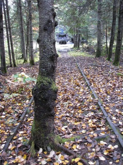
On Google Earth you can see the position of the old locomotives and remaining railroad on Eagle Lake. It would add two days to your trip but so worth it.

 
For what its worth I will chime in and vote in favor of Royalex depending on your skill level. Norm gives that advice because he has seen countless people every year tear up their Kevlar boats in low water on the Allagash. He knows what he is talking about. What you are going to see on this trip is miles and miles of fairly wide and very shallow water. The skill you need comes from experience in this kind of water. My feeling is you need to stand a lot of the time and look for the main water channel from a standing position. It can be very hard to see. If you have done that sort of thing before maybe you can use Kevlar - but why? Take the stress out of the trip and use a Tripper. You won't regret it. Enjoy the trip. It is a lovely river. Too bad you can't include the lakes. The lakes are gorgeous. I think it is worth considering a trip on just the lakes.
 
At 1500 cfs you will be hard pressed to find rocks to hit. The water actually gets pretty deep. So far this year we have had LOTS of rain.

Standing is a good thing to do but not always necessary.. At 1000 cfs the river becomes tricky and at 600 you will drag. To me its not a very wide river. To one running it at low water finding themselves running out of water..its a wide river.

Two days it was 1000 cfs. Yesterday it was 3000. So wide swings in a short period of time are the norm.
 
Thank you all for the great advice, much appreciated. I will confess that I have zero experience navigating rivers, all my canoe time has been on lakes. I've read path of the paddle numerous times and we' ve praticed our back ferrying a bit this year on lakes, but nothing equals true on water experience. Sooo, let's hope for sunny days and cfs over 1500!

shan
 
Just got back last night. We were the beneficiaries of 2 1/2" of rain the evening we camped on Round Pond and that 3000 CFM flow. We didn't see any Kevlar boats on the river and almost 100% ABS OTs, My Royalex did fine in the lower water earlier in the week. I had a new bow paddler with broad shoulders, in awe of his surrounding and it took a good hit.

You're going to have great water and few rocks

http://www.wunderground.com/q/locid:MESPAW
 
It was under 1000 on the 24th and then Sweeper hit it at a high point because of a LOT of rain. It is dropping very fast now. Looking like it will be at or below 1000 in about 2-3 days and heading south fast from there unless there is more rain. Check the water levels carefully the day before you put in. Royalex works well at any water level above 700 or so. vHope it works out for you. I have been on the river a lot over the last 30 years and there are times when it gets very low. Especially in July and August. I have no doubt Norm has put thousands of people on that river. He knows what he is talking about. It is a gentle river though and a nice river for you to paddle. You will love it. Also, if the water is too low you could switch gears and do a trip on the lakes. The lakes are wonderful. Some think the lakes are the best part of the Allagash.

As far as the cost of the shuttle goes, that is a fair price. Also, Norm is about as straight a shooter as you will ever find. Honest and reliable. He has never failed me.
 
Last edited:
Everyone worries about Chase but the rips beyond Round deserve attention.

Water levels go up and down fast here ( I am about 100 miles as the crow flies from the Allagash) and make no predictions. The last rainfall was not really much compared to what we got two weeks earlier.

You stick your hand out the window.. if its wet its raining.. or pine sap dripping..

The river is dam controlled at Chamberlain.. Lock Dam.. If the lake is dropped river levels can be pretty constant even if no rain.. Also Churchill Dam releases vary in amount of water.

Norm has to go by the averages. No outfitter would ever stock Kevlar in this country.. But it can be done at the right water levels just fine. Have hope, but budget for the worst.

Brush up on your French! ( or equally as fun pretend you don't understand what other drivers are saying). Last shuttle was us and also a bunch of drivers going to Chamberlain to pick up private cars.. (some folks use the two key drop system)
 
Last edited:
I will look into tripping on the lakes if the water level is too low. I will have my canoe with me as we are going on a three week roadtrip through acadia nat park, the allagash wilderness and the gaspe region, so I'd rather not shell out the $$ to rent one. Since I only looked into a river trip, can you recommend a nice loop I could do? I have a subaru outback to give you an indication of what kind of roads I can drive on, so nothing more than a well maintained dirt road.
Yellowcanoe, what is the two key system?
 
I should add that after Maine, I was hoping to spend two nights on the Bonaventure in Quebec, should I be concerned with low levels of water there as well?
 
By two key he means that you drive to the put in and hire norm to drive your car to the take out. I have done this many times. If you are coming from the south it saves time. Not sure about water levels on the Bonaventure but that time of year could pose problems there as well. That is a lovely trip with lots of white water.

Most of the white water trips in Northern New England are spring trips if you want reliable water. Water levels get low in summer.

In the Allagash country the "Lobster Trip" is pretty close to a loop. Put in at Lobster Lake and spend a night, paddle back out and down the West Branch of the Penobscot, and spend a night half way down to Chesuncook. One or two night on Chesuncook and out. The shuttle is very short - I'm guessing 10 miles or so maybe - because the trip is a big U shape. Nice way to spend 3-4 nights. Chesuncook is a big lake and you can get stuck there if the wind comes up. So be careful about that. I like this for a quick short trip in nice country. Chesuncook can be low these days because of all the water they run down the Penobscot for the rafter crowd. It is a really nice lake though and low water just means that the banks of the river are not as attractive.

But you could also just put in at the dam at the top of Chase Rapids and paddle up to the end of Eagle lake and maybe carry into Chamberlain and then retrace your steps back to you car. Lovely area. I think you will be ok driving your Subaru in that country but you would be smart to carry an extra spare tire.
 
I should add that after Maine, I was hoping to spend two nights on the Bonaventure in Quebec, should I be concerned with low levels of water there as well?


The Allagash can be run when its low. The Bonaventure cannot. Its already late. A favorite run of Mainers, the Bonny is run in late May and the first two weeks of June. The Bonaventure has the most beautiful clear turquoise water.
 
I'd call Norm re boat. The Allagash has not been getting the rains we have in the other half of Maine.
 
I dont want to shell out the dollars to rent a canoe so when we arrive in the region in about a week (headed to acadia on sunday), we will do some of the lakes as recommended by rpg. I'm also worried that if the water is too low, we don't have the skills to navigate the river safely.

As before, all will depend on water levels, so I will call Norm a few days ahead of time and see what he thinks. Maybe they will have wifi at the campsite in acadia for me to monitor water levels through the site you provided YC!

thank you all for the precious advice!

Shan
 
Get yourself a Maine Gazetteer available in almost every little store in Maine including gas station food marts. (see link below to Walmart). This is all you need for maps in Maine. We use the gazetteer as our only map on almost every trip we go on in Maine. I could read the thing for hours and hours and plan all sorts of whacko trips that I'll never actually go on. It will be very useful for all your travels in Maine.

There are many ways to see the Allagash country on the lakes - one is to put in at Chamberlain Bridge. You could drive there yourself and leave you car for Norm to shuttle. From Chamberlain you could paddle several days - take your time if you can and relax in the lovely campsites for a day or two - down to Churchill Lake. Churchill Lake is where the dam is that controls the water downstream in Chase Rapids and on down. There is a decent road that comes into Churchill Dam so you might just have Norm leave you car there and drive yourself out. I would talk to Norm about this idea - and solicit other ideas from him and others here too.

There is one spot that might be slightly troublesome but nothing death defying or anything. When you go from Chamberlain Lake to Eagle Lake you can take a portage trail or do what almost everyone does which is to float down the outlet at Lock Dam. The outlet stream is very short - and it can be real boney. It is a tiny stream. You might have to do some walking perhaps. In the old days you could open the dam yourself and let more water into the stream to float your boats. I don't think you can do that anymore.

Eagle is gorgeous. Two nights on Eagle sounds glorious to me sitting on my couch here this morning. Lots of campsites are available and most of them are very nice. There is a table and a ridge pole and a fireplace or fire circle at every site. A tarp thrown over the ridge pole gives you a nice dry place to sit. At many of the site the ridge pole extends past the end of the table over a fire place so you can cover the fireplace as well and have a fire in the rain.

Be aware that there is no cell service so you have to nail down you plans with Norm before you put in. Also, have the cash you need to pay the piper at the north maine woods gate. They take a pretty good pound of flesh for daily use and overnight camping fees. Seems like it is $15 or $20 per person per day or close to that for non residents.

By the way - I don't think you have to worry about safety on the river in low water. Its not safety that is the issue when the water is real low. The problem is that it becomes a struggle to find enough water to float your boat and you find yourself getting in and out of your boat all the time to walk in the water - not fun after a full day. Ten miles of dragging can get pretty old pretty fast. If you have royalex you can drag the loaded boat over gravel without a big worry. Kevlar not so much. When there is enough water the river is a very easy river paddle with the Chase rapids section being the only real white water you have to contend with. So, with enough water the original plan you have is a good one for you. I just have my doubts that you will have enough water.
 
Last edited:
Bring a big tarp.. A 12 x 12 Kelty cat cut looks like a hanky when suspended on the ridgepole.. And the winds have been substantial.. leave yourself a little wiggle room in the schedule. Chamberlain and Eagle can butt whip you ba.d
 
Well doncha know.. Plans now are for an Allagash trip. I think that four weeks post cardiac I can get permission for a canoe trip. The Allagash is friendly for any evac if needed. (Lake Superior isn't). We'll take zee dawg and two solo canoes. Probably let Norm pick up our truck in Chamberlain Bridge and have one of his drivers return it to his base. This involves key mailing which is no big deal.
 
Back
Top