• Happy Halloween! 🎃🎂

East end of WCPP to Lake Winnipeg via the Blood Vein - any suggestions?

Thanks guys, Martin - excellent map that helps a lot. So are the mothers tough because they are swampy, mucky - hard to find, steep, looooong ... what is it that make them so difficult? Also, are they open from the snow event - I am guessing there are not a lot of travelers in that area until the Bloodvein.
The only good news is that they are never steep. They are always long, sometimes submerged from beaver activity and not maintained very often. If you follow my GPS coordinates you will not veer off onto the local trapper's snowmobile route that really get swampy and mucky. There are some real good stories on canoestories.com that are entertaining reading. http://canoestories.com/fly_in_paddle_out.htm
 
If it helps, we 2 middle aged womenfolk did them twice in a week. Coming back we did all 3 in a day, 2 carries each, 8 1/2 hours.

If you follow this link... http://www.myccr.com/phpbbforum/viewtopic.php?f=113&t=36193 you get to my reports on these portages from 2011 on MyCCR. Lots of photo's to help take out some of the mystery. When we did them it was a VERY dry year. There was still plenty of thigh deep mud if you stepped in the wrong places but it wasn't near as wet as some of the horror stories I have read. It would seem one of the difficult parts is where you come out of the trees up from Siderock lake and cross the creek. It is a overgrown dry beaver pond, difficult to walk, but I've been told finding the trail again is the hard part. It is not straight across but angled to the right a ways.

Don't know if we will get up there in the Spring at all, but if we do we can walk up and flag it again for others.
 
Last edited:
No Title

I am following this thread with interest. There are no bad choices, reguardless of the route you select, wether you tour WCPP or make tracks straight to the Bloodvein - or the Gammon. I am familiar with the area, having been there many times since the mid '80's, so it will be interesting to hear about your choices and experiences on the water here in our neck of the woods.

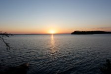
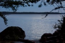
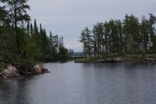
These pictures are from my September solo trip from Wallace lake to Wapeskapek lodge on the Gammon river.
 

Attachments

  • photo1268.jpg
    photo1268.jpg
    88 KB · Views: 0
  • photo1269.jpg
    photo1269.jpg
    92.9 KB · Views: 0
  • photo1270.jpg
    photo1270.jpg
    120.5 KB · Views: 0
Although none of the portages in Atikaki are maintained, the Mothers actually form a snowmobile route in the Winter and Marty up at Wallace Lake campground uses it to get up to Obukowin to ice fish so generally they are kept open. The one caveat, in the section from Siderock to First Lake, at the fork in the trail, the sleds go right but the portage goes left up over the rocks. The sleds usually take the lower route since it it frozen and they stay off the high road.

We did not get up to Wallace Lake at all this year so I'm sure Marty is wondering what happened to us, but whenever we have been there we let him know which trails have dead fall and he does his best to get it cleaned out, at least on the Mothers.
 
Back
Top