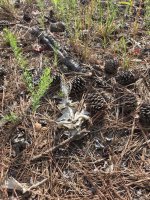
We've gone from flood to drought here in the Carolinas. Over the 4th of July weekend I went to see the north western end of Falls Lake.
Location: Falls Lake, NC, near Hickory Hill boat ramp.
Date: early July 2026
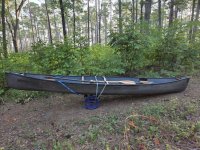
Craft: fiberglass Mad River Explorer
Paddlers: 1 adult
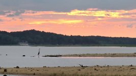
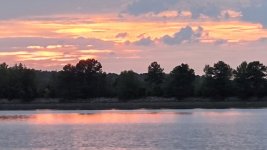
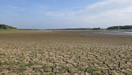
Falls Lake was about 6 feet below normal pool. The area around I85 is very shallow. I think a few square miles of lake bed are either dry or nearly dry.
It was brutal hot. The nighttime low was 75 F. The morning was hot, sunny, and temperatures were in the low 80s during my paddle.
The first challenge was getting to the water. Hickory Hill boat ramp is closed due to the low water. Roadside put-ins, like at Panther Creek cove, are dry. You could walk under the bridge without getting your feet wet.
I walked around 700 yards on the Mountains to Sea Trail (MST) with the canoe. I walked another 1/2 mile scouting for a steep, firm spot to put in.
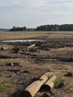
While scouting I came upon the old railroad causeway. It was mainly wood piles, which were cut off in the 1980s to clear the lakebed. In the foreground is driftwood and old stumps. Far in the distance the Nuese river cuts through the mud.
Brick and wood debris from pre-lake structures area are visible.
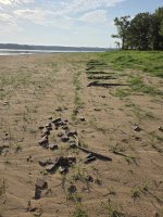
Some places are sandy, some gooey mud, some cracked mud.
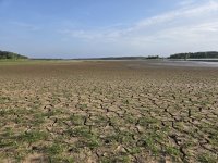
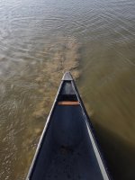
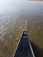
I finally made it to the water, but it was very shallow in most places. The canoe was frequently stirring up mud. It was slow, hot and tiring.
The egrets, heron, sandpipers and osprey were plentiful as usual. I couldn't get good pictures. The egrets were feeding a 1/2 mile across the mud. The heron flew off with a horse cloak. The osprey chattered as it flew, but stayed out of camera range.
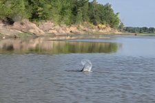
As I approached the Hickory Hill boat ramp three beaver took exception to my presence. I got several tail slap warnings.
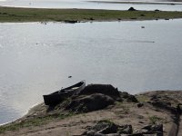
I landed near the boat ramp to walk up the bluff for a better view. As i landed my pole sank 5 feet into the mud along the shore. I understood why they closed the ramp, it would be easy to get into trouble here.
When I returned the three beavers were circling my canoe. I was relieved they weren't gators or sharks.
I turned back to the southeast, hoping to find deeper water and a better takeout. After about a 1/2 mile of 2 inch deep water I finally reached deeper water.
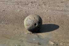
I spotted an odd sized sphere submerged along the shore. A bowling ball? Rubber dog ball? Unexploded ordinance? It was a coconut?!
I found a takeout along the MST close to a paved road. It required beaching hard to bridge 10 feet of muck, but I managed to get on semi-solid ground.
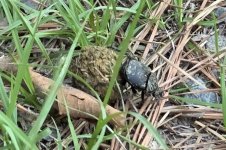
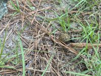
The final wildlife sighting was a dung beetle doing its backward rolling trick.
The walk back was much easier along the road. But the sun was getting high and the shade was shrinking. It was time to get inside.
It was a very tough, muddy morning, but worth it to see the lake. Next time have to download historic topos to find the river channel.
Location: Falls Lake, NC, near Hickory Hill boat ramp.
Date: early July 2026
Craft: fiberglass Mad River Explorer
Paddlers: 1 adult
Falls Lake was about 6 feet below normal pool. The area around I85 is very shallow. I think a few square miles of lake bed are either dry or nearly dry.
It was brutal hot. The nighttime low was 75 F. The morning was hot, sunny, and temperatures were in the low 80s during my paddle.
The first challenge was getting to the water. Hickory Hill boat ramp is closed due to the low water. Roadside put-ins, like at Panther Creek cove, are dry. You could walk under the bridge without getting your feet wet.
I walked around 700 yards on the Mountains to Sea Trail (MST) with the canoe. I walked another 1/2 mile scouting for a steep, firm spot to put in.
While scouting I came upon the old railroad causeway. It was mainly wood piles, which were cut off in the 1980s to clear the lakebed. In the foreground is driftwood and old stumps. Far in the distance the Nuese river cuts through the mud.
Brick and wood debris from pre-lake structures area are visible.
Some places are sandy, some gooey mud, some cracked mud.
I finally made it to the water, but it was very shallow in most places. The canoe was frequently stirring up mud. It was slow, hot and tiring.
The egrets, heron, sandpipers and osprey were plentiful as usual. I couldn't get good pictures. The egrets were feeding a 1/2 mile across the mud. The heron flew off with a horse cloak. The osprey chattered as it flew, but stayed out of camera range.
As I approached the Hickory Hill boat ramp three beaver took exception to my presence. I got several tail slap warnings.
I landed near the boat ramp to walk up the bluff for a better view. As i landed my pole sank 5 feet into the mud along the shore. I understood why they closed the ramp, it would be easy to get into trouble here.
When I returned the three beavers were circling my canoe. I was relieved they weren't gators or sharks.
I turned back to the southeast, hoping to find deeper water and a better takeout. After about a 1/2 mile of 2 inch deep water I finally reached deeper water.
I spotted an odd sized sphere submerged along the shore. A bowling ball? Rubber dog ball? Unexploded ordinance? It was a coconut?!
I found a takeout along the MST close to a paved road. It required beaching hard to bridge 10 feet of muck, but I managed to get on semi-solid ground.
The final wildlife sighting was a dung beetle doing its backward rolling trick.
The walk back was much easier along the road. But the sun was getting high and the shade was shrinking. It was time to get inside.
It was a very tough, muddy morning, but worth it to see the lake. Next time have to download historic topos to find the river channel.
Attachments
Last edited: