Introduction
I am basically a river paddler, I can count on one hand the flatwater trips I have done over the past 40 years. Sure, some of those river trips have included long sections of flatwater. For example, my 2018 George River trip started with a 100+km crossing of the Smallwood Reservoir and then later in the trip the 110km of Indian House Lake but that trip included well over 125 sets of rapids some of which were up to 10km in length. This year I was looking for an “easy” trip with little if any portages and minimal moving water drama.
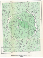
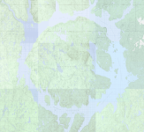
I have driven Hwy 389 (north) from Baie Comeau to Labrador City four times in the past and returned south two times in the past (great drive if you don’t mind the +/- 200km gravel sections!). From Hwy 389 you only get a couple of places where you can actually see the reservoir from the Hwy but it has always struck me as a place I should paddle some time.
I planned to do this trip last year but had to cancel at the last minute due to health issues (my partner not me), figured I would be a considerate person and not say “I’m going paddling; hope you are still alive when I get back”.
Getting There (August 18/19)
It is 1540km from my home in Toronto to the put in at Relais Gabriel. It is a truck stop and one of the few places you can buy overpriced gas and get a high fat content meal along Hwy 389. I planned for one or two “stealth camps” along the way. If you know anything about Toronto, you would be aware that rush hour starts at 7:00am and ends sometime after 7:00pm. Since I am in the west end of the city and am driving east I planned to leave around 1:00pm to avoid the worst of the worst. No big surprise I did not leave until 3:15pm and paid the price, two hours to cover the first 70km (in the middle of the night it would be 45 minutes).
Once past the bumper to bumper it was smooth sailing, I got to the Big Apple before closing to pick up my pie, Belleville for a quick stop at Wendy’s for a burger and then the final stop at the Rez in Marysville for cheap gas and a spare carton of smokes. I used my sneak route to get past Montreal and get on Hwy 20 for Quebec City. Stealth Camp 1 is about an hour past Montreal, I was aware that it was closed for renovations (highway rest area) so I had to go past, take the next exit, backtrack a short distance to the rest area for westbound traffic. This stop is not quite as nice but there was some parking available near the back that I could use. Parked there are managed 4 – 5 hours of sleep in the back of my Tacoma (already set up with my Thermarest and sleeping bag). When I got up I made some tea and a quick breakfast and headed east to Quebec City.
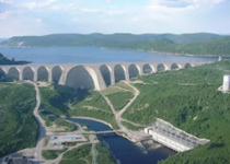
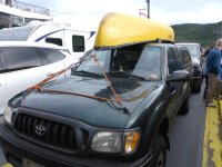
Having done this route many times, I actually took all the right turns, got across the bridge, did NOT end up in the old city and took the correct exit off the expressway to get to the local Costco. Why Costco? Well multiple reasons, I wanted to gas up (gas prices in Quebec are out of hand), I wanted to see if they had local strawberries (YES!) and of course, no visit to Costco is complete without a rotisserie chicken! It’s a nice drive along the north shore of the St Lawrence all the way from QC to Baie Comeau, good highway but very hilly which is a bit of a challenge for my fully loaded 4-banger Taco. One has a short break to stretch when you reach the ferry that crosses the Saguenay Fjord. Sometimes you get to see whales here (I have but only once). 25 years ago, there used to be a good stealth camp right after the ferry but about 15 years ago, they built a police station right next to it! In any event, it was only early afternoon, far too early to camp again. I continued east contemplating a stop at Stealth 2 (a dirt road turn off with a good parking spot just a few hundred meters from the highway). I was feeling good and only about an hour away from Baie Comeau and the turn off for Hwy 389 so I continued. I gassed up to overflowing, the return trip on 389 is a bit over 600km, my tank will get me about the same distance and while there are a couple of places you can refuel the price of gas on that road is EXTREME. There is an ongoing 30 Billion Dollar project to upgrade the road, one day the whole thing will be paved and in many places, they will blast out some of the hills and the twist and turns but for now only the section up to the Manic-5 power station is paved, the next 100km to the put-in is gravel. It’s good gravel but by the time I reached Manic-5 it was dark so that 100km was a bit of a white knuckle ride given there are trucks going both ways and they don’t slow down for anyone!
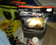
It should be noted, the paved portions are extremely well marked with signs for upcoming turns and the center and shoulder lines always seem to be freshly painted. The gravel parts are not so good, the surface, especially if recently graded is also good but the ditches are deadly if you need to move over to get away from an oncoming truck. I arrived at Relais Gabriel around 11:30pm, parked on the other side of the highway, tore a drumstick off my Costco chicken for a quick “dinner” and crashed out in the back of Taco as usual. Tomorrow my trip will begin!
Crossing the Saguenay Fiord
View of the mouth of the fjord

I am basically a river paddler, I can count on one hand the flatwater trips I have done over the past 40 years. Sure, some of those river trips have included long sections of flatwater. For example, my 2018 George River trip started with a 100+km crossing of the Smallwood Reservoir and then later in the trip the 110km of Indian House Lake but that trip included well over 125 sets of rapids some of which were up to 10km in length. This year I was looking for an “easy” trip with little if any portages and minimal moving water drama.
I have driven Hwy 389 (north) from Baie Comeau to Labrador City four times in the past and returned south two times in the past (great drive if you don’t mind the +/- 200km gravel sections!). From Hwy 389 you only get a couple of places where you can actually see the reservoir from the Hwy but it has always struck me as a place I should paddle some time.
I planned to do this trip last year but had to cancel at the last minute due to health issues (my partner not me), figured I would be a considerate person and not say “I’m going paddling; hope you are still alive when I get back”.
Getting There (August 18/19)
It is 1540km from my home in Toronto to the put in at Relais Gabriel. It is a truck stop and one of the few places you can buy overpriced gas and get a high fat content meal along Hwy 389. I planned for one or two “stealth camps” along the way. If you know anything about Toronto, you would be aware that rush hour starts at 7:00am and ends sometime after 7:00pm. Since I am in the west end of the city and am driving east I planned to leave around 1:00pm to avoid the worst of the worst. No big surprise I did not leave until 3:15pm and paid the price, two hours to cover the first 70km (in the middle of the night it would be 45 minutes).
Once past the bumper to bumper it was smooth sailing, I got to the Big Apple before closing to pick up my pie, Belleville for a quick stop at Wendy’s for a burger and then the final stop at the Rez in Marysville for cheap gas and a spare carton of smokes. I used my sneak route to get past Montreal and get on Hwy 20 for Quebec City. Stealth Camp 1 is about an hour past Montreal, I was aware that it was closed for renovations (highway rest area) so I had to go past, take the next exit, backtrack a short distance to the rest area for westbound traffic. This stop is not quite as nice but there was some parking available near the back that I could use. Parked there are managed 4 – 5 hours of sleep in the back of my Tacoma (already set up with my Thermarest and sleeping bag). When I got up I made some tea and a quick breakfast and headed east to Quebec City.
Having done this route many times, I actually took all the right turns, got across the bridge, did NOT end up in the old city and took the correct exit off the expressway to get to the local Costco. Why Costco? Well multiple reasons, I wanted to gas up (gas prices in Quebec are out of hand), I wanted to see if they had local strawberries (YES!) and of course, no visit to Costco is complete without a rotisserie chicken! It’s a nice drive along the north shore of the St Lawrence all the way from QC to Baie Comeau, good highway but very hilly which is a bit of a challenge for my fully loaded 4-banger Taco. One has a short break to stretch when you reach the ferry that crosses the Saguenay Fjord. Sometimes you get to see whales here (I have but only once). 25 years ago, there used to be a good stealth camp right after the ferry but about 15 years ago, they built a police station right next to it! In any event, it was only early afternoon, far too early to camp again. I continued east contemplating a stop at Stealth 2 (a dirt road turn off with a good parking spot just a few hundred meters from the highway). I was feeling good and only about an hour away from Baie Comeau and the turn off for Hwy 389 so I continued. I gassed up to overflowing, the return trip on 389 is a bit over 600km, my tank will get me about the same distance and while there are a couple of places you can refuel the price of gas on that road is EXTREME. There is an ongoing 30 Billion Dollar project to upgrade the road, one day the whole thing will be paved and in many places, they will blast out some of the hills and the twist and turns but for now only the section up to the Manic-5 power station is paved, the next 100km to the put-in is gravel. It’s good gravel but by the time I reached Manic-5 it was dark so that 100km was a bit of a white knuckle ride given there are trucks going both ways and they don’t slow down for anyone!
It should be noted, the paved portions are extremely well marked with signs for upcoming turns and the center and shoulder lines always seem to be freshly painted. The gravel parts are not so good, the surface, especially if recently graded is also good but the ditches are deadly if you need to move over to get away from an oncoming truck. I arrived at Relais Gabriel around 11:30pm, parked on the other side of the highway, tore a drumstick off my Costco chicken for a quick “dinner” and crashed out in the back of Taco as usual. Tomorrow my trip will begin!
Crossing the Saguenay Fiord

View of the mouth of the fjord

Last edited:

