• Happy Father's Day! 👨‍🦳👨‍👧‍👦😍

Allagash Loop. What’s your preferred direction?

Joined
Sep 18, 2022
Messages
157
Reaction score
239
Location
Camden, Maine
I’m planning to paddle the Allagash Loop the week after next and am wondering, especially for those who have paddled it in both directions, which is your preferred direction — clockwise or counter clockwise? And why?

Thanks. Art
 
Could you expand a bit on the Loop? I'm assuming you mean Chesuncook-Allagash-Chamberlain-Mud Pond- Umbazooksus-Chesuncook. If so, I'll be anxious to read opinions too, as I am pondering a couple of adventures in that area that include the Mud Pond Carry.
 
Could you expand a bit on the Loop? I'm assuming you mean Chesuncook-Allagash-Chamberlain-Mud Pond- Umbazooksus-Chesuncook. If so, I'll be anxious to read opinions too, as I am pondering a couple of adventures in that area that include the Mud Pond Carry.
5
Thanks, Patrick. Yes, that’s the loop I’m referring to.

I’d rather go counter clockwise, since the wind would likely be to my back on the trip down Chamberlain Lake. But I’m wondering if there is an advantage in terms of which stream I would have to go against the current — Allagash Stream or Caucomgomoc Stream.

Art
 
Most recent trip was 2015 during high water. Put-in April 8, take-out, load-up April 13. High water versus lower water assists greatly. I parked at the campsite at Caucomgomoc Dam. Going clockwise made most sense to me.

Going with the current on Allagash Stream and Umbazookus Stream was the deciding factor. I attained Caucomgomoc Stream to a point due to high water for my get-out. As soon as both stream banks begin to rise, take out on riverright. This is the end of the marsh like portion of Caucomgomoc Stream. Find your way through tall marsh grass to the forest to a woods road that leads to the dam.

You have completed the Loop!
 
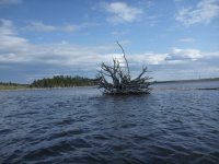
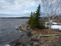
P1020685.jpegNorthern wind ripping through, do I stay or do I go? I’m going! Five months of no canoeing, time to get the canoe under me again and live. Twenty two minutes later I am in the lee. Ciss Stream will give me access to Round Pond campsite.

If possible, call the Maine Game Warden Service and North Maine Woods to confirm the levels on Allagash and Caucomgomoc Streams. There are no USGS gages on either of those streams. Though, I thought there was a gage on Caucomgomoc? Gages come and go…

Best to ask if the Warden has paddled the stream at present level before? What did they experience, solo, tandem and what difficulties did they have? I carried three times due to high water. Solo, I needed to be safe.

Unfortunately, the Allagash River and St. John River are horribly low. Better to have more water than less.

Wind is ever present, no way to plan or know. I met three fisherman as I was doing the final gear check. They told me two days before the lake was covered in ice. Due to constant high winds the ice broke, waved and evaporated due to the high angled sun and high winds. I survived after twenty two minutes of furious paddling, correcting and knowing I can best this headwind. Finally in the lee and headed for Ciss Stream.

The artwork of nature not ever fails me.
 
I've only done it once, clockwise, but I've separately gone up Allagash Stream. I think Allagash Stream is harder upstream than Caucomgomic, and it's a lot of fun downstream if there's water. Also, there is sort of a trail (no warranty!) leading to a road with Caucomgomic, whereas with Allagash Lake it's purely poling/tracking. That said, if I was going to do it again I might go counterclockwise just for variety.

If Allagash Stream is really low it's a slog either way, but then you have the place to yourself as the rangers will have scared off the float trip folks. Save time for the tower trail on Allagash Lake.
 
I’m planning to paddle the Allagash Loop the week after next and am wondering, especially for those who have paddled it in both directions, which is your preferred direction — clockwise or counter clockwise? And why?

Thanks. Art
I did this trip clockwise in May 22. I put in at Umbazookus west campsite and paddled down through Chesuncook and up Black pond. As it was May the current was pretty stiff as I lined up to the Horserace and Caucomgomoc and I fell about 500 times. I had planned to do the Mud pond carry later in the trip but this did my knee in. Camped at Caucomgomoc dam.

The next day I paddled up Ciss stream to round pond and did the 2 1/2 mile carry ( on wheels ) to Allagash lake. Spent two nights, one at Ede’s and one at Sandy Point. Eventually headed down Allagash stream ( beware the ledge drops below Little Allagash falls ) and into Chamberlain. Spent a night at some random campsite on the lake and took out at Chamberlain bridge. Left my canoe at the ranger station and hiked / hitched back to my truck at Umbazookus west.
I’m not sure how you would deal with Allagash stream if you went counter clockwise.
 
I've tried it twice (Clockwise, starting at Umbazookus Stream ). On the first try, I got turned back at Caucomgomoc Stream due to high winds. On the second try, I ran out of water. Ray at Loon Lodge recommended not going forward as Allagash Stream was mostly a drag.
My choice for clockwise is riding Allagash Stream down and Mud Pond carry at the end of the trip because the load is lighter.
Side trips: Ciss Stream into Dagget Pond, lots of Moose, and Poland Pond for the same reason.
 
The time I did it in low water (August 2019 -- this trip), it was still doable but definitely a drag. But solitude ... I was definitely the only person on Little Round Pond that night.

img_20190803_085108879s-jpg.102159


As @JD Corry says, watch those ledge drops (if there's actually water). None of them are huge, but there's one pair that are too close together -- you want to go right then left, but there isn't enough carpet for that.
 
I'm heading to Allagash Lake in early July and trying to hedge my chances of having enough water to put in at Johnson Pond, or the upper portion of Allagash Stream (along Johnson Pond Rd, to the west of Allagash Lake, near the "To St. Juste" label in the map below).

In the days leading up to the trip, I plan to take @Dirigo's advice and call ahead to the NMW checkpoint, as well as the Rangers.

I know "it all depends" but I'm curious if anyone will opine on the relative likelihood of water levels being viable based on early July norms. I presume this is wishful thinking and that I ought to plan to carry in at the southern gate.

EDIT: Satellite images look like the outlet from Johnson Pond isn't a viable connection to Allagash Stream.

Allagash Lake Screenshot 2025-05-29 101451.jpg
 
Last edited:
Almost two years ago a friend and I went in via Johnson pond on July 4th in kayaks. The water level was very high for that time of the year. None of the rangers we spoke to could tell us the conditions in advance. We took a chance. I made it most of the way but my friend had to walk almost all of johnson stream. Johnson pond road was in rough shape and slow driving. A ranger told us Johnson pond road was impassable past the pond. Another ranger ranger later told us it was very difficult but he managed to make it all the way to allagash stream. I seem to remember that about 7 years ago the road was in much better condition. We came out the same way. A group of canoes were headed in as we were leaving. We decided it was a wash for time taken between Johnson pond and the carry trail at that water level. Many years ago the head ranger told me the water levels were far too low at that time of the year for Johnson stream. At the time we had split up, some by carry trail and one canoe via johnson stream. The canoe pair had a terrible time wading in deep mud at the stream and vowed to never do that again. That pair ended up exiting by the carry trail.
 
Back
Top