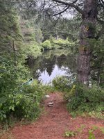
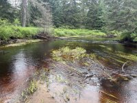
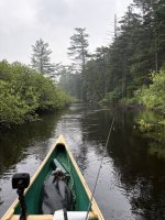
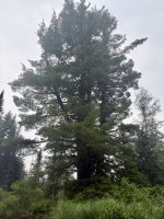
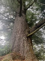
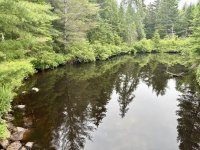
The Jordan River runs through the Raquette Boreal Complex in the Adirondack park, and is a place that I had been interested in exploring ever since I read about it in an obscure Adirondack Explorer article. The article claimed it was one of the most “true wilderness experiences you could get in the Adirondack park” or something along those lines.
After additional research, I learned that accessing the river required a 1.5 mile portage from Carry Falls Reservoir. The few bits of information I found claimed that the river is rarely paddled, and there is zero development after the portage and put in, including no designated campsites. I should expect a bunch of lift overs for beaver dams and downed trees, supposedly the river is navigable for up to 16 miles upstream from the put in, and there may be native brook trout.
All of this information sounded great to me. I looked at the area in google earth and on CalTopo, and created a route that I thought I could tackle. I planned for two nights, one night camping on the shores of Carry Falls Reservoir and another night roughly 7 miles up from the put-in on the Jordan River in an area with what looked like favorable topography and large trees to accommodate a bush camp.
I tucked this information away and waited for a free weekend and my wife’s approval to leave her with our 3 young kids for two nights. Lo and behold, on Thursday, July 16th my wife looked at me after dinner and said, “We don’t have plans this weekend. Didn’t you say you wanted to do a solo camping trip?” That was all I needed to hear. The plans were dusted off, gear was packed, canoe loaded, and after a sleep and full day of work on Friday, I said my goodbyes to the family and hit the road for the one hour drive to Carry Falls Reservoir.
Friday, July 17th, Carry Falls Reservoir, Colton, NY:
Parmenter Campground is located along the road to the public boat ramp at the south end of Carry Falls Reservoir. You pass through the campground to get to the boat ramp. While I was loading my canoe, an older couple that had been camping and fishing on the reservoir since the 60’s chatted with me about what my plans were. The man (Dave I think his name was) said that he had always heard there were old growth white pines along the Jordan River. I told him I would keep my eyes open and promised to take a picture and show him if I saw him when I got back.
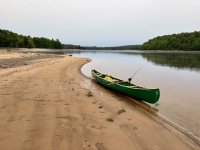
Carry Falls Reservoir, looking north after putting in at Parmenter Campground
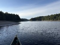
I started paddling around 6:30 pm with the goal of finding a place to camp near the start of the portage. The older couple I had talked to said there were plenty of nice beaches at the current water level and anything below the high water line was fair game for camping. There are private camps on the lake, and I made a point to look for a spot that didn’t have any posted signs above the high water line.
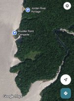
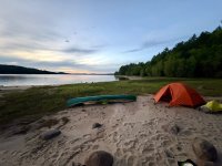
I paddled a little over 2 miles that evening. I stopped twice to fish structure that I just couldn’t resist and was rewarded with a nice smallmouth bass and a small pike. About 30 mins before sunset, I found a sandy point on the eastern shore that looked like it would make a good camp. It was located between the mouth of the Jordan River to the south, and the start of the portage to the north.
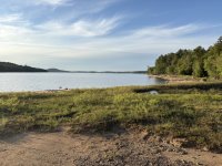
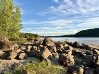
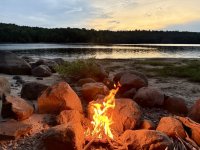
There were some large boulders, on the point above the beach that offered some protection and a place for a fire.
I quickly made camp as the sun was setting and had a nice fire and enjoyable evening watching the stars come out.
The boat traffic on the lake picked up after dark, and some folks camping out of a pontoon boat on an island set off a few fireworks with some battle yells and whoops for effect. I tried not to be too annoyed with them. Accessible places tend to be loud places, and everyone has their own ideas of fun. I would find my solitude tomorrow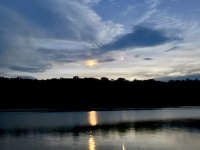
It was still a beautiful evening and great campsite. Everything was quiet and peaceful after about 10:30 pm. I decided it was time for bed, and I put out my driftwood fire. The weather was great, but rain was in the forecast for Saturday.
Tomorrow would be an adventure.
After additional research, I learned that accessing the river required a 1.5 mile portage from Carry Falls Reservoir. The few bits of information I found claimed that the river is rarely paddled, and there is zero development after the portage and put in, including no designated campsites. I should expect a bunch of lift overs for beaver dams and downed trees, supposedly the river is navigable for up to 16 miles upstream from the put in, and there may be native brook trout.
All of this information sounded great to me. I looked at the area in google earth and on CalTopo, and created a route that I thought I could tackle. I planned for two nights, one night camping on the shores of Carry Falls Reservoir and another night roughly 7 miles up from the put-in on the Jordan River in an area with what looked like favorable topography and large trees to accommodate a bush camp.
I tucked this information away and waited for a free weekend and my wife’s approval to leave her with our 3 young kids for two nights. Lo and behold, on Thursday, July 16th my wife looked at me after dinner and said, “We don’t have plans this weekend. Didn’t you say you wanted to do a solo camping trip?” That was all I needed to hear. The plans were dusted off, gear was packed, canoe loaded, and after a sleep and full day of work on Friday, I said my goodbyes to the family and hit the road for the one hour drive to Carry Falls Reservoir.
Friday, July 17th, Carry Falls Reservoir, Colton, NY:
Parmenter Campground is located along the road to the public boat ramp at the south end of Carry Falls Reservoir. You pass through the campground to get to the boat ramp. While I was loading my canoe, an older couple that had been camping and fishing on the reservoir since the 60’s chatted with me about what my plans were. The man (Dave I think his name was) said that he had always heard there were old growth white pines along the Jordan River. I told him I would keep my eyes open and promised to take a picture and show him if I saw him when I got back.
Carry Falls Reservoir, looking north after putting in at Parmenter Campground
I started paddling around 6:30 pm with the goal of finding a place to camp near the start of the portage. The older couple I had talked to said there were plenty of nice beaches at the current water level and anything below the high water line was fair game for camping. There are private camps on the lake, and I made a point to look for a spot that didn’t have any posted signs above the high water line.
I paddled a little over 2 miles that evening. I stopped twice to fish structure that I just couldn’t resist and was rewarded with a nice smallmouth bass and a small pike. About 30 mins before sunset, I found a sandy point on the eastern shore that looked like it would make a good camp. It was located between the mouth of the Jordan River to the south, and the start of the portage to the north.
There were some large boulders, on the point above the beach that offered some protection and a place for a fire.
I quickly made camp as the sun was setting and had a nice fire and enjoyable evening watching the stars come out.
The boat traffic on the lake picked up after dark, and some folks camping out of a pontoon boat on an island set off a few fireworks with some battle yells and whoops for effect. I tried not to be too annoyed with them. Accessible places tend to be loud places, and everyone has their own ideas of fun. I would find my solitude tomorrow
It was still a beautiful evening and great campsite. Everything was quiet and peaceful after about 10:30 pm. I decided it was time for bed, and I put out my driftwood fire. The weather was great, but rain was in the forecast for Saturday.
Tomorrow would be an adventure.
Last edited: