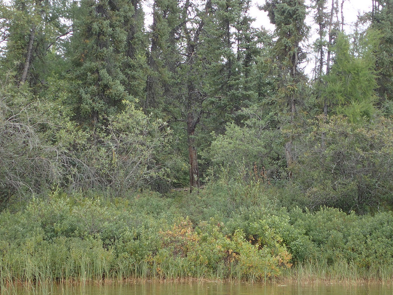
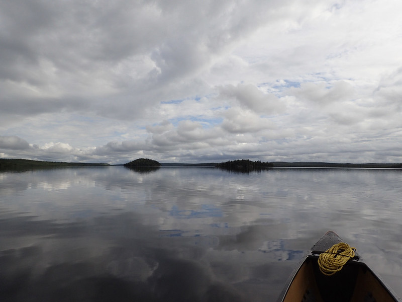
Too soon the esker lakes were gone. Always my internal conflict of keep paddling or stop and do more exploring. I like paddling so that's what usually wins. Besides, I'd be coming back this same way in 2-3 weeks for another look. The last portage from the esker lakes into Fort Hall Lake is interesting. It's only about 25' (7.6m) long but the difference between lakes'; elevations is about 6' (1.8m). No rapids or anything exciting like that. Just pull your canoe up on shore, drag it down a dirt bank, and suddenly you're eye level with where you were paddling 2 minutes ago. Coming into this portage there was a strong tail wind and I was really looking forward to getting onto Fort Hall Lake and putting up sail. But in the 10 minutes it took to complete the portage the wind completely died off and instead we found ourselves floating on a perfectly flat sheet of glass. If I couldn't have a tail wind that was the next best thing. After paddling out into the middle of the lake to get away from the bugs we spent about 10 minutes just sitting motionless listening to the absolute silence. A Pacific Loon may or may not have flown right over us, twice.
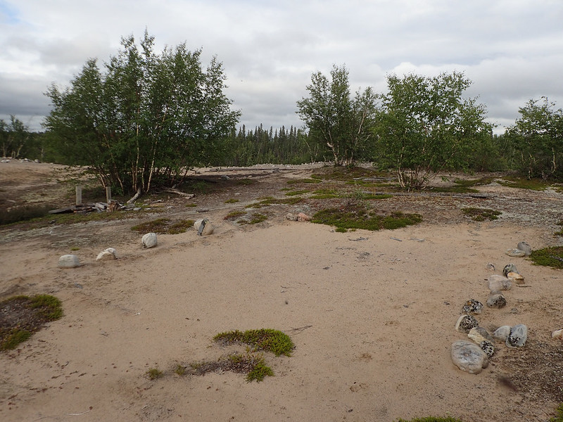
It was still relatively early and I decided to paddle the last few miles and stop at “The Hammer”, which is the name I gave the peninsula located mid-lake for obvious reasons, hoping I'd find a good place to camp for the night. Since it was so peaceful and I was in no hurry I was just plodding along when all of a sudden the wind started to pick up again. Next thing I know I've got the sail flying and we're making good headway up the lake. It pushed me for a couple miles and then died again just as suddenly when I was 200 yards away from the hammer. Between the odd wind and the foreboding clouds I found the most protected site I could on the north side of the peninsula where the hammer meets the handle. Pulling ashore there was a nice path through the alders to higher ground that led immediately to an opening in the woods that would make a wonderful campsite. I took a little tour and found these sites scattered all over the peninsula. It was like someone laid out a campsite for a new national park and then no one ever showed up to use them. There was no garbage, no cut down trees, and after searching I was only able to find one old fire ring. This seems like the most obvious place to camp on the whole lake with sand beaches and nice camping but you'd never know anyone had.
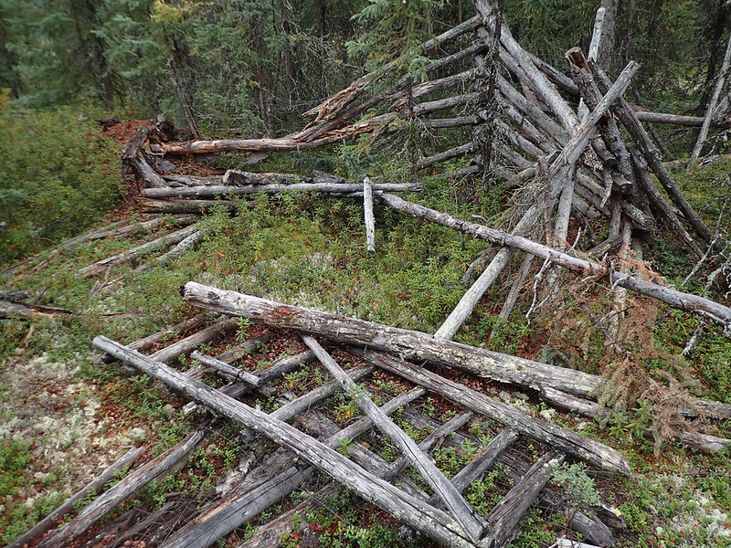
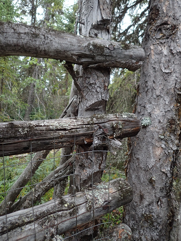
Well, except for the old corral that took up half the peninsula. I was quite surprised when I came across a section of fallen down fence and the more I looked the more I saw. Originally it was quite extensive with multiples gates and chutes. It probably stood close to 6' (1.8m) high with square steel mesh covering the whole thing. At first I figured it was to trap caribou that walked out on the peninsula to swim the narrow channel but if it was for caribou why the steel mesh? The whole thing was built with local materials except for the mesh and nails. I wonder when it was built and how long it was used? Some pretty good work went into it.
 20160813_185
 by
Alan, on Flickr
 20160813_188
 by
Alan, on Flickr
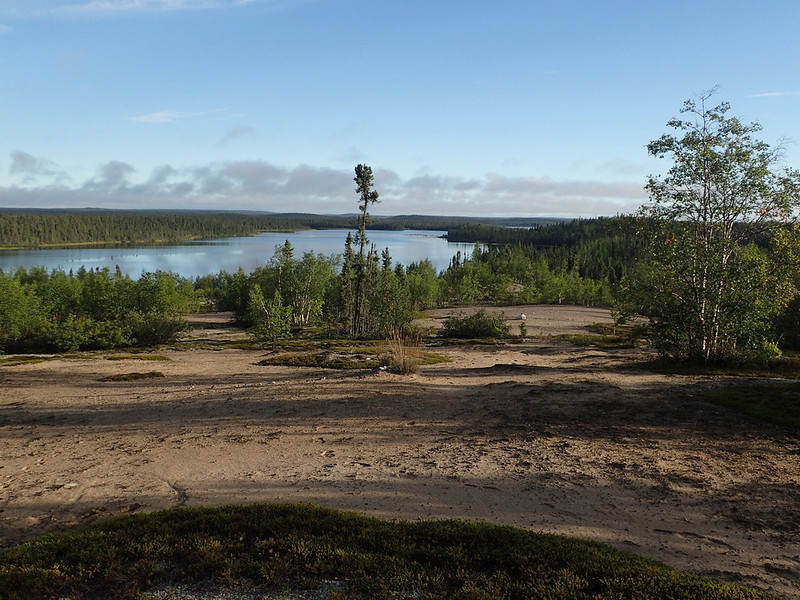
That evening there was some thunder in the distance and the wind switched to the West but thankfully it was only a small rain shower that passed through. In the morning it was warm, humid, and dead calm again. The mosquitoes were out in force and I couldn't get out on the lake fast enough. After paddling a few miles we passed the tall overlook between Fort Hall and Thanout Lakes where old Kasmere was buried. His request was to be buried standing up, on top of this hill, so that he could watch over his people as they traveled through. I'd planned to climb the hill (no quick task) but knowing it would be crawling with hungry mosquitoes and wanting to take advantage of the calm wind I kept paddling on. There was always the return trip to take a visit.
We stopped for a rest in the middle of Thanout Lake and a curious loon swam to within 20'; of the canoe before stopping to stare at us. It began to call and then dive. It repeated this about 6 times before losing interest and moving on. I'd been seeing more loons than I could shake a stick at but this was pretty special.
 20160813_193
 by
Alan, on Flickr
About then an east wind suddenly sprang up. There's a lot I don't know about reading and predicting weather but one thing I've learned is that nothing good ever comes from an east wind. I picked up the pace and headed for the ruins of Fort Hall, an old Hudson's Bay trading post a little over a mile away. Looking over my shoulder I could see the far hills being shrouded in a white haze from the incoming rain. Every time I checked it seemed one more ridge had been taken over. We hit the beach just as the rain started to fall in earnest. I pulled the gear up on the beach and turned the canoe over the top of it before Sadie and I ran up the shore to find some trees to hide in. Thankfully the storm soon passed but the clouds were still threatening. I decided to spend some time exploring the site while I waited to see what the weather would do.
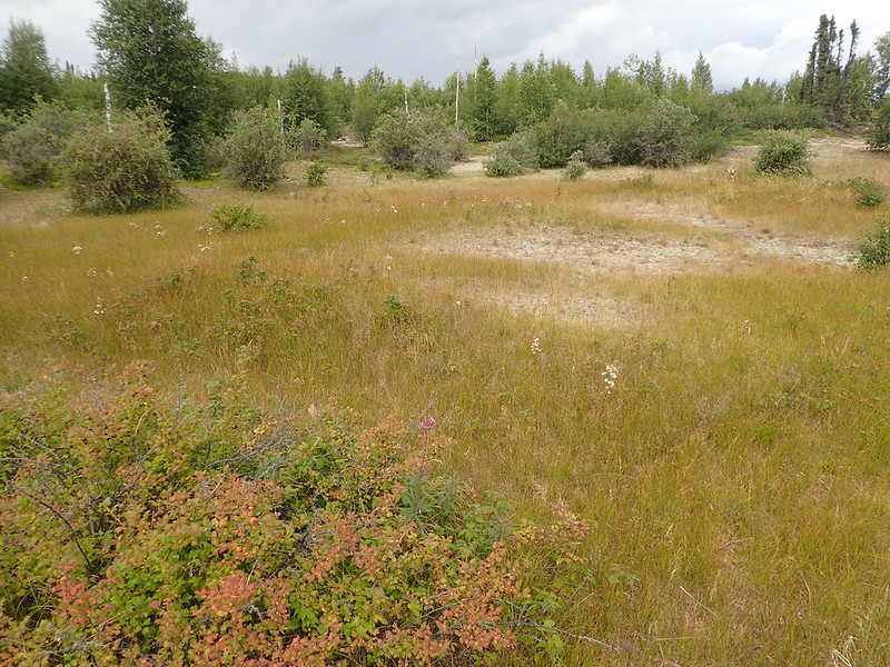
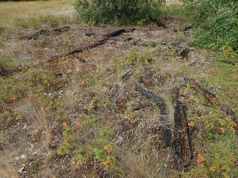
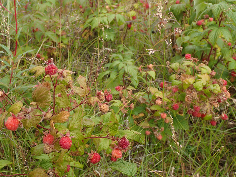
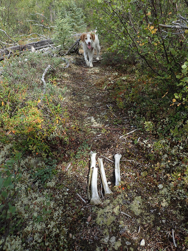
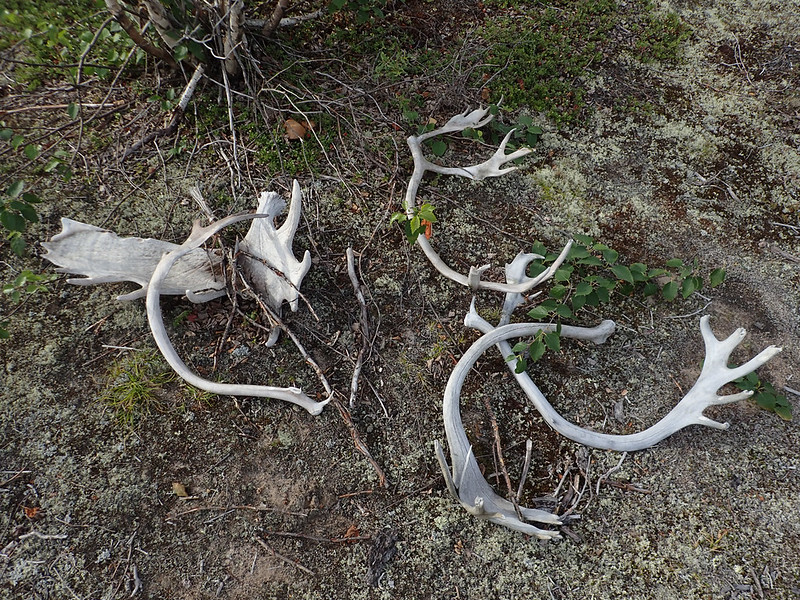
I believe the post was abandoned in the 20's or early 30's and then burned down when a fire came through in the early 90's. All that's left now is a grassy hillside, some charred logs, and a lot of rusty tin cans. It's a beautiful site and easy to see why it was chosen. There were multiple fire rings on the site and shelter poles piled here and there with bones and antlers from moose and caribous scattered around. Apparently it's still a popular place. By far the best part of the exploration was finding a bunch of ripe raspberries which occupied about 30 minutes of my time.
 20160813_207
 by
Alan, on Flickr
 20160813_202
 by
Alan, on Flickr
 20160813_203
 by
Alan, on Flickr
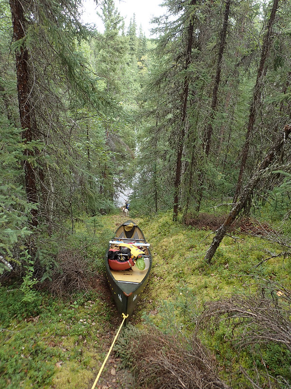
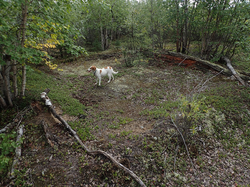
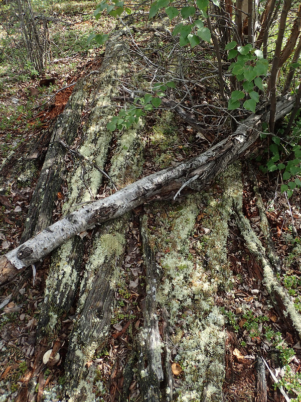
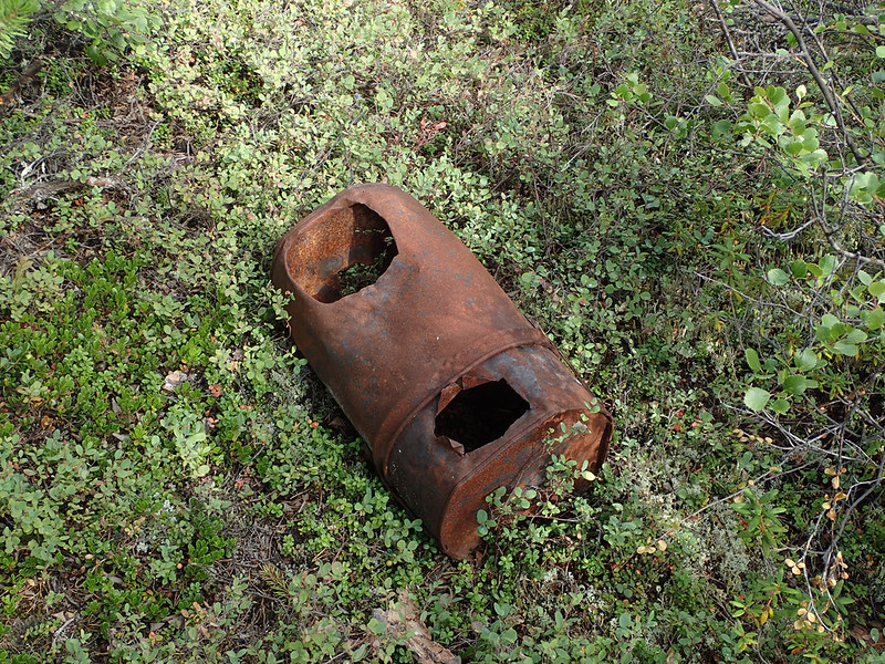
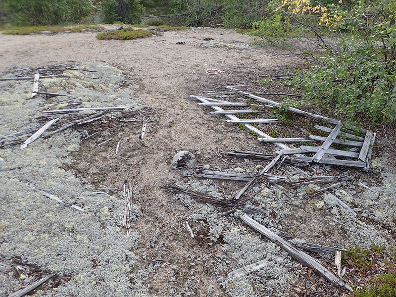
The skies still weren't pretty but it wasn't raining so we set off back up the lake. I wanted to get over the portage around Kasmere Falls and onto Kasmere Lake itself. I'd been making good time now that the weather had improved I thought if I could get across big Kasmere Lake without being held up by wind I might be able to make Nueltin Lake after all. The weather remained touch and go all afternoon but the rain missed us and soon enough we were beginning the long, but fairly easy, portage around Kasmere Falls. I'd guess it was about 1.25 miles (2km). From the landing a well worn path led up the hill where I promptly lost it as it split off into multiple caribou trails. Wandering around trying to figure out where to go I came across what must have been a couple old cabin sites. Small depressions in the ground surrounded by 4 berms which were the remains of the log walls. The logs from one wall hadn't quite disintegrated yet and were still visible. Lots of tin cans and old stove parts scattered around the area.
Sadie in the cabin:
 20160813_212
 by
Alan, on Flickr
What's left of a wall:
 20160813_214
 by
Alan, on Flickr
Stove:
 20160813_217
 by
Alan, on Flickr
I re-found my trail and also discovered a key that would help me traverse some of the other portages. This whole time I'd been keeping my eye out for white man trail markers like blazed trees or survey tape. What I really needed to be looking for was broken tree branches and other make-shift markers. Once I realized this following the trail was a breeze.
Trail markers:
 20160813_216
 by
Alan, on Flickr
 20160813_222
 by
Alan, on Flickr
After getting everything over we ran the rapid just downstream, got a nice gouge in the side of the canoe when we bounced off a big exposed boulder after taking evasive action around a submerged boulder, and made camp at the first suitable site we found. It rained on and off a little while setting up shelter and cooking dinner but not bad. The mosquitoes forced me to put on my head net for the first time of the trip. Saw a flock of Bohemian Waxwings and went to bed hoping for favorable conditions to cross Kasmere Lake the following day.
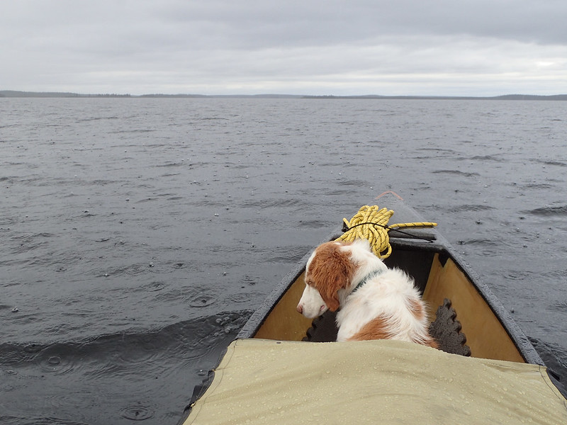
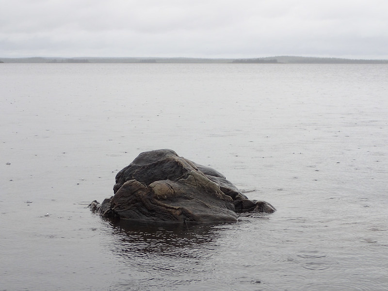
It rained on and off all night and when I woke in the morning I could hear the wind blowing hard. I was almost afraid to go outside to see which direction it was coming from. Thankfully it was still from the south as any other direction would likely have left us wind bound for the day. It looked like it could start raining again at any minute so I decided to wait a while and see what the weather would do. After 3 hours of no rain we left at 10:00. It started raining again in an hour and would continue to do so sporadically all day. We were mostly hidden from the south wind but although we were mainly following the south shore it was able to reach out and mess with us more than I would have liked and made for some difficult paddling at times. There was a mile long crossing across Southeast arm that would be exposed to the wind and waves. As I started the crossing I looked a few miles down the arm to the south and saw stacks of ridges rising up on the far shoreline, all of them heavily shrouded in the white that meant more rain was coming. I wasn't particularly worried about the rain but was concerned it might carry even stronger winds with it. I made for the lee of a small island and cast anxious glances to the south where the islands and peninsulas were now starting to disappear in the haze. Soon enough I couldn't tell where the line of rain started and within seconds we were in it. We'd just made the protection of our island which kept us out of the wind but not the rain. Thankfully the rain shower didn't bring any extra wind with it and after waiting it out for 15 minutes continued our crossing through the large swells.
Rainy day on Kasmere Lake:
 20160814_227
 by
Alan, on Flickr
 20160814_230
 by
Alan, on Flickr
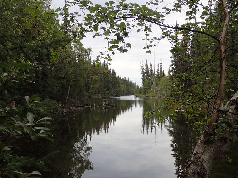
The rest of the paddle across Kasmere Lake was rather uneventful and at 4:45 we ran the small rapid at the exit of the lake and made for the first esker shown on the map a couple miles ahead. It hadn't been a long day but it had been hard and not much fun at all and I really wanted to make camp. I was relieved to see a sand beach up ahead and when we made shore was ecstatic at the beautiful site we'd landed at. The site was huge and has no doubt been used for centuries. It was large and open with room for hundreds of people. Shelter poles were laying in bunches as well as moose and caribou antlers.
 20160814_236
 by
Alan, on Flickr
 20160815_248
 by
Alan, on Flickr
 20160814_234
 by
Alan, on Flickr
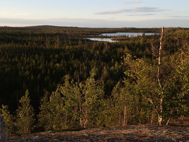
We began to climb to the top of the rise and found a nice pond contained within the esker. At the very top of the hill I was surprised to find an old grave yard. I could make out what looked like 8 graves; most of which had once been surrounded by small picket fences that were now rotting on the ground. A couple still had the actual markers left standing.
 20160814_239
 by
Alan, on Flickr
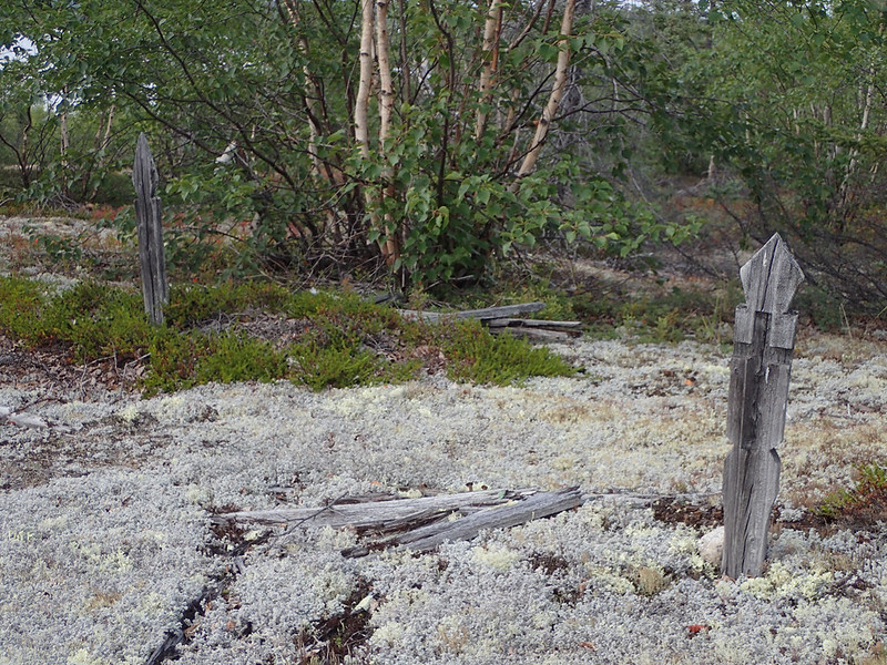 20160814_240
 by
Alan, on Flickr
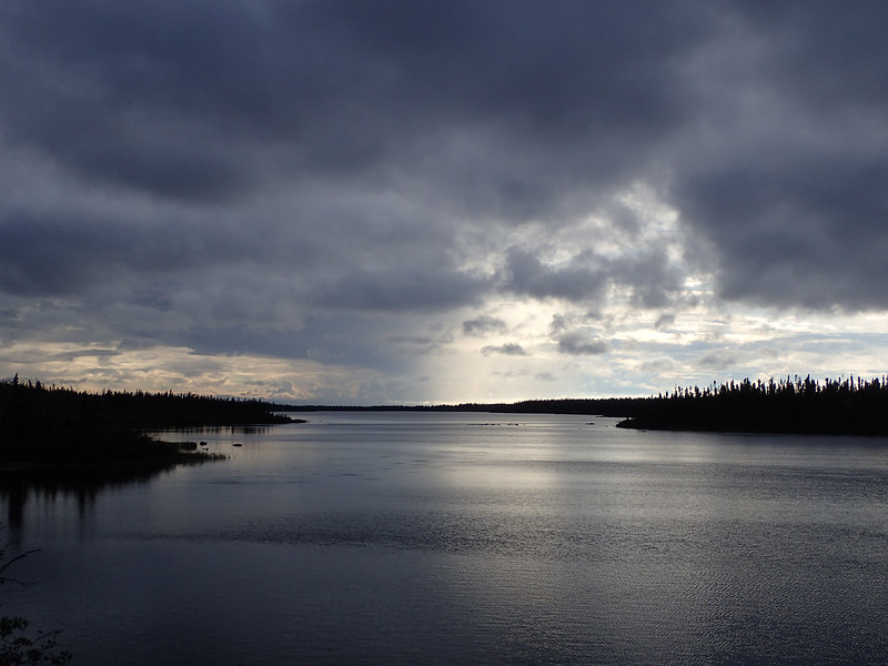
The day hadn't been terribly long but it had been a difficult paddle and not much fun at all in the rain and wind. But we were over Kasmere Lake and only 13 days into the trip. I studied the map, tried to estimate distance and time, set aside a few days for bad weather, and decided Nueltin Lake was still in play. The only decision left to make was would I continue down the Thlewiaza, which would be the shorter and faster route with more and bigger rapids, or portage over to the Putahow River, which would be a little longer but perhaps a little more tame. I was camped only 1/2 mile from where I'd need to turn either right or left.
That evening I distinctly remember walking down to the beach to get water. There was a confident swagger in my step I couldn't stop if I tried and I was at least 8 feet tall. I'd been working hard for nearly two weeks and could feel myself getting stronger every day. I was all alone in the middle of the great Canadian wilderness and I was going to make it to Nueltin Lake after all.
Sunset over the Thlewiaza after a hard day crossing Kasmere:
 20160814_246
 by
Alan, on Flickr
Alan