I made a last minute decision to take my Campfire Tent and wood stove on this trip. I can't believe I almost went without them. I'm too old to camp this time of year without a proper heat source. I was especially looking forward to this trip because I was going to meet up with forum member Penns Woods. Larry and I would have preferred to go earlier in the season but we both had other obligations. Better late than never as the saying goes. Although I had a lot of great day trips this year I only spent three night out camping, which is pitiful for a retired guy with a canoe tripping bug.
I arrived at the put in at the lower dam later then I planned. The gps on my phone wasn't sending me the usual route. I like to take back roads and am open to the different routes the gps takes me, but this seemed to be taking too long. To make matters worse when in the Adirondaks it took me on the road that accesses Little Tupper Lake and Lake Lila. This was new to me, but I went along. About eight miles in the road came to a dead end and I had to back track. By the time I was approaching the put in I was tired and would have preferred to take a nap then taking off. When I got there and saw there were only a few vehicles there and knowing I had the hot tent with a few Duraflame Logs my attitude changed. Even though there was a light rain coming down I knew that I in a short while I could be warm and comfortable at campsite #4, where I was to meet Larry in a couple days.
At the put in about 3:30

In route and arrival at campsite by 4:30.
The first thing I did was set up the tent and gather some firewood. I was going to forgo using the stove as there was no wind and I wanted to enjoy a fire. It worked great, I stayed warm, cooked up some food and was very comfortable.


The clouds that were present when I started out had moved on and the stars were the best I'd seen in a while. I decided to take a little paddle to get a better view. This is something I rarely have energy for. I guess it's a benefit of only paddling about 2.5 miles to a campsite. I didn't stay out long, maybe just ten minutes as it was cold. I took a couple of pictures. After one shot, I thought I saw a shooting star as I brought the phone down. I was surprised to see that I actually got a picture of it.


I got a good nights sleep and day two started about 6:30. Had a coffee and some sausage and was hoping for an early start. My plan was to head to Lows and explore the far end of the lake. I planned on staying back there at least one night while leaving my base camp set up on Hitchens. I didn't get out until about 9 as the fog was pretty thick. When I did get out I was treated to a spectacular paddle in the breaking fog mixed with blue skies.

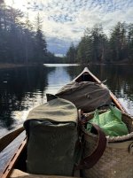
This is how I left my base camp.


I made it to the portage to Lows and carried my stuff up over the dam. My goals were to check out Virgin Timbers and Grassy Pond and camp somewhere down there. While inroute I decided to check out the Bog River where it flows into Lows. I hoped to make it to the portage to Clear pond to get an idea what the ports were like, but I came across a beaver dam and decided not to cross it and headed back to Lows. I'll leave that for another day. I made an open water crossing towards Virgin Timber hoping I was reading the map correctly and got there about 5 PM.
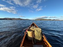
Here are some pics from my paddle this day. I put in 15.25 miles. It took 7 hours and 42 minutes which included a stop for a hot lunch and many breaks. My moving time was 5 hours and 45 minutes, averaging 2.6 mph.


my only guess is that this is a muskrat mound, but I've never seen one like iy before. Anyone know what it is?

After getting to camp and collecting wood I set up a tarp. I wanted to see if I could be as comfortable hanging out by the fire using the tarp as I was in the Campfire Tent the night before. It was hard to judge because the wind was blowing off the water pushing smoke into my shelter. I was going to sleep under the tarp, but it didn't turn out as good as I hoped and I noticed lots of small holes in it. Not wanting to risk a bad nights sleep or a wet bag, I set up my tent. I had my MSR tent already packed when I decided to take the Campfire tent and I was glad I left it in there.
Camp was pretty comfortable despite the wind. I was up early, packed and hit the water without breakfast or coffee. I planned to do that at a campsite on Grassy Pond. It was 2.75 miles and took about an hour. I got to watch the sun rise on the way. I quickly made a coffee and boiled water for my Mountain House Biscuits and Gravy. This was only the second freeze dried meal I've had since the 70's and it was good. I had a second coffee and took my time. I took a little walk around and found a pile of cut and split firewood. It had been there quite a while and was slightly wet. I thought that it might burn so I took about half of it. I removed the pack basket from the Duluth pack that I keep it in and filled it with the wood. I felt a little guilty, but I didn't think the person who cut it ever intended to return for it. I paddled back towards the dam into a head wind. The predominant wind on this lake comes out of the west. I ran into that the day before. As luck would have it, it turned around on me and I had to paddle into it again. I paddled 13.6 miles in 7hours 18 minutes. My moving time was a little over 5 hours, with an average 2.7 mph. I got back to my base camp at 2:30


I was happy to be back at my base camp and see that it was undisturbed.
TO BE CONTINUED
I arrived at the put in at the lower dam later then I planned. The gps on my phone wasn't sending me the usual route. I like to take back roads and am open to the different routes the gps takes me, but this seemed to be taking too long. To make matters worse when in the Adirondaks it took me on the road that accesses Little Tupper Lake and Lake Lila. This was new to me, but I went along. About eight miles in the road came to a dead end and I had to back track. By the time I was approaching the put in I was tired and would have preferred to take a nap then taking off. When I got there and saw there were only a few vehicles there and knowing I had the hot tent with a few Duraflame Logs my attitude changed. Even though there was a light rain coming down I knew that I in a short while I could be warm and comfortable at campsite #4, where I was to meet Larry in a couple days.
At the put in about 3:30
In route and arrival at campsite by 4:30.
The first thing I did was set up the tent and gather some firewood. I was going to forgo using the stove as there was no wind and I wanted to enjoy a fire. It worked great, I stayed warm, cooked up some food and was very comfortable.
The clouds that were present when I started out had moved on and the stars were the best I'd seen in a while. I decided to take a little paddle to get a better view. This is something I rarely have energy for. I guess it's a benefit of only paddling about 2.5 miles to a campsite. I didn't stay out long, maybe just ten minutes as it was cold. I took a couple of pictures. After one shot, I thought I saw a shooting star as I brought the phone down. I was surprised to see that I actually got a picture of it.
I got a good nights sleep and day two started about 6:30. Had a coffee and some sausage and was hoping for an early start. My plan was to head to Lows and explore the far end of the lake. I planned on staying back there at least one night while leaving my base camp set up on Hitchens. I didn't get out until about 9 as the fog was pretty thick. When I did get out I was treated to a spectacular paddle in the breaking fog mixed with blue skies.
This is how I left my base camp.
I made it to the portage to Lows and carried my stuff up over the dam. My goals were to check out Virgin Timbers and Grassy Pond and camp somewhere down there. While inroute I decided to check out the Bog River where it flows into Lows. I hoped to make it to the portage to Clear pond to get an idea what the ports were like, but I came across a beaver dam and decided not to cross it and headed back to Lows. I'll leave that for another day. I made an open water crossing towards Virgin Timber hoping I was reading the map correctly and got there about 5 PM.
Here are some pics from my paddle this day. I put in 15.25 miles. It took 7 hours and 42 minutes which included a stop for a hot lunch and many breaks. My moving time was 5 hours and 45 minutes, averaging 2.6 mph.
my only guess is that this is a muskrat mound, but I've never seen one like iy before. Anyone know what it is?
After getting to camp and collecting wood I set up a tarp. I wanted to see if I could be as comfortable hanging out by the fire using the tarp as I was in the Campfire Tent the night before. It was hard to judge because the wind was blowing off the water pushing smoke into my shelter. I was going to sleep under the tarp, but it didn't turn out as good as I hoped and I noticed lots of small holes in it. Not wanting to risk a bad nights sleep or a wet bag, I set up my tent. I had my MSR tent already packed when I decided to take the Campfire tent and I was glad I left it in there.
Camp was pretty comfortable despite the wind. I was up early, packed and hit the water without breakfast or coffee. I planned to do that at a campsite on Grassy Pond. It was 2.75 miles and took about an hour. I got to watch the sun rise on the way. I quickly made a coffee and boiled water for my Mountain House Biscuits and Gravy. This was only the second freeze dried meal I've had since the 70's and it was good. I had a second coffee and took my time. I took a little walk around and found a pile of cut and split firewood. It had been there quite a while and was slightly wet. I thought that it might burn so I took about half of it. I removed the pack basket from the Duluth pack that I keep it in and filled it with the wood. I felt a little guilty, but I didn't think the person who cut it ever intended to return for it. I paddled back towards the dam into a head wind. The predominant wind on this lake comes out of the west. I ran into that the day before. As luck would have it, it turned around on me and I had to paddle into it again. I paddled 13.6 miles in 7hours 18 minutes. My moving time was a little over 5 hours, with an average 2.7 mph. I got back to my base camp at 2:30
I was happy to be back at my base camp and see that it was undisturbed.
TO BE CONTINUED
Attachments
Last edited: